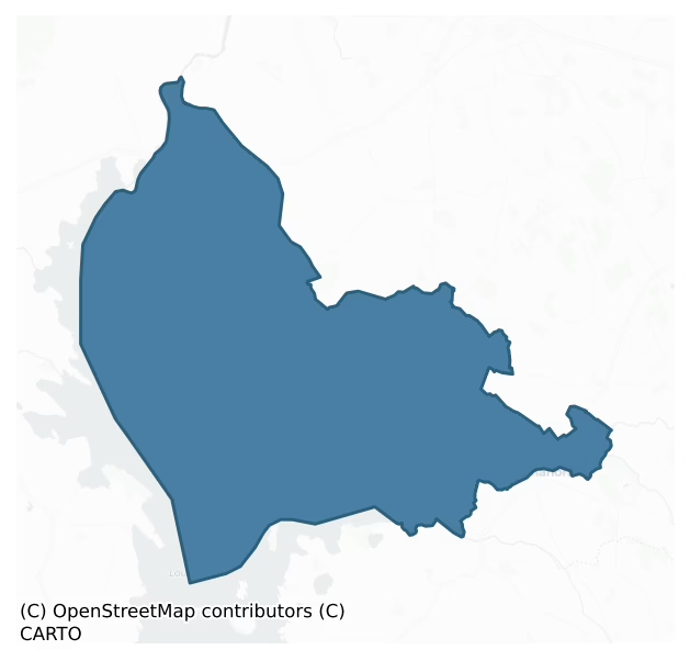
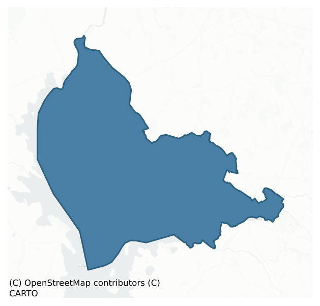
Rathcline is a barony of County Longford, in the historical province of Leinster (Irish: Ráth Claon), covering 198 km² of land. The barony records 619 NMS archaeological sites and 109 NIAH listed buildings, placing it at around the 84th percentile among 280 ROI baronies for sites per km². This means it is in the top fifth of all baronies for sites per km². Dated archaeological evidence runs from the Early Bronze Age through to the Post Medieval, spanning 6 of 9 archaeological periods, placing the barony in the 20th percentile among 280 ROI baronies for chronological depth. This means it is in the bottom third of all baronies for chronological depth. The largest dated subset of recorded sites dates to the Early Medieval. Logainm flags 22 placenames in the barony as carrying a recognised heritage root; the largest share — around 82% — are names associated with pre-christian defensive.
Heritage at a glance
Percentile rankings throughout this profile compare each barony only against the other 279 Republic of Ireland baronies.
The recorded heritage of Rathcline
The National Monuments Service Sites and Monuments Record (SMR) is the statutory inventory of archaeological sites for the Republic of Ireland, maintained by the Department of Tourism, Culture, Arts, Gaeltacht, Sport and Media. Sites recorded here include earthworks, ringforts, megalithic tombs, ecclesiastical remains, and post-medieval features; not every record is legally protected, but each is registered as a monument of archaeological interest.
The National Monuments Service records 619 archaeological sites in Rathcline, putting it at the 84th percentile among 280 ROI baronies for sites per km². This means it is in the top fifth of all baronies for sites per km². Protection coverage is near-universal — 595 sites (96%) fall within a recorded monument protection zone, indicating an extensively surveyed landscape. The record is dominated by transport features — wooden trackways, roads, and bridges (201 sites, 32% of the total), with defensive sites forming a substantial secondary presence (146 sites, 24%). Road – class 3 togher is the most prevalent type, making up 32% of the barony's recorded sites (197 records) — well above the ROI average of 9% across all baronies where this type occurs. Road – class 3 togher is a short wooden peatland trackway up to 15m long, deliberately laid to cross a small area of bog; Neolithic to medieval. Other significant types include Ringfort – rath (98) and Structure – peatland (21). Ringfort – rath is an earthen ringfort enclosed by a bank and external ditch — the most common Early Medieval farmstead, broadly dated 500–1000 AD; Structure – peatland is a construction of unknown function, either extant or implied by archaeological evidence, of any date. Across the barony's 198 km², this gives a recorded density of 3.13 sites per km².
Most common monument types
Hover or tap a monument type to see its definition.
| Type | Count |
|---|---|
| Road – class 3 togher a short wooden peatland trackway up to 15m long, deliberately laid to cross a small area of bog; Neolithic to medieval | 197 |
| Ringfort – rath an earthen ringfort enclosed by a bank and external ditch — the most common Early Medieval farmstead, broadly dated 500–1000 AD | 98 |
| Structure – peatland a construction of unknown function, either extant or implied by archaeological evidence, of any date | 21 |
| Enclosure a banked or ditched feature of uncertain type, used as a catch-all where the original function cannot be determined from surface evidence | 19 |
Chronological distribution
The dated archaeological record for Rathcline spans from the Early Bronze Age through to the Post Medieval, with activity attested across 6 of 9 archaeological periods. This is the 20th percentile across ROI baronies — a relatively narrow chronological band, with much of Irish prehistory not represented in the dated record. Every period from earliest to latest is represented in the record — an unbroken sequence of dated activity across the full chronological span. Activity concentrates most heavily in the Early Medieval (102 sites, 45% of dated material), with the Iron Age forming a secondary peak (90 sites, 40%). A further 393 recorded sites (63% of the overall NMS register for the barony) carry no period attribution — appearing as 'Unknown' in the bar chart below. This typically reflects either records that pre-date the standardised period vocabulary or sites awaiting specialist dating review, rather than a genuine absence of chronological evidence.
Sample of recorded monuments
Show 25 sample monuments (of 619 total)
A representative sample of 25 recorded monuments drawn from the barony’s 619 total NMS entries. Sites within a recorded monument protection zone and rarer site types are prioritised so the list shows a meaningful cross-section rather than only the most common type. Each entry shows the official Sites and Monuments Record reference number and the description published by the National Monuments Service.
Sheela-na-gig
On the external face of the N jamb of a window, at first-floor level, in the W gable of the late-medieval church (LF017-003001-). Carved in relief is a sheela-na-gig comprising a small, female figure with her hands…
On the external face of the N jamb of a window, at first-floor level, in the W gable of the late-medieval church (LF017-003001-). Carved in relief is a sheela-na-gig comprising a small, female figure with her hands positioned under the breasts and the genitalia exposed. (Moore 2007, No. 15)
Compiled by: Patrick F. O'Donovan
Date of upload: 16 April 2012
Cairn – unclassified
National Monument No. 91. On a NNE-facing slope in pasture. In the course of the survey of Inchcleraun Island in 1837 the OS recorded the minor name 'Innadmarfa Meva', the reputed place where Queen Meava of Croghan…
National Monument No. 91. On a NNE-facing slope in pasture. In the course of the survey of Inchcleraun Island in 1837 the OS recorded the minor name 'Innadmarfa Meva', the reputed place where Queen Meava of Croghan died (OSL 1837, 33-4). The name is positioned on the Fair Plan beside a tiny circular feature demarcated by four pecks. At the time of the engraving of the 1837 printed map the boulders were omitted and only the name was engraved. During the course of the OS 25-inch resurvey of the county in 1911 this name was linked to the remains at the current position, which is c. 45m to the NNW of its location as shown on the Fair Plan. The remains consist of a curving bank-like feature with a small mound of earth and stones at its W end. The precise nature of this feature is uncertain as the remains are difficult to examine due to dense vegetation cover. They might represent the last remnants of an enclosure. An old field drain extends from the W end of the bank and runs NE to a short stretch of a modern field boundary c. 120m distant. A monastic enclosure (LF021-048—-) lies c. 270m to the SE, a church (LF021-046—-) and a possible cashel, known as 'Grianan Meva' (LF021-047—-), lie c. 130m to the SW.
Compiled by: Paul Walsh
Date of upload: 19 December 2012
Cist
In low-lying rough pasture that had been reclaimed from bog. This rectangular cist (int. dims. 1.75m N-S; 0.85m E-W; D 0.85m at S, c. 1.1m at N), aligned approx. N-S, was discovered in 1995 (SMR file). Its S and W sides…
In low-lying rough pasture that had been reclaimed from bog. This rectangular cist (int. dims. 1.75m N-S; 0.85m E-W; D 0.85m at S, c. 1.1m at N), aligned approx. N-S, was discovered in 1995 (SMR file). Its S and W sides were constructed of vertically set, large stone slabs, the tops of which were covered by a layer of peaty soil. The N and E sides were ruinous and appeared to have been defined partly by drystone-walling. A number of horizontal slabs were also identified on the E side that may have formed part of the original walling. The cist had been covered with a large roofstone that had been broken into a number of pieces, one of which fell into the cist. The floor was formed, in part, of large stones. Two bones, identified as a human ulna and rib, were recovered together with a quantity of what appeared to be charred wood. The cist was infilled and is not visible at ground level.
Compiled by: Patrick F. O'Donovan
Date of upload: 5 March 2012
Castle – motte
On a SSW-facing slope in pasture with extensive views in all directions. The Inny River is c. 450m to the S. A steep-sided, oval mound of earth and stone (H 4.5-6m; dims. at base c. 24m NE-SW; c. 16m NW-SE) encircled by…
On a SSW-facing slope in pasture with extensive views in all directions. The Inny River is c. 450m to the S. A steep-sided, oval mound of earth and stone (H 4.5-6m; dims. at base c. 24m NE-SW; c. 16m NW-SE) encircled by fragmentary traces of a wide, shallow fosse. A large cavity on the summit (16.5m NE-SW; 12.5m NW-SE) and in the face of the motte at N is the result of quarrying. Traces of an unclassified castle (LF026-013002-) survive at E.
Compiled by: Caimin O'Brien
Date of upload: 15 March 2012
Fulacht fia
On a gentle, W-facing slope in low-lying pasture with extensive areas of raised bog to the W and NW. A low, oval-shaped, grass-covered mound (13.4m N–S; 9.5m E–W; H 0.1–0.2m). During land-reclamation works quantities of…
On a gentle, W-facing slope in low-lying pasture with extensive areas of raised bog to the W and NW. A low, oval-shaped, grass-covered mound (13.4m N–S; 9.5m E–W; H 0.1–0.2m). During land-reclamation works quantities of burnt stone were uncovered at, and in the vicinity of, the mound.
Compiled by: Patrick F. O'Donovan
Date of upload: 22 November 2011
Mass-rock
Circa 33m to the SSE of a holy well (LF025-001001-). This mass-rock consists of a roughly shaped, squared limestone boulder (max. H 0.65m; 1.15m NE-SW; 0.9m NW-SE). Its SW end is incised with the letters 'BM' (Blessed…
Circa 33m to the SSE of a holy well (LF025-001001-). This mass-rock consists of a roughly shaped, squared limestone boulder (max. H 0.65m; 1.15m NE-SW; 0.9m NW-SE). Its SW end is incised with the letters 'BM' (Blessed Mary) in the style of late-18th/early 19th-century gravestone inscriptions.
Compiled by: Patrick F. O'Donovan
Date of upload: 7 June 2013
House – fortified house
Adjoining the N wall of a tower house (LF017-009002-) and occupying and forming the NE corner of a bawn (LF017-009001-). In 1627 the English Crown granted Sir Thomas Dutton 'the castle [LF017-009002], town, and lands of…
Adjoining the N wall of a tower house (LF017-009002-) and occupying and forming the NE corner of a bawn (LF017-009001-). In 1627 the English Crown granted Sir Thomas Dutton 'the castle [LF017-009002], town, and lands of Rathcline … with a clause creating those lands into a manor, to be called the Manor of Rathclyne (Cal. pat. rolls Ire., Chas I, 251). A house built by Dutton appears to have been remodelled c. 1667 by Sir George Lane who purchased the manor and lands of Rathcline in 1649 (Brown 1784, 227); an armorial plaque (LF017-009007-) commemorated this work.
A late 17th-century manuscript plan (NLI, MS 8646 (6)) indicates that the house was approximately H-shaped in plan, consisting of a central block aligned E-W, with asymmetrical E and W wings aligned N-S. The E wing was in line with the central block. It extended off the N wall of the tower house and projected beyond the line of the N wall of the bawn. A square-shaped angle tower of the bawn projected off its NE angle. The W wing projected to the S and N of the central block but did not extent as far N as the bawn wall. Another building, aligned E-W, extended off its W wall. The house was accessed through a classical doorway in the centre of the S wall of the central block and a stairway at its E end accessed the E wing. A wooden stairs is depicted against the external face of the N gable of this wing. Two buildings that were probably outhouses associated with the house are shown; one, aligned E-W, was built ag…
Ecclesiastical site
In pasture on the E shore of Inchcleraun in Lough Ree. According to legend, the island is named after Clothra, sister of the mythical Medbh/Meave, Queen of Connaught but in the 19th century it was known as ‘Quaker’s…
In pasture on the E shore of Inchcleraun in Lough Ree. According to legend, the island is named after Clothra, sister of the mythical Medbh/Meave, Queen of Connaught but in the 19th century it was known as ‘Quaker’s Island’ (AFM vol. 3, 98). A monastery was founded here by St Diarmuid in the 6th century. This record was formerly classed as Archaeological Complex, which has now been changed to Ecclesiastical Site which includes the following monuments, LF021-046—-, LF021-047—-, LF021-048001-, LF021-048002-, LF021-048003-, LF021-048004-, LF021-048005-, LF021-048006-, LF021-048007-, LF021-048008-, LF021-048009-, LF021-048010-, LF021-048011- , LF021-048012-, LF021-048013-, LF021-049—-.
Compiled by: Patrick F. O'Donovan
Revised by: Caimin O'Brien
Date of revised upload: 1 February 2023
Armorial plaque (present location)
Within the 19th-century (C of I) church dedicated to St John’s, which is to the N of the centre of Lanesborough town (LF017-003—-). This 17th-century limestone armorial plaque, on the W wall of the church, displays…
Within the 19th-century (C of I) church dedicated to St John’s, which is to the N of the centre of Lanesborough town (LF017-003—-). This 17th-century limestone armorial plaque, on the W wall of the church, displays the coat of arms of the 1st Viscount Lanesborough, Sir George Lane, who died in 1682. The family motto beneath it in Latin reads 'INCONCVSSA VIRTUS', which translates as unshaken virtue. The plaque may originally have been on the family vault beneath the church (LF017-030004-) (Brewer 1825-6, 275) or it may have been in the recess above the entrance gateway to the graveyard (LF017-003008-) as illustrated by Grose (1791, vol. 1, 74).
Compiled by: Caimin O'Brien
Date of upload: 13 June 2013
Ritual site – holy tree/bush
Associated with a holy well (LF025-001001-), c. 3m to its SSW. Rags, holy medals, coins, rosary beads and statuettes have been hung on this bush. A mass-rock (LF025-001002-) lies c. 30m to the SSE.
Compiled by:…
Associated with a holy well (LF025-001001-), c. 3m to its SSW. Rags, holy medals, coins, rosary beads and statuettes have been hung on this bush. A mass-rock (LF025-001002-) lies c. 30m to the SSE.
Compiled by: Patrick F. O'Donovan
Date of upload: 7 June 2013
Burial mound
In July 1982 human remains were discovered in the corner of a large field, on the grounds of a newly constructed house near Lanesborough. A mound (3m N-S; H 0.5m) had been levelled and the remains of four or five…
In July 1982 human remains were discovered in the corner of a large field, on the grounds of a newly constructed house near Lanesborough. A mound (3m N-S; H 0.5m) had been levelled and the remains of four or five individuals were scattered throughout the disturbed soil. They had been lying in an east-west direction and no grave goods were found with them. There was no tradition of a church or graveyard in the immediate area (Cahill and Sikora 2011, vol. 2, 367-9).
Compiled by: Patrick F. O'Donovan
Date of upload: 17 April 2012
Burnt pit
An irregularly shaped pit (2.5m x 1.55m; D 0.13m) was discovered during monitoring, c. 200m N of Lanesborough, at the site of the ESB power station. It was subsequently excavated in 2003 and three layers of fill were…
An irregularly shaped pit (2.5m x 1.55m; D 0.13m) was discovered during monitoring, c. 200m N of Lanesborough, at the site of the ESB power station. It was subsequently excavated in 2003 and three layers of fill were identified. The uppermost fill contained charcoal-rich, silty clay in which a fragment of bone and a piece of burnt chert were found. Below this was a deposit of mottled, silty clay with charcoal flecks containing six sherds of pottery that are likely to be prehistoric in date. The base comprised a compact band of oxidised, heat-reddened clay (Powell 2003, 6–7).
Compiled by: Mary Tunney
Date of upload: 28 February 2012
Fortification
At the NW end of Lanesborough town (LF017-003—-), at a strategic crossing point across the river Shannon where it flows into the NE end of Lough Ree. This fortification was probably built on the site of or…
At the NW end of Lanesborough town (LF017-003—-), at a strategic crossing point across the river Shannon where it flows into the NE end of Lough Ree. This fortification was probably built on the site of or incorporated the remains of an earlier castle (LF017-003002-). It is recorded that Sir Patrick Barnewell built a ‘fair and strong fort and house’ in the late 16th or early 17th century (Cal. S.P. Ire., 1611-1614, 51). In 1616 Barnewell was granted the right to operate a ‘ferry over the Shannon, from the town of Beallaleege [county Roscommon] to the King’s fort in Longford co.’ provided that the ‘ferrymen and boats from time to time to be at the disposal and under the command of the constable or chief officer of the fort' (Cal. pat. rolls Ire., Jas I, 304). The fortification is depicted as a rectangular-shaped bawn on an early 17th-century map of Rathcline barony (BL Cotton MS Augustus I.i.48). In 1620 it was in a ruinous condition (Cal. pat. rolls Ire., Jas I, 482). The Down Survey map (1655-6) of Rathcline barony depicts it as standing opposite ‘Ballyleage Castle [RO037-004—-] in Connought’ (NLI MS 716). It was described in 1682 as ‘an antient Fort built 8 Square is Garrisened and is the King’s’ (Gillespie and Moran 1991, 208). Not visible at ground level.
Compiled by Caimin O'Brien
Date of upload: 26 March 2012
Enclosure – large enclosure
Cropmark of circular-shaped area (diam. c. 73m) defined by a ditch visible on Google Earth photograph taken 20/09/2020.
See attached Google Earth orthoimages
Compiled by: Caimin O'Brien based on details provided…
Cropmark of circular-shaped area (diam. c. 73m) defined by a ditch visible on Google Earth photograph taken 20/09/2020.
See attached Google Earth orthoimages
Compiled by: Caimin O'Brien based on details provided by Jean-Charles Caillère
Date of upload: 10 January 2022
Cultivation ridges
In grassland, overlooking the River Inny immediately to S. Cultivation ridges running NE-SW enclosed by a low earthen bank forming a large irregular-shaped field (diam. c. 214m N-S x 226m E-W) is clearly visible on…
In grassland, overlooking the River Inny immediately to S. Cultivation ridges running NE-SW enclosed by a low earthen bank forming a large irregular-shaped field (diam. c. 214m N-S x 226m E-W) is clearly visible on Google Earth orthoimages and on Digital Globe orthophoto taken between 2011-13.
See attached Google Earth orthophoto
Compiled by: Caimin O'Brien based on details provided by Jean-Charles Caillère
Date of upload: 12 July 2022
Platform
On flood-land area of small lake located immediately to E as depicted on historic OSi maps. Outline of roughly circular-shaped earthwork (diam. c. 18m) surrounded by water is visible on Google Earth orthoimages and on…
On flood-land area of small lake located immediately to E as depicted on historic OSi maps. Outline of roughly circular-shaped earthwork (diam. c. 18m) surrounded by water is visible on Google Earth orthoimages and on Lidar imagery. Possible wetland habitation platform with oval-shaped earthwork (LF021-068—-) immediately to W.
See attached Google Earth orthophotos
Compiled by: Caimin O'Brien based on details provided by Jean-Charles Caillère
Date of upload: 12 July 2022
Well
Spring well in a field that was annotated 'Beorlyon Field' on the 1837 ed. OSi 6-inch map and which was recorded by O'Donovan as the place where Queen Maeve was killed. In 1837 the Ordnance Survey recorded that the…
Spring well in a field that was annotated 'Beorlyon Field' on the 1837 ed. OSi 6-inch map and which was recorded by O'Donovan as the place where Queen Maeve was killed. In 1837 the Ordnance Survey recorded that the field where Maeve was killed was called ‘Beor-Laighionn (Beorlyon)’. O'Donovan recorded the following tradition about this field; 'the story about Forby's killing Queen Meava on this island is vividly remembered, and the spot where she was bathing when the stone struck her in the forehead, pointed out with great traditional confidence; to the field called Beor-Laighionn (Beorlyon), in Inis Clothran. After Oilioll (the husband of Meava) had been killed by Conall Cearnach, Meava went to reside on Inis Clothran, in Lough Riv, and while there it was enjoined upon her to bathe herself every morning in a well which is in the entrance to the island. herself every morning in a well which is in the entrance to the island. When Forbaid, the son of Conquobar (of Ulster), heard of this he came alone one day to visit the well, and measured with a thread the distance from the brink of it to the opposite shore of the lake; and this measurement did he carry with him to Ulster. One morning, while there, he perceived Meava bathing herself in the well according to her custom, and thereupon he fixed a stone in his Crann Tabhuill, and making a shot towards her, aimed her directly in the fore head, and killed her on the spot' (Bigger 1900, 85-6).
In 1891 Mr. Dan Farrell, an is…
Burial Vault
A 'Vault' is depicted on the 1837 edition of the OSi 6-inch map in the ENE sector of the monastic enclosure (LF021-048—-) at Inchcleraun, and may be the remains of a burial vault of uncertain antiquity. The outline of…
A 'Vault' is depicted on the 1837 edition of the OSi 6-inch map in the ENE sector of the monastic enclosure (LF021-048—-) at Inchcleraun, and may be the remains of a burial vault of uncertain antiquity. The outline of this vault is visible today as low grass-covered wall-footings.
Compiled by: Caimin O'Brien
Date of upload: 10 February 2023
Slipway
Sunken-shaped scrub-covered waterlogged area aligned NE-SW on the E edge of the monastic cashel cut into the E shoreline of Lough Ree which may be the remains of some form of boat naust or slipway feature. This…
Sunken-shaped scrub-covered waterlogged area aligned NE-SW on the E edge of the monastic cashel cut into the E shoreline of Lough Ree which may be the remains of some form of boat naust or slipway feature. This earthwork which is open to the water, lies adjacent to ‘Corraphortanarla Point’ that is annotated on the OSi 25-inch map. The ‘phort’ element of the place-name along with the sunken waterlogged earthwork and a projecting feature visible on the shoreline at this location on the Digital Globe orthoimage may indicate the presence of a harbour of unknown antiquity. The ‘Corra’ element of the place-name may indicate the presence of a fishing weir along the shoreline at this location.
Compiled by: Caimin O'Brien
Date of upload: 15 February 2023
Building
Situated in S quadrant of Inchcleraun monastic cashel (LF021-048—-), 15m W of Templemore (LF021-048004-). Possible building visible as a sunken-shaped area defined by grass-covered wall footings now covered with scrub…
Situated in S quadrant of Inchcleraun monastic cashel (LF021-048—-), 15m W of Templemore (LF021-048004-). Possible building visible as a sunken-shaped area defined by grass-covered wall footings now covered with scrub vegetation. Possible grass-covered footings of a low wall running W off this structure, which may be the remains of a small paddock or garden plot belonging to this structure. A series of walls visible as low grass-covered footings, forming irregular shaped areas are visible in the SW quadrant of the monastic cashel.
Compiled by: Caimin O'Brien
Date of upload: 15 February 2023
Bullaun stone
Situated on SSE edge of Inchcleraun monastic cashel (LF021-048—-) beside Romanesque decorated jamb-stones and a possible unfinished cross-base (LF021-048020-), on a cobbled pathway leading from the monastery to a…
Situated on SSE edge of Inchcleraun monastic cashel (LF021-048—-) beside Romanesque decorated jamb-stones and a possible unfinished cross-base (LF021-048020-), on a cobbled pathway leading from the monastery to a possible church (LF021-048007-) located 55m to WSW. Recumbent stone with multiple hollows on the surface of the stone, which appears to form part of the surface of a cobbled pathway.
Compiled by: Caimin O'Brien
Date of upload: 15 February 2023
Historic town
At a crossing point on the river Shannon where it enters Lough Ree. Lanesborough was formerly known as Athleague or Ballyleague (AFM vol. 1, 1063, 1109; vol. 3, 200) and Joyce (1871, 343) translates Béal Átha Liag as…
At a crossing point on the river Shannon where it enters Lough Ree. Lanesborough was formerly known as Athleague or Ballyleague (AFM vol. 1, 1063, 1109; vol. 3, 200) and Joyce (1871, 343) translates Béal Átha Liag as the mouth of the ford of the stones. It occupied a strategic border location on the river Shannon between the early medieval kingdoms of Connacht and Midhe and the modern counties of Longford and Roscommon. Records indicate that a causeway (LF017-003003-) was constructed across the river in 1000 (AFM, sub 1000; Ann. Clon., sub 994), while bridges (cliathdroichid) (LF017-003001-) were built in the mid-12th century (AFM, sub 1140 and 1154; Ann. Clon., sub 1132). In 1172 Walter de Lacy began to build a castle but it was not completed because Cathal Crobderg O Conncobair, King of Connacht, forced him to abandon it (AFM; ALC; Ann. Clon., sub 1220). The castle (LF017-003002-) built in 1227 by the Irish Justiciar Geoffrey de Marisco (Ann. Conn.; AFM) may have been built on or close to its site. The latter castle appears to have been the spur to the development of a vill, for a charter of borough status was granted before 1235 (MacNiocaill 1977, 55). Upon Walter de Lacy's death in 1241, Lanesborough was inherited by John de Verdon (Otway-Ruthven 1968b, 411-13). Its situation made it vulnerable and in 1271 Aedh O Conncobair attacked and destroyed the castle (Ann. Conn.; AFM; AU). In 1284 Theobald de Verdon was granted a charter to hold a weekly market (Cal. doc. Ire. v…
Ford
At the NW end of Lanesborough (LF017-003—-), which was known as Béal Átha Liag (Ballyleague) or Áth Liag (the mouth of the ford of the flagstones) before 1664 (Cal. S.P. Ire. 1663-5, 442; Bradley et al. 1985, 26;…
At the NW end of Lanesborough (LF017-003—-), which was known as Béal Átha Liag (Ballyleague) or Áth Liag (the mouth of the ford of the flagstones) before 1664 (Cal. S.P. Ire. 1663-5, 442; Bradley et al. 1985, 26; Gillespie and Moran 1991, 208). This was a major crossing point on the river Shannon at the NE end of Lough Ree, on a strategic boundary separating the early medieval kingdoms of Connacht and Meath and the modern counties of Longford and Roscommon. Causeways were constructed in AD 1000 by Mael Sechnaill, King of Midhe, and also by Cathal Ua Conchobhair (AFM; A. Clon. sub 994; Bradley et al. 1985, 25). Their exact location is unknown, athough they were probably replaced by later bridges (see LF017-003001-).
Compiled by: Caimin O'Brien
Date of upload: 11 May 2012
Windmill
On the highest part of a prominent broad gently rising NW-SE ridge. Ruins of a windmill constructed of mortared slabs. There are two opposing doorways at N and S, each with a relieving arch but missing their wooden…
On the highest part of a prominent broad gently rising NW-SE ridge. Ruins of a windmill constructed of mortared slabs. There are two opposing doorways at N and S, each with a relieving arch but missing their wooden lintels and jambs. There is a fireplace on the interior first floor with a simple horizontal stone lintel. Two opes directly over each doorway gives light to first-floor level. Although it is difficult to date the structure, it is not likely to be earlier than the 18th century. Archaeological testing was undertaken, in 2005, in the general area in advance of the development of a housing estate. No archaeological features or artifacts were identified (Crumlish 2008, 253). This windmill was probably constructed in the early 19th century as it is depicted as an upstanding windmill on the 1837 ed. of the OS 6-inch map. It may have been built on the site of an earlier windmill which was recorded as a 'stump' on the 1814 Grand Jury map of County Longford (Mimnagh 2010, 383).
R. Crumlish, Knock (05E0367) in I. Bennett (ed.), Excavations 2005: Summary accounts of archaeological excavations in Ireland. Wordwell (2008), p. 253, No. 1031.
Compiled by: Paul Walsh
Date of upload: 26 August 2011
Road – class 3 togher
A togher (Wth 0.2m; D 0.08m), orientated NW-SE, consisting of longitudinal oak and hazel roundwood and brushwood.
Compiled by: Mary Tunney based on data supplied by the former Irish Archaeological Wetland Unit,…
A togher (Wth 0.2m; D 0.08m), orientated NW-SE, consisting of longitudinal oak and hazel roundwood and brushwood.
Compiled by: Mary Tunney based on data supplied by the former Irish Archaeological Wetland Unit, University College, Dublin.
Date of upload: 26 August 2011
Listed buildings
The National Inventory of Architectural Heritage (NIAH) is a state survey appraising buildings of architectural, historical, archaeological, artistic, cultural, scientific, social, or technical interest. Each surveyed structure receives a rating from International (the highest, for buildings of European importance) through National, Regional, Local, and Record-Only.
The NIAH records 109 listed buildings in Rathcline (53rd percentile across ROI baronies). The highest-graded structures include 2 of National significance. The Republic holds 937 National-graded buildings in total, so this barony accounts for around 0% of the national total. Construction dates concentrate most heavily in the Victorian (1830-1900) period. The most-recorded building type is house (31 examples, 28% of the listed stock).
Terrain and environment
Mean elevation across the barony is 46m — the 14th percentile among 280 ROI baronies for elevation. This means it is in the bottom fifth of all baronies for elevation. This is a relatively low-lying landscape by ROI standards. Elevation matters for heritage because higher-altitude baronies typically favour defensive monuments — ringforts and hilltop forts placed on prominent ground — while lowland baronies are more likely to carry the dense settlement and church networks of intensive agricultural landscapes. Mean slope is 1.8° — the 2nd percentile among 280 ROI baronies for slope. This means it is in the bottom tenth of all baronies for slope. This is broadly flat terrain, the kind of landscape best suited to intensive agriculture. Slope is a key control on both land use and archaeological preservation: steep ground resists ploughing and tends to preserve earthworks intact, while gentle slopes favour intensive cultivation that damages or destroys surface archaeology over time. The Topographic Wetness Index averages 12.1, the 100th percentile among 280 ROI baronies for wetness. This means it is in the top tenth of all baronies for wetness. This is wet, slow-draining ground by ROI standards — the kind of landscape that may carry waterlogged archaeological sites of unusual preservation value. Drainage matters for heritage because poorly-drained ground preserves organic archaeology (wooden trackways, leather, textiles, and on rare occasions human remains) far better than free-draining soil; well-drained ground favours arable use but destroys organic material rapidly. The land-cover mosaic combines improved grassland (68%), open water (17%), and woodland (13%), giving a mixed agricultural and semi-natural landscape. In overall character, this is low-lying, gently-sloping terrain — characteristic of Ireland's central plain and coastal lowlands, with land use dominated by improved grassland.
Terrain measurements
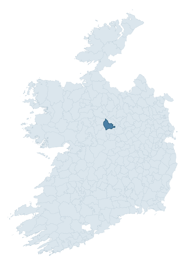
Where this barony sits in the Republic of Ireland
Geology and preservation
Bedrock geology shapes the landscape long before any settlement begins — controlling soil drainage, agricultural potential, the survival of upstanding monuments, and the preservation of buried archaeology. The figures below come from the Geological Survey Ireland 1:100,000 bedrock map.
The bedrock underlying Rathcline is predominantly limestones (62% of the barony by area), laid down during the Carboniferous period (100% by area, around 359 to 299 million years ago). Limestone is the most heritage-rich bedrock in Ireland. It supports fertile, well-drained soils that favoured dense Early Medieval settlement and Norman manorial agriculture, and it weathers into karst features — sinkholes, caves, swallow holes, and souterrains — that frequently carry archaeology. Where peat overlies limestone, organic preservation can be exceptional. A substantial secondary geology of limestone (31%) adds further variety to the underlying landscape. The single largest mapped unit is the Visean Limestones (undifferentiated) (62% of the barony's bedrock).
Rock type composition
Largest mapped unit: Visean Limestones (undifferentiated) (63% of the barony)
Placename evidence
Logainm records 22 heritage-diagnostic placenames for Rathcline, drawn from townland and civil-parish names across the barony. The dominant stratum is pre-Christian and Early Medieval defensive — ráth-, lios-, dún-, and caiseal-prefixed names that mark Iron Age and early historic settlement. The leading diagnostic roots are lios- (10 — ringfort or enclosure), ráth- (3 — earthen ringfort), and caiseal- (3 — stone ringfort). This is below the ROI average of 30.7 heritage placenames per barony, suggesting either lighter survey coverage or a townland-naming tradition that draws more on generic landscape vocabulary. The presence of multiple heritage strata side by side indicates layered occupation of the landscape across successive prehistoric and historic periods. Logainm records 171 placenames for Rathcline (predominantly townland names). Of these, 22 (13%) carry one of the diagnostic Gaelic roots tracked above; the remainder draw on more generic landscape vocabulary that does not encode a heritage period.
Pre-Christian / Early Medieval Defensive
| Root | Count | Meaning |
|---|---|---|
| lios- | 10 | ringfort or enclosure |
| ráth- | 3 | earthen ringfort |
| caiseal- | 3 | stone ringfort |
| dún- | 2 | hilltop or promontory fort |
Early Christian Ecclesiastical
| Root | Count | Meaning |
|---|---|---|
| cill- | 3 | church (early) |
| tobar- | 1 | holy well |
Burial, Ritual, and Norse-Contact
| Root | Count | Meaning |
|---|---|---|
| gall- | 1 | foreigner — Norse settlement marker |

Explore further
Grounding History: 10 Maps of Northern Ireland’s Past
If you’re interested in Irish heritage more widely, the companion report for Northern Ireland brings together the analysis of all 462 NI wards into one place through 10 high-quality maps — covering monument density, archaeological periods, placename heritage, terrain, wetland, and the historic landscape at first survey. Take a look.
About this profile
Click any section below to expand.
What is a barony?
A barony is a historic administrative unit in Ireland, broadly equivalent to an English hundred. The 280 baronies used here are from the OSi 2019 National Statutory Boundaries (generalised 20m), covering the 26 counties of the Republic of Ireland. Baronies derive from the Norman period, were formalised in the 17th century, and have not been redrawn for statistical purposes. They vary enormously in area, from compact urban baronies in Dublin to vast upland baronies in Connacht, and should not be compared by raw site count without accounting for area differences.
What counts as a site?
This profile combines three distinct heritage registers, each with its own definition of what constitutes a recordable site:
- Archaeological sites (NMS). The National Monuments Service Sites and Monuments Record (SMR) catalogues every known archaeological monument or site of archaeological interest in the Republic, from prehistoric burial mounds and ringforts to medieval churches and post-medieval defensive works. Inclusion does not require legal protection — only that the site has been identified, surveyed, and assessed as having archaeological value. A separate subset of these sites lies within a recorded protection zone, which gives them statutory protection under the National Monuments Acts.
- Listed buildings (NIAH). The National Inventory of Architectural Heritage records buildings of architectural, historical, archaeological, artistic, cultural, scientific, social, or technical interest. Each surveyed structure is appraised on a five-tier scale: International, National, Regional, Local, and Record-Only. The NIAH appraisal is informational rather than strictly statutory, but it underpins local-authority Record of Protected Structures (RPS) listings.
- Heritage placenames (Logainm). Logainm is the authoritative database of Irish placenames maintained by the Placenames Branch. This profile applies a heritage-diagnostic classifier to the Irish-language form of each townland name, flagging roots that signal defensive sites (ráth-, lios-, dún-, caiseal-, cathair-), ecclesiastical foundations (cill-, teampall-, domhnach-, mainistir-), prehistoric burial-ritual features (tuaim-, carn-, leaba-), or Norse-contact settlement (gall-). Townlands without one of these diagnostic roots are not flagged here — they may still carry historical significance, but that significance is not encoded in the name itself.
Editorial principles
The narrative sections of this profile follow several explicit principles:
- Evidential. Every claim about this barony’s heritage character is anchored in the underlying register data. Where a site count, a placename count, or a percentile rank is cited, it is computed from the source datasets at export time, not estimated.
- Comparative. Counts and metrics are reported alongside their percentile rank against the other 279 ROI baronies. A barony with 50 ringforts in absolute terms could be unusually high or unusually low depending on its size and regional context; percentile ranking removes that ambiguity.
- Transparent on limits. Where a register has known coverage gaps, survey biases, or data-quality issues that affect this barony’s figures, the profile flags them rather than presenting the numbers as definitive.
- No interpretation beyond what the data supports. The narrative does not speculate about historical events, social dynamics, or cultural meaning beyond what the recorded heritage and placename evidence directly attests.
Data caveats and limits
- NMS Sites and Monuments Record is the product of survey campaigns conducted at different intensities across different counties and decades. Some baronies have been surveyed more thoroughly than others, and absolute counts should be read in that light. Sites destroyed by development before survey are typically not represented; sites in heavily forested or upland terrain are sometimes under-recorded.
- NIAH coverage is broadly complete for the Republic of Ireland but the survey was conducted on a rolling county-by-county basis, and the most recent appraisal date varies. Buildings demolished or substantially altered after their original survey may still appear in the register; conversely, recent buildings of merit may not yet have been appraised.
- Logainm classification applies a deliberately conservative pattern-matching approach to the Irish-language townland forms. The classifier prioritises true positives over recall: a townland may carry a heritage signal that the classifier doesn’t recognise, particularly where the diagnostic root has been heavily anglicised or where the townland name draws on a less common term. The 60,000+ townland records and ~9,800 classified placenames give a substantial signal at barony scale, but individual townland names should be checked against Logainm directly for definitive interpretation.
- Period attribution. The chronological distribution reflects only those NMS sites that carry a recognised period attribution in the source data. Sites listed as “Unknown” period are excluded from the dated subset.
- Boundary changes. Some baronies have undergone minor boundary adjustments since their 19th-century definition; the OSi 2019 generalised boundaries used here are the current statutory definition and may differ slightly from historical maps in border areas.
- Bedrock geology is mapped at 1:100,000 scale, which means local variation within a barony — small pockets of different rock type, mineral veins, alluvium overlying bedrock — is generalised. The dominant-system and rocktype figures are area-weighted, so a barony reading “70% Carboniferous limestone” may still contain small but archaeologically important pockets of older or younger rock. Around 3% of GSI polygons do not match the lexicon and contribute no rocktype or system attribution.
Data sources
- National Monuments Service — Sites and Monuments Record (SMR) https://data.gov.ie/dataset/national-monuments-service-archaeological-survey-of-ireland
- National Inventory of Architectural Heritage (NIAH) https://data.gov.ie/dataset/national-inventory-of-architectural-heritage-niah-national-dataset
- Logainm — Placenames Database of Ireland https://www.logainm.ie/
- Ordnance Survey Ireland — National Statutory Barony Boundaries 2019 https://data-osi.opendata.arcgis.com/
- EURODEM — European Digital Elevation Model https://www.mapsforeurope.org/datasets/euro-dem
- ESA WorldCover https://esa-worldcover.org/en
- Geological Survey Ireland — 1:100,000 Bedrock Geology https://www.gsi.ie/en-ie/data-and-maps/Pages/Bedrock.aspx
Explore more: Search any of the 280 ROI baronies, browse by historical province, or read the methodology and data sources for the full Republic of Ireland Heritage Tool.