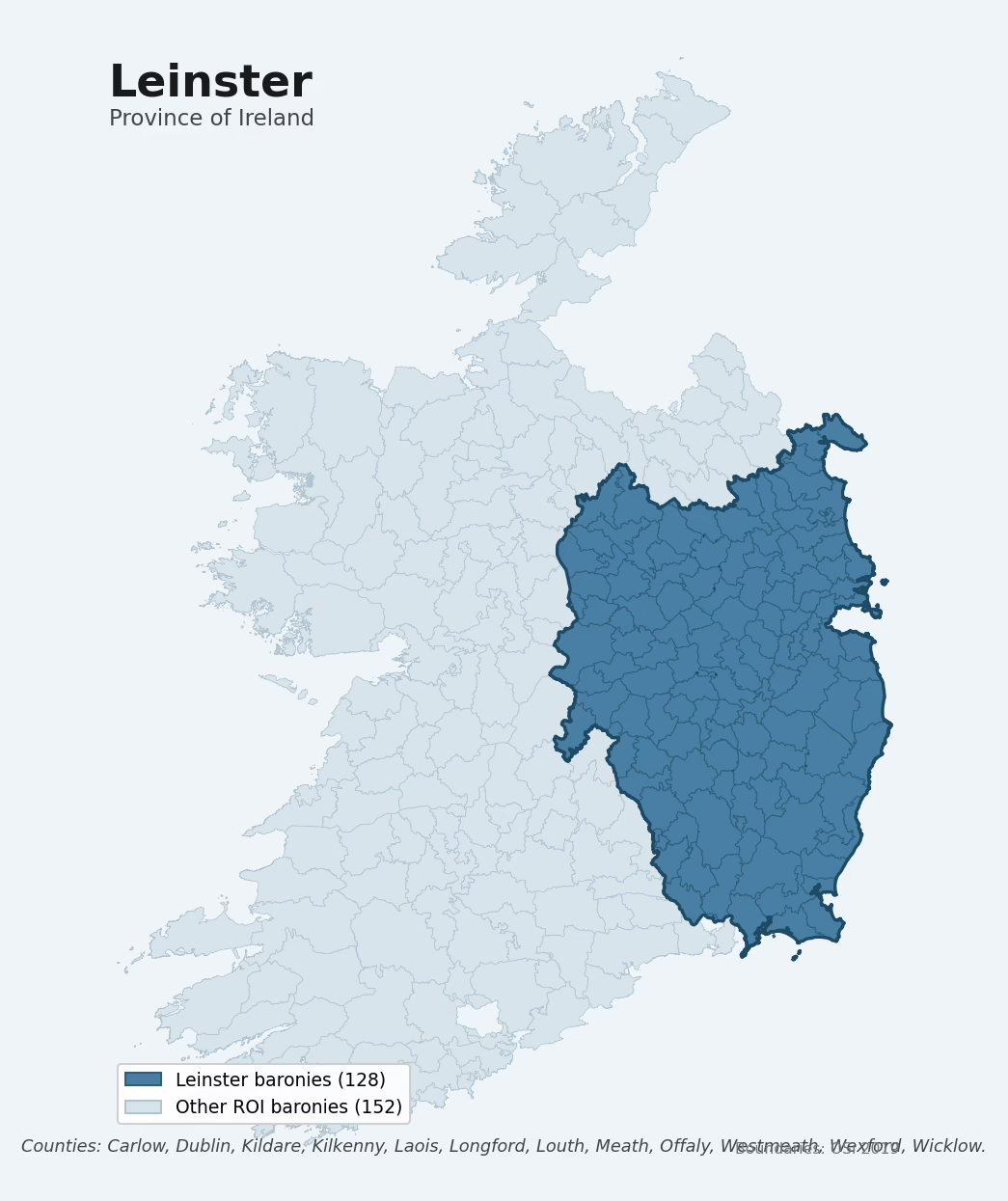
Leinster is one of Ireland's four historical provinces, covering 128 of the Republic's 280 baronies across 12 counties: Carlow, Dublin, Kildare, Kilkenny, Laois, Longford, Louth, Meath, Offaly, Westmeath, Wexford, Wicklow. The dated archaeological record is dominated by the Early Medieval period, which accounts for 35% of period-attributed sites. The most prevalent single monument type is Enclosure (4,978 records). Mean elevation across the province is 107m, between the upland and lowland extremes of the other provinces.
Heritage at a glance
Archaeological character
The National Monuments Service Sites and Monuments Record holds 37,947 archaeological sites across the 128 baronies of Leinster, of which 33,873 (89%) sit within a formally recorded protection zone. In absolute terms this is the second-highest of the four provinces for total recorded archaeological sites. The record is led by defensive sites — ringforts, enclosures, hillforts, and stone forts, making up around 52% of the categorised sites in the province. Within Leinster, the record is relatively evenly spread across baronies. The three baronies holding the largest share of the record by absolute count are Garrycastle (Offaly) (2,146 sites), Gowran (Kilkenny) (1,059), and Rathconrath (Westmeath) (686) — together accounting for around 10% of the province's archaeological record. Adjusted for area, the highest site density is in Drogheda (Louth) at 5.9 sites per km², reflecting an unusually heritage-rich landscape rather than simply a large barony with many sites overall.
Most common monument types
| Type | Count |
|---|---|
| Enclosure | 4,978 |
| Ringfort – rath | 4,879 |
| Structure – peatland | 1,648 |
| Church | 1,606 |
| Graveyard | 1,368 |
| Ring-ditch | 1,202 |
| Cross-slab | 1,074 |
| Road – class 3 togher | 940 |
Chronological character
Dated archaeological evidence across Leinster runs from the Mesolithic through to the Modern, spanning 9 of 9 canonical archaeological periods. Activity concentrates most heavily in the Early Medieval (9,595 sites, 35% of dated material). A further 12,085 sites (31% of the overall NMS record for Leinster) carry no period attribution — typically records pre-dating the standardised period vocabulary or awaiting specialist dating review.
Architectural heritage
The National Inventory of Architectural Heritage records 22,442 listed buildings across Leinster, appraised on a five-tier scale from Record-Only through Local, Regional, National, and International. Of these, 8 carry an International grading (buildings of European architectural importance) and 522 are graded National. This makes Leinster the highest of the four provinces for listed-building count. The single largest concentration of listed buildings is in Dublin (Dublin) with 4,576 records — around 20% of the province's NIAH total.
Terrain and environment
The mean elevation across Leinster is 107m. Mean slope is 3.8°, the lowest of the four provinces. The Topographic Wetness Index averages 10.9 across the province, the highest of the four provinces. High wetness is significant for heritage: waterlogged ground preserves organic archaeology — wooden trackways, leather, textiles — far better than free-draining soil. The land-cover mosaic is dominated by improved grassland (68%), woodland (16%), and arable farmland (11%).
Terrain measurements
Geology and preservation
Bedrock geology shapes the landscape long before any settlement begins — controlling soil drainage, agricultural potential, the survival of upstanding monuments, and the preservation of buried archaeology. The figures below are area-weighted aggregates of the per-barony bedrock data, drawn from the Geological Survey Ireland 1:100,000 bedrock map.
The bedrock underlying Leinster is predominantly limestone (44% of the province by area), laid down during the Carboniferous period (58% of the province). Limestone is the most heritage-rich bedrock in Ireland. It supports fertile, well-drained soils that favoured dense Early Medieval ringfort agriculture and Norman manorial estates, and it weathers into karst features — sinkholes, caves, swallow holes, and souterrains — that frequently carry archaeology.
Placename heritage
Logainm records 14,749 placenames across the baronies of Leinster, predominantly townland names. Of these, 2,407 (16%) carry one of the diagnostic Gaelic roots tracked by the heritage classifier — defensive (ráth-, lios-, dún-, caiseal-), ecclesiastical (cill-, teampall-, domhnach-), burial-ritual, or Norse-contact terms. The dominant stratum is Early Christian ecclesiastical (1,390 names), with pre-Christian / Early Medieval defensive (870) forming a strong secondary layer. The single most common diagnostic root is cill- (church), appearing in 1,003 placenames across the province.
Baronies in Leinster
| Barony | County | km² | NMS | NIAH | Dominant period |
|---|---|---|---|---|---|
| Carlow | Carlow | 127 | 455 | 58 | Iron Age |
| Forth | Carlow | 160 | 205 | 33 | Iron Age |
| Idrone East | Carlow | 195 | 382 | 65 | Iron Age |
| Idrone West | Carlow | 93 | 159 | 27 | Iron Age |
| Rathvilly | Carlow | 181 | 284 | 50 | Early Medieval |
| Slievemargy | Carlow | 1 | 1 | 2 | Iron Age |
| St. Mullin's Lower | Carlow | 108 | 253 | 45 | Early Bronze Age |
| St. Mullin's Upper | Carlow | 32 | 27 | 11 | Iron Age |
| Balrothery East | Dublin | 122 | 480 | 177 | Iron Age |
| Balrothery West | Dublin | 102 | 170 | 57 | Iron Age |
| Castleknock | Dublin | 68 | 123 | 673 | Iron Age |
| Coolock | Dublin | 71 | 254 | 721 | Iron Age |
| Dublin | Dublin | 0 | 2 | 4,576 | Unknown |
| Nethercross | Dublin | 89 | 296 | 107 | Iron Age |
| Newcastle | Dublin | 92 | 209 | 366 | Medieval |
| Rathdown | Dublin | 127 | 422 | 517 | Iron Age |
| Uppercross | Dublin | 137 | 204 | 337 | Early Bronze Age |
| Carbury | Kildare | 195 | 177 | 54 | Early Medieval |
| Clane | Kildare | 130 | 158 | 36 | Iron Age |
| Connell | Kildare | 141 | 135 | 135 | Iron Age |
| Ikeathy And Oughterany | Kildare | 104 | 175 | 59 | Iron Age |
| Kilcullen | Kildare | 34 | 77 | 28 | Iron Age |
| Kilkea And Moone | Kildare | 188 | 509 | 106 | Iron Age |
| Naas North | Kildare | 103 | 209 | 202 | Iron Age |
| Naas South | Kildare | 111 | 170 | 77 | Iron Age |
| Narragh And Reban East | Kildare | 87 | 184 | 84 | Iron Age |
| Narragh And Reban West | Kildare | 90 | 173 | 195 | Iron Age |
| Offaly East | Kildare | 190 | 422 | 183 | Early Bronze Age |
| Offaly West | Kildare | 164 | 167 | 134 | Iron Age |
| Salt North | Kildare | 89 | 185 | 264 | Early Medieval |
| Salt South | Kildare | 68 | 139 | 28 | Iron Age |
| Callan | Kilkenny | 23 | 92 | 84 | Medieval |
| Crannagh | Kilkenny | 236 | 571 | 189 | Iron Age |
| Fassadinin | Kilkenny | 276 | 511 | 180 | Iron Age |
| Galmoy | Kilkenny | 163 | 522 | 69 | Iron Age |
| Gowran | Kilkenny | 454 | 1,059 | 614 | Iron Age |
| Ida | Kilkenny | 249 | 296 | 63 | Medieval |
| Iverk | Kilkenny | 167 | 245 | 179 | Early Medieval |
| Kells | Kilkenny | 155 | 297 | 70 | Early Medieval |
| Kilculliheen | Kilkenny | 9 | 27 | 156 | Middle-Late Bronze Age |
| Knocktopher | Kilkenny | 189 | 306 | 79 | Early Medieval |
| Shillelogher | Kilkenny | 151 | 625 | 388 | Iron Age |
| Ballyadams | Laois | 98 | 156 | 16 | Iron Age |
| Clandonagh | Laois | 177 | 242 | 39 | Early Medieval |
| Clarmallagh | Laois | 176 | 281 | 49 | Iron Age |
| Cullenagh | Laois | 178 | 179 | 89 | Iron Age |
| Maryborough East | Laois | 102 | 129 | 199 | Iron Age |
| Maryborough West | Laois | 170 | 100 | 45 | Early Medieval |
| Portnahinch | Laois | 145 | 152 | 97 | Iron Age |
| Slievemargy | Laois | 143 | 101 | 18 | Iron Age |
| Stradbally | Laois | 113 | 162 | 49 | Iron Age |
| Tinnahinch | Laois | 220 | 100 | 68 | Early Medieval |
| Upperwoods | Laois | 198 | 106 | 23 | Iron Age |
| Ardagh | Longford | 163 | 322 | 235 | Early Medieval |
| Granard | Longford | 270 | 445 | 136 | Early Medieval |
| Longford | Longford | 235 | 286 | 197 | Early Medieval |
| Moydow | Longford | 140 | 657 | 64 | Early Medieval |
| Rathcline | Longford | 198 | 619 | 109 | Early Medieval |
| Shrule | Longford | 85 | 181 | 95 | Early Medieval |
| Ardee | Louth | 218 | 486 | 183 | Iron Age |
| Drogheda | Louth | 19 | 109 | 306 | Medieval |
| Duleek Lower | Louth | 5 | 5 | 25 | Early Medieval |
| Dundalk Lower | Louth | 155 | 447 | 186 | Early Medieval |
| Dundalk Upper | Louth | 126 | 543 | 415 | Early Medieval |
| Ferrard | Louth | 200 | 442 | 184 | Iron Age |
| Louth | Louth | 104 | 308 | 48 | Early Medieval |
| Deece Lower | Meath | 81 | 140 | 24 | Iron Age |
| Deece Upper | Meath | 116 | 135 | 16 | Iron Age |
| Duleek Lower | Meath | 150 | 384 | 111 | Early Medieval |
| Duleek Upper | Meath | 116 | 334 | 37 | Iron Age |
| Dunboyne | Meath | 68 | 177 | 21 | Iron Age |
| Fore | Meath | 176 | 501 | 126 | Early Medieval |
| Kells Lower | Meath | 146 | 234 | 60 | Early Medieval |
| Kells Upper | Meath | 200 | 413 | 145 | Early Medieval |
| Lune | Meath | 162 | 136 | 56 | Iron Age |
| Morgallion | Meath | 127 | 245 | 38 | Early Medieval |
| Moyfenrath Lower | Meath | 164 | 242 | 78 | Iron Age |
| Moyfenrath Upper | Meath | 128 | 168 | 39 | Medieval |
| Navan Lower | Meath | 102 | 229 | 168 | Iron Age |
| Navan Upper | Meath | 72 | 205 | 32 | Iron Age |
| Ratoath | Meath | 145 | 338 | 31 | Iron Age |
| Skreen | Meath | 165 | 407 | 65 | Iron Age |
| Slane Lower | Meath | 106 | 165 | 30 | Early Medieval |
| Slane Upper | Meath | 118 | 385 | 67 | Neolithic |
| Ballyboy | Offaly | 131 | 112 | 31 | Early Medieval |
| Ballybritt | Offaly | 219 | 339 | 369 | Iron Age |
| Ballycowan | Offaly | 157 | 235 | 177 | Early Medieval |
| Clonlisk | Offaly | 199 | 264 | 102 | Early Medieval |
| Coolestown | Offaly | 194 | 194 | 102 | Iron Age |
| Eglish | Offaly | 116 | 165 | 17 | Iron Age |
| Garrycastle | Offaly | 420 | 2,146 | 140 | Early Medieval |
| Geashill | Offaly | 125 | 113 | 67 | Iron Age |
| Kilcoursey | Offaly | 78 | 113 | 61 | Iron Age |
| Philipstown Lower | Offaly | 124 | 640 | 52 | Iron Age |
| Philipstown Upper | Offaly | 150 | 172 | 46 | Iron Age |
| Warrenstown | Offaly | 87 | 123 | 28 | Iron Age |
| Athlone South | Westmeath | 3 | 42 | 90 | Medieval |
| Brawny | Westmeath | 46 | 59 | 100 | Early Medieval |
| Clonlonan | Westmeath | 130 | 252 | 114 | Early Medieval |
| Corkaree | Westmeath | 109 | 357 | 70 | Early Medieval |
| Delvin | Westmeath | 158 | 242 | 100 | Early Medieval |
| Farbill | Westmeath | 143 | 256 | 112 | Early Medieval |
| Fartullagh | Westmeath | 159 | 306 | 131 | Early Medieval |
| Fore | Westmeath | 213 | 482 | 140 | Early Medieval |
| Kilkenny West | Westmeath | 152 | 260 | 65 | Early Medieval |
| Moyashel And Magheradernon | Westmeath | 174 | 475 | 284 | Early Medieval |
| Moycashel | Westmeath | 191 | 624 | 181 | Early Medieval |
| Moygoish | Westmeath | 163 | 296 | 110 | Early Medieval |
| Rathconrath | Westmeath | 195 | 686 | 121 | Early Medieval |
| Ballaghkeen North | Wexford | 185 | 166 | 126 | Iron Age |
| Ballaghkeen South | Wexford | 166 | 248 | 160 | Iron Age |
| Bantry | Wexford | 413 | 631 | 479 | Early Bronze Age |
| Bargy | Wexford | 174 | 317 | 147 | Iron Age |
| Forth | Wexford | 168 | 467 | 789 | Iron Age |
| Gorey | Wexford | 331 | 444 | 229 | Iron Age |
| Ida | Wexford | 1 | 5 | 21 | Medieval |
| Scarawalsh | Wexford | 432 | 455 | 456 | Iron Age |
| Shelburne | Wexford | 216 | 408 | 183 | Iron Age |
| Shelmaliere East | Wexford | 79 | 71 | 79 | Iron Age |
| Shelmaliere West | Wexford | 206 | 328 | 172 | Iron Age |
| Arklow | Wicklow | 272 | 462 | 157 | Iron Age |
| Ballinacor North | Wicklow | 300 | 408 | 83 | Early Medieval |
| Ballinacor South | Wicklow | 317 | 196 | 88 | Iron Age |
| Newcastle | Wicklow | 212 | 363 | 143 | Medieval |
| Rathdown | Wicklow | 134 | 245 | 539 | Iron Age |
| Shillelagh | Wicklow | 180 | 198 | 82 | Iron Age |
| Talbotstown Lower | Wicklow | 358 | 478 | 92 | Iron Age |
| Talbotstown Upper | Wicklow | 253 | 351 | 110 | Iron Age |
About this profile
Click any section below to expand.
What is a province?
Ireland’s four historical provinces — Ulster, Munster, Leinster, and Connacht — are pre-modern territorial groupings dating in form to the early medieval period and codified later in the Norman and Tudor administrative reforms. Each province aggregates a fixed set of counties and (for the Republic) a fixed set of baronies. This profile aggregates the per-barony heritage data within Leinster to give a province-level analytical picture.
Data coverage
This profile aggregates the per-barony heritage data for the 128 Leinster baronies in the Republic of Ireland, covering the counties of Carlow, Dublin, Kildare, Kilkenny, Laois, Longford, Louth, Meath, Offaly, Westmeath, Wexford, Wicklow. The underlying data is drawn from three primary state registers: the National Monuments Service (NMS) Sites and Monuments Record for archaeological sites, the National Inventory of Architectural Heritage (NIAH) for listed buildings, and Logainm for placename heritage. Terrain and geology statistics are derived from the EURODEM digital elevation model, ESA WorldCover land-cover classifications, and the Geological Survey Ireland 1:100,000 bedrock map.
What counts as a site?
This profile combines three distinct heritage registers, each with its own definition of what constitutes a recordable site:
- Archaeological sites (NMS). The National Monuments Service Sites and Monuments Record catalogues every known archaeological monument or site of archaeological interest in the Republic — from prehistoric burial mounds and ringforts to medieval churches and post-medieval defensive works. A subset lies within a recorded protection zone, which gives those sites statutory protection under the National Monuments Acts.
- Listed buildings (NIAH). The National Inventory of Architectural Heritage records buildings of architectural, historical, archaeological, artistic, cultural, scientific, social, or technical interest, appraised on a five-tier scale from International through National, Regional, Local, and Record-Only.
- Heritage placenames (Logainm). A heritage-diagnostic classifier flags Irish-language townland names carrying roots that signal defensive sites, ecclesiastical foundations, prehistoric burial-ritual features, or Norse-contact settlement.
Editorial principles
The narrative sections of this profile follow several explicit principles:
- Evidential. Every claim about this province’s heritage character is anchored in the underlying register data. Where a count, share, or comparative ranking is cited, it is computed from the source datasets at export time.
- Comparative. Counts are reported alongside their rank among the four provinces and within-province distribution among baronies, so the reader can see whether a figure is unusual.
- Transparent on limits. Coverage gaps and survey biases are flagged where they meaningfully affect the figures rather than hidden.
- No interpretation beyond what the data supports. The narrative does not speculate about historical events or social dynamics beyond what the recorded heritage and placename evidence directly attests.
Data caveats and limits
- NMS Sites and Monuments Record is the product of survey campaigns at different intensities across counties and decades. Absolute counts should be read in that light.
- NIAH coverage is broadly complete for the Republic but was conducted on a rolling county-by-county basis. Recently built or recently demolished structures may not be reflected.
- Logainm classification applies a deliberately conservative pattern-matching approach. A townland may carry a heritage signal the classifier doesn’t recognise.
- Period attribution. The chronological distribution reflects only NMS sites with a recognised period attribution in the source data; sites listed as “Unknown” are surfaced in the bar chart but excluded from canonical period totals.
- Bedrock geology is mapped at 1:100,000 scale, which means local variation within a barony is generalised. The dominant-system and rocktype figures are area-weighted.
Data sources
- National Monuments Service — Sites and Monuments Record (SMR) https://data.gov.ie/dataset/national-monuments-service-archaeological-survey-of-ireland
- National Inventory of Architectural Heritage (NIAH) https://data.gov.ie/dataset/national-inventory-of-architectural-heritage-niah-national-dataset
- Logainm — Placenames Database of Ireland https://www.logainm.ie/
- Ordnance Survey Ireland — National Statutory Barony Boundaries 2019 https://data-osi.opendata.arcgis.com/
- EURODEM — European Digital Elevation Model https://www.mapsforeurope.org/datasets/euro-dem
- ESA WorldCover https://esa-worldcover.org/en
- Geological Survey Ireland — 1:100,000 Bedrock Geology https://www.gsi.ie/en-ie/data-and-maps/Pages/Bedrock.aspx