
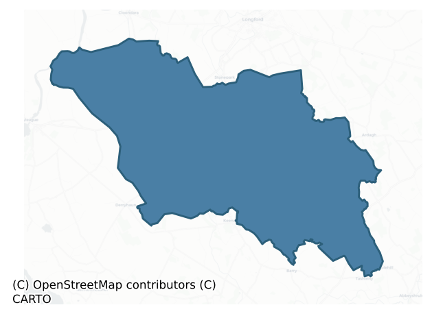
Moydow is a barony of County Longford, in the historical province of Leinster (Irish: Maigh Dumha), covering 140 km² of land. The barony records 657 NMS archaeological sites and 64 NIAH listed buildings, placing it at around the 95th percentile among 280 ROI baronies for sites per km². This means it is in the top tenth of all baronies for sites per km². Dated archaeological evidence runs from the Neolithic through to the Modern, spanning 8 of 9 archaeological periods, placing the barony in the 72nd percentile among 280 ROI baronies for chronological depth. This means it is in the top third of all baronies for chronological depth. The largest dated subset of recorded sites dates to the Early Medieval. Logainm flags 19 placenames in the barony as carrying a recognised heritage root; the largest share — around 47% — are names associated with early Christian church and monastic foundations.
Heritage at a glance
Percentile rankings throughout this profile compare each barony only against the other 279 Republic of Ireland baronies.
The recorded heritage of Moydow
The National Monuments Service Sites and Monuments Record (SMR) is the statutory inventory of archaeological sites for the Republic of Ireland, maintained by the Department of Tourism, Culture, Arts, Gaeltacht, Sport and Media. Sites recorded here include earthworks, ringforts, megalithic tombs, ecclesiastical remains, and post-medieval features; not every record is legally protected, but each is registered as a monument of archaeological interest.
The National Monuments Service records 657 archaeological sites in Moydow, putting it at the 95th percentile among 280 ROI baronies for sites per km². This means it is in the top tenth of all baronies for sites per km². Of these, 568 (86%) fall within a recorded monument protection zone. The record is dominated by transport features — wooden trackways, roads, and bridges (268 sites, 41% of the total), with defensive sites forming a substantial secondary presence (170 sites, 26%). Road – class 3 togher is the most prevalent type, making up 41% of the barony's recorded sites (268 records) — well above the ROI average of 9% across all baronies where this type occurs. Road – class 3 togher is a short wooden peatland trackway up to 15m long, deliberately laid to cross a small area of bog; Neolithic to medieval. Other significant types include Ringfort – rath (134) and Structure – peatland (52). Ringfort – rath is an earthen ringfort enclosed by a bank and external ditch — the most common Early Medieval farmstead, broadly dated 500–1000 AD; Structure – peatland is a construction of unknown function, either extant or implied by archaeological evidence, of any date. Across the barony's 140 km², this gives a recorded density of 4.70 sites per km².
Most common monument types
Hover or tap a monument type to see its definition.
| Type | Count |
|---|---|
| Road – class 3 togher a short wooden peatland trackway up to 15m long, deliberately laid to cross a small area of bog; Neolithic to medieval | 268 |
| Ringfort – rath an earthen ringfort enclosed by a bank and external ditch — the most common Early Medieval farmstead, broadly dated 500–1000 AD | 134 |
| Structure – peatland a construction of unknown function, either extant or implied by archaeological evidence, of any date | 52 |
| Enclosure a banked or ditched feature of uncertain type, used as a catch-all where the original function cannot be determined from surface evidence | 18 |
| House – indeterminate date a habitation building whose date cannot be determined from available evidence | 10 |
Chronological distribution
The dated archaeological record for Moydow spans from the Neolithic through to the Modern, with activity attested across 8 of 9 archaeological periods. This is the 72nd percentile across ROI baronies for chronological depth — an above-average span. Every period from earliest to latest is represented in the record — an unbroken sequence of dated activity across the full chronological span. Activity concentrates most heavily in the Early Medieval (111 sites, 49% of dated material), with the Iron Age forming a secondary peak (77 sites, 34%). A further 429 recorded sites (65% of the overall NMS register for the barony) carry no period attribution — appearing as 'Unknown' in the bar chart below. This typically reflects either records that pre-date the standardised period vocabulary or sites awaiting specialist dating review, rather than a genuine absence of chronological evidence.
Sample of recorded monuments
Show 25 sample monuments (of 657 total)
A representative sample of 25 recorded monuments drawn from the barony’s 657 total NMS entries. Sites within a recorded monument protection zone and rarer site types are prioritised so the list shows a meaningful cross-section rather than only the most common type. Each entry shows the official Sites and Monuments Record reference number and the description published by the National Monuments Service.
Ecclesiastical enclosure
On a SW facing slope in poorly drained pasture, c. 200m to the NW of a stream. This possible ecclesiastical enclosure (c. 200m ENE-WSW; c. 180m NNW-SSE) is visible on an aerial photograph (CUCAP 1970, BDK 93) to the N,…
On a SW facing slope in poorly drained pasture, c. 200m to the NW of a stream. This possible ecclesiastical enclosure (c. 200m ENE-WSW; c. 180m NNW-SSE) is visible on an aerial photograph (CUCAP 1970, BDK 93) to the N, E, S and W of the church (LF013-045002-) and graveyard (LF013-045009-). Described in 1975 (SMR file) as 'the curve of a probable large earthen enclosure bank’ that was visible in the field to the W of the graveyard and could be traced as far the roadway to the NW.
It is now defined by a low earthen bank (Wth 3m; H 0.2m), that is reduced to a scarp in places, and an external fosse (Wth 1m; ext. D 0.3m) in the field to the E of the graveyard. Earthworks (LF013-045008-) in this field and in the adjoining fields to the NE, E and W of the enclosure appear to be associated with land-reclamation schemes. Five cross-slabs (LF013-045004-, LF013-045010-, LF013-045011-, LF013-045012-, LF013-045013-) and two bullaun stones (LF013-045006-, LF013-045005-) are associated. (McNamee 1940b, 40-41; 1942b, 47-60; ITA Survey 1944; English 1971, 148)
Compiled by: Caimin O'Brien
Date of upload: 4 June 2012
Megalithic tomb – court tomb
On a low ridge. This tomb is very overgrown with hazel and thorn bushes. Three stones of the E arm of a N-facing court stand 2m forward of a gallery (L c. 6.5m) divided into an antechamber and two main chambers. The…
On a low ridge. This tomb is very overgrown with hazel and thorn bushes. Three stones of the E arm of a N-facing court stand 2m forward of a gallery (L c. 6.5m) divided into an antechamber and two main chambers. The entrance to the gallery is between a set of tall, doubled jambs forming the antechamber. The antechamber leads to the first of the two main chambers, each side of which is formed by a single stone. A pair of jambs separates it from the longer, second chamber, open at the rear, its sides each of two stones. A displaced stone leans against the inner face of the southernmost sidestone on the E side of this chamber. The structure stands in a long cairn, the precise outline of which is obscured by the overgrowth. (Higgins 1978, 270-71)
Compiled by: Eamon Cody
Date of upload: 26 August 2011
See linked document with a plan of the monument.
Religious house – Augustinian canons
In wet low-lying pasture, c. 40m to the SW of a stream, and in the E end of graveyard (LF018-066002-). Founded shortly before 1199 by Gormghall Ó Cuinn (Ó Riain 2010, 41). Dedicated to St Peter; in 1540 it was one of…
In wet low-lying pasture, c. 40m to the SW of a stream, and in the E end of graveyard (LF018-066002-). Founded shortly before 1199 by Gormghall Ó Cuinn (Ó Riain 2010, 41). Dedicated to St Peter; in 1540 it was one of five monasteries in the Annaly region that was surrendered to Henry VIII (Gwynn and Hadcock 1970, 156).Granted to Shane O'Ferald in 1551-2 (Nicholls 1994, vol. 1, 186) and in 1567 to Thomas Byram (ibid., vol. 2, 124). Named 'Derge Abbey' on an early 17th-century map of Moydow barony (BL, Cotton MS Augustus I.ii.28), where a possible crossing tower or castellated transept chapel is shown rising above the roofline. The Down Survey (1655-6) map of Taghsheenod parish records the lands of 'Abby Derry' as 'Colledge Land in possession of Sr James Ware' (NLI, MS 719). Described in the late 17th century as 'the ruins of a Priory of the Cannons of St. Augustines Order called Derg or Monasterderg' (Downing 1932, 22).
Remains comprise a nave and chancel church (int. dims. 23m E-W; 5.95m N-S; wall T 0.8m) constructed of rubble masonry with cut and dressed alternating quoins. There appears to have been a small square-shaped tower (int. dims. 5.9m N-S; 5.9m E-W) at the W end. It is not clear if it is contemporary with the priory or whether it was added in the late medieval period.
The E end of the church is best preserved; the E gable and E ends of the N (L 8.9m) and S (L 9.2m) walls of the chancel survive to full height, elsewhere the walls are defined by low wall-footi…
Megalithic tomb – unclassified
In pastureland. On the 1837 ed. of the OS 6-inch map this feature is shown some 60m to the SE of the position recorded on the 1914 ed. In 1837 O'Donovan recorded that there was then in this townland a 'giant's grave…
In pastureland. On the 1837 ed. of the OS 6-inch map this feature is shown some 60m to the SE of the position recorded on the 1914 ed. In 1837 O'Donovan recorded that there was then in this townland a 'giant's grave fifteen feet [c. 4.6m] long which should be shewn on the map' (OSL, 76). The name 'Site of Ker's Grave' applied to it on the 1837 ed. suggests that the feature may have been destroyed shortly after it was recorded in the OSL. There are no remains at the position indicated on the 1914 OS 6-inch map. At the position shown on the 1837 edition, immediately N of a field fence, a rectangular area (c. 30m E-W; 12m N-S) is distinguished from the rest of a large pasture field by its uneven surface and patches of nettles.
Compiled by: Eamon Cody
Date of upload: 27 February 2012
Moated site
On a gentle E-facing slope in low-lying pasture. A raised rectangular area (c. 48m NE-SW; c. 42m NW-SE) defined by a scarp (H 0.6-0.8m) with a partially infilled intervening fosse (Wth 3.5m; max. D 0.8m), and traces of…
On a gentle E-facing slope in low-lying pasture. A raised rectangular area (c. 48m NE-SW; c. 42m NW-SE) defined by a scarp (H 0.6-0.8m) with a partially infilled intervening fosse (Wth 3.5m; max. D 0.8m), and traces of an outer bank (Wth 4m; H 0.4m) at NW. At SW this bank has been modified and incorporated into the townland boundary. Elsewhere it has been levelled. At the W corner is a partially collapsed bastion (4.5m NE-SW; 3m NW-SE; H 0.6m) with evidence of wall-facing on its SE side. The original entrance is not recognisable.
Compiled by: Patrick F. O'Donovan
Date of upload: 3 May 2012
Cist
In relatively level pasture. Uncovered c. 1930. Recorded by Waddell (1990, 111) as comprising a double cist, each of which reportedly contained a crouched skeleton covered by a single capstone (1.52m x 1.31m). The…
In relatively level pasture. Uncovered c. 1930. Recorded by Waddell (1990, 111) as comprising a double cist, each of which reportedly contained a crouched skeleton covered by a single capstone (1.52m x 1.31m). The capstone bore markings that reportedly were 'figure carvings and inscriptions which are believed to be ogham' (The Irish Times, 3 August 1935). However, a report in 1935 dismissed these as being 'no doubt due to the plough' (NMI File). Not visible at ground level.
Compiled by: Patrick F. O'Donovan
Date of upload: 5 March 2012
Barrow – bowl-barrow
In low-lying pasture. A circular, dome-shaped mound of earth and stone (diam. at base c. 10m; H 1.3m). A report in 1976 (SMR file) recorded fragmentary traces of a possible encircling fosse which are no longer…
In low-lying pasture. A circular, dome-shaped mound of earth and stone (diam. at base c. 10m; H 1.3m). A report in 1976 (SMR file) recorded fragmentary traces of a possible encircling fosse which are no longer identifiable.
Compiled by: Patrick F. O'Donovan
Date of upload: 26 August 2011
Castle – unclassified
A long, rectangular, two-storey house with a tall, roughly centrally located, projecting three-storey tower, is depicted on the Down Survey (1655-6) map of Moydow barony (NLI, MS 719). It is possible that the tower…
A long, rectangular, two-storey house with a tall, roughly centrally located, projecting three-storey tower, is depicted on the Down Survey (1655-6) map of Moydow barony (NLI, MS 719). It is possible that the tower represents a medieval castle to which the house (LF019-070003-) was added in the 17th century. The terrier of the Down Survey (1655-6) map of Killglasse parish (ibid.) records that there was a ‘Castle at Drumyn in reasonable repaire with some Cabbins’, the owner of these lands is listed as John Nugent, who is described as an ‘Irish Papist’ (ibid.). The house is named 'Drumming old' on the OS Fair Plan and is depicted as an unroofed rectangular structure aligned NNW-SSE; it may have incorporated the castle. The house has been levelled and no visible surface trace of it or the castle survives.
Compiled by: Caimin O'Brien
Date of upload: 15 October 2012
Font
In the yard of the now-ruined house named 'Druming Park' on the 1911 OS 25-inch plan. Recorded in 1996 as a circular, bowl-shaped stone (diam. 0.38m; D 0.2m) with a plughole that was sunk into the ground immediately…
In the yard of the now-ruined house named 'Druming Park' on the 1911 OS 25-inch plan. Recorded in 1996 as a circular, bowl-shaped stone (diam. 0.38m; D 0.2m) with a plughole that was sunk into the ground immediately above a modern drain (SMR file). The yard where this stone was located is covered in earth and stone and there is no visible trace of it.
Compiled by: Paul Walsh
Date of upload: 07 June 2013
Barrow – embanked barrow
On a low knoll on a gentle SE-facing slope. Depicted as a circular enclosure with the designation 'Fort' on the 1837 ed. of the OS 6-inch map. A circular area (diam. 5.6m), slightly dished in profile, enclosed by a low…
On a low knoll on a gentle SE-facing slope. Depicted as a circular enclosure with the designation 'Fort' on the 1837 ed. of the OS 6-inch map. A circular area (diam. 5.6m), slightly dished in profile, enclosed by a low bank of earth and stone (Wth 2-3m; H 0.5m). A break (Wth 2m) in the bank at NNE may mark the original entrance. Two mature larch trees are growing within the interior. At ESE a large boulder (H 0.7m; Wth 0.8m; T 0.2m) may have served as a facing stone on the inner face of the bank.
Compiled by: Patrick F. O'Donovan
Date of upload: 4 February 2012
Ringfort – cashel
On a hill within a plantation of coniferous trees. According to local tradition, there was a 'stone fort' on the summit of the hill. No visible surface trace was found.
Compiled by: Patrick F. O'Donovan
Date of…
On a hill within a plantation of coniferous trees. According to local tradition, there was a 'stone fort' on the summit of the hill. No visible surface trace was found.
Compiled by: Patrick F. O'Donovan
Date of upload: 26 August 2011
Designed landscape – tree-ring
On the E-facing slope of a low ridge in pasture. Depicted on the 1837 ed. of the OS 6-inch map as a tree-covered irregular enclosure formed at the junction of a number of field boundaries. It is represented on the OS…
On the E-facing slope of a low ridge in pasture. Depicted on the 1837 ed. of the OS 6-inch map as a tree-covered irregular enclosure formed at the junction of a number of field boundaries. It is represented on the OS 25-inch plan (surveyed 1911) as a circular tree-covered enclosure. It consists of a low hillock (40m NNE-SSW; 38m WNW-ESE) enclosed from E-S-N by a bank of earth and stone and elsewhere defined by a scarp, both of which have been extensively modified and incorporated into the field boundary. From S-W-N there is a shallow fosse at the outer foot of the bank. No entrance is recognisable. At the inner face of the bank at W are the remains of a subrectangular enclosure (LF023-014002-) In addition, a report in 1976 (SMR file) recorded a house site (LF023-014003-) at the inner face of the bank at N. In all probability this is a designed landscape feature associated with Richmount Hill house, c. 320m to SE. Another landscape feature (LF021-015—-) lies 220m to SSW.
Compiled by: Patrick F. O'Donovan
Date of upload: 26 August 2011
Castle – motte
Within the interior of a possible rath (LF023-059001-). A steep-sided, oval earthen mound (H c. 7m; dims. at base c. 45m NNE-SSW; c. 40m WNW-ESE) with a flat-topped summit (c. 32m N-S; c. 28m E-W) is enclosed by a…
Within the interior of a possible rath (LF023-059001-). A steep-sided, oval earthen mound (H c. 7m; dims. at base c. 45m NNE-SSW; c. 40m WNW-ESE) with a flat-topped summit (c. 32m N-S; c. 28m E-W) is enclosed by a shallow fosse (Wth 6.3m; D 1.1m) with a very wide, low external bank of earth and stone (Wth 9.3m; H 1m) from SSE-N-NE. There is a causeway (Wth 4.25m) leading across the fosse and up to the top of the motte at SE. (CUCAP, AVO 49)
Compiled by: Patrick F. O'Donovan
Date of upload: 26 March 2012
Cross
Within the S sector of the graveyard (LF019-030001-), to the S of the church (C of I). All that survives of this 17th-century cross is its limestone collar (H 0.2m; Wth 0.26m; D 0.25), which has been set into a concrete…
Within the S sector of the graveyard (LF019-030001-), to the S of the church (C of I). All that survives of this 17th-century cross is its limestone collar (H 0.2m; Wth 0.26m; D 0.25), which has been set into a concrete plinth with a modern concrete cross rising from the top of it. The collar is square in section and has three panels on each face. The upper and lower panels are chamfered while the central one is flat. The inscription which is carved in false relief in Roman English capitals runs around all four faces and reads: THIS CR[O]SS WAS/ BVILT BY/ MORGAN/ & ROSE/ FARRELL/PRAY FOR TIRLAG/H [M?][V?][H?][N?][V/]&/[?][?][?]MON/ THE 18/OF7EMBER/1640. (Baxter 1999, 74, 80, no. 104a; Lennon 2006)
Compiled by: Caimin O'Brien
Date of upload: 6 June 2013
Children's burial ground
Within an enclosure (LF018-022001-). This monument is locally believed to be an ancient burial place. The 'Caldragh' element of the townland name suggests that it may have been used as a children's burial…
Within an enclosure (LF018-022001-). This monument is locally believed to be an ancient burial place. The 'Caldragh' element of the townland name suggests that it may have been used as a children's burial ground.
Compiled by: Patrick F. O'Donovan
Date of upload: 7 June 2013
Causeway
Located at the E angle of the filled-in moat of the castle (LF019-005002-) is a drystone wall causeway (Wth 4m) with small square culvert-like opening to allow the water of the moat flow through the wall. This causeway…
Located at the E angle of the filled-in moat of the castle (LF019-005002-) is a drystone wall causeway (Wth 4m) with small square culvert-like opening to allow the water of the moat flow through the wall. This causeway appears to be contemporary with the drystone field wall to the E and also with the destroyed house known as 'Bawn House' to the SW. This house dates from the 18th/early 19th century and it is likely that the causeway dates from the same period. It does not appear to be contemporaneous with the late medieval castle (LF019-005002-).
Compiled by: Caimin O'Brien
Date of upload: 26 August 2011
Wall monument
Built into the E end of the internal face of the S wall of the church (LF018-039—-). An inscription in relief reads: 'HERE LIETH/THE CORPS OF/SIR RICH[AR]D BROWN, BARO/NET AND HIS LA/MARY PLUNCKET/O SWEET JESUS HAVE…
Built into the E end of the internal face of the S wall of the church (LF018-039—-). An inscription in relief reads: 'HERE LIETH/THE CORPS OF/SIR RICH[AR]D BROWN, BARO/NET AND HIS LA/MARY PLUNCKET/O SWEET JESUS HAVE MERCY' (Wilson 1892, 291). Sir Richard Brown of Ballinamore Castle (LA018-038001-) died in 1642 (Burtchaell 1892, 443) and wife died in 1645 (Ó Cianáin 1935, 47).
Compiled by: Caimin O'Brien
Date of upload: 4 June 2013
Castle – Anglo-Norman masonry castle
On a NE-facing slope in poorly drained pasture. In 1261 a castle was built by ‘John de Verdun in Magh-dumha [Moydow] in Muinter-Ghilgan’ (ALC, 444). In 1295 it was razed by Sefraid O Fergail [O’Ferrall]’ (Ann. Conn.,…
On a NE-facing slope in poorly drained pasture. In 1261 a castle was built by ‘John de Verdun in Magh-dumha [Moydow] in Muinter-Ghilgan’ (ALC, 444). In 1295 it was razed by Sefraid O Fergail [O’Ferrall]’ (Ann. Conn., 195). The index of the Annals of Connacht indicates that this castle, described as ‘Caislen Moige Duma’ (Moydow Castle), was constructed in the townland of Bawn near the modern townland of Moydow (Ann. Conn., 814). It comprises a raised rectangular platform (c. 72m NE–SW; c. 48m NW–SE) defined by a scarp with a very wide, deep, external fosse (Wth 11.2m; D 1.1-4m) evident along the NW and NE sides, where the external face of the platform appears to have been retained by stone wall-facing. Elsewhere the fosse has been filled in. In the 17th-century a fortified house (LF019-005002-) was built in the E sector of the interior and its associated bawn wall (LF019-005001-) runs along the perimeter of the NE and NW sides of the platform. It is possible that this bawn wall may be the remains of the curtain wall of the castle. A 19th-century wall runs along on the SE and SW sides. The remains of a courtyard in the SE quadrant are associated with Bawn House, a 19th-century house that has been levelled. A small stone bridge (LF019-005004-) at the E angle of the platform is probably contemporary with this house. A modern farmhouse is situated in the SW quadrant.
Compiled by: Caimin O'Brien
Date of upload: 12 April 2012
House – 17th century
A long, rectangular, two-storey house with a tall, roughly centrally located, projecting three-storey tower is depicted on the Down Survey (1655-6) map of Moydow barony (NLI, MS 719). It is possible that the tower…
A long, rectangular, two-storey house with a tall, roughly centrally located, projecting three-storey tower is depicted on the Down Survey (1655-6) map of Moydow barony (NLI, MS 719). It is possible that the tower represents an earlier castle (LF019-070001-) and that the house was subsequently added in the 17th century. The house may be that noted by Nicholas Dowdall in 1682 as that of ‘John Kerr Dean of Ardagh' who 'built a fair house at Druing’ (Gillespie and Moran 1991, 210). The house is named 'Drumming old' on the OS Fair Plan and is depicted as an unroofed rectangular structure aligned NNW-SSE. It has been levelled and no visible surface trace of it or the castle survives.
Compiled by: Caimin O'Brien
Date of upload: 7 January 2013
Earthwork
There are numerous earthworks visible in the fields to the N, E, S and W of the graveyard (LF013-045009-). The majority – if not all – of these earthworks are associated with modern drainage channels which have been…
There are numerous earthworks visible in the fields to the N, E, S and W of the graveyard (LF013-045009-). The majority – if not all – of these earthworks are associated with modern drainage channels which have been constructed in an attempt to reclaim the wet marshy land that surrounds the church (LF013-045002-) and graveyard (LF013-045009-).
Compiled by: Patrick F. O'Donovan
Date of upload: 26 August 2011
Ritual site – holy well
On partially reclaimed low-lying pasture, to the S of a stream. The name 'Ardneeve' is a corruption of the Irish 'Ard Naomh' or 'Chief Saint', a title usually reserved for St Patrick (ITA Survey 1944). A report in 1976…
On partially reclaimed low-lying pasture, to the S of a stream. The name 'Ardneeve' is a corruption of the Irish 'Ard Naomh' or 'Chief Saint', a title usually reserved for St Patrick (ITA Survey 1944). A report in 1976 (SMR file) recorded that the well consisted of a deep, steep-sided, water-filled hollow. It has since been filled in and there are pieces of concrete and boulders in its vicinity. Known locally as a holy well.
Compiled by: Patrick F. O'Donovan
Date of upload: 7 June 2013
Barrow – ring-barrow
On a SW-facing slope in pasture. Depicted as a circular enclosure with the designation 'Fort' on the 1837 ed. of the OS 6-inch map and 'Site of' on the 1883 revised edition. A report in 1987 (SMR file) described it as a…
On a SW-facing slope in pasture. Depicted as a circular enclosure with the designation 'Fort' on the 1837 ed. of the OS 6-inch map and 'Site of' on the 1883 revised edition. A report in 1987 (SMR file) described it as a ring-barrow. It has since been levelled but the outline of its perimeter, defining a circular area (diam. c. 28.5m), is still identifiable.
Compiled by: Patrick F. O'Donovan
Date of upload: 26 August 2011
Ritual site – holy well
At the base of a S-facing hillside adjacent to an E–W valley floor. This well is depicted on the Down Survey (1655-6) map of Taghsheenode and Moydow parishes where it is annotated 'a well & Elme Tree' (NLI MS 719). It…
At the base of a S-facing hillside adjacent to an E–W valley floor. This well is depicted on the Down Survey (1655-6) map of Taghsheenode and Moydow parishes where it is annotated 'a well & Elme Tree' (NLI MS 719). It comprises a circular well (ext. diam. 2.7m) enclosed by a wall of roughly coursed drystone masonry (max. H 1.15m; Wth 0.62m) to which concrete has been applied in places. Water flowing from a small opening at SSW feeds a small stream.
Compiled by: Patrick F. O'Donovan
Date of upload: 7 June 2013
Fulacht fia
On low-lying, recently reclaimed, ground. A low, grassed-over, kidney-shaped mound (max. dims. 10.6m NNE-SSW; 4.75m WNW-ESE; max. H 0.45m).
Compiled by: Patrick F. O'Donovan
Date of upload: 26 August 2011
Road – class 3 togher
This togher (L 11m min.; Wth 1.6m; D 0.15m), noted in 1987, was oriented E-W and consisted of a superstructure of longitudinal small brushwood (av. diam. 0.08m; av. L 1.8m) on a substructure of transverse rods and…
This togher (L 11m min.; Wth 1.6m; D 0.15m), noted in 1987, was oriented E-W and consisted of a superstructure of longitudinal small brushwood (av. diam. 0.08m; av. L 1.8m) on a substructure of transverse rods and larger roundwood (av. diam 0.15m; av. L 3m). Short pegs (av. diam. 0.11m; av. L 0.45m) were used in its construction. The evidence for worked wood was extremely good. Presuming the togher crossed the bog, its original length would have been c. 650m. Radiocarbon dated to 1286-1000 BC (2925±40 BP, GrN-16559) (Raftery 1990, 63; 1996, Derryoghil 2, 115-20).
Compiled by: Mary Tunney based on data supplied by the former Irish Archaeological Wetland Unit, University College, Dublin.
Date of upload: 26 August 2011
Listed buildings
The National Inventory of Architectural Heritage (NIAH) is a state survey appraising buildings of architectural, historical, archaeological, artistic, cultural, scientific, social, or technical interest. Each surveyed structure receives a rating from International (the highest, for buildings of European importance) through National, Regional, Local, and Record-Only.
The NIAH records 64 listed buildings in Moydow (33rd percentile across ROI baronies). All recorded buildings carry Regional or lower grading; the barony does not contain any structures appraised as being of National or International architectural importance. Construction dates concentrate most heavily in the Late Georgian (1800-1830) period. The most-recorded building type is house (17 examples, 27% of the listed stock).
Terrain and environment
Mean elevation across the barony is 68m — the 31st percentile among 280 ROI baronies for elevation. This means it is in the bottom third of all baronies for elevation. Elevation matters for heritage because higher-altitude baronies typically favour defensive monuments — ringforts and hilltop forts placed on prominent ground — while lowland baronies are more likely to carry the dense settlement and church networks of intensive agricultural landscapes. A maximum elevation of 197m gives the barony meaningful vertical relief. Mean slope is 2.3° — the 19th percentile among 280 ROI baronies for slope. This means it is in the bottom fifth of all baronies for slope. This is broadly flat terrain, the kind of landscape best suited to intensive agriculture. Slope is a key control on both land use and archaeological preservation: steep ground resists ploughing and tends to preserve earthworks intact, while gentle slopes favour intensive cultivation that damages or destroys surface archaeology over time. The Topographic Wetness Index averages 11.6, the 80th percentile among 280 ROI baronies for wetness. This means it is in the top fifth of all baronies for wetness. This is wet, slow-draining ground by ROI standards — the kind of landscape that may carry waterlogged archaeological sites of unusual preservation value. Drainage matters for heritage because poorly-drained ground preserves organic archaeology (wooden trackways, leather, textiles, and on rare occasions human remains) far better than free-draining soil; well-drained ground favours arable use but destroys organic material rapidly. The land cover is dominated by improved grassland (78%) and woodland (19%).
Terrain measurements
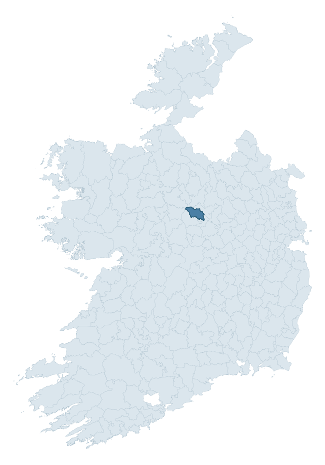
Where this barony sits in the Republic of Ireland
Geology and preservation
Bedrock geology shapes the landscape long before any settlement begins — controlling soil drainage, agricultural potential, the survival of upstanding monuments, and the preservation of buried archaeology. The figures below come from the Geological Survey Ireland 1:100,000 bedrock map.
The bedrock underlying Moydow is predominantly limestone (46% of the barony by area), laid down during the Carboniferous period (100% by area, around 359 to 299 million years ago). Limestone is the most heritage-rich bedrock in Ireland. It supports fertile, well-drained soils that favoured dense Early Medieval settlement and Norman manorial agriculture, and it weathers into karst features — sinkholes, caves, swallow holes, and souterrains — that frequently carry archaeology. Where peat overlies limestone, organic preservation can be exceptional. A substantial secondary geology of limestones (29%) and conglomerate and sandstones (10%) adds further variety to the underlying landscape. The single largest mapped unit is the Visean Limestones (undifferentiated) (29% of the barony's bedrock).
Rock type composition
Largest mapped unit: Visean Limestones (undifferentiated) (29% of the barony)
Placename evidence
Logainm records 19 heritage-diagnostic placenames for Moydow, drawn from townland and civil-parish names across the barony. The dominant stratum is Early Christian ecclesiastical — cill-, teampall-, and domhnach-prefixed names that record the dense network of early church foundations established between the fifth and tenth centuries. The leading diagnostic roots are lios- (5 — ringfort or enclosure), cill- (4 — church), and dún- (2 — hilltop fort or promontory fort). This is below the ROI average of 30.7 heritage placenames per barony, suggesting either lighter survey coverage or a townland-naming tradition that draws more on generic landscape vocabulary. The presence of multiple heritage strata side by side indicates layered occupation of the landscape across successive prehistoric and historic periods. Logainm records 147 placenames for Moydow (predominantly townland names). Of these, 19 (13%) carry one of the diagnostic Gaelic roots tracked above; the remainder draw on more generic landscape vocabulary that does not encode a heritage period.
Pre-Christian / Early Medieval Defensive
| Root | Count | Meaning |
|---|---|---|
| lios- | 5 | ringfort or enclosure |
| dún- | 2 | hilltop or promontory fort |
Early Christian Ecclesiastical
| Root | Count | Meaning |
|---|---|---|
| cill- | 4 | church (early) |
| teampall- | 2 | church (later medieval) |
| cillín- | 2 | unconsecrated burial ground |
| mainistir- | 1 | monastery |
Burial, Ritual, and Norse-Contact
| Root | Count | Meaning |
|---|---|---|
| dumha- | 2 | mound |
| uaimh- | 1 | cave / souterrain |
About this profile
Click any section below to expand.
What is a barony?
A barony is a historic administrative unit in Ireland, broadly equivalent to an English hundred. The 280 baronies used here are from the OSi 2019 National Statutory Boundaries (generalised 20m), covering the 26 counties of the Republic of Ireland. Baronies derive from the Norman period, were formalised in the 17th century, and have not been redrawn for statistical purposes. They vary enormously in area, from compact urban baronies in Dublin to vast upland baronies in Connacht, and should not be compared by raw site count without accounting for area differences.
What counts as a site?
This profile combines three distinct heritage registers, each with its own definition of what constitutes a recordable site:
- Archaeological sites (NMS). The National Monuments Service Sites and Monuments Record (SMR) catalogues every known archaeological monument or site of archaeological interest in the Republic, from prehistoric burial mounds and ringforts to medieval churches and post-medieval defensive works. Inclusion does not require legal protection — only that the site has been identified, surveyed, and assessed as having archaeological value. A separate subset of these sites lies within a recorded protection zone, which gives them statutory protection under the National Monuments Acts.
- Listed buildings (NIAH). The National Inventory of Architectural Heritage records buildings of architectural, historical, archaeological, artistic, cultural, scientific, social, or technical interest. Each surveyed structure is appraised on a five-tier scale: International, National, Regional, Local, and Record-Only. The NIAH appraisal is informational rather than strictly statutory, but it underpins local-authority Record of Protected Structures (RPS) listings.
- Heritage placenames (Logainm). Logainm is the authoritative database of Irish placenames maintained by the Placenames Branch. This profile applies a heritage-diagnostic classifier to the Irish-language form of each townland name, flagging roots that signal defensive sites (ráth-, lios-, dún-, caiseal-, cathair-), ecclesiastical foundations (cill-, teampall-, domhnach-, mainistir-), prehistoric burial-ritual features (tuaim-, carn-, leaba-), or Norse-contact settlement (gall-). Townlands without one of these diagnostic roots are not flagged here — they may still carry historical significance, but that significance is not encoded in the name itself.
Editorial principles
The narrative sections of this profile follow several explicit principles:
- Evidential. Every claim about this barony’s heritage character is anchored in the underlying register data. Where a site count, a placename count, or a percentile rank is cited, it is computed from the source datasets at export time, not estimated.
- Comparative. Counts and metrics are reported alongside their percentile rank against the other 279 ROI baronies. A barony with 50 ringforts in absolute terms could be unusually high or unusually low depending on its size and regional context; percentile ranking removes that ambiguity.
- Transparent on limits. Where a register has known coverage gaps, survey biases, or data-quality issues that affect this barony’s figures, the profile flags them rather than presenting the numbers as definitive.
- No interpretation beyond what the data supports. The narrative does not speculate about historical events, social dynamics, or cultural meaning beyond what the recorded heritage and placename evidence directly attests.
Data caveats and limits
- NMS Sites and Monuments Record is the product of survey campaigns conducted at different intensities across different counties and decades. Some baronies have been surveyed more thoroughly than others, and absolute counts should be read in that light. Sites destroyed by development before survey are typically not represented; sites in heavily forested or upland terrain are sometimes under-recorded.
- NIAH coverage is broadly complete for the Republic of Ireland but the survey was conducted on a rolling county-by-county basis, and the most recent appraisal date varies. Buildings demolished or substantially altered after their original survey may still appear in the register; conversely, recent buildings of merit may not yet have been appraised.
- Logainm classification applies a deliberately conservative pattern-matching approach to the Irish-language townland forms. The classifier prioritises true positives over recall: a townland may carry a heritage signal that the classifier doesn’t recognise, particularly where the diagnostic root has been heavily anglicised or where the townland name draws on a less common term. The 60,000+ townland records and ~9,800 classified placenames give a substantial signal at barony scale, but individual townland names should be checked against Logainm directly for definitive interpretation.
- Period attribution. The chronological distribution reflects only those NMS sites that carry a recognised period attribution in the source data. Sites listed as “Unknown” period are excluded from the dated subset.
- Boundary changes. Some baronies have undergone minor boundary adjustments since their 19th-century definition; the OSi 2019 generalised boundaries used here are the current statutory definition and may differ slightly from historical maps in border areas.
- Bedrock geology is mapped at 1:100,000 scale, which means local variation within a barony — small pockets of different rock type, mineral veins, alluvium overlying bedrock — is generalised. The dominant-system and rocktype figures are area-weighted, so a barony reading “70% Carboniferous limestone” may still contain small but archaeologically important pockets of older or younger rock. Around 3% of GSI polygons do not match the lexicon and contribute no rocktype or system attribution.
Data sources
- National Monuments Service — Sites and Monuments Record (SMR) https://data.gov.ie/dataset/national-monuments-service-archaeological-survey-of-ireland
- National Inventory of Architectural Heritage (NIAH) https://data.gov.ie/dataset/national-inventory-of-architectural-heritage-niah-national-dataset
- Logainm — Placenames Database of Ireland https://www.logainm.ie/
- Ordnance Survey Ireland — National Statutory Barony Boundaries 2019 https://data-osi.opendata.arcgis.com/
- EURODEM — European Digital Elevation Model https://www.mapsforeurope.org/datasets/euro-dem
- ESA WorldCover https://esa-worldcover.org/en
- Geological Survey Ireland — 1:100,000 Bedrock Geology https://www.gsi.ie/en-ie/data-and-maps/Pages/Bedrock.aspx
Explore more: Search any of the 280 ROI baronies, browse by historical province, or read the methodology and data sources for the full Republic of Ireland Heritage Tool.