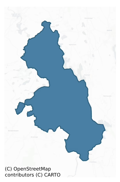
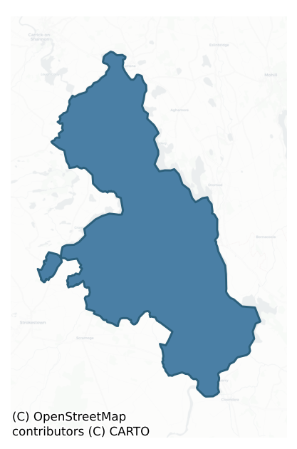
Ballintober North is a barony of County Roscommon, in the historical province of Connacht (Irish: Baile an Tobair Thuaidh), covering 138 km² of land. The barony records 312 NMS archaeological sites and 16 NIAH listed buildings, placing it at around the 64th percentile among 280 ROI baronies for sites per km². This means it is in the upper half of all baronies for sites per km². Dated archaeological evidence runs from the Early Bronze Age through to the Modern, spanning 7 of 9 archaeological periods, placing the barony in the 42nd percentile among 280 ROI baronies for chronological depth. This means it is in the lower half of all baronies for chronological depth. The largest dated subset of recorded sites dates to the Early Medieval. Logainm flags 16 placenames in the barony as carrying a recognised heritage root; the largest share — around 81% — are names associated with early Christian church and monastic foundations.
Heritage at a glance
Percentile rankings throughout this profile compare each barony only against the other 279 Republic of Ireland baronies.
The recorded heritage of Ballintober North
The National Monuments Service Sites and Monuments Record (SMR) is the statutory inventory of archaeological sites for the Republic of Ireland, maintained by the Department of Tourism, Culture, Arts, Gaeltacht, Sport and Media. Sites recorded here include earthworks, ringforts, megalithic tombs, ecclesiastical remains, and post-medieval features; not every record is legally protected, but each is registered as a monument of archaeological interest.
The National Monuments Service records 312 archaeological sites in Ballintober North, putting it at the 64th percentile among 280 ROI baronies for sites per km². This means it is in the upper half of all baronies for sites per km². Protection coverage is near-universal — 306 sites (98%) fall within a recorded monument protection zone, indicating an extensively surveyed landscape. The dominant category is defensive sites — ringforts, enclosures, hillforts, and stone forts (174 sites, 56% of the record). Ringfort – rath is the most prevalent type, making up 45% of the barony's recorded sites (140 records) — well above the ROI average of 20% across all baronies where this type occurs. Ringfort – rath is an earthen ringfort enclosed by a bank and external ditch — the most common Early Medieval farmstead, broadly dated 500–1000 AD. Other significant types include Crannog (17) and Enclosure (8). Crannog is an artificial or partly artificial island built up on a lake or river bed, in use from the 6th to 17th centuries AD; Enclosure is a banked or ditched feature of uncertain type, used as a catch-all where the original function cannot be determined from surface evidence. Across the barony's 138 km², this gives a recorded density of 2.25 sites per km².
Most common monument types
Hover or tap a monument type to see its definition.
| Type | Count |
|---|---|
| Ringfort – rath an earthen ringfort enclosed by a bank and external ditch — the most common Early Medieval farmstead, broadly dated 500–1000 AD | 140 |
| Crannog an artificial or partly artificial island built up on a lake or river bed, in use from the 6th to 17th centuries AD | 17 |
| Enclosure a banked or ditched feature of uncertain type, used as a catch-all where the original function cannot be determined from surface evidence | 8 |
| Ritual site – holy well a well or spring traditionally associated with a saint, often credited with healing properties; many trace earlier ritual origins but devotion is documented from the medieval period onwards | 7 |
| Structure – peatland a construction of unknown function, either extant or implied by archaeological evidence, of any date | 7 |
| Church a building used for public Christian worship, of any date from c. 500 AD onwards | 6 |
| Road – class 3 togher a short wooden peatland trackway up to 15m long, deliberately laid to cross a small area of bog; Neolithic to medieval | 6 |
Chronological distribution
The dated archaeological record for Ballintober North spans from the Early Bronze Age through to the Modern, with activity attested across 7 of 9 archaeological periods. Every period from earliest to latest is represented in the record — an unbroken sequence of dated activity across the full chronological span. Activity concentrates most heavily in the Early Medieval (174 sites, 70% of dated material), with the Modern forming a secondary peak (34 sites, 14%). A further 65 recorded sites (21% of the overall NMS register for the barony) carry no period attribution — appearing as 'Unknown' in the bar chart below. This typically reflects either records that pre-date the standardised period vocabulary or sites awaiting specialist dating review, rather than a genuine absence of chronological evidence.
Sample of recorded monuments
Show 25 sample monuments (of 312 total)
A representative sample of 25 recorded monuments drawn from the barony’s 312 total NMS entries. Sites within a recorded monument protection zone and rarer site types are prioritised so the list shows a meaningful cross-section rather than only the most common type. Each entry shows the official Sites and Monuments Record reference number and the description published by the National Monuments Service.
Souterrain
According to local information, a 'cave' exists within rath (RO011-129001-). There is no visible surface evidence of this feature.
Compiled by: Michael Moore
Date of upload: 24 August 2010
Castle – unclassified
Identified by John O'Donovan in the 1830s as Daingean Bona Cuilinn which was burned in 1145 (AFM vol. 2, 1079), the name Dangan (daingean) means stronghold. It was called Dangen I Beirne and had a fair on 25th May in…
Identified by John O'Donovan in the 1830s as Daingean Bona Cuilinn which was burned in 1145 (AFM vol. 2, 1079), the name Dangan (daingean) means stronghold. It was called Dangen I Beirne and had a fair on 25th May in the later 16th century. Donogh O'Birne held it in the early 17th century (O'Flanagan 1931, vol. 2, 11), and his son Donogh owned a quarter amounting to 160 acres there in 1641 (Simington 1949, 29). It does not feature in the history of the Mac Dermot clan of Moylurg (Mac Dermot 1996). It is described as the site of Dangan Castle on the 1837 and 1911 editions of the OS 6-inch map, and iis situated on a low rise in a low-lying landscape, but no features are visible at ground level in pasture. Rath (RO011-138—-) is c. 40m to the W.
Compiled by: Michael Moore
Date of revised upload: 27 November 2018
Standing stone – pair
On a gentle W-facing slope at the NE edge of a disused quarry. An upright stone (dims 1.5m x 0.3m; H 0.6-1.4m) is oriented WNW-ESE, and a prone stone (dims 1.4m x 1-1.4m) are placed 4m apart and form a NW-SE alignment.…
On a gentle W-facing slope at the NE edge of a disused quarry. An upright stone (dims 1.5m x 0.3m; H 0.6-1.4m) is oriented WNW-ESE, and a prone stone (dims 1.4m x 1-1.4m) are placed 4m apart and form a NW-SE alignment. Standing stone (RO017-202—-) is c. 70m to the SSE.
Compiled by: Michael Moore
Date of upload: 24 August 2010
Memorial stone
A Church of Ireland church, which has a monument on its W wall of James King, the son of Edward King, Bishop of Elphin, dated 1687 (Craig 1976, 14; Hanly 1994) is within the graveyard (RO018-002004-).
The memorial is…
A Church of Ireland church, which has a monument on its W wall of James King, the son of Edward King, Bishop of Elphin, dated 1687 (Craig 1976, 14; Hanly 1994) is within the graveyard (RO018-002004-).
The memorial is described by Bayly (1903, 427) as '6' 6'' by 2' 6" (c. 1.98m x c. 0.75m)' and beneath a crest of a lion and the motto ‘In God is my trust’ the inscription reads: HEER. LYES. THE. BODY. OF / JAMES KING. OF. CHARLESTOWNE / ESQ. THE SON. OF. DOCTOR. ED-/WARD KING. BISHOPP. OF. EL-/PHIN. WHO DYED. ON. SA-/TURDAY. YE 2ND OF. APRILL/ IN. YE YEAR. OF. OUR. LORD/ GOD. 1687. BE/ING. YE 77TH/ YEARE/OF. HIS. ADGE/ANNO DOM./1.68.7
Compiled by: Michael Moore
Date of revised upload: 30 June 2015
Religious house – Augustinian canons
The parish church of Kilmore is listed as Kilmore in the ecclesiastical taxation of Elphin in 1306 (Cal. doc. Ire., vol. 5, 224). It is probably the site of the abbey of Kilmore of Tir Briuin na Sinna (RO018-026002*),…
The parish church of Kilmore is listed as Kilmore in the ecclesiastical taxation of Elphin in 1306 (Cal. doc. Ire., vol. 5, 224). It is probably the site of the abbey of Kilmore of Tir Briuin na Sinna (RO018-026002*), which was reputedly founded by St Patrick (Stokes 1887b, 95). In 1232 the church of Kilmore in Hy Briuin na Sinna was consecrated by Donnagh O'Conor, Bishop of Elphin, when it was placed under the Augustinian rule. In 1249 Con O'Flanagan, the prior, and Teige O'Monaghan, Lord of Ui Briuin na Sionna were buried there (AFM vol. 3, P 261, 333). The abbey may have been transformed into a parish church in 1412, but it continued at least until the mid-fifteenth century. In 1580 it was leased by a Tyrell O'Farrell (Gwynn and Hadcock 1988, 183).
Situated on a level landscape. There is no evidence of an early church structure within a rectangular graveyard (RO018-002004-) (dims 64m E-W; 40m N-S) defined by masonry walls, containing a Church of Ireland church, which has a memorial (RO018-002002-) to James King, son of Edward King, Bishop of Elphin dated 1687 (Bayly 1901-03, 427; Craig 1976a, 14; Hanly 1994). A grave-slab (RO018-002001-) (dims 1.05m x 0.3m; T 0.05m) with an inscription, recording Edwina, the daughter of MacBrannan, and the date 1357 (Bayley 1901-03, 425-6; O'Flanagan 1931, vol. 2, 22-3) is inside the entrance to the graveyard. The site of Tobernacleggan well (RO018-003—-) is c. 130m to the ESE.
Compiled by: Michael Moore
Date of upload: 24…
Barrow – unclassified
Marked on the 1837 and 1914 eds of the OS 6-inch map, but named 'Cruckawn' only on the later map. Situated on the E-facing crest of a low N-S ridge, c. 150m from the River Shannon N-E. Circular overgrown earth and stone…
Marked on the 1837 and 1914 eds of the OS 6-inch map, but named 'Cruckawn' only on the later map. Situated on the E-facing crest of a low N-S ridge, c. 150m from the River Shannon N-E. Circular overgrown earth and stone mound (diam. of base 14.5m; diam. of top 6.7-8m; H 0.8m at S to 1.8m at N) with traces of facing-stones at S and W. There is a conical stone-lined pit (diam. of top 2.3m; diam. of base 1.4m; D 1.2m) on the summit. Rath (RO018-004—-) is c. 70m to the W.
Compiled by: Michael Moore
Date of upload: 24 August 2010
Millstone quarry
On a low spur of rock outcrop in a low-lying landscape c. 150m E of Grange Lough. Two rough-outs of conglomerate millstones (diam. 1.25m; T 0.25m) are still attached to the rock.
Compiled by: Michael Moore
Date of…
On a low spur of rock outcrop in a low-lying landscape c. 150m E of Grange Lough. Two rough-outs of conglomerate millstones (diam. 1.25m; T 0.25m) are still attached to the rock.
Compiled by: Michael Moore
Date of upload: 24 August 2010
Hilltop enclosure
At S end of a broad NE-SW ridge with the S-N Mountain River c. 250m to the W and Kilglass Lough c. 300m to the E. Circular grass-covered area (diam. 98m E-W; 94m N-S) defined by an overgrown scarp (H 0.4m at E to 1.1m…
At S end of a broad NE-SW ridge with the S-N Mountain River c. 250m to the W and Kilglass Lough c. 300m to the E. Circular grass-covered area (diam. 98m E-W; 94m N-S) defined by an overgrown scarp (H 0.4m at E to 1.1m at W) which cannot be traced SSW-SW. There is a field bank and hedge at the base of the scarp W-N and a NE-SW field bank and drain cross the interior NW of the centre.
Compiled by: Michael Moore
Date of upload: 24 August 2010
Monumental structure
Marked only on the 1837 ed. of the OS 6-inch map where it is described in italic lettering as 'Monument', and situated on the N bank of a small SE-NW stream which runs into Kilglass Lough c. 170m to the W. It is also c.…
Marked only on the 1837 ed. of the OS 6-inch map where it is described in italic lettering as 'Monument', and situated on the N bank of a small SE-NW stream which runs into Kilglass Lough c. 170m to the W. It is also c. 300m S of Kilglass graveyard (RO024-005001-). There is no other information, and it is not now visible at ground level in pasture.
Compiled by: Michael Moore
Date of upload: 24 August 2010
Round tower
The round tower, which was c. 4.5m W of Tempall Mór (RO024-016001-), collapsed c. 1770 and its stump (diam. c. 2.75-3.35m) was removed c. 1830 when some of its stones were incorporated into the graveyard wall while the…
The round tower, which was c. 4.5m W of Tempall Mór (RO024-016001-), collapsed c. 1770 and its stump (diam. c. 2.75-3.35m) was removed c. 1830 when some of its stones were incorporated into the graveyard wall while the conical capstone (diam. 0.46m; H 0.45m) with a mortice on top is just N of Teach Geal. (Barrow 1979, 179, 180)
Compiled by: Michael Moore
Date of upload: 24 August 2010
Architectural fragment
There are architectural fragments built into the walls of the graveyard (RO024-016008-), but others recorded in the 18th century are now missing (Stalley 1991, 204-05).
Compiled by: Michael Moore
Date of upload:…
There are architectural fragments built into the walls of the graveyard (RO024-016008-), but others recorded in the 18th century are now missing (Stalley 1991, 204-05).
Compiled by: Michael Moore
Date of upload: 24 August 2010
Children's burial ground
Marked on the 1837 and 1914 eds of the OS 6-inch map, and situated on a small rise on the E bank of a small N-S stream. Rectangular grass-covered area (dims 11m NE-SW; 8m NW-SE) within four trees marking the corners…
Marked on the 1837 and 1914 eds of the OS 6-inch map, and situated on a small rise on the E bank of a small N-S stream. Rectangular grass-covered area (dims 11m NE-SW; 8m NW-SE) within four trees marking the corners strewn with small grave-markers. A round-topped granite slab (RO024-017002-) (dims 0.3m x 0.12m; H 0.3m) inscribed with a plain cross on one side is set upright amongst the grave-markers. It was conserved during 2009.
Compiled by: Michael Moore
Date of upload: 24 August 2010
Road – gravel/stone trackway – peatland
Emerging from a bog and rising up the S-facing slope of the slight E-W ridge on which Kilbarry church (RO024-016001-) is situated. Running NE-SW (L c. 600m) down the side of the ridge, it is known as the 'Saint's Road'…
Emerging from a bog and rising up the S-facing slope of the slight E-W ridge on which Kilbarry church (RO024-016001-) is situated. Running NE-SW (L c. 600m) down the side of the ridge, it is known as the 'Saint's Road' and its course is known locally as a direct route between Kilbarry church and the RC church of Whitehall where St. Barry's Boat (RO030-007—-) is kept. At the bottom of the slope it proceeds N (L c. 300m) on the E side of a N-S field bank where it is barely noticeable at the S end as a slight berm (Wth c. 3-5m), before swinging NE across fields (L c. 450m) to meet the public road c. 80m W of the graveyard (RO024-016002-). It is reputed locally to have a metalled surface that can be detected in parched conditions. Archaeological testing (16E0174) by A. Wallace just to the NW at a point where the old road approaches the E-W public road produced no related material (excavations.ie 2016:857).
Compiled by: Michael Moore
Date of upload: 24 August 2010
Amended: 20 October 2021
Font
There is a fragment of a font inside Teampull Mor (RO024-016001-).
Compiled by: Michael Moore
Date of upload: 24 August 2010
Ritual site – holy/saint's stone (present location)
On a level landscape just E of the RC church at Whitehall. A limestone block (dims. 2.4m x 1.2m; T 0.3m) on which traditionally St Barry of Kilbarry (RO024-016001-) crossed the River Shannon from Co. Longford. It was…
On a level landscape just E of the RC church at Whitehall. A limestone block (dims. 2.4m x 1.2m; T 0.3m) on which traditionally St Barry of Kilbarry (RO024-016001-) crossed the River Shannon from Co. Longford. It was found c. 1900 at an unknown place (RO024-018—-) in the bed of the river at Kilbarry and brought to its present location. (OS Name Books; Farrell 1996)
See the attached image.
Compiled by: Michael Moore
Date of upload: 24 August 2010
Settlement cluster
On a W-facing slope of a low drumlin. The village of Aughmore existed before the Great Famine (1845-9) but the tenants were evicted in 1847 after a bitter rent strike when the village was levelled (Coyle 1994, 27-36).…
On a W-facing slope of a low drumlin. The village of Aughmore existed before the Great Famine (1845-9) but the tenants were evicted in 1847 after a bitter rent strike when the village was levelled (Coyle 1994, 27-36). Geophysical testing of an area of c. 1 ha located c. 70m NE of the rath (RO024-004001-) identified a sunken roadway (RO024-004003-) approaching the rath from the NE. Excavation recovered over 9000 pottery artefacts dating from 1800 to 1848 at the site of a house, identified through records as the Neary house, and an adjacent cobbled yard (Orser 1999, 2000; 2002; 2003; Hull and Orser 2004; Hull 2006).
Compiled by: Michael Moore
Date of upload: 24 August 2010
Road – road/trackway
On a W-facing slope. Geophysical testing of an area of c. 1 ha located c. 70m NE of the rath (RO024-004001-) identified a sunken roadway approaching the rath from the NE associated with a post-medieval house…
On a W-facing slope. Geophysical testing of an area of c. 1 ha located c. 70m NE of the rath (RO024-004001-) identified a sunken roadway approaching the rath from the NE associated with a post-medieval house (RO024-004002-). (Orser 1999, 2000; 2002; 2003; Hull and Orser 2004).
Compiled by: Michael Moore
Date of upload: 24 August 2010
Cross-inscribed stone
On a small rise on the E bank of a small N-S stream and within children's burial ground (RO024-017001-). A round-topped granite slab (dims 0.3m x 0.12m; H 0.3m) inscribed with a plain cross on one side is set upright…
On a small rise on the E bank of a small N-S stream and within children's burial ground (RO024-017001-). A round-topped granite slab (dims 0.3m x 0.12m; H 0.3m) inscribed with a plain cross on one side is set upright amongst the grave-markers.
Compiled by: Michael Moore
Date of upload: 24 August 2010
Ring-ditch
On a low-lying, level landscape. Circular area (diam. c. 20m) defined by a fosse (Wth 1.5-1.8m; D 0.45m), which was partly revealed in excavation (05E0394) by C. Read (2008f) in 2005. Charcoal and fragments of cremated…
On a low-lying, level landscape. Circular area (diam. c. 20m) defined by a fosse (Wth 1.5-1.8m; D 0.45m), which was partly revealed in excavation (05E0394) by C. Read (2008f) in 2005. Charcoal and fragments of cremated bone were recovered, and the monument remains preserved. It is likely to be the same feature as the enclosure (RO011-057—-).
Compiled by: Michael Moore
Date of upload: 24 August 2010
Burial
A human skull was found in July 1999 in digging a canal close to the Jamestown canal. It was investigated by Mary Cahill of the National Museum of Irealnd, and it is now in the Museum (1992:32). The context was…
A human skull was found in July 1999 in digging a canal close to the Jamestown canal. It was investigated by Mary Cahill of the National Museum of Irealnd, and it is now in the Museum (1992:32). The context was disturbed and no other bones were recovered, but the skull seems to have come from the location of a small lake. (Sikora and Cahill 2011, vol. 2, P 509-10, 7.178)
Compiled by: Michael Moore.
Date of upload: 20 March, 2012.
Road – class 2 togher
This site was initially recorded in the 2008 Archaeological Survey of Ireland Peatland Survey as a platform (Rohan 2009). It was located c. 170-200m from the edge of a bay at the NW end of Cloonshannagh Bog and visible…
This site was initially recorded in the 2008 Archaeological Survey of Ireland Peatland Survey as a platform (Rohan 2009). It was located c. 170-200m from the edge of a bay at the NW end of Cloonshannagh Bog and visible in a drain face, 0.09m below the field surface. During the 2013 Re-Assessment Survey carried out by ADS it became apparent that this site and another nearby platform also recorded in 2008 formed a linear togher, orientated NW-SE, which was then recorded as CLS180a-d (Whitaker 2014).
The togher was excavated in 2015 under licence 15E0203. The site was dated to cal. 2870-2495 BC. It was situated in Sphagnum pool peat. The excavated site was up to 3.5m in width, consisting of transverse roundwood and brushwood elements in very poor condition. It was supported by longitudinal roundwoods, interspersed with some lighter longitudinal brushwood and a loose scatter of brushwood. An organic layer consisting of twigs and woody detritus was found towards the E extent of the cutting. The trackway was secured by pegs. Some of them displayed toolmarked ends with concave facets (Coughlan & Whitaker 2019).
Compiled by: Ros O Maoldúin/Michael Moore, Edited by: Femke Vleeshouwer, 15 April 2020
Date of upload: 12th April, 2011
Holed stone
There is a holed stone (dims 0.32m x 0.09m; H 0.45m) set in the ground c. 20m NW of Teach Dorcha, which was first identified and recorded by Gary Dempsey. It has a rounded top where it is penetrated by a hole (diam.…
There is a holed stone (dims 0.32m x 0.09m; H 0.45m) set in the ground c. 20m NW of Teach Dorcha, which was first identified and recorded by Gary Dempsey. It has a rounded top where it is penetrated by a hole (diam. 0.1m).
Compiled by: Michael Moore
Date of upload: 2 December, 2014
Penitential station
On a level landscape. There is a grass-covered penitential cairn (dims 10m E-W; 7m N-S; max. H 1.2m) of fist-sized stones at the holy well (RO030-005001-).
Compiled by: Michael Moore
Date of upload: 24 August 2010
Linear earthwork
Two parallel systems of banks and ditches (L c. 1.6km E-W) cut off a loop of the River Shannon to the N which contains c. 2 km(2). This is identified as a defensive earthwork of Connaught against its enemies in Ulster…
Two parallel systems of banks and ditches (L c. 1.6km E-W) cut off a loop of the River Shannon to the N which contains c. 2 km(2). This is identified as a defensive earthwork of Connaught against its enemies in Ulster (Kane 1915) and part of the extensive linear defences called the Black Pig's Dyke and the Danes Cast demarking the boundaries of Ulster (Kane 1909).
Described as two principal lines of defence, the one to the N consisting of an inner earthen bank (Wth of base c. 30m; H up to 6m) separated by a 'paved causeway' (Wth c. 4-10m) from an outer double bank (Wth c. 3m; H 1m) further N. There are two entrances (Wth c. 16-23m) with inturned horns (L c. 40m) situated c. 80m and c. 650m from the E end. About 60-100m to the S is a second line of defence surviving only at the E end (L c. 300m) and consisting of two earthen banks (Wth c. 4m; H c. 0.8m) separated by a fosse or 'causeway'.
These works are interpreted as a defensive line of Connaught controlling a number of fords in the loop and W of the loop in Cuiltyconway (Condit and Buckley 1989). Geophysical survey (Buckley et al. (1990a,b) revealed the possible presence of a central gatepost in the E entrance of the main rampart. Excavation (Buckley and Condit 1991) revealed that the main rampart may have been enlarged, while a calibrated Carbon 14 date of 338-44 BC suggests Iron Age construction (Lanting et al. 1991). Archaeological testing (04E1301) at the W end of the banks in Ardanaffrin failed to produce any rel…
Ringfort – rath
On a slight NE-facing slope. Circular grass-covered area (diam. 27m N-S) defined by an eroded earthen bank with some scrub (Wth 3m at N to 4.7m at S; int. H 0.2-0.6m; ext. H 0.8-1.2m) N-S-WSW, with an outer fosse (Wth…
On a slight NE-facing slope. Circular grass-covered area (diam. 27m N-S) defined by an eroded earthen bank with some scrub (Wth 3m at N to 4.7m at S; int. H 0.2-0.6m; ext. H 0.8-1.2m) N-S-WSW, with an outer fosse (Wth of top 3.2m; D 0.2-0.4m) SE-S represented by a band of rushes (Wth 3m) N-E but expanded into a pond S-WSW. There is no visible entrance, and the perimeter is truncated by the scarp of a removed NE-SW field bank at NW. Earthwork (RO011-057—-) and ring-ditch (RO011-057001-) are c. 60m to the SSE, but archaeological testing (06E1187) c. 50m to the E failed to produce any related material (Read 2009b).
Compiled by: Michael Moore
Date of upload: 24 August 2010
Listed buildings
The National Inventory of Architectural Heritage (NIAH) is a state survey appraising buildings of architectural, historical, archaeological, artistic, cultural, scientific, social, or technical interest. Each surveyed structure receives a rating from International (the highest, for buildings of European importance) through National, Regional, Local, and Record-Only.
The NIAH records only 16 listed buildings in Ballintober North, the 4th percentile across ROI baronies — a relatively thin architectural record. All recorded buildings carry Regional or lower grading; the barony does not contain any structures appraised as being of National or International architectural importance. Construction dates concentrate most heavily in the Victorian (1830-1900) period.
Terrain and environment
Mean elevation across the barony is 52m — the 16th percentile among 280 ROI baronies for elevation. This means it is in the bottom fifth of all baronies for elevation. This is a relatively low-lying landscape by ROI standards. Elevation matters for heritage because higher-altitude baronies typically favour defensive monuments — ringforts and hilltop forts placed on prominent ground — while lowland baronies are more likely to carry the dense settlement and church networks of intensive agricultural landscapes. A maximum elevation of 154m gives the barony meaningful vertical relief. Mean slope is 2.7° — the 32nd percentile among 280 ROI baronies for slope. This means it is in the bottom third of all baronies for slope. Slope is a key control on both land use and archaeological preservation: steep ground resists ploughing and tends to preserve earthworks intact, while gentle slopes favour intensive cultivation that damages or destroys surface archaeology over time. The Topographic Wetness Index averages 11.4, the 71st percentile among 280 ROI baronies for wetness. This means it is in the top third of all baronies for wetness. Drainage matters for heritage because poorly-drained ground preserves organic archaeology (wooden trackways, leather, textiles, and on rare occasions human remains) far better than free-draining soil; well-drained ground favours arable use but destroys organic material rapidly. The land-cover mosaic combines improved grassland (70%), woodland (20%), and open water (8%), giving a mixed agricultural and semi-natural landscape.
Terrain measurements
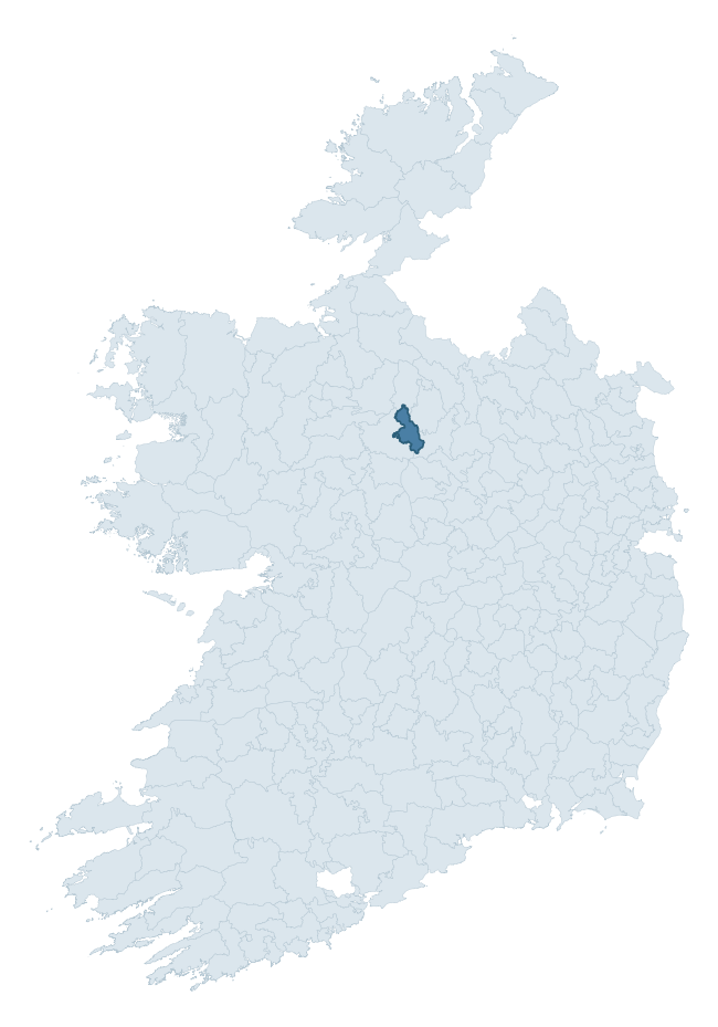
Where this barony sits in the Republic of Ireland
Geology and preservation
Bedrock geology shapes the landscape long before any settlement begins — controlling soil drainage, agricultural potential, the survival of upstanding monuments, and the preservation of buried archaeology. The figures below come from the Geological Survey Ireland 1:100,000 bedrock map.
The bedrock underlying Ballintober North is predominantly limestone (28% of the barony by area), laid down during the Carboniferous period (82% by area, around 359 to 299 million years ago). Limestone is the most heritage-rich bedrock in Ireland. It supports fertile, well-drained soils that favoured dense Early Medieval settlement and Norman manorial agriculture, and it weathers into karst features — sinkholes, caves, swallow holes, and souterrains — that frequently carry archaeology. Where peat overlies limestone, organic preservation can be exceptional. A substantial secondary geology of limestones (17%) and black calcarenites and shales (16%) adds further variety to the underlying landscape. With 10 distinct rock types mapped, the barony sits in the top third of ROI baronies for geological diversity (90th percentile) — typically a sign of complex tectonic history or coastal mosaics of differing rock units.
Rock type composition
Largest mapped unit: Oakport Limestone Formation (21% of the barony)
Placename evidence
Logainm records 16 heritage-diagnostic placenames for Ballintober North, drawn from townland and civil-parish names across the barony. The dominant stratum is Early Christian ecclesiastical — cill-, teampall-, and domhnach-prefixed names that record the dense network of early church foundations established between the fifth and tenth centuries. The leading diagnostic roots are cill- (13 — church), lios- (1 — ringfort or enclosure), and gall- (1 — foreigner). This is below the ROI average of 30.7 heritage placenames per barony, suggesting either lighter survey coverage or a townland-naming tradition that draws more on generic landscape vocabulary. The presence of multiple heritage strata side by side indicates layered occupation of the landscape across successive prehistoric and historic periods. Logainm records 127 placenames for Ballintober North (predominantly townland names). Of these, 16 (13%) carry one of the diagnostic Gaelic roots tracked above; the remainder draw on more generic landscape vocabulary that does not encode a heritage period.
Pre-Christian / Early Medieval Defensive
| Root | Count | Meaning |
|---|---|---|
| lios- | 1 | ringfort or enclosure |
Early Christian Ecclesiastical
| Root | Count | Meaning |
|---|---|---|
| cill- | 13 | church (early) |
Burial, Ritual, and Norse-Contact
| Root | Count | Meaning |
|---|---|---|
| gall- | 1 | foreigner — Norse settlement marker |
Other baronies in Roscommon
About this profile
Click any section below to expand.
What is a barony?
A barony is a historic administrative unit in Ireland, broadly equivalent to an English hundred. The 280 baronies used here are from the OSi 2019 National Statutory Boundaries (generalised 20m), covering the 26 counties of the Republic of Ireland. Baronies derive from the Norman period, were formalised in the 17th century, and have not been redrawn for statistical purposes. They vary enormously in area, from compact urban baronies in Dublin to vast upland baronies in Connacht, and should not be compared by raw site count without accounting for area differences.
What counts as a site?
This profile combines three distinct heritage registers, each with its own definition of what constitutes a recordable site:
- Archaeological sites (NMS). The National Monuments Service Sites and Monuments Record (SMR) catalogues every known archaeological monument or site of archaeological interest in the Republic, from prehistoric burial mounds and ringforts to medieval churches and post-medieval defensive works. Inclusion does not require legal protection — only that the site has been identified, surveyed, and assessed as having archaeological value. A separate subset of these sites lies within a recorded protection zone, which gives them statutory protection under the National Monuments Acts.
- Listed buildings (NIAH). The National Inventory of Architectural Heritage records buildings of architectural, historical, archaeological, artistic, cultural, scientific, social, or technical interest. Each surveyed structure is appraised on a five-tier scale: International, National, Regional, Local, and Record-Only. The NIAH appraisal is informational rather than strictly statutory, but it underpins local-authority Record of Protected Structures (RPS) listings.
- Heritage placenames (Logainm). Logainm is the authoritative database of Irish placenames maintained by the Placenames Branch. This profile applies a heritage-diagnostic classifier to the Irish-language form of each townland name, flagging roots that signal defensive sites (ráth-, lios-, dún-, caiseal-, cathair-), ecclesiastical foundations (cill-, teampall-, domhnach-, mainistir-), prehistoric burial-ritual features (tuaim-, carn-, leaba-), or Norse-contact settlement (gall-). Townlands without one of these diagnostic roots are not flagged here — they may still carry historical significance, but that significance is not encoded in the name itself.
Editorial principles
The narrative sections of this profile follow several explicit principles:
- Evidential. Every claim about this barony’s heritage character is anchored in the underlying register data. Where a site count, a placename count, or a percentile rank is cited, it is computed from the source datasets at export time, not estimated.
- Comparative. Counts and metrics are reported alongside their percentile rank against the other 279 ROI baronies. A barony with 50 ringforts in absolute terms could be unusually high or unusually low depending on its size and regional context; percentile ranking removes that ambiguity.
- Transparent on limits. Where a register has known coverage gaps, survey biases, or data-quality issues that affect this barony’s figures, the profile flags them rather than presenting the numbers as definitive.
- No interpretation beyond what the data supports. The narrative does not speculate about historical events, social dynamics, or cultural meaning beyond what the recorded heritage and placename evidence directly attests.
Data caveats and limits
- NMS Sites and Monuments Record is the product of survey campaigns conducted at different intensities across different counties and decades. Some baronies have been surveyed more thoroughly than others, and absolute counts should be read in that light. Sites destroyed by development before survey are typically not represented; sites in heavily forested or upland terrain are sometimes under-recorded.
- NIAH coverage is broadly complete for the Republic of Ireland but the survey was conducted on a rolling county-by-county basis, and the most recent appraisal date varies. Buildings demolished or substantially altered after their original survey may still appear in the register; conversely, recent buildings of merit may not yet have been appraised.
- Logainm classification applies a deliberately conservative pattern-matching approach to the Irish-language townland forms. The classifier prioritises true positives over recall: a townland may carry a heritage signal that the classifier doesn’t recognise, particularly where the diagnostic root has been heavily anglicised or where the townland name draws on a less common term. The 60,000+ townland records and ~9,800 classified placenames give a substantial signal at barony scale, but individual townland names should be checked against Logainm directly for definitive interpretation.
- Period attribution. The chronological distribution reflects only those NMS sites that carry a recognised period attribution in the source data. Sites listed as “Unknown” period are excluded from the dated subset.
- Boundary changes. Some baronies have undergone minor boundary adjustments since their 19th-century definition; the OSi 2019 generalised boundaries used here are the current statutory definition and may differ slightly from historical maps in border areas.
- Bedrock geology is mapped at 1:100,000 scale, which means local variation within a barony — small pockets of different rock type, mineral veins, alluvium overlying bedrock — is generalised. The dominant-system and rocktype figures are area-weighted, so a barony reading “70% Carboniferous limestone” may still contain small but archaeologically important pockets of older or younger rock. Around 3% of GSI polygons do not match the lexicon and contribute no rocktype or system attribution.
Data sources
- National Monuments Service — Sites and Monuments Record (SMR) https://data.gov.ie/dataset/national-monuments-service-archaeological-survey-of-ireland
- National Inventory of Architectural Heritage (NIAH) https://data.gov.ie/dataset/national-inventory-of-architectural-heritage-niah-national-dataset
- Logainm — Placenames Database of Ireland https://www.logainm.ie/
- Ordnance Survey Ireland — National Statutory Barony Boundaries 2019 https://data-osi.opendata.arcgis.com/
- EURODEM — European Digital Elevation Model https://www.mapsforeurope.org/datasets/euro-dem
- ESA WorldCover https://esa-worldcover.org/en
- Geological Survey Ireland — 1:100,000 Bedrock Geology https://www.gsi.ie/en-ie/data-and-maps/Pages/Bedrock.aspx
Explore more: Search any of the 280 ROI baronies, browse by historical province, or read the methodology and data sources for the full Republic of Ireland Heritage Tool.