
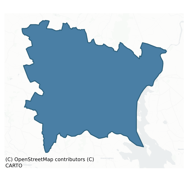
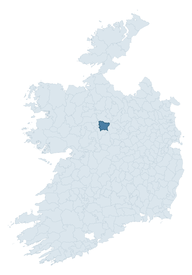
Ballintober South is a barony of County Roscommon, in the historical province of Connacht (Irish: Baile an Tobair Theas), covering 205 km² of land. The barony records 455 NMS archaeological sites and 51 NIAH listed buildings, placing it at around the 62nd percentile among 280 ROI baronies for sites per km². This means it is in the upper half of all baronies for sites per km². Dated archaeological evidence runs from the Early Bronze Age through to the Modern, spanning 7 of 9 archaeological periods, placing the barony in the 28th percentile among 280 ROI baronies for chronological depth. This means it is in the bottom third of all baronies for chronological depth. The largest dated subset of recorded sites dates to the Early Medieval. Logainm flags 24 placenames in the barony as carrying a recognised heritage root; the largest share — around 50% — are names associated with early Christian church and monastic foundations.
Heritage at a glance
Percentile rankings throughout this profile compare each barony only against the other 279 Republic of Ireland baronies.
The recorded heritage of Ballintober South
The National Monuments Service Sites and Monuments Record (SMR) is the statutory inventory of archaeological sites for the Republic of Ireland, maintained by the Department of Tourism, Culture, Arts, Gaeltacht, Sport and Media. Sites recorded here include earthworks, ringforts, megalithic tombs, ecclesiastical remains, and post-medieval features; not every record is legally protected, but each is registered as a monument of archaeological interest.
The National Monuments Service records 455 archaeological sites in Ballintober South, putting it at the 62nd percentile among 280 ROI baronies for sites per km². This means it is in the upper half of all baronies for sites per km². Protection coverage is near-universal — 427 sites (94%) fall within a recorded monument protection zone, indicating an extensively surveyed landscape. The dominant category is defensive sites — ringforts, enclosures, hillforts, and stone forts (184 sites, 40% of the record). Ringfort – rath is the most prevalent type, making up 26% of the barony's recorded sites (117 records) — well above the ROI average of 20% across all baronies where this type occurs. Ringfort – rath is an earthen ringfort enclosed by a bank and external ditch — the most common Early Medieval farmstead, broadly dated 500–1000 AD. Other significant types include House – indeterminate date (27) and Enclosure (19). House – indeterminate date is a habitation building whose date cannot be determined from available evidence; Enclosure is a banked or ditched feature of uncertain type, used as a catch-all where the original function cannot be determined from surface evidence. Across the barony's 205 km², this gives a recorded density of 2.22 sites per km².
Most common monument types
Hover or tap a monument type to see its definition.
| Type | Count |
|---|---|
| Ringfort – rath an earthen ringfort enclosed by a bank and external ditch — the most common Early Medieval farmstead, broadly dated 500–1000 AD | 117 |
| House – indeterminate date a habitation building whose date cannot be determined from available evidence | 27 |
| Enclosure a banked or ditched feature of uncertain type, used as a catch-all where the original function cannot be determined from surface evidence | 19 |
| Barrow – ring-barrow a Bronze/Iron Age burial monument: a low circular area enclosed by ditch and outer bank | 18 |
| Ringfort – cashel the stone-walled equivalent of the rath, found mainly in upland or western areas, broadly dated 500–1000 AD | 15 |
| Cross-slab a stone slab inscribed with a cross, used as a grave-marker or memorial, dated pre-1200 AD | 13 |
| Field system a group of related fields forming a coherent agricultural landscape, of any date from the Neolithic onwards | 12 |
Chronological distribution
The dated archaeological record for Ballintober South spans from the Early Bronze Age through to the Modern, with activity attested across 7 of 9 archaeological periods. Every period from earliest to latest is represented in the record — an unbroken sequence of dated activity across the full chronological span. Activity concentrates most heavily in the Early Medieval (171 sites, 45% of dated material), with the Iron Age forming a secondary peak (74 sites, 19%). A further 72 recorded sites (16% of the overall NMS register for the barony) carry no period attribution — appearing as 'Unknown' in the bar chart below. This typically reflects either records that pre-date the standardised period vocabulary or sites awaiting specialist dating review, rather than a genuine absence of chronological evidence.
Sample of recorded monuments
Show 25 sample monuments (of 455 total)
A representative sample of 25 recorded monuments drawn from the barony’s 455 total NMS entries. Sites within a recorded monument protection zone and rarer site types are prioritised so the list shows a meaningful cross-section rather than only the most common type. Each entry shows the official Sites and Monuments Record reference number and the description published by the National Monuments Service.
Bawn
Reputedly a castle of the O'Flanagans (O'Flanagan 1931, vol. 1, 51), and situated on a gentle N-facing slope of a WNW-ESE ridge with rock outcrop. The mound of Leitrim castle (RO035-019001-) is at the NE angle of a…
Reputedly a castle of the O'Flanagans (O'Flanagan 1931, vol. 1, 51), and situated on a gentle N-facing slope of a WNW-ESE ridge with rock outcrop. The mound of Leitrim castle (RO035-019001-) is at the NE angle of a rectangular enclosure or bawn (dims c. 30m E-W; c. 30m N-S) defined by grass-covered wall footings and stone spreads (Wth 1m; H 0.15-0.25m) on the N and W sides. At the NW angle are the foundations a small structure (int. dims 3m E-W; 3m N-S) with an entrance (Wth 0.6m) at N, which is probably a corner tower. Within the bawn are the foundations of two houses (RO035-019003-; RO035-019004-).
Compiled by: Michael Moore
Date of upload: 24 August 2010
Barrow – pond barrow
At the crest of the W-facing slope of a hill. Circular, grass-covered concave area (diam. 25m N-S; 24.4m E-W; D 0.8-1.3m) defined by a flat-topped earthen bank (Wth of base 4.8-7.1m; Wth of top 1.5-2.2m; ext. H…
At the crest of the W-facing slope of a hill. Circular, grass-covered concave area (diam. 25m N-S; 24.4m E-W; D 0.8-1.3m) defined by a flat-topped earthen bank (Wth of base 4.8-7.1m; Wth of top 1.5-2.2m; ext. H 0.2-0.45m), which is surmounted by a field wall NNW-ENE. Ring-barrow (RO035-076—-) is c. 50m to the SW and embanked barrow (RO035-078—-) is c. 50m to the S. Rath (RO035-079—-) is c. 120m to the NNE.
See the attached aerial images taken from the NW.
Compiled by: Michael Moore
Date of upload: 24 August 2010
Barrow – embanked barrow
At the summit of a broad hill. Circular grass-covered area (diam. 15m E-W; 14.3m N-S) defined by a slight earthen bank (Wth 3.5-4.5m; int. H 0.1-0.2m; ext. H 0.45-0.85m) but the perimeter has been disturbed NNW-SSE…
At the summit of a broad hill. Circular grass-covered area (diam. 15m E-W; 14.3m N-S) defined by a slight earthen bank (Wth 3.5-4.5m; int. H 0.1-0.2m; ext. H 0.45-0.85m) but the perimeter has been disturbed NNW-SSE (ext. diam. 21.4m E-W; 19.8m N-S). Pond-barrow (RO035-077—-) is c. 50m to the N and ring-barrow (RO035-076—-) is c. 60m to the W.
See the attached aerial images taken from the NW (001) and W (003).
Compiled by: Michael Moore
Date of upload: 24 August 2010
Standing stone
On a broad WNW-ESE ridge. This a limestone upright (dims 0.5m x 0.45m; H 2.15m), tapering slightly towards the top (dims 0.4m x 0.3m), and roughly aligned NW-SE. (Siggins 1986a)
See the attached image taken from the…
On a broad WNW-ESE ridge. This a limestone upright (dims 0.5m x 0.45m; H 2.15m), tapering slightly towards the top (dims 0.4m x 0.3m), and roughly aligned NW-SE. (Siggins 1986a)
See the attached image taken from the S.
Compiled by: Michael Moore
Date of upload: 24 August 2010
Barrow – bowl-barrow
Called a castle and the chapel of Mullaghnashee by O'Donovan in 1837 (O'Flanagan 1931, vol. 1, 50), the name has become attached and it is known locally as 'the Steeple', although there is no evidence of either…
Called a castle and the chapel of Mullaghnashee by O'Donovan in 1837 (O'Flanagan 1931, vol. 1, 50), the name has become attached and it is known locally as 'the Steeple', although there is no evidence of either structure. Known as Sídh Neannta it was one of the landmarks on the bounds of Uí Maine (O'Donovan 1843, 5). It is associated with the O'Hanley family, and it may have been an inauguration site for them.
Situated at the summit of Fairymount Hill. D-shaped, grass-covered earthen mound with a gently domed summit (dims of top 13m E-W; 9m N-S; dims of base 28.2m E-W; 21.6m N-S; H 2.6-3m). A N-S field bank and drain clip the E edge of the mound and an E-W field bank with a drain on its N side truncates the mound towards the perimeter at S. Given its prominent location and its size, it might contain a passage tomb.
Some cut stone, including two fragments of an inscription (RO036-013003-), probably from a graveslab or a cross, mention Eilis and Peter Hanley. Barrow (RO036-014—-) is c. 110m to the SE..
Compiled by: Michael Moore
Date of upload: 24 August 2010
Religious house – Augustinian, of Arrouaise nuns
An abbey of Augustinian Arroasian nuns was established here from Roscommon (RO039-043006-) probably by Turlough O'Conor before his death in 1156. By 1223 it was a cell of the Arroasian nuns at Kilcreevanty…
An abbey of Augustinian Arroasian nuns was established here from Roscommon (RO039-043006-) probably by Turlough O'Conor before his death in 1156. By 1223 it was a cell of the Arroasian nuns at Kilcreevanty (GA029-096001-), but it may have been defunct shortly afterwards (Gwynn and Hadcock, 1970, 163, 316; Hall 2003, 79, 152). It is listed as Doryn in the ecclesiastical taxation of Elphin in 1306 (Cal. doc. Ire., vol. 5, 223), and is situated on a broad, low NW-SE ridge. A rectangular structure (dims c. 30m NW-SE; c. 10m NE-SW) described in gothic lettering as ‘Derrane Abbey’ is marked on the 1837 ed. of the OS 6-inch map and is probably the abbey church, which once had a large decorated window (Weld 1832, 458-9).
The Roman Catholic church of Our Lady of Lourdes was built on its site in 1857 (Beirne 2000, 263) but is aligned NE-SW.
A fragment of a wall (L 11.7m NE-SW; T 0.9-1m; H 0.6-0.8m) with a taller section (H 2.3m) at its SW end survives inside the NW wall of the rectangular graveyard (RO040-004002-) (dims 53m NWE-SE; 40m NE-SW) defined by masonry walls, which is just to the SE of the present church. This might be the original wall of the graveyard. There is the head of a maltese cross (RO040-004004-) (Wth 0.68m; H 0.58m; T 0.1m) and about ten architectural fragments in the graveyard. The cross-head has an inscription commemorating Hugh and Margaret Hanly and their daughter-in-law Ann with the dates 1677 and 1692. It is set on a hexagonal shaft with the symbols of t…
Decorated stone
The early church that became an Augustinian abbey (RO037-001001-) is situated on low-lying ground at the S end of graveyard (RO037-001002-).
At least eighteen stones with inscribed crosses have been recorded up to…
The early church that became an Augustinian abbey (RO037-001001-) is situated on low-lying ground at the S end of graveyard (RO037-001002-).
At least eighteen stones with inscribed crosses have been recorded up to 2008, but some of these are missing. Five have been recorded by Fanning and O'hEailidhe (1980, 10, 13-15), one of which is now missing. Two others were recorded by Siggins (1988, 56-7) and six other simpler cross-inscribed stones were described by Herity (et al. 1997, 116-7). Other stones have since come to light, and most of the displayed stones are set in the walls of a rectangular enclosure with an altar at the W edge of the graveyard. In all six cross-slabs and eleven other cross-inscribed stones have been recorded in this display. There are also numerous architectural fragments (RO037-001017-) from a high medieval church on display here and in the church ruin as well as decorative pieces from an earlier structure. Most of the decorated stones were recovered from the graveyard in a clean-up c. 1990, at which time others were displayed around a style in the graveyard wall at N. These have been identified recently by Gary Dempsey, and amongst the dressed stones he has recorded are portions of four cross-slabs and five cross-inscribed stones.
This is a sandstone (H 0.7m; Wth 0.48m; T 0.13-0.2m) set out from the wall of the altar enclosure at the W side of the graveyard (RO037-001002-). The narrow edge of the stone is very straight and has been dressed to fit…
Castle – tower house
On a slight rise on the flood-plain of the River Shannon, c. 150m from the river at Lanesborough where there was a bridge (RO037-005—-) from 1140 AD. Walter de Lacy started to build a castle at Ath Liagh in 1220, and…
On a slight rise on the flood-plain of the River Shannon, c. 150m from the river at Lanesborough where there was a bridge (RO037-005—-) from 1140 AD. Walter de Lacy started to build a castle at Ath Liagh in 1220, and in 1227 a castle was completed by Geoffry Mares, but this was probably an earth and timber castle and may have been in Co. Longford (LF017-003002-).
This tower house, which was known as Caisleán Maol, has few historical references, although the abbot of Cloontuskert (RO037-001001-) possessed the castle of Lanesborough, then called Boalalege (Ballyleague), and six cabins (RO037-008—-) in 1571 (O'Flanagan 1931, vol. 1, 49), which remain unlocated. By 1596 the castle had been lost by Irriell O'Farrel to Irish rebels (Cronin 1980, 117). Ballyleague castle is depicted and named on the Down Survey barony map (1655-6) of Rathcline, Co. Longford.
Rectangular structure (int. dims. 8.8m N-S; 5.6m E-W) with largely robbed quoins surviving to the second floor under the N-S vault. The destroyed entrance is at the S end of the E wall which led through a projecting and now destroyed tower which probably also contained the stairs, into the ground floor. There is a destroyed fireplace and two horizontal gun-loops in the the E wall with two gun-loops and a large hole in the W wall. The N wall has a large destroyed window and the S has a gun-loop and a large window. The first floor has a fireplace and two gun-loops in the E wall, and two fine round-headed lights in the S…
Mound
At the crest of the SE-facing slope of a NW-SE ridge. This is the mythical burial place of Glas Mac Drecán, a Scandinavian king who had been defeated in a great battle here by the Fianna (O’Grady 1892, 1, 121; 2 131-2;…
At the crest of the SE-facing slope of a NW-SE ridge. This is the mythical burial place of Glas Mac Drecán, a Scandinavian king who had been defeated in a great battle here by the Fianna (O’Grady 1892, 1, 121; 2 131-2; Dooley and Roe 1999, 39-41). It is a grass-covered mound (diam. 9.5m NW-SE; 8.7m NE-SW; H 0.5-1.3m) inside the perimeter of rath (RO039-035002-) at E. The presence of a mound within the enclosure leads Knox (1915, 292-3) to compare the rath with ceremonial enclosures like Rathra (RO027-012001-).
Compiled by: Michael Moore
Date of upload: 24 August 2010
Crannog
In a turlough basin (diam. c. 1km) which was a lake called Lough na n-Ean. In 1225 O'Neill plundered Lough na n-Ean and carried off O'Conor's jewels (AFM vol. 3, 221). Subcircular grass-covered mound (dims. 41m E-W; 34m…
In a turlough basin (diam. c. 1km) which was a lake called Lough na n-Ean. In 1225 O'Neill plundered Lough na n-Ean and carried off O'Conor's jewels (AFM vol. 3, 221). Subcircular grass-covered mound (dims. 41m E-W; 34m N-S; H c. 0.5m) with a drain through it towards the perimeter at S, in which a quernstone was found. (Bradley and Dunne 1990)
Compiled by: Michael Moore
Date of upload: 24 August 2010
Historic town
A monastery (RO039-0430006-) was founded here by St Comán, who died in AD 747. The monastery and its abbots are mentioned occasionally into the 12th century. It was attacked by Vikings in 807 and 823, and in 1050 its…
A monastery (RO039-0430006-) was founded here by St Comán, who died in AD 747. The monastery and its abbots are mentioned occasionally into the 12th century. It was attacked by Vikings in 807 and 823, and in 1050 its round tower was destroyed. The cross of Cong, containing a fragment of the true cross, was made for this monastery in 1123 at the behest of Turlough O'Conor (O Rian and Murray 2005). The monastery was nominated as a diocesan centre at Kells in 1152, but lost this place to Elphin (RO016-127002-) in 1170, by which time the monastery at Roscommn had become an Augustinian house. The town is situated around a low hill, the abbey on its S-facing side, the castle at the foot of the N-facing slope.
Roscommon was probably the only town founded by an Irish lord, Turlough O'Conor, although not formally chartered, and the Anglo-Normans conducted raids against it in 1235 and 1260. The town appears to have been defended from the beginning which can be associated with the building of the castle from 1268. However, no walls survive and their course is unknown, but a gate (RO039-043004-) at the S end of Main St. is known from as late as the early 19th century. There are no known grants of murage, but there are references to burgages and a north gate in 1299 and a charter was confirmed in 1310-11. A Dominican friary (RO039-055—-) was founded to the S of the town in 1253. The castle (RO039-043001-) was begun by the Crown in 1268 to resist O'Conor aggression, and a settlemen…
Castle – Anglo-Norman masonry castle
Roscommon castle was commenced by the Crown in 1269 but it was attacked and burned three times by O'Conor before construction was completed c. 1290. It was damaged by Felimid O'Conor in 1305 and repaired, but it was…
Roscommon castle was commenced by the Crown in 1269 but it was attacked and burned three times by O'Conor before construction was completed c. 1290. It was damaged by Felimid O'Conor in 1305 and repaired, but it was captured by Ruarai O'Conor in 1315 and again by Turlough O'Conor in 1540. It was occupied by the O'Conors from about 1360 until 1566, but a list of the Royal Constables of the castle can be constructed (O’Brien 2013). It was attacked by MacWilliam Burkes and the O'Kellys in 1377, and in 1394-5 Richard II made O'Conor Don constable, recognising the de facto situation. Possession moved between various O'Conor factions in the fifteenth century, being held briefly by the Earl of Kildare in 1499 and 1512, until it passed to the Earl of Clanrickard in 1553, after which the Crown began to re-assert control. In 1569 O'Conor Don surrendered the castle to the Lord Deputy, Sir Henry Sydney, after which it remained in government hands.
The castle was granted to Sir Nicholas Malby in 1577, and he, or his son Henry, may have transformed it into a fortified house (RO039-043010-), although repairs and alterations were also conducted in 1609. It was burned again in 1596 and 1599 by O'Donnell, and it was garrisoned by Parliamentarians under Sir Charles Coote in the 1640s until it was surrendered to the Confederate forces under General Preston after a battle in 1645. Capt. Daly surrendered it to Col. Gore for Cromwell without a fight in 1652. It may have been slighted then, but…
Gatehouse
Roscommon town (RO039-043—-) appears to have been defended, but no walls survive and their course is unknown, but a gate at the S end of Main St. survived as late as the early 19th century and appears on maps by…
Roscommon town (RO039-043—-) appears to have been defended, but no walls survive and their course is unknown, but a gate at the S end of Main St. survived as late as the early 19th century and appears on maps by Francis Plunkett (1736) (Bradley and Dunne 1988a, 91) and D. A. Beaufort (1808) (Siggins 1998b). Archaeological monitoring (19E0428) by P. Walsh of the trench for a water-pipe on Main St at the junction with Church St and Goff St identified on the E side of the trench what is probably a medieval wall just 0.2m below the road surface. Its width could not be gauged but the wall face extended along the trench (L 5.5m) and beyond its depth (D 0.96m). The earlier water-pipe took advantage of the passage of the town gate at this point. (Walsh 2012, 13)
Compiled by: Michael Moore
Date of upload: 24 August 2010
Amended: 3 August 2021
House – fortified house
Roscommon castle (RO039-043001-) was returned to the Crown in 1569. In 1577 it was leased to Sir Nicholas Malby who proposed alterations in 1582, and he or his son, Henry, may have transformed it into a fortified house,…
Roscommon castle (RO039-043001-) was returned to the Crown in 1569. In 1577 it was leased to Sir Nicholas Malby who proposed alterations in 1582, and he or his son, Henry, may have transformed it into a fortified house, although repairs and alterations were also conducted in 1609. It was burned in 1596 and 1599 by Hugh O'Donnell, and it was garrisoned by Parliamentarians under Sir Charles Coote in the 1640s until it was surrendered to General Preston after a battle in 1645. Capt. Daly surrendered it to Col. Gore for Cromwell without a fight in 1652, after which it may have been abandoned, although constables continued to be appointed into the 1660s. It was burned in 1691 and has been derelict ever since, although conservation works were conducted in the 20th century. The castle is situated on the E edge of a turlough (diam. c. 1km), which was called Lough na n-Eán, and c. 800m N of St Comán's church (RO039-043006-). (Murphy, D. 1891; Murphy and O'Conor 2008, 29, 36)
A large three-storey and attic L-shaped house was erected encompassing all of the N side and the greater part of the E side of the inner ward of the 13th century castle (RO039-043001-). This involved altering the NW and NE corner towers, and demolishing most of the E gateway. Little of this house remains apart from the altered corner towers, the altered E wall of the castle ward, the altered curved portions of the E gatehouse, and the S gable of the E range. The house had large mullion and transom windows with…
Crucifixion plaque
Five dressed stones were set into the back wall of a garden in Chapel Lane where a Roman Catholic church was located from 1756 to 1834 when the old Session House (RO9039-043015-) was converted into a church. However,…
Five dressed stones were set into the back wall of a garden in Chapel Lane where a Roman Catholic church was located from 1756 to 1834 when the old Session House (RO9039-043015-) was converted into a church. However, the crucifixion plaque is thought to have come originally from St. Coman's Well (RO039-047—-) (Siggins 1998c). The plaque (Wth 0.37-0.39m; H 0.33-0.36m) is in relief showing the crucifixion and two figures (Timoney 1980, 142-3). It is surrounded by some fragments of medieval tracery. After re-development of the area it is now displayed on a wall in Chapel Lane.
See the attached image.
Compiled by: Michael Moore
Date of upload: 24 August 2010
Inscribed slab
An inscribed slab (dims 0.93m x 0.37-0.65m; T 0.06-0.15m) dating from the 9th century was found in the rectangular graveyard (RO039-043007-) at the site of St Colmán's church (RO039-043006-) and is now in the Roscommon…
An inscribed slab (dims 0.93m x 0.37-0.65m; T 0.06-0.15m) dating from the 9th century was found in the rectangular graveyard (RO039-043007-) at the site of St Colmán's church (RO039-043006-) and is now in the Roscommon County Museum (RO039-043024-). It asks for a blessing for Ioseph, who died in 811 or 828, (Siggins 1996a; Barton 1994).
Compiled by: Michael Moore
Date of upload: 24 August 2010
Religious house – Dominican friars
A Dominican friary was established by Felimid O'Conor in 1253. It was burned in 1270 and struck by lightning in 1308. By 1445 it was in disrepair when an indulgence was granted to restore its fabric, and in 1578 it was…
A Dominican friary was established by Felimid O'Conor in 1253. It was burned in 1270 and struck by lightning in 1308. By 1445 it was in disrepair when an indulgence was granted to restore its fabric, and in 1578 it was granted to Sir Nicholas Malby. In 1615 the friary was granted to Francis Viscount Valentia, but it had been described as in ruins in 1612. It is situated on a slight rise in a low-lying landscape. (Gwynn and Hadcock 1980, 229)
The remains consist of a nave and chancel church (int. dims 40m E-W; 6.8m N-S) entered through a modern entrance in the W gable. There is a N aisle (int. dims 22.8m E-W; 3.3m N-S), now represented by three circular piers separating it from the nave. A N transept (int. dims 6.6m E-W; 5.4m N-S) with a three-light N window, now robbed, was added to the E end of the N aisle in the 15th century, at which time a tower was put over the chancel, of which only the bases of the S piers survive.
The E window of the chancel, originally of three lancets, was replaced with a five-light tracery window, now robbed, and the W window, originally of three lancets, was replaced with a four-light tracery window, now robbed. There were six lancets on the S nave wall, placed above the cloister roof, and at least four on the N chancel wall, while doorways on the S wall led to a sacristy and the cloister, of which nothing remains. Beneath the lancet windows on the inner face of the S nave wall there are six recesses (Wth 1.8m; H c. 1m; D 0.4m), one of which…
Ring-ditch
Towards the top of a S-facing slope. Described by Knox (1914b, 352) as a barrow, but no dimensions are given. A circular feature (diam. c. 15m) can be seen on aerial photographs (GSIAP M 144-5), but it is not visible at…
Towards the top of a S-facing slope. Described by Knox (1914b, 352) as a barrow, but no dimensions are given. A circular feature (diam. c. 15m) can be seen on aerial photographs (GSIAP M 144-5), but it is not visible at ground level in pasture. The rectangular enclosure (RO039-085001-) is immediately to the NE, and the barrows (RO039-014001-, RO039-014002-, RO039-014003-) and rath (RO039-015—-) are c. 100m to the E-SE as described by Knox.
Compiled by: Michael Moore
Date of upload: 24 August 2010
Mass-rock
Inside the perimeter of rath (RO040-034001-) at N. Two flat-topped limestone boulders set side by side (dims 1.35m x 0.6m; H 0.6m) are within an oval enclosure (dims 9.5m NE-SW; 6.6m NW-SE) defined by large slabs (dims…
Inside the perimeter of rath (RO040-034001-) at N. Two flat-topped limestone boulders set side by side (dims 1.35m x 0.6m; H 0.6m) are within an oval enclosure (dims 9.5m NE-SW; 6.6m NW-SE) defined by large slabs (dims c. 0.6m x 0.2m; H 1.2m) set on end. A masonry pier (dims 1.35m x 0.95m; H 2m) containing a niche with a statue and a stoup, and a modern latin cross, are within the enclosure. (Fannon 1994; Ryan 1997, 228)
See the attached view of the mass-rock enclosure from the SE.
Compiled by: Michael Moore
Date of upload: 24 August 2010
Sweathouse
Marked only on the 1914 ed. of the OS 6-inch map with no houses in the vicinity, and situated in a flat, low-lying landscape. It is not visible at ground level in a young coniferous forest.
Compiled by: Michael…
Marked only on the 1914 ed. of the OS 6-inch map with no houses in the vicinity, and situated in a flat, low-lying landscape. It is not visible at ground level in a young coniferous forest.
Compiled by: Michael Moore
Date of upload: 24 August 2010
Settlement deserted – medieval
The Strafford map of 1636 shows a village with a church in Carron townland (Simington 1949, Ballintober A (25)). Situated on a gentle N-facing slope in a field known locally as the church field. An area of about 10 ha…
The Strafford map of 1636 shows a village with a church in Carron townland (Simington 1949, Ballintober A (25)). Situated on a gentle N-facing slope in a field known locally as the church field. An area of about 10 ha (c. 25 acres) contains about eight small rectangular fields (dims c. 25m x 35m to c. 50m x 50m) defined by earthen banks (Wth 3-5.5m; int. H 0.1-0.2m; ext. H 0.4-0.6m), sometimes with silted drains (Wth 1-2m; D 0.2m), or defined simply by scarps (H 0.2m-0.4m). These fields are at the S end of the complex and are gathered around an open area (Wth c. 10-30m) running NE-SW (L c. 200m) which may be a roadway. At least 6 house platforms (dims c. 5-10m x c. 3m) defined by scarps (H 0.2-0.4m) can be identified close to the possible roadway, and an isolated platform (dims 17m NW-SE; 16m NE-SW) at its SW end may be the church (RO040-051002-). Extending NW of the house platforms and smaller fields are four larger strips divided into fields (dims 90-100 NW-SE; 35-50m NE-SW). The entire field was planted in barley for the first time in 2010. Archaeological testing (11E0320) at the S extremity of the area failed to produce any related material (O'Hara 2011).
Compiled by: Michael Moore
Date of upload: 8th August 2011.
O’Hara, B. 2011 Archaeological monitoring of a proposed development at Carrowroe townland, Co. Roscommon. Licence No. 0320, Unpublished report, Midlands Archaeological Services
Inscribed stone (present location)
On a level low-lying landscape and in the back garden of a house. A boulder (dims c. 0.5m x. c. 0.5m) which was recovered from a garden c. 50m S of rath (RO036-023—-) c. 1996 bears the date in relief 'July 26 1689',…
On a level low-lying landscape and in the back garden of a house. A boulder (dims c. 0.5m x. c. 0.5m) which was recovered from a garden c. 50m S of rath (RO036-023—-) c. 1996 bears the date in relief 'July 26 1689', but its significance is not known. (Siggins 1998a)
Compiled by: Michael Moore
Date of upload: 24 August 2010
Armorial plaque
In the front garden of Durham Lodge, although thought locally to have come from Hollywell House c. 700m to the N and to relate to a family called Sandys, who were in Ireland since the late 17th century. Limestone slab…
In the front garden of Durham Lodge, although thought locally to have come from Hollywell House c. 700m to the N and to relate to a family called Sandys, who were in Ireland since the late 17th century. Limestone slab (Wth 0.82m; H 0.8m; T 0.13m) with a raised crest of the arms of France and (probably) England, surrounded by the motto of the Order of the Garter. There is a raised 'R' in the top right corner, but the top left corner has been removed, but may have had an 'E' for Elizabeth, indicating a late 16th century date. It may have formed part of Malby's refurbishment of Roscommon Castle (RO039-043010-). (Mehigan, 2006)
Compiled by: Michael Moore
Date of upload: 24 August 2010
Cairn – burial cairn
On a broad col with higher ground to the NW and SE, and lower ground to the NE and SW. Overlaid by the cemetery mound (RO028-204001-), the whole monument was excavated and reconstructed in 1966-7 (Ó Ríordáin 1997). The…
On a broad col with higher ground to the NW and SE, and lower ground to the NE and SW. Overlaid by the cemetery mound (RO028-204001-), the whole monument was excavated and reconstructed in 1966-7 (Ó Ríordáin 1997). The cairn (diam. 13m N-S; 14m E-W; H 1.5m) was defined by a drystone facing (H up to 0.5m) with a line of kerbstones E-SE where cremated bone was recovered. Eight cist burials were recovered under the cairn, within it, and outside it, containing a total of eight Bowl Food Vessels, a fragment of a bowl, the cremated remains of fourteen individuals, and three inhumations. Graves 1, 3, and 13 were in the old ground surface or the subsoil and probably pre-date the building of the cairn. Grave 2 was within the cairn close to its centre and is probably contemporary with the building of the cairn.
Grave 1 is a cist (RO028-204003-) (int. dims 0.56m E-W; 0.5m N-S; H 0.3m) with a capstone (dims c. 1.45m x c. 0.8m) which contained a bowl food vessel and scattered cremation set into the old ground surface c. 2m inside the perimeter of the cairn. Grave 2 is a cist (RO028-204004-) (int. dims 0.85m E-W; 0.6m N-S; H 0.45) with a large capstone (dims c. 1.75m x c. 1.45m) which contained two bowl food vessels and the inhumed remains of two individuals. It was close to the centre within the cairn. Grave 3 is a cist (RO028-204005-) (int. dims 0.38m E-W; 0.35m N-S; H 0.35m) with a double capstone (dims c. 0.87m x c. 0.8m; T 0.35m) which contained a bowl food vessel and an inhumed…
Ringfort – rath
On a gentle SE-facing slope. Circular grass-covered area (diam. 24m E-W; 23m N-S) defined by an earthen scrub-covered bank (Wth 4.7-5.7m; int. H 0.1-0.5m; ext. H 1.25-1.75m) which is reduced to a scarp (H 1.2m) NW-N-NE.…
On a gentle SE-facing slope. Circular grass-covered area (diam. 24m E-W; 23m N-S) defined by an earthen scrub-covered bank (Wth 4.7-5.7m; int. H 0.1-0.5m; ext. H 1.25-1.75m) which is reduced to a scarp (H 1.2m) NW-N-NE. A rounded fosse (Wth of top 5.1-6.2m; Wth of base 2.5-2.7m; D 0.5-1m) survives ENE-S-WNW, and the entrance (Wth 3m) and causeway (Wth 2.2m) are at ENE.
A rectangular enclosure or annexe (RO028-209002-) (dims 26m NNE-SSW; 25m WNW-ESE) is attached to the E, and is defined by a scrub-covered earthen bank (Wth 5.4m; int. H 0.45m; ext. H 1.4m) and rounded fosse (Wth of top 5.6m; Wth of base 2.3m; D 0.7m) at S, but the perimeter is cut by a quarry at E and an NW-SE drystone wall and townland boundary with Carroward at N. A test excavation (04E1504) on the site of a new house c. 80m to the S in produced no related archaeological material (Morahan 2007a).
Compiled by: Michael Moore
Date of upload: 24 August 2010
Listed buildings
The National Inventory of Architectural Heritage (NIAH) is a state survey appraising buildings of architectural, historical, archaeological, artistic, cultural, scientific, social, or technical interest. Each surveyed structure receives a rating from International (the highest, for buildings of European importance) through National, Regional, Local, and Record-Only.
The NIAH records 51 listed buildings in Ballintober South (24th percentile across ROI baronies). The highest-graded structures include 2 of National significance. The Republic holds 937 National-graded buildings in total, so this barony accounts for around 0% of the national total. Construction dates concentrate most heavily in the Victorian (1830-1900) period. The most-recorded building type is house (15 examples, 29% of the listed stock).
Terrain and environment
Mean elevation across the barony is 61m — the 23rd percentile among 280 ROI baronies for elevation. This means it is in the bottom third of all baronies for elevation. This is a relatively low-lying landscape by ROI standards. Elevation matters for heritage because higher-altitude baronies typically favour defensive monuments — ringforts and hilltop forts placed on prominent ground — while lowland baronies are more likely to carry the dense settlement and church networks of intensive agricultural landscapes. A maximum elevation of 215m gives the barony meaningful vertical relief. Mean slope is 2.2° — the 12th percentile among 280 ROI baronies for slope. This means it is in the bottom fifth of all baronies for slope. This is broadly flat terrain, the kind of landscape best suited to intensive agriculture. Slope is a key control on both land use and archaeological preservation: steep ground resists ploughing and tends to preserve earthworks intact, while gentle slopes favour intensive cultivation that damages or destroys surface archaeology over time. The Topographic Wetness Index averages 11.7, the 85th percentile among 280 ROI baronies for wetness. This means it is in the top fifth of all baronies for wetness. This is wet, slow-draining ground by ROI standards — the kind of landscape that may carry waterlogged archaeological sites of unusual preservation value. Drainage matters for heritage because poorly-drained ground preserves organic archaeology (wooden trackways, leather, textiles, and on rare occasions human remains) far better than free-draining soil; well-drained ground favours arable use but destroys organic material rapidly. The land cover is dominated by improved grassland (82%) and woodland (11%). In overall character, this is low-lying, gently-sloping terrain — characteristic of Ireland's central plain and coastal lowlands, with land use dominated by improved grassland.
Terrain measurements
Where this barony sits in the Republic of Ireland
Geology and preservation
Bedrock geology shapes the landscape long before any settlement begins — controlling soil drainage, agricultural potential, the survival of upstanding monuments, and the preservation of buried archaeology. The figures below come from the Geological Survey Ireland 1:100,000 bedrock map.
The bedrock underlying Ballintober South is predominantly limestones (42% of the barony by area), laid down during the Carboniferous period (98% by area, around 359 to 299 million years ago). Limestone is the most heritage-rich bedrock in Ireland. It supports fertile, well-drained soils that favoured dense Early Medieval settlement and Norman manorial agriculture, and it weathers into karst features — sinkholes, caves, swallow holes, and souterrains — that frequently carry archaeology. Where peat overlies limestone, organic preservation can be exceptional. A substantial secondary geology of limestone (38%) adds further variety to the underlying landscape. The single largest mapped unit is the Visean Limestones (undifferentiated) (42% of the barony's bedrock). With 8 distinct rock types mapped, the barony sits in the top third of ROI baronies for geological diversity (77th percentile) — typically a sign of complex tectonic history or coastal mosaics of differing rock units.
Rock type composition
Largest mapped unit: Visean Limestones (undifferentiated) (42% of the barony)
Placename evidence
Logainm records 24 heritage-diagnostic placenames for Ballintober South, drawn from townland and civil-parish names across the barony. The dominant stratum is Early Christian ecclesiastical — cill-, teampall-, and domhnach-prefixed names that record the dense network of early church foundations established between the fifth and tenth centuries. The leading diagnostic roots are cill- (11 — church), lios- (6 — ringfort or enclosure), and caiseal- (4 — stone ringfort). This is broadly in line with the ROI average of 30.7 heritage placenames per barony. The presence of multiple heritage strata side by side indicates layered occupation of the landscape across successive prehistoric and historic periods. Logainm records 147 placenames for Ballintober South (predominantly townland names). Of these, 24 (16%) carry one of the diagnostic Gaelic roots tracked above; the remainder draw on more generic landscape vocabulary that does not encode a heritage period.
Pre-Christian / Early Medieval Defensive
| Root | Count | Meaning |
|---|---|---|
| lios- | 6 | ringfort or enclosure |
| caiseal- | 4 | stone ringfort |
Early Christian Ecclesiastical
| Root | Count | Meaning |
|---|---|---|
| cill- | 11 | church (early) |
| cillín- | 1 | unconsecrated burial ground |
Burial, Ritual, and Norse-Contact
| Root | Count | Meaning |
|---|---|---|
| sián- | 2 | fairy mound |
| gall- | 2 | foreigner — Norse settlement marker |
Other baronies in Roscommon
About this profile
Click any section below to expand.
What is a barony?
A barony is a historic administrative unit in Ireland, broadly equivalent to an English hundred. The 280 baronies used here are from the OSi 2019 National Statutory Boundaries (generalised 20m), covering the 26 counties of the Republic of Ireland. Baronies derive from the Norman period, were formalised in the 17th century, and have not been redrawn for statistical purposes. They vary enormously in area, from compact urban baronies in Dublin to vast upland baronies in Connacht, and should not be compared by raw site count without accounting for area differences.
What counts as a site?
This profile combines three distinct heritage registers, each with its own definition of what constitutes a recordable site:
- Archaeological sites (NMS). The National Monuments Service Sites and Monuments Record (SMR) catalogues every known archaeological monument or site of archaeological interest in the Republic, from prehistoric burial mounds and ringforts to medieval churches and post-medieval defensive works. Inclusion does not require legal protection — only that the site has been identified, surveyed, and assessed as having archaeological value. A separate subset of these sites lies within a recorded protection zone, which gives them statutory protection under the National Monuments Acts.
- Listed buildings (NIAH). The National Inventory of Architectural Heritage records buildings of architectural, historical, archaeological, artistic, cultural, scientific, social, or technical interest. Each surveyed structure is appraised on a five-tier scale: International, National, Regional, Local, and Record-Only. The NIAH appraisal is informational rather than strictly statutory, but it underpins local-authority Record of Protected Structures (RPS) listings.
- Heritage placenames (Logainm). Logainm is the authoritative database of Irish placenames maintained by the Placenames Branch. This profile applies a heritage-diagnostic classifier to the Irish-language form of each townland name, flagging roots that signal defensive sites (ráth-, lios-, dún-, caiseal-, cathair-), ecclesiastical foundations (cill-, teampall-, domhnach-, mainistir-), prehistoric burial-ritual features (tuaim-, carn-, leaba-), or Norse-contact settlement (gall-). Townlands without one of these diagnostic roots are not flagged here — they may still carry historical significance, but that significance is not encoded in the name itself.
Editorial principles
The narrative sections of this profile follow several explicit principles:
- Evidential. Every claim about this barony’s heritage character is anchored in the underlying register data. Where a site count, a placename count, or a percentile rank is cited, it is computed from the source datasets at export time, not estimated.
- Comparative. Counts and metrics are reported alongside their percentile rank against the other 279 ROI baronies. A barony with 50 ringforts in absolute terms could be unusually high or unusually low depending on its size and regional context; percentile ranking removes that ambiguity.
- Transparent on limits. Where a register has known coverage gaps, survey biases, or data-quality issues that affect this barony’s figures, the profile flags them rather than presenting the numbers as definitive.
- No interpretation beyond what the data supports. The narrative does not speculate about historical events, social dynamics, or cultural meaning beyond what the recorded heritage and placename evidence directly attests.
Data caveats and limits
- NMS Sites and Monuments Record is the product of survey campaigns conducted at different intensities across different counties and decades. Some baronies have been surveyed more thoroughly than others, and absolute counts should be read in that light. Sites destroyed by development before survey are typically not represented; sites in heavily forested or upland terrain are sometimes under-recorded.
- NIAH coverage is broadly complete for the Republic of Ireland but the survey was conducted on a rolling county-by-county basis, and the most recent appraisal date varies. Buildings demolished or substantially altered after their original survey may still appear in the register; conversely, recent buildings of merit may not yet have been appraised.
- Logainm classification applies a deliberately conservative pattern-matching approach to the Irish-language townland forms. The classifier prioritises true positives over recall: a townland may carry a heritage signal that the classifier doesn’t recognise, particularly where the diagnostic root has been heavily anglicised or where the townland name draws on a less common term. The 60,000+ townland records and ~9,800 classified placenames give a substantial signal at barony scale, but individual townland names should be checked against Logainm directly for definitive interpretation.
- Period attribution. The chronological distribution reflects only those NMS sites that carry a recognised period attribution in the source data. Sites listed as “Unknown” period are excluded from the dated subset.
- Boundary changes. Some baronies have undergone minor boundary adjustments since their 19th-century definition; the OSi 2019 generalised boundaries used here are the current statutory definition and may differ slightly from historical maps in border areas.
- Bedrock geology is mapped at 1:100,000 scale, which means local variation within a barony — small pockets of different rock type, mineral veins, alluvium overlying bedrock — is generalised. The dominant-system and rocktype figures are area-weighted, so a barony reading “70% Carboniferous limestone” may still contain small but archaeologically important pockets of older or younger rock. Around 3% of GSI polygons do not match the lexicon and contribute no rocktype or system attribution.
Data sources
- National Monuments Service — Sites and Monuments Record (SMR) https://data.gov.ie/dataset/national-monuments-service-archaeological-survey-of-ireland
- National Inventory of Architectural Heritage (NIAH) https://data.gov.ie/dataset/national-inventory-of-architectural-heritage-niah-national-dataset
- Logainm — Placenames Database of Ireland https://www.logainm.ie/
- Ordnance Survey Ireland — National Statutory Barony Boundaries 2019 https://data-osi.opendata.arcgis.com/
- EURODEM — European Digital Elevation Model https://www.mapsforeurope.org/datasets/euro-dem
- ESA WorldCover https://esa-worldcover.org/en
- Geological Survey Ireland — 1:100,000 Bedrock Geology https://www.gsi.ie/en-ie/data-and-maps/Pages/Bedrock.aspx
Explore more: Search any of the 280 ROI baronies, browse by historical province, or read the methodology and data sources for the full Republic of Ireland Heritage Tool.