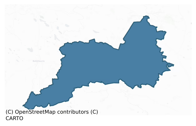
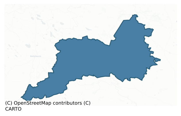
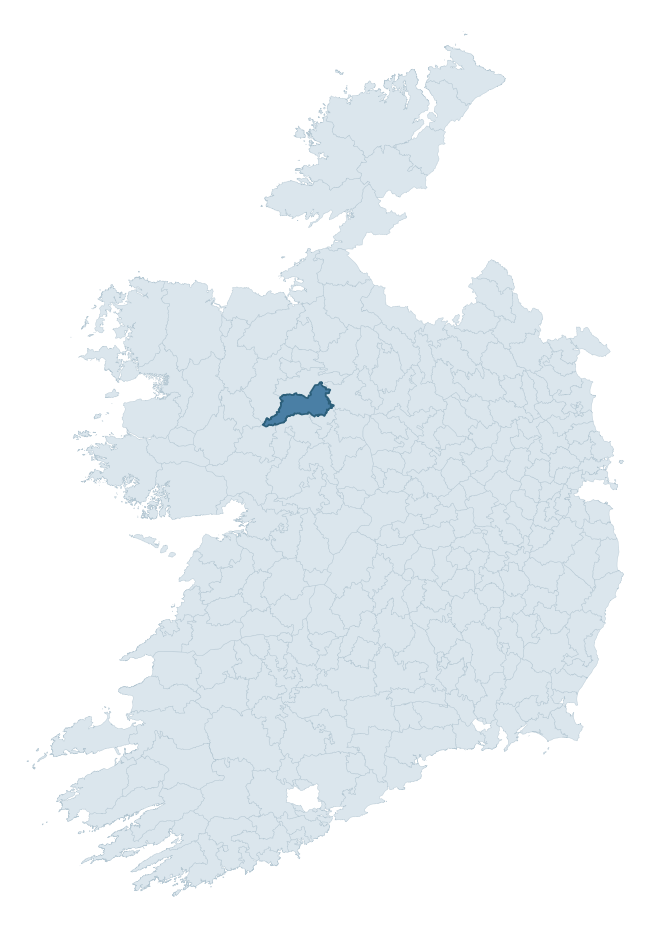
Castlereagh is a barony of County Roscommon, in the historical province of Connacht (Irish: An Caisleán Riabhach), covering 334 km² of land. The barony records 599 NMS archaeological sites and 61 NIAH listed buildings, placing it at around the 46th percentile among 280 ROI baronies for sites per km². This means it is in the lower half of all baronies for sites per km². Dated archaeological evidence runs from the Neolithic through to the Modern, spanning 8 of 9 archaeological periods, placing the barony in the 86th percentile among 280 ROI baronies for chronological depth. This means it is in the top fifth of all baronies for chronological depth. The largest dated subset of recorded sites dates to the Early Medieval. Logainm flags 30 placenames in the barony as carrying a recognised heritage root; the largest share — around 57% — are names associated with pre-christian defensive.
Heritage at a glance
Percentile rankings throughout this profile compare each barony only against the other 279 Republic of Ireland baronies.
The recorded heritage of Castlereagh
The National Monuments Service Sites and Monuments Record (SMR) is the statutory inventory of archaeological sites for the Republic of Ireland, maintained by the Department of Tourism, Culture, Arts, Gaeltacht, Sport and Media. Sites recorded here include earthworks, ringforts, megalithic tombs, ecclesiastical remains, and post-medieval features; not every record is legally protected, but each is registered as a monument of archaeological interest.
The National Monuments Service records 599 archaeological sites in Castlereagh, putting it at the 46th percentile among 280 ROI baronies for sites per km². This means it is in the lower half of all baronies for sites per km². Protection coverage is near-universal — 554 sites (92%) fall within a recorded monument protection zone, indicating an extensively surveyed landscape. The dominant category is defensive sites — ringforts, enclosures, hillforts, and stone forts (265 sites, 44% of the record). Ringfort – rath is the most prevalent type, making up 26% of the barony's recorded sites (156 records) — well above the ROI average of 20% across all baronies where this type occurs. Ringfort – rath is an earthen ringfort enclosed by a bank and external ditch — the most common Early Medieval farmstead, broadly dated 500–1000 AD. Other significant types include Enclosure (43) and House – indeterminate date (31). Enclosure is a banked or ditched feature of uncertain type, used as a catch-all where the original function cannot be determined from surface evidence; House – indeterminate date is a habitation building whose date cannot be determined from available evidence. Across the barony's 334 km², this gives a recorded density of 1.79 sites per km².
Most common monument types
Hover or tap a monument type to see its definition.
| Type | Count |
|---|---|
| Ringfort – rath an earthen ringfort enclosed by a bank and external ditch — the most common Early Medieval farmstead, broadly dated 500–1000 AD | 156 |
| Enclosure a banked or ditched feature of uncertain type, used as a catch-all where the original function cannot be determined from surface evidence | 43 |
| House – indeterminate date a habitation building whose date cannot be determined from available evidence | 31 |
| Field system a group of related fields forming a coherent agricultural landscape, of any date from the Neolithic onwards | 31 |
| Church a building used for public Christian worship, of any date from c. 500 AD onwards | 22 |
| Ringfort – cashel the stone-walled equivalent of the rath, found mainly in upland or western areas, broadly dated 500–1000 AD | 19 |
| Standing stone a deliberately set upright stone, used variously as a Bronze/Iron Age burial marker, route marker or commemorative monument | 19 |
| Children's burial ground an unconsecrated medieval and early-modern burial ground for unbaptised or stillborn children, often called a cillín or ceallúnach | 17 |
Chronological distribution
The dated archaeological record for Castlereagh spans from the Neolithic through to the Modern, with activity attested across 8 of 9 archaeological periods. This is the 86th percentile across ROI baronies for chronological depth — an above-average span. Every period from earliest to latest is represented in the record — an unbroken sequence of dated activity across the full chronological span. Activity concentrates most heavily in the Early Medieval (199 sites, 42% of dated material), with the Iron Age forming a secondary peak (121 sites, 26%). A further 130 recorded sites (22% of the overall NMS register for the barony) carry no period attribution — appearing as 'Unknown' in the bar chart below. This typically reflects either records that pre-date the standardised period vocabulary or sites awaiting specialist dating review, rather than a genuine absence of chronological evidence.
Sample of recorded monuments
Show 25 sample monuments (of 599 total)
A representative sample of 25 recorded monuments drawn from the barony’s 599 total NMS entries. Sites within a recorded monument protection zone and rarer site types are prioritised so the list shows a meaningful cross-section rather than only the most common type. Each entry shows the official Sites and Monuments Record reference number and the description published by the National Monuments Service.
Megalithic tomb – court tomb
On a gentle SW-facing slope. Trapezoidal overgrown cairn (dims 17m E-W; 6m N-S at W to c. 14m N-S at E) with some kerbstones at S and visible in an NE-SW field wall at N. The full court (dims 9m N-S; c. 8m E-W) at its E…
On a gentle SW-facing slope. Trapezoidal overgrown cairn (dims 17m E-W; 6m N-S at W to c. 14m N-S at E) with some kerbstones at S and visible in an NE-SW field wall at N. The full court (dims 9m N-S; c. 8m E-W) at its E end consists of 7 stones on the S side and four surviving on the N. Two jambstones 0.6m apart allow access to the gallery (dims c. 5m E-W; 2.15m N-S), of which only one stone on the N side and two on the S side remain. There is a local tradition of its use as a children's burial ground (RO015-042002-).
Compiled by: Michael Moore
Date of upload: 24 August 2010
See attached document with a plan and section of the monument.
Bawn
On a slight S-facing slope. Denis O'Conor received a partial return of O'Conor lands in 1720 and built a house (RO015-048001-) here in 1727 which became the home of his son Charles O'Conor, the antiquarian. The house is…
On a slight S-facing slope. Denis O'Conor received a partial return of O'Conor lands in 1720 and built a house (RO015-048001-) here in 1727 which became the home of his son Charles O'Conor, the antiquarian. The house is at the NW angle of a walled courtyard or bawn (dims 34m N-S; 34m E-W) defined by masonry walls (T 0.7m; max. H 3m), which does not appear to be an ancient structure.
Compiled by: Michael Moore
Date of upload: 24 August 2010
Road – hollow-way
Visible as a linerar feature on aerial photograph (ACP V206/39), and situated towards the bottom of a lsight N-facing slope. A depression (Wth 4-5m; D 0.3-0.6m) runs E-W (L c. 300m). It may be a road, and part of the…
Visible as a linerar feature on aerial photograph (ACP V206/39), and situated towards the bottom of a lsight N-facing slope. A depression (Wth 4-5m; D 0.3-0.6m) runs E-W (L c. 300m). It may be a road, and part of the bealach or road after which Balanagare is named (O'Flanagan 1931, vol. 1, 71).
Compiled by: Michael Moore
Date of upload: 24 August 2010
Religious house – Augustinian, of Arrouaise nuns
Traditionally founded by St Caolin or Caolainn, sometimes described a disciple of St Bridget's (Lupeta 1912). A convent of Arrouaisian nuns, known as Termonkeelin, was founded after 1223, probably by nuns from Derrane…
Traditionally founded by St Caolin or Caolainn, sometimes described a disciple of St Bridget's (Lupeta 1912). A convent of Arrouaisian nuns, known as Termonkeelin, was founded after 1223, probably by nuns from Derrane (RO040-004001-) and Roscommon (RO039-043006-), and it is listed as Ternumkrum in the ecclesiastical taxation of 1306 (Cal. doc. Ire., vol. 5, 223). Later it became a dependency of Kilcreevanty (GA029-096001-) (Gwynn and Hadcock 1988, 324; Hall 2003, 152, 209). Situated on a gentle S-facing slope.
Raised rectangular grass-covered area (ext. dims 25.5m E-W; 15m N-S; ext. H 0.8m at N to 1.3-1.5m) defined by grass-covered stone spreads (Wth 5.3-7m; int. H 0.2-0.5m) that may be largely field spoil. Some stones which may be in situ from the original walls of the church are visible. There is a tradition that the field to the N was used as a Childrens' Burial Ground (RO020-043002-). Tober Caelainn (RO020-042—-) is c. 450m to the W, and a road (RO020-044—-) led S from the church to Termon More church site (RO026-034—-). Standing stone (RO020-055—-) is c. 100m to the SE. (Timoney 1990, 15)
Compiled by: Michael Moore
Date of upload: 24 August 2010
Inauguration stone (present location)
When a portion was broken off the inauguration stone of the O'Conor kings at Carnfree (RO028-69001-) it was moved to the avenue of Cargin House near Tulsk c. 1840 by the landowner Daniel Kelly to prevent further damage…
When a portion was broken off the inauguration stone of the O'Conor kings at Carnfree (RO028-69001-) it was moved to the avenue of Cargin House near Tulsk c. 1840 by the landowner Daniel Kelly to prevent further damage by quarrying at the original site (Jones 1922-3). It has since been moved to the grounds of Clonalis House in the 1970s, although its authenticity as an inauguration stone is doubtful (FitzPatrick 2004, 113-5). It is a roughly rectangular limestone block (dims of base 0.8m x 0.4m; H 0.45-0.55m) with a subrectangular upper surface (dims 0.9m x 0.35-0.6m) which has an oval hollow (dims 0.3 x 0.1m; D 0.7m) divided in two by a ridge at the base to represent a footprint.
Compiled by: Michael Moore
Date of upload: 24 August 2010
Penitential station
On a shelf towards the bottom of a S-facing slope overlooking a bog to the SE, and c. 20m N of church (RO021-022008-), which is on the other (S) side of the NE-SW Bellanagare to Castlerea road. The basin of a bullaun…
On a shelf towards the bottom of a S-facing slope overlooking a bog to the SE, and c. 20m N of church (RO021-022008-), which is on the other (S) side of the NE-SW Bellanagare to Castlerea road. The basin of a bullaun stone (RO021-022003-) is set in the ground in an alcove (dims 0.5m x 0.5m; H 0.5-0.7m) at the centre of an overgrown penitential cairn (dims c. 5.5m E-W; c. 4m N-S; H c. 1m). A roofless drystone-built passage (Wth 1m; H 0.8m) leads to the bullaun stone from the W. (Knox 1902c, 189)
Compiled by: Michael Moore
Date of revised upload: 3 July, 2015
Coffin-resting stone
On a bluff overlooking a N-S stream to the E and S. The single flat headstone (dims 2.2m x 1.1m; T 0.2m) of a Michael Balfe dated 1777 where coffins were traditionally laid is just outside the graveyard (RO021-083002-)…
On a bluff overlooking a N-S stream to the E and S. The single flat headstone (dims 2.2m x 1.1m; T 0.2m) of a Michael Balfe dated 1777 where coffins were traditionally laid is just outside the graveyard (RO021-083002-) beside the gate at W. (Gormley 1989a, 107)
Compiled by: Michael Moore
Date of upload: 24 August 2010
Ford
On the River Suck with Kilkeevan church (RO026-040001-) on higher ground c. 60m to the NW. A ford is marked on an unreferrenced and undated Longfield map in NLI. Neither the ford nor the church are marked on a late 18th…
On the River Suck with Kilkeevan church (RO026-040001-) on higher ground c. 60m to the NW. A ford is marked on an unreferrenced and undated Longfield map in NLI. Neither the ford nor the church are marked on a late 18th centuyr map (Kelly, M. J. 2000). A concrete bridge (Wth 3m) now spans the river with connecting laneways. Archaeological testing on both sides of the river in 2003 failed to produce any archaeological material (Fitzpatrick 2006b).
Compiled by: Michael Moore
Date of upload: 24 August 2010
Promontory fort – inland
Visible on aerial photographs (GSIAP: M 63-4), and situated on level ground on the E bank of the N-S River Suck where the river turns E. D-shaped grass-covered area (int. dims 27.3m N-S; 22m E-W) defined by a fosse (Wth…
Visible on aerial photographs (GSIAP: M 63-4), and situated on level ground on the E bank of the N-S River Suck where the river turns E. D-shaped grass-covered area (int. dims 27.3m N-S; 22m E-W) defined by a fosse (Wth of base 3.5-4m; int. D 0.2-0.3m; ext. D 0.2-0.6m) separated by an earthen bank (Wth 5.9-6.4m; ext. H 0.5-0.7m) from a second fosse (Wth of base 3.8-4m; ext. D 0.5m) NW-S. There is a second outer bank (Wth 4.9-5.9m; ext. H 0.4-0.5m) and a third outer fosse (Wth of base 3.9-4.3m; ext D. 0.4-0.6m) NW-E-S, while the other sides are formed by the river at W and S. There is no identifiable original entrance (max. ext. dims 48m E-W; 79m N-S). It was planted with forestry since 2005. Enclosure (RO026-033—-) is immediately across the river (Wth c. 20m) to the S.
Compiled by: Michael Moore
Date of upload: 24 August 2010
Hillfort
At the summit of Mewlaghadooey Hill. Subcircular grass-covered area (dims c. 200m E-W; c. 150m N-S) defined by an earthen bank (at W: Wth c. 6m; int. H 0.1m; ext. H 0.3m) SW-NW and a low scarp (H 0.2m) NW-E. Bowl barrow…
At the summit of Mewlaghadooey Hill. Subcircular grass-covered area (dims c. 200m E-W; c. 150m N-S) defined by an earthen bank (at W: Wth c. 6m; int. H 0.1m; ext. H 0.3m) SW-NW and a low scarp (H 0.2m) NW-E. Bowl barrow (RO027-014002-) is inside the perimeter at NW, ring-barrow (RO027-014003-) is on the line of the perimeter at SSE, and ring-barrow (RO027-014004-) is inside the line of the perimeter at SE. The road (RO027-014005-) approaches the perimeter externally at SE. The enclosure is cut by a NE-SW public road W of the bowl barrow, and overlain by NW-SE field banks to NE and SW of this barrow. Rathra ceremonial enclosure (RO027-012001-) is c. 600m to the WNW.
Compiled by: Michael Moore
Date of upload: 24 August 2010
House – 17th century
Marked as a small rectangular building and described as a 'Castle' in gothic lettering on the 1837 ed. of the OS 6-inch map, it is situated at the summit of a broad hill. Regarded locally as the site of a castle of the…
Marked as a small rectangular building and described as a 'Castle' in gothic lettering on the 1837 ed. of the OS 6-inch map, it is situated at the summit of a broad hill. Regarded locally as the site of a castle of the Plunkett family who were transplanted here from Meath in the mid-17th century. They lost their lands in the early 18th century to landowners called Knox, who never occupied it. The castle was used as a fever house during cholera outbreaks (1825-1835) and it was burnt before 1840. It is not visible at ground level in pasture. (Gormley 1989, 78)
Compiled by: Michael Moore
Date of upload: 24 August 2010
Historic town
Ballintober was granted to Richard de Burgh as a manor and a town was probably established after 1235, but it was burnt by Ruarai Mac Cathal O Conchobair in 1315 and by 1333 it was described as waste and the castle…
Ballintober was granted to Richard de Burgh as a manor and a town was probably established after 1235, but it was burnt by Ruarai Mac Cathal O Conchobair in 1315 and by 1333 it was described as waste and the castle ruinous. From this time the castle became a centre of the O'Conor Don, and a settlement continued in its vicinity. Ballintober was burned in 1434, 1487, and 1489, and the town was hardly extant in the 16th century. In 1617 Sir Hugh O'Conor was granted the town and castle, when a weekly market and annual fair began to be held, and the census of 1659 returns a population of 59 (Pender 1939). (Bradley and Dunne 1988a, 21-3)
Situated on a S-facing slope overlooking a NW-SE stream, the town was probably defended by earthworks (RO027-048009-), although their course cannot be indicated. The town was located between the castle (RO027-048002-) and the site of the church (RO027-048005-), while the cross-base (RO027-048004-) may have indicated the location where the fairs (RO027-048003-) were held. The remains consist of the castle, and the site of the church (RO027-048005-) with St Bridget's Well (RO027-048006-) nearby, but the base of a cross between them is no longer extant. (Claffey, 1974-5)
Compiled by: Michael Moore
Date of upload: 24 August 2010
Castle – Anglo-Norman masonry castle
Located at the SE end of a low NW-SE drumlin ridge. Ballintober Castle was built by Richard de Burgh, the second Earl of Ulster known as the Red Earl, c. 1300 (Claffey 1972-3; 1974-5), and it is first mentioned in 1315…
Located at the SE end of a low NW-SE drumlin ridge. Ballintober Castle was built by Richard de Burgh, the second Earl of Ulster known as the Red Earl, c. 1300 (Claffey 1972-3; 1974-5), and it is first mentioned in 1315 when it was captured by Ruaraí O'Conor. It was described in an inquisition of 1333 as surrounded by a stone wall with ruinous buildings, a hall, a chamber, and a kitchen. About 300 acres were worked directly in demesne and there were free tenants in the territory of Síl Mael Ruain, which extended off to the NW (Knox 1903, 59-60). In 1362 Cathal Óg O’Conor seized the castle, and it was retained by one branch or another of the O'Conors throughout the rest of the Middle Ages.
Ballintober Castle was recognised as the caput of O’Conor Don after the split with O’Conor Rua in 1381, and it remained in their hands thereafter, apart from occupation or siege by Mac William Burke in 1409, O'Kelly in 1426 and 1434-5, Mac William Burke again in 1466, the earl of Kildare in 1526, and O'Donnell in 1530. In 1571 it was captured by Richard Bingham, President of Connaught, but granted to Hugh O'Conor in 1585 (Bradley and Dunne 1988a, 25). It was captured by Hugh O'Donnell in 1598, and reconstructed in 1627, which probably involved the conversion of the NW angle tower. The castle was confiscated from O’Conor in 1652 but it was restored to Col. Hugh O'Conor in 1677, who died shortly afterwards. By this time the castle was mortgaged, and Hugh was probably the last person to liv…
Cross – Market cross
Marked on the 1837 and 1929 eds. of the OS 6-inch map, and situated on the W side of the main street, between the castle (RO027-048002-) and the church (RO027-048005-). It does not survive, but is described as small and…
Marked on the 1837 and 1929 eds. of the OS 6-inch map, and situated on the W side of the main street, between the castle (RO027-048002-) and the church (RO027-048005-). It does not survive, but is described as small and was probably a late medieval market cross. (Crawford 1907A, 217)
Compiled by: Michael Moore
Date of upload: 24 August 2010
Stone head
A stone head is kept at a house on the Main street of Ballintober (RO027-048—-). (Bradley and Dunne 1988a, 30)
Compiled by: Michael Moore
Date of upload: 24 August 2010
House – 16th/17th century
In a slight col with hills to the NW and SE. Land at Sleaveen that had been owned by Dermot O'Conor in 1641 was transferred to Garret Dillon under the Cromwellian settlement (Simington 1949, 49). Described as a…
In a slight col with hills to the NW and SE. Land at Sleaveen that had been owned by Dermot O'Conor in 1641 was transferred to Garret Dillon under the Cromwellian settlement (Simington 1949, 49). Described as a rectangular earthwork (dims c. 15m NE-SW; c. 8m NW-SE) defined by banks (H c. 3m) situated at the N corner of a rectangular enclosure (dims c. 27m NE-SW; c. 20m NW-SE) (Knox 1911, 327-8). It is described locally as a masonry structure with walls (T c. 1.2m) but apparently no vaulting which was built by Dillons and which was removed c. 1975. It was within field system (RO028-052001-) and was probably a house of the late 16th or early 17th century.
Compiled by: Michael Moore
Date of upload: 26th September 2011
Water mill – horizontal-wheeled
In the valley of an E-W stream. The mill, which had been operated by seven generations of the Gannon family, is described as having a wheel (diam. c. 1.5m) with wooden ladles made from round wood hollowed into cups on…
In the valley of an E-W stream. The mill, which had been operated by seven generations of the Gannon family, is described as having a wheel (diam. c. 1.5m) with wooden ladles made from round wood hollowed into cups on the up-stream side. The wheel was laid horizontally and the stream (Wth c. 1.5m) which had been narrowed to a nozzle (dim. c. 0.2m) directed at the wheel. The mill-house is now removed, but the mill-wheel is now at NMI, Turlough, Co. Mayo. (Knox 1906-07, 268-9)
Compiled by: Michael Moore
Date of upload: 24 August 2010
Mass-rock
At the crest of the SW-facing edge of a low plateau. Conglomerate boulder (dims 3m NW-SE; 1m NE-SW at NW to 2m NE-SW at SE; H 0.8m at NW to 1.5m at SE) with a vertical and straight SW edge (max. H 1.8m) where a modern…
At the crest of the SW-facing edge of a low plateau. Conglomerate boulder (dims 3m NW-SE; 1m NE-SW at NW to 2m NE-SW at SE; H 0.8m at NW to 1.5m at SE) with a vertical and straight SW edge (max. H 1.8m) where a modern stone altar (dims 1.5m x 1m; H 0.9m) has been built. A drystone wall (L c. 10m) extends down the slope from the W edge of the boulder. Mass is celebrated at the beginning of September each year, and there is a local tradition of a massacre having occurred here. Children's burial ground (RO032-05001-) is immediately to the N. (Fitzmaurice 1988)
Compiled by: Michael Moore
Date of upload: 24 August 2010
House – 17th/18th century
Traditionally associated with the Lynch family who were merchants from Galway city, and possibly built c. 1710 (Timoney 1996, 12). Situated on a shelf of a S-facing slope. This is a rectangular structure (ext. dims…
Traditionally associated with the Lynch family who were merchants from Galway city, and possibly built c. 1710 (Timoney 1996, 12). Situated on a shelf of a S-facing slope. This is a rectangular structure (ext. dims 19.7m N-S; 9.35m E-W) of two storeys and attic with good quoins, but only the N and S gables with large chimney-stacks survive complete, and fragments of the other walls (T 0.7m). The doorway at the centre of the E wall is in a slight two-storey projection (dims 4.4m x 0.9m) with a large round-headed window over. There are gun-loops in the N and S walls of the door projection. The ground floor had a central E-W corridor, and four rooms which had brick firplaces in the internal angles with the gables. The S chimney stack is completed in brick. One room has a slop-stone. Two-storey wings which do not communicate directly with the original house were added to the N and S, but these have largely been removed. (Craig 1982, 134)
See the attached image taken from the NE.
Compiled by: Michael Moore
Date of upload: 24 August 2010
Barrow – embanked barrow
On a knoll in a low-lying level landscape. Circular grass-covered area (diam. 6m N-S; 5.2m E-W) defined by an earthen bank (Wth 2.8m; int. H 0.1-0.3m; ext. H 0.3-5m) which is reduced to a scarp at N. There is an…
On a knoll in a low-lying level landscape. Circular grass-covered area (diam. 6m N-S; 5.2m E-W) defined by an earthen bank (Wth 2.8m; int. H 0.1-0.3m; ext. H 0.3-5m) which is reduced to a scarp at N. There is an entrance (Wth 2.7m) at SE (max. ext. diam. 11.3m N-S; 10.8m E-W). Enclosure (RO021-063005-) is c. 30m to the SSW.
Compiled by: Michael Moore
Date of upload: 24 August 2010
Cross-inscribed stone
On a shelf towards the bottom of a S-facing slope overlooking a bog to the SE, and c. 20m N of church (RO021-022008-), which is on the other (S) side of the NE-SW Bellanagare to Castlerea road. A stone penal-style cross…
On a shelf towards the bottom of a S-facing slope overlooking a bog to the SE, and c. 20m N of church (RO021-022008-), which is on the other (S) side of the NE-SW Bellanagare to Castlerea road. A stone penal-style cross (RO021-022013-) is set on the penitential cairn (RO021-022004-) over the bullaun (RO021-022003-) that serves as a holy well, and a rectangular slab (dims 0.22m x 0.21m; T 0.06m) with crosses incised on both faces is nearby.
Compiled by: Michael Moore
Date of upload: 3 July 2015
Bullaun stone (present location)
A bullaun stone (dims 0.4m x 0.4m; H 0.22m) with a single basin (dims 0.3m x 0.25m; D 0.1m) from the children's burial ground at Ballyrane Upper (RO032-016003-) is now in the porch of the Roman Catholic church of…
A bullaun stone (dims 0.4m x 0.4m; H 0.22m) with a single basin (dims 0.3m x 0.25m; D 0.1m) from the children's burial ground at Ballyrane Upper (RO032-016003-) is now in the porch of the Roman Catholic church of Garranlahan.
Compiled by: Michael Moore
Date of upload: 24 August 2010
Excavation – miscellaneous
Archaeological testing (00E0763) c. 20m S of the SW angle of the castle revealed a section of an E-W paved path (L 3.6m E-W; Wth 0.6m) and a pit (diam. c. 1.25m; D 0.5m) (RO027-048015-) (Grant 2003a; 2006), but…
Archaeological testing (00E0763) c. 20m S of the SW angle of the castle revealed a section of an E-W paved path (L 3.6m E-W; Wth 0.6m) and a pit (diam. c. 1.25m; D 0.5m) (RO027-048015-) (Grant 2003a; 2006), but archaeological testing (00E0762; 02E0310) of adjacent areas further S and W produced no archaeological material (Grant 2003b; 2006; Zajac 2004).
Compiled by: Michael Moore
Date of upload: 24 August 2010
Crucifixion plaque
On a slight S-facing slope. Also within the church (RO027-029001-) is a fragment of a crucifixion plaque (H 0.95m; Wth 0.85m; T 0.15m) depicting Christ and two figures in relief, although the bottom of the stone is…
On a slight S-facing slope. Also within the church (RO027-029001-) is a fragment of a crucifixion plaque (H 0.95m; Wth 0.85m; T 0.15m) depicting Christ and two figures in relief, although the bottom of the stone is missing. The church is within a small D-shaped graveyard (RO027-029002-) and the church and well were conserved in the 1990s.
See the attached image
Compiled by: Michael Moore
Date of upload: 24 August 2010
Ringfort – rath
On a gentle SW-facing slope. Circular grass-covered area with mature deciduous trees (diam. 55m E-W; 54m N-S) defined by an earthen bank (Wth 4.9-5.65m; int. H 0.4m at N to 1.4m at SE; ext. H 1.6-1.7m) NW-N-SE, reduced…
On a gentle SW-facing slope. Circular grass-covered area with mature deciduous trees (diam. 55m E-W; 54m N-S) defined by an earthen bank (Wth 4.9-5.65m; int. H 0.4m at N to 1.4m at SE; ext. H 1.6-1.7m) NW-N-SE, reduced to a scarp (H 0.4m at S) elsewhere. There is a fosse (Wth of top 8.8m; Wth of base 4-4.8m; D 0.2-0.55m) W-N, but there is no visible entrance. The perimeter is truncated slightly by a NW-SE field wall at SW, and the standing stones (RO015-051001-; RO015-051003-) are inside the perimeter at SW, the first with an ogham inscription. In 1985 a second ogham stone (RO015-051004-) was discovered in the bank that became dislodged and is now lying on top of the bank at SW (SMR file).
This is a National Monument in state ownership: No. 650
Compiled by: Michael Moore
Date of upload: 14 November, 2012
Listed buildings
The National Inventory of Architectural Heritage (NIAH) is a state survey appraising buildings of architectural, historical, archaeological, artistic, cultural, scientific, social, or technical interest. Each surveyed structure receives a rating from International (the highest, for buildings of European importance) through National, Regional, Local, and Record-Only.
The NIAH records 61 listed buildings in Castlereagh (30th percentile across ROI baronies). All recorded buildings carry Regional or lower grading; the barony does not contain any structures appraised as being of National or International architectural importance. Construction dates concentrate most heavily in the Victorian (1830-1900) period. The most-recorded building type is house (16 examples, 26% of the listed stock).
Terrain and environment
Mean elevation across the barony is 93m — the 53rd percentile among 280 ROI baronies for elevation. This means it is in the upper half of all baronies for elevation. Elevation matters for heritage because higher-altitude baronies typically favour defensive monuments — ringforts and hilltop forts placed on prominent ground — while lowland baronies are more likely to carry the dense settlement and church networks of intensive agricultural landscapes. Mean slope is 2.5° — the 28th percentile among 280 ROI baronies for slope. This means it is in the bottom third of all baronies for slope. Slope is a key control on both land use and archaeological preservation: steep ground resists ploughing and tends to preserve earthworks intact, while gentle slopes favour intensive cultivation that damages or destroys surface archaeology over time. The Topographic Wetness Index averages 11.4, the 72nd percentile among 280 ROI baronies for wetness. This means it is in the top third of all baronies for wetness. Drainage matters for heritage because poorly-drained ground preserves organic archaeology (wooden trackways, leather, textiles, and on rare occasions human remains) far better than free-draining soil; well-drained ground favours arable use but destroys organic material rapidly. The land cover is dominated by improved grassland (82%) and woodland (16%).
Terrain measurements
Where this barony sits in the Republic of Ireland
Geology and preservation
Bedrock geology shapes the landscape long before any settlement begins — controlling soil drainage, agricultural potential, the survival of upstanding monuments, and the preservation of buried archaeology. The figures below come from the Geological Survey Ireland 1:100,000 bedrock map.
The bedrock underlying Castlereagh is predominantly black calcarenites and shales (46% of the barony by area), laid down during the Carboniferous period (100% by area, around 359 to 299 million years ago). A substantial secondary geology of limestone (31%) and sandstones and red green conglomerates (19%) adds further variety to the underlying landscape. The single largest mapped unit is the Ballymore Limestone Formation (46% of the barony's bedrock).
Rock type composition
Largest mapped unit: Ballymore Limestone Formation (46% of the barony)
Placename evidence
Logainm records 30 heritage-diagnostic placenames for Castlereagh, drawn from townland and civil-parish names across the barony. The dominant stratum is pre-Christian and Early Medieval defensive — ráth-, lios-, dún-, and caiseal-prefixed names that mark Iron Age and early historic settlement. The leading diagnostic roots are lios- (9 — ringfort or enclosure), cill- (8 — church), and caiseal- (5 — stone ringfort). This is broadly in line with the ROI average of 30.7 heritage placenames per barony. The presence of multiple heritage strata side by side indicates layered occupation of the landscape across successive prehistoric and historic periods. Logainm records 269 placenames for Castlereagh (predominantly townland names). Of these, 30 (11%) carry one of the diagnostic Gaelic roots tracked above; the remainder draw on more generic landscape vocabulary that does not encode a heritage period.
Pre-Christian / Early Medieval Defensive
| Root | Count | Meaning |
|---|---|---|
| lios- | 9 | ringfort or enclosure |
| caiseal- | 5 | stone ringfort |
| ráth- | 3 | earthen ringfort |
Early Christian Ecclesiastical
| Root | Count | Meaning |
|---|---|---|
| cill- | 8 | church (early) |
| tobar- | 1 | holy well |
| gráinseach- | 1 | monastic farm / grange |
Burial, Ritual, and Norse-Contact
| Root | Count | Meaning |
|---|---|---|
| leacht- | 2 | grave monument |
| carn- | 1 | cairn |
| gall- | 1 | foreigner — Norse settlement marker |
Other baronies in Roscommon
About this profile
Click any section below to expand.
What is a barony?
A barony is a historic administrative unit in Ireland, broadly equivalent to an English hundred. The 280 baronies used here are from the OSi 2019 National Statutory Boundaries (generalised 20m), covering the 26 counties of the Republic of Ireland. Baronies derive from the Norman period, were formalised in the 17th century, and have not been redrawn for statistical purposes. They vary enormously in area, from compact urban baronies in Dublin to vast upland baronies in Connacht, and should not be compared by raw site count without accounting for area differences.
What counts as a site?
This profile combines three distinct heritage registers, each with its own definition of what constitutes a recordable site:
- Archaeological sites (NMS). The National Monuments Service Sites and Monuments Record (SMR) catalogues every known archaeological monument or site of archaeological interest in the Republic, from prehistoric burial mounds and ringforts to medieval churches and post-medieval defensive works. Inclusion does not require legal protection — only that the site has been identified, surveyed, and assessed as having archaeological value. A separate subset of these sites lies within a recorded protection zone, which gives them statutory protection under the National Monuments Acts.
- Listed buildings (NIAH). The National Inventory of Architectural Heritage records buildings of architectural, historical, archaeological, artistic, cultural, scientific, social, or technical interest. Each surveyed structure is appraised on a five-tier scale: International, National, Regional, Local, and Record-Only. The NIAH appraisal is informational rather than strictly statutory, but it underpins local-authority Record of Protected Structures (RPS) listings.
- Heritage placenames (Logainm). Logainm is the authoritative database of Irish placenames maintained by the Placenames Branch. This profile applies a heritage-diagnostic classifier to the Irish-language form of each townland name, flagging roots that signal defensive sites (ráth-, lios-, dún-, caiseal-, cathair-), ecclesiastical foundations (cill-, teampall-, domhnach-, mainistir-), prehistoric burial-ritual features (tuaim-, carn-, leaba-), or Norse-contact settlement (gall-). Townlands without one of these diagnostic roots are not flagged here — they may still carry historical significance, but that significance is not encoded in the name itself.
Editorial principles
The narrative sections of this profile follow several explicit principles:
- Evidential. Every claim about this barony’s heritage character is anchored in the underlying register data. Where a site count, a placename count, or a percentile rank is cited, it is computed from the source datasets at export time, not estimated.
- Comparative. Counts and metrics are reported alongside their percentile rank against the other 279 ROI baronies. A barony with 50 ringforts in absolute terms could be unusually high or unusually low depending on its size and regional context; percentile ranking removes that ambiguity.
- Transparent on limits. Where a register has known coverage gaps, survey biases, or data-quality issues that affect this barony’s figures, the profile flags them rather than presenting the numbers as definitive.
- No interpretation beyond what the data supports. The narrative does not speculate about historical events, social dynamics, or cultural meaning beyond what the recorded heritage and placename evidence directly attests.
Data caveats and limits
- NMS Sites and Monuments Record is the product of survey campaigns conducted at different intensities across different counties and decades. Some baronies have been surveyed more thoroughly than others, and absolute counts should be read in that light. Sites destroyed by development before survey are typically not represented; sites in heavily forested or upland terrain are sometimes under-recorded.
- NIAH coverage is broadly complete for the Republic of Ireland but the survey was conducted on a rolling county-by-county basis, and the most recent appraisal date varies. Buildings demolished or substantially altered after their original survey may still appear in the register; conversely, recent buildings of merit may not yet have been appraised.
- Logainm classification applies a deliberately conservative pattern-matching approach to the Irish-language townland forms. The classifier prioritises true positives over recall: a townland may carry a heritage signal that the classifier doesn’t recognise, particularly where the diagnostic root has been heavily anglicised or where the townland name draws on a less common term. The 60,000+ townland records and ~9,800 classified placenames give a substantial signal at barony scale, but individual townland names should be checked against Logainm directly for definitive interpretation.
- Period attribution. The chronological distribution reflects only those NMS sites that carry a recognised period attribution in the source data. Sites listed as “Unknown” period are excluded from the dated subset.
- Boundary changes. Some baronies have undergone minor boundary adjustments since their 19th-century definition; the OSi 2019 generalised boundaries used here are the current statutory definition and may differ slightly from historical maps in border areas.
- Bedrock geology is mapped at 1:100,000 scale, which means local variation within a barony — small pockets of different rock type, mineral veins, alluvium overlying bedrock — is generalised. The dominant-system and rocktype figures are area-weighted, so a barony reading “70% Carboniferous limestone” may still contain small but archaeologically important pockets of older or younger rock. Around 3% of GSI polygons do not match the lexicon and contribute no rocktype or system attribution.
Data sources
- National Monuments Service — Sites and Monuments Record (SMR) https://data.gov.ie/dataset/national-monuments-service-archaeological-survey-of-ireland
- National Inventory of Architectural Heritage (NIAH) https://data.gov.ie/dataset/national-inventory-of-architectural-heritage-niah-national-dataset
- Logainm — Placenames Database of Ireland https://www.logainm.ie/
- Ordnance Survey Ireland — National Statutory Barony Boundaries 2019 https://data-osi.opendata.arcgis.com/
- EURODEM — European Digital Elevation Model https://www.mapsforeurope.org/datasets/euro-dem
- ESA WorldCover https://esa-worldcover.org/en
- Geological Survey Ireland — 1:100,000 Bedrock Geology https://www.gsi.ie/en-ie/data-and-maps/Pages/Bedrock.aspx
Explore more: Search any of the 280 ROI baronies, browse by historical province, or read the methodology and data sources for the full Republic of Ireland Heritage Tool.