
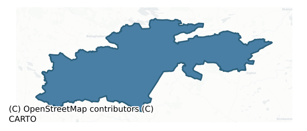
Frenchpark is a barony of County Roscommon, in the historical province of Connacht (Irish: Dún Gar), covering 291 km² of land. The barony records 454 NMS archaeological sites and 12 NIAH listed buildings, placing it at around the 36th percentile among 280 ROI baronies for sites per km². This means it is in the lower half of all baronies for sites per km². Dated archaeological evidence runs from the Early Bronze Age through to the Modern, spanning 7 of 9 archaeological periods, placing the barony in the 38th percentile among 280 ROI baronies for chronological depth. This means it is in the lower half of all baronies for chronological depth. The largest dated subset of recorded sites dates to the Early Medieval. Logainm flags 30 placenames in the barony as carrying a recognised heritage root; the largest share — around 60% — are names associated with pre-christian defensive.
Heritage at a glance
Percentile rankings throughout this profile compare each barony only against the other 279 Republic of Ireland baronies.
The recorded heritage of Frenchpark
The National Monuments Service Sites and Monuments Record (SMR) is the statutory inventory of archaeological sites for the Republic of Ireland, maintained by the Department of Tourism, Culture, Arts, Gaeltacht, Sport and Media. Sites recorded here include earthworks, ringforts, megalithic tombs, ecclesiastical remains, and post-medieval features; not every record is legally protected, but each is registered as a monument of archaeological interest.
The National Monuments Service records 454 archaeological sites in Frenchpark, putting it at the 36th percentile among 280 ROI baronies for sites per km². This means it is in the lower half of all baronies for sites per km². Protection coverage is near-universal — 437 sites (96%) fall within a recorded monument protection zone, indicating an extensively surveyed landscape. The dominant category is defensive sites — ringforts, enclosures, hillforts, and stone forts (307 sites, 68% of the record). Ringfort – rath is the most prevalent type, making up 44% of the barony's recorded sites (200 records) — well above the ROI average of 20% across all baronies where this type occurs. Ringfort – rath is an earthen ringfort enclosed by a bank and external ditch — the most common Early Medieval farmstead, broadly dated 500–1000 AD. Other significant types include Crannog (37) and Souterrain (22). Crannog is an artificial or partly artificial island built up on a lake or river bed, in use from the 6th to 17th centuries AD; Souterrain is an underground stone-built passage and chamber, generally Early Medieval and often associated with ringforts as a defensive or storage feature. Across the barony's 291 km², this gives a recorded density of 1.56 sites per km².
Most common monument types
Hover or tap a monument type to see its definition.
| Type | Count |
|---|---|
| Ringfort – rath an earthen ringfort enclosed by a bank and external ditch — the most common Early Medieval farmstead, broadly dated 500–1000 AD | 200 |
| Crannog an artificial or partly artificial island built up on a lake or river bed, in use from the 6th to 17th centuries AD | 37 |
| Souterrain an underground stone-built passage and chamber, generally Early Medieval and often associated with ringforts as a defensive or storage feature | 22 |
| Enclosure a banked or ditched feature of uncertain type, used as a catch-all where the original function cannot be determined from surface evidence | 13 |
| Earthwork an unclassified earthen structure with no diagnostic features that allow a more specific classification | 13 |
| Children's burial ground an unconsecrated medieval and early-modern burial ground for unbaptised or stillborn children, often called a cillín or ceallúnach | 10 |
| Hut site a low stone or earthen foundation enclosing a small circular or oval area, generally interpreted as a former dwelling, of any date from prehistory to the medieval period | 10 |
| Fulacht fia a horseshoe-shaped Bronze Age burnt mound built around a sunken trough beside a water source, traditionally interpreted as a cooking site | 10 |
Chronological distribution
The dated archaeological record for Frenchpark spans from the Early Bronze Age through to the Modern, with activity attested across 7 of 9 archaeological periods. Every period from earliest to latest is represented in the record — an unbroken sequence of dated activity across the full chronological span. Activity concentrates most heavily in the Early Medieval (291 sites, 73% of dated material), with the Iron Age forming a secondary peak (44 sites, 11%). A further 57 recorded sites (13% of the overall NMS register for the barony) carry no period attribution — appearing as 'Unknown' in the bar chart below. This typically reflects either records that pre-date the standardised period vocabulary or sites awaiting specialist dating review, rather than a genuine absence of chronological evidence.
Sample of recorded monuments
Show 25 sample monuments (of 454 total)
A representative sample of 25 recorded monuments drawn from the barony’s 454 total NMS entries. Sites within a recorded monument protection zone and rarer site types are prioritised so the list shows a meaningful cross-section rather than only the most common type. Each entry shows the official Sites and Monuments Record reference number and the description published by the National Monuments Service.
Road – class 1 togher
In cut-away bog on flat, low-lying ground on the S bank of the W-E River Lung, 1.3m below the surface of Callow Bog. Investigated in 1966 by E. Rynne. A NNE-SSW timber road (L c. 100m) leading to what must have been a…
In cut-away bog on flat, low-lying ground on the S bank of the W-E River Lung, 1.3m below the surface of Callow Bog. Investigated in 1966 by E. Rynne. A NNE-SSW timber road (L c. 100m) leading to what must have been a fording point across the Lung River where it was continued by togher (RO008-016—-) on the N bank. One or two logitudinal planks (oak) retained by vertical pegs (oak) formed a narrow walking surface (Wth 0.2-0.4m). Radiocarbon dated to 1433-1316 BC (3115±25 BP; GrN-14729) (Brindley and Lanting 1998, 54-5), it is not now visible at ground level although it may survive in uncut sections of bog. (NMI file; Golden 1992)
Compiled by: Michael Moore
Date of upload: 24 August 2010
Linear earthwork
Visible as a linear feature (L c. 100m) aligned NW-SE on aerial photographs (ACAP: V221/127-8), and situated on a gentle N-facing slope. A N-S field drain (Wth 2m; D 0.8m) survives at the N end (L 36m), but it is…
Visible as a linear feature (L c. 100m) aligned NW-SE on aerial photographs (ACAP: V221/127-8), and situated on a gentle N-facing slope. A N-S field drain (Wth 2m; D 0.8m) survives at the N end (L 36m), but it is visible extending SE from the S end of the drain as a grass-covered depression (Wth of top 6-7m; D 0.3-0.4m) which does not have accompanying banks but which curves to the E at the S end (total L c. 180m). It is overlaid by an E-W field bank that is marked on the 1837 and 1915 eds of the OS 6-inch map and it might be an old stream bed.
Compiled by: Michael Moore
Date of upload: 24 August 2010
Bawn
A Mac Dermot Gall centre probably from the late 14th century, the castle was burnt by O'Donnell in 1527 (Ann Conn, 665). By 1580 it had been acquired by William Clifford whose family retained it into the 1650s when the…
A Mac Dermot Gall centre probably from the late 14th century, the castle was burnt by O'Donnell in 1527 (Ann Conn, 665). By 1580 it had been acquired by William Clifford whose family retained it into the 1650s when the land passed to the French and King families. Callow castle was burned in 1596 by Irish rebels. (Mac Dermot 1996, 381-2; 449; O'Conor, 2007, 197-8).
Known as Caladh Lochae Deichet, Caislead an Chalaidh or Carrickbeg, and locally as 'Babhdhun a Chaluidh' in the mid-19th century according to J. O'Donovan when it was thought to have been owned by Drury (O'Flanagan 1933, 112). Situated on flat ground c. 130m from the present S shore of Callow Lough, although at one time it was at the shore (OS 1837 6-inch map).
It is a rectangular grass-covered area (dims 77m E-W; 60m N-S) defined by a wall (T 0.6m; max. int. H 1.1m) at W and fragments of a similar wall at E which has the remains of a tower at the SE angle. The outer flat-bottomed fosse at W (Wth of top 9m; D 0.5m) and S (Wth of top 8-9m; D 1.25m) is represented by a band of rushes (Wth 5m) at E, and a low scarp (H 0.6m) at N. A causeway (Wth 4m) crosses the fosse at S, and the E and W walls are now incorporated in N-S field walls. The grass-covered foundations (Wth 1m; H 0.2m) of a house (RO009-030001-) (int. dims 4.8m E-W; 4.5m N-S) are at the N edge of the interior, and the grass-covered foundations (Wth 0.5m) of another structure (RO009-030002-) (int. dims 2.5m x 2.5m) are at the centre. The rectangular…
Concentric enclosure
Situated on a low rise overlooking low-lying land to the N and S with the SE-NW Breedoge river c. 75m to the SW. Oval grass-covered area (dims 64m N-S; 43.5m E-W) defined by an earthen bank (Wth 4m generally to 5.7m at…
Situated on a low rise overlooking low-lying land to the N and S with the SE-NW Breedoge river c. 75m to the SW. Oval grass-covered area (dims 64m N-S; 43.5m E-W) defined by an earthen bank (Wth 4m generally to 5.7m at W; int. H 0.2m generally to 0.8m at E; ext. H 1.1m generally to 1.8m at W), which is reduced to a scarp at SE (H 0.4m) and N (H 0.8m). This is separated by a fosse (Wth 5.5m) SE-WNW, visible as a band of reeds N-E, from an outer bank (Wth 4.2m; int. H 0.55m; ext. H 0.4m) which survives S-WSW. Just S of the centre is a grass-covered stone spread (dims 8m N-S; 2-3m E-W; H 0.3-0.4m) which may be the remains of a house (RO009-040002-).
The enclosure is within a larger D-shaped enclosure (dims c. 150m N-S; c. 130m E-W) defined by an earthen bank (Wth c. 3-4m; H c. 0.5-1m) SE-W-NW, but this enclosure is truncated by an E-W field bank at N and a NNW-SSE field bank at E. Archaeological testing (08E0224) in an area (dims c. 50-80m WNW-ESE; c. 50m N-S) immediately E of the smaller enclosure produced evidence of a NW-SE ditch (Wth 1.1m) cut in the subsoil but with no dating material (Henry 2011), which could be the fosse of the outer enclosure located here c. 60m E of the inner enclosure.
Compiled by: Michael Moore
Date of revised upload: 15 March 2016
Barrow – embanked barrow
Marked only on the 1914 ed. of the OS 6-inch map, and situated on top of a small, steep-sided knoll. D-shaped grass-covered area (dims 9.3m E-W; 5m N-S) defined by an earthen bank (Wth 4.8m at W to 5.6m at E; int. H 1m;…
Marked only on the 1914 ed. of the OS 6-inch map, and situated on top of a small, steep-sided knoll. D-shaped grass-covered area (dims 9.3m E-W; 5m N-S) defined by an earthen bank (Wth 4.8m at W to 5.6m at E; int. H 1m; ext. H 0.6-1m generally to 1.7m at N) WSW-N-ESE, the perimeter being quarried away elsewhere. There is no visible fosse or entrance. Kilcolagh church (RO010-073001-) is c. 80m to the S.
Compiled by: Michael Moore
Date of upload: 24 August 2010
Road – road/trackway
Marked as an ancient road on a Longfield map of 1826 in NLI (ms. 21.F.44(72)). Running NNE-SSW (L c. 1 km) across a WNW-ESE ridge. The S end is a farm lane bordered by overgrown earthen banks, and N of an E-W public…
Marked as an ancient road on a Longfield map of 1826 in NLI (ms. 21.F.44(72)). Running NNE-SSW (L c. 1 km) across a WNW-ESE ridge. The S end is a farm lane bordered by overgrown earthen banks, and N of an E-W public road it is a right of way along the townland boundary with Creevy to the E. Archaeological testing (06E0116) at its S end did not produce any evidence of a roadway, (FitzPatrick 2009a).
Compiled by: Michael Moore
Date of upload: 24 August 2010
Mass-rock
At the crest of the E-facing slope of a NW-SE ridge, at the SE end, and just 9m SE of the perimeter of cashel (RO014-041001-). A stone (L 2.8m; Wth 1.2m; H 0.7m) is regarded locally as a mass rock.
Compiled by:…
At the crest of the E-facing slope of a NW-SE ridge, at the SE end, and just 9m SE of the perimeter of cashel (RO014-041001-). A stone (L 2.8m; Wth 1.2m; H 0.7m) is regarded locally as a mass rock.
Compiled by: Michael Moore
Date of upload: 24 August 2010
Cairn – unclassified
At the crest of the N end of the NW-SE ridge of Fairymount Hill. Subcircular grass and scrub-covered cairn (dims 22.3m N-S; 17.2m E-W; H 1.5-2.1m) with a quarried upper surface (dims 13.7m E-W; 13.1m N-S; D 0.2-0.5m).…
At the crest of the N end of the NW-SE ridge of Fairymount Hill. Subcircular grass and scrub-covered cairn (dims 22.3m N-S; 17.2m E-W; H 1.5-2.1m) with a quarried upper surface (dims 13.7m E-W; 13.1m N-S; D 0.2-0.5m). Hilltop enclosure (RO014-078001-) is c. 250m to the SE, and hut sites (RO014-067001-; RO014-067002-) are c. 200m to the E.
Compiled by: Michael Moore
Date of upload: 24 August 2010
Hilltop enclosure
Visible as a feature on aerial photograph (GSIAP: M 652) around the S end of the NW-SE ridge of Fairymount Hill. Oval area (dims c. 180m N-S; c. 90m E-W) defined by a grass-covered stone spread (Wth 1.8-3.2m; int. H…
Visible as a feature on aerial photograph (GSIAP: M 652) around the S end of the NW-SE ridge of Fairymount Hill. Oval area (dims c. 180m N-S; c. 90m E-W) defined by a grass-covered stone spread (Wth 1.8-3.2m; int. H 0.1-0.2m; ext. H 0.5-1.4m) S-NW and NE-E (Wth 2m; int. H 0.1m; ext. H 0.9m), but it is replaced by a wall (Wth 0.9m; int. H 0.1m) on the outer edge of a rock outcrop face (H 0.45m) N-NE. It has been removed by a water tank NW-N and by a quarry E-S. There is no visible entrance, but old field walls visible as grass-covered stone spreads (Wth 0.8m; H 0.2m) are attached to the perimeter at E and SW. Although the name suggests the presence of a mound (RO014-078002-) there are no internal features visible and there is no record of one. Cairn (RO014-066—-) is c. 250m to the NW, and hut site (RO014-068—-) is c. 150m to the E.
Compiled by: Michael Moore
Date of upload: 24 August 2010
Barrow – pond barrow
At the E end of a broad E-W ridge. Subcircular grass and rush-covered dished area (int. diam. 27.5 NE-SW; 23.7m NW-SE) defined by a grass-covered bank (Wth 10.5-11.3m; int. H 0.7-0.9m; ext. H 0.4-0.7m). The perimeter at…
At the E end of a broad E-W ridge. Subcircular grass and rush-covered dished area (int. diam. 27.5 NE-SW; 23.7m NW-SE) defined by a grass-covered bank (Wth 10.5-11.3m; int. H 0.7-0.9m; ext. H 0.4-0.7m). The perimeter at NW is overlain by a NE-SW field bank and drains, and a water-tower has been built on the perimeter at W (max. ext. diam. 50m NE-SW). There is no visible entrance, and it may be a small pingo or a natural pond that is now dry.
Compiled by: Michael Moore
Date of upload: 24 August 2010
Cross – High cross
On a slight rise in a level landscape. A latin cross composed of a single piece of sandstone (visible H 3.2m; breadth of arms 0.7m; T 0.2m; Wth of shaft 0.42-0.49m) with a boss at the junction of the arms on the E and W…
On a slight rise in a level landscape. A latin cross composed of a single piece of sandstone (visible H 3.2m; breadth of arms 0.7m; T 0.2m; Wth of shaft 0.42-0.49m) with a boss at the junction of the arms on the E and W faces widens out at the base (Wth of shaft 0.67m) and was supported in a shallow socket in the bedrock by stone wedges when it was excavated (Sweetman 1981-2) and straightened (total H 3.9m). Cloonshanville abbey (RO-015-03001-) is c. 300m to the NE. (Crawford 1907, 214-5; Harbison 1992, vol. 1, 59)
This is a National Monument in state guardianship: No. 608
See the attached view of the E face taken from the NE.
Compiled by: Michael Moore
Date of upload: 24 August 2010
Religious house – Dominican friars
A Dominican friary dedicated to the Holy Cross was founded here in 1385 by Rufus Mac Dermot Roe (Gwynn and Hadcock 1970, 223) or Tiege Roe Mac Dermot of Airteach on what was regarded by J. O'Donovan in 1837 as a church…
A Dominican friary dedicated to the Holy Cross was founded here in 1385 by Rufus Mac Dermot Roe (Gwynn and Hadcock 1970, 223) or Tiege Roe Mac Dermot of Airteach on what was regarded by J. O'Donovan in 1837 as a church site founded by St Patrick (O'Flanagan 1931, vol. 1, 77-9). It was listed as Glynsennul in the ecclesiastical taxation of Elphin in 1306 (Cal. doc. Ire., vol. 5, 224). After the Supression in 1577 it was held by Edward White in 1596 when it was burnt by Irish rebels (O'Conor, 2007, 197). A William Taffe or Davis then leased its 72 acres, which remained in the Davis family down to the 1880s when the land was sold to Baron de Freyne, a scion of the French family of Frenchpark (Jennings 2019). The friary is situated on a slight rise in a level landscape within a D-shaped graveyard (RO015-030002-) (dims 55m N-S c. 50m E-W) which has been extended with a new rectangular graveyard (dims 88m N-S; 43m E-W) attached to the E. There are traces of an ecclesiastical enclosure (RO015-030005-) visible as a scarp or bank (Wth c. 4m; H 0.2-0.4m) outside the graveyard NW-E (diam. c. 120m).
The church consisted of a nave which can no longer be traced, and chancel (int. dims 13.2m E-W; 6.1m N-S), of which only the base of the E wall (int. H 1m; ext. H 3m) and adjacent parts of the N wall and the S wall with a piscina remain. The E window was an elaborate three-light decorated feature, and there was a three-light window placed high on the S wall of the chancel (Grose 1791, vo…
Armorial plaque
Attached to the inside of the E wall of the mausoleum (RO015-030006-) is an armorial plaque (Wth 0.58m; H 0.97m) commemorating Patrick French Fitzstephen of Galway and Dungar (RO015-023—-) with a crucifixion plaque…
Attached to the inside of the E wall of the mausoleum (RO015-030006-) is an armorial plaque (Wth 0.58m; H 0.97m) commemorating Patrick French Fitzstephen of Galway and Dungar (RO015-023—-) with a crucifixion plaque (RO015-030003-) above. Beneath the arms is the inscription which reads: Pray for the soule of / Patrick French Fitzste / Then of Galway Burges / Who lived in this world / 86 years and deseased at / his own howse in Dungar / 14 of Aprill 1667.
This is part of a National Monument in the care of Roscommon County Council.
See the attached image.
Compiled by: Michael Moore
Date of revised upload: 20 April 2018
Religious house – Franciscan Third Order Regular
A monastery known as 'Ceall Braighe Uallaighe' was probably taken over by the Third Order of Regular Franciscans before 1487 when it was plundered by Aodh Rua O'Donnell (AFM vol. 4, 1153). There is no record of any…
A monastery known as 'Ceall Braighe Uallaighe' was probably taken over by the Third Order of Regular Franciscans before 1487 when it was plundered by Aodh Rua O'Donnell (AFM vol. 4, 1153). There is no record of any structures or that it was a nunnery, or of its supression, but in 1582 60 acres belonging to the church was leased to a Bryan McDermot (Gwynn and Hadcock 1970, 269). There was a local tradition in the 19th century that it was a nunnery (O'Flanagan 1837, vol. 2, 1).
Situated in a fold in an undulating landscape. Rectangular graveyard (RO016-015002-) (dims 55.5m ENE-WSW; 36.5m NNW-ESE) defined by masonry walls contains burials from the 18th to the 20th centuries. There is no visible evidence of a church or other structures. Field system (RO-016-015003-) is in the surrounding area.
Compiled by: Michael Moore
Date of upload: 24 August 2010
Castle – tower house
On the W shore of Lough Glinn. Traditionally regarded as a castle of the FitzGeralds of Mayo (Grosse, 1791, vol. 2, 53-4; Weld 1832, 300-1; Lewis 1837, 2, 599), an extensive estate centred on Loughglinn was accumulated…
On the W shore of Lough Glinn. Traditionally regarded as a castle of the FitzGeralds of Mayo (Grosse, 1791, vol. 2, 53-4; Weld 1832, 300-1; Lewis 1837, 2, 599), an extensive estate centred on Loughglinn was accumulated by Theobald Dillon, a descendent of the Sir James Dillon of Proudstown, Co. Meath, and connected with the Dillon families of Westmeath. In 1582 he entered government service in Connaught and used his position to accumulate land. Theobald died in 1624 when his second son, Sir Lucas Dillon, inherited the Loughglinn estate and held extensive lands by c. 1635 (Mac Dermot 1996, 397-8) when the castle, which may have been built by the Dillons, was owned by him (Simington 1949, 158).
Described as a castle with a tower at each angle, only two were left in the 18th century, and only one survives to-day. The W part of an ivy-covered three-storey circular tower (int. diam. 3m; H c. 10m; T 1m) with three gun-loops at the ground floor and simple rectangular windows on the upper floors which are rectangular in plan internally. Stones from the castle, including an inscribed plaque (RO020-007003-), are said to have been used to build Loughglinn House, c. 1km to the E.
Compiled by: Michael Moore
Date of upload: 24 August 2010
Inscribed stone
Stones from Loughglinn Castle (RO020-003001-), including an inscribed stone (RO020-007003-), were used to build Loughglynn House on the NE shore of the lake (Weld 1832, 301).
Compiled by: Michael Moore
Date of…
Stones from Loughglinn Castle (RO020-003001-), including an inscribed stone (RO020-007003-), were used to build Loughglynn House on the NE shore of the lake (Weld 1832, 301).
Compiled by: Michael Moore
Date of upload: 24 August 2010
House – 18th/19th century
On a rise overlooking Lough Glinn c. 170m to the SW. Eighteenth-century mansion of two storeys over basement and three bays, now used as a convent of the Franciscan Missionaries of Mary since 1921 and as a retirement…
On a rise overlooking Lough Glinn c. 170m to the SW. Eighteenth-century mansion of two storeys over basement and three bays, now used as a convent of the Franciscan Missionaries of Mary since 1921 and as a retirement home. A plaque commemorating Richard Dillon (RO020-007003-), possibly removed from the castle (RO020-003001-) has the date 1715.
Compiled by: Michael Moore
Date of upload: 24 August 2010
Inscribed stone (present location)
A plaque commemorating Sir Richard Dillon with the date 1715, possibly removed from the castle (RO020-003001-) is built into the outside wall of a W extension to Loughglynn House, an 18th century mansion, now used as a…
A plaque commemorating Sir Richard Dillon with the date 1715, possibly removed from the castle (RO020-003001-) is built into the outside wall of a W extension to Loughglynn House, an 18th century mansion, now used as a retirement home.
Compiled by: Michael Moore
Date of upload: 24 August 2010
Ecclesiastical site
Situated towards the top of the S-facing slope of a WNW-ESE ridge. The site of Cloonard Abbey, of which little is known other than its designation on the 1837 and 1914 eds of the OS 6-inch map, and of which nothing is…
Situated towards the top of the S-facing slope of a WNW-ESE ridge. The site of Cloonard Abbey, of which little is known other than its designation on the 1837 and 1914 eds of the OS 6-inch map, and of which nothing is visible, is immediately adjacent to the W of church site (RO020-019001-). Saint Aodh Fionn of Cloonard was one of seven sons of Caol Uí Oilealla in Co. Sligo, and he may have founded an early church here. These brothers may the same as the sons of Caolbhadh, noted in the martyrologies at 24 April (Ó Riain 2011, 71).
Compiled by: Michael Moore
Date of revised upload: 9 April 2018
Mausoleum
A rectangular mausoleum of the French family is immediately E of the N transept and impinges on the site of the nave of the Dominican church (RO015-030001-). It is a square roofless structure (ext. dims 4.9m E-W; 4.55m…
A rectangular mausoleum of the French family is immediately E of the N transept and impinges on the site of the nave of the Dominican church (RO015-030001-). It is a square roofless structure (ext. dims 4.9m E-W; 4.55m N-S; H 2.5m) with a doorway (ext. Wth 1.1m) at the W end of the S wall, and at one time had gables at E and W, the latter with a narrow light (Grose 1791, vol. 2, Pl. 89). A crucifixion plaque (RO015-030004-) and an armorial stone (RO015-030003-) are attached to the inside of the E wall.
This is part of a National Monument in the care of Roscommon County Council.
Compiled by: Michael Moore
Date of upload: 20 April 2018
Standing stone
On a slight rise in an undulating landscape. Sandstone upright with a regular rectangular cross-section (dims 0.37-0.4m x 0.13-0.18m; H 1.7m) oriented NNW-SSE.
Compiled by: Michael Moore
Date of upload: 24 August…
On a slight rise in an undulating landscape. Sandstone upright with a regular rectangular cross-section (dims 0.37-0.4m x 0.13-0.18m; H 1.7m) oriented NNW-SSE.
Compiled by: Michael Moore
Date of upload: 24 August 2010
Cist
At the NE-facing crest of a broad NW-SE ridge. What was probably a Bowl Food Vessel (diam. of top c. 12.7cm; H c. 12.7cm) with a convex waist was found in a stone-lined cist together with cremated bone in 1926. The…
At the NE-facing crest of a broad NW-SE ridge. What was probably a Bowl Food Vessel (diam. of top c. 12.7cm; H c. 12.7cm) with a convex waist was found in a stone-lined cist together with cremated bone in 1926. The material was not recovered, and the precise location is not known but it was within 50m of Teampal Maoil church (RO020-058001-) (NMI file, 1926).
Compiled by: Michael Moore
Date of upload: 24 August 2010
Barrow – unclassified
Marked only on the 1914 ed. of the OS 6-inch map where it is described in gothic lettering as a Sheeaun – little fairy mound, and situated on the crest of the SE-facing slope of a low hillock which is largely quarried…
Marked only on the 1914 ed. of the OS 6-inch map where it is described in gothic lettering as a Sheeaun – little fairy mound, and situated on the crest of the SE-facing slope of a low hillock which is largely quarried away. Circular overgrown mound (diam. of base c. 28m; dims of top 8m E-W; 5m N-S; H 4.8m at S to 6.3m at E) with terraced sides. There is no visible fosse, kerb or other feature.
Compiled by: Michael Moore
Date of upload: 24 August 2010
Crucifixion plaque
In the grounds of the Roman Catholic church of Lisacul. A gable-shaped limestone plaque (Wth 0.33m; H 0.77m; T 0.18m) with a recessed panel on one face and which is damaged on one long side. It displays a crucifixion in…
In the grounds of the Roman Catholic church of Lisacul. A gable-shaped limestone plaque (Wth 0.33m; H 0.77m; T 0.18m) with a recessed panel on one face and which is damaged on one long side. It displays a crucifixion in relief, but no symbols of the Passion. Above the crucifixion an inscription reads GONE TO THE HOUSE OF PRAYER. Below the crucifixion are four lines of an inscription. The first line reads GONE TO ADORE IN HIS HONOUR, the next two are illegible and the final line consists of a single word CROSS. It is probably 19th century, and may have come from the old Roman Catholic church marked on the 1837 ed. of the OS 6-inch map c. 250m to the WSW.
Compiled by: Michael Moore
Date of upload: 24 August 2010
Ringfort – rath
On a slight rise in a low-lying landscape. Circular grass and rush-covered area (diam. 52.7m E-W; 51.8m N-S) defined by three earthen banks and intervening fosses which are barely perceptible W of a N-S field wall which…
On a slight rise in a low-lying landscape. Circular grass and rush-covered area (diam. 52.7m E-W; 51.8m N-S) defined by three earthen banks and intervening fosses which are barely perceptible W of a N-S field wall which lies just W of the centre of the enclosure. The inner bank (Wth 2.4-3.3m; int. H 0.1-0.5m; ext. H 0.6-0.8m) is separated by a fosse (Wth of top 5.1-5.6m; Wth of base 3.7-4.6m; D 0.3m at N to 1.4m at E) from a flat-topped earthen bank (Wth of base 3-4.2m; Wth of top 1.6-2.1m; ext. H 0.6-0.9m). This is surrounded by a fosse (Wth of base 2.5-3.7m; D 0.1m generally to 0.6m at E) and outer bank (Wth of base 2.6-3.1m; ext. H 0.1-0.3m), which is missing SSE-S. There is a modernised entrance through the inner (Wth 3m), central (Wth 5m) and outer (Wth 9m) banks at E, and a second N-S field wall overlies the defining features just E of the inner bank at E (max. ext. diam. 84.6m E-W). It may be a ceremonial enclosure. Archaeological testing (14E0053) c. 80m to the S at the closest point produced no related material (Quinn 2014). See: excavations.ie 2014:164
Compiled by: Michael Moore
Date of upload: 24 August 2010
Amended: 5 February 2020
Listed buildings
The National Inventory of Architectural Heritage (NIAH) is a state survey appraising buildings of architectural, historical, archaeological, artistic, cultural, scientific, social, or technical interest. Each surveyed structure receives a rating from International (the highest, for buildings of European importance) through National, Regional, Local, and Record-Only.
The NIAH records only 12 listed buildings in Frenchpark, the 4th percentile across ROI baronies — a relatively thin architectural record. All recorded buildings carry Regional or lower grading; the barony does not contain any structures appraised as being of National or International architectural importance. Construction dates concentrate most heavily in the Victorian (1830-1900) period.
Terrain and environment
Mean elevation across the barony is 88m — the 50th percentile among 280 ROI baronies for elevation. This means it is in the upper half of all baronies for elevation. Elevation matters for heritage because higher-altitude baronies typically favour defensive monuments — ringforts and hilltop forts placed on prominent ground — while lowland baronies are more likely to carry the dense settlement and church networks of intensive agricultural landscapes. Mean slope is 2.4° — the 24th percentile among 280 ROI baronies for slope. This means it is in the bottom third of all baronies for slope. This is broadly flat terrain, the kind of landscape best suited to intensive agriculture. Slope is a key control on both land use and archaeological preservation: steep ground resists ploughing and tends to preserve earthworks intact, while gentle slopes favour intensive cultivation that damages or destroys surface archaeology over time. The Topographic Wetness Index averages 11.6, the 77th percentile among 280 ROI baronies for wetness. This means it is in the top third of all baronies for wetness. This is wet, slow-draining ground by ROI standards — the kind of landscape that may carry waterlogged archaeological sites of unusual preservation value. Drainage matters for heritage because poorly-drained ground preserves organic archaeology (wooden trackways, leather, textiles, and on rare occasions human remains) far better than free-draining soil; well-drained ground favours arable use but destroys organic material rapidly. The land cover is dominated by improved grassland (77%) and woodland (21%).
Terrain measurements
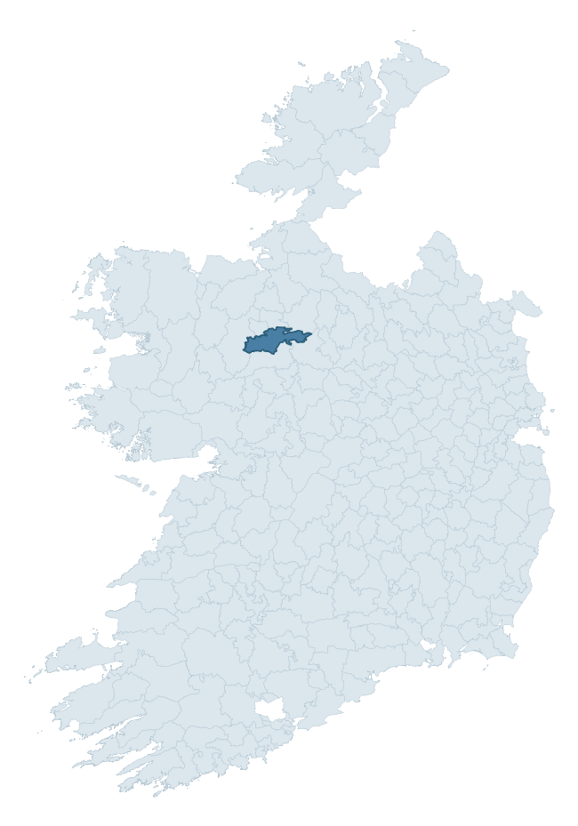
Where this barony sits in the Republic of Ireland
Geology and preservation
Bedrock geology shapes the landscape long before any settlement begins — controlling soil drainage, agricultural potential, the survival of upstanding monuments, and the preservation of buried archaeology. The figures below come from the Geological Survey Ireland 1:100,000 bedrock map.
The bedrock underlying Frenchpark is predominantly black calcarenites and shales (68% of the barony by area), laid down during the Carboniferous period (100% by area, around 359 to 299 million years ago). A substantial secondary geology of limestone (24%) adds further variety to the underlying landscape. The single largest mapped unit is the Ballymore Limestone Formation (68% of the barony's bedrock).
Rock type composition
Largest mapped unit: Ballymore Limestone Formation (68% of the barony)
Placename evidence
Logainm records 30 heritage-diagnostic placenames for Frenchpark, drawn from townland and civil-parish names across the barony. The dominant stratum is pre-Christian and Early Medieval defensive — ráth-, lios-, dún-, and caiseal-prefixed names that mark Iron Age and early historic settlement. The leading diagnostic roots are lios- (12 — ringfort or enclosure), cill- (12 — church), and ráth- (3 — earthen ringfort). This is broadly in line with the ROI average of 30.7 heritage placenames per barony. Logainm records 206 placenames for Frenchpark (predominantly townland names). Of these, 30 (15%) carry one of the diagnostic Gaelic roots tracked above; the remainder draw on more generic landscape vocabulary that does not encode a heritage period.
Pre-Christian / Early Medieval Defensive
| Root | Count | Meaning |
|---|---|---|
| lios- | 12 | ringfort or enclosure |
| ráth- | 3 | earthen ringfort |
| dún- | 2 | hilltop or promontory fort |
| caiseal- | 1 | stone ringfort |
Early Christian Ecclesiastical
| Root | Count | Meaning |
|---|---|---|
| cill- | 12 | church (early) |
Other baronies in Roscommon
About this profile
Click any section below to expand.
What is a barony?
A barony is a historic administrative unit in Ireland, broadly equivalent to an English hundred. The 280 baronies used here are from the OSi 2019 National Statutory Boundaries (generalised 20m), covering the 26 counties of the Republic of Ireland. Baronies derive from the Norman period, were formalised in the 17th century, and have not been redrawn for statistical purposes. They vary enormously in area, from compact urban baronies in Dublin to vast upland baronies in Connacht, and should not be compared by raw site count without accounting for area differences.
What counts as a site?
This profile combines three distinct heritage registers, each with its own definition of what constitutes a recordable site:
- Archaeological sites (NMS). The National Monuments Service Sites and Monuments Record (SMR) catalogues every known archaeological monument or site of archaeological interest in the Republic, from prehistoric burial mounds and ringforts to medieval churches and post-medieval defensive works. Inclusion does not require legal protection — only that the site has been identified, surveyed, and assessed as having archaeological value. A separate subset of these sites lies within a recorded protection zone, which gives them statutory protection under the National Monuments Acts.
- Listed buildings (NIAH). The National Inventory of Architectural Heritage records buildings of architectural, historical, archaeological, artistic, cultural, scientific, social, or technical interest. Each surveyed structure is appraised on a five-tier scale: International, National, Regional, Local, and Record-Only. The NIAH appraisal is informational rather than strictly statutory, but it underpins local-authority Record of Protected Structures (RPS) listings.
- Heritage placenames (Logainm). Logainm is the authoritative database of Irish placenames maintained by the Placenames Branch. This profile applies a heritage-diagnostic classifier to the Irish-language form of each townland name, flagging roots that signal defensive sites (ráth-, lios-, dún-, caiseal-, cathair-), ecclesiastical foundations (cill-, teampall-, domhnach-, mainistir-), prehistoric burial-ritual features (tuaim-, carn-, leaba-), or Norse-contact settlement (gall-). Townlands without one of these diagnostic roots are not flagged here — they may still carry historical significance, but that significance is not encoded in the name itself.
Editorial principles
The narrative sections of this profile follow several explicit principles:
- Evidential. Every claim about this barony’s heritage character is anchored in the underlying register data. Where a site count, a placename count, or a percentile rank is cited, it is computed from the source datasets at export time, not estimated.
- Comparative. Counts and metrics are reported alongside their percentile rank against the other 279 ROI baronies. A barony with 50 ringforts in absolute terms could be unusually high or unusually low depending on its size and regional context; percentile ranking removes that ambiguity.
- Transparent on limits. Where a register has known coverage gaps, survey biases, or data-quality issues that affect this barony’s figures, the profile flags them rather than presenting the numbers as definitive.
- No interpretation beyond what the data supports. The narrative does not speculate about historical events, social dynamics, or cultural meaning beyond what the recorded heritage and placename evidence directly attests.
Data caveats and limits
- NMS Sites and Monuments Record is the product of survey campaigns conducted at different intensities across different counties and decades. Some baronies have been surveyed more thoroughly than others, and absolute counts should be read in that light. Sites destroyed by development before survey are typically not represented; sites in heavily forested or upland terrain are sometimes under-recorded.
- NIAH coverage is broadly complete for the Republic of Ireland but the survey was conducted on a rolling county-by-county basis, and the most recent appraisal date varies. Buildings demolished or substantially altered after their original survey may still appear in the register; conversely, recent buildings of merit may not yet have been appraised.
- Logainm classification applies a deliberately conservative pattern-matching approach to the Irish-language townland forms. The classifier prioritises true positives over recall: a townland may carry a heritage signal that the classifier doesn’t recognise, particularly where the diagnostic root has been heavily anglicised or where the townland name draws on a less common term. The 60,000+ townland records and ~9,800 classified placenames give a substantial signal at barony scale, but individual townland names should be checked against Logainm directly for definitive interpretation.
- Period attribution. The chronological distribution reflects only those NMS sites that carry a recognised period attribution in the source data. Sites listed as “Unknown” period are excluded from the dated subset.
- Boundary changes. Some baronies have undergone minor boundary adjustments since their 19th-century definition; the OSi 2019 generalised boundaries used here are the current statutory definition and may differ slightly from historical maps in border areas.
- Bedrock geology is mapped at 1:100,000 scale, which means local variation within a barony — small pockets of different rock type, mineral veins, alluvium overlying bedrock — is generalised. The dominant-system and rocktype figures are area-weighted, so a barony reading “70% Carboniferous limestone” may still contain small but archaeologically important pockets of older or younger rock. Around 3% of GSI polygons do not match the lexicon and contribute no rocktype or system attribution.
Data sources
- National Monuments Service — Sites and Monuments Record (SMR) https://data.gov.ie/dataset/national-monuments-service-archaeological-survey-of-ireland
- National Inventory of Architectural Heritage (NIAH) https://data.gov.ie/dataset/national-inventory-of-architectural-heritage-niah-national-dataset
- Logainm — Placenames Database of Ireland https://www.logainm.ie/
- Ordnance Survey Ireland — National Statutory Barony Boundaries 2019 https://data-osi.opendata.arcgis.com/
- EURODEM — European Digital Elevation Model https://www.mapsforeurope.org/datasets/euro-dem
- ESA WorldCover https://esa-worldcover.org/en
- Geological Survey Ireland — 1:100,000 Bedrock Geology https://www.gsi.ie/en-ie/data-and-maps/Pages/Bedrock.aspx
Explore more: Search any of the 280 ROI baronies, browse by historical province, or read the methodology and data sources for the full Republic of Ireland Heritage Tool.