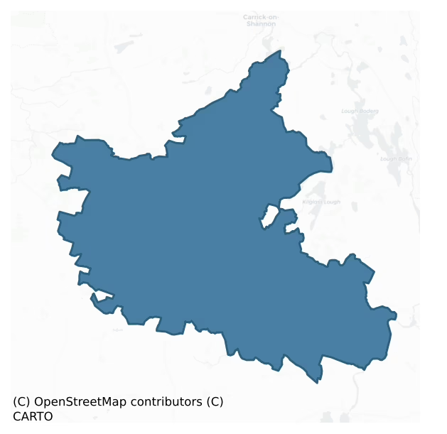
Roscommon is a barony of County Roscommon, in the historical province of Connacht (Irish: Ros Comáin), covering 334 km² of land. The barony records 1,283 NMS archaeological sites and 43 NIAH listed buildings, placing it at around the 91st percentile among 280 ROI baronies for sites per km². This means it is in the top tenth of all baronies for sites per km². Dated archaeological evidence runs from the Neolithic through to the Modern, spanning 8 of 9 archaeological periods, placing the barony in the 56th percentile among 280 ROI baronies for chronological depth. This means it is in the upper half of all baronies for chronological depth. The largest dated subset of recorded sites dates to the Early Medieval. Logainm flags 68 placenames in the barony as carrying a recognised heritage root; the largest share — around 56% — are names associated with early Christian church and monastic foundations.
Heritage at a glance
Percentile rankings throughout this profile compare each barony only against the other 279 Republic of Ireland baronies.
The recorded heritage of Roscommon
The National Monuments Service Sites and Monuments Record (SMR) is the statutory inventory of archaeological sites for the Republic of Ireland, maintained by the Department of Tourism, Culture, Arts, Gaeltacht, Sport and Media. Sites recorded here include earthworks, ringforts, megalithic tombs, ecclesiastical remains, and post-medieval features; not every record is legally protected, but each is registered as a monument of archaeological interest.
The National Monuments Service records 1,283 archaeological sites in Roscommon, putting it at the 91st percentile among 280 ROI baronies for sites per km². This means it is in the top tenth of all baronies for sites per km². Protection coverage is near-universal — 1,240 sites (97%) fall within a recorded monument protection zone, indicating an extensively surveyed landscape. The dominant category is defensive sites — ringforts, enclosures, hillforts, and stone forts (788 sites, 61% of the record). Ringfort – rath is the most prevalent type, making up 44% of the barony's recorded sites (562 records) — well above the ROI average of 20% across all baronies where this type occurs. Ringfort – rath is an earthen ringfort enclosed by a bank and external ditch — the most common Early Medieval farmstead, broadly dated 500–1000 AD. Other significant types include Enclosure (77) and House – indeterminate date (63). Enclosure is a banked or ditched feature of uncertain type, used as a catch-all where the original function cannot be determined from surface evidence; House – indeterminate date is a habitation building whose date cannot be determined from available evidence. Across the barony's 334 km², this gives a recorded density of 3.84 sites per km².
Most common monument types
Hover or tap a monument type to see its definition.
| Type | Count |
|---|---|
| Ringfort – rath an earthen ringfort enclosed by a bank and external ditch — the most common Early Medieval farmstead, broadly dated 500–1000 AD | 562 |
| Enclosure a banked or ditched feature of uncertain type, used as a catch-all where the original function cannot be determined from surface evidence | 77 |
| House – indeterminate date a habitation building whose date cannot be determined from available evidence | 63 |
| Crannog an artificial or partly artificial island built up on a lake or river bed, in use from the 6th to 17th centuries AD | 52 |
| Field system a group of related fields forming a coherent agricultural landscape, of any date from the Neolithic onwards | 34 |
| Earthwork an unclassified earthen structure with no diagnostic features that allow a more specific classification | 30 |
| Barrow – ring-barrow a Bronze/Iron Age burial monument: a low circular area enclosed by ditch and outer bank | 27 |
Chronological distribution
The dated archaeological record for Roscommon spans from the Neolithic through to the Modern, with activity attested across 8 of 9 archaeological periods. Every period from earliest to latest is represented in the record — an unbroken sequence of dated activity across the full chronological span. Activity concentrates most heavily in the Early Medieval (674 sites, 59% of dated material), with the Iron Age forming a secondary peak (225 sites, 20%). A further 147 recorded sites (11% of the overall NMS register for the barony) carry no period attribution — appearing as 'Unknown' in the bar chart below. This typically reflects either records that pre-date the standardised period vocabulary or sites awaiting specialist dating review, rather than a genuine absence of chronological evidence.
Sample of recorded monuments
Show 25 sample monuments (of 1,283 total)
A representative sample of 25 recorded monuments drawn from the barony’s 1,283 total NMS entries. Sites within a recorded monument protection zone and rarer site types are prioritised so the list shows a meaningful cross-section rather than only the most common type. Each entry shows the official Sites and Monuments Record reference number and the description published by the National Monuments Service.
Cross-inscribed stone
The church of Lissonuffy (RO029-099001-) is within a rectangular graveyard (RO029-099002-) where there is a stone (H 0.7m; Wth 0.2m; T 0.13m) inscribed with a cross (H 12cm; span 13cm) that has expanding terminals…
The church of Lissonuffy (RO029-099001-) is within a rectangular graveyard (RO029-099002-) where there is a stone (H 0.7m; Wth 0.2m; T 0.13m) inscribed with a cross (H 12cm; span 13cm) that has expanding terminals outside the S church wall.
Compiled by: Michael Moore
Date of upload: 3 November, 2014
Cathedral
Ono, a Druid and one of two brothers who owned this territory sought gold from St. Patrick for the site of a a church. For this offence the saint said that none of the Cinel Mac Earca would rule the Connachta but would…
Ono, a Druid and one of two brothers who owned this territory sought gold from St. Patrick for the site of a a church. For this offence the saint said that none of the Cinel Mac Earca would rule the Connachta but would always be allies of their kings. A contrite Ono offered his own fort to the saint who brought forth a spring at Ail Fin which means the fair spring of the stone (O'Flanagan 1931, vol. 2, 2-5; Bieler 1979). Another derivation of the name, using Welsh sources, suggests that St Brendan may have been the founder and it means ‘the rock of the fair one’ (Beggan 2016).
Elphin supplanted Roscommon (RO039-043006-) as the diocesan centre by c.1170, probably because of the strength and reputation of St Patrick's abbey (RO016-148001-), but a separate cathedral of St Mary had been built by the early 13th century and is listed in the ecclesiastical taxation of Elphin diocese in 1306 (Cal. doc. Ire., vol. 5, 223). There were eight bishops named O'Conor before 1343, one of whom, Tomaltach, became Archbishop of Armagh in 1180. After a disputed election in 1244, the elections came more under the direction of the King and the Pope. Roland de Burgo, appointed in the 1540s, was the first Protestant bishop and Elphin continued as the diocesan centre until 1961. (Gwynn and Hadcock 1970, 75-7)
The church was damaged in 1641, and a new cathedral was erected on the original foundations in 1757-8. This was rebuilt in 1823, while the apse was added in 1872. The church was largely dem…
Religious house – Augustinian canons
Traditionally, a church was established by St Patrick at a well beside a rock (Bieler 1978, 95-7), hence the name Ail Fionn or Elphin meaning 'the sweet well by the rock'. The names of the first two bishops, Assicus and…
Traditionally, a church was established by St Patrick at a well beside a rock (Bieler 1978, 95-7), hence the name Ail Fionn or Elphin meaning 'the sweet well by the rock'. The names of the first two bishops, Assicus and Bite, are known, but nothing else is recorded until the Augustinian rule was introduced to St Patrick's in the early 12th century. St Patrick's continued separate from St Mary's Cathedral (RO016-127001-) and is listed in the ecclesiastical taxation of Elphin in 1306 (Cal. doc. Ire., vol. 5, 223). However, by 1442 the community was extinct and the church had been transferred to the Franciscans (Gibley 1988), although some sources describe them as Dominican (Nicholls 1972-3, 37). St Patrick's was suppressed in 1563 and it was described as a church, cloister and dormitory in 1591, (Gwynn and Hadcock 1970, 175, 249). A palace (RO016-128001-) for the Church of Ireland bishop was built from its materials which became known as the castle, the location of which was identified by J. O'Donovan in 1837 as the castle field, which is also the site of St. Patrick's (O'Flanagan 1931, vol. 2, 5). The Franciscans continued in the Elphin area, even holding a chapter here in 1672, but by the late 18th century they had disappeared from the area (Gibley 1988, 27). No trace of the church is extant and its exact location is not known.
Compiled by: Michael Moore
Date of upload: 24 August 2010
Ford
Identified by J. O'Donovan c. 1837 as the ford of Ath Slisean on the NE-SW Owenur River where Manus O'Conor defeated his brother Cathal in 1288 (AFM vol. 3, 447), and where William Burke fought Roderic O'Conor in 1309…
Identified by J. O'Donovan c. 1837 as the ford of Ath Slisean on the NE-SW Owenur River where Manus O'Conor defeated his brother Cathal in 1288 (AFM vol. 3, 447), and where William Burke fought Roderic O'Conor in 1309 (AFM vol. 3, 493). The river has been drained and straightened and the stream is now crossed by a four-arched bridge. Moated site (RO017-151—-) is c. 100m W of the bridge.
Compiled by: Michael Moore
Date of upload: 24 August 2010
Ritual site – holy/saint's stone
Towards the E end of a low ridge. Triangular stone (dims 0.5m x 0.4m) with two oval solution holes (dims c. 0.25m x 0.1m; D 0.1m) which is known locally as St Patrick's Stone and believed to hold the imprint of his…
Towards the E end of a low ridge. Triangular stone (dims 0.5m x 0.4m) with two oval solution holes (dims c. 0.25m x 0.1m; D 0.1m) which is known locally as St Patrick's Stone and believed to hold the imprint of his knees.
Compiled by: Michael Moore
Date of upload: 24 August 2010
Habitation site
On a flat, low-lying landscape. A peninsula (dims c. 200m NW-SE; c. 80m NE-SW) with many bays and hummocks projects NW from the S shore of Clooncullaan Lough North (dims c. 600m E-W; c. 150m N-S at W to c. 300m N-S at…
On a flat, low-lying landscape. A peninsula (dims c. 200m NW-SE; c. 80m NE-SW) with many bays and hummocks projects NW from the S shore of Clooncullaan Lough North (dims c. 600m E-W; c. 150m N-S at W to c. 300m N-S at E). Animal bones were found on a shore (L c. 50m) on the E side of the peninsula in the 20th century (NMI file).
Compiled by: Michael Moore
Date of upload: 24 August 2010
Barrow – stepped barrow
On the E-facing slope of Rathcroghan ridge. Circular grass-covered platform (diam. 41.5m NNE-SSW; 39.4m WNW-ESE; H 0.2m at E to 2m at W) which slopes down to the E (H c. 3.5m). It is bisected by a NNE-SSW field bank and…
On the E-facing slope of Rathcroghan ridge. Circular grass-covered platform (diam. 41.5m NNE-SSW; 39.4m WNW-ESE; H 0.2m at E to 2m at W) which slopes down to the E (H c. 3.5m). It is bisected by a NNE-SSW field bank and drain, and is barely visible E of this feature. The platform is defined by a fosse (Wth of top 10-11m; Wth of base 5-7m; D 0.6m) and outer bank (Wth 1.5-2.2m; H 0.3m) SSW-WNW, but the fosse is reduced to a berm (Wth 7.5-10m) defined by a scarp (H 0.1-0.9m) and the bank is absent elsewhere (max. ext. diam. 63m NNE-SSW; 63m WNW-ESE). Just NW of the centre is a low mound (RO022-056054-) (diam. 5m; H 0.1m). The road (RO022-056034-) runs W from this barrow past Rathscreg barrow (RO022-056035-) and the smaller barrows (RO022-056036-; RO022-056037-), which are c. 180m, c. 130m, and c. 100m to the WNW respectively. (Knox 1914a, 23-4 fig. 9; Herity 1983, 131; 1984, Kilnanooan; Waddell 1983, 39-41; 1988, 12, No. 42)
Compiled by: Michael Moore
Date of upload: 24 August 2010
Cave
On the S-facing slope of Rathcroghan plateau, inside earthwork (RO022-057028-). It was considered to be the entrance to the underworld, and the residence of Morrigan, a pagan goddess of war, as well as being the…
On the S-facing slope of Rathcroghan plateau, inside earthwork (RO022-057028-). It was considered to be the entrance to the underworld, and the residence of Morrigan, a pagan goddess of war, as well as being the dwelling of magical pigs, cats and other animals and spirits who emerged at Samhain or Halloween, the feast of the dead. (Gormley 1989b, 12-14)
A stone-built and lintelled passage (dims 10.5m NNW-SSE; 0.75-1.4m; H 1-1.8m) of a souterrain (RO022-057029-) is partly rock-cut and descends from the blocked entrance at SE to a natural cave (dims 37m NNW-SSE; Wth of base c. 0.7-2.5m; max. H c. 7m). A second passage which joins the main passage close to the blocked entrance is now destroyed in its central part but allows access to the main passage through a short section (Wth 1.35m; H 0.9m) aligned ENE-WSW (L 2m), which serves as the present entrance to the whole structure. The original end of this passage is preserved as an inaccessible undifferentiated passage end (dims c. 1.5m x 1.5m) in the field bank c. 3m W of the present entrance to Oweynagat, although this has been interpreted as a separate souterrain (Waddell et al. 2009, 81-3). There is an ogham stone (RO022-057030-) at the junction of the two passages, and another (RO022-057084-) is at the SE end of the main passage. (Herity 1983, 132; 1987a, 138, Glenballythomas 17; Waddell 1983, 33, No. 21; Waddell 1988, 13-4; Condit and Moore 2003)
This is a National Monument in state ownership: No. 473
Compiled by:…
Megalithic tomb – court tomb
On a slight rise on the floor of a NW-SE valley at the bottom of the S-facing slope of Rathcroghan ridge. Two orthostats indicate the S wall of an E-W gallery (L c. 2.7m), while a third forms the jamb at W. Two other…
On a slight rise on the floor of a NW-SE valley at the bottom of the S-facing slope of Rathcroghan ridge. Two orthostats indicate the S wall of an E-W gallery (L c. 2.7m), while a third forms the jamb at W. Two other stones to the W may be a further chamber of the gallery. (Knox 1914a, 37-8; de Valera and Ó Nualláin 1972, 35; Herity 1983, 131, Glenballythomas 23; Waddell 1983, 33, No. 17)
This is a National Monument in state ownership: No. 473
Compiled by: Michael Moore
Date of upload: 24 August 2010
See linked document with details from Ruaidhrí de Valera and Seán Ó Nualláin, Survey of the Megalithic Tombs of Ireland. Volume III. Counties Galway, Roscommon, Leitrim, Longford, Westmeath, Laoighis, Offaly, Kildare, Cavan. (Dublin: Stationery Office, 1972).
Barrow – embanked barrow
On the N-facing slope of a low E-W ridge. Circular grass-covered area (diam. 17.3m E-W; 16.6m N-S) defined by a broad earthen bank (Wth 4-5m; int. H 0.1-0.3m; ext. H 0.2-0.6m). There is no visible fosse or identifiable…
On the N-facing slope of a low E-W ridge. Circular grass-covered area (diam. 17.3m E-W; 16.6m N-S) defined by a broad earthen bank (Wth 4-5m; int. H 0.1-0.3m; ext. H 0.2-0.6m). There is no visible fosse or identifiable entrance (ext. diam. 22.2m N-S; 19.7m E-W). Rath (RO022-079—-) is c. 180m to the SW.
Compiled by: Michael Moore
Date of upload: 24 August 2010
Cross
There are fragments from an ogee-headed window and a more complex tracery at Ogulla holy well (RO022-106003-) and there are three stones with chamfered edges and a cross-base (dims of base 0.73 x 0.56m; dims of top 0.5m…
There are fragments from an ogee-headed window and a more complex tracery at Ogulla holy well (RO022-106003-) and there are three stones with chamfered edges and a cross-base (dims of base 0.73 x 0.56m; dims of top 0.5m x 0.43m; H 0.27m) with a large socket (dims 0.33m x 0.26m; D 0.15m) (Kelly 1993, 154) in the graveyard (RO022-106002-).
Compiled by: Michael Moore
Date of upload: 24 August 2010
Cross – High cross
The holy well of Ogulla (RO022-106003-) is overlooked by a large tree where the head of a high cross (Harbison 1992, vol. 1, 185; Kelly 1993, 154-6), now in NMI but replaced by a replica (Kelly 1994), is kept. It…
The holy well of Ogulla (RO022-106003-) is overlooked by a large tree where the head of a high cross (Harbison 1992, vol. 1, 185; Kelly 1993, 154-6), now in NMI but replaced by a replica (Kelly 1994), is kept. It consists of the crux (dims c 0.8m x 0.8m; T 0.3m) with a large boss on one face and a plainly-carved head on the other.
Compiled by: Michael Moore
Date of upload: 24 August 2010
Historic town
In the SW-NE valley of the Ogulla River. The foundation of a castle by O'Conor Rua in 1406 and the Dominican friary in 1448 may have led to the development of a settlement which was burnt in 1595. From 1582 to 1601 the…
In the SW-NE valley of the Ogulla River. The foundation of a castle by O'Conor Rua in 1406 and the Dominican friary in 1448 may have led to the development of a settlement which was burnt in 1595. From 1582 to 1601 the friary was an important English garrison, securing the road from Athlone to Sligo. Incorporation as a borrough was mooted in 1612 and accomplished in 1662 but, although a market (RO022-114002-) was established in 1617, the settlement seems not to have grown and never had any defences (RO022-114005-). (Bradley and Dunne 1988a, 112-19; Gormley 1989, 44-5)
The remains consist of an earlier rath (RO022-114003-) associated with a well (RO022-114004-), the castle (RO022-114001-) and the Dominican Priory (RO022-114006-) later fortified as a tower house (RO022-114009-), with the field system (RO022-113001-) SW of the friary.
Compiled by: Michael Moore
Date of upload: 24 August 2010
Religious house – Dominican friars
An ancient church may have existed at Tulsk since it is listed in the Registry of Clonmacnoise (O'Donovan 1856-7, 451), and such a church might be that listed as Tulagh in the ecclesiastical taxation of Elphin in 1306…
An ancient church may have existed at Tulsk since it is listed in the Registry of Clonmacnoise (O'Donovan 1856-7, 451), and such a church might be that listed as Tulagh in the ecclesiastical taxation of Elphin in 1306 (Cal. doc. Ire., vol. 5, 223). A Dominican friary dedicated to St Patrick was founded in 1448 by either by Fedlimid mac Fedlimid O'Conor or Fedlimid MacDowell (Gwynn and Hadcock 1988, 230-1), probably the former (McDermott 2016), but nothing is known of its history and it may have been derelict by 1582 when Sir Charles Bingham established a garrison at Tulsk (O'Conor, 2007, 196). The tower house (RO022-114009-) in the chancel may have been built then or in 1595 when Sir Richard Bingham built fortifications at Tulsk and placed them under the command of Capt. George Lane. It is situated on a gentle N-facing slope. (Gormley 1989, 38-44)
Only the S wall (surviving L c. 28m) with the remains of one window, and fragments of the W and N walls (int. dim. 7.25m N-S) survive of the undifferentiated nave and chancel church, forming the earliest construction phase in the mid-15th century. In the later 15th century two pointed arches springing from a central cylindrical pillar give access to a S transept (ext. dims 12m N-S; 8m E-W) towards the W end of the S wall. There are mason's marks on the E corbel of the E arch and the SW side of the pillar, but the tracery of the S transept window, which had three lights, is missing. The top (dims 2.15m x 0.35m plus; T 0.2m) of th…
Stone trough
On a level landscape. There is a rectangular limestone trough (ext. dims 1.3m x 0.5m; H 0.3m; int. dims 1.15m x 0.35m; D 0.2m) at the holy well (RO023-097001-), but there is no evidence of a stone said to have the…
On a level landscape. There is a rectangular limestone trough (ext. dims 1.3m x 0.5m; H 0.3m; int. dims 1.15m x 0.35m; D 0.2m) at the holy well (RO023-097001-), but there is no evidence of a stone said to have the imprint of St Patrick's knee (Gannon 1972).
Compiled by: Michael Moore
Date of upload: 24 August 2010
Bridge
A bridge is marked on the Petty map of Roscommon barony dated 1683 between Clonycoylemore (Clooneen) and Ballytynne (Ballyfeeny) townlands. It is on the boundary of the parishes of Bumlin in Roscommon barony and…
A bridge is marked on the Petty map of Roscommon barony dated 1683 between Clonycoylemore (Clooneen) and Ballytynne (Ballyfeeny) townlands. It is on the boundary of the parishes of Bumlin in Roscommon barony and Kilglass in Ballintober North. A three-arch bridge (L c. 15m) with dressed voussoirs is built as one unit (Wth c. 6m) across the S-N Scramoge River. The present bridge may be 18th century in date.
Compiled by: Michael Moore
Date of upload: 24 August 2010
House – 16th/17th century
On the E-facing slope of Cregga Hill. Cregga was acquired by McDermot Roe in 1661 (Kennedy 2000, 80-1) and the house may have been built thereafter. Cregga House is depicted as an occupied U-shaped building with two…
On the E-facing slope of Cregga Hill. Cregga was acquired by McDermot Roe in 1661 (Kennedy 2000, 80-1) and the house may have been built thereafter. Cregga House is depicted as an occupied U-shaped building with two wings extending to the SW on the 1837 ed. of the OS 6-inch map. The SW wing survives as a vaulted chamber (int. dims 5.5m NE-SW; 3m NW-SE; H 2.2m) which had an upper floor. It communicated by a doorway (Wth 1.23m; H 1.6m) in its NE wall with the rest of the house which is now represented by a grass-covered mound (dims c. 25m NE-SW; c. 5.5m NW-SE; max. H 1.5m). Three rooms and a passageway (Wth 2.3m) leading through the house to a yard (dims 12m NE-SW; 5m NW-SE) between the wings can be identified in the mound. The NW wing, which survives as a featureless NW gable and a SW wall (Wth 0.6m; H 1.8m) with one window, appears to be later than the rest of the structure. An underground store (int. dims 3.3m ENE-WSW; 1.2m NNW-SSE; H 0.9m) with a corbelled roof is no longer visible. Dovecote (RO023-201—-) is c. 20m to the SSE, and tower house (RO023-200001-) is c. 100m to the W.
Compiled by: Michael Moore
Date of upload: 24 August 2010
Dovecote
On the E-facing slope of Cregga Hill and c. 20m SSE of Cregga House (RO023-200002-). This is a rectangular two-storey structure (ext. dims 3.6m NE-SW; 3.6m NW-SE; int. dims 2.2m x 2.2m) which has a barrel-vault roof,…
On the E-facing slope of Cregga Hill and c. 20m SSE of Cregga House (RO023-200002-). This is a rectangular two-storey structure (ext. dims 3.6m NE-SW; 3.6m NW-SE; int. dims 2.2m x 2.2m) which has a barrel-vault roof, two windows, and a doorway (Wth 0.62, H 1.64m) in the NW wall. The first floor is inaccessible but has a window in the NW wall and alcoves for roosts. There are gables on the NE and SW walls. (Kennedy 2000)
Compiled by: Michael Moore
Date of upload: 24 August 2010
Religious house – Franciscan Third Order Regular
On an undulating low-lying landscape. A friary which may have been Dominican or Franciscan was founded here by O'Conor Rua, probably in the 15th century. In 1585 when it was granted to Edward Crofton it was described as…
On an undulating low-lying landscape. A friary which may have been Dominican or Franciscan was founded here by O'Conor Rua, probably in the 15th century. In 1585 when it was granted to Edward Crofton it was described as Friancisan Third Order, and consisted of a church, cemetery and a quarter of land (Gwynn and Hadcock 1980, 275; Gormley 1989, 147-8). It is not visible at ground level in pasture. Field system (RO-028-010—) is just to the SW, on the other side of a NW-SE stream, and the road (RO028-008002-) runs NE towards Ogulla well (RO022-106003-).
Compiled by: Michael Moore
Date of upload: 24 August 2010
Megalithic structure
Marked only on the 1930 ed. of the OS 6-inch map, and situated on a gentle S-facing slope overlooking a W-E section of the Ogulla River, c. 50m to the S in an area which has been quarried. Described as a rectangular…
Marked only on the 1930 ed. of the OS 6-inch map, and situated on a gentle S-facing slope overlooking a W-E section of the Ogulla River, c. 50m to the S in an area which has been quarried. Described as a rectangular cist (dims c. 3m x c. 1.5m; H c. 1.8m) where bones were found on a platform at one end when it was discovered during quarrying c. 1885 (OS Name Book). It is not now visible at ground level in an area disturbed by old quarrying.
Compiled by: Michael Moore
Date of upload: 24 August 2010
Barrow – pond barrow
Marked only on the 1930 ed. of the OS 6-inch map, and situated at the crest of the S end of a N-S ridge at the E base of the Carnfree ridge. Circular grass-covered dished area (diam. 25.7m NW-SE; D 0.4-0.45m) defined by…
Marked only on the 1930 ed. of the OS 6-inch map, and situated at the crest of the S end of a N-S ridge at the E base of the Carnfree ridge. Circular grass-covered dished area (diam. 25.7m NW-SE; D 0.4-0.45m) defined by an earthen bank (Wth c. 2.7-3m; ext. H 0.1-0.2m) WNW-N-SE, although flush with the external ground elsewhere. There is a collapsed drystone wall and hedge on the perimeter S-WNW.
Compiled by: Michael Moore
Date of upload: 24 August 2010
Cist
On a N-facing slope overlooking the valley of a W-E stream. A cist containing a Bowl Food Vessel and a cremation, which may have been under a mound (RO028-195001-), were recovered in land reclamation in 1965. (Lucas…
On a N-facing slope overlooking the valley of a W-E stream. A cist containing a Bowl Food Vessel and a cremation, which may have been under a mound (RO028-195001-), were recovered in land reclamation in 1965. (Lucas 1968, 120-1; Waddell 1990,130; O Riordain and Waddell 1993, 128)
Compiled by: Michael Moore
Date of upload: 24 August 2010
Mausoleum
On a level landscape c. 220m SSW of Strokestown House (RO029-025002*) and within the demesne. This was built by Nicholas Mahon c. 1667 (Hayward 1955, 204). It is a rectangular structure (ext. dims 13.4m E-W; 7.95m N-S)…
On a level landscape c. 220m SSW of Strokestown House (RO029-025002*) and within the demesne. This was built by Nicholas Mahon c. 1667 (Hayward 1955, 204). It is a rectangular structure (ext. dims 13.4m E-W; 7.95m N-S) constructed of masonry walls which are almost complete (H 2.7m; T 0.8m) and have roughly dressed quoins. There is an inserted twin-light pointed window (H 2.3m; Wth 0.9m) with chamfered surrounds in the E gable. The locked door, flanked by two plain shields, is at the W end of the S wall, and the interior contains a large hexagonal tomb or mausoleum, and a wall memorial (RO029-024002-) against the N end of the E wall. This is the tomb of Nicholas Mahon and his wife Magdalene (nee French) who died in 1680 and 1683 respectively, according to the inscription.
Compiled by: Michael Moore
Date of upload: 8 December 2011
Cross – Churchyard cross
A fragment of the stem of a memorial cross (dims 0.23m x 0.17m; H 0.8m) dated 1628 (Siggins 1986b, 35) or 1605 is in the graveyard (RO029-053002-) of the parish church (RO029-053001-) of Cloonfinlough. The inscription…
A fragment of the stem of a memorial cross (dims 0.23m x 0.17m; H 0.8m) dated 1628 (Siggins 1986b, 35) or 1605 is in the graveyard (RO029-053002-) of the parish church (RO029-053001-) of Cloonfinlough. The inscription reads: C:B / 1605 / COM.
Compiled by: Michael Moore
Date of upload: 24 August 2010
Ringfort – rath
Marked as a subcircular embanked enclosure on the 1837 and 1914 (ext. dims c. 40m N-S; c. 35m E-W) eds of the OS 6-inch map, and situated on top of a low rise in a low-lying landscape. Described as slight traces of a…
Marked as a subcircular embanked enclosure on the 1837 and 1914 (ext. dims c. 40m N-S; c. 35m E-W) eds of the OS 6-inch map, and situated on top of a low rise in a low-lying landscape. Described as slight traces of a semicircular bank (Gannon 1972), it is no longer visible at ground level in reclaimed pasture.
Compiled by: Michael Moore
Date of upload: 24 August 2010
Listed buildings
The National Inventory of Architectural Heritage (NIAH) is a state survey appraising buildings of architectural, historical, archaeological, artistic, cultural, scientific, social, or technical interest. Each surveyed structure receives a rating from International (the highest, for buildings of European importance) through National, Regional, Local, and Record-Only.
The NIAH records only 43 listed buildings in Roscommon, the 20th percentile across ROI baronies — a relatively thin architectural record. The highest-graded structure include 1 of National significance. The Republic holds 937 National-graded buildings in total, so this barony accounts for around 0% of the national total. Construction dates concentrate most heavily in the Victorian (1830-1900) period. The most-recorded building type is house (19 examples, 44% of the listed stock).
Terrain and environment
Mean elevation across the barony is 65m — the 27th percentile among 280 ROI baronies for elevation. This means it is in the bottom third of all baronies for elevation. This is a relatively low-lying landscape by ROI standards. Elevation matters for heritage because higher-altitude baronies typically favour defensive monuments — ringforts and hilltop forts placed on prominent ground — while lowland baronies are more likely to carry the dense settlement and church networks of intensive agricultural landscapes. A maximum elevation of 262m gives the barony meaningful vertical relief. Mean slope is 2.9° — the 36th percentile among 280 ROI baronies for slope. This means it is in the lower half of all baronies for slope. Slope is a key control on both land use and archaeological preservation: steep ground resists ploughing and tends to preserve earthworks intact, while gentle slopes favour intensive cultivation that damages or destroys surface archaeology over time. The Topographic Wetness Index averages 11.2, the 63rd percentile among 280 ROI baronies for wetness. This means it is in the upper half of all baronies for wetness. Drainage matters for heritage because poorly-drained ground preserves organic archaeology (wooden trackways, leather, textiles, and on rare occasions human remains) far better than free-draining soil; well-drained ground favours arable use but destroys organic material rapidly. The land cover is dominated by improved grassland (82%) and woodland (16%).
Terrain measurements
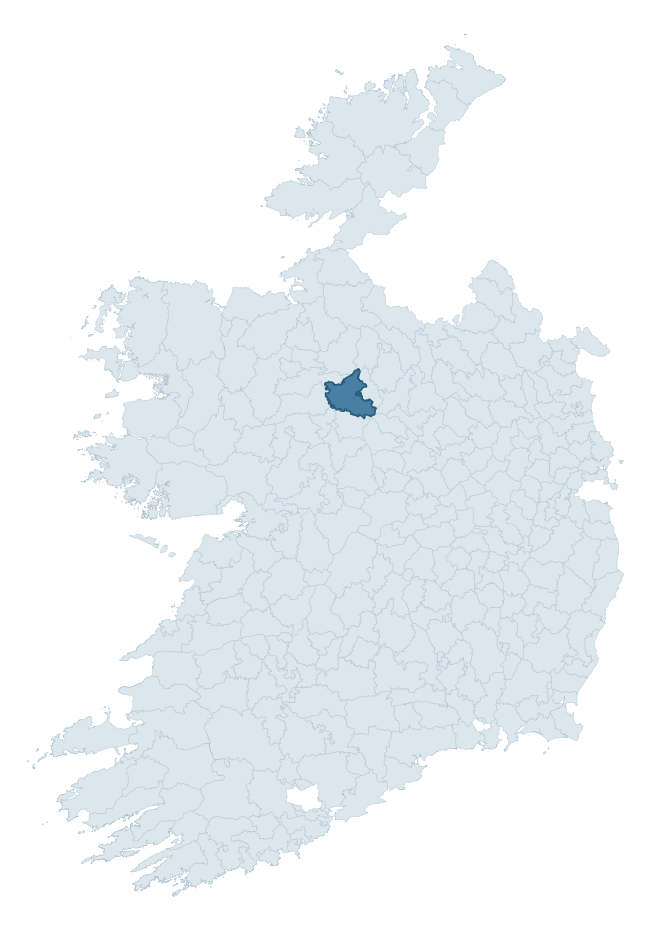
Where this barony sits in the Republic of Ireland
Geology and preservation
Bedrock geology shapes the landscape long before any settlement begins — controlling soil drainage, agricultural potential, the survival of upstanding monuments, and the preservation of buried archaeology. The figures below come from the Geological Survey Ireland 1:100,000 bedrock map.
The bedrock underlying Roscommon is predominantly limestone (40% of the barony by area), laid down during the Carboniferous period (97% by area, around 359 to 299 million years ago). Limestone is the most heritage-rich bedrock in Ireland. It supports fertile, well-drained soils that favoured dense Early Medieval settlement and Norman manorial agriculture, and it weathers into karst features — sinkholes, caves, swallow holes, and souterrains — that frequently carry archaeology. Where peat overlies limestone, organic preservation can be exceptional. A substantial secondary geology of black calcarenites and shales (40%) adds further variety to the underlying landscape. The single largest mapped unit is the Ballymore Limestone Formation (40% of the barony's bedrock). With 9 distinct rock types mapped, the barony sits in the top third of ROI baronies for geological diversity (85th percentile) — typically a sign of complex tectonic history or coastal mosaics of differing rock units.
Rock type composition
Largest mapped unit: Ballymore Limestone Formation (40% of the barony)
Placename evidence
Logainm records 68 heritage-diagnostic placenames for Roscommon, drawn from townland and civil-parish names across the barony. The dominant stratum is Early Christian ecclesiastical — cill-, teampall-, and domhnach-prefixed names that record the dense network of early church foundations established between the fifth and tenth centuries. The leading diagnostic roots are cill- (30 — church), lios- (19 — ringfort or enclosure), and dún- (7 — hilltop fort or promontory fort). This is well above the ROI average of 30.7 heritage placenames per barony — around 2.2× the typical figure. The presence of multiple heritage strata side by side indicates layered occupation of the landscape across successive prehistoric and historic periods. Logainm records 351 placenames for Roscommon (predominantly townland names). Of these, 68 (19%) carry one of the diagnostic Gaelic roots tracked above; the remainder draw on more generic landscape vocabulary that does not encode a heritage period.
Pre-Christian / Early Medieval Defensive
| Root | Count | Meaning |
|---|---|---|
| lios- | 19 | ringfort or enclosure |
| dún- | 7 | hilltop or promontory fort |
| caiseal- | 1 | stone ringfort |
Early Christian Ecclesiastical
| Root | Count | Meaning |
|---|---|---|
| cill- | 30 | church (early) |
| gráinseach- | 3 | monastic farm / grange |
| tobar- | 2 | holy well |
| cillín- | 2 | unconsecrated burial ground |
| teampall- | 1 | church (later medieval) |
Burial, Ritual, and Norse-Contact
| Root | Count | Meaning |
|---|---|---|
| tuaim- | 2 | burial mound |
| carn- | 1 | cairn |
Other baronies in Roscommon
About this profile
Click any section below to expand.
What is a barony?
A barony is a historic administrative unit in Ireland, broadly equivalent to an English hundred. The 280 baronies used here are from the OSi 2019 National Statutory Boundaries (generalised 20m), covering the 26 counties of the Republic of Ireland. Baronies derive from the Norman period, were formalised in the 17th century, and have not been redrawn for statistical purposes. They vary enormously in area, from compact urban baronies in Dublin to vast upland baronies in Connacht, and should not be compared by raw site count without accounting for area differences.
What counts as a site?
This profile combines three distinct heritage registers, each with its own definition of what constitutes a recordable site:
- Archaeological sites (NMS). The National Monuments Service Sites and Monuments Record (SMR) catalogues every known archaeological monument or site of archaeological interest in the Republic, from prehistoric burial mounds and ringforts to medieval churches and post-medieval defensive works. Inclusion does not require legal protection — only that the site has been identified, surveyed, and assessed as having archaeological value. A separate subset of these sites lies within a recorded protection zone, which gives them statutory protection under the National Monuments Acts.
- Listed buildings (NIAH). The National Inventory of Architectural Heritage records buildings of architectural, historical, archaeological, artistic, cultural, scientific, social, or technical interest. Each surveyed structure is appraised on a five-tier scale: International, National, Regional, Local, and Record-Only. The NIAH appraisal is informational rather than strictly statutory, but it underpins local-authority Record of Protected Structures (RPS) listings.
- Heritage placenames (Logainm). Logainm is the authoritative database of Irish placenames maintained by the Placenames Branch. This profile applies a heritage-diagnostic classifier to the Irish-language form of each townland name, flagging roots that signal defensive sites (ráth-, lios-, dún-, caiseal-, cathair-), ecclesiastical foundations (cill-, teampall-, domhnach-, mainistir-), prehistoric burial-ritual features (tuaim-, carn-, leaba-), or Norse-contact settlement (gall-). Townlands without one of these diagnostic roots are not flagged here — they may still carry historical significance, but that significance is not encoded in the name itself.
Editorial principles
The narrative sections of this profile follow several explicit principles:
- Evidential. Every claim about this barony’s heritage character is anchored in the underlying register data. Where a site count, a placename count, or a percentile rank is cited, it is computed from the source datasets at export time, not estimated.
- Comparative. Counts and metrics are reported alongside their percentile rank against the other 279 ROI baronies. A barony with 50 ringforts in absolute terms could be unusually high or unusually low depending on its size and regional context; percentile ranking removes that ambiguity.
- Transparent on limits. Where a register has known coverage gaps, survey biases, or data-quality issues that affect this barony’s figures, the profile flags them rather than presenting the numbers as definitive.
- No interpretation beyond what the data supports. The narrative does not speculate about historical events, social dynamics, or cultural meaning beyond what the recorded heritage and placename evidence directly attests.
Data caveats and limits
- NMS Sites and Monuments Record is the product of survey campaigns conducted at different intensities across different counties and decades. Some baronies have been surveyed more thoroughly than others, and absolute counts should be read in that light. Sites destroyed by development before survey are typically not represented; sites in heavily forested or upland terrain are sometimes under-recorded.
- NIAH coverage is broadly complete for the Republic of Ireland but the survey was conducted on a rolling county-by-county basis, and the most recent appraisal date varies. Buildings demolished or substantially altered after their original survey may still appear in the register; conversely, recent buildings of merit may not yet have been appraised.
- Logainm classification applies a deliberately conservative pattern-matching approach to the Irish-language townland forms. The classifier prioritises true positives over recall: a townland may carry a heritage signal that the classifier doesn’t recognise, particularly where the diagnostic root has been heavily anglicised or where the townland name draws on a less common term. The 60,000+ townland records and ~9,800 classified placenames give a substantial signal at barony scale, but individual townland names should be checked against Logainm directly for definitive interpretation.
- Period attribution. The chronological distribution reflects only those NMS sites that carry a recognised period attribution in the source data. Sites listed as “Unknown” period are excluded from the dated subset.
- Boundary changes. Some baronies have undergone minor boundary adjustments since their 19th-century definition; the OSi 2019 generalised boundaries used here are the current statutory definition and may differ slightly from historical maps in border areas.
- Bedrock geology is mapped at 1:100,000 scale, which means local variation within a barony — small pockets of different rock type, mineral veins, alluvium overlying bedrock — is generalised. The dominant-system and rocktype figures are area-weighted, so a barony reading “70% Carboniferous limestone” may still contain small but archaeologically important pockets of older or younger rock. Around 3% of GSI polygons do not match the lexicon and contribute no rocktype or system attribution.
Data sources
- National Monuments Service — Sites and Monuments Record (SMR) https://data.gov.ie/dataset/national-monuments-service-archaeological-survey-of-ireland
- National Inventory of Architectural Heritage (NIAH) https://data.gov.ie/dataset/national-inventory-of-architectural-heritage-niah-national-dataset
- Logainm — Placenames Database of Ireland https://www.logainm.ie/
- Ordnance Survey Ireland — National Statutory Barony Boundaries 2019 https://data-osi.opendata.arcgis.com/
- EURODEM — European Digital Elevation Model https://www.mapsforeurope.org/datasets/euro-dem
- ESA WorldCover https://esa-worldcover.org/en
- Geological Survey Ireland — 1:100,000 Bedrock Geology https://www.gsi.ie/en-ie/data-and-maps/Pages/Bedrock.aspx
Explore more: Search any of the 280 ROI baronies, browse by historical province, or read the methodology and data sources for the full Republic of Ireland Heritage Tool.