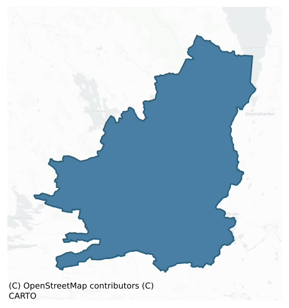
Boyle is a barony of County Roscommon, in the historical province of Connacht (Irish: Mainistir na Búille), covering 350 km² of land. The barony records 1,145 NMS archaeological sites and 127 NIAH listed buildings, placing it at around the 86th percentile among 280 ROI baronies for sites per km². This means it is in the top fifth of all baronies for sites per km². Dated archaeological evidence runs from the Neolithic through to the Modern, spanning 8 of 9 archaeological periods, placing the barony in the 62nd percentile among 280 ROI baronies for chronological depth. This means it is in the upper half of all baronies for chronological depth. The largest dated subset of recorded sites dates to the Early Medieval. Logainm flags 44 placenames in the barony as carrying a recognised heritage root; the largest share — around 52% — are names associated with early Christian church and monastic foundations.

Heritage at a glance
Percentile rankings throughout this profile compare each barony only against the other 279 Republic of Ireland baronies.
The recorded heritage of Boyle
The National Monuments Service Sites and Monuments Record (SMR) is the statutory inventory of archaeological sites for the Republic of Ireland, maintained by the Department of Tourism, Culture, Arts, Gaeltacht, Sport and Media. Sites recorded here include earthworks, ringforts, megalithic tombs, ecclesiastical remains, and post-medieval features; not every record is legally protected, but each is registered as a monument of archaeological interest.
The National Monuments Service records 1,145 archaeological sites in Boyle, putting it at the 86th percentile among 280 ROI baronies for sites per km². This means it is in the top fifth of all baronies for sites per km². Protection coverage is near-universal — 1,089 sites (95%) fall within a recorded monument protection zone, indicating an extensively surveyed landscape. The dominant category is defensive sites — ringforts, enclosures, hillforts, and stone forts (549 sites, 48% of the record). Ringfort – rath is the most prevalent type, making up 29% of the barony's recorded sites (331 records) — well above the ROI average of 20% across all baronies where this type occurs. Ringfort – rath is an earthen ringfort enclosed by a bank and external ditch — the most common Early Medieval farmstead, broadly dated 500–1000 AD. Other significant types include Ringfort – cashel (80) and Crannog (56). Ringfort – cashel is the stone-walled equivalent of the rath, found mainly in upland or western areas, broadly dated 500–1000 AD; Crannog is an artificial or partly artificial island built up on a lake or river bed, in use from the 6th to 17th centuries AD. Across the barony's 350 km², this gives a recorded density of 3.27 sites per km².
Most common monument types
Hover or tap a monument type to see its definition.
| Type | Count |
|---|---|
| Ringfort – rath an earthen ringfort enclosed by a bank and external ditch — the most common Early Medieval farmstead, broadly dated 500–1000 AD | 331 |
| Ringfort – cashel the stone-walled equivalent of the rath, found mainly in upland or western areas, broadly dated 500–1000 AD | 80 |
| Crannog an artificial or partly artificial island built up on a lake or river bed, in use from the 6th to 17th centuries AD | 56 |
| Enclosure a banked or ditched feature of uncertain type, used as a catch-all where the original function cannot be determined from surface evidence | 34 |
| House – indeterminate date a habitation building whose date cannot be determined from available evidence | 30 |
| Church a building used for public Christian worship, of any date from c. 500 AD onwards | 22 |
Chronological distribution
The dated archaeological record for Boyle spans from the Neolithic through to the Modern, with activity attested across 8 of 9 archaeological periods. Every period from earliest to latest is represented in the record — an unbroken sequence of dated activity across the full chronological span. Activity concentrates most heavily in the Early Medieval (525 sites, 66% of dated material), with the Iron Age forming a secondary peak (95 sites, 12%). A further 351 recorded sites (31% of the overall NMS register for the barony) carry no period attribution — appearing as 'Unknown' in the bar chart below. This typically reflects either records that pre-date the standardised period vocabulary or sites awaiting specialist dating review, rather than a genuine absence of chronological evidence.
Sample of recorded monuments
Show 25 sample monuments (of 1,145 total)
A representative sample of 25 recorded monuments drawn from the barony’s 1,145 total NMS entries. Sites within a recorded monument protection zone and rarer site types are prioritised so the list shows a meaningful cross-section rather than only the most common type. Each entry shows the official Sites and Monuments Record reference number and the description published by the National Monuments Service.
Castle – motte
On the SE shore of Lough Arrow. Flat-topped grass-covered earthen mound (diam. of base c. 22m; diam. of top 15m N-S; 13m E-W; H 3-4m) planted with mature deciduous trees, with slight traces of a fosse (Wth 4.5-5.5m; D…
On the SE shore of Lough Arrow. Flat-topped grass-covered earthen mound (diam. of base c. 22m; diam. of top 15m N-S; 13m E-W; H 3-4m) planted with mature deciduous trees, with slight traces of a fosse (Wth 4.5-5.5m; D 0.1m) NW-NE. Crannog (RO003-011—-) is c. 125m to the NW in the lake, and fortified house (RO003-012001-) is c. 125m to the NNE along the shore. (Doran 5005, 376-7)
Compiled by: Michael Moore
Date of upload: 24 August 2010
Well
Marked on the 1837 and 1914 eds. of the OS 6-inch map, and situated on a SW-facing slope. Described as a stone hollow (Gannon 1972), there is no record of veneration and it is not now visible at ground level in…
Marked on the 1837 and 1914 eds. of the OS 6-inch map, and situated on a SW-facing slope. Described as a stone hollow (Gannon 1972), there is no record of veneration and it is not now visible at ground level in pasture.
Compiled by: Michael Moore
Date of upload: 24 August 2010
Standing stone – pair
On a gentle SW-facing slope, c. 200m from the shore if an E arm of Lough Key, c. 800m NW of where the Boyle river leaves the lake. Two stones placed 7m apart are aligned WNW-ESE. The W stone (dims 1.65m x 0.25-0.5m; H…
On a gentle SW-facing slope, c. 200m from the shore if an E arm of Lough Key, c. 800m NW of where the Boyle river leaves the lake. Two stones placed 7m apart are aligned WNW-ESE. The W stone (dims 1.65m x 0.25-0.5m; H 1.25m) is oriented NW-SE and the E stone (dims 1.95m x 0.2m; H 1.1m) is oriented NW-SE. (deValera and O'Nuallain 1972, 41)
See the attached view taken from the E.
Compiled by: Michael Moore
Date of upload: 24 August 2010
Altar
On the N shore of Lough Meelagh (dims c. 2km E-W; c. 600m-1km N-S), c. 75m W of Kilronan church (RO004-003001-), on the S side of the Keadew-Ballyfarnon road and just E of St Lasair's holy well (RO004-002002-). An…
On the N shore of Lough Meelagh (dims c. 2km E-W; c. 600m-1km N-S), c. 75m W of Kilronan church (RO004-003001-), on the S side of the Keadew-Ballyfarnon road and just E of St Lasair's holy well (RO004-002002-). An uninscribed stone, probably intended as a headstone and known locally as an altar, consists of a rectangular limestone slab (dims 1.8m x 1.05m; T 0.1m) supported by four corner stones (H c. 1m) on which water-rolled stones are placed. It was mistaken for a megalithic monument (Borlase 1897, vol. 1, 196), and was once on the N side of the road (OS Name Books). (Hayward 1955, 135; O'Connell 1988, 61)
Compiled by: Michael Moore
Date of upload: 24 August 2010
Megalithic structure
On a low rise towards the bottom of the S-facing slope of Ballyformoyle Hill. A sunken, overgrown area (int. dims 2.2m NE-SW; 1.7m NW-SE; D 0.6m) defined by a large sandstone slab at SE and parallel limestone slabs at…
On a low rise towards the bottom of the S-facing slope of Ballyformoyle Hill. A sunken, overgrown area (int. dims 2.2m NE-SW; 1.7m NW-SE; D 0.6m) defined by a large sandstone slab at SE and parallel limestone slabs at the NE and SW sides. It was investigated in the early 19th-century when it was thought to have rock-art (RO004-052002-) (D'Alton 1845, 115-6), of which there is no evidence, and it now includes drystone walling at the NW end.
Compiled by: Michael Moore
Date of upload: 24 August 2010
Megalithic tomb – portal tomb
Situated at the W end of a low E-W rise, c. 200m N of what was the E end of Lower Lough Gara which is now reclaimed. Rectangular chamber (int. dims.2.2m NW-SE; 1.95m NE-SW) facing NE defined by two sidestones and a…
Situated at the W end of a low E-W rise, c. 200m N of what was the E end of Lower Lough Gara which is now reclaimed. Rectangular chamber (int. dims.2.2m NW-SE; 1.95m NE-SW) facing NE defined by two sidestones and a backstone with two portal stones (H 1.75m; 2.2m) and the septal stone (H 1.9m). The roofstone (dims. 4m NE-SW; 3m NW-SE; T c. 0.7m) is in situ, and a slight grass-covered cairn (dims. c. 7m NW-SE; c. 6m NE-SW) surrounds the stones. Standing stone (RO005-016—-) is c. 100m to the S. (de Valera and Ó Nualláin 1972, 32,33)
It has been known and described from the early 19th century (Weld 1832, 278; D'Alton 1845, 81-2; Borlase 1897, vol. 1, 195-7; Clarke 1899, Ó Nualláin 1983, 100) and was excavated and conserved in 1954 (Topp 1962) when cremated human remains, a polished stone axe, two Bann flakes and a chert core were recovered (Herity 1964, 130).
See the attached view from the E
Compiled by: Michael Moore
Date of upload: 24 August 2010
See linked document with details from Ruaidhrí de Valera and Seán Ó Nualláin, Survey of the Megalithic Tombs of Ireland. Volume III. Counties Galway, Roscommon, Leitrim, Longford, Westmeath, Laoighis, Offaly, Kildare, Cavan. (Dublin: Stationery Office, 1972).
Ford
It is related in the tripartite life of St Patrick, that the saint on a return visit to this area was crossing the Boyle River when his chariot was upset. He was using a ford near the waterfall, and henceforth the ford…
It is related in the tripartite life of St Patrick, that the saint on a return visit to this area was crossing the Boyle River when his chariot was upset. He was using a ford near the waterfall, and henceforth the ford was called Ath Carpait, the ford of the chariot (FitzPatrick 1998, 353). The river is quite narrow at the falls here beneath Assylin church (RO005-020001-), and although there are islands in the river above and below the falls there is no indication that there was ever a ford here.
Compiled by: Michael Moore
Date of upload: 24 August 2010
Embanked enclosure
On a slight ridge in a low-lying landscape surrounded by hills. Circular grass-covered area (diam. 52.5m N-S; 49.5m E-W) defined by an earthen bank (Wth 8-10m; int. H 1-1.2m; ext. H 0.9-1.1m). There are entrances at NE…
On a slight ridge in a low-lying landscape surrounded by hills. Circular grass-covered area (diam. 52.5m N-S; 49.5m E-W) defined by an earthen bank (Wth 8-10m; int. H 1-1.2m; ext. H 0.9-1.1m). There are entrances at NE (Wth 14m) and SW (Wth 18.5m), which allowed an old stream, visible as a band of rushes (Wth 6m), to flow through the interior. A N-S field bank and drain overlie the E part of the site, distorting the bank to its E. (Stout 1991, 283; Condit 1993, 16)
Compiled by: Michael Moore
Date of upload: 24 August 2010
Religious house – Augustinian canons
This is an early ecclesiastical site called Inchmacnerin with no historical references concerning its foundation or early history. It adopted the Augustinian rule when a priory of Augustinian canons, called St Mary's,…
This is an early ecclesiastical site called Inchmacnerin with no historical references concerning its foundation or early history. It adopted the Augustinian rule when a priory of Augustinian canons, called St Mary's, was established here probably between 1140 and 1170. The death of Muiredach O'Gormley, the prior, is recoded in 1229, but there are no further references. The site continued until the 1590s when it was described a a church and two ruined houses (Gwynn and Hadcock 1988, 179). It is at the centre of Church Island (diam. c. 150m) at the SW angle of Lough Key, c. 350m from the W shore.
The remains consist of an early church (RO006-006001-) which was extended to the E in the 13th century together with the foundations of E, S and W ranges, of which little remains. around a cloister S of the church. The buildings were enclosed in a rectangular enclosure (dims 36m N-S; 40m E-W) with drystone walls to the W and N of the church completing the enclosure, while a saint's tomb (RO006-006002-) is just N of the E end of the extended church, and a children's burial ground (RO006-006003-) was added after the Suppression outside the W gable of the church.
The original church (ext. dims 8.1m N-S; at least 15m E-W) is composed of cyclopean masonry and has a complete W gable with a trabeate doorway (Wth 0.67-0.73m; H 1.56m) dating to the tenth or eleventh century. There is an inserted doorway (Wth 0.78m) in the N wall, of which only the jambs survive (H c. 1m). A destroyed…
Kiln
On high ground overlooking the gorge of the W-E Boyle River c. 50m to the S as it leaves Lough Key. A circular structure (diam. c. 2.5m) defined by a stone spread and built into the slope just S of the residence…
On high ground overlooking the gorge of the W-E Boyle River c. 50m to the S as it leaves Lough Key. A circular structure (diam. c. 2.5m) defined by a stone spread and built into the slope just S of the residence (RO006-013002-) may be a kiln. The field system (RO009-012002-) around it may be contemporary.
Compiled by: Michael Moore
Date of upload: 24 August 2010
Ecclesiastical residence
Marked as the Bishop's Seat on the 1837 and 1914 eds. of the OS 6-inch map and situated on high ground overlooking the gorge of the W-E Boyle River as it leaves Lough Key c. 50m to the S. References to Cill tSesin date…
Marked as the Bishop's Seat on the 1837 and 1914 eds. of the OS 6-inch map and situated on high ground overlooking the gorge of the W-E Boyle River as it leaves Lough Key c. 50m to the S. References to Cill tSesin date from 1243 (AFM vol. 3, 307-09), and in 1253 the Bishop of Elphin, Tomaltach O'Conor, had a court or palace at Kilteisin (ibid., 349), which was destroyed in 1258 by his cousin Hugh O'Conor along with the bishop's other residence at Elphin (RO016-126—-) (ibid., 365). A church, listed as Kilseisyn in the ecclesiastical taxation of Elphin in 1306 (Cal. Doc. Ire. vol. 5, 224), had probably been established here in the late 12th century and is probably located on the burial ground (RO006-012001-) c. 30m to the SW, but it has yet to be found.
The overgrown foundations and fragments of masonry walls (Wth 1-1.2m; H 0.2-1m), partly re-built with drystone walling, define a rectangular structure (int. dims. 12.2m E-W; 6.75m N-S). A circular structure (RO006-013001-) (int. diam. c. 2.5m) defined by a stone spread and built into the slope just to the S may be a kiln. Excavation of the interior produced evidence of a floor, later industrial activity and two inserted child burials. There is a small fore-building attached to the exterior of the N wall at the W end. Excavation and analysis during 2009 revealed that both structures had evidence of many phases of construction, and the main building was originally clay-bonded. The enclosure (RO006-012001-) c. 30m to the S…
Weir – regulating
In the W-E Boyle River. There is a reference to a weir in this general part of the river in 1583-4 (Gwynn and Hadcock 1988, 273), but there is no visible surface evidence of an antiquity. The present weir was built in…
In the W-E Boyle River. There is a reference to a weir in this general part of the river in 1583-4 (Gwynn and Hadcock 1988, 273), but there is no visible surface evidence of an antiquity. The present weir was built in 1848 by the Commissioners for the improvement of the Navigation of the River Shannon. Any older weirs were removed at that time.
Compiled by: Michael Moore
Date of upload: 24 August 2010
Religious house – Premonstratensian canons
The Praemonstratensian abbey of Holy Trinity was founded c. 1215 by Clarus Mac Mailin O Maelconaire, dean of Elphin, and was liberally endowed by the Mac Dermots, including land at Kilbryan on the shore to the S where…
The Praemonstratensian abbey of Holy Trinity was founded c. 1215 by Clarus Mac Mailin O Maelconaire, dean of Elphin, and was liberally endowed by the Mac Dermots, including land at Kilbryan on the shore to the S where Kilbryan church (RO006-038001-) probably functioned as a parish church for the home farm (Clyne 2010, 69). The abbey was captured briefly by Anglo-Normans in 1235, and in 1237 a daughter house was founded at Lough Oughter, Co. Cavan. It is listed as Locque Cononicoriem (the place of the canons) in the ecclesiastical taxation of Elphin in 1306 (Cal. Doc. Ire. vol. 5, 225). In 1310 rival abbots arose, and it was burned in 1466 when a wooden image of the Trinity was destroyed (Roe 1979, 145). In the later middle ages it was the effective head of the order in Ireland, and had extensive possessions in the late sixteenth century, particularly in Sligo, according to a rental of the abbot, Cornelius McGyllohcran (Clyne 2010). After the Suppression it was held by the MacDermots and continued to be occupied until c. 1594 when it was granted to Robert Harrison, but it may have continued to be occupied by monks until 1608. The Annals of Lough Key were compiled here in the later 16th century under the patronage of Brian Mac Dermot of the Rock. (Gwynne and Hadcock 1970, 205)
The abbey is situated on the oval wooded Trinity Island (dims c. 170m NE-SW; c. 80m NW-SE), c. 200m from the S shore of the lake. There is a slipway (RO006-036003-) (Wth 2.4m; H 0.2-0.6m) partly ov…
Religious house – unclassified
On the gentle NE-facing slope of a rise. There is no visible surface evidence of a church or of burial at church (RO006-059001-), but there is a local tradition that it was a nunnery (Gannon 1972).
Compiled by:…
On the gentle NE-facing slope of a rise. There is no visible surface evidence of a church or of burial at church (RO006-059001-), but there is a local tradition that it was a nunnery (Gannon 1972).
Compiled by: Michael Moore
Date of upload: 24 August 2010
Historic town
A town may have grown up around the Cistercian abbey (RO006-068005-) after its foundation in the 12th century, but evidence of a town cannot be discerned before the late 16th century when it became an important location…
A town may have grown up around the Cistercian abbey (RO006-068005-) after its foundation in the 12th century, but evidence of a town cannot be discerned before the late 16th century when it became an important location for the Dublin government on the road from Athlone to Sligo and in the conquest of Connaught and Ulster. A garrison was placed in the Abbey from 1595 until 1607 when the artillery fort (RO006-068001-) was built incorporating part of a prehistoric barrow (RO006-068002-). The abbey withstood sieges by O'Donnell in 1596-7 and 1599-1600. The town was granted to Joseph Bingley and Joseph King in 1603, and was incorporated as a borough in 1613. Although probably not walled, it continued to be garrisioned throughout the 17th century, and returned two members of Parliament until 1800.
The remains consist of the abbey (RO006-068005-) and the nearby bridge (RO006-068007-), and the bastioned fort (RO006-068001-). Archaeological testing has failed to produce evidence of the orginal settlement (Conway 2002; Timoney, M. A. 2002; Henry 2003; Timoney, M. A. 2003; Read 2004l), apart from one N-S boundary wall (RO006-068008-) (Wth 0.7m; H 1.2m; L 12.6m plus) (Carey 2004a; Timoney 2004). (Bradley and Dunne 1988a)
Compiled by: Michael Moore
Date of upload: 24 August 2010
Bastioned fort
The fort was built by Bingley and King in 1607 (Cal. SP Ire, 150), and it had a garrison of 94 in 1659 (Pender 1939). It is situated on a commanding height overlooking the town of Boyle. Rectangular grass-covered but…
The fort was built by Bingley and King in 1607 (Cal. SP Ire, 150), and it had a garrison of 94 in 1659 (Pender 1939). It is situated on a commanding height overlooking the town of Boyle. Rectangular grass-covered but poached area (dims 72m N-S; 57m E-W) defined by an earthen bank (Wth c. 13m; int. H 0.8-1m; ext. H 1.5-1.9m) with five triangular bastions visible as raised platforms (dims. 11-16m x 8-9m). There are traces of an outer fosse (Wth of base 5-7m; D 0.4m at E to 1m at N) on the W, N and E sides. The E bastion incorporates the barrow (RO006-068002-). (O'Conor, 2007, 194-5)
Compiled by: Michael Moore
Date of upload: 24 August 2010
House – 18th/19th century
The town of Boyle (RO006-068—-) developed first around the junctions of Main St., Bridge St., Green St., and Eaton Lane in the early 17th century. A later extension was to the S around the Crescent and Market Square,…
The town of Boyle (RO006-068—-) developed first around the junctions of Main St., Bridge St., Green St., and Eaton Lane in the early 17th century. A later extension was to the S around the Crescent and Market Square, beginning in the late 17th century and into the 18th century. No houses in the town are known to date earlier than the eighteenth century. (Bradley and Dunne 1988a, 37-8)
Compiled by: Michael Moore
Date of upload: 24 August 2010
Religious house – Cistercian monks
Founded in 1161 by Cistercian monks who had left Mellifont in 1148, but moved to a succession of locations before settling on Boyle (Gwynn and Hadcock 1970, 128-9). Its history is well recorded as the 'Annals of Lough…
Founded in 1161 by Cistercian monks who had left Mellifont in 1148, but moved to a succession of locations before settling on Boyle (Gwynn and Hadcock 1970, 128-9). Its history is well recorded as the 'Annals of Lough Cé' (ALC) were compiled here throughout the Middle Ages. It was founded on lands provided by the MacDermots of Moylurg, and its daughter houses of Assaroe, Co. Donegal, and Abbeyknockmoy, Co. Galway, were founded in 1178 and 1189-90 respectively. The site was occupied by William Burke in 1202. The church was consecrated in 1218-20 and repaired after 1402. It is listed as de Buello in the ecclesiastical taxation of 1306 (CDI vol. 5, 225). The abbey was flooded in 1471, and at the suppression in 1569 it seems to have been intact. English troops are recorded in Boyle in 1566 but a garrision was established from 1585 when the abbey was fortified and altered with additional buildings. It was besieged by Irish forces in 1645. It is situated on the W bank of the SW-NE Boyle river, c. 3 km from the point where it enters Lough Key. (O'Conor, 2007, 194)
The remains consist of the church and fragments of the claustral buildings, which were altered in the 16th and 17th centuries. The chancel and transcepts survive intact as do the nave arcades, but the N aisle is completely destoyed and the S aisle is reduced to the foundations. Excavation during 2006 uncovered the foundations of the N wall of the N aisle together with burials within the aisle (Quinn 2009). The church…
Headstone
On top of a rise. Limestone headstone (L 1m; Wth 0.65m; T 0.1m) with the inscription `IHS Pray for the Soul of Carbry Bern Anno Domini 1730'. It is lying on a field bank with an uninscribed headstone and modern dressed…
On top of a rise. Limestone headstone (L 1m; Wth 0.65m; T 0.1m) with the inscription `IHS Pray for the Soul of Carbry Bern Anno Domini 1730'. It is lying on a field bank with an uninscribed headstone and modern dressed stones beside it.
Compiled by: Michael Moore
Date of upload: 24 August 2010
Religious house – Augustinian, of Arrouaise nuns
An Arroasian house of nuns and canons was established as St Mary's, Ardcarn, probably in the 12th century, and the church was enlarged by Clarus Mac Mailin in 1243. By 1223 it had been annexed to the convent of…
An Arroasian house of nuns and canons was established as St Mary's, Ardcarn, probably in the 12th century, and the church was enlarged by Clarus Mac Mailin in 1243. By 1223 it had been annexed to the convent of Kilcreevanty, Co. Galway (Hall 2003, 79). An inquisition in 1590 describes the nunnery as a church and two houses of stone. In 1595 it was granted to a Terence O'Byrne, and in 1598 to Trinity College, Dublin. It is situated on flat dry ground at the base of the E-facing slope of Ardcarn Hill. The visible remains consist of the foundations of a mortared stone wall (L 8.67 NW-SE, Wth 0.75m, H 1.75m) within the field-system (RO006-103007-). (Weld 1832, 245-6; O'Flanigan 1931, 90-91; D'alton 1845, 93-6; Gwynne and Hadcock 1988, 312; Tonra 1998)
Compiled by: Michael Moore
Date of upload: 24 August 2010
Armorial plaque
The early monastery of Ardcarn (RO006-103001-) was also the site of Ardcarn parish (RO006-103002-) in the later midlle ages and is situated on the E-facing slope of Ardcarn Hill. A limestone armorial plaque erected by…
The early monastery of Ardcarn (RO006-103001-) was also the site of Ardcarn parish (RO006-103002-) in the later midlle ages and is situated on the E-facing slope of Ardcarn Hill. A limestone armorial plaque erected by Cormac MacDermot, possibly a son of Owen Mac Conor Og of Aghacarra (Mulhall 1907-09; Mac Dermot 1996, 360), in honour of his wife Elinor Crean in 1688 is situated just E of the present Church of Ireland church in the graveyard (RO006-103004-). It consists of a crucifixion over the crests of both families and a largely illegible inscription, all within a raised border (Wth 1.4m; H 1.95m). (Weld 1832,245-6; D'Alton 1845,93-6; Timoney 1982, 8; Tonra 1998)
See the attached image.
Compiled by: Michael Moore
Date of upload: 24 August 2010
Settlement deserted – medieval
On an E-facing slope with rock outcrop, between Ardcarn church (RO006-103001-) and the NW-SE line of the N4 which turns WSW c. 300m N of the church. Nothing survives N and E of the N4. An area of c. 30 ha (c. 80 acres)…
On an E-facing slope with rock outcrop, between Ardcarn church (RO006-103001-) and the NW-SE line of the N4 which turns WSW c. 300m N of the church. Nothing survives N and E of the N4. An area of c. 30 ha (c. 80 acres) containing D-shaped, wedge-shaped and rectangular fields (dims 23m x 17m to 140m x 125m). The field boundaries are defined by grass-covered scarps, collapsed stone walls and earthen banks (Wth 3-5m; H 0.2-1m). A roadway (RO006-103012-), visible in part as a hollow way (Wth 4-6m; D 0.2-0.5m), runs NE-SW from rath (RO006-149—-) (L c. 800m), curving N around the base of Ardcarn hill (L c. 300m). At its N end it meets a NW-SE roadway (RO006-103008-), visible in part as a hollow way (Wth 5-10m; L c. 700m) (Halpin 1995) which is parallel with the N4 and c. 30-40m from it. The angle between the relict roads is foreshortened by another hollow way (L c. 260m) c. 230m short of their junction.
The nunnery (RO006-103003-) is situated within this triangle, and there are three house-sites in this area including (RO006-103013-) a rectangular grass-covered platform (dims 6.5m N-S; 6m E-W; H 0.3m), (RO006-103014-) a subcircular grass-covered area (int. dims 8.5m E-W; 7.8m N-S) defined by a grass-covered stone spread (Wth 1.65-4m; int. H 0.3-0.7m; ext. H 0.3-1m) with an entrance (Wth 1.5m) at E, and (RO006-103015-) a rectangular structure (int. dims 12m E-W; 5.8m N-S) defined by the base of a double-faced wall (Wth 1-1.3m) with no visible entrance. About 200m N of Ardcarn…
Religious house – Franciscan Third Order Regular
There are references to a cell of Dominicans (Nicholls 1972-3, 37) or Franciscans Third Order (Gwynne and Hadcock 1973, 273) at Knockvicar in the late 16th century when it possessed a house and c. 40 acres. D'Alton's…
There are references to a cell of Dominicans (Nicholls 1972-3, 37) or Franciscans Third Order (Gwynne and Hadcock 1973, 273) at Knockvicar in the late 16th century when it possessed a house and c. 40 acres. D'Alton's description (1845, 114-5) and local tradition locates it on Knockvicar Hill, overlooking a loop of the Boyle River c. 200-270m distant NW-E, but no feature is visible at ground level.
Compiled by: Michael Moore
Date of upload: 24 August 2010
Megalithic tomb – unclassified
Towards the bottom of the N-facing slope of a low E-W ridge. A single chamber (dims 9m NW-SE; 1.55m NE-SW to 2m NE-SW at SE) now filled with field stones is defined by four stones (dims 1.25-2.15m x 0.15-0.4m; H…
Towards the bottom of the N-facing slope of a low E-W ridge. A single chamber (dims 9m NW-SE; 1.55m NE-SW to 2m NE-SW at SE) now filled with field stones is defined by four stones (dims 1.25-2.15m x 0.15-0.4m; H 0.2-0.8m) on the NE side and two (dims 2.1m x 0.25-0.35m; H 0.3-1m) on the SW side. There is a single stone at NW (dims 1m x 0.3m; H 0.63m) and SE (dims 1.6m x 0.25m; H 0.25m). It may be a court tomb. Rath (RO007-025001-) is c. 140m to the SSW and enclosure (RO007-026—-) is c. 140m to the SSE. (de Valera and O'Nuallain 1972, 34-5)
Compiled by: Michael Moore
Date of upload: 24 August 2010
See linked document with details from Ruaidhrí de Valera and Seán Ó Nualláin, Survey of the Megalithic Tombs of Ireland. Volume III. Counties Galway, Roscommon, Leitrim, Longford, Westmeath, Laoighis, Offaly, Kildare, Cavan. (Dublin: Stationery Office, 1972).
Ringfort – rath
Not depicted on any OS map, this rath is visible as a circular feature on aerial photographs (GSIAP: G 274-5), and is situated on the summit of a NW-SE ridge. It is a circular grass-covered area (diam. 35.6m NNW-SSE;…
Not depicted on any OS map, this rath is visible as a circular feature on aerial photographs (GSIAP: G 274-5), and is situated on the summit of a NW-SE ridge. It is a circular grass-covered area (diam. 35.6m NNW-SSE; 33m ENE-WSW) defined by a scarp (H 1.5-1.65m), with a slight fosse (Wth of top 6-6.6m; D 0.1m) NE-ESE which is visible as a wet area NW-NE. There is no identifiable original entrance, but the monument was planted with trees, now removed, and is overlain by a NW-SE avenue.
Compiled by: Michael Moore
Date of upload: 24 August 2010
Listed buildings
The National Inventory of Architectural Heritage (NIAH) is a state survey appraising buildings of architectural, historical, archaeological, artistic, cultural, scientific, social, or technical interest. Each surveyed structure receives a rating from International (the highest, for buildings of European importance) through National, Regional, Local, and Record-Only.
The NIAH records 127 listed buildings in Boyle (61st percentile across ROI baronies). The highest-graded structures include 2 of National significance. The Republic holds 937 National-graded buildings in total, so this barony accounts for around 0% of the national total. Construction dates concentrate most heavily in the Victorian (1830-1900) period. The most-recorded building type is house (30 examples, 24% of the listed stock).
Terrain and environment
Mean elevation across the barony is 89m — the 50th percentile among 280 ROI baronies for elevation. This means it is in the upper half of all baronies for elevation. Elevation matters for heritage because higher-altitude baronies typically favour defensive monuments — ringforts and hilltop forts placed on prominent ground — while lowland baronies are more likely to carry the dense settlement and church networks of intensive agricultural landscapes. The barony reaches 415m at its highest point — a vertical span of more than 326m within its boundary, indicating significant topographic diversity. Mean slope is 4.4° — the 67th percentile among 280 ROI baronies for slope. This means it is in the top third of all baronies for slope. Slope is a key control on both land use and archaeological preservation: steep ground resists ploughing and tends to preserve earthworks intact, while gentle slopes favour intensive cultivation that damages or destroys surface archaeology over time. The Topographic Wetness Index averages 10.5, the 35th percentile among 280 ROI baronies for wetness. This means it is in the lower half of all baronies for wetness. Drainage matters for heritage because poorly-drained ground preserves organic archaeology (wooden trackways, leather, textiles, and on rare occasions human remains) far better than free-draining soil; well-drained ground favours arable use but destroys organic material rapidly. The land-cover mosaic combines improved grassland (64%), woodland (29%), and open water (6%), giving a mixed agricultural and semi-natural landscape.
Terrain measurements
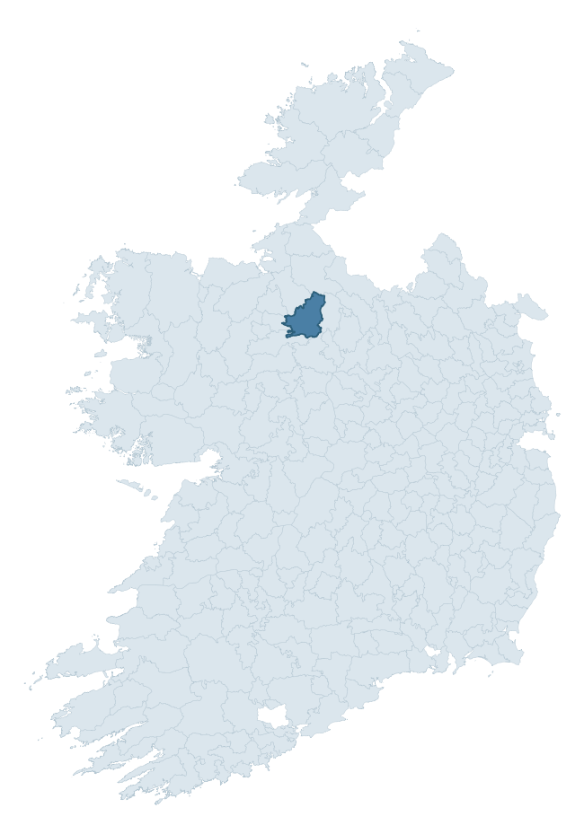
Where this barony sits in the Republic of Ireland
Geology and preservation
Bedrock geology shapes the landscape long before any settlement begins — controlling soil drainage, agricultural potential, the survival of upstanding monuments, and the preservation of buried archaeology. The figures below come from the Geological Survey Ireland 1:100,000 bedrock map.
The bedrock underlying Boyle is predominantly limestone (35% of the barony by area), laid down during the Carboniferous period (83% by area, around 359 to 299 million years ago). Limestone is the most heritage-rich bedrock in Ireland. It supports fertile, well-drained soils that favoured dense Early Medieval settlement and Norman manorial agriculture, and it weathers into karst features — sinkholes, caves, swallow holes, and souterrains — that frequently carry archaeology. Where peat overlies limestone, organic preservation can be exceptional. A substantial secondary geology of quartz rich sandstones (16%) and black calcarenites and shales (14%) adds further variety to the underlying landscape. With 10 distinct rock types mapped, the barony sits in the top third of ROI baronies for geological diversity (90th percentile) — typically a sign of complex tectonic history or coastal mosaics of differing rock units.
Rock type composition
Largest mapped unit: Croghan Limestone Formation (17% of the barony)
Placename evidence
Logainm records 44 heritage-diagnostic placenames for Boyle, drawn from townland and civil-parish names across the barony. The dominant stratum is Early Christian ecclesiastical — cill-, teampall-, and domhnach-prefixed names that record the dense network of early church foundations established between the fifth and tenth centuries. The leading diagnostic roots are cill- (17 — church), lios- (8 — ringfort or enclosure), and caiseal- (4 — stone ringfort). This is above the ROI average of 30.7 heritage placenames per barony. The presence of multiple heritage strata side by side indicates layered occupation of the landscape across successive prehistoric and historic periods. Logainm records 385 placenames for Boyle (predominantly townland names). Of these, 44 (11%) carry one of the diagnostic Gaelic roots tracked above; the remainder draw on more generic landscape vocabulary that does not encode a heritage period.
Pre-Christian / Early Medieval Defensive
| Root | Count | Meaning |
|---|---|---|
| lios- | 8 | ringfort or enclosure |
| caiseal- | 4 | stone ringfort |
| ráth- | 1 | earthen ringfort |
| dún- | 1 | hilltop or promontory fort |
Early Christian Ecclesiastical
| Root | Count | Meaning |
|---|---|---|
| cill- | 17 | church (early) |
| gráinseach- | 3 | monastic farm / grange |
| díseart- | 2 | hermitage |
| mainistir- | 1 | monastery |
Burial, Ritual, and Norse-Contact
| Root | Count | Meaning |
|---|---|---|
| gall- | 4 | foreigner — Norse settlement marker |
| tuaim- | 2 | burial mound |
| carn- | 2 | cairn |
| dumha- | 2 | mound |
| uaimh- | 1 | cave / souterrain |
Other baronies in Roscommon
About this profile
Click any section below to expand.
What is a barony?
A barony is a historic administrative unit in Ireland, broadly equivalent to an English hundred. The 280 baronies used here are from the OSi 2019 National Statutory Boundaries (generalised 20m), covering the 26 counties of the Republic of Ireland. Baronies derive from the Norman period, were formalised in the 17th century, and have not been redrawn for statistical purposes. They vary enormously in area, from compact urban baronies in Dublin to vast upland baronies in Connacht, and should not be compared by raw site count without accounting for area differences.
What counts as a site?
This profile combines three distinct heritage registers, each with its own definition of what constitutes a recordable site:
- Archaeological sites (NMS). The National Monuments Service Sites and Monuments Record (SMR) catalogues every known archaeological monument or site of archaeological interest in the Republic, from prehistoric burial mounds and ringforts to medieval churches and post-medieval defensive works. Inclusion does not require legal protection — only that the site has been identified, surveyed, and assessed as having archaeological value. A separate subset of these sites lies within a recorded protection zone, which gives them statutory protection under the National Monuments Acts.
- Listed buildings (NIAH). The National Inventory of Architectural Heritage records buildings of architectural, historical, archaeological, artistic, cultural, scientific, social, or technical interest. Each surveyed structure is appraised on a five-tier scale: International, National, Regional, Local, and Record-Only. The NIAH appraisal is informational rather than strictly statutory, but it underpins local-authority Record of Protected Structures (RPS) listings.
- Heritage placenames (Logainm). Logainm is the authoritative database of Irish placenames maintained by the Placenames Branch. This profile applies a heritage-diagnostic classifier to the Irish-language form of each townland name, flagging roots that signal defensive sites (ráth-, lios-, dún-, caiseal-, cathair-), ecclesiastical foundations (cill-, teampall-, domhnach-, mainistir-), prehistoric burial-ritual features (tuaim-, carn-, leaba-), or Norse-contact settlement (gall-). Townlands without one of these diagnostic roots are not flagged here — they may still carry historical significance, but that significance is not encoded in the name itself.
Editorial principles
The narrative sections of this profile follow several explicit principles:
- Evidential. Every claim about this barony’s heritage character is anchored in the underlying register data. Where a site count, a placename count, or a percentile rank is cited, it is computed from the source datasets at export time, not estimated.
- Comparative. Counts and metrics are reported alongside their percentile rank against the other 279 ROI baronies. A barony with 50 ringforts in absolute terms could be unusually high or unusually low depending on its size and regional context; percentile ranking removes that ambiguity.
- Transparent on limits. Where a register has known coverage gaps, survey biases, or data-quality issues that affect this barony’s figures, the profile flags them rather than presenting the numbers as definitive.
- No interpretation beyond what the data supports. The narrative does not speculate about historical events, social dynamics, or cultural meaning beyond what the recorded heritage and placename evidence directly attests.
Data caveats and limits
- NMS Sites and Monuments Record is the product of survey campaigns conducted at different intensities across different counties and decades. Some baronies have been surveyed more thoroughly than others, and absolute counts should be read in that light. Sites destroyed by development before survey are typically not represented; sites in heavily forested or upland terrain are sometimes under-recorded.
- NIAH coverage is broadly complete for the Republic of Ireland but the survey was conducted on a rolling county-by-county basis, and the most recent appraisal date varies. Buildings demolished or substantially altered after their original survey may still appear in the register; conversely, recent buildings of merit may not yet have been appraised.
- Logainm classification applies a deliberately conservative pattern-matching approach to the Irish-language townland forms. The classifier prioritises true positives over recall: a townland may carry a heritage signal that the classifier doesn’t recognise, particularly where the diagnostic root has been heavily anglicised or where the townland name draws on a less common term. The 60,000+ townland records and ~9,800 classified placenames give a substantial signal at barony scale, but individual townland names should be checked against Logainm directly for definitive interpretation.
- Period attribution. The chronological distribution reflects only those NMS sites that carry a recognised period attribution in the source data. Sites listed as “Unknown” period are excluded from the dated subset.
- Boundary changes. Some baronies have undergone minor boundary adjustments since their 19th-century definition; the OSi 2019 generalised boundaries used here are the current statutory definition and may differ slightly from historical maps in border areas.
- Bedrock geology is mapped at 1:100,000 scale, which means local variation within a barony — small pockets of different rock type, mineral veins, alluvium overlying bedrock — is generalised. The dominant-system and rocktype figures are area-weighted, so a barony reading “70% Carboniferous limestone” may still contain small but archaeologically important pockets of older or younger rock. Around 3% of GSI polygons do not match the lexicon and contribute no rocktype or system attribution.
Data sources
- National Monuments Service — Sites and Monuments Record (SMR) https://data.gov.ie/dataset/national-monuments-service-archaeological-survey-of-ireland
- National Inventory of Architectural Heritage (NIAH) https://data.gov.ie/dataset/national-inventory-of-architectural-heritage-niah-national-dataset
- Logainm — Placenames Database of Ireland https://www.logainm.ie/
- Ordnance Survey Ireland — National Statutory Barony Boundaries 2019 https://data-osi.opendata.arcgis.com/
- EURODEM — European Digital Elevation Model https://www.mapsforeurope.org/datasets/euro-dem
- ESA WorldCover https://esa-worldcover.org/en
- Geological Survey Ireland — 1:100,000 Bedrock Geology https://www.gsi.ie/en-ie/data-and-maps/Pages/Bedrock.aspx
Explore more: Search any of the 280 ROI baronies, browse by historical province, or read the methodology and data sources for the full Republic of Ireland Heritage Tool.