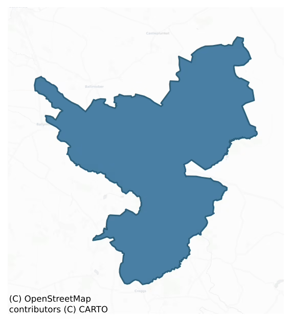
Ballymoe is a barony of County Roscommon, in the historical province of Connacht (Irish: Béal Átha Mó), covering 113 km² of land. The barony records 272 NMS archaeological sites and 11 NIAH listed buildings, placing it at around the 68th percentile among 280 ROI baronies for sites per km². This means it is in the top third of all baronies for sites per km². Dated archaeological evidence runs from the Neolithic through to the Modern, spanning 8 of 9 archaeological periods, placing the barony in the 73rd percentile among 280 ROI baronies for chronological depth. This means it is in the top third of all baronies for chronological depth. The largest dated subset of recorded sites dates to the Early Medieval. Logainm flags 21 placenames in the barony as carrying a recognised heritage root; the largest share — around 52% — are names associated with pre-christian defensive.
Heritage at a glance
Percentile rankings throughout this profile compare each barony only against the other 279 Republic of Ireland baronies.
The recorded heritage of Ballymoe
The National Monuments Service Sites and Monuments Record (SMR) is the statutory inventory of archaeological sites for the Republic of Ireland, maintained by the Department of Tourism, Culture, Arts, Gaeltacht, Sport and Media. Sites recorded here include earthworks, ringforts, megalithic tombs, ecclesiastical remains, and post-medieval features; not every record is legally protected, but each is registered as a monument of archaeological interest.
The National Monuments Service records 272 archaeological sites in Ballymoe, putting it at the 68th percentile among 280 ROI baronies for sites per km². This means it is in the top third of all baronies for sites per km². Protection coverage is near-universal — 261 sites (96%) fall within a recorded monument protection zone, indicating an extensively surveyed landscape. The dominant category is defensive sites — ringforts, enclosures, hillforts, and stone forts (161 sites, 59% of the record). Ringfort – rath is the most prevalent type, making up 43% of the barony's recorded sites (117 records) — well above the ROI average of 20% across all baronies where this type occurs. Ringfort – rath is an earthen ringfort enclosed by a bank and external ditch — the most common Early Medieval farmstead, broadly dated 500–1000 AD. Other significant types include Enclosure (22) and Barrow – ring-barrow (12). Enclosure is a banked or ditched feature of uncertain type, used as a catch-all where the original function cannot be determined from surface evidence; Barrow – ring-barrow is a Bronze/Iron Age burial monument: a low circular area enclosed by ditch and outer bank. Across the barony's 113 km², this gives a recorded density of 2.40 sites per km².
Most common monument types
Hover or tap a monument type to see its definition.
| Type | Count |
|---|---|
| Ringfort – rath an earthen ringfort enclosed by a bank and external ditch — the most common Early Medieval farmstead, broadly dated 500–1000 AD | 117 |
| Enclosure a banked or ditched feature of uncertain type, used as a catch-all where the original function cannot be determined from surface evidence | 22 |
| Barrow – ring-barrow a Bronze/Iron Age burial monument: a low circular area enclosed by ditch and outer bank | 12 |
| Earthwork an unclassified earthen structure with no diagnostic features that allow a more specific classification | 9 |
| Field system a group of related fields forming a coherent agricultural landscape, of any date from the Neolithic onwards | 9 |
| Standing stone a deliberately set upright stone, used variously as a Bronze/Iron Age burial marker, route marker or commemorative monument | 7 |
| Church a building used for public Christian worship, of any date from c. 500 AD onwards | 6 |
| Moated site | 6 |
Chronological distribution
The dated archaeological record for Ballymoe spans from the Neolithic through to the Modern, with activity attested across 8 of 9 archaeological periods. This is the 73rd percentile across ROI baronies for chronological depth — an above-average span. Every period from earliest to latest is represented in the record — an unbroken sequence of dated activity across the full chronological span. Activity concentrates most heavily in the Early Medieval (260 sites, 54% of dated material), with the Iron Age forming a secondary peak (169 sites, 35%). A further 196 recorded sites (29% of the overall NMS register for the barony) carry no period attribution — appearing as 'Unknown' in the bar chart below. This typically reflects either records that pre-date the standardised period vocabulary or sites awaiting specialist dating review, rather than a genuine absence of chronological evidence.
Sample of recorded monuments
Show 25 sample monuments (of 272 total)
A representative sample of 25 recorded monuments drawn from the barony’s 272 total NMS entries. Sites within a recorded monument protection zone and rarer site types are prioritised so the list shows a meaningful cross-section rather than only the most common type. Each entry shows the official Sites and Monuments Record reference number and the description published by the National Monuments Service.
Barrow – bowl-barrow
On the crest of a NW-SE ridge, towards its NW end. Subcircular flat-topped and grass-covered mound (dims of base 19.7m ENE-WSW; 18.4m NNW-SSE; dims of top 14m ENE-WSW; 14.7m NNW-SSE; H 0.6m at E to 1.2m at W) separated…
On the crest of a NW-SE ridge, towards its NW end. Subcircular flat-topped and grass-covered mound (dims of base 19.7m ENE-WSW; 18.4m NNW-SSE; dims of top 14m ENE-WSW; 14.7m NNW-SSE; H 0.6m at E to 1.2m at W) separated by a rounded fosse (Wth of base 2-2.5m) or berm (Wth 3m) from an outer overgrown bank (Wth 5-8m; int. H 0.2-0.4m; ext. H 1.2-1.6m). This is surrounded by a field bank and hedge (max. ext. dims 38.8m NNW-SSE; 38m ENE-WSW). It is within ceremonial enclosure (RO027-047002-). (Herity 1984, 138)
See the attached aerial image taken from the E.
Compiled by: Michael Moore
Date of upload: 24 August 2010
Ceremonial enclosure
On the crest of a NW-SE ridge, towards its NW end. Circular grass-covered area (int. diam. 105.75m NW-SE; 97.5m NE-SW) defined by a fosse (Wth of top 5.5m at NW to 8.5m at NE; max. int. D 0.3m) and outer bank (Wth…
On the crest of a NW-SE ridge, towards its NW end. Circular grass-covered area (int. diam. 105.75m NW-SE; 97.5m NE-SW) defined by a fosse (Wth of top 5.5m at NW to 8.5m at NE; max. int. D 0.3m) and outer bank (Wth 3.5-4.8m; int. H 0.5-1.4m; ext. H 0.2-0.5m) NE-E-SE, which can be traced as slight features SE-SW and NW-NE, but the inner edge of the fosse can be traced all around. There are gaps in the bank at NE, ENE, ESE and SE, but these are probably modern. Bowl barrow (RO027-047001-) is at the centre, and two E-W field walls with hedges overlie the enclosure S of the barrow. (Herity 1984, 138)
See the attached aerial image taken from the E
Compiled by: Michael Moore
Date of upload: 24 August 2010
Mill – unclassified
Marked only on the 1837 ed. of the OS 6-inch map where it is described in italic lettering as an 'old mill', and situated on a low-lying landscape on the E bank of a canalised N-S-stream. No feature is visible at ground…
Marked only on the 1837 ed. of the OS 6-inch map where it is described in italic lettering as an 'old mill', and situated on a low-lying landscape on the E bank of a canalised N-S-stream. No feature is visible at ground level, and there is no reason to believe it is an antiquity. Archaeological monitoring (08E0867) of a water-pipe close to the site produced no evidence of the mill (McCarthy 2012b).
Compiled by: Michael Moore
Date of upload: 5 February, 2013
Barrow – stepped barrow
At the summit towards the NW end of a NW-SE ridge. Grass-covered circular platform (diam. of top 37m N-S; 37m E-W; H 0.35-1m) separated by a berm (Wth 19-21.6m) which is really a fosse from an earthen bank (Wth…
At the summit towards the NW end of a NW-SE ridge. Grass-covered circular platform (diam. of top 37m N-S; 37m E-W; H 0.35-1m) separated by a berm (Wth 19-21.6m) which is really a fosse from an earthen bank (Wth 4.4-8.6m; int. H 0.6-1m; ext. H 1.4-1.7m). The bank is surmounted by a stone wall and incorporated into a townland boundary with Rathmew N-SE. This bank is separated by a rounded fosse (Wth of top 6.3-7.2m; Wth of base 1.5-3.3m; D 0.4-1.1m) from an outer bank (Wth 2.4-4.3m; H 0.3-0.45m) which survives only SE-W-N (max. ext. diam. 100m N-S; 96m E-W).
There are small mound barrows at the NW (RO034-035002-) (dims 4m x 4.8m; H 0.3m) and NE (RO034-035003-) (dims 7.2m N-S; 6.2m E-W; H 0.45m) edges of the central platform, and a concentric bank (Wth 3.4-4.4m; H 0.1-0.35m), probably a modern feature, exists on the berm between the platform and the first bank WNW-N-SSE. There is an entrance (Wth 1.8m) through the two outer banks, but no causeway, at WSW. A D-shaped enclosure (RO034-035004-) (int. dims 4.6m N-S; 2m E-W) defined by an earthen bank (Wth 2.4m; H 0.2-0.4m) is attached to the outer bank at WNW. Misinterpretation of the location of barrow (RO034-037—-) led to the invention of an enclosure (RO034-035005-) attached to the outer perimeter of the barrow at S. Ditch-barrows (RO034-036—-) and (RO034-037—-) are just outside the perimeter at WSW and S.
See the attached aerial view taken from the NW.
Compiled by: Michael Moore
Date of revised upload: 24 Aug…
Barrow – unclassified
On a shelf of the SW-facing slope at the NW end of a low WNW-ESE ridge. Circular, domed grass-covered mound (diam. 6.5-6.7m; H 1.1-1.3m). Rath (RO034-05201-) is 10m to the W and rath (RO034-53—-) is c. 100m to the…
On a shelf of the SW-facing slope at the NW end of a low WNW-ESE ridge. Circular, domed grass-covered mound (diam. 6.5-6.7m; H 1.1-1.3m). Rath (RO034-05201-) is 10m to the W and rath (RO034-53—-) is c. 100m to the SE.
Compiled by: Michael Moore
Date of upload: 24 August 2010
Round tower
Towards the bottom of the S-facing slope at the SE end of a broad NW-SE ridge. The round tower (ext. diam. 6m; surviving H 3.6m) of Oran church (RO034-080001-) is composed of well-laid courses of limestone over a plinth…
Towards the bottom of the S-facing slope at the SE end of a broad NW-SE ridge. The round tower (ext. diam. 6m; surviving H 3.6m) of Oran church (RO034-080001-) is composed of well-laid courses of limestone over a plinth (H 0.3m) (Crawford 1913; Barrow 1979; Lalor 1999, 213) and is 15m WSW of the surviving wall of the church.
See the attached view from the W.
Compiled by: Michael Moore
Date of upload: 24 August 2010
Road – road/trackway
At the bottom of the S-facing slope at the SE end of a NW-SE ridge. There is what appears to be a hollow way (L c. 100m) running NE from the NE corner of the moated site (RO034-083—-) towards the church of Oran…
At the bottom of the S-facing slope at the SE end of a NW-SE ridge. There is what appears to be a hollow way (L c. 100m) running NE from the NE corner of the moated site (RO034-083—-) towards the church of Oran (RO034-080001-) visible on aerial photograph (CUCAP AVH 72) from c. 1973. It is not visible now at ground level in pasture.
Compiled by: Michael Moore
Date of upload: 24 August 2010
Burial ground
Marked as a circular enclosure and described similarly on the 1837 and 1928 editions of the OS 6-inch map as a burial ground. It is situated on a shelf of a NW-facing slope. This is a private burial ground associated…
Marked as a circular enclosure and described similarly on the 1837 and 1928 editions of the OS 6-inch map as a burial ground. It is situated on a shelf of a NW-facing slope. This is a private burial ground associated with the Fallon family of Runamoat House c. 1 km to the W, which was also known as Runnimede. According to a plaque, now preserved at the Roman Catholic church in Newbridge, Co. Galway (GA046-071—-) and thought to refer to this monument, the burial ground and vault were established by Bryan Fallon in 1752. It is thought that the family moved to Co. Galway in 1815 and took this plaque with them.
The burial ground could be the site of the medieval parish church of Cloonygormican (pers. comm. James Owens 31/10/2018) which is listed as Colmacarmacan in the ecclesiastical taxation of Elphin in 1302-06 separately from the only other church in the parish (RO028-181001-) known as Aghclare or Aclare church (Cal. doc. Ire. Vol. 5, 223-4). The church of Clonegormigan is depicted in the SW part of the parish on the Down Survey (1655-8) barony map of Ballymoe barony, for which see this web-page accessed on 31/10/2018: http://downsurvey.tcd.ie/index.html
The burial ground is a circular area (int. diam. c. 23m) defined by a collapsed and moss-covered wall. There is one central vault (RO035-049002-) which is reduced to the foundations with an entrance (Wth 0.7m) at W between two jamb stones. There is an outer enclosure (diam. c. 70m) defined by a stone spread visible…
Mausoleum
Situated on a shelf on a NW-facing slope. There is one central vault in the burial ground (RO035-049001-) which is reduced to foundations with an entrance (Wth 0.7m) at W between two jamb stones. According to a plaque,…
Situated on a shelf on a NW-facing slope. There is one central vault in the burial ground (RO035-049001-) which is reduced to foundations with an entrance (Wth 0.7m) at W between two jamb stones. According to a plaque, now preserved at the Roman Catholic church in Newbridge, Co. Galway (GA046-071—-) and thought to refer to this monument, the burial ground and vault were established by Bryan Fallon in 1752. It is thought that the family moved to Co. Galway in 1815 and took this plaque with them. The inscription reads in part: ‘Pray for the Soul of Bryan Fallon Esq. who caused this Church yard and Vault to be inclosed and built Anno Domini 1752.’
Compiled by: Michael Moore
Date of revised upload: 31 October 2018
Cairn – clearance cairn
Gannon (1972) mentions a large heap of stones at the centre of (RO035-053002-) which is no longer in evidence, and which is described as like rubble.
Compiled by: Michael Moore
Date of upload: 24 August 2010
Castle – unclassified
Dún Iomain or Dún Imghain, where Turlough O'Conor built a fort, was burnt by Muirchartach Ua Lochlainn in 1154 (AFM vol. 2, 1113). The O'Finaghty of Clanconway, a territory W of the Suck, were dispossessed in the 13th…
Dún Iomain or Dún Imghain, where Turlough O'Conor built a fort, was burnt by Muirchartach Ua Lochlainn in 1154 (AFM vol. 2, 1113). The O'Finaghty of Clanconway, a territory W of the Suck, were dispossessed in the 13th century when Adam Staunton erected a castle, probably an earthwork castle, here in 1232 which was destroyed by Felim O'Conor in 1233. In 1283 a castle was built by John de Stanford (Graham 1988, 31; Lynn 1986, 101) which passed to the Berminghams before passing to the Burkes c. 1310, when it became a centre of the Mac David Burkes. It was captured by Aodh Mac an Abbot O'Conor in 1400. Up to this it may have been an earthen ringwork castle. The present structure may have been built by the Burkes in the fifteenth century, and references to the castle continue into the 17th century (O'Flanagan 1931, vol. 1, 59-60).
The Burkes were dispossessed in the 1650s, but they may have converted the castle into a fortified house (RO038-010002-) modelled on their nearby castle at Glinsk, Co. Galway (GA007-062001-), and given it its present general appearance in the early 17th century. The King family of Boyle leased it to the Caulfield family in 1668, who acquired it outright in 1733. The castle was extended by adding a W wing in 1855 when the present crenellations were added to the older structure. The Caulfields continued to live there until 1920 (Conboy 1986), and the Divine Word Missionaries acquired it in 1939. It is now a diocesan retreat centre for the diocese of E…
House – fortified house
Dún Iomain or Dún Imghain, where Turlough O'Conor built a fort, was burnt by Muirchartach Ua Lochlainn in 1154 (AFM vol. 2, 1113). The O'Finaghty of Clanconway, a territory W of the Suck, were dispossessed in the 13th…
Dún Iomain or Dún Imghain, where Turlough O'Conor built a fort, was burnt by Muirchartach Ua Lochlainn in 1154 (AFM vol. 2, 1113). The O'Finaghty of Clanconway, a territory W of the Suck, were dispossessed in the 13th century when Adam Staunton erected a castle, probably an earthwork castle, here in 1232 which was destroyed by Felim O'Conor in 1233. In 1283 a castle was built by John de Stanford (Graham 1988, 31; Lynn 1986, 101) which passed to the Berminghams before passing to the Burkes c. 1310, when it became a centre of the Mac David Burkes. It was captured by Aodh Mac an Abbot O'Conor in 1400. Up to this it may have been an earthen ringwork castle but the present structure may have been built by the Burkes in the fifteenth century, and references to the castle continue into the 17th century (O'Flanagan 1931, vol. 1, 59-60).
The Burkes were dispossessed in the 1650s, but they may have converted the castle into a fortified house (RO038-010002-) modelled on their nearby castle at Glinsk, Co. Galway (GA007-062001-), and given it its present general appearance in the early 17th century. The King family of Boyle leased it to the Caulfield family in 1668, who acquired it outright in 1733. The castle was extended by adding a W wing in 1855 when the present crenellations were added to the older structure. The Caulfields continued to live there until 1920 (Conboy 1986), and the Divine Word Missionaries acquired it in 1939. It is now a diocesan retreat centre for the diocese o…
Megalithic tomb – wedge tomb
On a slight rise in a low-lying landscape. Descirbed in 1978 as a stone gallery (dims. 6.5m E-W; 1. 25m N-S; H up to 1m) with a portico at W, and with an outer line of stones 1m N of the chamber (SMR file). It is no…
On a slight rise in a low-lying landscape. Descirbed in 1978 as a stone gallery (dims. 6.5m E-W; 1. 25m N-S; H up to 1m) with a portico at W, and with an outer line of stones 1m N of the chamber (SMR file). It is no longer visible at ground level.
Compiled by: Michael Moore
Date of upload: 24 August 2010
See attached document with sketch by Dr Seán Ó Nualláin of the remains (July 1973).
Hut site
On a gentle SE-facing slope. A hut-site (ext. diam. 6m) defined by a low earthen bank which was inside the perimeter of rath (RO038-042001-) at ESE in 1975 (SMR file) is no longer evident.
Compiled by: Michael…
On a gentle SE-facing slope. A hut-site (ext. diam. 6m) defined by a low earthen bank which was inside the perimeter of rath (RO038-042001-) at ESE in 1975 (SMR file) is no longer evident.
Compiled by: Michael Moore
Date of upload: 24 August 2010
Sheela-na-gig
A corbel stone (RO039-001001-) decorated with late medevial foliage and a carved figure, possibly a sheela-na-gig, is kept at a farmhouse. (Siggins 1990, 47-8; Freitag 2004, 132)
See attached screenshots of 3D model…
A corbel stone (RO039-001001-) decorated with late medevial foliage and a carved figure, possibly a sheela-na-gig, is kept at a farmhouse. (Siggins 1990, 47-8; Freitag 2004, 132)
See attached screenshots of 3D model of Sheela-na-gig created by Digital Heritage Age. 3D model can be accessed on the Sketchfab website at: https://skfb.ly/6sWOE
Compiled by: Michael Moore
Date of upload: 24 August 2010
Penitential station
On a low-lying level landscape. The holy well (RO028-180001-) is surrrounded by a grass-covered cairn (diam. 6.6m NW-SE; 5.9m NE-SW; H 0.3-0.4m) on which an ash tree and whitethorns are growing. Fulacht fia…
On a low-lying level landscape. The holy well (RO028-180001-) is surrrounded by a grass-covered cairn (diam. 6.6m NW-SE; 5.9m NE-SW; H 0.3-0.4m) on which an ash tree and whitethorns are growing. Fulacht fia (RO028-180002-) is c. 50m to the WSW.
Compiled by: Michael Moore
Date of upload: 24 August 2010
Memorial stone
St Patrick's well (RO034-0800010-) is on a SW-facing slope on the W side of a N-S section of the N 60 Castlerea-Roscommon road and c. 80m W of the church (RO034-080001-). The well has a limestone plaque on the inner…
St Patrick's well (RO034-0800010-) is on a SW-facing slope on the W side of a N-S section of the N 60 Castlerea-Roscommon road and c. 80m W of the church (RO034-080001-). The well has a limestone plaque on the inner face of the NE wall which has an inscription in false relief commemorating Fr. William Hanley who renovated the well in 1687 (Beirne 2000, 290). The inscription reads: Pray for the soul of Fr. William Hanley who caused this monument to be made in ye honour of God and St Patrick of Ireland. Anno Domini IHS 1684.
Compiled by: Michael Moore
Date of upload: 24 August 2010
Ring-ditch
Located at the crest of the E-facing slope of a broad N-S ridge, with the round tower of Oran (RO034-080003-) c. 250m to the SSW. A geophysical survey (11R0074) of possible routes for a re-directed section of the N60 at…
Located at the crest of the E-facing slope of a broad N-S ridge, with the round tower of Oran (RO034-080003-) c. 250m to the SSW. A geophysical survey (11R0074) of possible routes for a re-directed section of the N60 at Oran identified a number of possible enclosures defined by ditches (Gimson and Regan 2011). Archaeological testing (11E0247) disproved many of the anomalies, but a group of four features in Field 2 proved to be archaeological, and elements of the field system (RO034-081003-) may extend into this area. (O’Hara 2011)
This penannular enclosure with a wide gap (Wth 11m) at N, was completely excavated (E004889) and it is a circular area (int. diam. 13.5m E-W) defined by a ditch (max. Wth of top 2.7m; max. D 1.2m) with an entrance (Wth c. 1.8m) at SE. A sample from the base of the ditch, from which sherds of a bucket-shaped vessel were also recovered, produced a C14 date of 1740-1535 cal. BC. A second phase is represented by an arc (Chord c. 9.5m N-S) of a shallow trench (Wth 0.32-0.4m; D 0.12-0.14m) partly overlying the primary ditch at SW but largely outside it. A piece of blackthorn charcoal from its fill produced a C14 date of 1391-1231 cal. BC.
A third phase consists of an occupation layer (dims 6.1m x 5.3m; D 0.25m) of brown silty clay with charcoal partly over the primary ditch at W. A sample from this produced a C14 date of 170 cal. BC to 0 as did a sample from a charcoal clamp, which was an oval pit (dims 1.5m x 0.56m; D 0.07m) with a fire-reddened ba…
Designed landscape – avenue
On a gentle SW-facing slope. The house (RO034-055—-) is at the NW end of a NW-SE avenue (L c. 850m) depicted on the 1837 ed. of the OS 6-inch map. Only the NW end survives (L c. 100m) as a level grass-covered area…
On a gentle SW-facing slope. The house (RO034-055—-) is at the NW end of a NW-SE avenue (L c. 850m) depicted on the 1837 ed. of the OS 6-inch map. Only the NW end survives (L c. 100m) as a level grass-covered area (Wth c. 25m) defined by field banks and hedges on either side.
Compiled by: Michael Moore
Date of upload: 25 August, 2015
Cross – Churchyard cross
Two fragments of what may be a churchyard cross with a square cross-section (dims L 0.57m; 0.4m; 0.2m x 0.21m: total L 0.9m) have been identified and recorded by Mary B. Timoney and Martin A. Timoney within the…
Two fragments of what may be a churchyard cross with a square cross-section (dims L 0.57m; 0.4m; 0.2m x 0.21m: total L 0.9m) have been identified and recorded by Mary B. Timoney and Martin A. Timoney within the graveyard (RO038-033002-) of Kilbegnet church site. It has at least two sets of pyramidal stops on the chamfered edges, and the remains of the square head has a panel with the date 1632 beneath the initials OS in false relief.
Compiled by: Michael Moore
See the attached image courtesy of Mary B. Timoney
Date of upload: 25 July, 2016
Graveslab
A graveslab (L 2.04m; Wth 0.65-0.78m; T 0.18m) with an incised floriated and ringed cross on a two-step calvary has been identified and recorded by Mary B. Timoney and Martin A. Timoney with the graveyard…
A graveslab (L 2.04m; Wth 0.65-0.78m; T 0.18m) with an incised floriated and ringed cross on a two-step calvary has been identified and recorded by Mary B. Timoney and Martin A. Timoney with the graveyard (RO038-033002-) of Kilbegnet church site. The initials IB are within the ring, and the date 1624 is beneath it, in relief.
Compiled by: Michael Moore
See the attached images courtesy of Mary B. Timoney
Date of upload: 25 July, 2016
Barrow – mound barrow
At the summit towards the NW end of a NW-SE ridge, and at the NW edge of the central platform of the barrow (RO034-035001-). This is a small mound (dims 4m x 4.8m; H 0.3m).
Compiled by: Michael Moore
Date of…
At the summit towards the NW end of a NW-SE ridge, and at the NW edge of the central platform of the barrow (RO034-035001-). This is a small mound (dims 4m x 4.8m; H 0.3m).
Compiled by: Michael Moore
Date of upload: 24 August 2010
This monument is subject to a preservation order made under the National Monuments Acts 1930 to 2014 (PO no. 17/1977).
Promontory fort – inland
Visible on aerial photographs (GSIAP: M 63-4), and situated on low-lying ground on the W bank of the N-S River Suck which loops sharply to the E around the monument. Grass-covered D-shaped area with some bushes (dims…
Visible on aerial photographs (GSIAP: M 63-4), and situated on low-lying ground on the W bank of the N-S River Suck which loops sharply to the E around the monument. Grass-covered D-shaped area with some bushes (dims 50m N-S; 32.5m E-W) defined by the river on all sides except the W where there is an earthen bank (at N: Wth 4.2m; int. H 0.25m; ext. H 0.55m; at S: Wth 9m; int. H 0.55m; ext. H 1.75m) and a rounded fosse (Wth of top 8.6-11.2m; Wth of base 2.8-3.2m; D 0.6m). There is no identifiable original entrance and spoil from river drainage has been deposited on the river bank at N, while ther river is eroding the perimeter at E.
Compiled by: Michael Moore
Date of upload: 24 August 2010
Promontory fort – inland
Visible on aerial photographs (GSIAP: M 11-12), and situated on the S bank of the River Suck at a bend where the E-W river turns S and then E. The W-E Island River joins the Suck at this point. This is a grass-covered…
Visible on aerial photographs (GSIAP: M 11-12), and situated on the S bank of the River Suck at a bend where the E-W river turns S and then E. The W-E Island River joins the Suck at this point. This is a grass-covered D-shaped area (dims c. 85m WNW-ESE; c. 50m NNE-WSW) defined by the river SE-W-NE and by a curved earthen bank (Wth 6m; int. H 0.5-0.6m; ext. H 0.65-1.25m) NE-SE, with a flat-bottomed fosse (Wth of top 9.4m; Wth of base 3m; D 0.35m) E-SE. There is an entrance (Wth 2.6m) through the bank at SE.
Compiled by: Michael Moore
Date of upload: 24 August 2010
Ringfort – rath
Towards the bottom of a N-facing slope. Described in 1978 as a circular area (diam. 34m N-S; c. 36m E-W) defined by an earthen bank and shallow fosse (SMR file). A fragment of earthen bank (Wth 3.7m; int. H 0.5m; ext. H…
Towards the bottom of a N-facing slope. Described in 1978 as a circular area (diam. 34m N-S; c. 36m E-W) defined by an earthen bank and shallow fosse (SMR file). A fragment of earthen bank (Wth 3.7m; int. H 0.5m; ext. H 1.3m; L 15m) with some bushes survives at E.
Compiled by: Michael Moore
Date of upload: 24 August 2010
Listed buildings
The National Inventory of Architectural Heritage (NIAH) is a state survey appraising buildings of architectural, historical, archaeological, artistic, cultural, scientific, social, or technical interest. Each surveyed structure receives a rating from International (the highest, for buildings of European importance) through National, Regional, Local, and Record-Only.
The NIAH records only 11 listed buildings in Ballymoe, the 3rd percentile across ROI baronies — a relatively thin architectural record. All recorded buildings carry Regional or lower grading; the barony does not contain any structures appraised as being of National or International architectural importance. Construction dates concentrate most heavily in the Victorian (1830-1900) period.
Terrain and environment
Mean elevation across the barony is 82m — the 43rd percentile among 280 ROI baronies for elevation. This means it is in the lower half of all baronies for elevation. Elevation matters for heritage because higher-altitude baronies typically favour defensive monuments — ringforts and hilltop forts placed on prominent ground — while lowland baronies are more likely to carry the dense settlement and church networks of intensive agricultural landscapes. Mean slope is 2.2° — the 15th percentile among 280 ROI baronies for slope. This means it is in the bottom fifth of all baronies for slope. This is broadly flat terrain, the kind of landscape best suited to intensive agriculture. Slope is a key control on both land use and archaeological preservation: steep ground resists ploughing and tends to preserve earthworks intact, while gentle slopes favour intensive cultivation that damages or destroys surface archaeology over time. The Topographic Wetness Index averages 11.7, the 85th percentile among 280 ROI baronies for wetness. This means it is in the top fifth of all baronies for wetness. This is wet, slow-draining ground by ROI standards — the kind of landscape that may carry waterlogged archaeological sites of unusual preservation value. Drainage matters for heritage because poorly-drained ground preserves organic archaeology (wooden trackways, leather, textiles, and on rare occasions human remains) far better than free-draining soil; well-drained ground favours arable use but destroys organic material rapidly. The land cover is dominated by improved grassland (86%) and woodland (12%).
Terrain measurements
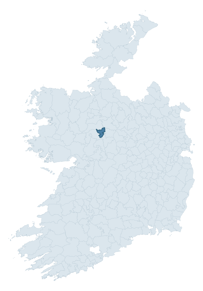
Where this barony sits in the Republic of Ireland
Geology and preservation
Bedrock geology shapes the landscape long before any settlement begins — controlling soil drainage, agricultural potential, the survival of upstanding monuments, and the preservation of buried archaeology. The figures below come from the Geological Survey Ireland 1:100,000 bedrock map.
The bedrock underlying Ballymoe is predominantly limestone (95% of the barony by area), laid down during the Carboniferous period (100% by area, around 359 to 299 million years ago). Limestone is the most heritage-rich bedrock in Ireland. It supports fertile, well-drained soils that favoured dense Early Medieval settlement and Norman manorial agriculture, and it weathers into karst features — sinkholes, caves, swallow holes, and souterrains — that frequently carry archaeology. Where peat overlies limestone, organic preservation can be exceptional. The single largest mapped unit is the Croghan Limestone Formation (95% of the barony's bedrock). With only 2 distinct rock types mapped, the barony is geologically uniform compared to the rest of the Republic (16th percentile for diversity) — a single coherent bedrock landscape.
Rock type composition
Largest mapped unit: Croghan Limestone Formation (95% of the barony)
Placename evidence
Logainm records 21 heritage-diagnostic placenames for Ballymoe, drawn from townland and civil-parish names across the barony. The dominant stratum is pre-Christian and Early Medieval defensive — ráth-, lios-, dún-, and caiseal-prefixed names that mark Iron Age and early historic settlement. The leading diagnostic roots are cill- (7 — church), dún- (6 — hilltop fort or promontory fort), and lios- (3 — ringfort or enclosure). This is below the ROI average of 30.7 heritage placenames per barony, suggesting either lighter survey coverage or a townland-naming tradition that draws more on generic landscape vocabulary. Logainm records 100 placenames for Ballymoe (predominantly townland names). Of these, 21 (21%) carry one of the diagnostic Gaelic roots tracked above; the remainder draw on more generic landscape vocabulary that does not encode a heritage period.
Pre-Christian / Early Medieval Defensive
| Root | Count | Meaning |
|---|---|---|
| dún- | 6 | hilltop or promontory fort |
| lios- | 3 | ringfort or enclosure |
| ráth- | 2 | earthen ringfort |
Early Christian Ecclesiastical
| Root | Count | Meaning |
|---|---|---|
| cill- | 7 | church (early) |
| teampall- | 2 | church (later medieval) |
| tobar- | 1 | holy well |
Other baronies in Roscommon
About this profile
Click any section below to expand.
What is a barony?
A barony is a historic administrative unit in Ireland, broadly equivalent to an English hundred. The 280 baronies used here are from the OSi 2019 National Statutory Boundaries (generalised 20m), covering the 26 counties of the Republic of Ireland. Baronies derive from the Norman period, were formalised in the 17th century, and have not been redrawn for statistical purposes. They vary enormously in area, from compact urban baronies in Dublin to vast upland baronies in Connacht, and should not be compared by raw site count without accounting for area differences.
What counts as a site?
This profile combines three distinct heritage registers, each with its own definition of what constitutes a recordable site:
- Archaeological sites (NMS). The National Monuments Service Sites and Monuments Record (SMR) catalogues every known archaeological monument or site of archaeological interest in the Republic, from prehistoric burial mounds and ringforts to medieval churches and post-medieval defensive works. Inclusion does not require legal protection — only that the site has been identified, surveyed, and assessed as having archaeological value. A separate subset of these sites lies within a recorded protection zone, which gives them statutory protection under the National Monuments Acts.
- Listed buildings (NIAH). The National Inventory of Architectural Heritage records buildings of architectural, historical, archaeological, artistic, cultural, scientific, social, or technical interest. Each surveyed structure is appraised on a five-tier scale: International, National, Regional, Local, and Record-Only. The NIAH appraisal is informational rather than strictly statutory, but it underpins local-authority Record of Protected Structures (RPS) listings.
- Heritage placenames (Logainm). Logainm is the authoritative database of Irish placenames maintained by the Placenames Branch. This profile applies a heritage-diagnostic classifier to the Irish-language form of each townland name, flagging roots that signal defensive sites (ráth-, lios-, dún-, caiseal-, cathair-), ecclesiastical foundations (cill-, teampall-, domhnach-, mainistir-), prehistoric burial-ritual features (tuaim-, carn-, leaba-), or Norse-contact settlement (gall-). Townlands without one of these diagnostic roots are not flagged here — they may still carry historical significance, but that significance is not encoded in the name itself.
Editorial principles
The narrative sections of this profile follow several explicit principles:
- Evidential. Every claim about this barony’s heritage character is anchored in the underlying register data. Where a site count, a placename count, or a percentile rank is cited, it is computed from the source datasets at export time, not estimated.
- Comparative. Counts and metrics are reported alongside their percentile rank against the other 279 ROI baronies. A barony with 50 ringforts in absolute terms could be unusually high or unusually low depending on its size and regional context; percentile ranking removes that ambiguity.
- Transparent on limits. Where a register has known coverage gaps, survey biases, or data-quality issues that affect this barony’s figures, the profile flags them rather than presenting the numbers as definitive.
- No interpretation beyond what the data supports. The narrative does not speculate about historical events, social dynamics, or cultural meaning beyond what the recorded heritage and placename evidence directly attests.
Data caveats and limits
- NMS Sites and Monuments Record is the product of survey campaigns conducted at different intensities across different counties and decades. Some baronies have been surveyed more thoroughly than others, and absolute counts should be read in that light. Sites destroyed by development before survey are typically not represented; sites in heavily forested or upland terrain are sometimes under-recorded.
- NIAH coverage is broadly complete for the Republic of Ireland but the survey was conducted on a rolling county-by-county basis, and the most recent appraisal date varies. Buildings demolished or substantially altered after their original survey may still appear in the register; conversely, recent buildings of merit may not yet have been appraised.
- Logainm classification applies a deliberately conservative pattern-matching approach to the Irish-language townland forms. The classifier prioritises true positives over recall: a townland may carry a heritage signal that the classifier doesn’t recognise, particularly where the diagnostic root has been heavily anglicised or where the townland name draws on a less common term. The 60,000+ townland records and ~9,800 classified placenames give a substantial signal at barony scale, but individual townland names should be checked against Logainm directly for definitive interpretation.
- Period attribution. The chronological distribution reflects only those NMS sites that carry a recognised period attribution in the source data. Sites listed as “Unknown” period are excluded from the dated subset.
- Boundary changes. Some baronies have undergone minor boundary adjustments since their 19th-century definition; the OSi 2019 generalised boundaries used here are the current statutory definition and may differ slightly from historical maps in border areas.
- Bedrock geology is mapped at 1:100,000 scale, which means local variation within a barony — small pockets of different rock type, mineral veins, alluvium overlying bedrock — is generalised. The dominant-system and rocktype figures are area-weighted, so a barony reading “70% Carboniferous limestone” may still contain small but archaeologically important pockets of older or younger rock. Around 3% of GSI polygons do not match the lexicon and contribute no rocktype or system attribution.
Data sources
- National Monuments Service — Sites and Monuments Record (SMR) https://data.gov.ie/dataset/national-monuments-service-archaeological-survey-of-ireland
- National Inventory of Architectural Heritage (NIAH) https://data.gov.ie/dataset/national-inventory-of-architectural-heritage-niah-national-dataset
- Logainm — Placenames Database of Ireland https://www.logainm.ie/
- Ordnance Survey Ireland — National Statutory Barony Boundaries 2019 https://data-osi.opendata.arcgis.com/
- EURODEM — European Digital Elevation Model https://www.mapsforeurope.org/datasets/euro-dem
- ESA WorldCover https://esa-worldcover.org/en
- Geological Survey Ireland — 1:100,000 Bedrock Geology https://www.gsi.ie/en-ie/data-and-maps/Pages/Bedrock.aspx
Explore more: Search any of the 280 ROI baronies, browse by historical province, or read the methodology and data sources for the full Republic of Ireland Heritage Tool.