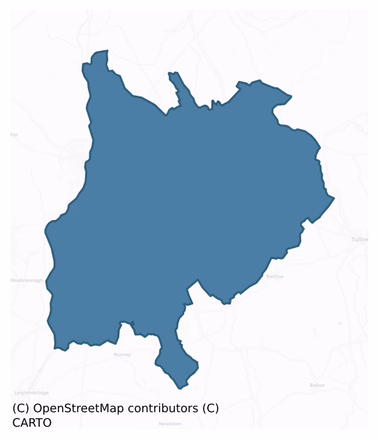
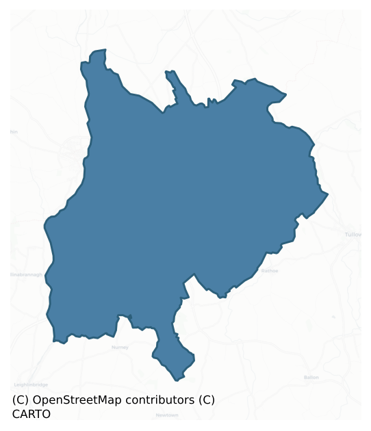
Carlow is a barony of County Carlow, in the historical province of Leinster (Irish: Ceatharlach), covering 127 km² of land. The barony records 455 NMS archaeological sites and 58 NIAH listed buildings, placing it at around the 90th percentile among 280 ROI baronies for sites per km². This means it is in the top tenth of all baronies for sites per km². Dated archaeological evidence runs from the Neolithic through to the Modern, spanning 8 of 9 archaeological periods, placing the barony in the 84th percentile among 280 ROI baronies for chronological depth. This means it is in the top fifth of all baronies for chronological depth. The largest dated subset of recorded sites dates to the Iron Age. Logainm flags 21 placenames in the barony as carrying a recognised heritage root; the largest share — around 67% — are names associated with early Christian church and monastic foundations.
Heritage at a glance
Percentile rankings throughout this profile compare each barony only against the other 279 Republic of Ireland baronies.
The recorded heritage of Carlow
The National Monuments Service Sites and Monuments Record (SMR) is the statutory inventory of archaeological sites for the Republic of Ireland, maintained by the Department of Tourism, Culture, Arts, Gaeltacht, Sport and Media. Sites recorded here include earthworks, ringforts, megalithic tombs, ecclesiastical remains, and post-medieval features; not every record is legally protected, but each is registered as a monument of archaeological interest.
The National Monuments Service records 455 archaeological sites in Carlow, putting it at the 90th percentile among 280 ROI baronies for sites per km². This means it is in the top tenth of all baronies for sites per km². Of these, 399 (88%) fall within a recorded monument protection zone. The record is dominated by defensive sites — ringforts, enclosures, hillforts, and stone forts (177 sites, 39% of the total), with burial and ritual monuments forming a substantial secondary presence (78 sites, 17%). The most diagnostically specific type is Ring-ditch (58 records, 13% of the barony's NMS total) — compared to an ROI average of 6% across all baronies where this type occurs. Ring-ditch is a circular ditch under 20m across, often the ploughed-out remains of a barrow, ring-barrow or roundhouse. The broader 'Enclosure' classification — which catches unclassified ringforts and field enclosures — accounts for a further 140 records (31%) and reflects the difficulty of sub-classifying degraded earthworks from surface evidence alone. Across the barony's 127 km², this gives a recorded density of 3.59 sites per km².
Most common monument types
Hover or tap a monument type to see its definition.
| Type | Count |
|---|---|
| Enclosure a banked or ditched feature of uncertain type, used as a catch-all where the original function cannot be determined from surface evidence | 140 |
| Ring-ditch a circular ditch under 20m across, often the ploughed-out remains of a barrow, ring-barrow or roundhouse | 58 |
| Excavation – miscellaneous | 21 |
| Fulacht fia a horseshoe-shaped Bronze Age burnt mound built around a sunken trough beside a water source, traditionally interpreted as a cooking site | 16 |
| Graveyard a burial area associated with a church, in use from the medieval period onwards | 14 |
| Church a building used for public Christian worship, of any date from c. 500 AD onwards | 13 |
Chronological distribution
The dated archaeological record for Carlow spans from the Neolithic through to the Modern, with activity attested across 8 of 9 archaeological periods. This is the 84th percentile across ROI baronies for chronological depth — an above-average span. Every period from earliest to latest is represented in the record — an unbroken sequence of dated activity across the full chronological span. Activity concentrates most heavily in the Iron Age (152 sites, 57% of dated material), with the Middle Late Bronze Age forming a secondary peak (44 sites, 16%). A further 186 recorded sites (41% of the overall NMS register for the barony) carry no period attribution — appearing as 'Unknown' in the bar chart below. This typically reflects either records that pre-date the standardised period vocabulary or sites awaiting specialist dating review, rather than a genuine absence of chronological evidence.
Sample of recorded monuments
Show 25 sample monuments (of 455 total)
A representative sample of 25 recorded monuments drawn from the barony’s 455 total NMS entries. Sites within a recorded monument protection zone and rarer site types are prioritised so the list shows a meaningful cross-section rather than only the most common type. Each entry shows the official Sites and Monuments Record reference number and the description published by the National Monuments Service.
Megalithic tomb – portal tomb
National Monument No. 613. Known as Brownshill. Very large capstone (4.7m x 6.1m x 2m) rests on two portal stones, door stone and prostrate slab. Side stones missing. Single orthostat flanks N portal stone, possibly…
National Monument No. 613. Known as Brownshill. Very large capstone (4.7m x 6.1m x 2m) rests on two portal stones, door stone and prostrate slab. Side stones missing. Single orthostat flanks N portal stone, possibly remains of facade, but no visible trace of cairn or mound. According to Borlase (1897, 398), one of three 'dolmens' in this townland (see also CW007-011—- and CW007-012—-). Chamber faces E. (Ó Nualláin 1983, 91).
Historic Monument No. HM00328, this monument was entered in the Register of Historic Monuments on the 04 September 1970.
The above description is derived from the published 'Archaeological Inventory of County Carlow' (Dublin: Stationery Office, 1993). In certain instances the entries have been revised and updated in the light of recent research.
Date of upload/revision: 17 July 2007
Historic town
Sited at the confluence of the rivers Burren and Barrow. Earliest charter dates to c. 1223. Its main elements include the castle (CW007-018002-) founded by William Marshall and town defences (CW007-018006-), although no…
Sited at the confluence of the rivers Burren and Barrow. Earliest charter dates to c. 1223. Its main elements include the castle (CW007-018002-) founded by William Marshall and town defences (CW007-018006-), although no traces of the latter survive. (see CW007-018001- to CW007-018008-)
Compiled by: Claire Breen
Date of upload: 19 August 2011
Castle – Anglo-Norman masonry castle
National Monument No. 10030. Large rectangular three-story limestone keep, of early thirteenth-century date, with circular towers at each angle. Present remains consist of W wall with circular end towers. Built on…
National Monument No. 10030. Large rectangular three-story limestone keep, of early thirteenth-century date, with circular towers at each angle. Present remains consist of W wall with circular end towers. Built on rising ground with large crennelated stone wall enclosing castle. Main entrance in W wall at first-floor level, now broken out. Similar ground plan to Ferns, Co. Wexford, and Lea, Co. Laois. (Leask 1936, 168-70; AJ 1973, 47-49; Bradley 1989, 8)
The above description is derived from the published 'Archaeological Inventory of County Carlow' (Dublin: Stationery Office, 1993). In certain instances the entries have been revised and updated in the light of recent research.
Date of upload/revision: 17 July 2007
Mill – unclassified
The following description is derived from the published 'Archaeological Inventory of County Carlow' (Dublin: Stationery Office, 1993). In certain instances the entries have been revised and updated in the light of…
The following description is derived from the published 'Archaeological Inventory of County Carlow' (Dublin: Stationery Office, 1993). In certain instances the entries have been revised and updated in the light of recent research.
Date of revision: 05 May 2011
Marked 'Corn Mill' on the 1840 OS 6-inch map. Four mills identified on Colombine's 1735 map (Bradley 1989, 7) (see also CW007-018011-, CW007-018012- and CW007-018013-). Possibly one of the three mills referred to in the 1307 inquisition (Mills 1914, 346).
References:
Bradley, J. 1989 Urban archaeological survey – Co. Carlow (limited distribution). Office of Public Works, Dublin.
Mills, J. (ed.) 1914 Calendar of the Justiciary Rolls Ireland 1305-7, Dublin.
Town defences
The following description is derived from the published 'Archaeological Inventory of County Carlow' (Dublin: Stationery Office, 1993). In certain instances the entries have been revised and updated in the light of…
The following description is derived from the published 'Archaeological Inventory of County Carlow' (Dublin: Stationery Office, 1993). In certain instances the entries have been revised and updated in the light of recent research.
Date of upload/revision: 17 July 2007
Documentary evidence indicates town was fortified in mid-fourteenth century (Otway-Ruthven 1968, 287). No visible trace. Precise location and extent unknown. (Bradley 1989, 8)
House – 16th/17th century
The following description is derived from the published 'Archaeological Inventory of County Carlow' (Dublin: Stationery Office, 1993). In certain instances the entries have been revised and updated in the light of…
The following description is derived from the published 'Archaeological Inventory of County Carlow' (Dublin: Stationery Office, 1993). In certain instances the entries have been revised and updated in the light of recent research.
Date of upload/revision: 17 July 2007
Large house, known as 'the Turrets', home of Sir William Temple for about a decade in mid-seventeenth century. Earthworks to N and SE of site are probably landscape features. Medieval village lay in vicinity of Steplestown Lodge and Staplestown Bridge. Neither house nor village, which were illustrated by Dineley in 1680 (JRSAI 1862-3, 44-5), are marked on Down Survey of 1650.
Settlement deserted – medieval
Medieval village lay in vicinity of Steplestown Lodge and Staplestown Bridge. Illustrated by Dineley in 1680 (JRSAI 1862-3, 44-5).
Compiled by: Claire Breen
Date of upload: 19 August 2011
Cist
The following description is derived from the published 'Archaeological Inventory of County Carlow' (Dublin: Stationery Office, 1993). In certain instances the entries have been revised and updated in the light of…
The following description is derived from the published 'Archaeological Inventory of County Carlow' (Dublin: Stationery Office, 1993). In certain instances the entries have been revised and updated in the light of recent research.
Date of upload/revision: 17 July 2007
… a small boulder … forming the covering of a small cist … of granite stones, just sufficient in size to contain the urn'. Vessel (probably food vessel) described as 'curiously ornamented with incised markings …4 inches in height, the widest diam.eter that of the rim … 5 inches; bottom 2 3/4 inches'. Associated with cremation, and possibly with bone object. Discovered about 1872. Two similar cists and vessels were also found in the same locality but subsequently destroyed (JRSAI 1872-3, 252).
Religious house – Knights Hospitallers
The following description is derived from the published 'Archaeological Inventory of County Carlow' (Dublin: Stationery Office, 1993). In certain instances the entries have been revised and updated in the light of…
The following description is derived from the published 'Archaeological Inventory of County Carlow' (Dublin: Stationery Office, 1993). In certain instances the entries have been revised and updated in the light of recent research.
Date of upload/revision: 17 July 2007
Also known as Friarstown and founded by Gilbert de Borand (OSL 1839, 16-25). Registrum de Kilmainham (152) states it was confirmed to the Knights Hospitallers in 1212. In 1540 the jurors reported in Frerton a ruined castle and three messuages (Gwynn and Hadcockk 1988, 337). Down Survey records a castle in good repair here in 1650. Farmyard on site, no trace of medieval structures. (Gwynn and Hadcock 1988, 336-7)
Urn burial
The following description is derived from the published 'Archaeological Inventory of County Carlow' (Dublin: Stationery Office, 1993). In certain instances the entries have been revised and updated in the light of…
The following description is derived from the published 'Archaeological Inventory of County Carlow' (Dublin: Stationery Office, 1993). In certain instances the entries have been revised and updated in the light of recent research.
Date of upload/revision: 17 July 2007
Urn and bone pin found at base of standing stone (CW008-016001-) when surrounding earth dug away with a view to the removal of stone. Urn broken on discovery. Pin preserved in NMI (JRSAI 1939, 101)
Round tower
The Anthologia Hibernica (Vol. IV., p. 105 July – December 1794) contains a sketch of a Round Tower in ruins at Kellistown (JKAS 1933, 271-7). A drawing by J. Saunders TCD, believed to date to c. 1797 also depicts the…
The Anthologia Hibernica (Vol. IV., p. 105 July – December 1794) contains a sketch of a Round Tower in ruins at Kellistown (JKAS 1933, 271-7). A drawing by J. Saunders TCD, believed to date to c. 1797 also depicts the round tower in ruins. The OS Letters (O' Flanagan 1934, 44) note that the Belfry of the chuch (CW008-038001-) was built where the round tower stood.
Reference:
O' Flanagan, E. (typescript) 1934 Letters containing information relative to the Antiquities of the County of Carlow collected during the progress of the Ordnance Survey in 1839.
Compiled by: Claire Breen
Date of upload: 19 August 2011
Cross – High cross
The following description is derived from the published 'Archaeological Inventory of County Carlow' (Dublin: Stationery Office, 1993). In certain instances the entries have been revised and updated in the light of…
The following description is derived from the published 'Archaeological Inventory of County Carlow' (Dublin: Stationery Office, 1993). In certain instances the entries have been revised and updated in the light of recent research.
Date of revision: 13 April 2011
According to O'Donovan (OSL 1839, 16) probably site of 'Cill Eogain'. Present remains consist of oval uncultivated area, enclosed by fence. Within graveyard (CW012-025001) is plain, bossed solid-wheeled cross and base. Panel on shaft may have had interlace ornament. Cross is broken into fragments. (Harbison 1992, 94 (entry 111)). Aerial photograph (GB89.34) shows enclosure (CW012-025) of 'Killogan burial ground' (Barrett 1989).
Bibliography
Barrett, G.F. 'Early landscapes in County Carlow: an aerial perspective, in T. McGrath and T. O'Keefe (eds), County Carlow: History and Society, Geography Publications, Dublin.. Forthcoming 2008.
Barrett , G.F. (2002) 'Flights of discovery: archaeological air survey in Ireland, 1989-2000' in the Journal of Irish Archaeology, XI, 2002., pp. 1-30.
Harbison, P. 1992 The high crosses of Ireland; An iconographical and photographic survey 3 vols. Royal Irish Academy, Dublin; Dr. Rudolf Habelt GMBH, Bonn.
Concentric enclosure
Indicated on the 1st ed. OS 6-inch map as a circular enclosure (diam. c. 20m) with an outer hachured concentric enclosure at a distance of c. 15m. Shown on 1938-39 'OS 6-inch' map as circular raised area (diam. c. 30m).…
Indicated on the 1st ed. OS 6-inch map as a circular enclosure (diam. c. 20m) with an outer hachured concentric enclosure at a distance of c. 15m. Shown on 1938-39 'OS 6-inch' map as circular raised area (diam. c. 30m). Visible on aerial photograph (GSI S 436) as circular area defined by cropmark of fosse. No visible surface traces. It is visible as a cropmark on Google Earth (imagery date 14 July 2018) as a circular enclosure (diam. c. 34m) with an outer concentric sub-circular enclosure (overall diam. c. 65m). The fosses are c. 15-20m apart.
The above description is derived from the published 'Archaeological Inventory of County Carlow' (Dublin: Stationery Office, 1993). In certain instances the entries have been revised and updated in the light of recent research.
See attached Google Earth image (imagery date 14 July 2018)
Compiled by: Anna Brindley, Annaba Kilfeather and Jean Farrelly
Date of revised upload: 11 February 2020
Weir – regulating
An Inquisition of 1614 makes reference to a fishing weir in existence in Dunganstown in 1597. This was probably on the same site as the weir marked on the 1839 'OS 6-inch' map. (Went 1954, 234)
Reference:
Went…
An Inquisition of 1614 makes reference to a fishing weir in existence in Dunganstown in 1597. This was probably on the same site as the weir marked on the 1839 'OS 6-inch' map. (Went 1954, 234)
Reference:
Went A.E.J. 1954 'Notes on the Fisheries of the River Barrow' in The Journal of Kildare Archaeological Society Vol 13, 234.
Compiled by: Claire Breen
Date of upload: 6 January 2012
Road – hollow-way
Partially excavated in advance of construction of the N9/N10 Kilcullen-Waterford Road (Excavation Licence number E2581; area 1 in final report). A hollow way (Wth 4m; D 1.4m) which runs from Busherstown House towards…
Partially excavated in advance of construction of the N9/N10 Kilcullen-Waterford Road (Excavation Licence number E2581; area 1 in final report). A hollow way (Wth 4m; D 1.4m) which runs from Busherstown House towards the post-medieval enclosure (CW007-093—-). (O' Neill N. 2009, 13; 45-6)
Reference:
O' Neill N. 2009 N9/N10 Kilcullen to Waterford Scheme: Kilcullen to Powerstown. Archaeological Services Contract No. 4 – Resolution, Prumpelstown to Powerstown. Final Report on archaeological investigations at site E2581, in the townland of Busherstown, Co. Carlow. Unpublished report, Headland Archaeology (Ireland) Ltd., Cork
Compiled by: Claire Breen
Date of upload: 10 November 2010
House – prehistoric
Excavated in advance of construction of the N9/N10 Kilcullen-Waterford Road (Excavation Licence number E2595), a circular slot trench (diam 7m; Wth of trench 0.55m) was uncovered. No finds were recovered from the trench…
Excavated in advance of construction of the N9/N10 Kilcullen-Waterford Road (Excavation Licence number E2595), a circular slot trench (diam 7m; Wth of trench 0.55m) was uncovered. No finds were recovered from the trench but 15 stone artefacts including a barbed and tanged arrowhead and a polished stone axe were recovered in the immediate area. A late Neolithic to early/middle Bronze age date has been suggested for the structure. It was heavily disturbed by ditches dating to the medieval period (CW007-140—-). (Hughes J. and Doyle T. 2009, 25-6)
Reference:
Hughes J. and Doyle T. 2009 N9/N10 Kilcullen to Waterford Scheme: Kilcullen to Powerstown. Archaeological Services Contract No. 4 – Resolution, Prumpelstown to Powerstown. Final Report on archaeological investigations at site E2595, in the townland of Moyle Big, Co. Carlow. Unpublished report, Headland Archaeology (Ireland) Ltd., Cork
Compiled by: Claire Breen
Date of upload: 10 November 2010
Tomb – effigial
Effigial tomb cover of Robert Hartpole, Constable of Carlow Castle (CW007-018002-), originally located in the graveyard (CW007-018010-) of St. Mary's church (CW007-018007-), relocated to Oak Park House, later to the…
Effigial tomb cover of Robert Hartpole, Constable of Carlow Castle (CW007-018002-), originally located in the graveyard (CW007-018010-) of St. Mary's church (CW007-018007-), relocated to Oak Park House, later to the town park in Portarlington Co. Laois (LA005-032—-) and recently removed from the town park and now housed in Carlow County Museum (CW007-181—-). Under the 2021 Community Monument Fund, the 16th century Hartpole Effigy was moved from the park in Portarlington on the 13/10/2021 by Gebel & Helling Conservation Ltd. under the supervision of Isabella Mulhall & Karena Morton of the National Museum of Ireland and Martin Reid of the National Monuments Service.
In 1895 John C. O’Neill wrote the following account about the discovery of the Hartpole tomb in a letter to the editor of the Carlow Vindicator; ‘Having read in your issue of the 26th Jan., a very interesting letter from the pen of " C. J. H.," relative to the whereabouts of the effigy of Robert Harpol (nicknamed by the peasantry for his cruelties, "Robert the Terrible"), which was unearthed in the ancient burial-ground known as St. Mary's, and afterwards conveyed to Oak Park, the residence of Mr. Bruen, I thought that perhaps a few incidents relative to "Robert the Terrible," and the manner in which his effigy was discovered, might interest your readers, especially those who love to take a backward glance at the past history of their country. The old churchyard known as St. Mary's, and of which at the p…
Cremated remains
Excavated in advance of construction of the N9/N10 Kilcullen-Waterford Road (Excavation Licence number E2597). Cremated human bone was discovered in the fill of one of the possible furnaces at a metalworking site (see…
Excavated in advance of construction of the N9/N10 Kilcullen-Waterford Road (Excavation Licence number E2597). Cremated human bone was discovered in the fill of one of the possible furnaces at a metalworking site (see CW007-115—-). (Doyle 2009; 9-10)
Reference:
Doyle T. 2009 N9/N10 Kilcullen to Waterford Scheme: Kilcullen to Powerstown. Archaeological Services Contract No. 4 – Resolution, Prumpelstown to Powerstown. Final Report on archaeological investigations at site E2597, in the townland of Moyle Big, Co. Carlow. Unpublished report, Headland Archaeology (Ireland) Ltd., Cork
Compiled by: Claire Breen
Date of upload: 10 November 2010
Pit
Aerial photograph (GB95.FV.08 ) shows cropmarks of a series of pits
Compiled by: Dr Gillian Barrett for the Archaeological Survey of Ireland.
Date of upload: 15 April 2011
Stone head (present location)
This granite stone head (overall dims. L 044m x Wth 0.32m; D 0.24m), currently located in Carlow County Museum, was discovered lying in Ballinacarrig graveyard (CW007-025002-) which is c. 3km SW of Carlow town. The…
This granite stone head (overall dims. L 044m x Wth 0.32m; D 0.24m), currently located in Carlow County Museum, was discovered lying in Ballinacarrig graveyard (CW007-025002-) which is c. 3km SW of Carlow town. The outline of the ruined medieval church (CW007-025—-) is visible within the graveyard. The head, carved in high relief, narrows towards the chin (Wth 0.05m). It has round bulging eyes, a pronounced flat nose with splays towards the end and the lips are well defined. At the top of the head there is a circular bowl (diam. 0.13m; D 0.12m) with a hole at the base and a raised rim (T 0.04m). Five vertical lines within the bowl at the top of the forehead probably represent hair. It is possible that it functioned as an ornate water spout, though it is unclear how it would have been fixed to a wall unless the stone extended further back and this portion has been broken off, though there is no obvious break. The style of the carving suggests a 12th-century date.
Compiled by: Jean Farrelly
Date of upload: 23 June 2015
Battlefield
The Archaeological Survey of Ireland (ASI) is in the process of providing information on all monuments on The Historic Environment Viewer (HEV). Currently the information for this record has not been uploaded. To…
The Archaeological Survey of Ireland (ASI) is in the process of providing information on all monuments on The Historic Environment Viewer (HEV). Currently the information for this record has not been uploaded. To access available information for research purposes please make an appointment in advance with the Archive Unit (open Fridays 10.00 am – 5.00 pm), Department of Culture, Heritage and the Gaeltacht, The Custom House, Dublin 1 D01W6XO or email nmarchive@chg.gov.ie.
Tomb – effigial (present location)
In 1895 John C. O’Neill wrote the following account about the discovery of the Hartpole tomb in a letter to the editor of the Carlow Vindicator; ‘Having read in your issue of the 26th Jan., a very interesting letter…
In 1895 John C. O’Neill wrote the following account about the discovery of the Hartpole tomb in a letter to the editor of the Carlow Vindicator; ‘Having read in your issue of the 26th Jan., a very interesting letter from the pen of " C. J. H.," relative to the whereabouts of the effigy of Robert Harpol (nicknamed by the peasantry for his cruelties, "Robert the Terrible"), which was unearthed in the ancient burial-ground known as St. Mary's, and afterwards conveyed to Oak Park, the residence of Mr. Bruen, I thought that perhaps a few incidents relative to "Robert the Terrible," and the manner in which his effigy was discovered, might interest your readers, especially those who love to take a backward glance at the past history of their country. The old churchyard known as St. Mary's, and of which at the present day but one solitary tomb remains, was situated in Castle Hill, Carlow, and stretched right along through Coal Market to the present Protestant Cathedral. It was a tine old graveyard, perched upon a rising ground, and within a few perches of the River Barrow. The graveyard was cut away to make room for dwelling-houses, although many more convenient sites might have been easily obtained without desecrating the City of the Dead. The cutting away of this once magnificent churchyard was an act worthy of the earliest days of vandalism, and not at all creditable to the traditions of those who are credited with holding the sepulchres of the dead in extreme veneration. The…
Ecclesiastical site
The following description is derived from the published 'Archaeological Inventory of County Carlow' (Dublin: Stationery Office, 1993). In certain instances the entries have been revised and updated in the light of…
The following description is derived from the published 'Archaeological Inventory of County Carlow' (Dublin: Stationery Office, 1993). In certain instances the entries have been revised and updated in the light of recent research.
Date of upload/revision: 17 July 2007
Marked on the Down Survey (1655-6) map as castle-like structure with cross on top. No visible surface traces. See also Chapelstown rectangular enclosure (CW007-057—-).
Bridge
The following description is derived from the published 'Archaeological Inventory of County Carlow' (Dublin: Stationery Office, 1993). In certain instances the entries have been revised and updated in the light of…
The following description is derived from the published 'Archaeological Inventory of County Carlow' (Dublin: Stationery Office, 1993). In certain instances the entries have been revised and updated in the light of recent research.
Date of upload/revision: 17 July 2007
Down Survey (1655-6) map shows stone bridge over Barrow and timber bridge over Burren, both of which appear to have been built before sixteenth century. Present bridges are modern but may be located close to or on sites of original bridges. (Bradley 1989, 5)
Enclosure
The following description is derived from the published 'Archaeological Inventory of County Carlow' (Dublin: Stationery Office, 1993). In certain instances the entries have been revised and updated in the light of…
The following description is derived from the published 'Archaeological Inventory of County Carlow' (Dublin: Stationery Office, 1993). In certain instances the entries have been revised and updated in the light of recent research.
Date of upload/revision: 17 July 2007
Aerial photograph (CUCAP BGH 38) shows small circular area defined by cropmark of fosse (est. max. diam. c. 20m). Possibly ring-ditch or ring-barrow. No visible surface traces.
Listed buildings
The National Inventory of Architectural Heritage (NIAH) is a state survey appraising buildings of architectural, historical, archaeological, artistic, cultural, scientific, social, or technical interest. Each surveyed structure receives a rating from International (the highest, for buildings of European importance) through National, Regional, Local, and Record-Only.
The NIAH records 58 listed buildings in Carlow (29th percentile across ROI baronies). The highest-graded structures include 2 of National significance. The Republic holds 937 National-graded buildings in total, so this barony accounts for around 0% of the national total. Construction dates concentrate most heavily in the Victorian (1830-1900) period.
Terrain and environment
Mean elevation across the barony is 75m — the 36th percentile among 280 ROI baronies for elevation. This means it is in the lower half of all baronies for elevation. Elevation matters for heritage because higher-altitude baronies typically favour defensive monuments — ringforts and hilltop forts placed on prominent ground — while lowland baronies are more likely to carry the dense settlement and church networks of intensive agricultural landscapes. A maximum elevation of 193m gives the barony meaningful vertical relief. Mean slope is 2.4° — the 25th percentile among 280 ROI baronies for slope. This means it is in the bottom third of all baronies for slope. Slope is a key control on both land use and archaeological preservation: steep ground resists ploughing and tends to preserve earthworks intact, while gentle slopes favour intensive cultivation that damages or destroys surface archaeology over time. The Topographic Wetness Index averages 11.5, the 75th percentile among 280 ROI baronies for wetness. This means it is in the top third of all baronies for wetness. This is wet, slow-draining ground by ROI standards — the kind of landscape that may carry waterlogged archaeological sites of unusual preservation value. Drainage matters for heritage because poorly-drained ground preserves organic archaeology (wooden trackways, leather, textiles, and on rare occasions human remains) far better than free-draining soil; well-drained ground favours arable use but destroys organic material rapidly. Urban land covers 5% of the barony (the 91st percentile among 280 ROI baronies for urban cover. This means it is in the top tenth of all baronies for urban cover). Heavy urban coverage compresses heritage analysis: many archaeological features have been buried or destroyed by development, but the surviving record is concentrated in protected city-centre cores, and the NIAH listed-buildings count is typically high. The land-cover mosaic combines improved grassland (45%), arable farmland (42%), and woodland (7%), giving a mixed agricultural and semi-natural landscape.
Terrain measurements
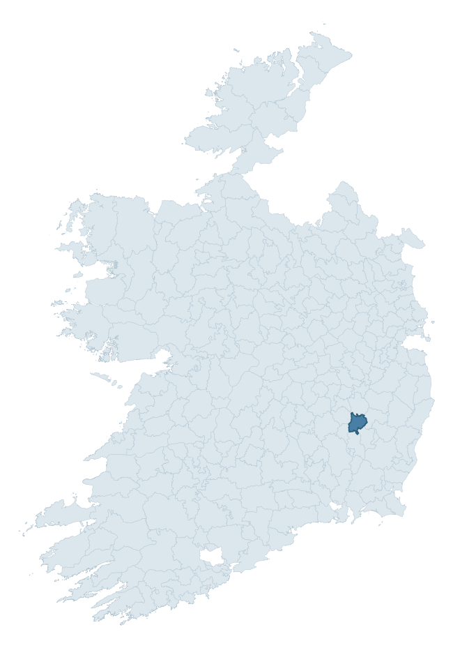
Where this barony sits in the Republic of Ireland
Geology and preservation
Bedrock geology shapes the landscape long before any settlement begins — controlling soil drainage, agricultural potential, the survival of upstanding monuments, and the preservation of buried archaeology. The figures below come from the Geological Survey Ireland 1:100,000 bedrock map.
The bedrock underlying Carlow is predominantly granite (62% of the barony by area), laid down during the Caledonian period (62% by area, during the Caledonian orogeny (around 490–390 million years ago)). Granite weathers slowly and produces thin, acidic, often poorly-drained soils that historically limited arable agriculture but favoured pastoralism, upland settlement, and the construction of stone monuments. Granite-dominated landscapes typically carry fewer ringforts but a higher density of megalithic tombs, standing stones, and stone circles, which survive well against the resistant bedrock. A substantial secondary geology of dolomitised limestone (16%) and limestone (11%) adds further variety to the underlying landscape. The single largest mapped unit is the Type 2 Equigranular Granite (Tullow Pluton) (55% of the barony's bedrock).
Rock type composition
Largest mapped unit: Type 2 Equigranular Granite (Tullow Pluton) (55% of the barony)
Placename evidence
Logainm records 21 heritage-diagnostic placenames for Carlow, drawn from townland and civil-parish names across the barony. The dominant stratum is Early Christian ecclesiastical — cill-, teampall-, and domhnach-prefixed names that record the dense network of early church foundations established between the fifth and tenth centuries. The leading diagnostic roots are cill- (10 — church), ráth- (5 — earthen ringfort), and gráinseach- (4 — grange). This is below the ROI average of 30.7 heritage placenames per barony, suggesting either lighter survey coverage or a townland-naming tradition that draws more on generic landscape vocabulary. The presence of multiple heritage strata side by side indicates layered occupation of the landscape across successive prehistoric and historic periods. Logainm records 86 placenames for Carlow (predominantly townland names). Of these, 21 (24%) carry one of the diagnostic Gaelic roots tracked above; the remainder draw on more generic landscape vocabulary that does not encode a heritage period.
Pre-Christian / Early Medieval Defensive
| Root | Count | Meaning |
|---|---|---|
| ráth- | 5 | earthen ringfort |
| dún- | 1 | hilltop or promontory fort |
Early Christian Ecclesiastical
| Root | Count | Meaning |
|---|---|---|
| cill- | 10 | church (early) |
| gráinseach- | 4 | monastic farm / grange |
Burial, Ritual, and Norse-Contact
| Root | Count | Meaning |
|---|---|---|
| carn- | 1 | cairn |
Other baronies in Carlow
About this profile
Click any section below to expand.
What is a barony?
A barony is a historic administrative unit in Ireland, broadly equivalent to an English hundred. The 280 baronies used here are from the OSi 2019 National Statutory Boundaries (generalised 20m), covering the 26 counties of the Republic of Ireland. Baronies derive from the Norman period, were formalised in the 17th century, and have not been redrawn for statistical purposes. They vary enormously in area, from compact urban baronies in Dublin to vast upland baronies in Connacht, and should not be compared by raw site count without accounting for area differences.
What counts as a site?
This profile combines three distinct heritage registers, each with its own definition of what constitutes a recordable site:
- Archaeological sites (NMS). The National Monuments Service Sites and Monuments Record (SMR) catalogues every known archaeological monument or site of archaeological interest in the Republic, from prehistoric burial mounds and ringforts to medieval churches and post-medieval defensive works. Inclusion does not require legal protection — only that the site has been identified, surveyed, and assessed as having archaeological value. A separate subset of these sites lies within a recorded protection zone, which gives them statutory protection under the National Monuments Acts.
- Listed buildings (NIAH). The National Inventory of Architectural Heritage records buildings of architectural, historical, archaeological, artistic, cultural, scientific, social, or technical interest. Each surveyed structure is appraised on a five-tier scale: International, National, Regional, Local, and Record-Only. The NIAH appraisal is informational rather than strictly statutory, but it underpins local-authority Record of Protected Structures (RPS) listings.
- Heritage placenames (Logainm). Logainm is the authoritative database of Irish placenames maintained by the Placenames Branch. This profile applies a heritage-diagnostic classifier to the Irish-language form of each townland name, flagging roots that signal defensive sites (ráth-, lios-, dún-, caiseal-, cathair-), ecclesiastical foundations (cill-, teampall-, domhnach-, mainistir-), prehistoric burial-ritual features (tuaim-, carn-, leaba-), or Norse-contact settlement (gall-). Townlands without one of these diagnostic roots are not flagged here — they may still carry historical significance, but that significance is not encoded in the name itself.
Editorial principles
The narrative sections of this profile follow several explicit principles:
- Evidential. Every claim about this barony’s heritage character is anchored in the underlying register data. Where a site count, a placename count, or a percentile rank is cited, it is computed from the source datasets at export time, not estimated.
- Comparative. Counts and metrics are reported alongside their percentile rank against the other 279 ROI baronies. A barony with 50 ringforts in absolute terms could be unusually high or unusually low depending on its size and regional context; percentile ranking removes that ambiguity.
- Transparent on limits. Where a register has known coverage gaps, survey biases, or data-quality issues that affect this barony’s figures, the profile flags them rather than presenting the numbers as definitive.
- No interpretation beyond what the data supports. The narrative does not speculate about historical events, social dynamics, or cultural meaning beyond what the recorded heritage and placename evidence directly attests.
Data caveats and limits
- NMS Sites and Monuments Record is the product of survey campaigns conducted at different intensities across different counties and decades. Some baronies have been surveyed more thoroughly than others, and absolute counts should be read in that light. Sites destroyed by development before survey are typically not represented; sites in heavily forested or upland terrain are sometimes under-recorded.
- NIAH coverage is broadly complete for the Republic of Ireland but the survey was conducted on a rolling county-by-county basis, and the most recent appraisal date varies. Buildings demolished or substantially altered after their original survey may still appear in the register; conversely, recent buildings of merit may not yet have been appraised.
- Logainm classification applies a deliberately conservative pattern-matching approach to the Irish-language townland forms. The classifier prioritises true positives over recall: a townland may carry a heritage signal that the classifier doesn’t recognise, particularly where the diagnostic root has been heavily anglicised or where the townland name draws on a less common term. The 60,000+ townland records and ~9,800 classified placenames give a substantial signal at barony scale, but individual townland names should be checked against Logainm directly for definitive interpretation.
- Period attribution. The chronological distribution reflects only those NMS sites that carry a recognised period attribution in the source data. Sites listed as “Unknown” period are excluded from the dated subset.
- Boundary changes. Some baronies have undergone minor boundary adjustments since their 19th-century definition; the OSi 2019 generalised boundaries used here are the current statutory definition and may differ slightly from historical maps in border areas.
- Bedrock geology is mapped at 1:100,000 scale, which means local variation within a barony — small pockets of different rock type, mineral veins, alluvium overlying bedrock — is generalised. The dominant-system and rocktype figures are area-weighted, so a barony reading “70% Carboniferous limestone” may still contain small but archaeologically important pockets of older or younger rock. Around 3% of GSI polygons do not match the lexicon and contribute no rocktype or system attribution.
Data sources
- National Monuments Service — Sites and Monuments Record (SMR) https://data.gov.ie/dataset/national-monuments-service-archaeological-survey-of-ireland
- National Inventory of Architectural Heritage (NIAH) https://data.gov.ie/dataset/national-inventory-of-architectural-heritage-niah-national-dataset
- Logainm — Placenames Database of Ireland https://www.logainm.ie/
- Ordnance Survey Ireland — National Statutory Barony Boundaries 2019 https://data-osi.opendata.arcgis.com/
- EURODEM — European Digital Elevation Model https://www.mapsforeurope.org/datasets/euro-dem
- ESA WorldCover https://esa-worldcover.org/en
- Geological Survey Ireland — 1:100,000 Bedrock Geology https://www.gsi.ie/en-ie/data-and-maps/Pages/Bedrock.aspx