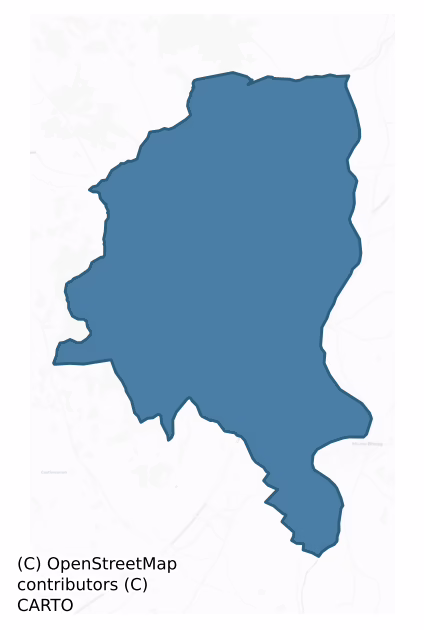
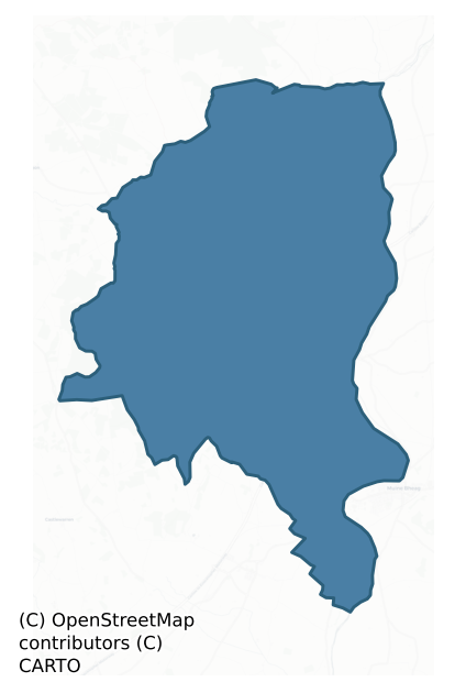
Idrone West is a barony of County Carlow, in the historical province of Leinster (Irish: Uí Dhróna Thiar), covering 93 km² of land. The barony records 159 NMS archaeological sites and 27 NIAH listed buildings, placing it at around the 43rd percentile among 280 ROI baronies for sites per km². This means it is in the lower half of all baronies for sites per km². Dated archaeological evidence runs from the Early Bronze Age through to the Medieval, spanning 5 of 9 archaeological periods, placing the barony in the 7th percentile among 280 ROI baronies for chronological depth. This means it is in the bottom tenth of all baronies for chronological depth. The largest dated subset of recorded sites dates to the Iron Age.
Heritage at a glance
Percentile rankings throughout this profile compare each barony only against the other 279 Republic of Ireland baronies.
The recorded heritage of Idrone West
The National Monuments Service Sites and Monuments Record (SMR) is the statutory inventory of archaeological sites for the Republic of Ireland, maintained by the Department of Tourism, Culture, Arts, Gaeltacht, Sport and Media. Sites recorded here include earthworks, ringforts, megalithic tombs, ecclesiastical remains, and post-medieval features; not every record is legally protected, but each is registered as a monument of archaeological interest.
The National Monuments Service records 159 archaeological sites in Idrone West, putting it at the 43rd percentile among 280 ROI baronies for sites per km². This means it is in the lower half of all baronies for sites per km². Protection coverage is near-universal — 144 sites (91%) fall within a recorded monument protection zone, indicating an extensively surveyed landscape. The record is dominated by defensive sites — ringforts, enclosures, hillforts, and stone forts (70 sites, 44% of the total), with burial and ritual monuments forming a substantial secondary presence (28 sites, 18%). The most diagnostically specific type is Ring-ditch (21 records, 13% of the barony's NMS total) — compared to an ROI average of 6% across all baronies where this type occurs. Ring-ditch is a circular ditch under 20m across, often the ploughed-out remains of a barrow, ring-barrow or roundhouse. The broader 'Enclosure' classification — which catches unclassified ringforts and field enclosures — accounts for a further 41 records (26%) and reflects the difficulty of sub-classifying degraded earthworks from surface evidence alone. Across the barony's 93 km², this gives a recorded density of 1.70 sites per km².
Most common monument types
Hover or tap a monument type to see its definition.
| Type | Count |
|---|---|
| Enclosure a banked or ditched feature of uncertain type, used as a catch-all where the original function cannot be determined from surface evidence | 41 |
| Ring-ditch a circular ditch under 20m across, often the ploughed-out remains of a barrow, ring-barrow or roundhouse | 21 |
| Ringfort – rath an earthen ringfort enclosed by a bank and external ditch — the most common Early Medieval farmstead, broadly dated 500–1000 AD | 13 |
| Fulacht fia a horseshoe-shaped Bronze Age burnt mound built around a sunken trough beside a water source, traditionally interpreted as a cooking site | 8 |
| Earthwork an unclassified earthen structure with no diagnostic features that allow a more specific classification | 8 |
| Church a building used for public Christian worship, of any date from c. 500 AD onwards | 6 |
| Graveyard a burial area associated with a church, in use from the medieval period onwards | 6 |
| Moated site | 4 |
Chronological distribution
The dated archaeological record for Idrone West spans from the Early Bronze Age through to the Medieval, with activity attested across 5 of 9 archaeological periods. This is the 7th percentile across ROI baronies — a relatively narrow chronological band, with much of Irish prehistory not represented in the dated record. Every period from earliest to latest is represented in the record — an unbroken sequence of dated activity across the full chronological span. Activity concentrates most heavily in the Iron Age (45 sites, 45% of dated material), with the Early Medieval forming a secondary peak (19 sites, 19%). A further 58 recorded sites (36% of the overall NMS register for the barony) carry no period attribution — appearing as 'Unknown' in the bar chart below. This typically reflects either records that pre-date the standardised period vocabulary or sites awaiting specialist dating review, rather than a genuine absence of chronological evidence.
Sample of recorded monuments
Show 25 sample monuments (of 159 total)
A representative sample of 25 recorded monuments drawn from the barony’s 159 total NMS entries. Sites within a recorded monument protection zone and rarer site types are prioritised so the list shows a meaningful cross-section rather than only the most common type. Each entry shows the official Sites and Monuments Record reference number and the description published by the National Monuments Service.
Cross-inscribed stone
Incorporated into W gable of church (CW007-039001-) is a stone with incised cross, of pre-Norman date.
Compiled by: Claire Breen
Date of upload: 19 August 2011
Barrow – ditch barrow
The following description is derived from the published 'Archaeological Inventory of County Carlow' (Dublin: Stationery Office, 1993). In certain instances the entries have been revised and updated in the light of…
The following description is derived from the published 'Archaeological Inventory of County Carlow' (Dublin: Stationery Office, 1993). In certain instances the entries have been revised and updated in the light of recent research.
Date of upload/revision: 17 July 2007
Large steep-sided mound with rounded summit (H 3m; base diam. c. 23m). Summit disturbed and overgrown but appears to be relatively small. Traces of fosse and possible levelled bank enclose mound.
Historic town
A deserted medieval borough c. 3 km W of Leighlinbridge. Site of an early Christian monastery which was plundered by the Vikings in 916 and burned in 1060. It functioned as one of the five bishoprics of Leinster in the…
A deserted medieval borough c. 3 km W of Leighlinbridge. Site of an early Christian monastery which was plundered by the Vikings in 916 and burned in 1060. It functioned as one of the five bishoprics of Leinster in the early twelfth century. The first Norman bishop was appointed in the early thirteenth century and this probably led to the establishment of the borough. Abandoned gradually during the fourteenth century but reconstituted in 1688. (Bradley 1989, 46-50)
Reference:
Bradley, J. 1989 Urban archaeological survey – Co. Carlow (limited distribution). Office of Public Works, Dublin.
Compiled by: Claire Breen
Date of upload: 19 August 2011
Mound
The following description is derived from the published 'Archaeological Inventory of County Carlow' (Dublin: Stationery Office, 1993). In certain instances the entries have been revised and updated in the light of…
The following description is derived from the published 'Archaeological Inventory of County Carlow' (Dublin: Stationery Office, 1993). In certain instances the entries have been revised and updated in the light of recent research.
Date of upload/revision: 17 July 2007
Shown on 1938-39 'OS 6-inch' map as small circular mound (max. diam. c. 20m). No visible surface traces. Already seriously damaged by 1839 OS 6" map, 27-8).
Barrow – ring-barrow
The following description is derived from the published 'Archaeological Inventory of County Carlow' (Dublin: Stationery Office, 1993). In certain instances the entries have been revised and updated in the light of…
The following description is derived from the published 'Archaeological Inventory of County Carlow' (Dublin: Stationery Office, 1993). In certain instances the entries have been revised and updated in the light of recent research.
Date of upload/revision: 17 July 2007
Large well preserved monument, consisting of circular area (diam. 19m) enclosed by wide fosse (Wth 10m; D 1.5m). Interior is domed but does not rise above surrounding ground level. Field boundary skirts monument from SE-SW-NW, but no definite evidence of external bank.
Bridge
The following description is derived from the published 'Archaeological Inventory of County Carlow' (Dublin: Stationery Office, 1993). In certain instances the entries have been revised and updated in the light of…
The following description is derived from the published 'Archaeological Inventory of County Carlow' (Dublin: Stationery Office, 1993). In certain instances the entries have been revised and updated in the light of recent research.
Date of upload/revision: 17 July 2007
Built in 1320 by Maurice Jakis and defended by tower house (CW012-070003-). According to Lewis (1837, Vol II, 251), the then bridge had nine arches and may have been, or incorporated parts of, the medieval one. Present bridge is modern. (Bradley 1989, 35)
Quarry
Listed in the RMP (1995) as 'Potential site – map' based on depiction on the 1908 ed. of OS 6-inch map. Area densely overgrown when inspected in 1987 by ASI. Shown as and marked 'Quarry (Disused)' on the 25 inch OS…
Listed in the RMP (1995) as 'Potential site – map' based on depiction on the 1908 ed. of OS 6-inch map. Area densely overgrown when inspected in 1987 by ASI. Shown as and marked 'Quarry (Disused)' on the 25 inch OS 6-inch map.
Compiled by: Claire Breen
Date of upload: 19 August 2011
Souterrain
Local report of an underground tunnel with lintels discovered while carrying out construction work at a farm building attached to Wells Cottage sometime in the 1920's or 1930's.
Compiled by: Claire Breen
Date of…
Local report of an underground tunnel with lintels discovered while carrying out construction work at a farm building attached to Wells Cottage sometime in the 1920's or 1930's.
Compiled by: Claire Breen
Date of upload: 19 August 2011
Boundary stone
A roughly square limestone block (L at base 0.58m; H 0.48m) with a rectangular socket in its upper surface.
Compiled by: Claire Breen
Date of upload: 19 August 2011
Castle – motte
The following description is derived from the published 'Archaeological Inventory of County Carlow' (Dublin: Stationery Office, 1993). In certain instances the entries have been revised and updated in the light of…
The following description is derived from the published 'Archaeological Inventory of County Carlow' (Dublin: Stationery Office, 1993). In certain instances the entries have been revised and updated in the light of recent research.
Date of upload/revision: 17 July 2007
Monument No. HM00318, this monument was entered in the Register of Historic Monuments on the 03 February 1960. Very large steep-sided flat-topped mound (H above fosse base at N c. 10m; summit diam. 38-40m) surrounded by large deep fosse (base Wth c. 3.5m) with large external bank except at W (H above base at N 5.7m; at E 3.3m; at S 1.2m). Situated at S end of gravel ridge and junction of two rivers to take maximum advantage of natural topography. Gaps in the bank at N and S probably modern. According to Giraldus Cambrensis, constructed in twelfth century (OKR 1985, 187-8). Price mentions discovery of skulls outside fosse and bank at N (Notebook 28, 1966, 26-9).
Aerial photograph (GB89.W.22) shows 'Dinn Righ' or 'Ballyknockan moat'
Cist
The following description is derived from the published 'Archaeological Inventory of County Carlow' (Dublin: Stationery Office, 1993). In certain instances the entries have been revised and updated in the light of…
The following description is derived from the published 'Archaeological Inventory of County Carlow' (Dublin: Stationery Office, 1993). In certain instances the entries have been revised and updated in the light of recent research.
Date of upload/revision: 17 July 2007
Rectangular cist (1.05m NE-SW x 0.57m NW-SE) on old ground surface. Contained cremated remains of two individuals, rock crystal and quartz fragments, and bowl food vessel in NE corner (OKR 1984, 64-8).
Flat cemetery
The following description is derived from the published 'Archaeological Inventory of County Carlow' (Dublin: Stationery Office, 1993). In certain instances the entries have been revised and updated in the light of…
The following description is derived from the published 'Archaeological Inventory of County Carlow' (Dublin: Stationery Office, 1993). In certain instances the entries have been revised and updated in the light of recent research.
Date of upload/revision: 17 July 2007
Three conjoined rectangular cists, orientated approximately N-S. Cist 1: inhumation with bowl food vessel, Cist 2 : 'urn' and cremation, Cist 3: inhumed bones. Excavated in 1884 (JRSAI 1887-8, 491-4; 1970, 109).
Ecclesiastical enclosure
The following description is derived from the published 'Archaeological Inventory of County Carlow' (Dublin: Stationery Office, 1993). In certain instances the entries have been revised and updated in the light of…
The following description is derived from the published 'Archaeological Inventory of County Carlow' (Dublin: Stationery Office, 1993). In certain instances the entries have been revised and updated in the light of recent research.
Date of revision: 09 March 2012
Revised by: Claire Breen
Pear-shaped ecclesiastical enclosure (visible on AP GB99.GG.32) (dims. 80m N-S, 70m E-W) defined by very low bank, incorporating a graveyard (CW016-063004-) which was used as children's burial ground (CW016-063002-). Towards S of enclosure lower courses of a church (CW016-063003-) (dims. c. 11m E-W, c. 6.4m N-S) are visible.
Children's burial ground
The following description is derived from the published 'Archaeological Inventory of County Carlow' (Dublin: Stationery Office, 1993). In certain instances the entries have been revised and updated in the light of…
The following description is derived from the published 'Archaeological Inventory of County Carlow' (Dublin: Stationery Office, 1993). In certain instances the entries have been revised and updated in the light of recent research.
Date of upload/revision: 17 July 2007
Pear-shaped enclosure (80m N-S, 70m E-W) defined by very low bank. Towards S of enclosure lower courses of rectangular structure (c. 11m E-W, c. 6.4m N-S) are visible. Used as children's burial ground.
Cathedral
The following description is derived from the published 'Archaeological Inventory of County Carlow' (Dublin: Stationery Office, 1993). In certain instances the entries have been revised and updated in the light of…
The following description is derived from the published 'Archaeological Inventory of County Carlow' (Dublin: Stationery Office, 1993). In certain instances the entries have been revised and updated in the light of recent research.
Date of upload/revision: 17 July 2007
Present remains consists of thirteenth-century long nave and chancel to which two transepts, low crossing tower and chapel were added in sixteenth century. Built of mixed rubble with dressed granite jambs, windows and sedilia. Nave may incorporate thirteenth-century stonework. Two fonts within cathedral: (1) thirteenth-century, Kilkenny limestone, large square bowl with rounded arcades, standing on possibly modern drum-shaped base: (2) large square undecorated limestone basin, on drum-shaped base, two mid-sixteenth-century limestone memorial slabs. Limestone tomb table and end stone of another in nave. (Bradley 1989, 46-50)
Cross – High cross
The following description is derived from the published 'Archaeological Inventory of County Carlow' (Dublin: Stationery Office, 1993). In certain instances the entries have been revised and updated in the light of…
The following description is derived from the published 'Archaeological Inventory of County Carlow' (Dublin: Stationery Office, 1993). In certain instances the entries have been revised and updated in the light of recent research.
Date of upload/revision: 17 July 2007
Small granite undecorated wheeled cross with edge mouldings now standing in modern enclosure by St Molaise's Well (CW011-016004-). Granite base set in modern plinth. (Cross, H 1.27m; max. Wth 0.60m; T 0.15m; Base H 0.15m; 0.70m x 0.70m) (Bradley 1989, 45).
Font (present location)
A 13th-century font of Kilkenny limestone located inside the S entrance door of the cathedral's nave (CW011-016005-) (Bradley 1989, 47). It has a large square bowl decorated with rounded arcades resting on a large,…
A 13th-century font of Kilkenny limestone located inside the S entrance door of the cathedral's nave (CW011-016005-) (Bradley 1989, 47). It has a large square bowl decorated with rounded arcades resting on a large, possibly modern, drum shaped base (ibid.). According to Pike (1989, 574) this font, described as 'decorated with heavy Romanesque flutes, ten on each side, Fleur-de-lis decoration on the top surface', was moved here from St Mary's Church (KK020-060006-), Gowran, Co. Kilkenny (where the font is recorded as KK020-060070-).
Compiled by: Claire Breen and Jean Farrelly
Date of revised upload: 22 August 2018
Memorial stone
Polished black limestone slab in three pieces, set into the centre aisle of the cathedral's chancel (CW011-016005-). It is decorated in false relief with an eight armed cross, rosettes and an inscription. (Bradley 1989,…
Polished black limestone slab in three pieces, set into the centre aisle of the cathedral's chancel (CW011-016005-). It is decorated in false relief with an eight armed cross, rosettes and an inscription. (Bradley 1989, 48-9)
Reference:
Bradley, J. 1989 County Carlow: the urban archaeological survey. (Unpublished report). Dublin. Office of Public Works.
Compiled by: Claire Breen
Date of upload: 19 August 2011
Rock art
A granite boulder embedded into the NW slope of a barrow (CW016-064—-) with four concentric motifs visible on the exposed area.
Compiled by: Claire Breen
Date of upload: 19 August 2011
Burnt mound
A 'small burnt mound spread' was uncovered during the testing phase in advance of construction of the N9/N10 Kilcullen-Waterford Road (Excavation Licence number E3732). Due to continuous flooding it was not possible to…
A 'small burnt mound spread' was uncovered during the testing phase in advance of construction of the N9/N10 Kilcullen-Waterford Road (Excavation Licence number E3732). Due to continuous flooding it was not possible to excavate this potential monument. (O' Carroll, E. 2009, 1-2)
Reference:
O' Carroll E. (2009) Final archaeological resolution report, N9/N10 Kilcullen to Waterford scheme phase 4B: Rathclogh to Powerstown on behalf of Kilkenny county council carried out by Irish Archeological Consultancy Ltd. Unpublished report
Compiled by: Claire Breen
Date of upload: 10 November 2010
Pit
Aerial photograph (GB96.FW.38) shows cropmarks of eight pits located in close proximity.
Compiled by: Dr. Gillian Barrett for the Archaeological Survey of Ireland.
Date of upload: 3 February 2012
Enclosure – large enclosure
In tillage. A large semi-circular enclosure (dims. c. 200m NE-SW; c. 117m NW-SE) identified as a cropmark on Google Earth Pro imagery (imagery date 14 July 2018) by Jean-Charles Caillère. The enclosure appears to run up…
In tillage. A large semi-circular enclosure (dims. c. 200m NE-SW; c. 117m NW-SE) identified as a cropmark on Google Earth Pro imagery (imagery date 14 July 2018) by Jean-Charles Caillère. The enclosure appears to run up to the River Barrow, though the cropmark is not visible to the N and S where there is a road running N-S through the E portion of the monument and there are trees growing between the road and the river. The monument is defined by a curving cropmark of a fosse (Wth c. 4-5) with a slighter concentric inner fosse (gap of c. 20m) and a well-defined roughly concentric outer fosse (gap of c. 20m), though the latter is not as wide as the middle fosse.
See attached image:
CW012-213—-_01 Google Earth Pro imagery
Compiled by: Jean Farrelly
Date of upload: 3 September 2019
Castle – tower house
Sited at a former important crossing point of River Barrow. According to the OS Letters (1837-40, 128-9), ‘the castle ‘was built sometime in the 15th century by the Butlers, Earl of Ormond, and whose descendant,…
Sited at a former important crossing point of River Barrow. According to the OS Letters (1837-40, 128-9), ‘the castle ‘was built sometime in the 15th century by the Butlers, Earl of Ormond, and whose descendant, Richard Butler, during the Irish Rebellion, kept here a garrison for the King, which being on the point of being besieged by the Irish was relieved by James, 12th Earl of Ormond, and Duke; and whose son, Richard Butler, was in 1662 created Baron Butler of Clogrennan and afterwards Earl of Arran. The Castle came in subsequent periods into the possession of the Rochfort family, who built a house in the modern style, not far from the old mansion, which was suffered to decay, there being only at present two or three apartments tenantable, but which are pleasantly situated on the River, commanding an extensive view of the distant country’ (O’Flanagan ed. 1934, 34-5). There is a contemporary account of the attack on, and taking of, the castle by Sir Peter Carew in 1589 (Maclean 1857, 92-3).
A sketch by Thomas Dinely (1680) shows a large house of four storeys with an attic level, three decorative gables at front, crenellated parapet at sides and two substantial chimney stacks and a lower building, at least four-bays long to the N. Another sketch drawn a century later (Grose 1791, vol. 2, 10-11, plate 79), c. 1790 shows a ruinous three or four storey square tower S of the gate and projecting forward of it. The lower portion, with a large window with grille in the E f…
Excavation – miscellaneous
The following description is derived from the published 'Archaeological Inventory of County Carlow' (Dublin: Stationery Office, 1993). In certain instances the entries have been revised and updated in the light of…
The following description is derived from the published 'Archaeological Inventory of County Carlow' (Dublin: Stationery Office, 1993). In certain instances the entries have been revised and updated in the light of recent research.
Date of upload/revision: 17 July 2007
Small pit and area of burnt clay (D c. 0.9m) uncovered during soil stripping (no. 26; Cleary et al. 1987, 6).
Enclosure
The following description is derived from the published 'Archaeological Inventory of County Carlow' (Dublin: Stationery Office, 1993). In certain instances the entries have been revised and updated in the light of…
The following description is derived from the published 'Archaeological Inventory of County Carlow' (Dublin: Stationery Office, 1993). In certain instances the entries have been revised and updated in the light of recent research.
Date of upload/revision: 17 July 2007
Aerial photograph (CUCAP BGH 35) shows subrectangular area enclosed by cropmarks of two concentric fosses and substantial bank (est max. dims. c. 90m N-S x c. 60m E-W). Viewed from S, site appears to rise very slightly but there are no other visible indications. Does not appear to be either ring-barrow or ringfort.
Listed buildings
The National Inventory of Architectural Heritage (NIAH) is a state survey appraising buildings of architectural, historical, archaeological, artistic, cultural, scientific, social, or technical interest. Each surveyed structure receives a rating from International (the highest, for buildings of European importance) through National, Regional, Local, and Record-Only.
The NIAH records only 27 listed buildings in Idrone West, the 11th percentile across ROI baronies — a relatively thin architectural record. The highest-graded structure include 1 of National significance. The Republic holds 937 National-graded buildings in total, so this barony accounts for around 0% of the national total. Construction dates concentrate most heavily in the Victorian (1830-1900) period. The most-recorded building type is house (6 examples, 22% of the listed stock).
Terrain and environment
Mean elevation across the barony is 154m — the 87th percentile among 280 ROI baronies for elevation. This means it is in the top fifth of all baronies for elevation. This is a relatively elevated landscape by ROI standards. Elevation matters for heritage because higher-altitude baronies typically favour defensive monuments — ringforts and hilltop forts placed on prominent ground — while lowland baronies are more likely to carry the dense settlement and church networks of intensive agricultural landscapes. A maximum elevation of 340m gives the barony meaningful vertical relief. Mean slope is 4.1° — the 61st percentile among 280 ROI baronies for slope. This means it is in the upper half of all baronies for slope. Slope is a key control on both land use and archaeological preservation: steep ground resists ploughing and tends to preserve earthworks intact, while gentle slopes favour intensive cultivation that damages or destroys surface archaeology over time. The Topographic Wetness Index averages 10.6, the 40th percentile among 280 ROI baronies for wetness. This means it is in the lower half of all baronies for wetness. Drainage matters for heritage because poorly-drained ground preserves organic archaeology (wooden trackways, leather, textiles, and on rare occasions human remains) far better than free-draining soil; well-drained ground favours arable use but destroys organic material rapidly. The land-cover mosaic combines improved grassland (70%), woodland (18%), and arable farmland (10%), giving a mixed agricultural and semi-natural landscape. In overall character, this is elevated but relatively gentle terrain — typical of plateau country, with land use dominated by improved grassland.
Terrain measurements
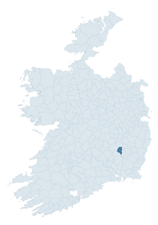
Where this barony sits in the Republic of Ireland
Geology and preservation
Bedrock geology shapes the landscape long before any settlement begins — controlling soil drainage, agricultural potential, the survival of upstanding monuments, and the preservation of buried archaeology. The figures below come from the Geological Survey Ireland 1:100,000 bedrock map.
The bedrock underlying Idrone West is predominantly limestone (43% of the barony by area), laid down during the Carboniferous period (100% by area, around 359 to 299 million years ago). Limestone is the most heritage-rich bedrock in Ireland. It supports fertile, well-drained soils that favoured dense Early Medieval settlement and Norman manorial agriculture, and it weathers into karst features — sinkholes, caves, swallow holes, and souterrains — that frequently carry archaeology. Where peat overlies limestone, organic preservation can be exceptional. A substantial secondary geology of sandstone (17%) and siltstone (14%) adds further variety to the underlying landscape. The single largest mapped unit is the Ballyadams Formation (30% of the barony's bedrock). With 7 distinct rock types mapped, the barony sits in the top third of ROI baronies for geological diversity (71st percentile) — typically a sign of complex tectonic history or coastal mosaics of differing rock units.
Rock type composition
Largest mapped unit: Ballyadams Formation (30% of the barony)
Placename evidence
Logainm records 6 heritage-diagnostic placenames for Idrone West, a modest sample drawn predominantly from the townland record. The dominant stratum is pre-christian defensive. The most frequent diagnostic roots are ráth- (3) and cill- (3). With a sample of this size the count should be treated as indicative rather than definitive.
Pre-Christian / Early Medieval Defensive
| Root | Count | Meaning |
|---|---|---|
| ráth- | 3 | earthen ringfort |
Early Christian Ecclesiastical
| Root | Count | Meaning |
|---|---|---|
| cill- | 3 | church (early) |
Other baronies in Carlow
About this profile
Click any section below to expand.
What is a barony?
A barony is a historic administrative unit in Ireland, broadly equivalent to an English hundred. The 280 baronies used here are from the OSi 2019 National Statutory Boundaries (generalised 20m), covering the 26 counties of the Republic of Ireland. Baronies derive from the Norman period, were formalised in the 17th century, and have not been redrawn for statistical purposes. They vary enormously in area, from compact urban baronies in Dublin to vast upland baronies in Connacht, and should not be compared by raw site count without accounting for area differences.
What counts as a site?
This profile combines three distinct heritage registers, each with its own definition of what constitutes a recordable site:
- Archaeological sites (NMS). The National Monuments Service Sites and Monuments Record (SMR) catalogues every known archaeological monument or site of archaeological interest in the Republic, from prehistoric burial mounds and ringforts to medieval churches and post-medieval defensive works. Inclusion does not require legal protection — only that the site has been identified, surveyed, and assessed as having archaeological value. A separate subset of these sites lies within a recorded protection zone, which gives them statutory protection under the National Monuments Acts.
- Listed buildings (NIAH). The National Inventory of Architectural Heritage records buildings of architectural, historical, archaeological, artistic, cultural, scientific, social, or technical interest. Each surveyed structure is appraised on a five-tier scale: International, National, Regional, Local, and Record-Only. The NIAH appraisal is informational rather than strictly statutory, but it underpins local-authority Record of Protected Structures (RPS) listings.
- Heritage placenames (Logainm). Logainm is the authoritative database of Irish placenames maintained by the Placenames Branch. This profile applies a heritage-diagnostic classifier to the Irish-language form of each townland name, flagging roots that signal defensive sites (ráth-, lios-, dún-, caiseal-, cathair-), ecclesiastical foundations (cill-, teampall-, domhnach-, mainistir-), prehistoric burial-ritual features (tuaim-, carn-, leaba-), or Norse-contact settlement (gall-). Townlands without one of these diagnostic roots are not flagged here — they may still carry historical significance, but that significance is not encoded in the name itself.
Editorial principles
The narrative sections of this profile follow several explicit principles:
- Evidential. Every claim about this barony’s heritage character is anchored in the underlying register data. Where a site count, a placename count, or a percentile rank is cited, it is computed from the source datasets at export time, not estimated.
- Comparative. Counts and metrics are reported alongside their percentile rank against the other 279 ROI baronies. A barony with 50 ringforts in absolute terms could be unusually high or unusually low depending on its size and regional context; percentile ranking removes that ambiguity.
- Transparent on limits. Where a register has known coverage gaps, survey biases, or data-quality issues that affect this barony’s figures, the profile flags them rather than presenting the numbers as definitive.
- No interpretation beyond what the data supports. The narrative does not speculate about historical events, social dynamics, or cultural meaning beyond what the recorded heritage and placename evidence directly attests.
Data caveats and limits
- NMS Sites and Monuments Record is the product of survey campaigns conducted at different intensities across different counties and decades. Some baronies have been surveyed more thoroughly than others, and absolute counts should be read in that light. Sites destroyed by development before survey are typically not represented; sites in heavily forested or upland terrain are sometimes under-recorded.
- NIAH coverage is broadly complete for the Republic of Ireland but the survey was conducted on a rolling county-by-county basis, and the most recent appraisal date varies. Buildings demolished or substantially altered after their original survey may still appear in the register; conversely, recent buildings of merit may not yet have been appraised.
- Logainm classification applies a deliberately conservative pattern-matching approach to the Irish-language townland forms. The classifier prioritises true positives over recall: a townland may carry a heritage signal that the classifier doesn’t recognise, particularly where the diagnostic root has been heavily anglicised or where the townland name draws on a less common term. The 60,000+ townland records and ~9,800 classified placenames give a substantial signal at barony scale, but individual townland names should be checked against Logainm directly for definitive interpretation.
- Period attribution. The chronological distribution reflects only those NMS sites that carry a recognised period attribution in the source data. Sites listed as “Unknown” period are excluded from the dated subset.
- Boundary changes. Some baronies have undergone minor boundary adjustments since their 19th-century definition; the OSi 2019 generalised boundaries used here are the current statutory definition and may differ slightly from historical maps in border areas.
- Bedrock geology is mapped at 1:100,000 scale, which means local variation within a barony — small pockets of different rock type, mineral veins, alluvium overlying bedrock — is generalised. The dominant-system and rocktype figures are area-weighted, so a barony reading “70% Carboniferous limestone” may still contain small but archaeologically important pockets of older or younger rock. Around 3% of GSI polygons do not match the lexicon and contribute no rocktype or system attribution.
Data sources
- National Monuments Service — Sites and Monuments Record (SMR) https://data.gov.ie/dataset/national-monuments-service-archaeological-survey-of-ireland
- National Inventory of Architectural Heritage (NIAH) https://data.gov.ie/dataset/national-inventory-of-architectural-heritage-niah-national-dataset
- Logainm — Placenames Database of Ireland https://www.logainm.ie/
- Ordnance Survey Ireland — National Statutory Barony Boundaries 2019 https://data-osi.opendata.arcgis.com/
- EURODEM — European Digital Elevation Model https://www.mapsforeurope.org/datasets/euro-dem
- ESA WorldCover https://esa-worldcover.org/en
- Geological Survey Ireland — 1:100,000 Bedrock Geology https://www.gsi.ie/en-ie/data-and-maps/Pages/Bedrock.aspx
Explore more: Search any of the 280 ROI baronies, browse by historical province, or read the methodology and data sources for the full Republic of Ireland Heritage Tool.