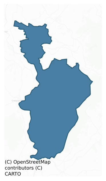
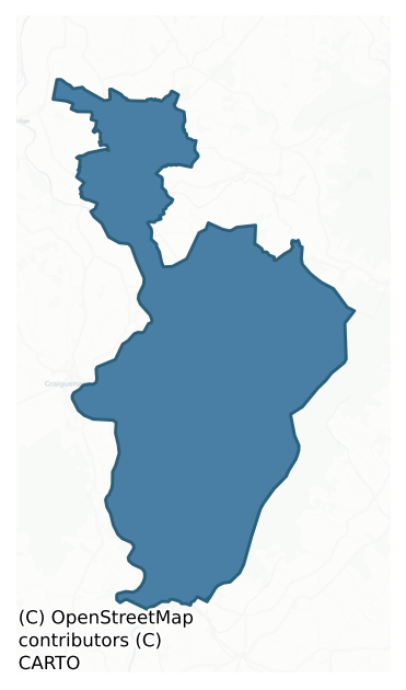
St. Mullin'S Lower is a barony of County Carlow, in the historical province of Leinster (Irish: Tigh Moling Íochtarach), covering 108 km² of land. The barony records 253 NMS archaeological sites and 45 NIAH listed buildings, placing it at around the 67th percentile among 280 ROI baronies for sites per km². This means it is in the top third of all baronies for sites per km². Dated archaeological evidence runs from the Neolithic through to the Post Medieval, spanning 7 of 9 archaeological periods, placing the barony in the 40th percentile among 280 ROI baronies for chronological depth. This means it is in the lower half of all baronies for chronological depth. The largest dated subset of recorded sites dates to the Early Bronze Age.
Heritage at a glance
Percentile rankings throughout this profile compare each barony only against the other 279 Republic of Ireland baronies.
The recorded heritage of St. Mullin's Lower
The National Monuments Service Sites and Monuments Record (SMR) is the statutory inventory of archaeological sites for the Republic of Ireland, maintained by the Department of Tourism, Culture, Arts, Gaeltacht, Sport and Media. Sites recorded here include earthworks, ringforts, megalithic tombs, ecclesiastical remains, and post-medieval features; not every record is legally protected, but each is registered as a monument of archaeological interest.
The National Monuments Service records 253 archaeological sites in St. Mullin'S Lower, putting it at the 67th percentile among 280 ROI baronies for sites per km². This means it is in the top third of all baronies for sites per km². Protection coverage is near-universal — 246 sites (97%) fall within a recorded monument protection zone, indicating an extensively surveyed landscape. The record is dominated by defensive sites — ringforts, enclosures, hillforts, and stone forts (99 sites, 39% of the total), with burial and ritual monuments forming a substantial secondary presence (48 sites, 19%). The most diagnostically specific type is Cairn – unclassified (41 records, 16% of the barony's NMS total) — compared to an ROI average of 2% across all baronies where this type occurs. Cairn – unclassified is a stone mound that cannot be assigned to a specific cairn type. The broader 'Enclosure' classification — which catches unclassified ringforts and field enclosures — accounts for a further 44 records (17%) and reflects the difficulty of sub-classifying degraded earthworks from surface evidence alone. Across the barony's 108 km², this gives a recorded density of 2.34 sites per km².
Most common monument types
Hover or tap a monument type to see its definition.
| Type | Count |
|---|---|
| Enclosure a banked or ditched feature of uncertain type, used as a catch-all where the original function cannot be determined from surface evidence | 44 |
| Cairn – unclassified a stone mound that cannot be assigned to a specific cairn type | 41 |
| Ringfort – rath an earthen ringfort enclosed by a bank and external ditch — the most common Early Medieval farmstead, broadly dated 500–1000 AD | 24 |
| Hut site a low stone or earthen foundation enclosing a small circular or oval area, generally interpreted as a former dwelling, of any date from prehistory to the medieval period | 21 |
| Earthwork an unclassified earthen structure with no diagnostic features that allow a more specific classification | 14 |
| Church a building used for public Christian worship, of any date from c. 500 AD onwards | 13 |
| Ringfort – cashel the stone-walled equivalent of the rath, found mainly in upland or western areas, broadly dated 500–1000 AD | 11 |
Chronological distribution
The dated archaeological record for St. Mullin'S Lower spans from the Neolithic through to the Post Medieval, with activity attested across 7 of 9 archaeological periods. Every period from earliest to latest is represented in the record — an unbroken sequence of dated activity across the full chronological span. Activity concentrates most heavily in the Early Bronze Age (55 sites, 32% of dated material), with the Iron Age forming a secondary peak (51 sites, 30%). A further 82 recorded sites (32% of the overall NMS register for the barony) carry no period attribution — appearing as 'Unknown' in the bar chart below. This typically reflects either records that pre-date the standardised period vocabulary or sites awaiting specialist dating review, rather than a genuine absence of chronological evidence.
Sample of recorded monuments
Show 25 sample monuments (of 253 total)
A representative sample of 25 recorded monuments drawn from the barony’s 253 total NMS entries. Sites within a recorded monument protection zone and rarer site types are prioritised so the list shows a meaningful cross-section rather than only the most common type. Each entry shows the official Sites and Monuments Record reference number and the description published by the National Monuments Service.
Enclosure – large enclosure
The following description is derived from the published 'Archaeological Inventory of County Carlow' (Dublin: Stationery Office, 1993). In certain instances the entries have been revised and updated in the light of…
The following description is derived from the published 'Archaeological Inventory of County Carlow' (Dublin: Stationery Office, 1993). In certain instances the entries have been revised and updated in the light of recent research.
Aerial photographs (CUCAP AYK 91-3; GSI S 278; GB91.DY.35) show very distinct cropmarks of four enclosures. This D-shaped enclosure is indicated by well-defined cropmarks of bank with external fosse and entrance causeway (Wth c. 6-10m) at midpoint of straight side on W (max. diam. c. 80m N-S; c. 76m E-W). There is another large enclosure c. 85m to the SSW; an enclosure (CW019-078—-) c. 40m to the N and two other enclosures (CW019-079—-; CW019-080—-) c. 10 and c. 60m N of that respectively.
Date of upload/revision: 11 December 2019
See attached photograph:
CW019-042—-_01 © CUCAP AYK092, 9 July 1969
Designed landscape feature
On an E-W ridge, in wooded area. A roughly oval shaped concentration of stones and large boulders which form an irregularly shaped mound (c. 100m NW-SE by 40m E-W). These features probably formed part of the landscape…
On an E-W ridge, in wooded area. A roughly oval shaped concentration of stones and large boulders which form an irregularly shaped mound (c. 100m NW-SE by 40m E-W). These features probably formed part of the landscape design associated with Borris house. Area heavily overgrown at time of inspection by ASI (February 2007).
Compiled by: Claire Breen
Date of upload: 26 January 2012
Font
Font ('stone reservoir') mentioned by O'Donovan (OSL 1839, 94, 95) but not located when inspected by ASI in 1987.
Compiled by: Claire Breen
Date of upload: 19 August 2011
Cross
Discovered in the late 1980's and placed loose against wall of graveyard (CW022-006004-). Free standing granite Latin cross with short stubby arms and slightly rounded top (H 44cm; max Wth 30cm). One face carved in…
Discovered in the late 1980's and placed loose against wall of graveyard (CW022-006004-). Free standing granite Latin cross with short stubby arms and slightly rounded top (H 44cm; max Wth 30cm). One face carved in false relief with initials TD and two crosses. (Carloviana 1989/90, 11)
Compiled by: Claire Breen
Date of upload: 19 August 2011
Megalithic structure
An account written in 1945 described this feature as ‘a much broken cromlech. About 18ft long [5.49m] and 8ft wide [2.44m], the huge slabs and boulders have been thrown out of position by four immense trees.’ (ITA…
An account written in 1945 described this feature as ‘a much broken cromlech. About 18ft long [5.49m] and 8ft wide [2.44m], the huge slabs and boulders have been thrown out of position by four immense trees.’ (ITA Survey 1945). The remains consist of a cairn of large boulders in and around a small copse of trees. Many of the boulders appear to be field clearance and to have been dumped there in modern times. It is possible that they could mask a megalithic structure. The precise nature of this monument is uncertain and it cannot, without further evidence, be accepted as the remains of a megalithic tomb. It is possible that the remains may mask a possible archaeological monument. (ITA Survey 1945; Brindley and Kilfeather 1993, 1, No. 3)
Compiled by: Paul Walsh
Date of upload: 1 April 2019
Megalithic tomb – portal tomb
Situated some 2.5km NE of the town of Borris, on the W side of the valley of the Glasheroge Stream which flows in a SW direction to join the Mountain River, a tributary of the River Barrow. The land in the immediate…
Situated some 2.5km NE of the town of Borris, on the W side of the valley of the Glasheroge Stream which flows in a SW direction to join the Mountain River, a tributary of the River Barrow. The land in the immediate vicinity comprises rough pasture with considerable amounts of outcropping rock and there is a dense growth of furze and bushes. An ash tree grows beside the structure at the SE. Much of the adjoining land has been reclaimed in modern times and now provides good tillage and pasture. The tomb stands on the SE side of a low hill overlooking the valley of the Glasheroge Stream and the Blackstairs Mountains form the skyline to the SE. The monument was named ‘Banshee Stone’ on both the OS Fair Plan and first and 2nd eds of the OS 6-inch map (1839, 1873). The name was positioned incorrectly on the third edition of the published OS 6-inch map (1908) and shown some 40m E of its true location. It would appear that the reviser associated the name with a natural granite erratic, 2m by 2m by 1.3m, which stands at this location.
The tomb, though partially collapsed, is fairly well preserved. The structure consists of two portal-stones and a door-stone marking the entrance at the E, a probable displaced N sidestone and a large roofstone which has slipped to the S off the portal-stones and rests on the door-stone and against the S portal. There is no evidence for a S sidestone or backstone. Two stones set in advance of the N portal-stone appear to indicate some form of elabo…
Castle – unclassified
The following description is derived from the published 'Archaeological Inventory of County Carlow' (Dublin: Stationery Office, 1993). In certain instances the entries have been revised and updated in the light of…
The following description is derived from the published 'Archaeological Inventory of County Carlow' (Dublin: Stationery Office, 1993). In certain instances the entries have been revised and updated in the light of recent research.
Date of upload/revision: 15 June 2016
Castle marked here on Down Survey (1655-6) map. This castle appears to be incorporated in Borris House. Bence-Jones (1988, 44) describes Borris House as, 'A plain 3 storey late C18 block, incorporating part of an old castle' badly damaged 1798 and restored ca 1820 by Richard and William Vitruvius Morrison who gave it a Tudor exterior and a rich and largely Classical interior. According to the National Inventory of Architectural Heritage, Borris House is a, 'Detached seven-bay three-storey over basement Tudor Revival country house, dated 1731, incorporating fabric of earlier castle, pre-1700, with render and cut stone façade enrichments. Renovated and extended, c. 1870, with projecting arcaded porch and crenellated parapet added having turret finials and service wing added to rear. Interior retains original appearance. Stable complex to rear. Walled garden to site. Freestanding folly tower, dated 1817, to site' (http://www.buildingsofireland.ie/niah/search.jsp?type=record&county=CW®no=10400802).
Hilltop enclosure
On the W edge of the Blackstairs mountain range. Enclosing the summit of a prominent hill (OD 235m) with extensive views over the valley of the River Barrow to the W and the Blackstairs are visible on the horizon to the…
On the W edge of the Blackstairs mountain range. Enclosing the summit of a prominent hill (OD 235m) with extensive views over the valley of the River Barrow to the W and the Blackstairs are visible on the horizon to the N, E and S (Redmond 2020, 37). A large enclosure (diam. c. 75m N-S; c. 80m E-W) defined along the NW sector by a grass-covered bank (overall Wth 5.6m; int. H 0.3m; ext. H 1.2m) of earth and stones, including several large boulders, several standing upright. A detailed survey of the enclosure was carried out by Redmond (2020, 37-41) and the resulting digital elevation model (ibid. fig. 8, 41), clearly shows the full extent of the monument. Rock art (CW023-013—) is to be found c. 130m NW of the hilltop enclosure, on an earth-fast boulder. It is decorated with eight groups of concentric circles (Hughes 1968, 62-3).
See attached:
KK023-014—-_01 Digital Elevation Model by James Redmond (2020, fig. 8, 41).
Compiled by: Jean Farrelly
Date of revised upload: 2 February 2021
Mass-rock
The following description is derived from the published 'Archaeological Inventory of County Carlow' (Dublin: Stationery Office, 1993). In certain instances the entries have been revised and updated in the light of…
The following description is derived from the published 'Archaeological Inventory of County Carlow' (Dublin: Stationery Office, 1993). In certain instances the entries have been revised and updated in the light of recent research.
Date of upload/revision: 17 July 2007
Large rock outcrop on which level platform (dims. 3.3m x 2.8m) has been created by building up with stone walling.
Watercourse
'St. Mullins Watercourse' indicated on the 1839 OS 6-inch map. Now dry but originally water was directed from the Aughavand River to flow along it. It commences at the junction of the boundaries of Bahana, Ballyknock…
'St. Mullins Watercourse' indicated on the 1839 OS 6-inch map. Now dry but originally water was directed from the Aughavand River to flow along it. It commences at the junction of the boundaries of Bahana, Ballyknock and Glebe townlands, directly NE of 'St Mullins Oratory'. From here it runs SE towards the ecclesiastical complex of St. Mullins, running NE of and roughly parallel to the river but at a higher level. Surviving potion was densely overgrown when inspected by ASI in 1987, a section in Templenaboe was examined and this consisted of a channel bounded on its lower side by a townland boundary wall (Wth c. 1.5m; H c. 1.1m) while the NE side was a steep scarp possibly originally stone faced.
Compiled by: Claire Breen
Date of upload: 19 August 2011
Historic town
Present remains consist of a round tower (CW026-011002-), upper portion and base of solid-wheeled cross (CW026-011003-), a motte and bailey with wall foundations visible on summit (CW026-011012-), a holy well…
Present remains consist of a round tower (CW026-011002-), upper portion and base of solid-wheeled cross (CW026-011003-), a motte and bailey with wall foundations visible on summit (CW026-011012-), a holy well (CW026-011011-). There are also the remains of six churches (CW026-011004-), (CW026-011005-), (CW026-011006-). (CW026-011007-), (CW026-011008-), (CW026-011009-) and the remains of a mill (CW026-011013-).
Compiled by: Claire Breen
Date of upload: 19 August 2011
Round tower
The following description is derived from the published 'Archaeological Inventory of County Carlow' (Dublin: Stationery Office, 1993). In certain instances the entries have been revised and updated in the light of…
The following description is derived from the published 'Archaeological Inventory of County Carlow' (Dublin: Stationery Office, 1993). In certain instances the entries have been revised and updated in the light of recent research.
Date of upload/revision: 17 July 2007
National Monument No. 003. Remains consist of four courses of granite ashlar (int. diam. 2.8m). (Bradley 1989, 60; JRSAI 1892, 383, 386)
Cross – High cross
The following description is derived from the published 'Archaeological Inventory of County Carlow' (Dublin: Stationery Office, 1993). In certain instances the entries have been revised and updated in the light of…
The following description is derived from the published 'Archaeological Inventory of County Carlow' (Dublin: Stationery Office, 1993). In certain instances the entries have been revised and updated in the light of recent research.
Date of revision: 13 April 2011
National Monument No. 003. Upper portion and base of solid-wheeled cross. Base and shaft decorated. Wheel shows large figure of Christ (total present H 1.6m). (Bradley 1989, 60-1). (Harbison 1992, 165 (entry 198)).
References:
Bradley, J. 1989 County Carlow: Urban Archaeological Survey. Unpublished report, OPW.
Harbison, P. 1992 The high crosses of Ireland; An iconographical and photographic survey 3 vols. Royal Irish Academy, Dublin; Dr. Rudolf Habelt GMBH, Bonn.
Building
The following description is derived from the published 'Archaeological Inventory of County Carlow' (Dublin: Stationery Office, 1993). In certain instances the entries have been revised and updated in the light of…
The following description is derived from the published 'Archaeological Inventory of County Carlow' (Dublin: Stationery Office, 1993). In certain instances the entries have been revised and updated in the light of recent research.
Date of upload/revision: 17 July 2007
National Monument No. 003. Rectangular structure (dims. 11m x 6m) of uncoursed granite rubble (H of walls c. 5m). Lintelled doorway in W gable. E gable has diamond-shaped ope and two wall niches. Lintelled window in S wall towards SW corner. Fireplace in N wall. (Bradley 1989, 59 (D); JRSAI 1892, 382-3)
Castle – motte and bailey
The following description is derived from the published 'Archaeological Inventory of County Carlow' (Dublin: Stationery Office, 1993). In certain instances the entries have been revised and updated in the light of…
The following description is derived from the published 'Archaeological Inventory of County Carlow' (Dublin: Stationery Office, 1993). In certain instances the entries have been revised and updated in the light of recent research.
Date of upload/revision: 17 July 2007
Situated on ridge overlooking river to W. Steep-sided mound (diam. c. 40m; H 9m) enclosed by deep wide fosse and outer bank at N and E (D of fosse below bank c. 4m; base Wth of fosse 3m). Rectangular bailey (dims. 24m x 46m) at NW, enclosed by low bank and external fosse (Wth c. 3m). Traces of wall foundations visible on summit of motte and on bailey. (Bradley 1989, 56-7)
Mill – unclassified
The following description is derived from the published 'Archaeological Inventory of County Carlow' (Dublin: Stationery Office, 1993). In certain instances the entries have been revised and updated in the light of…
The following description is derived from the published 'Archaeological Inventory of County Carlow' (Dublin: Stationery Office, 1993). In certain instances the entries have been revised and updated in the light of recent research.
Date of upload/revision: 17 July 2007
Town known to have had mills since pre-Norman times. Existing rectangular structure has no diagnostic features. (Bradley 1989, 56; JRSAI 1892, 383)
Children's burial ground
Children's burial ground here according to local tradition.
Compiled by: Claire Breen
Date of upload: 19 August 2011
Graveslab
Thirteenth or fourteenth century granite grave slab with Maltese cross and four roundels in false relief set in a niche in the south wall of church (CW026-011005-). (Bradley 1989, 61)
Reference:
Bradley, J. 1989…
Thirteenth or fourteenth century granite grave slab with Maltese cross and four roundels in false relief set in a niche in the south wall of church (CW026-011005-). (Bradley 1989, 61)
Reference:
Bradley, J. 1989 County Carlow: Urban Archaeological Survey. Unpublished report, OPW.
Compiled by: Claire Breen
Date of upload: 19 August 2011
Ecclesiastical enclosure
Church (CW026-005001-) stands in a roughly triangular enclosure (max. Wth c. 35m N-S; max. L c. 70m E-W) with original bank visible from SE-S-SW.
Compiled by: Claire Breen
Date of upload: 19 August 2011
Charcoal-making site
On a very steep NW-facing slope of Blackstairs Mountain, in coniferous forestry. There are extensive views SW-W-N overlooking the plain of the River Barrow.
A charcoal-making platform, suitable for a mound kiln,…
On a very steep NW-facing slope of Blackstairs Mountain, in coniferous forestry. There are extensive views SW-W-N overlooking the plain of the River Barrow.
A charcoal-making platform, suitable for a mound kiln, identified by Michael Monahan and Edward Butler. It is similar to charcoal-making platforms (CW023-035—- to CW023-039—-; CW023-041—- and CW023-042—-) on the SW-facing slope of Knockroe hill, part of the Blackstairs mountain range, c. 6km to the NE. It consists of a roughly oval level platform (dims. 7.9m NE-SW; 6.8m NW-SE). The rear SE portion of the platform is cut into the natural slope (H 1.05m) and has been revetted with stones and boulders. The NW edge (H 1m) is defined by scarp with a revetment of two stone courses, which in turn appears to rests on a slightly wider revetted platform (H 0.35m; Wth 0.7m), though this may just be caused by collaspsed revetment. The NE edge is defined by a slight scarp with some boulders evident but the SW edge is not very clearly defined and was probably damaged by the tree plantation.
See attached photographs:
CW025-010—-_01 From E with ranging-rod in interior
CW025-010—-_02 Front NW scarp in foreground, looking at rear SE scarp
Compiled by: Jean Farrelly
Date of upload: 25 May 2022
Cairn – ring-cairn
Situated on a summit of the Blackstairs Mountains known as Poul Art. This is a flat-topped caim (diam. of top 5-7m; diam. of base 19m; H 1.7-2m) with some quarry holes excavated in it. It is surrounded by a…
Situated on a summit of the Blackstairs Mountains known as Poul Art. This is a flat-topped caim (diam. of top 5-7m; diam. of base 19m; H 1.7-2m) with some quarry holes excavated in it. It is surrounded by a grass-covered bank of stones (Wth 3m; H 0.3-0.5m) which is separated from the cairn by berm (Wth 2m) except from W-N where it is immediately adjacent. The bank is absent from E-S.
The above description is derived from the published 'Archaeological Inventory of County Wexford' (Dublin: Stationery Office, 1996). In certain instances the entries have been revised and updated in the light of recent research.
Compiled by: Michael Moore
Date of upload/revision: 22 May, 2012
Mound
The following description is derived from the published 'Archaeological Inventory of County Carlow' (Dublin: Stationery Office, 1993). In certain instances the entries have been revised and updated in the light of…
The following description is derived from the published 'Archaeological Inventory of County Carlow' (Dublin: Stationery Office, 1993). In certain instances the entries have been revised and updated in the light of recent research.
Date of upload/revision: 17 July 2007
Conical mound (diam. c. 5.5m; max. H 1.8m) of stone and earth construction. Some large stones visible.
Fulacht fia
The following description is derived from the published 'Archaeological Inventory of County Carlow' (Dublin: Stationery Office, 1993). In certain instances the entries have been revised and updated in the light of…
The following description is derived from the published 'Archaeological Inventory of County Carlow' (Dublin: Stationery Office, 1993). In certain instances the entries have been revised and updated in the light of recent research.
Date of upload/revision: 17 July 2007
During reclamation of ill-drained area, spread of what appeared to be burnt stone and black soil uncovered. No visible surface traces.
Fulacht fia
The following description is derived from the published 'Archaeological Inventory of County Carlow' (Dublin: Stationery Office, 1993). In certain instances the entries have been revised and updated in the light of…
The following description is derived from the published 'Archaeological Inventory of County Carlow' (Dublin: Stationery Office, 1993). In certain instances the entries have been revised and updated in the light of recent research.
Date of upload/revision: 17 July 2007
Area of burnt stone and soil reportedly uncovered during reclamation work (diam. c. 35m).
Enclosure
On the northern foothills of Dranagh Mountain, a southern outlier of the Blackstairs Mountains, in an area of dense heather cover. An oval enclosure (c. 30m N-S; c. 35m E-W) identified by Séamus Ó Murchú on Bing…
On the northern foothills of Dranagh Mountain, a southern outlier of the Blackstairs Mountains, in an area of dense heather cover. An oval enclosure (c. 30m N-S; c. 35m E-W) identified by Séamus Ó Murchú on Bing satellite imagery (Ó Murchú 2016). Curvilinear banks immediately S and SW of the enclosure may be part of a relict field system (ibid.).
See attached satellite image (Digitalgoble, viewed 22 December 2020)
Compiled by: Jean Farrelly
Date of upload: 22 December 2020
Listed buildings
The National Inventory of Architectural Heritage (NIAH) is a state survey appraising buildings of architectural, historical, archaeological, artistic, cultural, scientific, social, or technical interest. Each surveyed structure receives a rating from International (the highest, for buildings of European importance) through National, Regional, Local, and Record-Only.
The NIAH records 45 listed buildings in St. Mullin'S Lower (21st percentile across ROI baronies). The highest-graded structure include 1 of National significance. The Republic holds 937 National-graded buildings in total, so this barony accounts for around 0% of the national total. Construction dates concentrate most heavily in the Victorian (1830-1900) period. The most-recorded building type is house (10 examples, 22% of the listed stock).
Terrain and environment
Mean elevation across the barony is 106m — the 62nd percentile among 280 ROI baronies for elevation. This means it is in the upper half of all baronies for elevation. Elevation matters for heritage because higher-altitude baronies typically favour defensive monuments — ringforts and hilltop forts placed on prominent ground — while lowland baronies are more likely to carry the dense settlement and church networks of intensive agricultural landscapes. The barony reaches 730m at its highest point — a vertical span of more than 624m within its boundary, indicating significant topographic diversity. Mean slope is 6.0° — the 83rd percentile among 280 ROI baronies for slope. This means it is in the top fifth of all baronies for slope. This is consistently steep terrain by ROI standards, the kind of landscape that tends to preserve upstanding archaeological features well. Slope is a key control on both land use and archaeological preservation: steep ground resists ploughing and tends to preserve earthworks intact, while gentle slopes favour intensive cultivation that damages or destroys surface archaeology over time. Localised maximum slopes reach 19°, typical of stream-cut valleys, escarpments, or coastal bluffs within the wider landscape. The Topographic Wetness Index averages 9.9, the 20th percentile among 280 ROI baronies for wetness. This means it is in the bottom third of all baronies for wetness. This is well-drained ground by ROI standards — typical of upland or steeply-sloping country that sheds water rapidly. Drainage matters for heritage because poorly-drained ground preserves organic archaeology (wooden trackways, leather, textiles, and on rare occasions human remains) far better than free-draining soil; well-drained ground favours arable use but destroys organic material rapidly. The land cover is dominated by improved grassland (78%) and woodland (18%). In overall character, this is steeply-sloping terrain at modest elevation, with land use dominated by improved grassland.
Terrain measurements
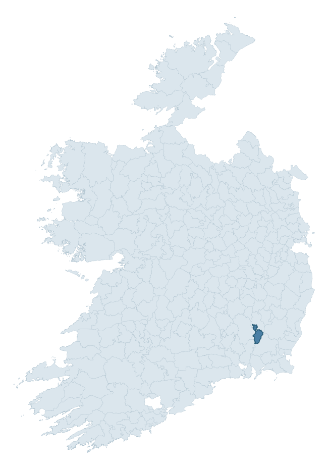
Where this barony sits in the Republic of Ireland
Geology and preservation
Bedrock geology shapes the landscape long before any settlement begins — controlling soil drainage, agricultural potential, the survival of upstanding monuments, and the preservation of buried archaeology. The figures below come from the Geological Survey Ireland 1:100,000 bedrock map.
The bedrock underlying St. Mullin'S Lower is predominantly granite (97% of the barony by area), laid down during the Caledonian period (99% by area, during the Caledonian orogeny (around 490–390 million years ago)). Granite weathers slowly and produces thin, acidic, often poorly-drained soils that historically limited arable agriculture but favoured pastoralism, upland settlement, and the construction of stone monuments. Granite-dominated landscapes typically carry fewer ringforts but a higher density of megalithic tombs, standing stones, and stone circles, which survive well against the resistant bedrock. The single largest mapped unit is the Type 2 Equigranular Granite (Blackstairs Granite) (67% of the barony's bedrock). With only 2 distinct rock types mapped, the barony is geologically uniform compared to the rest of the Republic (16th percentile for diversity) — a single coherent bedrock landscape.
Rock type composition
Largest mapped unit: Type 2 Equigranular Granite (Blackstairs Granite) (67% of the barony)
Placename evidence
Logainm records 7 heritage-diagnostic placenames for St. Mullin'S Lower, a modest sample drawn predominantly from the townland record. The dominant stratum is early christian ecclesiastical. The most frequent diagnostic roots are cill- (3) and ráth- (1). With a sample of this size the count should be treated as indicative rather than definitive.
Pre-Christian / Early Medieval Defensive
| Root | Count | Meaning |
|---|---|---|
| ráth- | 1 | earthen ringfort |
| lios- | 1 | ringfort or enclosure |
| dún- | 1 | hilltop or promontory fort |
Early Christian Ecclesiastical
| Root | Count | Meaning |
|---|---|---|
| cill- | 3 | church (early) |
| teampall- | 1 | church (later medieval) |
Other baronies in Carlow

Explore further
Grounding History: 10 Maps of Northern Ireland’s Past
If you’re interested in Irish heritage more widely, the companion report for Northern Ireland brings together the analysis of all 462 NI wards into one place through 10 high-quality maps — covering monument density, archaeological periods, placename heritage, terrain, wetland, and the historic landscape at first survey. Take a look.
About this profile
Click any section below to expand.
What is a barony?
A barony is a historic administrative unit in Ireland, broadly equivalent to an English hundred. The 280 baronies used here are from the OSi 2019 National Statutory Boundaries (generalised 20m), covering the 26 counties of the Republic of Ireland. Baronies derive from the Norman period, were formalised in the 17th century, and have not been redrawn for statistical purposes. They vary enormously in area, from compact urban baronies in Dublin to vast upland baronies in Connacht, and should not be compared by raw site count without accounting for area differences.
What counts as a site?
This profile combines three distinct heritage registers, each with its own definition of what constitutes a recordable site:
- Archaeological sites (NMS). The National Monuments Service Sites and Monuments Record (SMR) catalogues every known archaeological monument or site of archaeological interest in the Republic, from prehistoric burial mounds and ringforts to medieval churches and post-medieval defensive works. Inclusion does not require legal protection — only that the site has been identified, surveyed, and assessed as having archaeological value. A separate subset of these sites lies within a recorded protection zone, which gives them statutory protection under the National Monuments Acts.
- Listed buildings (NIAH). The National Inventory of Architectural Heritage records buildings of architectural, historical, archaeological, artistic, cultural, scientific, social, or technical interest. Each surveyed structure is appraised on a five-tier scale: International, National, Regional, Local, and Record-Only. The NIAH appraisal is informational rather than strictly statutory, but it underpins local-authority Record of Protected Structures (RPS) listings.
- Heritage placenames (Logainm). Logainm is the authoritative database of Irish placenames maintained by the Placenames Branch. This profile applies a heritage-diagnostic classifier to the Irish-language form of each townland name, flagging roots that signal defensive sites (ráth-, lios-, dún-, caiseal-, cathair-), ecclesiastical foundations (cill-, teampall-, domhnach-, mainistir-), prehistoric burial-ritual features (tuaim-, carn-, leaba-), or Norse-contact settlement (gall-). Townlands without one of these diagnostic roots are not flagged here — they may still carry historical significance, but that significance is not encoded in the name itself.
Editorial principles
The narrative sections of this profile follow several explicit principles:
- Evidential. Every claim about this barony’s heritage character is anchored in the underlying register data. Where a site count, a placename count, or a percentile rank is cited, it is computed from the source datasets at export time, not estimated.
- Comparative. Counts and metrics are reported alongside their percentile rank against the other 279 ROI baronies. A barony with 50 ringforts in absolute terms could be unusually high or unusually low depending on its size and regional context; percentile ranking removes that ambiguity.
- Transparent on limits. Where a register has known coverage gaps, survey biases, or data-quality issues that affect this barony’s figures, the profile flags them rather than presenting the numbers as definitive.
- No interpretation beyond what the data supports. The narrative does not speculate about historical events, social dynamics, or cultural meaning beyond what the recorded heritage and placename evidence directly attests.
Data caveats and limits
- NMS Sites and Monuments Record is the product of survey campaigns conducted at different intensities across different counties and decades. Some baronies have been surveyed more thoroughly than others, and absolute counts should be read in that light. Sites destroyed by development before survey are typically not represented; sites in heavily forested or upland terrain are sometimes under-recorded.
- NIAH coverage is broadly complete for the Republic of Ireland but the survey was conducted on a rolling county-by-county basis, and the most recent appraisal date varies. Buildings demolished or substantially altered after their original survey may still appear in the register; conversely, recent buildings of merit may not yet have been appraised.
- Logainm classification applies a deliberately conservative pattern-matching approach to the Irish-language townland forms. The classifier prioritises true positives over recall: a townland may carry a heritage signal that the classifier doesn’t recognise, particularly where the diagnostic root has been heavily anglicised or where the townland name draws on a less common term. The 60,000+ townland records and ~9,800 classified placenames give a substantial signal at barony scale, but individual townland names should be checked against Logainm directly for definitive interpretation.
- Period attribution. The chronological distribution reflects only those NMS sites that carry a recognised period attribution in the source data. Sites listed as “Unknown” period are excluded from the dated subset.
- Boundary changes. Some baronies have undergone minor boundary adjustments since their 19th-century definition; the OSi 2019 generalised boundaries used here are the current statutory definition and may differ slightly from historical maps in border areas.
- Bedrock geology is mapped at 1:100,000 scale, which means local variation within a barony — small pockets of different rock type, mineral veins, alluvium overlying bedrock — is generalised. The dominant-system and rocktype figures are area-weighted, so a barony reading “70% Carboniferous limestone” may still contain small but archaeologically important pockets of older or younger rock. Around 3% of GSI polygons do not match the lexicon and contribute no rocktype or system attribution.
Data sources
- National Monuments Service — Sites and Monuments Record (SMR) https://data.gov.ie/dataset/national-monuments-service-archaeological-survey-of-ireland
- National Inventory of Architectural Heritage (NIAH) https://data.gov.ie/dataset/national-inventory-of-architectural-heritage-niah-national-dataset
- Logainm — Placenames Database of Ireland https://www.logainm.ie/
- Ordnance Survey Ireland — National Statutory Barony Boundaries 2019 https://data-osi.opendata.arcgis.com/
- EURODEM — European Digital Elevation Model https://www.mapsforeurope.org/datasets/euro-dem
- ESA WorldCover https://esa-worldcover.org/en
- Geological Survey Ireland — 1:100,000 Bedrock Geology https://www.gsi.ie/en-ie/data-and-maps/Pages/Bedrock.aspx
Explore more: Search any of the 280 ROI baronies, browse by historical province, or read the methodology and data sources for the full Republic of Ireland Heritage Tool.