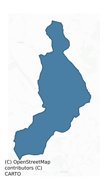
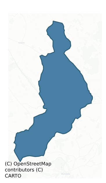
St. Mullin'S Upper is a barony of County Carlow, in the historical province of Leinster (Irish: Tigh Moling Uachtarach), covering 31.5 km² of land. The barony records 27 NMS archaeological sites and 11 NIAH listed buildings, placing it at around the 6th percentile among 280 ROI baronies for sites per km². This means it is in the bottom tenth of all baronies for sites per km². Dated archaeological evidence runs from the Early Bronze Age through to the Medieval, spanning 4 of 9 archaeological periods, placing the barony in the 4th percentile among 280 ROI baronies for chronological depth. This means it is in the bottom tenth of all baronies for chronological depth. The largest dated subset of recorded sites dates to the Iron Age.
Heritage at a glance
Percentile rankings throughout this profile compare each barony only against the other 279 Republic of Ireland baronies.
The recorded heritage of St. Mullin's Upper
The National Monuments Service Sites and Monuments Record (SMR) is the statutory inventory of archaeological sites for the Republic of Ireland, maintained by the Department of Tourism, Culture, Arts, Gaeltacht, Sport and Media. Sites recorded here include earthworks, ringforts, megalithic tombs, ecclesiastical remains, and post-medieval features; not every record is legally protected, but each is registered as a monument of archaeological interest.
The National Monuments Service records 27 archaeological sites in St. Mullin'S Upper, putting it at the 6th percentile among 280 ROI baronies for sites per km². This means it is in the bottom tenth of all baronies for sites per km². A sparse recorded total of this kind in Ireland often reflects survey priority rather than genuine absence of past activity. Protection coverage is near-universal — 27 sites (100%) fall within a recorded monument protection zone, indicating an extensively surveyed landscape. The record is dominated by defensive sites — ringforts, enclosures, hillforts, and stone forts (10 sites, 37% of the total), with ecclesiastical sites forming a substantial secondary presence (9 sites, 33%). The most diagnostically specific type is Ringfort – rath (2 records, 7% of the barony's NMS total) — compared to an ROI average of 20% across all baronies where this type occurs. Ringfort – rath is an earthen ringfort enclosed by a bank and external ditch — the most common Early Medieval farmstead, broadly dated 500–1000 AD. The broader 'Enclosure' classification — which catches unclassified ringforts and field enclosures — accounts for a further 6 records (22%) and reflects the difficulty of sub-classifying degraded earthworks from surface evidence alone.
Most common monument types
Hover or tap a monument type to see its definition.
| Type | Count |
|---|---|
| Enclosure a banked or ditched feature of uncertain type, used as a catch-all where the original function cannot be determined from surface evidence | 6 |
| Ringfort – rath an earthen ringfort enclosed by a bank and external ditch — the most common Early Medieval farmstead, broadly dated 500–1000 AD | 2 |
| Church a building used for public Christian worship, of any date from c. 500 AD onwards | 2 |
| Graveslab a recumbent grave-marking slab, dated 1200–1700 AD | 2 |
| Graveyard a burial area associated with a church, in use from the medieval period onwards | 2 |
| Ring-ditch a circular ditch under 20m across, often the ploughed-out remains of a barrow, ring-barrow or roundhouse | 2 |
| Cairn – unclassified a stone mound that cannot be assigned to a specific cairn type | 1 |
Chronological distribution
The dated archaeological record for St. Mullin'S Upper spans from the Early Bronze Age through to the Medieval, with activity attested across 4 of 9 archaeological periods. This is the 4th percentile across ROI baronies — a relatively narrow chronological band, with much of Irish prehistory not represented in the dated record. The record is near-continuous, with only the Middle Late Bronze Age period falling inside the span without any recorded sites. Activity concentrates most heavily in the Iron Age (9 sites, 53% of dated material), with the Early Medieval forming a secondary peak (5 sites, 29%). A further 10 recorded sites (37% of the overall NMS register for the barony) carry no period attribution — appearing as 'Unknown' in the bar chart below. This typically reflects either records that pre-date the standardised period vocabulary or sites awaiting specialist dating review, rather than a genuine absence of chronological evidence.
Sample of recorded monuments
Show 25 sample monuments (of 27 total)
A representative sample of 25 recorded monuments drawn from the barony’s 27 total NMS entries. Sites within a recorded monument protection zone and rarer site types are prioritised so the list shows a meaningful cross-section rather than only the most common type. Each entry shows the official Sites and Monuments Record reference number and the description published by the National Monuments Service.
Barrow – mound barrow
The following description is derived from the published 'Archaeological Inventory of County Carlow' (Dublin: Stationery Office, 1993). In certain instances the entries have been revised and updated in the light of…
The following description is derived from the published 'Archaeological Inventory of County Carlow' (Dublin: Stationery Office, 1993). In certain instances the entries have been revised and updated in the light of recent research.
Date of upload/revision: 17 July 2007
Large circular earthen mound (H 3m; base diam. 20m) small portion of what may be drystone walling (three courses of small granite boulders) visible in eroded W side. Appears superficially to be one side of splayed entrance feature.
Cairn – unclassified
The following description is derived from the published 'Archaeological Inventory of County Carlow' (Dublin: Stationery Office, 1993). In certain instances the entries have been revised and updated in the light of…
The following description is derived from the published 'Archaeological Inventory of County Carlow' (Dublin: Stationery Office, 1993). In certain instances the entries have been revised and updated in the light of recent research.
Date of upload/revision: 17 July 2007
Large cairn (H 2.8m; diam. 22m) delimited by kerb of granite boulders, visible only at N and S.
Earthwork
The following description is derived from the published 'Archaeological Inventory of County Carlow' (Dublin: Stationery Office, 1993). In certain instances the entries have been revised and updated in the light of…
The following description is derived from the published 'Archaeological Inventory of County Carlow' (Dublin: Stationery Office, 1993). In certain instances the entries have been revised and updated in the light of recent research.
Date of upload/revision: 17 July 2007
Very defaced traces of bank visible at SE in area now defined by irregular curve in field boundary and dump of field clearance stones (diam. c. 30m). Possibly a ringfort.
Castle – unclassified
The following description is derived from the published 'Archaeological Inventory of County Carlow' (Dublin: Stationery Office, 1993). In certain instances the entries have been revised and updated in the light of…
The following description is derived from the published 'Archaeological Inventory of County Carlow' (Dublin: Stationery Office, 1993). In certain instances the entries have been revised and updated in the light of recent research.
Date of upload/revision: 17 July 2007
According to Fitzgerald (JKAS 1912-14, 127), Manor of Clonogan belonged to Earls of Kildare in sixteenth century. Forfeited to Crown in 1534. Valuation of manor made in 1540 found 'the chief dwelling of the Manor of "Cloneogan" was formerly a castle, … but now ruinous, waste and uninhabited …' Marked on Down Survey (1655-6) map and described as 'an old castle'. Present remains consist of rectangular enclosure (45m x 35m) defined by ploughed-out remains of two banks with intervening fosse, visible at S, and at E where fosse is occasionally visible as cropmark. At NW and NE the banks are overlain by road and modern field boundary respectively. N portion of interior is raised above S portion. Materials from castle used to build Clonogan House about 1820.
Architectural fragment
According to OS letters (O' Flanagan 1934, 428 (132)), Clonogan House was constructed of material from Clonagan Castle (CW018-013001-).
Reference:
O' Flanagan Ed, 1934 Letters containing information relative to…
According to OS letters (O' Flanagan 1934, 428 (132)), Clonogan House was constructed of material from Clonagan Castle (CW018-013001-).
Reference:
O' Flanagan Ed, 1934 Letters containing information relative to the Antiquities of Carlow collected during the progress of the Ordnance Survey in 1839.
Compiled by: Claire Breen
Date of upload: 19 August 2011
Ritual site – holy well
The following description is derived from the published 'Archaeological Inventory of County Carlow' (Dublin: Stationery Office, 1993). In certain instances the entries have been revised and updated in the light of…
The following description is derived from the published 'Archaeological Inventory of County Carlow' (Dublin: Stationery Office, 1993). In certain instances the entries have been revised and updated in the light of recent research.
Date of upload/revision: 17 July 2007
According to O'Donovan (OSL 1839, 132), 'patron' held here until 1798.
Ecclesiastical enclosure
Possible traces of an outer enclosure around church (CW018-016001-) and ringfort (CW018-016007-) visible on GSAP photo (Roll 4: 1, 2). Not visible at ground level when inspected by ASI in 1988.
Compiled by: Claire…
Possible traces of an outer enclosure around church (CW018-016001-) and ringfort (CW018-016007-) visible on GSAP photo (Roll 4: 1, 2). Not visible at ground level when inspected by ASI in 1988.
Compiled by: Claire Breen
Date of upload: 19 August 2011
Cross
Cross base of socketed squared granite boulder within graveyard (CW018-016006-) to S of church.
Compiled by: Claire Breen
Date of upload: 19 August 2011
House – fortified house
The following description is derived from the published 'Archaeological Inventory of County Carlow' (Dublin: Stationery Office, 1993). In certain instances the entries have been revised and updated in the light of…
The following description is derived from the published 'Archaeological Inventory of County Carlow' (Dublin: Stationery Office, 1993). In certain instances the entries have been revised and updated in the light of recent research.
Date of upload/revision: 17 July 2007
Castellated house of many periods, the earliest built in 1625, probably not tower house, but semi-fortified seventeenth-century house, which would be appropriate to the proportions of the front façade of the present structure. Extended in c. 1680, with further additions in 1720 and 1860. Apparently described by Down Survey as house ('There is a Bridge over the River Derrin neare the said House') which further suggests a building which was not heavily fortified. Still occupied. External examination only. (Bence-Jones 1978, 157)
Bullaun stone
The following description is derived from the published 'Archaeological Inventory of County Carlow' (Dublin: Stationery Office, 1993). In certain instances the entries have been revised and updated in the light of…
The following description is derived from the published 'Archaeological Inventory of County Carlow' (Dublin: Stationery Office, 1993). In certain instances the entries have been revised and updated in the light of recent research.
Date of upload/revision: 17 July 2007
Large granite boulder, possibly still in original position in grounds of Huntington Castle (CW018-018—-). Single rather shallow basin (diam. 0.33m; D 0.21m).
Enclosure – large enclosure
In tillage. A large sub-circular enclosure (dims. c. 74m NE-SW; c. 62m NW-SE) visible as a cropmark on Google Earth (imagery date 14 July 2018) identified and reported by Simon Dowling. A curving field boundary,…
In tillage. A large sub-circular enclosure (dims. c. 74m NE-SW; c. 62m NW-SE) visible as a cropmark on Google Earth (imagery date 14 July 2018) identified and reported by Simon Dowling. A curving field boundary, indicated on the 1st ed. OS 6-inch map, defines the NE-E sector. A field boundary, also visible as a cropmark, runs NW-SE c. 5m NE of the enclosure and may be contemporary with it.
See attached Google Earth image (imagery date 14 July 2018)
Compiled by: Jean Farrelly
Date of upload: 29 January 2020
Ringfort – rath
The following description is derived from the published 'Archaeological Inventory of County Carlow' (Dublin: Stationery Office, 1993). In certain instances the entries have been revised and updated in the light of…
The following description is derived from the published 'Archaeological Inventory of County Carlow' (Dublin: Stationery Office, 1993). In certain instances the entries have been revised and updated in the light of recent research.
Date of upload/revision: 17 July 2007
Circular area (diam. 28m) enclosed by earthen bank (H 0.4m) on hilltop, incorporated into field system. No visible trace of fosse or entrance. Interior has been partially planted.
Church
The following description is derived from the published 'Archaeological Inventory of County Carlow' (Dublin: Stationery Office, 1993). In certain instances the entries have been revised and updated in the light of…
The following description is derived from the published 'Archaeological Inventory of County Carlow' (Dublin: Stationery Office, 1993). In certain instances the entries have been revised and updated in the light of recent research.
Date of revision: 16 December 2009
Revised by: J. Farrelly
Tickell (JKAS 1960, 408) mentions reference to church or chapel in 'Moyacan' now Clonegall, in Royal Grant of 1627 to Sir Maurice Eustace. Down Survey records church as 'ruined' in 1650. Present remains consist of central raised mound (H c. 3m) enclosed by fosse with external bank visible from W-N-NE, elsewhere modified by extention of graveyard (CW018-016006-). Nineteenth-century church now stands on mound. Cross base of socketed squared granite boulder. Quern stone found in graveyard in 1902 (JAPMD 1905, 192) and placed in present church. Earthwork is probably ringfort in origin although also resembles modified motte.
Graveslab
One of two exceptionally weathered granite graveslabs (see also CW018-016005-). One with incised cross.
Compiled by: Claire Breen
Date of upload: 19 August 2011
Graveslab
One of two exceptionally weathered granite graveslabs (see also CW018-016004-). One with incised cross.
Compiled by: Claire Breen
Date of upload: 19 August 2011
Church
The following description is derived from the published 'Archaeological Inventory of County Carlow' (Dublin: Stationery Office, 1993). In certain instances the entries have been revised and updated in the light of…
The following description is derived from the published 'Archaeological Inventory of County Carlow' (Dublin: Stationery Office, 1993). In certain instances the entries have been revised and updated in the light of recent research.
Date of upload/revision: 16 December 2009
Revised by: J. Farrelly
According to ITA Survey (1945), founded by St Abban in early sixth century. Subsequently attached to St Thomas' Abbey, Dublin. The 1839 'OS 6-inch' map shows remains of structure described by O'Donovan (OSL 1839, 119) as 'foundations… measuring thirty nine feet in length and twenty feet in breath. There is a small and little-frequented graveyard attached to the old site'. Leask (1941, OPW file) recorded traces of church of granite, with one piece of chamfered door jamb lying loose. No visible traces of either church or graveyard (CW018-017002-). Single eighteenth-century headstone lies on site.
Graveyard
According to ITA Survey (1945), founded by St Abban in the early sixth century. Subsequently attached to St Thomas' Abbey, Dublin. It is depicted by a dashed line on the 1839 'OS 6-inch' map, rectangular in shape with…
According to ITA Survey (1945), founded by St Abban in the early sixth century. Subsequently attached to St Thomas' Abbey, Dublin. It is depicted by a dashed line on the 1839 'OS 6-inch' map, rectangular in shape with the church (CW018-017001-) in the NW angle. O'Donovan (OSL 1839, 119) refers to 'a small and little-frequented graveyard attached to the old site'. By the latest 6-inch ed. the graveyard is roughly D-shaped (map dims. 26m E-W along straight N side, c. 24m N-S) and the church is no longer visible, being depicted by a cross. No visible traces of either church or graveyard. Single eighteenth-century headstone lies on site.
Compiled by: Jean Farrelly
Date of upload: 19 August 2011
Graveyard
Tickell (JKAS 1960, 408) mentions reference to church or chapel in 'Moyacan' now Clonegall, in Royal Grant of 1627 to Sir Maurice Eustace. Down Survey records church (CW018-016001-) as 'ruined' in 1650. Present remains…
Tickell (JKAS 1960, 408) mentions reference to church or chapel in 'Moyacan' now Clonegall, in Royal Grant of 1627 to Sir Maurice Eustace. Down Survey records church (CW018-016001-) as 'ruined' in 1650. Present remains consist of central raised mound (H c. 3m) enclosed by fosse with external bank visible from W-N-NE, elsewhere modified by extension of graveyard. Nineteenth-century church now stands on mound. Cross base of socketed squared granite boulder. Quern stone found in graveyard in 1902 (JAPMD 1905, 192) and placed in present church. Earthwork is probably ringfort in origin although also resembles modified motte. Graveyard is depicted on the latest OS 6-inch map as a sub-rectangular enclosure (map dims. c. 56m N-S; c. 58m E-W).
Compiled by: Jean Farrelly
Date of upload: 19 August 2011
Ringfort – rath
Central raised mound (H c. 3m) enclosed by fosse with external bank visible from W-N-NE, levelled from S to W where car park has been constructed and modified at SE-S by extension of graveyard…
Central raised mound (H c. 3m) enclosed by fosse with external bank visible from W-N-NE, levelled from S to W where car park has been constructed and modified at SE-S by extension of graveyard (CW018-016006-).
Compiled by: Claire Breen
Date of upload: 19 August 2011
Ring-ditch
In tillage. A small circular enclosure (diam. c. 13m) identified as the cropmark of a fosse on satellite imagery (Digitalglobe, viewed 7 December 2021). A similarly sized enclosure (CW018-023—-) overlaps the NE…
In tillage. A small circular enclosure (diam. c. 13m) identified as the cropmark of a fosse on satellite imagery (Digitalglobe, viewed 7 December 2021). A similarly sized enclosure (CW018-023—-) overlaps the NE sector. A larger enclosure (CW018-071—-) is also visible as a cropmark c. 40m to the SW.
See attached:
CW018-022—-_01 satellite imagery (Digitalglobe, viewed 7 December 2021)
Compiled by: Jean Farrelly
Date of upload: 7 December 2021
Ring-ditch
In tillage. A small circular enclosure (diam. c. 13m) identified as the cropmark of a fosse on satellite imagery (Digitalglobe, viewed 7 December 2021). A similarly sized enclosure (CW018-022—-) appears to underlie…
In tillage. A small circular enclosure (diam. c. 13m) identified as the cropmark of a fosse on satellite imagery (Digitalglobe, viewed 7 December 2021). A similarly sized enclosure (CW018-022—-) appears to underlie the SW sector. A larger enclosure (CW018-071—-) is also visible as a cropmark c. 40m to the SW.
See attached:
CW018-023—-_01 satellite imagery (Digitalglobe, viewed 7 December 2021)
Compiled by: Jean Farrelly
Date of upload: 7 December 2021
Enclosure
The following description is derived from the published 'Archaeological Inventory of County Carlow' (Dublin: Stationery Office, 1993). In certain instances the entries have been revised and updated in the light of…
The following description is derived from the published 'Archaeological Inventory of County Carlow' (Dublin: Stationery Office, 1993). In certain instances the entries have been revised and updated in the light of recent research.
Date of upload/revision: 17 July 2007
Marked on 1908 'OS 6-inch' map as circular enclosure. Visible on aerial photograph (GSI S 262) as cropmark of bank with entrance gap at SE, enclosing circular area (est max. diam. c. 35m). No visible surface traces. Possibly a ringfort.
Enclosure
The following description is derived from the published 'Archaeological Inventory of County Carlow' (Dublin: Stationery Office, 1993). In certain instances the entries have been revised and updated in the light of…
The following description is derived from the published 'Archaeological Inventory of County Carlow' (Dublin: Stationery Office, 1993). In certain instances the entries have been revised and updated in the light of recent research.
Date of upload/revision: 17 July 2007
Aerial photograph (GSI S 261) shows cropmark of what appears to be circular enclosure adjacent to now abandoned farmyard (est max. diam. c. 40m). Possibly a ringfort. No visible surface traces.
Enclosure
The following description is derived from the published 'Archaeological Inventory of County Carlow' (Dublin: Stationery Office, 1993). In certain instances the entries have been revised and updated in the light of…
The following description is derived from the published 'Archaeological Inventory of County Carlow' (Dublin: Stationery Office, 1993). In certain instances the entries have been revised and updated in the light of recent research.
Date of upload/revision: 17 July 2007
Shown on 1839 'OS 6-inch' map as large circular enclosure (max. diam. c. 70m). Adjacent field boundaries as shown on 1908 OS 6" map have been levelled. No visible surface traces.
Enclosure
Rectangular enclosure (45m x 35m) in which Castle (CW018-013001-) once stood. Defined by ploughed-out remains of two banks with intervening fosse, visible at S, and at E where fosse is occasionally visible as cropmark.…
Rectangular enclosure (45m x 35m) in which Castle (CW018-013001-) once stood. Defined by ploughed-out remains of two banks with intervening fosse, visible at S, and at E where fosse is occasionally visible as cropmark. At N and W the banks are overlain by road and modern field boundary respectively. N portion of interior is raised above S portion.
Compiled by: Claire Breen
Date of upload: 19 August 2011
Listed buildings
The National Inventory of Architectural Heritage (NIAH) is a state survey appraising buildings of architectural, historical, archaeological, artistic, cultural, scientific, social, or technical interest. Each surveyed structure receives a rating from International (the highest, for buildings of European importance) through National, Regional, Local, and Record-Only.
The NIAH records only 11 listed buildings in St. Mullin'S Upper, the 3rd percentile across ROI baronies — a relatively thin architectural record. The highest-graded structure include 1 of National significance. The Republic holds 937 National-graded buildings in total, so this barony accounts for around 0% of the national total. Construction dates concentrate most heavily in the Victorian (1830-1900) period.
Terrain and environment
Mean elevation across the barony is 106m — the 64th percentile among 280 ROI baronies for elevation. This means it is in the upper half of all baronies for elevation. Elevation matters for heritage because higher-altitude baronies typically favour defensive monuments — ringforts and hilltop forts placed on prominent ground — while lowland baronies are more likely to carry the dense settlement and church networks of intensive agricultural landscapes. The barony reaches 326m at its highest point — a vertical span of more than 219m within its boundary, indicating significant topographic diversity. Mean slope is 5.7° — the 80th percentile among 280 ROI baronies for slope. This means it is in the top fifth of all baronies for slope. This is consistently steep terrain by ROI standards, the kind of landscape that tends to preserve upstanding archaeological features well. Slope is a key control on both land use and archaeological preservation: steep ground resists ploughing and tends to preserve earthworks intact, while gentle slopes favour intensive cultivation that damages or destroys surface archaeology over time. The Topographic Wetness Index averages 9.7, the 13th percentile among 280 ROI baronies for wetness. This means it is in the bottom fifth of all baronies for wetness. This is well-drained ground by ROI standards — typical of upland or steeply-sloping country that sheds water rapidly. Drainage matters for heritage because poorly-drained ground preserves organic archaeology (wooden trackways, leather, textiles, and on rare occasions human remains) far better than free-draining soil; well-drained ground favours arable use but destroys organic material rapidly. The land-cover mosaic combines improved grassland (60%), arable farmland (19%), and woodland (18%), giving a mixed agricultural and semi-natural landscape. In overall character, this is steeply-sloping terrain at modest elevation, with land use dominated by improved grassland.
Terrain measurements
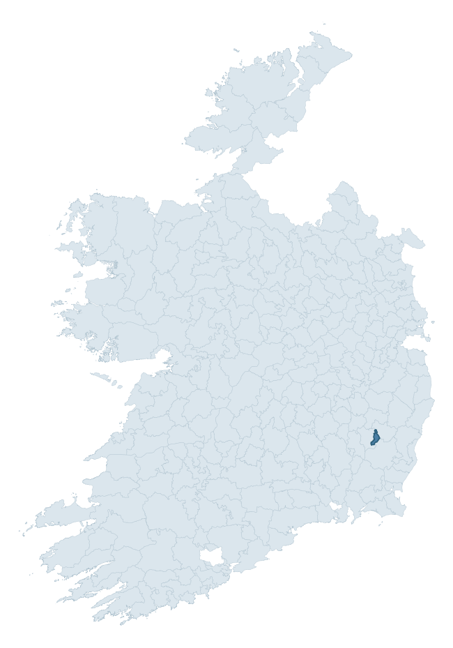
Where this barony sits in the Republic of Ireland
Geology and preservation
Bedrock geology shapes the landscape long before any settlement begins — controlling soil drainage, agricultural potential, the survival of upstanding monuments, and the preservation of buried archaeology. The figures below come from the Geological Survey Ireland 1:100,000 bedrock map.
The bedrock underlying St. Mullin'S Upper is predominantly schist (42% of the barony by area), laid down during the Ordovician period (60% by area, around 485 to 444 million years ago). Schist forms upland, often steep terrain with thin soils that limited agriculture but favoured the construction of stone-built monuments and field walls. Schist landscapes commonly carry megalithic monuments and prehistoric ritual sites. A substantial secondary geology of granite (40%) adds further variety to the underlying landscape. The single largest mapped unit is the Ballybeg Member (Maulin Formation) (42% of the barony's bedrock).
Rock type composition
Largest mapped unit: Ballybeg Member (Maulin Formation) (43% of the barony)
Placename evidence
The Logainm record for St. Mullin'S Upper contains only 2 heritage-diagnostic placenames — 2 cill-names and 1 gall-name. With this few records, the count should be read as indicative rather than as a firm characterisation of the linguistic heritage layers; a larger sample would be needed to reliably distinguish defensive, ecclesiastical, or other stratigraphic signals from chance occurrence.
Early Christian Ecclesiastical
| Root | Count | Meaning |
|---|---|---|
| cill- | 2 | church (early) |
Burial, Ritual, and Norse-Contact
| Root | Count | Meaning |
|---|---|---|
| gall- | 1 | foreigner — Norse settlement marker |
Other baronies in Carlow
About this profile
Click any section below to expand.
What is a barony?
A barony is a historic administrative unit in Ireland, broadly equivalent to an English hundred. The 280 baronies used here are from the OSi 2019 National Statutory Boundaries (generalised 20m), covering the 26 counties of the Republic of Ireland. Baronies derive from the Norman period, were formalised in the 17th century, and have not been redrawn for statistical purposes. They vary enormously in area, from compact urban baronies in Dublin to vast upland baronies in Connacht, and should not be compared by raw site count without accounting for area differences.
What counts as a site?
This profile combines three distinct heritage registers, each with its own definition of what constitutes a recordable site:
- Archaeological sites (NMS). The National Monuments Service Sites and Monuments Record (SMR) catalogues every known archaeological monument or site of archaeological interest in the Republic, from prehistoric burial mounds and ringforts to medieval churches and post-medieval defensive works. Inclusion does not require legal protection — only that the site has been identified, surveyed, and assessed as having archaeological value. A separate subset of these sites lies within a recorded protection zone, which gives them statutory protection under the National Monuments Acts.
- Listed buildings (NIAH). The National Inventory of Architectural Heritage records buildings of architectural, historical, archaeological, artistic, cultural, scientific, social, or technical interest. Each surveyed structure is appraised on a five-tier scale: International, National, Regional, Local, and Record-Only. The NIAH appraisal is informational rather than strictly statutory, but it underpins local-authority Record of Protected Structures (RPS) listings.
- Heritage placenames (Logainm). Logainm is the authoritative database of Irish placenames maintained by the Placenames Branch. This profile applies a heritage-diagnostic classifier to the Irish-language form of each townland name, flagging roots that signal defensive sites (ráth-, lios-, dún-, caiseal-, cathair-), ecclesiastical foundations (cill-, teampall-, domhnach-, mainistir-), prehistoric burial-ritual features (tuaim-, carn-, leaba-), or Norse-contact settlement (gall-). Townlands without one of these diagnostic roots are not flagged here — they may still carry historical significance, but that significance is not encoded in the name itself.
Editorial principles
The narrative sections of this profile follow several explicit principles:
- Evidential. Every claim about this barony’s heritage character is anchored in the underlying register data. Where a site count, a placename count, or a percentile rank is cited, it is computed from the source datasets at export time, not estimated.
- Comparative. Counts and metrics are reported alongside their percentile rank against the other 279 ROI baronies. A barony with 50 ringforts in absolute terms could be unusually high or unusually low depending on its size and regional context; percentile ranking removes that ambiguity.
- Transparent on limits. Where a register has known coverage gaps, survey biases, or data-quality issues that affect this barony’s figures, the profile flags them rather than presenting the numbers as definitive.
- No interpretation beyond what the data supports. The narrative does not speculate about historical events, social dynamics, or cultural meaning beyond what the recorded heritage and placename evidence directly attests.
Data caveats and limits
- NMS Sites and Monuments Record is the product of survey campaigns conducted at different intensities across different counties and decades. Some baronies have been surveyed more thoroughly than others, and absolute counts should be read in that light. Sites destroyed by development before survey are typically not represented; sites in heavily forested or upland terrain are sometimes under-recorded.
- NIAH coverage is broadly complete for the Republic of Ireland but the survey was conducted on a rolling county-by-county basis, and the most recent appraisal date varies. Buildings demolished or substantially altered after their original survey may still appear in the register; conversely, recent buildings of merit may not yet have been appraised.
- Logainm classification applies a deliberately conservative pattern-matching approach to the Irish-language townland forms. The classifier prioritises true positives over recall: a townland may carry a heritage signal that the classifier doesn’t recognise, particularly where the diagnostic root has been heavily anglicised or where the townland name draws on a less common term. The 60,000+ townland records and ~9,800 classified placenames give a substantial signal at barony scale, but individual townland names should be checked against Logainm directly for definitive interpretation.
- Period attribution. The chronological distribution reflects only those NMS sites that carry a recognised period attribution in the source data. Sites listed as “Unknown” period are excluded from the dated subset.
- Boundary changes. Some baronies have undergone minor boundary adjustments since their 19th-century definition; the OSi 2019 generalised boundaries used here are the current statutory definition and may differ slightly from historical maps in border areas.
- Bedrock geology is mapped at 1:100,000 scale, which means local variation within a barony — small pockets of different rock type, mineral veins, alluvium overlying bedrock — is generalised. The dominant-system and rocktype figures are area-weighted, so a barony reading “70% Carboniferous limestone” may still contain small but archaeologically important pockets of older or younger rock. Around 3% of GSI polygons do not match the lexicon and contribute no rocktype or system attribution.
Data sources
- National Monuments Service — Sites and Monuments Record (SMR) https://data.gov.ie/dataset/national-monuments-service-archaeological-survey-of-ireland
- National Inventory of Architectural Heritage (NIAH) https://data.gov.ie/dataset/national-inventory-of-architectural-heritage-niah-national-dataset
- Logainm — Placenames Database of Ireland https://www.logainm.ie/
- Ordnance Survey Ireland — National Statutory Barony Boundaries 2019 https://data-osi.opendata.arcgis.com/
- EURODEM — European Digital Elevation Model https://www.mapsforeurope.org/datasets/euro-dem
- ESA WorldCover https://esa-worldcover.org/en
- Geological Survey Ireland — 1:100,000 Bedrock Geology https://www.gsi.ie/en-ie/data-and-maps/Pages/Bedrock.aspx
Explore more: Search any of the 280 ROI baronies, browse by historical province, or read the methodology and data sources for the full Republic of Ireland Heritage Tool.