
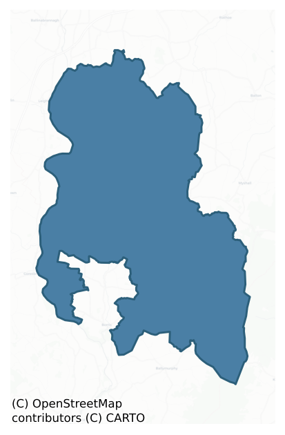
Idrone East is a barony of County Carlow, in the historical province of Leinster (Irish: Uí Dhróna Thoir), covering 195 km² of land. The barony records 382 NMS archaeological sites and 65 NIAH listed buildings, placing it at around the 54th percentile among 280 ROI baronies for sites per km². This means it is in the upper half of all baronies for sites per km². Dated archaeological evidence runs from the Neolithic through to the Post Medieval, spanning 7 of 9 archaeological periods, placing the barony in the 23rd percentile among 280 ROI baronies for chronological depth. This means it is in the bottom third of all baronies for chronological depth. The largest dated subset of recorded sites dates to the Iron Age. Logainm flags 33 placenames in the barony as carrying a recognised heritage root; the largest share — around 52% — are names associated with early Christian church and monastic foundations.
Heritage at a glance
Percentile rankings throughout this profile compare each barony only against the other 279 Republic of Ireland baronies.
The recorded heritage of Idrone East
The National Monuments Service Sites and Monuments Record (SMR) is the statutory inventory of archaeological sites for the Republic of Ireland, maintained by the Department of Tourism, Culture, Arts, Gaeltacht, Sport and Media. Sites recorded here include earthworks, ringforts, megalithic tombs, ecclesiastical remains, and post-medieval features; not every record is legally protected, but each is registered as a monument of archaeological interest.
The National Monuments Service records 382 archaeological sites in Idrone East, putting it at the 54th percentile among 280 ROI baronies for sites per km². This means it is in the upper half of all baronies for sites per km². Protection coverage is near-universal — 349 sites (91%) fall within a recorded monument protection zone, indicating an extensively surveyed landscape. The dominant category is defensive sites — ringforts, enclosures, hillforts, and stone forts (165 sites, 43% of the record). The most diagnostically specific type is Ring-ditch (29 records, 8% of the barony's NMS total) — compared to an ROI average of 6% across all baronies where this type occurs. Ring-ditch is a circular ditch under 20m across, often the ploughed-out remains of a barrow, ring-barrow or roundhouse. The broader 'Enclosure' classification — which catches unclassified ringforts and field enclosures — accounts for a further 99 records (26%) and reflects the difficulty of sub-classifying degraded earthworks from surface evidence alone. Across the barony's 195 km², this gives a recorded density of 1.96 sites per km².
Most common monument types
Hover or tap a monument type to see its definition.
| Type | Count |
|---|---|
| Enclosure a banked or ditched feature of uncertain type, used as a catch-all where the original function cannot be determined from surface evidence | 99 |
| Ring-ditch a circular ditch under 20m across, often the ploughed-out remains of a barrow, ring-barrow or roundhouse | 29 |
| Ringfort – rath an earthen ringfort enclosed by a bank and external ditch — the most common Early Medieval farmstead, broadly dated 500–1000 AD | 28 |
| Earthwork an unclassified earthen structure with no diagnostic features that allow a more specific classification | 18 |
| Church a building used for public Christian worship, of any date from c. 500 AD onwards | 17 |
| Rock art geometric and other motifs carved on earthfast boulders or rock outcrops, mainly Bronze Age but with possible Neolithic origins | 13 |
| Graveyard a burial area associated with a church, in use from the medieval period onwards | 11 |
| Ritual site – holy well a well or spring traditionally associated with a saint, often credited with healing properties; many trace earlier ritual origins but devotion is documented from the medieval period onwards | 10 |
Chronological distribution
The dated archaeological record for Idrone East spans from the Neolithic through to the Post Medieval, with activity attested across 7 of 9 archaeological periods. This is the 23rd percentile across ROI baronies — a relatively narrow chronological band, with much of Irish prehistory not represented in the dated record. Every period from earliest to latest is represented in the record — an unbroken sequence of dated activity across the full chronological span. Activity concentrates most heavily in the Iron Age (109 sites, 49% of dated material), with the Early Medieval forming a secondary peak (51 sites, 23%). A further 159 recorded sites (42% of the overall NMS register for the barony) carry no period attribution — appearing as 'Unknown' in the bar chart below. This typically reflects either records that pre-date the standardised period vocabulary or sites awaiting specialist dating review, rather than a genuine absence of chronological evidence.
Sample of recorded monuments
Show 25 sample monuments (of 382 total)
A representative sample of 25 recorded monuments drawn from the barony’s 382 total NMS entries. Sites within a recorded monument protection zone and rarer site types are prioritised so the list shows a meaningful cross-section rather than only the most common type. Each entry shows the official Sites and Monuments Record reference number and the description published by the National Monuments Service.
Cross – High cross (present location)
Portion of shaft, head and base of granite cross. Slightly protruding arms and small wheel, both outlined with low moulding. Boss on one side of the pyramidal base. Formerly in field known as 'The Church Field' (JRSAI…
Portion of shaft, head and base of granite cross. Slightly protruding arms and small wheel, both outlined with low moulding. Boss on one side of the pyramidal base. Formerly in field known as 'The Church Field' (JRSAI 1907, 218, 236), now standing by roadside (see CW012-044001- for original location). Well (CW012-044003-), reputed to be holy, existed in same field but has been covered by road widening.
Compiled by: Claire Breen
Date of upload: 19 August 2011
Historic town
Town of Leighlinbridge or New Leighlin is sited at a crossing point on the river Barrow, less than a mile N of Ballyknockan or Bungage motte (CW016-003—-), which was the castle of Leighlin built before 1186. Date of…
Town of Leighlinbridge or New Leighlin is sited at a crossing point on the river Barrow, less than a mile N of Ballyknockan or Bungage motte (CW016-003—-), which was the castle of Leighlin built before 1186. Date of founding of settlement is unknown but it may have been in existence by 1275-6 (Bradley 1989, 32). It was definitely a borough by 1292 (ibid 33). See CW012-070001- to CW012-070005- for description of main archaeological remains within town.
Compiled by: Claire Breen
Date of upload: 19 August 2011
Town defences
Murage grant made in 1310 (IRC 1829, 43-4). Remains consist of circular turret without distinguishable features and adjacent portion of wall (H 3.5m; L c. 10m). Defences may have originally only have been on E bank of…
Murage grant made in 1310 (IRC 1829, 43-4). Remains consist of circular turret without distinguishable features and adjacent portion of wall (H 3.5m; L c. 10m). Defences may have originally only have been on E bank of town. (Bradley 1989, 36)
Archaeological testing programmes undertaken in both 2002 and 2006 exposed remains of the 16th century bawn wall associated with the garrison (CW012-070005-) and tower house (CW012-070003-). (Byrne M. 2004, 15; Byrne M. 2009; 46).
The above description is derived from the published 'Archaeological Inventory of County Carlow' (Dublin: Stationery Office, 1993). In certain instances the entries have been revised and updated in the light of recent research.
Date of revision: 3 September 2010
Revised by: Claire Breen
Castle – tower house
The following description is derived from the published 'Archaeological Inventory of County Carlow' (Dublin: Stationery Office, 1993). In certain instances the entries have been revised and updated in the light of…
The following description is derived from the published 'Archaeological Inventory of County Carlow' (Dublin: Stationery Office, 1993). In certain instances the entries have been revised and updated in the light of recent research.
Date of upload/revision: 17 July 2007
National Monument No. 438. Known as 'Black Castle'. Constructed in 1320 to defend bridge (CW012-070002-) and possibly comtemporary in original construction. Present remains appear to be chiefly of sixteenth-century date and consist of rectangular structure (collapsed SE corner) with barrel vault over ground floor and attic, with one floor above, situated on E bank of River Barrow. Entrance in E wall, protected by machicolation and murder hole in window seat, leads to mural staircase giving access to attic floor and spiral staircase above vault. Two small chambers in curtains of vault. Bawn at N and W. Wall walks are covered on N and S walls, and open with crennelations on E and W walls, with corbelled chamber over stair turret at NE angle. Narrow opes with window seats in N, S and W walls. (Bradley 1989, 36-8)
Religious house – Carmelite friars
The following description is derived from the published 'Archaeological Inventory of County Carlow' (Dublin: Stationery Office, 1993). In certain instances the entries have been revised and updated in the light of…
The following description is derived from the published 'Archaeological Inventory of County Carlow' (Dublin: Stationery Office, 1993). In certain instances the entries have been revised and updated in the light of recent research.
Date of upload/revision: 17 July 2007
Carmelite Priory of St Mary. Considered to be site of earliest Carmelite foundation in Ireland (Gwynn and Hadcock 1970, 298). Located S of tower house (CW012-070003-). Suppressed in 1541 and used subsequently as a barracks. No visible trace. (Bradley 1989, 38).
Flat cemetery
The following description is derived from the published 'Archaeological Inventory of County Carlow' (Dublin: Stationery Office, 1993). In certain instances the entries have been revised and updated in the light of…
The following description is derived from the published 'Archaeological Inventory of County Carlow' (Dublin: Stationery Office, 1993). In certain instances the entries have been revised and updated in the light of recent research.
Date of upload/revision: 17 July 2007
Found prior to 1793. 'Numerous urns placed in low, narrow and long vaults' were 'of coarse earthenware … each closed by a cover … The garden under which they were found is the site or cemetery of a monastery founded by one of the Carews for the Carmelites …' (Anon. 1793, 274; JRSAI 1970, 109). Carmelite priory was located SE of bridge.
Concentric enclosure
Aerial photographs (CUCAP BDH 89, 90; GB90.AT.15, 30 May 1990) show cropmark of two concentric widely spaced banks each with narrow defining fosses on both sides (max. diam. c. 50m). No visible trace at ground level.…
Aerial photographs (CUCAP BDH 89, 90; GB90.AT.15, 30 May 1990) show cropmark of two concentric widely spaced banks each with narrow defining fosses on both sides (max. diam. c. 50m). No visible trace at ground level. Cropmarks are faint but very regular. Treble ring-barrow or ring-ditch site c 100m to NW (CW016-093—-).
See attached Google Earth image (imagery date 14 July 2018)
The above description is derived from the published 'Archaeological Inventory of County Carlow' (Dublin: Stationery Office, 1993). In this instance the entry has been revised and updated in the light of recent research.
Revised by: Jean Farrelly
Date of upload: 29 January 2020
Settlement deserted – medieval
The Borough of Dunleckny was established before 1207 and appears to have been abandoned in the fourteenth century (Bradley and King 1989, 20). Present remains consist of a large oval mound (CW016-085001-) and church…
The Borough of Dunleckny was established before 1207 and appears to have been abandoned in the fourteenth century (Bradley and King 1989, 20). Present remains consist of a large oval mound (CW016-085001-) and church (CW016-085002-) which was granted to the nunnery of Graney in Kildare in 1207.
Compiled by: Claire Breen
Date of upload: 19 August 2011
Castle – motte
The following description is derived from the published 'Archaeological Inventory of County Carlow' (Dublin: Stationery Office, 1993). In certain instances the entries have been revised and updated in the light of…
The following description is derived from the published 'Archaeological Inventory of County Carlow' (Dublin: Stationery Office, 1993). In certain instances the entries have been revised and updated in the light of recent research.
Date of upload/revision: 17 July 2007
Large oval mound (dims. 110m NW-SE; 70m NE-SW) to W of church (CW008-033002-), possibly a motte. (Bradley 1989, 21)
Barrow – ring-barrow
The following description is derived from the published 'Archaeological Inventory of County Carlow' (Dublin: Stationery Office, 1993). In certain instances the entries have been revised and updated in the light of…
The following description is derived from the published 'Archaeological Inventory of County Carlow' (Dublin: Stationery Office, 1993). In certain instances the entries have been revised and updated in the light of recent research.
Date of upload/revision: 17 July 2007
Aerial photographs (CUCAP BDH 89; GSI S 435) show cropmark of large circular enclosure with three concentric fosses (est max. diam. c. 100m). See also Rathellin ring-ditch (CW016-007—-).
Aerial photograph (GB89.P.03) shows cropmark of a circular enclosure defined by three concentric fosses, with evidence of a plough-levelled mound at centre. Comparable to Fenniscourt Barrow (CW016-064).
See attached Google Earth image (imagery date 14 July 2018)
Bibliography
Barrett, G.F. 'Early landscapes in County Carlow: an aerial perspective, in T. McGrath and T. O'Keefe (eds), County Carlow: History and Society, Geography Publications, Dublin. Forthcoming 2008.
Barrett , G.F. (2002) 'Flights of discovery: archaeological air survey in Ireland, 1989-2000' in the Journal of Irish Archaeology, XI, 2002., pp. 1-30.
Barrett, G.F. (1999) 'Relevé aérien d'archéologie en Irlande, in Archeologie Aerienne: Actes du colloque du festival international d'archéologie d'Amiens. Revue archaeologie de Picardie special 17/1999. APPAH Ministère de la culture, Amiens et de l'Université de Picardie, pp. 245-52. ISSN 0752-5656 .
Barrett, G.F. (1997) 'Recovering the hidden landscape' in F.H.A. Aalen, K. Whelan and M. S…
Gatehouse
To the E of Anglo-Norman masonry castle (CW019-018—-). Rectangular gatehouse with two circular towers of three storeys flanking arched entranceway.
Compiled by: Claire Breen
Date of upload: 19 August 2011
Graveslab
OS Letters noted a grave-slab dating to 1625 inside church at Ballyellen.
Compiled by: Claire Breen
Date of upload: 19 August 2011
Cairn – ring-cairn
On a flat break of an E-facing slope, in upland, hilly terrain, under pasture. The views are very good N, Tomduff Hill dominates from NE-SE and Mount Leinster peeks behind this hill to the E. From S-W the view is…
On a flat break of an E-facing slope, in upland, hilly terrain, under pasture. The views are very good N, Tomduff Hill dominates from NE-SE and Mount Leinster peeks behind this hill to the E. From S-W the view is extensive, however, it is impeded W by the rise in slope. There is a hawthorn tree growing in the SE quadrant. An oval partially grass-covered cairn (H c. 0.6m; dims. 11.7m N-S; 7.5m E-W) defined by kerbstones, some contiguous, particularly in the NE quadrant. In the northern half of the monument, particularly the NE quadrant there is evidence of internal kerbing, creating a kerbed bank (Wth 1.8m). In the NW the bank (Wth 2.6m) is grass covered and there is more slip. In the southern half the edge of the monument is defined by scarp and some kerbstones, the largest being a large quartz boulder in the SSW. The interior is lower than the enclosing bank and, while generally clear of cairn material, has some upright stones similar in size to the kerbstones. There is an area of disturbance in the W sector where the monument appears to have been dug into in the past. In the resulting hollow there is a large boulder, likely to have been dumped there as part of field clearance activity.
Photogrpahs:
CW019-069—-_01 Overall view from NE
CW019-069—-_02 Overall view from SE
CW019-069—-_03 Detail of kerbing in NE quadrant, from the N
CW019-069—-_04 Detail of kerbing in NE quadrant, particularly internal kerb, from NNW
Compiled by: Jean Farrelly
Date of rev…
House – 16th/17th century
OS letters noted a house still standing which belonged to a man who died in 1625. No visible remains at ground level although it appears to be visible on an aerial photograph (CUCAP BGH 17).
Compiled by: Claire…
OS letters noted a house still standing which belonged to a man who died in 1625. No visible remains at ground level although it appears to be visible on an aerial photograph (CUCAP BGH 17).
Compiled by: Claire Breen
Date of upload: 19 August 2011
Children's burial ground
Noted by O' Donovan (OSL 1837-40). Immediately N of graveyard (CW020-002005-), consisting of small unenclosed uncultivated rectangular area, marked by plain granite Latin cross (CW020-002003-).
Compiled by: Claire…
Noted by O' Donovan (OSL 1837-40). Immediately N of graveyard (CW020-002005-), consisting of small unenclosed uncultivated rectangular area, marked by plain granite Latin cross (CW020-002003-).
Compiled by: Claire Breen
Date of upload: 19 August 2011
Stone row
Marked 'The Ninestones' on the 1839 OS 6-inch map. On the E side of the pass between Slievebawn and the Black Banks and Mount Leinster. Nine low stones set in alignment orientated E-W (L 11.5m; distance between stones…
Marked 'The Ninestones' on the 1839 OS 6-inch map. On the E side of the pass between Slievebawn and the Black Banks and Mount Leinster. Nine low stones set in alignment orientated E-W (L 11.5m; distance between stones 1m-1.2m; H of stones 0.38m – 0.63m). According to OS Field Namebooks, erected to commemorate nine men murdered and buried nearby.
While the extant remains are hardly sufficient to permit classification as a stone row with certainty the remains bear close resemblance to many monuments of this class. In light of the tradition recorded by the OS the interpretation given must be regarded as tentative and a proper elucidation of the monument must await further investigation.
Compiled by: Claire Breen
Date of upload: 19 August 2011
Ecclesiastical enclosure
Possible extension of ecclesiastical enclosure surrounding church (CW022-017001-) visible to W on aerial photograph (CUCAP, BDS 37).
Compiled by: Claire Breen
Date of upload: 19 August 2011
Mass-rock
Beside Lady's well (CW022-054001-) according to local information. Dense vegetation and a deep scarp prevented access in 1987.
Compiled by: Claire Breen
Date of upload: 19 August 2011
Graveslab (present location)
The following description is derived from the published 'Archaeological Inventory of County Carlow' (Dublin: Stationery Office, 1993). In certain instances the entries have been revised and updated in the light of…
The following description is derived from the published 'Archaeological Inventory of County Carlow' (Dublin: Stationery Office, 1993). In certain instances the entries have been revised and updated in the light of recent research.
Date of upload/revision: 17 July 2007
Slightly tapering, squared granite pillar, (H 1.36m; 0.31-0.24m x 0.26m). Maltese cross in relief (0.31m x 0.39m). Date uncertain. Now used as gate pillar.
Quarry
This record was formerly classed as 'enclosure' in the SMR based on its appearance on aerial photographs (CUCAP AYL 13-15). It was subsequently test excavated prior and turned out to be a backfilled quarry pit…
This record was formerly classed as 'enclosure' in the SMR based on its appearance on aerial photographs (CUCAP AYL 13-15). It was subsequently test excavated prior and turned out to be a backfilled quarry pit (McLoughlin C. 2006, 9).
Compiled by: Claire Breen
Date of upload: 1 September 2010
Enclosure – large enclosure
In tillage. A large circular enclosure (diam. c. 80m) identified on Google Earth Pro imagery (imagery date 14 July 2018). There is an enclosure (CW019-042—-) c. 85m to the NNE; an enclosure (CW019-128—-) c. 67m to…
In tillage. A large circular enclosure (diam. c. 80m) identified on Google Earth Pro imagery (imagery date 14 July 2018). There is an enclosure (CW019-042—-) c. 85m to the NNE; an enclosure (CW019-128—-) c. 67m to the SW and a ring-ditch (CW019-129—-) c. 90m to the W.
See attached photograph:
CW019-130—-_01 Image ©2019 CNEW/Airbus: Google Earth Pro satellite imagery (14 July 2018)
Compiled by: Jean Farrelly
Date of upload: 11 December 2019
Building
On the lower SW-facing slopes of Knockoe hill, S of Mount Leinster on the western flanks of the Blackstairs Mountains. In very rocky terrain on a steep SW-facing hillslope strewn with granite boulders. This portion of…
On the lower SW-facing slopes of Knockoe hill, S of Mount Leinster on the western flanks of the Blackstairs Mountains. In very rocky terrain on a steep SW-facing hillslope strewn with granite boulders. This portion of the hillside is planted with coniferous forestry. There are extensive views to the W, overlooking the Aughnabrisky River valley to the S-SW.
A ruinous small rectangular building (int. dims. 2.62m NE-SW; 1.68m NW-SE) constructed of dry-stone walling (surviving H above int. c. 1m; above exterior 0.5-1.1m; wall T 0.6-0.8) consisting of large boulders with smaller stones filling any gaps. It survives to a maximum of three courses high. There is an entrance (Wth 0.74m) in the SW wall, positioned W of centre. A large conifer is growing in the entrance. There is moss-covered collapsed walling externally to the NW and SE. The rear NE wall (H 1m) only survives to the height of the external slope with which it is level.
There are numerous charcoal-making platforms (KK023-035—- to KK023-039—-; KK023-041—- and KK023-042—-) on this hillside and it is possible that this building was associated with this activity.
See attached photographs:
CW023-043—-_01 From SW with ranging-rod in interior
CW023-043—-_02 From NW with ranging-rod in interior
CW023-043—-_03 From NE with ranging-rod in interior
Compiled by: Jean Farrelly
Date of upload: 23 May 2022
Stone head
The following description is derived from the published 'Archaeological Inventory of County Carlow' (Dublin: Stationery Office, 1993). In certain instances the entries have been revised and updated in the light of…
The following description is derived from the published 'Archaeological Inventory of County Carlow' (Dublin: Stationery Office, 1993). In certain instances the entries have been revised and updated in the light of recent research.
Date of upload/revision: 17 July 2007
One of two granite corbels (see also CW012-085002-) for mantle shelf, showing portraits of man and woman. Apparently taken from Ballymoon by present owner. Dress details suggest thirteenth-century date.
Architectural fragment
A small stone (diam 0.1m; D 0.12m) with a circular cavity probably a spud stone and a large boulder (L 1.5m; Wth 0.9m; H 0.85m) with a deep rectangular hollow were discovered during an inspection carried out in February…
A small stone (diam 0.1m; D 0.12m) with a circular cavity probably a spud stone and a large boulder (L 1.5m; Wth 0.9m; H 0.85m) with a deep rectangular hollow were discovered during an inspection carried out in February 1989 following the removal of the remains of the church (CW016-032001-). Both are located alongside a single bullaun stone (CW016-032007-).
Compiled by: Claire Breen
Date of upload: 19 August 2011
Enclosure
The following description is derived from the published 'Archaeological Inventory of County Carlow' (Dublin: Stationery Office, 1993). In certain instances the entries have been revised and updated in the light of…
The following description is derived from the published 'Archaeological Inventory of County Carlow' (Dublin: Stationery Office, 1993). In certain instances the entries have been revised and updated in the light of recent research.
Date of upload/revision: 17 July 2007
Aerial photograph (CUCAP BDR 48) shows circular area surrounded by cropmark of fosse (est max. diam. c. 50m). Possibly a ringfort on slight rise.
Listed buildings
The National Inventory of Architectural Heritage (NIAH) is a state survey appraising buildings of architectural, historical, archaeological, artistic, cultural, scientific, social, or technical interest. Each surveyed structure receives a rating from International (the highest, for buildings of European importance) through National, Regional, Local, and Record-Only.
The NIAH records 65 listed buildings in Idrone East (33rd percentile across ROI baronies). The highest-graded structure include 1 of National significance. The Republic holds 937 National-graded buildings in total, so this barony accounts for around 0% of the national total. Construction dates concentrate most heavily in the Victorian (1830-1900) period.
Terrain and environment
Mean elevation across the barony is 127m — the 76th percentile among 280 ROI baronies for elevation. This means it is in the top third of all baronies for elevation. This is a relatively elevated landscape by ROI standards. Elevation matters for heritage because higher-altitude baronies typically favour defensive monuments — ringforts and hilltop forts placed on prominent ground — while lowland baronies are more likely to carry the dense settlement and church networks of intensive agricultural landscapes. The barony reaches 792m at its highest point — a vertical span of more than 665m within its boundary, indicating significant topographic diversity. Mean slope is 5.0° — the 73rd percentile among 280 ROI baronies for slope. This means it is in the top third of all baronies for slope. Slope is a key control on both land use and archaeological preservation: steep ground resists ploughing and tends to preserve earthworks intact, while gentle slopes favour intensive cultivation that damages or destroys surface archaeology over time. Localised maximum slopes reach 16°, typical of stream-cut valleys, escarpments, or coastal bluffs within the wider landscape. The Topographic Wetness Index averages 10.3, the 29th percentile among 280 ROI baronies for wetness. This means it is in the bottom third of all baronies for wetness. Drainage matters for heritage because poorly-drained ground preserves organic archaeology (wooden trackways, leather, textiles, and on rare occasions human remains) far better than free-draining soil; well-drained ground favours arable use but destroys organic material rapidly. The land-cover mosaic combines improved grassland (70%), arable farmland (17%), and woodland (12%), giving a mixed agricultural and semi-natural landscape. In overall character, this is elevated but relatively gentle terrain — typical of plateau country, with land use dominated by improved grassland.
Terrain measurements
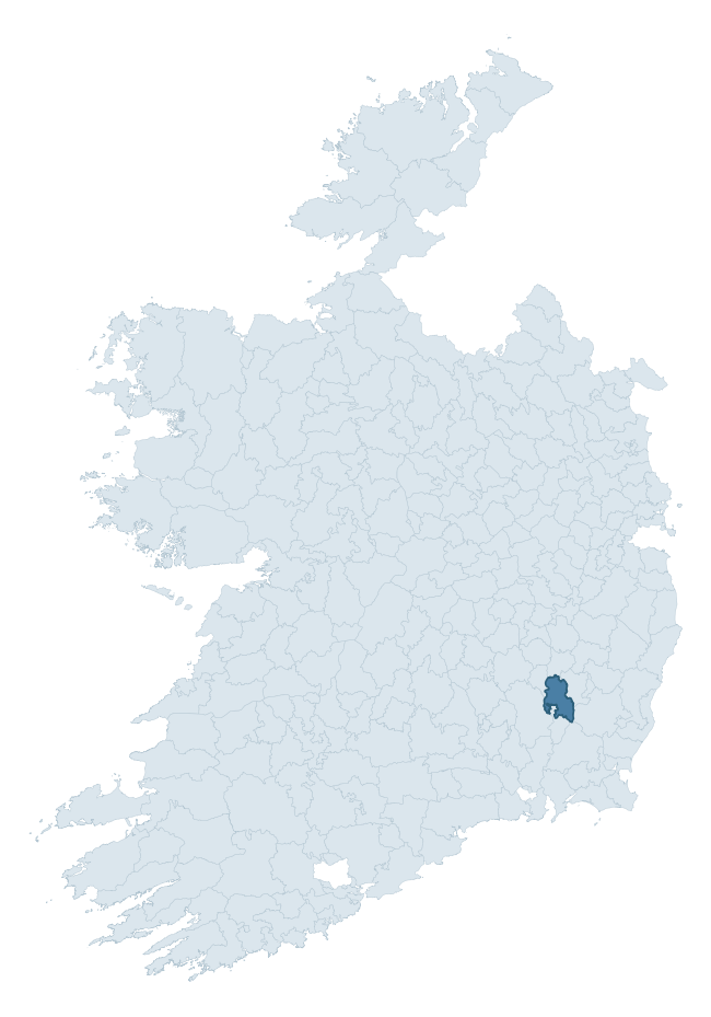
Where this barony sits in the Republic of Ireland
Geology and preservation
Bedrock geology shapes the landscape long before any settlement begins — controlling soil drainage, agricultural potential, the survival of upstanding monuments, and the preservation of buried archaeology. The figures below come from the Geological Survey Ireland 1:100,000 bedrock map.
The bedrock underlying Idrone East is predominantly granite (79% of the barony by area), laid down during the Caledonian period (79% by area, during the Caledonian orogeny (around 490–390 million years ago)). Granite weathers slowly and produces thin, acidic, often poorly-drained soils that historically limited arable agriculture but favoured pastoralism, upland settlement, and the construction of stone monuments. Granite-dominated landscapes typically carry fewer ringforts but a higher density of megalithic tombs, standing stones, and stone circles, which survive well against the resistant bedrock. The single largest mapped unit is the Type 2 Equigranular Granite (Tullow Pluton) (39% of the barony's bedrock). With 7 distinct rock types mapped, the barony sits in the top third of ROI baronies for geological diversity (67th percentile) — typically a sign of complex tectonic history or coastal mosaics of differing rock units.
Rock type composition
Largest mapped unit: Type 2 Equigranular Granite (Tullow Pluton) (39% of the barony)
Placename evidence
Logainm records 33 heritage-diagnostic placenames for Idrone East, drawn from townland and civil-parish names across the barony. The dominant stratum is Early Christian ecclesiastical — cill-, teampall-, and domhnach-prefixed names that record the dense network of early church foundations established between the fifth and tenth centuries. The leading diagnostic roots are cill- (16 — church), ráth- (8 — earthen ringfort), and dún- (4 — hilltop fort or promontory fort). This is broadly in line with the ROI average of 30.7 heritage placenames per barony. The presence of multiple heritage strata side by side indicates layered occupation of the landscape across successive prehistoric and historic periods. Logainm records 113 placenames for Idrone East (predominantly townland names). Of these, 33 (29%) carry one of the diagnostic Gaelic roots tracked above; the remainder draw on more generic landscape vocabulary that does not encode a heritage period.
Pre-Christian / Early Medieval Defensive
| Root | Count | Meaning |
|---|---|---|
| ráth- | 8 | earthen ringfort |
| dún- | 4 | hilltop or promontory fort |
| caiseal- | 1 | stone ringfort |
Early Christian Ecclesiastical
| Root | Count | Meaning |
|---|---|---|
| cill- | 16 | church (early) |
| tobar- | 1 | holy well |
Burial, Ritual, and Norse-Contact
| Root | Count | Meaning |
|---|---|---|
| tuaim- | 1 | burial mound |
| leaba- | 1 | megalithic tomb |
| feart- | 1 | grave mound |
Other baronies in Carlow
About this profile
Click any section below to expand.
What is a barony?
A barony is a historic administrative unit in Ireland, broadly equivalent to an English hundred. The 280 baronies used here are from the OSi 2019 National Statutory Boundaries (generalised 20m), covering the 26 counties of the Republic of Ireland. Baronies derive from the Norman period, were formalised in the 17th century, and have not been redrawn for statistical purposes. They vary enormously in area, from compact urban baronies in Dublin to vast upland baronies in Connacht, and should not be compared by raw site count without accounting for area differences.
What counts as a site?
This profile combines three distinct heritage registers, each with its own definition of what constitutes a recordable site:
- Archaeological sites (NMS). The National Monuments Service Sites and Monuments Record (SMR) catalogues every known archaeological monument or site of archaeological interest in the Republic, from prehistoric burial mounds and ringforts to medieval churches and post-medieval defensive works. Inclusion does not require legal protection — only that the site has been identified, surveyed, and assessed as having archaeological value. A separate subset of these sites lies within a recorded protection zone, which gives them statutory protection under the National Monuments Acts.
- Listed buildings (NIAH). The National Inventory of Architectural Heritage records buildings of architectural, historical, archaeological, artistic, cultural, scientific, social, or technical interest. Each surveyed structure is appraised on a five-tier scale: International, National, Regional, Local, and Record-Only. The NIAH appraisal is informational rather than strictly statutory, but it underpins local-authority Record of Protected Structures (RPS) listings.
- Heritage placenames (Logainm). Logainm is the authoritative database of Irish placenames maintained by the Placenames Branch. This profile applies a heritage-diagnostic classifier to the Irish-language form of each townland name, flagging roots that signal defensive sites (ráth-, lios-, dún-, caiseal-, cathair-), ecclesiastical foundations (cill-, teampall-, domhnach-, mainistir-), prehistoric burial-ritual features (tuaim-, carn-, leaba-), or Norse-contact settlement (gall-). Townlands without one of these diagnostic roots are not flagged here — they may still carry historical significance, but that significance is not encoded in the name itself.
Editorial principles
The narrative sections of this profile follow several explicit principles:
- Evidential. Every claim about this barony’s heritage character is anchored in the underlying register data. Where a site count, a placename count, or a percentile rank is cited, it is computed from the source datasets at export time, not estimated.
- Comparative. Counts and metrics are reported alongside their percentile rank against the other 279 ROI baronies. A barony with 50 ringforts in absolute terms could be unusually high or unusually low depending on its size and regional context; percentile ranking removes that ambiguity.
- Transparent on limits. Where a register has known coverage gaps, survey biases, or data-quality issues that affect this barony’s figures, the profile flags them rather than presenting the numbers as definitive.
- No interpretation beyond what the data supports. The narrative does not speculate about historical events, social dynamics, or cultural meaning beyond what the recorded heritage and placename evidence directly attests.
Data caveats and limits
- NMS Sites and Monuments Record is the product of survey campaigns conducted at different intensities across different counties and decades. Some baronies have been surveyed more thoroughly than others, and absolute counts should be read in that light. Sites destroyed by development before survey are typically not represented; sites in heavily forested or upland terrain are sometimes under-recorded.
- NIAH coverage is broadly complete for the Republic of Ireland but the survey was conducted on a rolling county-by-county basis, and the most recent appraisal date varies. Buildings demolished or substantially altered after their original survey may still appear in the register; conversely, recent buildings of merit may not yet have been appraised.
- Logainm classification applies a deliberately conservative pattern-matching approach to the Irish-language townland forms. The classifier prioritises true positives over recall: a townland may carry a heritage signal that the classifier doesn’t recognise, particularly where the diagnostic root has been heavily anglicised or where the townland name draws on a less common term. The 60,000+ townland records and ~9,800 classified placenames give a substantial signal at barony scale, but individual townland names should be checked against Logainm directly for definitive interpretation.
- Period attribution. The chronological distribution reflects only those NMS sites that carry a recognised period attribution in the source data. Sites listed as “Unknown” period are excluded from the dated subset.
- Boundary changes. Some baronies have undergone minor boundary adjustments since their 19th-century definition; the OSi 2019 generalised boundaries used here are the current statutory definition and may differ slightly from historical maps in border areas.
- Bedrock geology is mapped at 1:100,000 scale, which means local variation within a barony — small pockets of different rock type, mineral veins, alluvium overlying bedrock — is generalised. The dominant-system and rocktype figures are area-weighted, so a barony reading “70% Carboniferous limestone” may still contain small but archaeologically important pockets of older or younger rock. Around 3% of GSI polygons do not match the lexicon and contribute no rocktype or system attribution.
Data sources
- National Monuments Service — Sites and Monuments Record (SMR) https://data.gov.ie/dataset/national-monuments-service-archaeological-survey-of-ireland
- National Inventory of Architectural Heritage (NIAH) https://data.gov.ie/dataset/national-inventory-of-architectural-heritage-niah-national-dataset
- Logainm — Placenames Database of Ireland https://www.logainm.ie/
- Ordnance Survey Ireland — National Statutory Barony Boundaries 2019 https://data-osi.opendata.arcgis.com/
- EURODEM — European Digital Elevation Model https://www.mapsforeurope.org/datasets/euro-dem
- ESA WorldCover https://esa-worldcover.org/en
- Geological Survey Ireland — 1:100,000 Bedrock Geology https://www.gsi.ie/en-ie/data-and-maps/Pages/Bedrock.aspx
Explore more: Search any of the 280 ROI baronies, browse by historical province, or read the methodology and data sources for the full Republic of Ireland Heritage Tool.