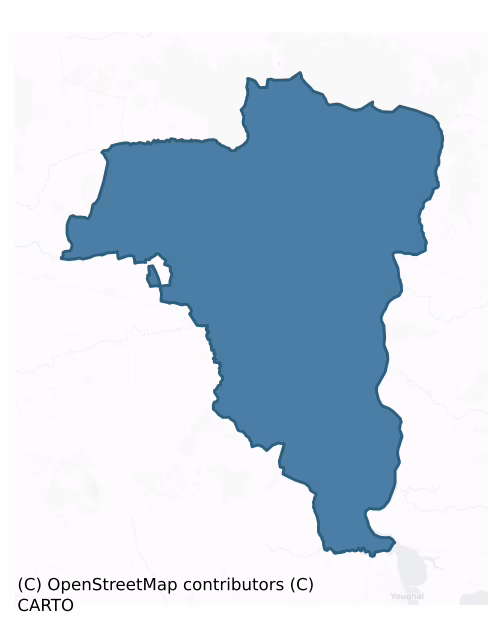
Coshmore And Coshbride is a barony of County Waterford, in the historical province of Munster (Irish: Cois Abha Móire agus Cois Bhríde), covering 362 km² of land. The barony records 254 NMS archaeological sites and 527 NIAH listed buildings, placing it at around the 4th percentile among 280 ROI baronies for sites per km². This means it is in the bottom tenth of all baronies for sites per km². Dated archaeological evidence runs from the Mesolithic through to the Modern, spanning 9 of 9 archaeological periods, placing the barony in the 88th percentile among 280 ROI baronies for chronological depth. This means it is in the top fifth of all baronies for chronological depth. The largest dated subset of recorded sites dates to the Early Medieval. Logainm flags 52 placenames in the barony as carrying a recognised heritage root; the largest share — around 58% — are names associated with early Christian church and monastic foundations.
Heritage at a glance
Percentile rankings throughout this profile compare each barony only against the other 279 Republic of Ireland baronies.
The recorded heritage of Coshmore And Coshbride
The National Monuments Service Sites and Monuments Record (SMR) is the statutory inventory of archaeological sites for the Republic of Ireland, maintained by the Department of Tourism, Culture, Arts, Gaeltacht, Sport and Media. Sites recorded here include earthworks, ringforts, megalithic tombs, ecclesiastical remains, and post-medieval features; not every record is legally protected, but each is registered as a monument of archaeological interest.
The National Monuments Service records 254 archaeological sites in Coshmore And Coshbride, putting it at the 4th percentile among 280 ROI baronies for sites per km². This means it is in the bottom tenth of all baronies for sites per km². A sparse recorded total of this kind in Ireland often reflects survey priority rather than genuine absence of past activity. Protection coverage is near-universal — 241 sites (95%) fall within a recorded monument protection zone, indicating an extensively surveyed landscape. The record is dominated by defensive sites — ringforts, enclosures, hillforts, and stone forts (92 sites, 36% of the total), with ecclesiastical sites forming a substantial secondary presence (53 sites, 21%). The most diagnostically specific type is Ringfort – rath (16 records, 6% of the barony's NMS total) — compared to an ROI average of 20% across all baronies where this type occurs. Ringfort – rath is an earthen ringfort enclosed by a bank and external ditch — the most common Early Medieval farmstead, broadly dated 500–1000 AD. The broader 'Enclosure' classification — which catches unclassified ringforts and field enclosures — accounts for a further 28 records (11%) and reflects the difficulty of sub-classifying degraded earthworks from surface evidence alone. Across the barony's 362 km², this gives a recorded density of 0.70 sites per km².
Most common monument types
Hover or tap a monument type to see its definition.
| Type | Count |
|---|---|
| Enclosure a banked or ditched feature of uncertain type, used as a catch-all where the original function cannot be determined from surface evidence | 28 |
| Ringfort – rath an earthen ringfort enclosed by a bank and external ditch — the most common Early Medieval farmstead, broadly dated 500–1000 AD | 16 |
| Ritual site – holy well a well or spring traditionally associated with a saint, often credited with healing properties; many trace earlier ritual origins but devotion is documented from the medieval period onwards | 14 |
| Church a building used for public Christian worship, of any date from c. 500 AD onwards | 12 |
| Ringfort – unclassified a circular Early Medieval settlement enclosure where surviving evidence does not allow distinction between earthen and stone forms | 12 |
| Graveyard a burial area associated with a church, in use from the medieval period onwards | 8 |
| Standing stone a deliberately set upright stone, used variously as a Bronze/Iron Age burial marker, route marker or commemorative monument | 8 |
Chronological distribution
The dated archaeological record for Coshmore And Coshbride spans from the Mesolithic through to the Modern, with activity attested across 9 of 9 archaeological periods. This is the 88th percentile across ROI baronies for chronological depth — an above-average span. Every period from earliest to latest is represented in the record — an unbroken sequence of dated activity across the full chronological span. Activity concentrates most heavily in the Early Medieval (69 sites, 38% of dated material), with the Iron Age forming a secondary peak (53 sites, 29%). A further 72 recorded sites (28% of the overall NMS register for the barony) carry no period attribution — appearing as 'Unknown' in the bar chart below. This typically reflects either records that pre-date the standardised period vocabulary or sites awaiting specialist dating review, rather than a genuine absence of chronological evidence.
Sample of recorded monuments
Show 25 sample monuments (of 254 total)
A representative sample of 25 recorded monuments drawn from the barony’s 254 total NMS entries. Sites within a recorded monument protection zone and rarer site types are prioritised so the list shows a meaningful cross-section rather than only the most common type. Each entry shows the official Sites and Monuments Record reference number and the description published by the National Monuments Service.
Leacht
The site remains unplanted in coniferous forest, on the top of a small rectangular hillock (dims. at top c. 70m x 40m; H c. 1.5-3m) with the ravine of the Araglin River immediately to the N (D c. 30m). It is called…
The site remains unplanted in coniferous forest, on the top of a small rectangular hillock (dims. at top c. 70m x 40m; H c. 1.5-3m) with the ravine of the Araglin River immediately to the N (D c. 30m). It is called 'Sidh Mochuda' or 'St Mochuda's/St Carthage's Chair' (Anon. 1899, JRSAI, 262), and is traditionally thought to be the place where the saint died and was buried. Described by Power (1899, WAJ, 146-50) as a small, stone-walled enclosure or grave '6ft x 4ft' (c. 1.82m x 1.2m) with three large stones visible internally, one of which was an ogham stone (WA011-003001-). The 'grave' is visible as a rectangular area (int. dims. 2.5m NW-SE; 1.1m NE-SW) defined by the grass-covered foundations of a wall (Wth 0.4m), but most of the long walls are not present. An ogham stone, which was once upright at the site, is now at UCC. It has been read by Macalister (1945, vol. 1, 257) as ERCAGNI MAQI ERCIAS. According to Power (1899, 147) there was local information that two other stones, possibly ogham stones, were rolled down the hill into the stream to the W, that have not been identified since.
The above description is derived from the published 'Archaeological Inventory of County Waterford' (Dublin: Stationery Office, 1999). In certain instances the entries have been revised and updated in the light of recent research.
Date of upload/revision: 23 December 2008
Cross
According to Power (1899, WAJ, 149) there was local information of a possible cross at the location which cannot be confirmed.
Power, Rev. P. (1899) Another Ogham discovery. WAJ 5, 146-50.
Compiled by: Michael…
According to Power (1899, WAJ, 149) there was local information of a possible cross at the location which cannot be confirmed.
Power, Rev. P. (1899) Another Ogham discovery. WAJ 5, 146-50.
Compiled by: Michael Moore
Date of upload: 9 December 2009
Cairn – radial-stone cairn
Situated on the summit of Knocknafallia Mountain. This is a stone spread (diam. 12m; H 0.8-1.2m) with ten visible kerbstones. Every second stone is set radially, the rest are set along the circumference (diam. 9m). A…
Situated on the summit of Knocknafallia Mountain. This is a stone spread (diam. 12m; H 0.8-1.2m) with ten visible kerbstones. Every second stone is set radially, the rest are set along the circumference (diam. 9m). A cist (dims. 0.8m x 0.6m; H 0.5m) is at the SE edge of the cairn and there is a hollow at the centre. The cairn is surrounded by a low bank (Wth 1-3m; H 0.1-0.2m) c. 20m from its outer edge.
The above description is derived from the published 'Archaeological Inventory of County Waterford' (Dublin: Stationery Office, 1999). In certain instances the entries have been revised and updated in the light of recent research.
Date of upload/revision: 23 December 2008
Headstone
Situated on a rise in the floodplain of the W-E Blackwater River. The headstone (max. H 1.25m; Wth 0.8-0.85m) of Richard Norris, with an incised roman inscription dated 1629, is at the centre of the rectangular…
Situated on a rise in the floodplain of the W-E Blackwater River. The headstone (max. H 1.25m; Wth 0.8-0.85m) of Richard Norris, with an incised roman inscription dated 1629, is at the centre of the rectangular graveyard (WA019-002002-) of Mocollop church. (Power 1898a, 216)
Power, Rev. P. (1898a) Ancient ruined churches of Co. Waterford, WAJ 4, 83-95, 195-219.
The above description is derived from the published 'Archaeological Inventory of County Waterford' (Dublin: Stationery Office, 1999). In certain instances the entries have been revised and updated in the light of recent research.
Revised by: Michael Moore
Date of upload: 16 February 2011
Metalworking site
Sir Walter Raleigh acquired extensive estates in east Cork and west Waterford, and he was the first person to develop its potential iron industry. Sir Richard Boyle, later the first Earl of Cork, acquired the Raleigh…
Sir Walter Raleigh acquired extensive estates in east Cork and west Waterford, and he was the first person to develop its potential iron industry. Sir Richard Boyle, later the first Earl of Cork, acquired the Raleigh estates in Ireland in 1604, and continued to develop the iron industry.
Situated on the E side of a S-N stream, close to its junction with the E-W Araglin River. An ironworks and blast furnace were established here in 1642 by a son of the Earl of Cork. New works were built c. 1741 for the production of bar iron (Smith 1746, 62, 305) but these seem to have gone into disuse by the end of the 18th century (Power 1978a, 30-31). A blast furnace with a charging area and two outlets (Wth 4.1m; H 1.55m) survives with the foundations of a forge (dims. 10.2m N-S; 9.3m E-W) nearby. The possible tailing tips of spoil from the ironworkings are to the E. The visible remains probably date to the 18th century. (Schubert 1957, 11-12)
Power, T. (1977) Richard Boyle's ironworks in Co. Waterford. Part 1.Decies, No. 6, 26-31.
Power, T. (1978a) Richard Boyle's ironworks in Co. Waterford. Part 2. Decies, No. 7, 30-36.
Schubert, H. R. (1957) History of the British Iron and Steel Industry from c. 450 BC to AD 1775. Oxford. University Press.
Smith, C. (1746) The history of the town and county of Waterford. W. Wilson. Dublin.
The above description is derived from the published 'Archaeological Inventory of County Waterford' (Dublin: Stationery Office, 1999). In certain instanc…
Cathedral
Lismore was recognised as a diocesan centre at the Synod of Rathbrassil in 1111, and the blessing of a great church in 1166 may have been the inauguration of the Cathedral. The plundering of Lismore by the Anglo-Normans…
Lismore was recognised as a diocesan centre at the Synod of Rathbrassil in 1111, and the blessing of a great church in 1166 may have been the inauguration of the Cathedral. The plundering of Lismore by the Anglo-Normans in 1173 and 1178 probably included the sacking of the Cathedral, and the diocese was in danger of anexation by Waterford in the early 13th century, although they were not united until 1363 (Gwynn and Hadcock 1981, 91-2). The cathedral was damaged in the rebellion of 1579 and was in ruins apart from the chancel, roofed by Boyle, in 1633 until rebuilt to a design of Sir William Robinson from 1679 onwards (Loeber 1977-9, 290, 296). The fabric of the church dates to this period although the windows and doors were largely altered in the 19th century. The chancel was rebuilt after 1811 and the W tower added in 1827.
The only medieval portions are the S wall of the chancel and the S piers of the crossing, and some architectural fragments kept at the W end of the nave. The chest tomb of John and Katherine McGrath, 1557 (Hunt 1974, vol. 1, 232-3) is at the W end of the nave.
Gwynn, A. and Hadcock, R. N. (1970) (reprint 1988) Medieval religious houses in Ireland. Irish Academic Press, Dublin.
Hunt, J. (1974) Irish medieval figure sculpture 1200-1600: a study of Irish tombs with notes on costume and armour, 2 vols. Irish University Press. Dublin.
Loeber, R. (1979) Bibliographical dictionary of engineers in Ireland 1600-1730, The Irish Sword 13, 106-22, 230-55, 2…
Castle – motte and bailey
Situated on a natural hill overlooking the floodplain of the W-E Blackwater River with the stream c. 150m to the N. The motte is a flat-topped mound (diam. of top 13m; diam. of base 40m; H 7.5m at S to 10m at SW) with a…
Situated on a natural hill overlooking the floodplain of the W-E Blackwater River with the stream c. 150m to the N. The motte is a flat-topped mound (diam. of top 13m; diam. of base 40m; H 7.5m at S to 10m at SW) with a subrectangular bailey (dims. 34m N-S; 19.5m E-W at N to 10m E-W at S) attached to the S. The bailey is raised 5m over a flat-bottomed fosse (Wth of base c. 3m; ext. D 1.7m). Both are surrounded by an earthen bank (Wth c. 7m; max. ext. H 5m) except at E where there is a natural cliff-edge (Anon. 1897, 271-2). It is planted with deciduous trees.
Anon. (1897) Proceedings, JRSAI 27, 270-72.
The above description is derived from the published 'Archaeological Inventory of County Waterford' (Dublin: Stationery Office, 1999). In certain instances the entries have been revised and updated in the light of recent research.
Date of upload: 23 December 2008
Altar
Situated at the N edge of a plateau overlooking the Blackwater river valley to the N, and just outside the perimeter of rath (WA028-002001-) at NW. 'St Carthage's Stone Altar' which is described as a piece of masonry…
Situated at the N edge of a plateau overlooking the Blackwater river valley to the N, and just outside the perimeter of rath (WA028-002001-) at NW. 'St Carthage's Stone Altar' which is described as a piece of masonry outside the bank (OS Name Book, 53) can no longer be found.
Compiled by: Michael Moore.
Date of upload: 26 July 2011
Mine
Located in the E-W valley of the Abha Beag or Owbeg river, in a scrub-covered area on both sides of the stream. This is an area of c. 5ha with large spoil mounds (L c. 40m; Wth c. 10-20m; H 3-6m) and open quarries which…
Located in the E-W valley of the Abha Beag or Owbeg river, in a scrub-covered area on both sides of the stream. This is an area of c. 5ha with large spoil mounds (L c. 40m; Wth c. 10-20m; H 3-6m) and open quarries which are now ponds of iron-rich water. It is probably one of Sir Richard Boyle's ironworkings dating to the early 17th century, and the road (WA029-005—-) may have serviced it.
The above description is derived from the published 'Archaeological Inventory of County Waterford' (Dublin: Stationery Office, 1999). In certain instances the entries have been revised and updated in the light of recent research.
Revised by: Michael Moore
Date of upload: 26 July 2011
Ring-ditch
In rough pasture at the base of a W-facing slope, on top of a broad E-W ridge. Cropmarks of five small enclosures (diams. c. 10-15m) which intersect with each other in a concentrated group. The cropmark of a sixth…
In rough pasture at the base of a W-facing slope, on top of a broad E-W ridge. Cropmarks of five small enclosures (diams. c. 10-15m) which intersect with each other in a concentrated group. The cropmark of a sixth enclosure (ext. diam. c. 15m) is c. 30m to S. All are visible on aerial photographs (MM (73) 0-3) but are not visible at ground level, and they may represent feeding rings.
The above description is derived from the published 'Archaeological Inventory of County Waterford' (Dublin: Stationery Office, 1999). In certain instances the entries have been revised and updated in the light of recent research.
Revised by: Michael Moore
Date of upload: 10 August 2011
Well
Marked as a well called 'Toberarananaig' on the 1840 ed. of the OS 6-inch map, and as 'Tobar a Rónánaig' on the 1927 ed. It is situated on relatively high ground at the head of a valley that opens out to the SW, and in…
Marked as a well called 'Toberarananaig' on the 1840 ed. of the OS 6-inch map, and as 'Tobar a Rónánaig' on the 1927 ed. It is situated on relatively high ground at the head of a valley that opens out to the SW, and in the corner of a field. Rev. P. Power thought that it was not a holy well, but named after a local person called Roynane (OS Name Books). This is a small rectangular hollow (dims. 0.88m x 0.77m; D 0.8m) defined by stones that have been cemented, but there is no evidence of veneration.
Compiled by: Michael Moore
Date of upload: 27 September 2011
Bullaun stone
Situated above the steep W-facing slope of the SSW-NNE Owenasack stream. According to Power (1952, 23) the name Killeenagh is derived from Cillíneach – the little church, and a church (WA034-041001-) and bullaun stone…
Situated above the steep W-facing slope of the SSW-NNE Owenasack stream. According to Power (1952, 23) the name Killeenagh is derived from Cillíneach – the little church, and a church (WA034-041001-) and bullaun stone were identified here (Power 1952, 23). The bullaun stone is known of locally but is now lost and buried in spoil.
Power, Rev. P. (1952) The placenames of the Decies. (second ed.) Cork University Press.
The above description is derived from the published 'Archaeological Inventory of County Waterford' (Dublin: Stationery Office, 1999). In certain instances the entries have been revised and updated in the light of recent research.
Revised by: Michael Moore
Date of upload: 02 October 2011
Fulacht fia
Located on a SW-facing slope with a N-S stream c. 20m to the W. This is an oval grass-covered mound of broken and burnt stone (dims. 16m x 13m; H 0.3-0.8m).
The above description is derived from the published…
Located on a SW-facing slope with a N-S stream c. 20m to the W. This is an oval grass-covered mound of broken and burnt stone (dims. 16m x 13m; H 0.3-0.8m).
The above description is derived from the published 'Archaeological Inventory of County Waterford' (Dublin: Stationery Office, 1999). In certain instances the entries have been revised and updated in the light of recent research.
Revised by: Michael Moore
Date of upload: 06 October 2011
Religious house – Augustinian canons
Located on an island (diam. c. 70-80m) at the W side of the N-S Blackwater river at a point where it is turning from E-W to N-S, and c. 200m N of where the W-E Glendine stream joins the Blackwater. The island was…
Located on an island (diam. c. 70-80m) at the W side of the N-S Blackwater river at a point where it is turning from E-W to N-S, and c. 200m N of where the W-E Glendine stream joins the Blackwater. The island was connected to the mainland at Lackaroe, S of the Glendine, by causeways and bridges in 1806 (Anon, 1903, 313). Although privately owned it is open to visitors daily in June and July, and Tuesday to Thursday from Easter to the end of September, with parking available near Templepmichael Church (WA037-013001-).
This is an early ecclesiastical site founded in the 6th century by St Molana, which was known as Dairinis Maelanfaid – the oakwood island of Molana, and two abbots of the 8th century are recorded (Power 1932a, 143). It adopted the Augustinian rule in the 12th century, possibly when it became associated with the Anglo-Norman lord Raymond le Gros, who was said to be buried there. The association is unlikely, but his reputed effigial grave-slab (Stalley 1991, 11) is now lost. Power (1932a, 152) illustrates another graveslab that is also untraceable. The abbey declined in the later middle ages and was suppressed in 1541. It was granted to Sir Walter Raleigh in the 1580s, whose first tennant, Thomas Harriot, had participated in Raleigh's Roanoke colony in north America (Klingelhofer and Lyttleton 2010), but it is unlikely that Harriot occupied the site.
The remains are substantial with most features surviving almost complete. The remains consist of an undiff…
Tomb – effigial
The early ecclesiastical site of St. Molana (WA037-011001-) adopted the Augustinian rule in the 12th century, possibly when it became associated with the Anglo-Norman lord Raymond le Gros, who was said to be buried…
The early ecclesiastical site of St. Molana (WA037-011001-) adopted the Augustinian rule in the 12th century, possibly when it became associated with the Anglo-Norman lord Raymond le Gros, who was said to be buried there. The association is unlikely, but his reputed effigial grave-slab, which was recorded by Daniel Grose in the 1820s or 1830s (Stalley 1991, 11) is now lost.
Stalley, R. (1991) Daniel Grosse (c. 1776-1838): the antiquities pf Ireland. The Irish Architectural Archive. Dublin.
Compiled by: Michael Moore
Date of upoad: 07 October 2011
Weir – fish
Four weirs are enumerated in the N-S River Blackwater between Ballynatray and Templemichael in 1602, and two are specifically associated with the manor of Ballynatray in 1604 (Went 1946, 181). The location is uncertain…
Four weirs are enumerated in the N-S River Blackwater between Ballynatray and Templemichael in 1602, and two are specifically associated with the manor of Ballynatray in 1604 (Went 1946, 181). The location is uncertain but a fish weir is recorded on a Bateman map of 1717 (NLI: ms. 6148, 1) and also on the 1840 ed. of the OS 6-inch map at he point where the W-E Glendine River joins the Blackwater.
Went, A. E. J. (1946) Irish fishing weirs. JRSAI, vol. 76. 176-194.
Compiled by: Michael Moore
Date of upload: 07 October 2011
Building
There is a stone-built building (int. dims. 12.85m E-W; 5.2m N-S) of one storey with an attic attached to the E of the tower house (WA037-014001-) just to the E of Templemichael church (WA037-013001-). This was the…
There is a stone-built building (int. dims. 12.85m E-W; 5.2m N-S) of one storey with an attic attached to the E of the tower house (WA037-014001-) just to the E of Templemichael church (WA037-013001-). This was the rectory of Templemichael (O'Connel Redmond 1918-19, 95) and it has a single dividing wall. This building also incorporated the ground floor of the tower house and re-built its doorway. At the ground floor the S stone wall (T 0.65m) has two doorways and a large window. There is a single doorway in the N wall and a window in the E wall. There are two internal doorways at the ground floor, and there is a doorway in the dividing wall at the attic level. It is probably 18th century in date.
O’Connell-Redmond, G. (1918-19) The castles of north-east Cork and near its borders. JCHAS 24-25, 1-6, 62-6, 93-103, 145-51.
Compiled by: Michael Moore
Date of upload: 01 March 2012
Religious house – Knights Templars
Situated at the E end of a W-E ridge or spur overlooking the Blackwater River to the N, E and S. A preceptory of the Knights Templar is traditionally thought to have been founded by Raymond le Gros (Gwynn and Hadcock…
Situated at the E end of a W-E ridge or spur overlooking the Blackwater River to the N, E and S. A preceptory of the Knights Templar is traditionally thought to have been founded by Raymond le Gros (Gwynn and Hadcock 1970, 330), but there are no contemporary references to its foundation or subsequent history. The remains consist of an ivy-clad undifferentiated structure (int. dims. 17.75m E-W; 8.1m N-S) of which only the E end of the long walls (Wth 1.1-1.3m; max. H 4m), with evidence of two large windows in each, survive. Abutting the church to the S is a raised platform (dims. 20m E-W; 17m N-S; H 0.4m).
A barrel-vaulted building (int. dims. 12.6m N-S; 6.2m E-W int. H 3m) adjacent to the NE corner of the church has three double-splay lights in the E wall and two doorways in the W wall. A light in the N wall is partly blocked by the vault, which must be inserted, and only the W wall, with evidence of a chimney at the first floor, survives partially to first-floor level. Attached to the N wall is a later two-storey building (int. dims. 9.2m N-S; 4.1m E-W), with two windows in its E wall, and a window and doorway in the W wall. No decorative stonework is present anywhere, and there is no brick. The church and vaulted building are probably 13th century in date. (Fitzgerald 1856-7, 289- 91; Power 1898a, 207-9; Buckley 1903; Stalley 1991, 54-5)
Buckley, M. J. C. (1903) Rincrew Preceptory, JRSAI 33, 312-13.
FitzGerald, E. (1856-7) Proceedings – “Jottings in archaeology”, J…
Gatehouse
Located at the SE angle of the walled garden (WA021-019018-) attached to the S of Lismore Castle (WA021-019001-). It forms an outer gateway to the castle and was built in 1631-2, after the walled garden. This is an…
Located at the SE angle of the walled garden (WA021-019018-) attached to the S of Lismore Castle (WA021-019001-). It forms an outer gateway to the castle and was built in 1631-2, after the walled garden. This is an elaborate arched gateway which passes between two rectangular three storey towers that are connected at the first floor by a passage. (Bradley et al. 1989, 80-1)
Bradley, J., Halpin, A. and King, H. (1989) Urban archaeology Survey of Waterford City and County, 2 vols. Unpublished report commissioned by the Office of Public Works.
Compiled by: Michael Moore
Date of upload: 21 March 2011
Architectural fragment
There are some fragments of cut stone at the W end of the nave of St Carthage's Cathedral (WA021-019003-). (Bradley et al. 1989, vol. 1, 92)
Bradley, J., Halpin, A. and King, H. (1989) Urban archaeology Survey of…
There are some fragments of cut stone at the W end of the nave of St Carthage's Cathedral (WA021-019003-). (Bradley et al. 1989, vol. 1, 92)
Bradley, J., Halpin, A. and King, H. (1989) Urban archaeology Survey of Waterford City and County, 2 vols. Unpublished report commissioned by the Office of Public Works.
Compiled by: Michael Moore
Date of upload: 21 March 2011
Forge
Situated on the floor of the W-E Bride river valley, c. 1km S of the river. Sir Richard Boyle, the first Earl of Cork, developed the iron industry at Tallow, which was known as Tullach an Iarainn (the hill of iron), in…
Situated on the floor of the W-E Bride river valley, c. 1km S of the river. Sir Richard Boyle, the first Earl of Cork, developed the iron industry at Tallow, which was known as Tullach an Iarainn (the hill of iron), in the early 17th century. A mill had been set up by 1608 and a report of 1622 says that there were two iron mills at Tallow. The iron-works seem to have survived the disturbances of the 1640s, but by 1685 they were defunct according to Sir Richard Cox (Walton 1987, 28). A forge is marked on a Bateman map of 1717 (NLI: ms. 6148, 21), which is probably the same feature. Its location is uncertain but it may have been on the site of the saw mill marked on the 1840 and 1927eds of the OS 6-inch map at the end of Mill Lane, although the standing remains appear to be 18th or 19th century in date (Bradley et al. 1989, vol. 1, 121-2). (Power 1978, 33)
Bradley, J., Halpin, A. and King, H. (1989) Urban archaeology Survey of Waterford City and County, 2 vols. Unpublished report commissioned by the Office of Public Works.
Power, T. (1978) Richard Boyle's ironworks in Co. Waterford. Part 2. Decies, No. 7, 30-36.
Walton, J. (1987) Two descriptions of County Waterford in the 1680s. Decies, No. 35, 25-33.
Compiled by: Michael Moore
Date of upload: 29 September 2011
Market-house
Situated on the floor of the W-E Bride river valley, c. 1km S of the river. Sir Richard Boyle, the first Earl of Cork, developed Tallow, which was incorporated as a borough in 1613. According to a contemporary document…
Situated on the floor of the W-E Bride river valley, c. 1km S of the river. Sir Richard Boyle, the first Earl of Cork, developed Tallow, which was incorporated as a borough in 1613. According to a contemporary document he built a market-house, which may have incorporated the courthouse and prison that the same document also ascribes to him (Ryland 1824, 342). The market house and jail are also ascribed to the Earl by Smith (1746, 40), and the market house is marked in the centre of Convent St. opposite West St. on a map by Richard Scalé (NLI: ms. 7218, 1), dated 1774. Archaeological monitoring (08N0240) of the route of a sewage pipe uncovered part of the W wall of the building in the Square (McCarthy 2008).
Compiled by: Michael Moore
Date of upload: 23 February, 2012
Sheela-na-gig
A sheela-na-gig, now in the Library of St. Carthag's cathedral at Lismore (WA021-019010-), is thought to have come from the graveyard (WA028-015007-) around the site of the parish church of Tallow…
A sheela-na-gig, now in the Library of St. Carthag's cathedral at Lismore (WA021-019010-), is thought to have come from the graveyard (WA028-015007-) around the site of the parish church of Tallow (WA028-015001-).
Compiled by: Michael Moore
Date of upload: 26 July 2011
Sheela-na-gig (present location)
A sheela-na-gig that was found at the graveyard in Tallow (WA028-015005-) is now kept at the Library in Lismore.
Compiled by: Michael Moore
Date of upload: 21 March 2011
Enclosure
Marked as a circular embanked enclosure (ext. diam. c. 35m) overlain by a NW-SE field bank on the 1840 ed. of the OS 6-inch map and situated on a steep SE-facing slope. Subrectangular area (dims. 12.8m NW-SE; 6.4m…
Marked as a circular embanked enclosure (ext. diam. c. 35m) overlain by a NW-SE field bank on the 1840 ed. of the OS 6-inch map and situated on a steep SE-facing slope. Subrectangular area (dims. 12.8m NW-SE; 6.4m NE-SW) defined by an earthen bank (Wth 2.5m; int. H 0.3m; ext. H 0.5-0.8m) with external stone-facing, it is described as a 'killeen' (Power 1952, 35). The perimeter is planted with deciduous trees.
Power, Rev. P. (1952) The placenames of the Decies. (second ed.) Cork University Press.
The above description is derived from the published 'Archaeological Inventory of County Waterford' (Dublin: Stationery Office, 1999). In certain instances the entries have been revised and updated in the light of recent research.
Date of upload: 30 July 2010
Listed buildings
The National Inventory of Architectural Heritage (NIAH) is a state survey appraising buildings of architectural, historical, archaeological, artistic, cultural, scientific, social, or technical interest. Each surveyed structure receives a rating from International (the highest, for buildings of European importance) through National, Regional, Local, and Record-Only.
The National Inventory of Architectural Heritage records 527 listed buildings in Coshmore And Coshbride, placing it in the top 4% of ROI baronies for listed-building density. Among these, 16 are graded National — buildings of interest to the whole of Ireland rather than only its region. The Republic holds 937 National-graded buildings in total, so this barony accounts for around 2% of the national total. Construction dates concentrate most heavily in the Victorian (1830-1900) period. The most-recorded building type is house (277 examples, 53% of the listed stock).
Terrain and environment
Mean elevation across the barony is 149m — the 85th percentile among 280 ROI baronies for elevation. This means it is in the top fifth of all baronies for elevation. This is a relatively elevated landscape by ROI standards. Elevation matters for heritage because higher-altitude baronies typically favour defensive monuments — ringforts and hilltop forts placed on prominent ground — while lowland baronies are more likely to carry the dense settlement and church networks of intensive agricultural landscapes. The barony reaches 787m at its highest point — a vertical span of more than 638m within its boundary, indicating significant topographic diversity. Mean slope is 6.1° — the 84th percentile among 280 ROI baronies for slope. This means it is in the top fifth of all baronies for slope. This is consistently steep terrain by ROI standards, the kind of landscape that tends to preserve upstanding archaeological features well. Slope is a key control on both land use and archaeological preservation: steep ground resists ploughing and tends to preserve earthworks intact, while gentle slopes favour intensive cultivation that damages or destroys surface archaeology over time. Localised maximum slopes reach 16°, typical of stream-cut valleys, escarpments, or coastal bluffs within the wider landscape. The Topographic Wetness Index averages 9.8, the 14th percentile among 280 ROI baronies for wetness. This means it is in the bottom fifth of all baronies for wetness. This is well-drained ground by ROI standards — typical of upland or steeply-sloping country that sheds water rapidly. Drainage matters for heritage because poorly-drained ground preserves organic archaeology (wooden trackways, leather, textiles, and on rare occasions human remains) far better than free-draining soil; well-drained ground favours arable use but destroys organic material rapidly. The land-cover mosaic combines improved grassland (62%), woodland (29%), and arable farmland (7%), giving a mixed agricultural and semi-natural landscape. In overall character, this is an upland landscape of steep, elevated terrain, with land use dominated by improved grassland.
Terrain measurements
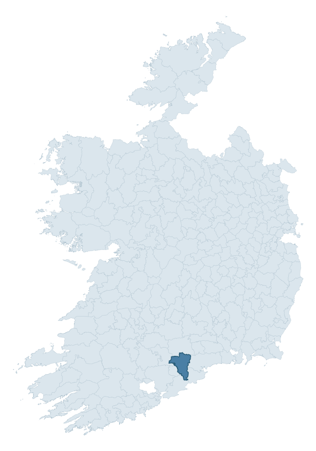
Where this barony sits in the Republic of Ireland
Geology and preservation
Bedrock geology shapes the landscape long before any settlement begins — controlling soil drainage, agricultural potential, the survival of upstanding monuments, and the preservation of buried archaeology. The figures below come from the Geological Survey Ireland 1:100,000 bedrock map.
The bedrock underlying Coshmore And Coshbride is predominantly sandstone (50% of the barony by area), laid down during the Devonian period (80% by area, around 419 to 359 million years ago). Sandstone weathers to free-draining, moderately fertile soils that supported Early Medieval ringfort agriculture and later manorial estates. The rock itself is a major source of building stone — visible in churches, tower houses, and farm buildings across the barony's historic landscape. A substantial secondary geology of mudstone (26%) and limestone (18%) adds further variety to the underlying landscape. The single largest mapped unit is the Knockmealdown Sandstone Formation (43% of the barony's bedrock).
Rock type composition
Largest mapped unit: Knockmealdown Sandstone Formation (43% of the barony)
Placename evidence
Logainm records 52 heritage-diagnostic placenames for Coshmore And Coshbride, drawn from townland and civil-parish names across the barony. The dominant stratum is Early Christian ecclesiastical — cill-, teampall-, and domhnach-prefixed names that record the dense network of early church foundations established between the fifth and tenth centuries. The leading diagnostic roots are cill- (23 — church), lios- (6 — ringfort or enclosure), and dún- (6 — hilltop fort or promontory fort). This is above the ROI average of 30.7 heritage placenames per barony. The presence of multiple heritage strata side by side indicates layered occupation of the landscape across successive prehistoric and historic periods. Logainm records 384 placenames for Coshmore And Coshbride (predominantly townland names). Of these, 52 (14%) carry one of the diagnostic Gaelic roots tracked above; the remainder draw on more generic landscape vocabulary that does not encode a heritage period.
Pre-Christian / Early Medieval Defensive
| Root | Count | Meaning |
|---|---|---|
| lios- | 6 | ringfort or enclosure |
| dún- | 6 | hilltop or promontory fort |
| ráth- | 5 | earthen ringfort |
| caiseal- | 1 | stone ringfort |
Early Christian Ecclesiastical
| Root | Count | Meaning |
|---|---|---|
| cill- | 23 | church (early) |
| cillín- | 3 | unconsecrated burial ground |
| teampall- | 2 | church (later medieval) |
| tobar- | 2 | holy well |
Burial, Ritual, and Norse-Contact
| Root | Count | Meaning |
|---|---|---|
| gall- | 3 | foreigner — Norse settlement marker |
| sián- | 2 | fairy mound |
| carn- | 1 | cairn |
| leaba- | 1 | megalithic tomb |
Other baronies in Waterford
- Decies Within Drum
- Middlethird
- Upperthird
- Glenahiry
- Gaultiere
- Decies Without Drum
- Bear — Cork
- Clanmaurice — Kerry
- Barrymore — Cork
- Kinalea — Cork
See all 280 baronies in the Republic of Ireland Heritage Tool.

Explore further
Grounding History: 10 Maps of Northern Ireland’s Past
If you’re interested in Irish heritage more widely, the companion report for Northern Ireland brings together the analysis of all 462 NI wards into one place through 10 high-quality maps — covering monument density, archaeological periods, placename heritage, terrain, wetland, and the historic landscape at first survey. Take a look.
About this profile
Click any section below to expand.
What is a barony?
A barony is a historic administrative unit in Ireland, broadly equivalent to an English hundred. The 280 baronies used here are from the OSi 2019 National Statutory Boundaries (generalised 20m), covering the 26 counties of the Republic of Ireland. Baronies derive from the Norman period, were formalised in the 17th century, and have not been redrawn for statistical purposes. They vary enormously in area, from compact urban baronies in Dublin to vast upland baronies in Connacht, and should not be compared by raw site count without accounting for area differences.
What counts as a site?
This profile combines three distinct heritage registers, each with its own definition of what constitutes a recordable site:
- Archaeological sites (NMS). The National Monuments Service Sites and Monuments Record (SMR) catalogues every known archaeological monument or site of archaeological interest in the Republic, from prehistoric burial mounds and ringforts to medieval churches and post-medieval defensive works. Inclusion does not require legal protection — only that the site has been identified, surveyed, and assessed as having archaeological value. A separate subset of these sites lies within a recorded protection zone, which gives them statutory protection under the National Monuments Acts.
- Listed buildings (NIAH). The National Inventory of Architectural Heritage records buildings of architectural, historical, archaeological, artistic, cultural, scientific, social, or technical interest. Each surveyed structure is appraised on a five-tier scale: International, National, Regional, Local, and Record-Only. The NIAH appraisal is informational rather than strictly statutory, but it underpins local-authority Record of Protected Structures (RPS) listings.
- Heritage placenames (Logainm). Logainm is the authoritative database of Irish placenames maintained by the Placenames Branch. This profile applies a heritage-diagnostic classifier to the Irish-language form of each townland name, flagging roots that signal defensive sites (ráth-, lios-, dún-, caiseal-, cathair-), ecclesiastical foundations (cill-, teampall-, domhnach-, mainistir-), prehistoric burial-ritual features (tuaim-, carn-, leaba-), or Norse-contact settlement (gall-). Townlands without one of these diagnostic roots are not flagged here — they may still carry historical significance, but that significance is not encoded in the name itself.
Editorial principles
The narrative sections of this profile follow several explicit principles:
- Evidential. Every claim about this barony’s heritage character is anchored in the underlying register data. Where a site count, a placename count, or a percentile rank is cited, it is computed from the source datasets at export time, not estimated.
- Comparative. Counts and metrics are reported alongside their percentile rank against the other 279 ROI baronies. A barony with 50 ringforts in absolute terms could be unusually high or unusually low depending on its size and regional context; percentile ranking removes that ambiguity.
- Transparent on limits. Where a register has known coverage gaps, survey biases, or data-quality issues that affect this barony’s figures, the profile flags them rather than presenting the numbers as definitive.
- No interpretation beyond what the data supports. The narrative does not speculate about historical events, social dynamics, or cultural meaning beyond what the recorded heritage and placename evidence directly attests.
Data caveats and limits
- NMS Sites and Monuments Record is the product of survey campaigns conducted at different intensities across different counties and decades. Some baronies have been surveyed more thoroughly than others, and absolute counts should be read in that light. Sites destroyed by development before survey are typically not represented; sites in heavily forested or upland terrain are sometimes under-recorded.
- NIAH coverage is broadly complete for the Republic of Ireland but the survey was conducted on a rolling county-by-county basis, and the most recent appraisal date varies. Buildings demolished or substantially altered after their original survey may still appear in the register; conversely, recent buildings of merit may not yet have been appraised.
- Logainm classification applies a deliberately conservative pattern-matching approach to the Irish-language townland forms. The classifier prioritises true positives over recall: a townland may carry a heritage signal that the classifier doesn’t recognise, particularly where the diagnostic root has been heavily anglicised or where the townland name draws on a less common term. The 60,000+ townland records and ~9,800 classified placenames give a substantial signal at barony scale, but individual townland names should be checked against Logainm directly for definitive interpretation.
- Period attribution. The chronological distribution reflects only those NMS sites that carry a recognised period attribution in the source data. Sites listed as “Unknown” period are excluded from the dated subset.
- Boundary changes. Some baronies have undergone minor boundary adjustments since their 19th-century definition; the OSi 2019 generalised boundaries used here are the current statutory definition and may differ slightly from historical maps in border areas.
- Bedrock geology is mapped at 1:100,000 scale, which means local variation within a barony — small pockets of different rock type, mineral veins, alluvium overlying bedrock — is generalised. The dominant-system and rocktype figures are area-weighted, so a barony reading “70% Carboniferous limestone” may still contain small but archaeologically important pockets of older or younger rock. Around 3% of GSI polygons do not match the lexicon and contribute no rocktype or system attribution.
Data sources
- National Monuments Service — Sites and Monuments Record (SMR) https://data.gov.ie/dataset/national-monuments-service-archaeological-survey-of-ireland
- National Inventory of Architectural Heritage (NIAH) https://data.gov.ie/dataset/national-inventory-of-architectural-heritage-niah-national-dataset
- Logainm — Placenames Database of Ireland https://www.logainm.ie/
- Ordnance Survey Ireland — National Statutory Barony Boundaries 2019 https://data-osi.opendata.arcgis.com/
- EURODEM — European Digital Elevation Model https://www.mapsforeurope.org/datasets/euro-dem
- ESA WorldCover https://esa-worldcover.org/en
- Geological Survey Ireland — 1:100,000 Bedrock Geology https://www.gsi.ie/en-ie/data-and-maps/Pages/Bedrock.aspx
Explore more: Search any of the 280 ROI baronies, browse by historical province, or read the methodology and data sources for the full Republic of Ireland Heritage Tool.