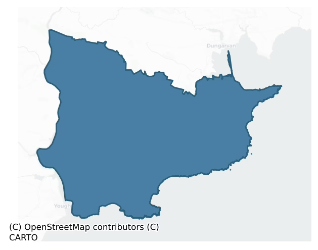
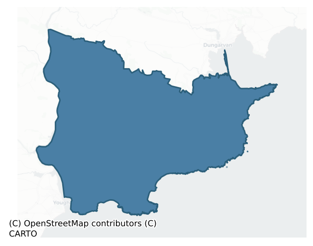
Decies Within Drum is a barony of County Waterford, in the historical province of Munster (Irish: Na Déise laistigh den Drom), covering 238 km² of land. The barony records 256 NMS archaeological sites and 151 NIAH listed buildings, placing it at around the 15th percentile among 280 ROI baronies for sites per km². This means it is in the bottom fifth of all baronies for sites per km². Dated archaeological evidence runs from the Neolithic through to the Medieval, spanning 6 of 9 archaeological periods, placing the barony in the 18th percentile among 280 ROI baronies for chronological depth. This means it is in the bottom fifth of all baronies for chronological depth. The largest dated subset of recorded sites dates to the Early Medieval. Logainm flags 38 placenames in the barony as carrying a recognised heritage root; the largest share — around 66% — are names associated with early Christian church and monastic foundations.
Heritage at a glance
Percentile rankings throughout this profile compare each barony only against the other 279 Republic of Ireland baronies.
The recorded heritage of Decies Within Drum
The National Monuments Service Sites and Monuments Record (SMR) is the statutory inventory of archaeological sites for the Republic of Ireland, maintained by the Department of Tourism, Culture, Arts, Gaeltacht, Sport and Media. Sites recorded here include earthworks, ringforts, megalithic tombs, ecclesiastical remains, and post-medieval features; not every record is legally protected, but each is registered as a monument of archaeological interest.
The National Monuments Service records 256 archaeological sites in Decies Within Drum, putting it at the 15th percentile among 280 ROI baronies for sites per km². This means it is in the bottom fifth of all baronies for sites per km². Protection coverage is near-universal — 239 sites (93%) fall within a recorded monument protection zone, indicating an extensively surveyed landscape. The record is dominated by defensive sites — ringforts, enclosures, hillforts, and stone forts (99 sites, 39% of the total), with ecclesiastical sites forming a substantial secondary presence (64 sites, 25%). Ringfort – rath is the most prevalent type, making up 14% of the barony's recorded sites (37 records) — below the ROI average of 20% across all baronies where this type occurs. Ringfort – rath is an earthen ringfort enclosed by a bank and external ditch — the most common Early Medieval farmstead, broadly dated 500–1000 AD. Other significant types include Enclosure (26) and Ringfort – unclassified (19). Enclosure is a banked or ditched feature of uncertain type, used as a catch-all where the original function cannot be determined from surface evidence; Ringfort – unclassified is a circular Early Medieval settlement enclosure where surviving evidence does not allow distinction between earthen and stone forms. Across the barony's 238 km², this gives a recorded density of 1.07 sites per km².
Most common monument types
Hover or tap a monument type to see its definition.
| Type | Count |
|---|---|
| Ringfort – rath an earthen ringfort enclosed by a bank and external ditch — the most common Early Medieval farmstead, broadly dated 500–1000 AD | 37 |
| Enclosure a banked or ditched feature of uncertain type, used as a catch-all where the original function cannot be determined from surface evidence | 26 |
| Ringfort – unclassified a circular Early Medieval settlement enclosure where surviving evidence does not allow distinction between earthen and stone forms | 19 |
| Standing stone a deliberately set upright stone, used variously as a Bronze/Iron Age burial marker, route marker or commemorative monument | 17 |
| Church a building used for public Christian worship, of any date from c. 500 AD onwards | 16 |
| Ritual site – holy well a well or spring traditionally associated with a saint, often credited with healing properties; many trace earlier ritual origins but devotion is documented from the medieval period onwards | 14 |
| Souterrain an underground stone-built passage and chamber, generally Early Medieval and often associated with ringforts as a defensive or storage feature | 13 |
| Graveyard a burial area associated with a church, in use from the medieval period onwards | 9 |
Chronological distribution
The dated archaeological record for Decies Within Drum spans from the Neolithic through to the Medieval, with activity attested across 6 of 9 archaeological periods. This is the 18th percentile across ROI baronies — a relatively narrow chronological band, with much of Irish prehistory not represented in the dated record. Every period from earliest to latest is represented in the record — an unbroken sequence of dated activity across the full chronological span. Activity concentrates most heavily in the Early Medieval (81 sites, 41% of dated material), with the Iron Age forming a secondary peak (69 sites, 35%). A further 59 recorded sites (23% of the overall NMS register for the barony) carry no period attribution — appearing as 'Unknown' in the bar chart below. This typically reflects either records that pre-date the standardised period vocabulary or sites awaiting specialist dating review, rather than a genuine absence of chronological evidence.
Sample of recorded monuments
Show 25 sample monuments (of 256 total)
A representative sample of 25 recorded monuments drawn from the barony’s 256 total NMS entries. Sites within a recorded monument protection zone and rarer site types are prioritised so the list shows a meaningful cross-section rather than only the most common type. Each entry shows the official Sites and Monuments Record reference number and the description published by the National Monuments Service.
Cross – Wayside cross
Situated on a level, low-lying landscape, c. 470m NE of the SE-NW Goish stream.
A stoup (Power 1898a, 204), later described as an octagonal font (ext. diam. c. 0.26m) with a basin 'six inches across (c. 15cm)' (Power…
Situated on a level, low-lying landscape, c. 470m NE of the SE-NW Goish stream.
A stoup (Power 1898a, 204), later described as an octagonal font (ext. diam. c. 0.26m) with a basin 'six inches across (c. 15cm)' (Power 1938a, 58), is probably the base of the stem of a wayside cross with an octagonal cross-section (dims. 0.28m x 0.28m; H 0.42m) that is now inside the entrance to the graveyard at N. It has pyramid stops at the base and a circular mortice (diam. 13cm, D 6cm) on top.
Power, Rev. P. (1898a) Ancient ruined churches of Co. Waterford, WAJ 4, 83-95, 195-219.
Power, Rev. P. (1938a) Some old churches of Decies, JRSAI, 68, 55-68.
Compiled by: Michael Moore
Date of upload: 03 February 2012
Religious house – Franciscan friars
Situated in a steep-sided E-W valley, and c. 900m SE of Aglish village. A Franciscan friary was established at Aglish after the expulsion of the order from their friary at Youghal, Co. Cork, in the 16th century. It was…
Situated in a steep-sided E-W valley, and c. 900m SE of Aglish village. A Franciscan friary was established at Aglish after the expulsion of the order from their friary at Youghal, Co. Cork, in the 16th century. It was probably under the protection of the FitzGeralds of Dromana (WA029-021001-) (Coleman 1899). A new house was built c. 1820 which is still extant, but no trace of the older house is visible. (Power 1937, 60-61; Gwynn and Hadcock 1970, 277)
Coleman, J. (1899) Notes and Queries – ‘Aglish, Co. Waterford’. WAJ 4, 64.
Gwynn, A. and Hadcock, R. N. (1970) (reprint 1988) Medieval religious houses in Ireland. Irish Academic Press, Dublin.
Power, Rev. P. (1937) Waterford and Lismore; a compendious history of the united dioceses. Cork University Press.
The above description is derived from the published 'Archaeological Inventory of County Waterford' (Dublin: Stationery Office, 1999). In certain instances the entries have been revised and updated in the light of recent research.
Revised by: Michael Moore
Date of upload: 27 September 2011
Hilltop enclosure
Marked as a circular wood (diam. c. 80m) on the 1840 ed. of the OS 6-inch map and as a circular field on the 1927 ed. Located in pasture on top of a hill. This is a circular area (int. diam. 75m E-W; 70m N-S) defined by…
Marked as a circular wood (diam. c. 80m) on the 1840 ed. of the OS 6-inch map and as a circular field on the 1927 ed. Located in pasture on top of a hill. This is a circular area (int. diam. 75m E-W; 70m N-S) defined by an overgrown earthen bank (Wth 2.2-3.5m; int. H 0.2-0.4m; ext. H 0.8-1.2m), which has external stone-facing at E. There is no visible fosse and an entrance could not be identified.
The above description is derived from the published 'Archaeological Inventory of County Waterford' (Dublin: Stationery Office, 1999). In certain instances the entries have been revised and updated in the light of recent research.
Revised by: Michael Moore
Date of upload: 27 September 2011
Cairn – unclassified
Located on top of Carronadavderg Hill, the highest point in the Drum Hills. This is a stone cairn (diam. 15-20m; H 2m), but no kerbstones or structural features are visible.
The above description is derived from the…
Located on top of Carronadavderg Hill, the highest point in the Drum Hills. This is a stone cairn (diam. 15-20m; H 2m), but no kerbstones or structural features are visible.
The above description is derived from the published 'Archaeological Inventory of County Waterford' (Dublin: Stationery Office, 1999). In certain instances the entries have been revised and updated in the light of recent research.
Date of upload/revision: 6th October, 2011
Compiled by: Michael Moore
Mine
In coniferous forest on a gentle SE-facing slope, in an area where many streams feed into the Licky River. The mines here were first worked by Sir Walter Raleigh and were later owned by Sir Richard Boyle, Earl of Cork.…
In coniferous forest on a gentle SE-facing slope, in an area where many streams feed into the Licky River. The mines here were first worked by Sir Walter Raleigh and were later owned by Sir Richard Boyle, Earl of Cork. The workings were destroyed in the 1641 Rebellion and the mines were not used again until the mid-19th century (Power 1978a, 35). There are four 'old shafts', now closed, shown on the 1st ed. of the OS 6-inch map in Drumslig, and in Lyre there are a number of oval mounds (max. dims. 30m x 15m; H 3m) which may be slag heaps, possibly from the 19th-century works.
The above description is derived from the published 'Archaeological Inventory of County Waterford' (Dublin: Stationery Office, 1999). In certain instances the entries have been revised and updated in the light of recent research.
Date of upload/revision: 23 December 2008
Castle – tower house
Situated at the bottom of a gentle S-facing slope and at the edge of the ravine of the E-W Licky river, with the stream c. 20m to the S. Land at Ballyheeny was owned by Garret FitzGerald of Dromana (WA029-021001-) in…
Situated at the bottom of a gentle S-facing slope and at the edge of the ravine of the E-W Licky river, with the stream c. 20m to the S. Land at Ballyheeny was owned by Garret FitzGerald of Dromana (WA029-021001-) in 1641, but there is no record of a castle, although a court is mentioned (Simington 1942, 31). The castle is marked as a ruin on a Taylor and Skinner map (1778, 128). The S wall with a base-batter survives almost complete (L 13.7m; Wth 1.7m). The entrance (Wth 1.3m) is towards the centre of the wall with a destroyed newal stairs at the W end, which has at least one light with gun-loops. There is evidence of at least four storeys, with an E-W vault over the first floor.
Simington, R. C. (ed.) (1942) The civil Survey AD 1654-1656, vi, the County of Waterford. Irish Manuscripts Commission. Dublin.
Taylor, G. and Skinner, A. (1778) Maps of the roads of Ireland. Reprint 1969, ed. by J. H. Andrews. Irish University Press. Shannon.
The above description is derived from the published 'Archaeological Inventory of County Waterford' (Dublin: Stationery Office, 1999). In certain instances the entries have been revised and updated in the light of recent research.
Revised by: Michael Moore
Date of upload: 07 October 2011
Ritual site – holy tree/bush
Situated on a plateau on a gentle S-facing slope. 'St Deglan's Tree' is recored on the Grand Jury map of Co. Waterford dated 1819 (NLI: 16 j 4), and 'St Colman's Tree' is marked on the 1840 ed. of the OS 6-inch map.…
Situated on a plateau on a gentle S-facing slope. 'St Deglan's Tree' is recored on the Grand Jury map of Co. Waterford dated 1819 (NLI: 16 j 4), and 'St Colman's Tree' is marked on the 1840 ed. of the OS 6-inch map. Tober Cholmain holy well (WA038-020003-) was situated close to a sacred tree at Kilcolman church (WA038-020002-) (Fitzgerald 1856-7, 40-43), but it is no longer extant.
FitzGerald, E. (1856-7) Proceedings – “Jottings in archaeology”, JRSAI 4, 40-49, 289-91.
Compiled by: Michael Moore.
Date of upload: 10th October, 2011
Barrow – unclassified
Situated on a gentle SE-facing slope within a slight basin with the head of an E-W stream c. 100m to the S and slightly higher ground all around, except to the W. Overgrown, low flat-topped mound (diam. c. 15m; H 0.5m)…
Situated on a gentle SE-facing slope within a slight basin with the head of an E-W stream c. 100m to the S and slightly higher ground all around, except to the W. Overgrown, low flat-topped mound (diam. c. 15m; H 0.5m) separated by a grass-covered berm (Wth 8.5m) from a wet, flat-bottomed fosse (Wth c. 4m; D 0.2-0.4m). A grass-covered outer berm (Wth c. 11m) separates the fosse from a slight outer fosse (Wth 2.5m; max. D 0.5m) NE-SE. The outer fosse is visible NW-S (max. ext. diam. c. 65m) on vertical aerial photographs (ACAP, V186/4-6).
The above description is derived from the published 'Archaeological Inventory of County Waterford' (Dublin: Stationery Office, 1999). In certain instances the entries have been revised and updated in the light of recent research.
Date of upload/revision: 10th October, 2011
Compiled by: Michael Moore
Megalithic tomb – court tomb
Located in rough pasture on top of a small headland, with sea-cliffs c. 70m to the E and c. 180m to the S. This is a gallery (L 3.95m) of two chambers with two portal-stones and a septal-stone opening to the W where…
Located in rough pasture on top of a small headland, with sea-cliffs c. 70m to the E and c. 180m to the S. This is a gallery (L 3.95m) of two chambers with two portal-stones and a septal-stone opening to the W where there is a court (Wth 5.5m) represented by four stones. It was excavated by T.G.E. Powell (1938). The chambers had been disturbed but fragments of cremated bone, two pottery vessels, one of which was decorated, and flint flakes were recovered.
Powell, T. G. E. (1938) Excavation of a megalithic tomb at Ballynamona Lower, Co. Waterford, JRSAI 68, 260-72.
The above description is derived from the published 'Archaeological Inventory of County Waterford' (Dublin: Stationery Office, 1999). In certain instances the entries have been revised and updated in the light of recent research.
Compiled by: Michael Moore
Date of upload/revision: 17 October 2010
This monument is subject to a preservation order made under the National Monuments Acts 1930 to 2014 (PO no. 68/1938).
Field system
Located on a gentle SE-facing slope. The grass-covered remains of a house (WA039-035002-) (ext. dims. 21m NE-SE; 9m NW-SE) with an entrance (Wth 1.2m) at the N end of the SE side, and a yard (dims. 22m x 21m) off-set to…
Located on a gentle SE-facing slope. The grass-covered remains of a house (WA039-035002-) (ext. dims. 21m NE-SE; 9m NW-SE) with an entrance (Wth 1.2m) at the N end of the SE side, and a yard (dims. 22m x 21m) off-set to the E and N are in a field called Pairc an Reachtaire – the Steward's field, on the E side of a N-S lane. It is associated with a field system covering c. 10 ha in a fleld called An Gort Mór – the big field, on the W side of the lane that also contains the fulacht fia (WA039-034—-). The fields are rectangular (dims. c. 100m x 50m) defined by low banks or scarps traversed by an old roadway or wide silted drain (Wth 2.8m; L c. 200m). A raised platform (dims. 50m E-W; 39m N-S) to the N is located at the junction of two old stream-beds.
The above description is derived from the published 'Archaeological Inventory of County Waterford' (Dublin: Stationery Office, 1999). In certain instances the entries have been revised and updated in the light of recent research.
Compiled by: Michael Moore
Date of upload/revision: 17 October 2011
Cathedral
Located towards the top of a N-facing slope with a N-S ravine to the E. Ardmore is the site of an early church founded by St Declan, traditionally a pre-Patrician saint, in the 5th century. With the exception of the…
Located towards the top of a N-facing slope with a N-S ravine to the E. Ardmore is the site of an early church founded by St Declan, traditionally a pre-Patrician saint, in the 5th century. With the exception of the death of Ultan, Declan’s successor who died in AD 555, little is recorded of the later history of the monastery. Ardmore was recognised as a diocesan centre between 1170 and 1210 (Gwynn and Hadcock 1970, 62) when the Cathedral was built. It is recorded that Moel-ettrim Ó Duibhe-rathra died in 1203, having finished the building of the church (MacNab 1987, 51). After 1210 when the Ardmore diocese was united with Lismore the cathedral became parochial.
In 1642 the cathedral and round tower were besieged (Windele 1856-7), but the chancel of the cathedral continued in use as a Protestant church until 1838, when the present Church of Ireland church was built c. 150m to the NNE, at which time the font (WA040-008019-) was moved to it. The three butresses were added to the cathedral in 1630 according to a crudely incised datestone (WA040-008025-) on the NW one (O'Keefe 1992, 77), if it is in its original position.
The earliest archaeological remains are represented by three ogham stones (WA040-008005-, WA040-008006-, WA040-008007-). The ecclesiastical remains comprise traces of a large monastic enclosure (WA040-008023-) which encompasses St Declan’s Oratory (WA040-008001-) and the graveyard (WA040-008008-), the cathedral (WA040-008002-) and the round tower (WA04…
Architectural fragment
Three fragments of Romanesque stonework are re-used at Ardmore Cathedral (WA040-008002-). Two stone heads are built into the butresses, and a sill in the W window of the S nave wall is possibly re-used from another…
Three fragments of Romanesque stonework are re-used at Ardmore Cathedral (WA040-008002-). Two stone heads are built into the butresses, and a sill in the W window of the S nave wall is possibly re-used from another church. (O'Keefe 1992, 84)
O’Keefe, T. (1992) Romanesque architecture and sculpture at Ardmore. in C. Nolan, T. P. Power and D. Cowman, (eds), Waterford – history and socitey, 73-104, Geography Publications, Dublin.
Compiled by: Michael Moore
Date of upload: 20 October, 2011
Font
An octagonal font (dim. 0.68m) with a circular basin (diam. 0.52m; D 0.22m; H c. 0.4m) and stiff-leaf decoration on the eight side-panels, was originally supported on four pillars. The font and its octagonal base (dim.…
An octagonal font (dim. 0.68m) with a circular basin (diam. 0.52m; D 0.22m; H c. 0.4m) and stiff-leaf decoration on the eight side-panels, was originally supported on four pillars. The font and its octagonal base (dim. 0.68m; H 0.23m) was moved in 1838 from the nave of the Cathedral (WA040-008002-) to the nearby, then newly-built Church of Ireland church (WA040-008020-). (Westropp 1903, 372-3)
Westropp, T. J. (1903) Notes on the antiquities of Ardmore. JRSAI, 33, 353-80.
The above description is derived from the published 'Archaeological Inventory of County Waterford' (Dublin: Stationery Office, 1999). In certain instances the entries have been revised and updated in the light of recent research.
Compiled by: Michael Moore
Date of upload/revision: 20 October 2011
Building
Westropp (1903, 373) suggests that the monastic buildings associated with the Cathedral (WA040-008002-) were across the road to the W, and that the foundations of houses were discovered there when a farmhouse was…
Westropp (1903, 373) suggests that the monastic buildings associated with the Cathedral (WA040-008002-) were across the road to the W, and that the foundations of houses were discovered there when a farmhouse was built.
Westropp, T. J. (1903) Notes on the antiquities of Ardmore. JRSAI, 33, 353-80.
Cross (present location)
According to Power (1952, 83) a stone described as a cross-base "four foot six inches by two feet three inches (dims. c. 1.4m x c. 0.7m)" was outside Monea House. It was known as Cloch a Datha – the Stone of the dye,…
According to Power (1952, 83) a stone described as a cross-base "four foot six inches by two feet three inches (dims. c. 1.4m x c. 0.7m)" was outside Monea House. It was known as Cloch a Datha – the Stone of the dye, which was used in dying cloth. This location is not known, but the description matches the cross-base now in Ardmore village. This is a conglomerate stone (dims. 1.05m x 0.7m; H c. 0.55m) with a socket (dims. 0.42 x 0.32m D 0.5m). It was originally located (WA040-013—-) c. 200m to the SE on the opposite side of the street from the Church of Ireland church (FitzGerald 1856-7, 43-4; Power 1932c, 18).
FitzGerald, E. (1856-7) Proceedings – “Jottings in archaeology”, JRSAI 4, 40-49, 287-91.
Power, Rev. P. (1907d) Place names of the Decies. WAJ. 10, 14- ?, 88-134, 184-240, 263-310.
Power, Rev. P. (1932c) Ardmore; its founder and early Christian monuments. Catholic Truth Society. Dublin
Date of upload: 10th October, 2011
Compiled by: Michael Moore
Font (present location)
An octagonal font (dim. 0.68m) with a circular basin (diam. 0.52m; D 0.22m; H c. 0.4m) and stiff-leaf decoration on the eight side-panels, was originally supported on four pillars. The font and its octagonal base (dim.…
An octagonal font (dim. 0.68m) with a circular basin (diam. 0.52m; D 0.22m; H c. 0.4m) and stiff-leaf decoration on the eight side-panels, was originally supported on four pillars. The font and its octagonal base (dim. 0.68m; H 0.23m) was moved in 1838 from the nave of the Cathedral (WA040-008002-) to the nearby, newly-built Church of Ireland church (WA040-008020-). (Westropp 1903, 372-3)
Westropp, T. J. (1903) Notes on the antiquities of Ardmore. JRSAI, 33, 353-80.
Compiled by: Michael Moore
Date of upload: 20 October, 2011
Settlement cluster
Situated on low-lying ground on the N bank of a NE-SW stream at a point where it emerges onto mud-flats and c. 1.5 km E of the estuary of the Blackwater River. The name is derived from Ceann tSaile – the head of the…
Situated on low-lying ground on the N bank of a NE-SW stream at a point where it emerges onto mud-flats and c. 1.5 km E of the estuary of the Blackwater River. The name is derived from Ceann tSaile – the head of the tide (Power 1952, 95). Kinsalebeg was the only part of the manor of Inchiquin in Co. Waterford, most of it being in Cork. Possession of Inchiquin was frequently disputed, and an inquistion in 1348 suggests that Kinsalebeg may have had as many as 24 burgesses (O'Brien 1982, 23, map), establishing its status as a town. A ferry operated to Youghal, which was an essential communication link until Youghal bridge was built in 1830 (Lewis 1837, vol. 2, 726). It is uncertain if the settlement survived beyond 1400, and possession swayed between the earls of Ormond and Desmond in the later middle ages.
The location is uncertain but it probably centered on the castle and mill at Pilltown. The former is described as an 'old battered castle' with a large bawn in the Civil Survey (1654-6) which had been the property of Sir Nicholas Walsh of Ballykeeroge (WA023-035001-) in 1641, but had been mortaged to the Earl of Cork by the 1650s (Simington 1942, 30). The mill was worth £10 in a good year (ibid.). Only six inhabitants are retuned for Kinsalebeg in the 1659, and 59 for Pilltown (Pender 1939, 333), so it was effectively deserted. (Bradley et al. 1988, 60-5)
Bradley, J., Halpin, A. and King, H. (1989) Urban archaeology Survey of Waterford City and County, 2 vols. Unpubl…
Mill – unclassified
The location of Kilsalebeg settlement is uncertain but it probably centered on the castle and mill at Pilltown, situated on relatively hisgh overgrown land on the N bank of a NE-SW stream at a point where it emerges…
The location of Kilsalebeg settlement is uncertain but it probably centered on the castle and mill at Pilltown, situated on relatively hisgh overgrown land on the N bank of a NE-SW stream at a point where it emerges onto mud-flats and c. 1.5 km E of the estuary of the Blackwater River. A mill, 'worth £10 in a good year' was the property of Sir Nicholas Walshe of Ballykeeroge (WA023-035001-) in 1640 (Simington 1942, 29). The mill remains date entirely to the 18th or 19th century. Archaeological testing (07E0099) in its vicinity produced one pit (Tierney 2010b). (Bradley et al. 1988, 60-5)
Bradley, J., Halpin, A. and King, H. (1989) Urban archaeology Survey of Waterford City and County, 2 vols. Unpublished report commissioned by the Office of Public Works.
Tierney, J. (2010b) Pilltown mill. Pillotwn. in Bennett (2010) Excavations 2007: summary accounts of archaeological excavations in Ireland, P 519, No. 1836. Wordwell, Dublin.
Simington, R. C. (ed.) (1942) The Civil Survey AD 1654-1656, vi, the County of Waterford. Irish Manuscripts Commission. Dublin.
Compiled by: Michael Moore
Date of upload: 07 October 2011
Moated site
Situated on a SW-facing slope in a low-lying landscape. According to Smith (1742, 52) there were towers at the four corners but the centre of the 'castle' was open, suggesting it may have been fortified as a bawn, but…
Situated on a SW-facing slope in a low-lying landscape. According to Smith (1742, 52) there were towers at the four corners but the centre of the 'castle' was open, suggesting it may have been fortified as a bawn, but there is no evidence of corner towers. It is marked as an Abbey ruin on a Taylor and Skinner map (1778, 128), but it has been interpreted as a castle by Ryland (1824, 324).
This is a rectangular grass-covered area (dims. 47m E-W; 34m N-S) defined by a moat (Wth 14-15m; max. D 1.1-1.4m) at N, E and S, with a roadway at W. The perimeter at the N end of the W side is fortified by a wall (L c. 10m; Wth 1.8m; int. H 0.5m; ext. H 1.5m).
Ryland, Rev. R. H. (1824) The History, topography and antiquities of the county and city of Waterford. John Murray. London.
Smith, C. (1746) The history of the town and county of Waterford. W. Wilson. Dublin.
Taylor, G. and Skinner, A. (1778) Maps of the roads of Ireland. Reprint 1969, ed. by J. H. Andrews. Irish University Press. Shannon.
The above description is derived from the published 'Archaeological Inventory of County Waterford' (Dublin: Stationery Office, 1999). In certain instances the entries have been revised and updated in the light of recent research.
Revised by: Michael Moore
Date of upload: 10 August 2011
Round tower
Located towards the top of a N-facing slope with a N-S ravine to the E. Unusually, it is situated S of the Cathedral (WA040-008002-), the principal church within the graveyard (WA040-008008-), rather than to the SW,…
Located towards the top of a N-facing slope with a N-S ravine to the E. Unusually, it is situated S of the Cathedral (WA040-008002-), the principal church within the graveyard (WA040-008008-), rather than to the SW, which leads O’Keeffe (1992, 81-5) to suggest that the tower may predate the cathedral (WA040-008002-) and relate to a now missing church.
This is a 12th-century round tower (diam. at base 5m; H c. 29m) with a cut-stone plinth and four of floors; the upper three floors are recessed externally with a string course (diam. at top 3.05m). A round-arched doorway (H c. 1.76m; Wth at base c. 0.7m), about 4m above ground level, is decorated by a continuous roll-moulding. The tower has three small lights and there are four windows, one at each of the cardinal points of the compass, beneath the cap which is surmounted by a modern cross. Internally there are sixteen corbels to support wooden floors, five of which are carved with grotesque faces.
The tower was conserved in the 1840s by Mr. Odell, a local landowner, when a truncated inhumation was discovered inside the tower (J.C. 1914). The original capstone is now inside the N doorway of the Cathedral (WA040-008002-) (Anon. 1867, 72). Excavation in 1996 (Lynch 1997) revealed a solid base of stone beneath the plinth and some recent burials. The tower was recently reconserved. (Power 1898b, 158-9; Power 1932, 20-2; Westropp 1903, 362-6; Barrow 1979, 192- 5; Harbison 1992b, 324-5; Lalor 1999, 225-7)
Anon. (1867) Procee…
Stone sculpture
The arcading on the exterior of the W wall of the Cathedral (WA040-008002-) was re-set at some time, possibly the 17th century (O'Keefe 1992, 89-91), and consists of a row of thirteen panels on a chamfered string…
The arcading on the exterior of the W wall of the Cathedral (WA040-008002-) was re-set at some time, possibly the 17th century (O'Keefe 1992, 89-91), and consists of a row of thirteen panels on a chamfered string course. Nine of the panels have figure carvings, although all may have had carvings originally (Ryland 1824, 330). The iconography of some the panels has been interpreted, where possible, as: Majestas, The Last Judgement and a number of bishops (Mac Nab 1987, 62-3; O’Keeffe 1992, 92-5). The panels are placed above two (originally three) larger lunettes, that on the N contains three sculpted panels, one of which depicts Adam and Eve, while that on the S contains seven panels combined into two scenes; the Judgement of Solomon over the Adoration of the Magi (Westropp 1903, 368-70; Mac Nab 1987, 63-5; O'Keefe 1992, 98-101).
McNab, S. L. (1987) The Romanesque sculptures of Ardmore Cathedral, Co. Waterford. JRSAI 117, 50-68.
O’Keefe, T. (1992) Romanesque architecture and sculpture at Ardmore. in C. Nolan, T. P. Power and D. Cowman, (eds), Waterford – history and socitey, 73-104, Geography Publications, Dublin.
Westropp, T. J. (1903) Notes on the antiquities of Ardmore. JRSAI, 33, 353-80.
The above description is derived from the published 'Archaeological Inventory of County Waterford' (Dublin: Stationery Office, 1999). In certain instances the entries have been revised and updated in the light of recent research.
Compiled by: Michael Moore
Date of upload/r…
Ogham stone (present location)
This ogham stone, which was built into the E wall of St Declan’s Oratory (see WA040-008005-), was removed c. 1855 (FitzGerald 1854-5) and is now displayed in the chancel of the cathedral. It has two inscriptions which…
This ogham stone, which was built into the E wall of St Declan’s Oratory (see WA040-008005-), was removed c. 1855 (FitzGerald 1854-5) and is now displayed in the chancel of the cathedral. It has two inscriptions which have been read by Macalister (1945, vol. 1, 257-8) as: 1. LUGUDECCAS MAQI […MU]COI NETA-SEGAMONAS and 2. DOLATI BIGA-ISGOB [… . A second ogham stone (WA040-008006-) was found built into a low wall in the cathedral and is now in the National Museum of Ireland (DU018-248—-). A third stone (WA040-008007-) was found beside a grave and it is now also displayed in the chancel of the cathedral. (Moore 1999, 1481)
This stone has been studied as part of the ‘Ogham in 3D’ project undertaken by the School of Celtic Studies, Dublin Institute for Advanced Studies. To access details go to the following website:
http://ogham.celt.dias.ie/search.php?ciic=263
Compiled by: Nora White
Date of upload: 01 November 2017
Enclosure – large enclosure
A large roughly circular enclosure (diam. c. 140m N-S; c. 145m E-W) identified by Lidar commissioned by Transport Infrastructure Ireland (pers. comm. Simon Dowling 6 December 2017) and visible on Digitalglobe …
A large roughly circular enclosure (diam. c. 140m N-S; c. 145m E-W) identified by Lidar commissioned by Transport Infrastructure Ireland (pers. comm. Simon Dowling 6 December 2017) and visible on Digitalglobe (https://binged.it/2BNrS2v). Though not indicated on any edition of the 6-inch OS maps, the townland boundary on the 1st (1840) ed. 6-inch OS map and a field boundary run along the SW quadrant of monument. By the 2nd end the course of the townland boundary had slightly altered and now comes to a point at the S sector of the monument. A fosse is only visible in the SW quadrant and its preservation may be due to its former inclusion in the townland and field boundaries.
Compiled by: Jean Farrelly
Date of upload: 11 December 2017
Cross-slab
In the graveyard (WA040-008008-) associated with the early medieval church (WA040-008001-) known as St Declan's Oratory, the late 12th-century cathedral (WA040-008002-) and the round tower (WA040-008003-) at Ardmore.
A…
In the graveyard (WA040-008008-) associated with the early medieval church (WA040-008001-) known as St Declan's Oratory, the late 12th-century cathedral (WA040-008002-) and the round tower (WA040-008003-) at Ardmore.
A roughly rectangular slab (H 0.5m; Wth 0.31m; D 0.08m) with irregular rounded edges and undressed surface. A deeply incised cross with expanded terminals occupies most of the surface of the slab. The three upper arms of the cross appear to be of roughly equal size, though the lateral terminals are quite worn, particularly that on the dexter side. The terminal of the cross-base is well preserved and is smaller than the upper arms.
See attached:
WA040-008026-_01 Cross-slab (Photograph by John Tierney)
Compiled by: Jean Farrelly
Date of upload: 4 August 2021
Ringfort – rath
Situated in a low-lying, level landscape. This is a raised circular, overgrown area (diam. 30.5m E-W) defined by an earthen bank (Wth 8.5-9.5m; int. H 1m; ext. H 2.4-2.6m) and a flat-bottomed fosse (Wth of top 8.5-11m;…
Situated in a low-lying, level landscape. This is a raised circular, overgrown area (diam. 30.5m E-W) defined by an earthen bank (Wth 8.5-9.5m; int. H 1m; ext. H 2.4-2.6m) and a flat-bottomed fosse (Wth of top 8.5-11m; Wth of base 4-5m; D 0.6-1m). An outer bank (Wth 3-4m; ext. H 0.7m) survives SSE-WSW, but there is no visible entrance.
The above description is derived from the published 'Archaeological Inventory of County Waterford' (Dublin: Stationery Office, 1999). In certain instances the entries have been revised and updated in the light of recent research.
Revised by: Michael Moore
Date of upload: 10 August 2011
Listed buildings
The National Inventory of Architectural Heritage (NIAH) is a state survey appraising buildings of architectural, historical, archaeological, artistic, cultural, scientific, social, or technical interest. Each surveyed structure receives a rating from International (the highest, for buildings of European importance) through National, Regional, Local, and Record-Only.
The NIAH records 151 listed buildings in Decies Within Drum (68th percentile across ROI baronies). All recorded buildings carry Regional or lower grading; the barony does not contain any structures appraised as being of National or International architectural importance. Construction dates concentrate most heavily in the Victorian (1830-1900) period. The most-recorded building type is house (60 examples, 40% of the listed stock).
Terrain and environment
Mean elevation across the barony is 94m — the 56th percentile among 280 ROI baronies for elevation. This means it is in the upper half of all baronies for elevation. Elevation matters for heritage because higher-altitude baronies typically favour defensive monuments — ringforts and hilltop forts placed on prominent ground — while lowland baronies are more likely to carry the dense settlement and church networks of intensive agricultural landscapes. The barony reaches 300m at its highest point — a vertical span of more than 205m within its boundary, indicating significant topographic diversity. Mean slope is 4.6° — the 70th percentile among 280 ROI baronies for slope. This means it is in the top third of all baronies for slope. Slope is a key control on both land use and archaeological preservation: steep ground resists ploughing and tends to preserve earthworks intact, while gentle slopes favour intensive cultivation that damages or destroys surface archaeology over time. The Topographic Wetness Index averages 10.3, the 32nd percentile among 280 ROI baronies for wetness. This means it is in the bottom third of all baronies for wetness. Drainage matters for heritage because poorly-drained ground preserves organic archaeology (wooden trackways, leather, textiles, and on rare occasions human remains) far better than free-draining soil; well-drained ground favours arable use but destroys organic material rapidly. The land-cover mosaic combines improved grassland (69%), woodland (20%), and arable farmland (7%), giving a mixed agricultural and semi-natural landscape.
Terrain measurements
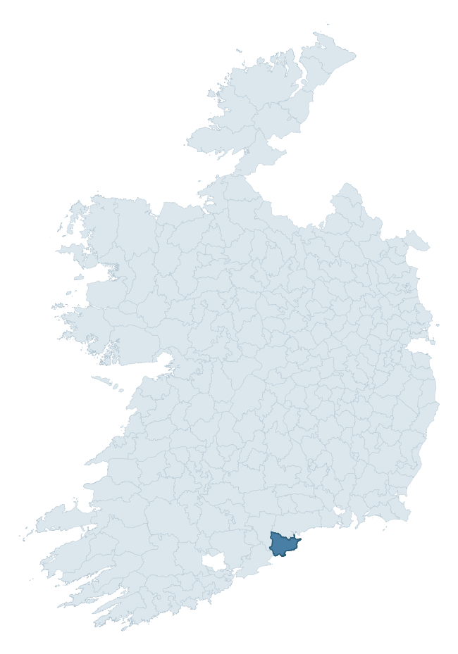
Where this barony sits in the Republic of Ireland
Geology and preservation
Bedrock geology shapes the landscape long before any settlement begins — controlling soil drainage, agricultural potential, the survival of upstanding monuments, and the preservation of buried archaeology. The figures below come from the Geological Survey Ireland 1:100,000 bedrock map.
The bedrock underlying Decies Within Drum is predominantly mudstone (35% of the barony by area), laid down during the Devonian period (80% by area, around 419 to 359 million years ago). Mudstone breaks down into heavy, often poorly-drained clay soils that historically limited intensive arable use. The lower density of ploughing tends to preserve subsurface archaeology better than in sandstone or limestone terrain, though waterlogging can be a factor for site survival. A substantial secondary geology of siltstone (26%) and sandstone (23%) adds further variety to the underlying landscape. The single largest mapped unit is the Ballytrasna Formation (35% of the barony's bedrock).
Rock type composition
Largest mapped unit: Ballytrasna Formation (35% of the barony)
Placename evidence
Logainm records 38 heritage-diagnostic placenames for Decies Within Drum, drawn from townland and civil-parish names across the barony. The dominant stratum is Early Christian ecclesiastical — cill-, teampall-, and domhnach-prefixed names that record the dense network of early church foundations established between the fifth and tenth centuries. The leading diagnostic roots are cill- (20 — church), lios- (6 — ringfort or enclosure), and gall- (6 — foreigner). This is broadly in line with the ROI average of 30.7 heritage placenames per barony. The presence of multiple heritage strata side by side indicates layered occupation of the landscape across successive prehistoric and historic periods. A notable Norse signal is also visible: 6 placenames carry the gall- ('foreigner') element, marking areas of Hiberno-Norse contact or settlement. Logainm records 244 placenames for Decies Within Drum (predominantly townland names). Of these, 38 (16%) carry one of the diagnostic Gaelic roots tracked above; the remainder draw on more generic landscape vocabulary that does not encode a heritage period.
Pre-Christian / Early Medieval Defensive
| Root | Count | Meaning |
|---|---|---|
| lios- | 6 | ringfort or enclosure |
| ráth- | 4 | earthen ringfort |
Early Christian Ecclesiastical
| Root | Count | Meaning |
|---|---|---|
| cill- | 20 | church (early) |
| gráinseach- | 2 | monastic farm / grange |
| díseart- | 1 | hermitage |
| tobar- | 1 | holy well |
| cillín- | 1 | unconsecrated burial ground |
Burial, Ritual, and Norse-Contact
| Root | Count | Meaning |
|---|---|---|
| gall- | 6 | foreigner — Norse settlement marker |
| carn- | 3 | cairn |
Other baronies in Waterford
- Gaultiere
- Middlethird
- Decies Without Drum
- Upperthird
- Glenahiry
- Coshmore And Coshbride
- Corcomroe — Clare
- Shanid — Limerick
- Ormond Upper — Tipperary
- Bantry — Cork
See all 280 baronies in the Republic of Ireland Heritage Tool.

Explore further
Grounding History: 10 Maps of Northern Ireland’s Past
If you’re interested in Irish heritage more widely, the companion report for Northern Ireland brings together the analysis of all 462 NI wards into one place through 10 high-quality maps — covering monument density, archaeological periods, placename heritage, terrain, wetland, and the historic landscape at first survey. Take a look.
About this profile
Click any section below to expand.
What is a barony?
A barony is a historic administrative unit in Ireland, broadly equivalent to an English hundred. The 280 baronies used here are from the OSi 2019 National Statutory Boundaries (generalised 20m), covering the 26 counties of the Republic of Ireland. Baronies derive from the Norman period, were formalised in the 17th century, and have not been redrawn for statistical purposes. They vary enormously in area, from compact urban baronies in Dublin to vast upland baronies in Connacht, and should not be compared by raw site count without accounting for area differences.
What counts as a site?
This profile combines three distinct heritage registers, each with its own definition of what constitutes a recordable site:
- Archaeological sites (NMS). The National Monuments Service Sites and Monuments Record (SMR) catalogues every known archaeological monument or site of archaeological interest in the Republic, from prehistoric burial mounds and ringforts to medieval churches and post-medieval defensive works. Inclusion does not require legal protection — only that the site has been identified, surveyed, and assessed as having archaeological value. A separate subset of these sites lies within a recorded protection zone, which gives them statutory protection under the National Monuments Acts.
- Listed buildings (NIAH). The National Inventory of Architectural Heritage records buildings of architectural, historical, archaeological, artistic, cultural, scientific, social, or technical interest. Each surveyed structure is appraised on a five-tier scale: International, National, Regional, Local, and Record-Only. The NIAH appraisal is informational rather than strictly statutory, but it underpins local-authority Record of Protected Structures (RPS) listings.
- Heritage placenames (Logainm). Logainm is the authoritative database of Irish placenames maintained by the Placenames Branch. This profile applies a heritage-diagnostic classifier to the Irish-language form of each townland name, flagging roots that signal defensive sites (ráth-, lios-, dún-, caiseal-, cathair-), ecclesiastical foundations (cill-, teampall-, domhnach-, mainistir-), prehistoric burial-ritual features (tuaim-, carn-, leaba-), or Norse-contact settlement (gall-). Townlands without one of these diagnostic roots are not flagged here — they may still carry historical significance, but that significance is not encoded in the name itself.
Editorial principles
The narrative sections of this profile follow several explicit principles:
- Evidential. Every claim about this barony’s heritage character is anchored in the underlying register data. Where a site count, a placename count, or a percentile rank is cited, it is computed from the source datasets at export time, not estimated.
- Comparative. Counts and metrics are reported alongside their percentile rank against the other 279 ROI baronies. A barony with 50 ringforts in absolute terms could be unusually high or unusually low depending on its size and regional context; percentile ranking removes that ambiguity.
- Transparent on limits. Where a register has known coverage gaps, survey biases, or data-quality issues that affect this barony’s figures, the profile flags them rather than presenting the numbers as definitive.
- No interpretation beyond what the data supports. The narrative does not speculate about historical events, social dynamics, or cultural meaning beyond what the recorded heritage and placename evidence directly attests.
Data caveats and limits
- NMS Sites and Monuments Record is the product of survey campaigns conducted at different intensities across different counties and decades. Some baronies have been surveyed more thoroughly than others, and absolute counts should be read in that light. Sites destroyed by development before survey are typically not represented; sites in heavily forested or upland terrain are sometimes under-recorded.
- NIAH coverage is broadly complete for the Republic of Ireland but the survey was conducted on a rolling county-by-county basis, and the most recent appraisal date varies. Buildings demolished or substantially altered after their original survey may still appear in the register; conversely, recent buildings of merit may not yet have been appraised.
- Logainm classification applies a deliberately conservative pattern-matching approach to the Irish-language townland forms. The classifier prioritises true positives over recall: a townland may carry a heritage signal that the classifier doesn’t recognise, particularly where the diagnostic root has been heavily anglicised or where the townland name draws on a less common term. The 60,000+ townland records and ~9,800 classified placenames give a substantial signal at barony scale, but individual townland names should be checked against Logainm directly for definitive interpretation.
- Period attribution. The chronological distribution reflects only those NMS sites that carry a recognised period attribution in the source data. Sites listed as “Unknown” period are excluded from the dated subset.
- Boundary changes. Some baronies have undergone minor boundary adjustments since their 19th-century definition; the OSi 2019 generalised boundaries used here are the current statutory definition and may differ slightly from historical maps in border areas.
- Bedrock geology is mapped at 1:100,000 scale, which means local variation within a barony — small pockets of different rock type, mineral veins, alluvium overlying bedrock — is generalised. The dominant-system and rocktype figures are area-weighted, so a barony reading “70% Carboniferous limestone” may still contain small but archaeologically important pockets of older or younger rock. Around 3% of GSI polygons do not match the lexicon and contribute no rocktype or system attribution.
Data sources
- National Monuments Service — Sites and Monuments Record (SMR) https://data.gov.ie/dataset/national-monuments-service-archaeological-survey-of-ireland
- National Inventory of Architectural Heritage (NIAH) https://data.gov.ie/dataset/national-inventory-of-architectural-heritage-niah-national-dataset
- Logainm — Placenames Database of Ireland https://www.logainm.ie/
- Ordnance Survey Ireland — National Statutory Barony Boundaries 2019 https://data-osi.opendata.arcgis.com/
- EURODEM — European Digital Elevation Model https://www.mapsforeurope.org/datasets/euro-dem
- ESA WorldCover https://esa-worldcover.org/en
- Geological Survey Ireland — 1:100,000 Bedrock Geology https://www.gsi.ie/en-ie/data-and-maps/Pages/Bedrock.aspx
Explore more: Search any of the 280 ROI baronies, browse by historical province, or read the methodology and data sources for the full Republic of Ireland Heritage Tool.