
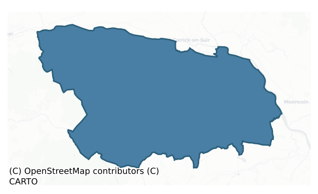
Upperthird is a barony of County Waterford, in the historical province of Munster (Irish: Uachtar Tíre), covering 256 km² of land. The barony records 380 NMS archaeological sites and 138 NIAH listed buildings, placing it at around the 32nd percentile among 280 ROI baronies for sites per km². This means it is in the bottom third of all baronies for sites per km². Dated archaeological evidence runs from the Early Bronze Age through to the Medieval, spanning 4 of 9 archaeological periods, placing the barony in the 3rd percentile among 280 ROI baronies for chronological depth. This means it is in the bottom tenth of all baronies for chronological depth. The largest dated subset of recorded sites dates to the Middle-Late Bronze Age. Logainm flags 20 placenames in the barony as carrying a recognised heritage root; the largest share — around 75% — are names associated with early Christian church and monastic foundations.
Heritage at a glance
Percentile rankings throughout this profile compare each barony only against the other 279 Republic of Ireland baronies.
The recorded heritage of Upperthird
The National Monuments Service Sites and Monuments Record (SMR) is the statutory inventory of archaeological sites for the Republic of Ireland, maintained by the Department of Tourism, Culture, Arts, Gaeltacht, Sport and Media. Sites recorded here include earthworks, ringforts, megalithic tombs, ecclesiastical remains, and post-medieval features; not every record is legally protected, but each is registered as a monument of archaeological interest.
The National Monuments Service records 380 archaeological sites in Upperthird, putting it at the 32nd percentile among 280 ROI baronies for sites per km². This means it is in the bottom third of all baronies for sites per km². Protection coverage is near-universal — 370 sites (97%) fall within a recorded monument protection zone, indicating an extensively surveyed landscape. The dominant category is defensive sites — ringforts, enclosures, hillforts, and stone forts (163 sites, 43% of the record). The most diagnostically specific type is Ringfort – rath (44 records, 12% of the barony's NMS total) — compared to an ROI average of 20% across all baronies where this type occurs. Ringfort – rath is an earthen ringfort enclosed by a bank and external ditch — the most common Early Medieval farmstead, broadly dated 500–1000 AD. The broader 'Enclosure' classification — which catches unclassified ringforts and field enclosures — accounts for a further 66 records (17%) and reflects the difficulty of sub-classifying degraded earthworks from surface evidence alone. Across the barony's 256 km², this gives a recorded density of 1.48 sites per km².
Most common monument types
Hover or tap a monument type to see its definition.
| Type | Count |
|---|---|
| Enclosure a banked or ditched feature of uncertain type, used as a catch-all where the original function cannot be determined from surface evidence | 66 |
| Ringfort – rath an earthen ringfort enclosed by a bank and external ditch — the most common Early Medieval farmstead, broadly dated 500–1000 AD | 44 |
| Standing stone a deliberately set upright stone, used variously as a Bronze/Iron Age burial marker, route marker or commemorative monument | 27 |
| Ringfort – unclassified a circular Early Medieval settlement enclosure where surviving evidence does not allow distinction between earthen and stone forms | 24 |
| Burnt mound a heap of fire-cracked stone, ash and charcoal, with no surviving trough, dated Bronze Age to early medieval | 21 |
| Church a building used for public Christian worship, of any date from c. 500 AD onwards | 17 |
| Bullaun stone a boulder or rock outcrop with hemispherical hollows ('bulláin'), commonly associated with ecclesiastical sites and holy wells | 17 |
| Fulacht fia a horseshoe-shaped Bronze Age burnt mound built around a sunken trough beside a water source, traditionally interpreted as a cooking site | 10 |
Chronological distribution
The dated archaeological record for Upperthird spans from the Early Bronze Age through to the Medieval, with activity attested across 4 of 9 archaeological periods. This is the 3rd percentile across ROI baronies — a relatively narrow chronological band, with much of Irish prehistory not represented in the dated record. The record is near-continuous, with only the Iron Age period falling inside the span without any recorded sites. Activity concentrates most heavily in the Middle Late Bronze Age (10 sites, 50% of dated material), with the Medieval forming a secondary peak (7 sites, 35%). A further 1 recorded sites (5% of the overall NMS register for the barony) carry no period attribution — appearing as 'Unknown' in the bar chart below. This typically reflects either records that pre-date the standardised period vocabulary or sites awaiting specialist dating review, rather than a genuine absence of chronological evidence.
Sample of recorded monuments
Show 25 sample monuments (of 380 total)
A representative sample of 25 recorded monuments drawn from the barony’s 380 total NMS entries. Sites within a recorded monument protection zone and rarer site types are prioritised so the list shows a meaningful cross-section rather than only the most common type. Each entry shows the official Sites and Monuments Record reference number and the description published by the National Monuments Service.
Cairn – clearance cairn
Situated towards the bottom of a gentle S-facing slope with a WNW-ESE stream to the S, on the early ecclesiastical site known as 'Cíll Eoghan' (Power 1952, 416). Centrally located in the S half of the ecclesiastical…
Situated towards the bottom of a gentle S-facing slope with a WNW-ESE stream to the S, on the early ecclesiastical site known as 'Cíll Eoghan' (Power 1952, 416). Centrally located in the S half of the ecclesiastical enclosure (WA002-040003-) is an overgrown cairn of collapsed material (dims. 7m N-S; 4m E-W; H 1m), which may contain the remains of the church (WA002-040001-). On its W side is a conglomerate double bullaun stone (WA002-040005-). The possible megalithic structures (WA002-040006-) and (WA002-040008-) were adjacent to it to the W and N respectively. (Lyons 1948, 178)
Power, P. (1952) The placenames of the Decies. (second ed.) Cork University Press.
Compiled by: Michael Moore. Date of upload: 27th August, 2010.
Castle – unclassified
Described by J. O'Donovan c. 1838 as the stump of a castle c. 50 paces E of Rathgormuck castle (WA003-039001-) (O'Flanagan 1929, 36). He described it as ' twelve feet high, and measuring twenty nine feet eight inches by…
Described by J. O'Donovan c. 1838 as the stump of a castle c. 50 paces E of Rathgormuck castle (WA003-039001-) (O'Flanagan 1929, 36). He described it as ' twelve feet high, and measuring twenty nine feet eight inches by 24 feet with walls about six feet thick' (dims. c. 12m x c. 7.5m).' It still had a vaulted roof. There is no other evidence of this castle, and the location is now occupied by farm sheds, but it may have been a corner tower of the bawn (WA003-039003-) associated with the tower house (WA003-039001-).
O'Flanagan, M. (Compiler) (1929) Letters containing information relative to the antiquities of the county of Waterford collected during the progress of the Ordnance Survey in 1841. Typescript. Bray.
Compiled by: Michael Moore
Date of upload: 16 November 2011
Stone head
It is cemented on top of a boulder (H 1.4m) on a W-facing slope. This is a carved sandstone head (H 0.22-0.3m; dims. of flat crown 0.34m x 0.3m). The facial features, carved in relief, are now partially destroyed and…
It is cemented on top of a boulder (H 1.4m) on a W-facing slope. This is a carved sandstone head (H 0.22-0.3m; dims. of flat crown 0.34m x 0.3m). The facial features, carved in relief, are now partially destroyed and only the ears and hairline at the poll are visible.
The above description is derived from the published 'Archaeological Inventory of County Waterford' (Dublin: Stationery Office, 1999). In certain instances the entries have been revised and updated in the light of recent research.
Date of upload/revision: 23 December 2008
Cairnfield
Located on a shoulder or col on the NE-facing slope of the Comeragh Mountains. This is an area of c. 2ha on a gentle S-facing slope containing about fifteen grass- and heather-covered clearance cairns (diam. 3-8m; H…
Located on a shoulder or col on the NE-facing slope of the Comeragh Mountains. This is an area of c. 2ha on a gentle S-facing slope containing about fifteen grass- and heather-covered clearance cairns (diam. 3-8m; H 0.3m). An old field wall (Wth 1.5-2m; H 0.3m) extends NE-SW (L c. 100m) across the site. Also within the cairnfield are a ring-cairn (WA006-014002-) and a booley hut (WA006-014003-).
The above description is derived from the published 'Archaeological Inventory of County Waterford' (Dublin: Stationery Office, 1999). In certain instances the entries have been revised and updated in the light of recent research.
Date of upload/revision: 27th October, 2010.
Cairn – ring-cairn
Situated on a shoulder of the NE-facing slope of the Comeragh Mountains, and within a cairnfield (WA006-014001-). Heather-covered ring of cairn material (ext. diam. 12.5-14.3m; int. diam. 9.3-10m) open at SSW (Wth…
Situated on a shoulder of the NE-facing slope of the Comeragh Mountains, and within a cairnfield (WA006-014001-). Heather-covered ring of cairn material (ext. diam. 12.5-14.3m; int. diam. 9.3-10m) open at SSW (Wth 1.1m).
The above description is derived from the published 'Archaeological Inventory of County Waterford' (Dublin: Stationery Office, 1999). In certain instances the entries have been revised and updated in the light of recent research.
Date of upload/revision: 23 December 2008
Field system
Situated on a plateau overlooking streams 300m to the NE and c. 400m to the SW. A grass and heather-covered area of c. 3ha is divided by field walls with stone-facing (Wth 1.5-2m; H c. 0.5m) into a number of large…
Situated on a plateau overlooking streams 300m to the NE and c. 400m to the SW. A grass and heather-covered area of c. 3ha is divided by field walls with stone-facing (Wth 1.5-2m; H c. 0.5m) into a number of large rectangular fields (dims. c. 150m x 50-60m). It is associated with conjoined circular huts (WA006-034001-) and two booley huts (WA006-034002-; WA006-034003-).
The above description is derived from the published 'Archaeological Inventory of County Waterford' (Dublin: Stationery Office, 1999). In certain instances the entries have been revised and updated in the light of recent research.
Date of upload/revision: 23 December 2008
Castle – motte and bailey
Situated on top of a broad plateau. This is a flat-topped earthen mound (max. dims. at top 8.5m N-S; 7m E-W: dims. at base 21m E-W; H 4.3m) that is now D-shaped as a result of quarrying at the NE. There is no evidence…
Situated on top of a broad plateau. This is a flat-topped earthen mound (max. dims. at top 8.5m N-S; 7m E-W: dims. at base 21m E-W; H 4.3m) that is now D-shaped as a result of quarrying at the NE. There is no evidence of a fosse. The site is overgrown and planted with coniferous trees. The enclosure (WA007-006002-), a grass-covered area (dims. 44m E-W; 40m N-S) defined by a scarp (max. H 0.7m) with traces of a fosse at S, is attached to the S and could serve as a bailey. Tower house (WA007-007—-) is c. 150m to the E.
The above description is derived from the published 'Archaeological Inventory of County Waterford' (Dublin: Stationery Office, 1999). In certain instances the entries have been revised and updated in the light of recent research.
Date of upload/revision: 27 July 2010
Religious house – Augustinian canons
Situated at the crest of the W-facing slope of a N-S valley. An early ecclesiastical site was reputedly founded here by St Brogan, succeeded by St. Cuan, in the 6th century. This may have been at St. Cuan's Well…
Situated at the crest of the W-facing slope of a N-S valley. An early ecclesiastical site was reputedly founded here by St Brogan, succeeded by St. Cuan, in the 6th century. This may have been at St. Cuan's Well (WA003-051002-) c. 2km to the NE.The foundation of an Augustinian house here may pre-date the Anglo-Norman invasion. The abbey was dissolved in 1540, although the church may have been parochial at this time serving Mothel parish (Gwynn and Hadcock 1970, 188). On its dissolution the abbey consisted of a church and steeple, five chambers, a dormitory, a kitchen, a granary and stables (Power 1896b, 9-14).
The remains consist of part of the W gable with a doorway placed high in the wall, which may have led to a tower that is no longer extant, and part of the S wall with evidence of three windows, one with a pointed twin-light. A chapel or transept to the S, originally entered through a round-headed doorway, is represented by wall foundations. The decorated side panels of a chest-tomb (WA007-010003-) (M.M. 1959; Hunt 1974, vol. 1, 233-4) with an inscription commemorating Abbot Rory O'Comoyn dating c. 1500, three medieval graveslabs (WA007-010004-; WA007-010005-; WA007-010006-), a panel from a chest tomb (WA007-010013-), a finial with a cross-socket (WA007-010010-) and dressed casement stones are within the large rectangular graveyard (dims. c. 90m NW-SE; c. 75m NE-SW). There are a number of architectural fragments in the S transept, including a double capital with fol…
Cross
The triangular base of a finial cross with a socket is in the graveyard (WA007-010002-) of Mothel Abbey (WA007-010001-).
Compiled by: Michael Moore
Date of upload: 01 November 2010
Cross-slab
A headstone (H 0.95m; Wth 0.63-0.69m; T 0.16-0.18m) in the graveyard (WA007-010002-) of Mothel Abbey (WA007-010001-) may be a re-used early cross-slab. It has a Latin cross (H 0.74m; Wth 0.59m) with hollowed angles in…
A headstone (H 0.95m; Wth 0.63-0.69m; T 0.16-0.18m) in the graveyard (WA007-010002-) of Mothel Abbey (WA007-010001-) may be a re-used early cross-slab. It has a Latin cross (H 0.74m; Wth 0.59m) with hollowed angles in relief, which is the same design as on the cross-inscribed pillar (WA007-011—-) c. 50m S of the graveyard, although it may be a recent feature inspired by the cross-inscribed pillar. (Manning 1981)
Manning, C. (1981) An Early Christian grave-slab at Mothel. Decies, No. 17, 80-1.
Compiled by: Michael Moore
Date of upload: 01 November 2010
Cross-inscribed pillar
Situated on a W-facing slope c. 50m S of the graveyard of Mothel Abbey (WA007-010001-), and at the entrance to a farmyard. A slightly tapering Old Red Sandstone pillar (H 1.2m; dims. of top 0.23m x 0.23m) has a socket…
Situated on a W-facing slope c. 50m S of the graveyard of Mothel Abbey (WA007-010001-), and at the entrance to a farmyard. A slightly tapering Old Red Sandstone pillar (H 1.2m; dims. of top 0.23m x 0.23m) has a socket (dims. 12cm x 11cm; D 11cm) on top and slight traces of an incised cross with hollow angles on one face. (Power 1897c, 117)
Power, P (1897c) Notes and queries – Cross inscribed pillar stone at Mothel. WAJ 3, 117.
Compiled by: Michael Moore
Date of upload: 01 November 2010
Mine
Located on a NW-facing slope of Croughaun Hill. An L-shaped, man-made passage (total L c. 4m; Wth 1-1.4m; H 1-1.5m) is excavated through rock into the NE bank of a SE-NW stream. It curves around to the NW and begins to…
Located on a NW-facing slope of Croughaun Hill. An L-shaped, man-made passage (total L c. 4m; Wth 1-1.4m; H 1-1.5m) is excavated through rock into the NE bank of a SE-NW stream. It curves around to the NW and begins to sink. There is no evidence of a spoil heap.
The above description is derived from the published 'Archaeological Inventory of County Waterford' (Dublin: Stationery Office, 1999). In certain instances the entries have been revised and updated in the light of recent research.
Compiled by: Michael Moore
Date of upload/revision: 02 November 2010
Stone row
Situated on a W-facing slope overlooking a col between Croughaun Hill and the Comeragh Mountains to the W. Three conglomerate stones form a row aligned E-W (L 4.3m). The E stone is rectangular (dims. 1.1m x 0.35m; H…
Situated on a W-facing slope overlooking a col between Croughaun Hill and the Comeragh Mountains to the W. Three conglomerate stones form a row aligned E-W (L 4.3m). The E stone is rectangular (dims. 1.1m x 0.35m; H 0.95m) and is aligned E-W. The central stone is rectangular (dims. 0.95m x 0.5m; H 0.8m) and aligned E-W, while the W stone is triangular in shape (dims. 0.95m x 0.4m: H 0.6m) and aligned E-W. The spaces between the stones from the E are 0.7m and 0.5m. A fourth stone lies prone (dims. 0.4-0.8m x 0.5-0.6m) at the W end. The stone row had been removed by January 2012.
The above description is derived from the published 'Archaeological Inventory of County Waterford' (Dublin: Stationery Office, 1999). In certain instances the entries have been revised and updated in the light of recent research.
Compiled by: Michael Moore
Date of upload/revision: 21 January 2012
Bridge
Spanning the Clodiagh River (total L 40m). It is mentioned in the Civil Survey of 1654 (Simington 1942, 105) and is traditionally thought to have been built by King John. A narrow bridge (Wth 4m) consisting of three…
Spanning the Clodiagh River (total L 40m). It is mentioned in the Civil Survey of 1654 (Simington 1942, 105) and is traditionally thought to have been built by King John. A narrow bridge (Wth 4m) consisting of three segmental arches of unequal width with plain voussoirs. The piers are carried to the parapet with refuges on the W side.
The above description is derived from the published 'Archaeological Inventory of County Waterford' (Dublin: Stationery Office, 1999). In certain instances the entries have been revised and updated in the light of recent research.
Date of upload/revision: 23 December 2008
Tomb – effigial
Situated at the edge of the floodplain of the River Suir with the W-E Kilbunny Stream 30-40m to the SE. The Romanesque parish church of Guilcagh (WA008-010001-) is within a small rectangular graveyard (WA008-010002-). A…
Situated at the edge of the floodplain of the River Suir with the W-E Kilbunny Stream 30-40m to the SE. The Romanesque parish church of Guilcagh (WA008-010001-) is within a small rectangular graveyard (WA008-010002-). A 16th or 17th century effigy of a bishop (dims. c. 0.75m x c. 0.4m) with the inscription S. MONNIA EPISCOPS was in the church and is now missing (pers. comm. M. Cahill, National Museum of Ireland). (Martin 1874-5, 248; Power 1895b, 247-50; 1922; P. and Ed. 1911)
The attached image (DU018-243—-_01.jpg) is from Power 1922.
Compiled by: Michael Moore
Updated by: Paul Walsh
Revised date of upload: 18 April 2017
Stone sculpture – iconic
Situated towards the top of a SW-facing slope, and cemented onto a conglomerate boulder. Thisi is a sandstone head (dims. 0.38m x 0.30m; H 0.43m) with features incised into a flat face. A raised area around the skull,…
Situated towards the top of a SW-facing slope, and cemented onto a conglomerate boulder. Thisi is a sandstone head (dims. 0.38m x 0.30m; H 0.43m) with features incised into a flat face. A raised area around the skull, covering the ears, may depict the hairline or a cap. It has a pointed chin which may be bearded. (Veale 1992)
The above description is derived from the published 'Archaeological Inventory of County Waterford' (Dublin: Stationery Office, 1999). In certain instances the entries have been revised and updated in the light of recent research.
Date of upload/revision: 23 December 2008
Ring-ditch
Situated at the crest of a S-facing slope in pasture. Circular area (ext. diam. 7.6-7.8m) defined by a band of visibly lusher grass-growth (Wth 0.4m).
Compiled by: Michael Moore.
Date of upload: 20th July 2010
Font (present location)
The sandstone ocatgonal font (ext. dims. 0.84m x 0.81m; H 0.36m) with a circular basin (int. diam. 0.6m; D 0.2m) from Tinhala church (WA004-005—-) is kept in the garden of a house.
Compiled by: Michael…
The sandstone ocatgonal font (ext. dims. 0.84m x 0.81m; H 0.36m) with a circular basin (int. diam. 0.6m; D 0.2m) from Tinhala church (WA004-005—-) is kept in the garden of a house.
Compiled by: Michael Moore
Date of upload: 20 July 2010
Boundary stone (present location)
Marked only on the 1926 ed. of the OS 6-inch map as Clogh na gCrann, it is more correctly called 'Cloch na gCeann'. Originally situated at the E side of a road (WA003-045001-) towards the top of a S-facing slope. This…
Marked only on the 1926 ed. of the OS 6-inch map as Clogh na gCrann, it is more correctly called 'Cloch na gCeann'. Originally situated at the E side of a road (WA003-045001-) towards the top of a S-facing slope. This is a sandstone boulder (dims. c. 1m x 1m x 1m) on which it is believed the heads of executed criminals were once displayed. It is now on the W side of the W road bank, c. 30m distant from its original location.
Compiled by: Michael Moore
Date of upload: 20 July 2010
Headstone
Situated at the N crest of the Suir escarpment. Burial in the graveyard (WA003-034002-) of the parish church of Feonagh dates from the the late 18th to the mid 19th century, but there is a headstone to James Bryan dated…
Situated at the N crest of the Suir escarpment. Burial in the graveyard (WA003-034002-) of the parish church of Feonagh dates from the the late 18th to the mid 19th century, but there is a headstone to James Bryan dated 1701.
Compiled by: Michael Moore
Date of upload: 20 July 2010
Road – road/trackway
A roadway, known locally as Boithrín na Socraithe or the road of the funerals, was built to connect the W and E sides of Rathgormuck parish that are separated by the Comeragh Mountains. The E part of the road, from the…
A roadway, known locally as Boithrín na Socraithe or the road of the funerals, was built to connect the W and E sides of Rathgormuck parish that are separated by the Comeragh Mountains. The E part of the road, from the Gap, called Barnavelavallagh, is marked on the Grand Jury map of Co. Waterford. dated 1818 (NLI: 16 J 4). The road rises on the W side from c. OD 320m in Carrigeen to the summit of The Gap at c. OD 460m, and descends through Graigavalla to a height of c. OD 320m (L c. 3.5km). At one time the E end continued down to roads on the lowland and on to Rathgormuck church (WA003-040001-).
It is traceable over most of its length, apart from the summit eastwards in Graigavalla where it cannot ba identified in a severe slope. It is visible as a grass and heather-covered sunken area (Wth c. 4-8m; D 0.2-0.5m), often bordered with slight earthen and stone banks. In many places the roadway has become a drain, since the opening of the surface provides an oportunity for rainwater to erode a channel, and the gradient provides a slope. In Carrigeen it is on a gentle S-facing slope, but in Graigavalla it is on a more severe N-facing slope.
Compiled by: Michael Moore
Date of Upload: 04 October 2011
Wall monument (present location)
This rectangular wall monument (H 1m; Wth 0.8m) of polished limestone was formerly located in the C of I church in Carrick-on-Suir, Co. Tipperary (TS085-004040-). It was recorded there by FitzGerald (1904-06, 144) as ‘a…
This rectangular wall monument (H 1m; Wth 0.8m) of polished limestone was formerly located in the C of I church in Carrick-on-Suir, Co. Tipperary (TS085-004040-). It was recorded there by FitzGerald (1904-06, 144) as ‘a white and black marble mural monument bearing the Power coat-of-arms, with the following inscription: Here lyeth the Body of the RIGHT HONBLE JOHN POWER EARLE of TYRONE who died the 14th of October 1693 in the 29th yeare of his Age’. After the church was deconsecrated the wall monument was moved to Clonagam C of I church in Co. Waterford. It is currently located on the internal face of the E gable wall, 1.4m from the NE angle and is 2.55m above the internal ground level. The incised inscription is still clearly visible but the coat-of-arms is no longer apparent.
Compiled by: Jean Farrelly
Date of upload: 13 May 2013
Weir – fish
According to Power (1991, 153) this weir is called Cor Uí Chriotháin (O'Crehan's Weir) and was also known as Davin's Weir. The extent of the Manor of Carrickmagriffin, carried out in 1415, mentions that there were 'vj…
According to Power (1991, 153) this weir is called Cor Uí Chriotháin (O'Crehan's Weir) and was also known as Davin's Weir. The extent of the Manor of Carrickmagriffin, carried out in 1415, mentions that there were 'vj gurgites salmonum' in the manorial waters of Suir, which has been interpreted as 'six weirs', and according to local tradition this is one of those six (ibid.). Power states that the weir 'was used until 1922, when abortive attempts to blow it up in April and May led the lessee Davin to dismantle it'. The Waterford side of this zig-zag weir (WA003-058—) is still apparent, even when the water level is fairly high, as at time of inspection. It is located c. 100m upstream of a small circular tower, which is c. 20m from the water's edge, on the Waterford side. The tower, which appears to be of 19th-century date, is marked on the 2nd (1922) ed. Waterford OS 6-inch sheet 3, as 'Coolnamuck Tower' and according to Power it functioned as a watchtower, keeping the weir under surveillance. The weir on the Waterford OS 6-inch map is called 'Coolnamuck Salmon Weir'. Across the river from the weir in Co. Tipperary there stood a small pier, known as Cois Cortha or Weirside (Power 1991, 153).
Compiled by: Jean Farrelly
Date of upload: 26 August 2011
House – 17th century
Situated on the floodplain of the River Suir. Built by Alexander Power during the reign of James I, it was owned by Richard Power FitzAlexander in 1640 (Simington 1942, 101) but the house passed to Sir Thomas Stanley…
Situated on the floodplain of the River Suir. Built by Alexander Power during the reign of James I, it was owned by Richard Power FitzAlexander in 1640 (Simington 1942, 101) but the house passed to Sir Thomas Stanley and then to Sir Nicholas Osborne during the Cromwellian settlement. The Osborne family lived here until they moved to Newtown Anner, Co. Tipperary, in the late 18th century (de la Paor 1898; Morrissey 1909; O'Flanagan 1929, 54-5).
This is a rectangular structure of three floors with an attic, and it has a four-bay W façade with two gables (ext. dims. 15.8m N-S; 9.2m E-W). A stairs tower (ext. dims. 5.3m N-S; 3.8m E-W) projects from the centre of the E wall. There are no internal divisions apart from one cross-wall at ground level placed towards the S gable. One garderobe chute is visible exiting on the external face of the N wall at the W end. There are small defensive windows of dressed sandstone at ground-floor level, except at W, and one lighting the stairs return has a musket loop. The upper floors have two- and three-light rectangular windows of dressed limestone with square hood-mouldings. The fireplaces number one on the ground floor in the N gable, two on the first floor in the N gable and E wall, four on the second floor where there is one on each wall, and one in the attic. They are provided with six plain chimneys, with another three chimneys over the stairs tower although two of these are false, and all rise to the same height. There is an extern…
Enclosure
This is a roughly square area with rounded corners (int. dims. 13m N-S and E-W), defined by a broad earthen bank (Wth at crest 1.5m; overall Wth 1.7-3m; int. H 0.45—1m; ext. H 0.37-0.45m) with inner and outer stone…
This is a roughly square area with rounded corners (int. dims. 13m N-S and E-W), defined by a broad earthen bank (Wth at crest 1.5m; overall Wth 1.7-3m; int. H 0.45—1m; ext. H 0.37-0.45m) with inner and outer stone revetment, though in some area this has been reduced to form a low, broad bank and the revetment is reduced to an inner and outer kerbing. The interior is sunken, however, while the ground surrounding the enclosure is very wet and muddy, the interior is dry. Within the interior there are two bedrock outcrops and in the S sector there is a large split boulder. The interior is quite overgrown with gorse and scrub. There is a stone-lined entrance in the SE sector (Wth 1.3m; L 3m) and to the S of the entrance, at the SE angle of the enclosure, there is a small rectangular stone feature, possibly the base of a gate pier. At a distance of 7.2m to the SW there is a small stone structure (H c. 1m; L c. 2m) of rough walling which is described by the present landowner as the remains of a windmill. This may have been related to the meteorological activities of Joseph Grubb who, in 1899, built the nearby Sheskin House, 150m to the SE, and who had a keen interest in geology, botany and archaeology (Ahern 2009, 284-5). The enclosure seems be that which is described and published in 1944 by Joseph’s daughter Isabel Grubb, as a ‘prehistoric burial site’. It is described by Ms. Grubb (1944, 176) as measuring, ‘roughly thirty-five feet [10.67m] from north to south and twenty-fi…
Listed buildings
The National Inventory of Architectural Heritage (NIAH) is a state survey appraising buildings of architectural, historical, archaeological, artistic, cultural, scientific, social, or technical interest. Each surveyed structure receives a rating from International (the highest, for buildings of European importance) through National, Regional, Local, and Record-Only.
The NIAH records 138 listed buildings in Upperthird (63rd percentile across ROI baronies). Among these, 11 are graded National — buildings of interest to the whole of Ireland rather than only its region. The Republic holds 937 National-graded buildings in total, so this barony accounts for around 1% of the national total. Construction dates concentrate most heavily in the Victorian (1830-1900) period. The most-recorded building type is house (38 examples, 28% of the listed stock).
Terrain and environment
Mean elevation across the barony is 28m — the 5th percentile among 280 ROI baronies for elevation. This means it is in the bottom tenth of all baronies for elevation. This is a relatively low-lying landscape by ROI standards. Elevation matters for heritage because higher-altitude baronies typically favour defensive monuments — ringforts and hilltop forts placed on prominent ground — while lowland baronies are more likely to carry the dense settlement and church networks of intensive agricultural landscapes. A maximum elevation of 134m gives the barony meaningful vertical relief. Mean slope is 6.7° — the 90th percentile among 280 ROI baronies for slope. This means it is in the top tenth of all baronies for slope. This is consistently steep terrain by ROI standards, the kind of landscape that tends to preserve upstanding archaeological features well. Slope is a key control on both land use and archaeological preservation: steep ground resists ploughing and tends to preserve earthworks intact, while gentle slopes favour intensive cultivation that damages or destroys surface archaeology over time. Localised maximum slopes reach 19°, typical of stream-cut valleys, escarpments, or coastal bluffs within the wider landscape. The Topographic Wetness Index averages 9.7, the 14th percentile among 280 ROI baronies for wetness. This means it is in the bottom fifth of all baronies for wetness. This is well-drained ground by ROI standards — typical of upland or steeply-sloping country that sheds water rapidly. Drainage matters for heritage because poorly-drained ground preserves organic archaeology (wooden trackways, leather, textiles, and on rare occasions human remains) far better than free-draining soil; well-drained ground favours arable use but destroys organic material rapidly. Urban land covers 7% of the barony (the 92nd percentile among 280 ROI baronies for urban cover. This means it is in the top tenth of all baronies for urban cover). Heavy urban coverage compresses heritage analysis: many archaeological features have been buried or destroyed by development, but the surviving record is concentrated in protected city-centre cores, and the NIAH listed-buildings count is typically high. The land-cover mosaic combines improved grassland (59%), woodland (24%), and urban land (7%), giving a mixed agricultural and semi-natural landscape. In overall character, this is steeply-sloping terrain at modest elevation, with land use dominated by improved grassland.
Terrain measurements
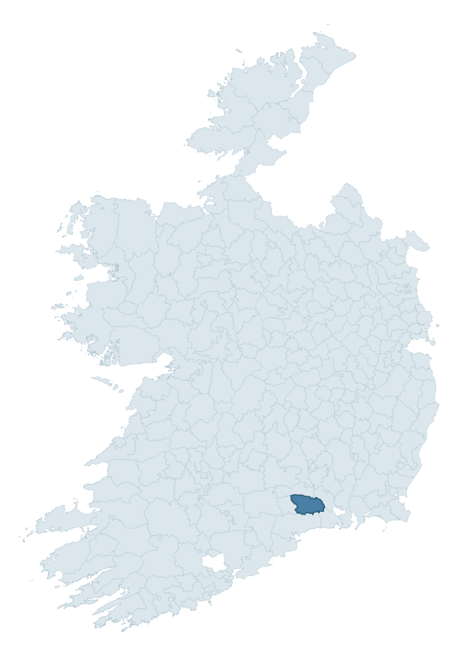
Where this barony sits in the Republic of Ireland
Geology and preservation
Bedrock geology shapes the landscape long before any settlement begins — controlling soil drainage, agricultural potential, the survival of upstanding monuments, and the preservation of buried archaeology. The figures below come from the Geological Survey Ireland 1:100,000 bedrock map.
The bedrock underlying Upperthird is predominantly slate (54% of the barony by area), with much of the rock dating to the Silurian period. Slate weathers to thin upland soils but provides high-value building and roofing stone, which often shows in surviving 19th-century rural and ecclesiastical architecture. A substantial secondary geology of sandstone (21%) and conglomerate (15%) adds further variety to the underlying landscape. The single largest mapped unit is the Ballindysert Formation (43% of the barony's bedrock).
Rock type composition
Largest mapped unit: Ballindysert Formation (43% of the barony)
Placename evidence
Logainm records 20 heritage-diagnostic placenames for Upperthird, drawn from townland and civil-parish names across the barony. The dominant stratum is Early Christian ecclesiastical — cill-, teampall-, and domhnach-prefixed names that record the dense network of early church foundations established between the fifth and tenth centuries. The leading diagnostic roots are cill- (12 — church), ráth- (4 — earthen ringfort), and díseart- (2 — hermitage). This is below the ROI average of 30.7 heritage placenames per barony, suggesting either lighter survey coverage or a townland-naming tradition that draws more on generic landscape vocabulary. Logainm records 148 placenames for Upperthird (predominantly townland names). Of these, 20 (14%) carry one of the diagnostic Gaelic roots tracked above; the remainder draw on more generic landscape vocabulary that does not encode a heritage period.
Pre-Christian / Early Medieval Defensive
| Root | Count | Meaning |
|---|---|---|
| ráth- | 4 | earthen ringfort |
| lios- | 1 | ringfort or enclosure |
Early Christian Ecclesiastical
| Root | Count | Meaning |
|---|---|---|
| cill- | 12 | church (early) |
| díseart- | 2 | hermitage |
| gráinseach- | 1 | monastic farm / grange |
Other baronies in Waterford
- Middlethird
- Coshmore And Coshbride
- Decies Without Drum
- Glenahiry
- Gaultiere
- Decies Within Drum
- Imokilly — Cork
- Kinsale — Cork
- Fermoy — Cork
- Owneybeg — Limerick
See all 280 baronies in the Republic of Ireland Heritage Tool.

Explore further
Grounding History: 10 Maps of Northern Ireland’s Past
If you’re interested in Irish heritage more widely, the companion report for Northern Ireland brings together the analysis of all 462 NI wards into one place through 10 high-quality maps — covering monument density, archaeological periods, placename heritage, terrain, wetland, and the historic landscape at first survey. Take a look.
About this profile
Click any section below to expand.
What is a barony?
A barony is a historic administrative unit in Ireland, broadly equivalent to an English hundred. The 280 baronies used here are from the OSi 2019 National Statutory Boundaries (generalised 20m), covering the 26 counties of the Republic of Ireland. Baronies derive from the Norman period, were formalised in the 17th century, and have not been redrawn for statistical purposes. They vary enormously in area, from compact urban baronies in Dublin to vast upland baronies in Connacht, and should not be compared by raw site count without accounting for area differences.
What counts as a site?
This profile combines three distinct heritage registers, each with its own definition of what constitutes a recordable site:
- Archaeological sites (NMS). The National Monuments Service Sites and Monuments Record (SMR) catalogues every known archaeological monument or site of archaeological interest in the Republic, from prehistoric burial mounds and ringforts to medieval churches and post-medieval defensive works. Inclusion does not require legal protection — only that the site has been identified, surveyed, and assessed as having archaeological value. A separate subset of these sites lies within a recorded protection zone, which gives them statutory protection under the National Monuments Acts.
- Listed buildings (NIAH). The National Inventory of Architectural Heritage records buildings of architectural, historical, archaeological, artistic, cultural, scientific, social, or technical interest. Each surveyed structure is appraised on a five-tier scale: International, National, Regional, Local, and Record-Only. The NIAH appraisal is informational rather than strictly statutory, but it underpins local-authority Record of Protected Structures (RPS) listings.
- Heritage placenames (Logainm). Logainm is the authoritative database of Irish placenames maintained by the Placenames Branch. This profile applies a heritage-diagnostic classifier to the Irish-language form of each townland name, flagging roots that signal defensive sites (ráth-, lios-, dún-, caiseal-, cathair-), ecclesiastical foundations (cill-, teampall-, domhnach-, mainistir-), prehistoric burial-ritual features (tuaim-, carn-, leaba-), or Norse-contact settlement (gall-). Townlands without one of these diagnostic roots are not flagged here — they may still carry historical significance, but that significance is not encoded in the name itself.
Editorial principles
The narrative sections of this profile follow several explicit principles:
- Evidential. Every claim about this barony’s heritage character is anchored in the underlying register data. Where a site count, a placename count, or a percentile rank is cited, it is computed from the source datasets at export time, not estimated.
- Comparative. Counts and metrics are reported alongside their percentile rank against the other 279 ROI baronies. A barony with 50 ringforts in absolute terms could be unusually high or unusually low depending on its size and regional context; percentile ranking removes that ambiguity.
- Transparent on limits. Where a register has known coverage gaps, survey biases, or data-quality issues that affect this barony’s figures, the profile flags them rather than presenting the numbers as definitive.
- No interpretation beyond what the data supports. The narrative does not speculate about historical events, social dynamics, or cultural meaning beyond what the recorded heritage and placename evidence directly attests.
Data caveats and limits
- NMS Sites and Monuments Record is the product of survey campaigns conducted at different intensities across different counties and decades. Some baronies have been surveyed more thoroughly than others, and absolute counts should be read in that light. Sites destroyed by development before survey are typically not represented; sites in heavily forested or upland terrain are sometimes under-recorded.
- NIAH coverage is broadly complete for the Republic of Ireland but the survey was conducted on a rolling county-by-county basis, and the most recent appraisal date varies. Buildings demolished or substantially altered after their original survey may still appear in the register; conversely, recent buildings of merit may not yet have been appraised.
- Logainm classification applies a deliberately conservative pattern-matching approach to the Irish-language townland forms. The classifier prioritises true positives over recall: a townland may carry a heritage signal that the classifier doesn’t recognise, particularly where the diagnostic root has been heavily anglicised or where the townland name draws on a less common term. The 60,000+ townland records and ~9,800 classified placenames give a substantial signal at barony scale, but individual townland names should be checked against Logainm directly for definitive interpretation.
- Period attribution. The chronological distribution reflects only those NMS sites that carry a recognised period attribution in the source data. Sites listed as “Unknown” period are excluded from the dated subset.
- Boundary changes. Some baronies have undergone minor boundary adjustments since their 19th-century definition; the OSi 2019 generalised boundaries used here are the current statutory definition and may differ slightly from historical maps in border areas.
- Bedrock geology is mapped at 1:100,000 scale, which means local variation within a barony — small pockets of different rock type, mineral veins, alluvium overlying bedrock — is generalised. The dominant-system and rocktype figures are area-weighted, so a barony reading “70% Carboniferous limestone” may still contain small but archaeologically important pockets of older or younger rock. Around 3% of GSI polygons do not match the lexicon and contribute no rocktype or system attribution.
Data sources
- National Monuments Service — Sites and Monuments Record (SMR) https://data.gov.ie/dataset/national-monuments-service-archaeological-survey-of-ireland
- National Inventory of Architectural Heritage (NIAH) https://data.gov.ie/dataset/national-inventory-of-architectural-heritage-niah-national-dataset
- Logainm — Placenames Database of Ireland https://www.logainm.ie/
- Ordnance Survey Ireland — National Statutory Barony Boundaries 2019 https://data-osi.opendata.arcgis.com/
- EURODEM — European Digital Elevation Model https://www.mapsforeurope.org/datasets/euro-dem
- ESA WorldCover https://esa-worldcover.org/en
- Geological Survey Ireland — 1:100,000 Bedrock Geology https://www.gsi.ie/en-ie/data-and-maps/Pages/Bedrock.aspx
Explore more: Search any of the 280 ROI baronies, browse by historical province, or read the methodology and data sources for the full Republic of Ireland Heritage Tool.