
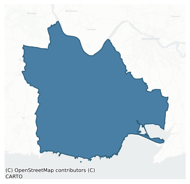
Middlethird is a barony of County Waterford, in the historical province of Munster (Irish: An Trian Meánach), covering 172 km² of land. The barony records 373 NMS archaeological sites and 294 NIAH listed buildings, placing it at around the 60th percentile among 280 ROI baronies for sites per km². This means it is in the upper half of all baronies for sites per km². Dated archaeological evidence runs from the Mesolithic through to the Post Medieval, spanning 8 of 9 archaeological periods, placing the barony in the 86th percentile among 280 ROI baronies for chronological depth. This means it is in the top fifth of all baronies for chronological depth. The largest dated subset of recorded sites dates to the Iron Age. Logainm flags 36 placenames in the barony as carrying a recognised heritage root; the largest share — around 53% — are names associated with early Christian church and monastic foundations.
Heritage at a glance
Percentile rankings throughout this profile compare each barony only against the other 279 Republic of Ireland baronies.
The recorded heritage of Middlethird
The National Monuments Service Sites and Monuments Record (SMR) is the statutory inventory of archaeological sites for the Republic of Ireland, maintained by the Department of Tourism, Culture, Arts, Gaeltacht, Sport and Media. Sites recorded here include earthworks, ringforts, megalithic tombs, ecclesiastical remains, and post-medieval features; not every record is legally protected, but each is registered as a monument of archaeological interest.
The National Monuments Service records 373 archaeological sites in Middlethird, putting it at the 60th percentile among 280 ROI baronies for sites per km². This means it is in the upper half of all baronies for sites per km². Of these, 324 (87%) fall within a recorded monument protection zone. The dominant category is defensive sites — ringforts, enclosures, hillforts, and stone forts (141 sites, 38% of the record). The most diagnostically specific type is Burnt mound (33 records, 9% of the barony's NMS total) — compared to an ROI average of 2% across all baronies where this type occurs. Burnt mound is a heap of fire-cracked stone, ash and charcoal, with no surviving trough, dated Bronze Age to early medieval. The broader 'Enclosure' classification — which catches unclassified ringforts and field enclosures — accounts for a further 57 records (15%) and reflects the difficulty of sub-classifying degraded earthworks from surface evidence alone. Across the barony's 172 km², this gives a recorded density of 2.17 sites per km².
Most common monument types
Hover or tap a monument type to see its definition.
| Type | Count |
|---|---|
| Enclosure a banked or ditched feature of uncertain type, used as a catch-all where the original function cannot be determined from surface evidence | 57 |
| Burnt mound a heap of fire-cracked stone, ash and charcoal, with no surviving trough, dated Bronze Age to early medieval | 33 |
| Ringfort – unclassified a circular Early Medieval settlement enclosure where surviving evidence does not allow distinction between earthen and stone forms | 33 |
| Standing stone a deliberately set upright stone, used variously as a Bronze/Iron Age burial marker, route marker or commemorative monument | 29 |
| Ringfort – rath an earthen ringfort enclosed by a bank and external ditch — the most common Early Medieval farmstead, broadly dated 500–1000 AD | 26 |
| Church a building used for public Christian worship, of any date from c. 500 AD onwards | 19 |
| Excavation – miscellaneous | 18 |
| Graveyard a burial area associated with a church, in use from the medieval period onwards | 14 |
Chronological distribution
The dated archaeological record for Middlethird spans from the Mesolithic through to the Post Medieval, with activity attested across 8 of 9 archaeological periods. This is the 86th percentile across ROI baronies for chronological depth — an above-average span. Every period from earliest to latest is represented in the record — an unbroken sequence of dated activity across the full chronological span. Activity concentrates most heavily in the Iron Age (121 sites, 43% of dated material), with the Early Medieval forming a secondary peak (52 sites, 19%). A further 92 recorded sites (25% of the overall NMS register for the barony) carry no period attribution — appearing as 'Unknown' in the bar chart below. This typically reflects either records that pre-date the standardised period vocabulary or sites awaiting specialist dating review, rather than a genuine absence of chronological evidence.
Sample of recorded monuments
Show 25 sample monuments (of 373 total)
A representative sample of 25 recorded monuments drawn from the barony’s 373 total NMS entries. Sites within a recorded monument protection zone and rarer site types are prioritised so the list shows a meaningful cross-section rather than only the most common type. Each entry shows the official Sites and Monuments Record reference number and the description published by the National Monuments Service.
Megalithic structure
This feature was listed in the SMR as a possible megalithic tomb (1988, WA016-018—). It stands on the NW side of a low hill in the N part of the townland and lies just N of an exposed section of outcropping rock. It…
This feature was listed in the SMR as a possible megalithic tomb (1988, WA016-018—). It stands on the NW side of a low hill in the N part of the townland and lies just N of an exposed section of outcropping rock. It consists of a small chamber (int. dims. 1.6m E-W; 0.35m N-S; H 0.75m), opening to the E, formed, in part, of upright slabs of outcropping rock which have split along the bedding planes. It is roofed by two slabs (dims. 1.5m x 0.9m; T 0.15m: 1.1m, x 0.5m) which are supported on the S side by small stones packed with mortar. An external upright stone (L 2m; H 0.45-0.9m) at S is part of the bedrock. The structure is not a megalithic tomb and, indeed, may not be ancient.
Compiled by: Michael Moore, Paul Walsh
Date of upload: 23 April 2013
Tomb – chest tomb
Situated on a S-facing slope. The parish church of Newcastle (WA016-026001-) has a chest tomb cover (dims. 1.9m x 1.1m) of James Ronan of Hacketstown dated 1626 (Walton 1980, 70) in the NE corner of the church, but its…
Situated on a S-facing slope. The parish church of Newcastle (WA016-026001-) has a chest tomb cover (dims. 1.9m x 1.1m) of James Ronan of Hacketstown dated 1626 (Walton 1980, 70) in the NE corner of the church, but its side-panels with symbols of the Passion is in the SE corner. An octagonal font (WA016-025004-) is just outside the church to the N. A castle site (WA016-025—-) is c. 70m to the NW. (Martin 1874-5, 249-50; Power 1895, 169-70)
Compiled by: Michael Moore.
Date of upload/revision: 20th December, 2010.
Boundary stone
Located at the N side of the NW-SE road known as the Sweep, on a W-facing slope. A shale stone (dims. 1.2m x 0.8m x 0.5m) which is not earthfast is lying in a slight hollow. The folk history is now forgotten.
The…
Located at the N side of the NW-SE road known as the Sweep, on a W-facing slope. A shale stone (dims. 1.2m x 0.8m x 0.5m) which is not earthfast is lying in a slight hollow. The folk history is now forgotten.
The above description is derived from the published 'Archaeological Inventory of County Waterford' (Dublin: Stationery Office, 1999). In certain instances the entries have been revised and updated in the light of recent research.
Date of upload/revision: 23 December 2008
Bastioned fort
Depicted as a rectangular embanked enclosure with four lozenge-shaped corner bastions on the 1840 ed. of the OS 6-inch map, it is situated on a rise planted with a cereal crop overlooking a S-N stream to the W and N.…
Depicted as a rectangular embanked enclosure with four lozenge-shaped corner bastions on the 1840 ed. of the OS 6-inch map, it is situated on a rise planted with a cereal crop overlooking a S-N stream to the W and N. The fort is thought to date to the Elizabethan (Poole 1928) or Cromwellian period (Carroll 1976a, b), although there are no contemporary records. J. O'Donovan in the 1840s (O'Flanagan 1929, 61) records that it was used as a barracks in 1798, a view which is supported by artefacts recovered at the site (Poole 1928). This is a rectangular platform (dims. 62m N-S; 51m E-W) defined by low scarps (H 0.5m) except at N where there is a natural slope down to a stream (H c. 3m). Bastions are evident at the SE and SW corners as eroded mounds (diam. 25m; H 0.2-1.6m). (Kerrigan 1995, 102-3)
Carroll, J. S. (1976a) Cromwell's camp at Kilbarry? Decies No. 1, 12-13.
Carroll, J. S. (1976b) The camp site at Kilbarry Decies No. 3, 20.
Kerrigan, P. M. (1995) Castles and fortifications in Ireland 1485-1945. The Collins Press, Cork.
O'Flanagan, M. (Compiler) (1929) Letters containing information relative to the antiquities of the county of Waterford collected during the progress of the Ordnance Survey in 1841. Typescript. Bray.
Poole, B.(1928) Miscellanea – The fort of Duagh. JRSAI vol. 58, 64-5.
The above description is derived from the published 'Archaeological Inventory of County Waterford' (Dublin: Stationery Office, 1999). In certain instances the entries have been r…
Gatehouse
Situated towards the bottom of an E-facing slope, with the S-N Ballymoat stream c. 200m to the E. Loughdeheen was originally owned by the Knights Hospitallers of Kilbarry (WA017-003001-), but after the Suppression it…
Situated towards the bottom of an E-facing slope, with the S-N Ballymoat stream c. 200m to the E. Loughdeheen was originally owned by the Knights Hospitallers of Kilbarry (WA017-003001-), but after the Suppression it passed to the Wyse family who probably built the gatehouse and bawn. It was owned by the Sherlock family of Butlerstown castle (WA017-008—-) in the 17th century (Decie 1978, 15; Carroll 1985, 22-3).
It consists of a rectangular gatehouse (ext. dims. 12.45m NE-SW; 7.55m NW-SE; H c. 6m) of two-storeys with an attic at the NW side of a large bawn. The entrance passage (Wth 2.85m) with rounded arches of uncut stone is at the SW end with a double-splayed loop in the SW gable. A barrel-vaulted chamber (int. dims. 5.9m NE-SW; 4m NW-SE) with four loops, three of which are double-splayed, is entered from the entrance passage. Access to the first floor was probably by stairs (now destroyed) in the SW gable. The first floor has a garderobe at the N angle in a projecting tower, a large destroyed window in the NE wall, a fireplace (now destroyed) in the SE wall and evidence of two possible windows in each long wall. The attic was supported on joists set directly into the long walls with windows in each gable and a machicolation over the N angle.
The subrectangular bawn (int. dims. 40-58m NE-SW; 50m NW-SE) is defined by a mortared stone wall (int. H 1m; ext. H 1.8-2.4m; T 1m) on the NE, SE and the S part of the SW sides. A stone-faced earthen bank (Wth 5m; H 1.2-1.7…
Castle – motte
Situated on the W-facing slope of the valley of the S-N Ballymoat stream, which is c. 180m to the W. This is a flat-topped earthen mound (diam. of top 10m; diam. of base 22.5m; H 3.8m at S to 5m at N) defined by a…
Situated on the W-facing slope of the valley of the S-N Ballymoat stream, which is c. 180m to the W. This is a flat-topped earthen mound (diam. of top 10m; diam. of base 22.5m; H 3.8m at S to 5m at N) defined by a flat-bottomed fosse (Wth of top 6.5m; Wth of base 2-2.5m; ext. D 1m) and overgrown with trees and scrub (max. ext. diam. 34m N-S).
The above description is derived from the published 'Archaeological Inventory of County Waterford' (Dublin: Stationery Office, 1999). In certain instances the entries have been revised and updated in the light of recent research.
Compiled by: Michael Moore
Date of upload: 05 January 2011
Concentric enclosure
Situated on a NW-facing slope, at the junction with a steeper N-facing slope that rises over it to the S. Subcircular scrub-covered area (dims. 35m N-S; 29m E-W) defined by an overgrown earthen bank (Wth 2.5-4m; int. H…
Situated on a NW-facing slope, at the junction with a steeper N-facing slope that rises over it to the S. Subcircular scrub-covered area (dims. 35m N-S; 29m E-W) defined by an overgrown earthen bank (Wth 2.5-4m; int. H 0.5-1m; ext. H 0.5-0.6m generally to 1.5m at N) with no visible fosse or entrance. A grassy berm (Wth 5.7m at W to 15m at E) separates the bank from an outer enclosure (diam. 60m N-S; 58m E-W) which is defined by a stone-faced earthen bank (Wth 2.2-3.3m; int. H 1.1-1.4m; ext. H 0.4-1.4m) with a modern entrance (Wth 2.8m) at NE.
The above description is derived from the published 'Archaeological Inventory of County Waterford' (Dublin: Stationery Office, 1999). In certain instances the entries have been revised and updated in the light of recent research.
Compiled by: Michael Moore
Date of upload: 05 January 2011
Road – road/trackway
Power (1895b, 137) describes a possible deserted settlement (WA017-050004-) in the vicinity of Kilbride church (WA017-050001-), and an ancient N-S roadway, probably connecting the church with the post-medieval house…
Power (1895b, 137) describes a possible deserted settlement (WA017-050004-) in the vicinity of Kilbride church (WA017-050001-), and an ancient N-S roadway, probably connecting the church with the post-medieval house (WA017-051—-) c. 130m to the S. It is not visible at ground level but there are clearance cairns at the site.
Power, Rev. P. (1895b) The ancient ruined churches of Waterford. WAJ. 1, 133-41, 152-72; 247-53.
Compiled by: Michael Moore
Date of upload/revision: 06 January 2011
House – 18th/19th century
Situated towards the S end of a slight S-N valley. Marked as a 'Mansion House (in Ruins)' on the 1840 and 1951 eds. of the OS 6-inch map. It was known locally as the White House, and is thought to have belonged to a…
Situated towards the S end of a slight S-N valley. Marked as a 'Mansion House (in Ruins)' on the 1840 and 1951 eds. of the OS 6-inch map. It was known locally as the White House, and is thought to have belonged to a branch of a Power family that was dispossessed in the 1650s (OSFM), although the land was owned by a James White of Waterford City in 1640 (Simington 1942, 144).
The house is a rectangular structure (ext. dims. 17.2m E-W; 12.3m) of masonry walls (H 2.8-3m; T 0.7m) with no brick and has at least two tall windows in the N and one in the W walls. The house is in the NW angle of a rectangular walled garden (int. dims. 50.3m E-W; 32.8m N-S) that has a doorway (Wth 0.8m) in the S wall, although there are other gaps. It is probably 18th century in date. A roadway (WA017-050005-), which does not survive, led N to Kilbride church (WA017-050001-), c. 130m distant.
OSFM. Ordinance Suvey Field Memorandum. Unpublished. Ordinance Survey, Dublin.
Simington, R. C. (ed.) (1942) The Civil Survey AD 1654-1656, vi, the County of Waterford. Irish Manuscripts Commission. Dublin.
Compiled by: Michael Moore
Date of upload/revision: 06 January 2011
Coffin-resting stone
Situated towards the bottom of a NW-facing slope at the NE side of a SE-NW laneway and c. 25m from its junction with another NNNE-SSW road. It is described locally as a spherical boulder (diam. c. 1m) traditionally…
Situated towards the bottom of a NW-facing slope at the NE side of a SE-NW laneway and c. 25m from its junction with another NNNE-SSW road. It is described locally as a spherical boulder (diam. c. 1m) traditionally believed to have been thrown by a giant from Carriglong passage tomb (WA017-057—-) (Heylin 1978, 14). According to local information coffins were rested on it en route to Drumcannon church (WA026-017001-), c. 450m to the SE. It is now missing.
Heylin, F. (1978) Reports of the Summer outings and Winter lectures: Drumcannon cromlech, Decies, No. 7, 13-15.
The above description is derived from the published 'Archaeological Inventory of County Waterford' (Dublin: Stationery Office, 1999). In certain instances the entries have been revised and updated in the light of recent research.
Compiled by: Michael Moore
Date of upload/revision: 06 January 2011
Embanked enclosure
Situated on an E-facing slope at the S end of a N-S ridge. Subcircular dished area (dims. c. 90m N-S; c. 80m E-W) defined by an earthen bank surviving in its original condition S-W (Wth 13.5m; int. H 2.2m; ext. H 2m).…
Situated on an E-facing slope at the S end of a N-S ridge. Subcircular dished area (dims. c. 90m N-S; c. 80m E-W) defined by an earthen bank surviving in its original condition S-W (Wth 13.5m; int. H 2.2m; ext. H 2m). The perimeter is altered into modern field banks W-N-E and is absent E-S. The interior is planted with a cereal crop. (Condit and Gibbons 1988)
Condit, T. and Gibbons, M. (1988) A henge-type monument at Castletown, Co. Waterford, Decies, No. 37, 5-7.
The above description is derived from the published 'Archaeological Inventory of County Waterford' (Dublin: Stationery Office, 1999). In certain instances the entries have been revised and updated in the light of recent research.
Compiled by: Michael Moore
Date of upload/revision: 06 January 2011
Bridge
Crossing the N-S Annestown river, just below Dunhill tower house (WA025-045001-). It is described as 'antique' by Ryland (1824, 260) but there is no clear evidence of the age of the original bridge. The present…
Crossing the N-S Annestown river, just below Dunhill tower house (WA025-045001-). It is described as 'antique' by Ryland (1824, 260) but there is no clear evidence of the age of the original bridge. The present structure is a concrete bridge.
Compiled by: Michael Moore.
Date of upload: 19th May, 2011.
Standing stone – pair
Situated on the summit of a low shelf. Two stones placed 2.5m apart form a rough NW-SE alignment and are incorporated into a field wall. The E stone is aligned NNW-SSE and has a rectangular cross-section (dims. 1.15m x…
Situated on the summit of a low shelf. Two stones placed 2.5m apart form a rough NW-SE alignment and are incorporated into a field wall. The E stone is aligned NNW-SSE and has a rectangular cross-section (dims. 1.15m x 0.25m; H 2.85m) narrowing towards the top. The W stone (dims. 0.8m x 0.4m; H 1.5m) also narrows towards the top.
The above description is derived from the published 'Archaeological Inventory of County Waterford' (Dublin: Stationery Office, 1999). In certain instances the entries have been revised and updated in the light of recent research.
Compiled by: Michael Moore.
Date of upload: 20th May, 2011.
Font (present location)
An octagonal sandstone font (ext. dims. 0.75m x 0.75m) with a circular, round-bottomed basin (diam. 0.46m; D 0.3m) is now kept outside Dunhill RC church. It may have originally come from the medieval parish church of…
An octagonal sandstone font (ext. dims. 0.75m x 0.75m) with a circular, round-bottomed basin (diam. 0.46m; D 0.3m) is now kept outside Dunhill RC church. It may have originally come from the medieval parish church of Dunhill (WA025-044003-).
The above description is derived from the published 'Archaeological Inventory of County Waterford' (Dublin: Stationery Office, 1999). In certain instances the entries have been revised and updated in the light of recent research.
Compiled by: Michael Moore.
Date of upload: 20th May, 2011.
Kerb circle
Situated at the crest of a SW-facing slope, in an abandoned haggard. There are two arcs of kerbstones, both disturbed. The W arc (C 2.5m) has four stones, each set with its long axis on the circumference (max. H 0.4m),…
Situated at the crest of a SW-facing slope, in an abandoned haggard. There are two arcs of kerbstones, both disturbed. The W arc (C 2.5m) has four stones, each set with its long axis on the circumference (max. H 0.4m), and is open to E. The E arc (C 2.4m) has four stones (max. H 0.25m), is open to SW and has extraneous stones. They may be corn stands.
The above description is derived from the published 'Archaeological Inventory of County Waterford' (Dublin: Stationery Office, 1999). In certain instances the entries have been revised and updated in the light of recent research.
Compiled by: Michael Moore.
Date of upload: 20th May, 2011.
Ogham stone
Situated on level ground SE of enclosure site (WA26-002002-). It was described as top-heavy (dims. c. 0.75m x c. 0.45m; H c. 2m) with an ogham inscription that was read by Macalister (1945, 291, no. 302) as CUMNI MAQI…
Situated on level ground SE of enclosure site (WA26-002002-). It was described as top-heavy (dims. c. 0.75m x c. 0.45m; H c. 2m) with an ogham inscription that was read by Macalister (1945, 291, no. 302) as CUMNI MAQI MUCOI VALUVI. It had been removed by 1907 (Power 1907c, 378). (Moore 1999, 1484)
Compiled by: Nora White
Date of upload: 28 July 2016
Mine
Situated on a slight N-facing slope. This is an area of rock outcrop which was exploited as a source of rhyolite. Excavations (E000348) by D. Henson in 1986 recovered over 10,000 artefacts including cores, blades,…
Situated on a slight N-facing slope. This is an area of rock outcrop which was exploited as a source of rhyolite. Excavations (E000348) by D. Henson in 1986 recovered over 10,000 artefacts including cores, blades, flakes, roughouts and retouched tools as well as debitage (Green et al. 1987, 35). Archaeological testing (96E0360) by Orla Scully c. 70m to the N produced some flint debitage but no features (Scully 1997f).
Green, S. W., Moore, J. and Zvelebil, M. (1987) Fornaght Strand, Monvoy and Knockavelish; Mesolithic /Neiolithic sites, in C. Cotter (Ed.) Excavations 1986: summary accounts of excavations in Ireland, 34-5. Wordwell. Dublin.
Scully, O.M.B. (1997e) Monvoy, Tramore. Prehistoric. in I. Bennett Excavations 1996: summary accounts of archaeological excavations in Ireland, 111, No 389. Wordwell. Bray.
The above description is derived from the published 'Archaeological Inventory of County Waterford' (Dublin: Stationery Office, 1999). In certain instances the entries have been revised and updated in the light of recent research.
Compiled by: Michael Moore
Date of upload/revision: 27 May 2011
Stone sculpture
Set into a wall in the garden of a large house on Newtown Hill, Tramore. A rectangular plaque (H 0.4m; Wth 0.36m), known as the Apostle stone, has three carved figures. Each figure is robed and has a halo. One has a…
Set into a wall in the garden of a large house on Newtown Hill, Tramore. A rectangular plaque (H 0.4m; Wth 0.36m), known as the Apostle stone, has three carved figures. Each figure is robed and has a halo. One has a crook, another a staff, and the third a sword or short staff. It may be a moulded copy of a panel, but if so, the original is not known.
Compiled by: Michael Moore
Date of upload/revision: 27 May 2011
Burnt spread
Situated on a W-facing slope, and now within the suburbs of Tramore. Archaeological testing (Excavation Licence 00E0735) uncovered a mound (diam. c. 10m) of broken and fire-cracked stones. (Ryan 2002)
Ryan, F. (2002)…
Situated on a W-facing slope, and now within the suburbs of Tramore. Archaeological testing (Excavation Licence 00E0735) uncovered a mound (diam. c. 10m) of broken and fire-cracked stones. (Ryan 2002)
Ryan, F. (2002) Mounloun and Corbally Upper. Burnt stone spread. In I. Bennett (Ed.) Excavations 2000: summary accounts of excavations in Ireland, 339, No. 998.
Compiled by: Michael Moore
Date of upload/revision: 27 May 2011
Mill – unclassified
Situated in the valley of the S-N Dawn River. In 1700 John Otterington leased 'the grist mill of Killmeadane' to Stephen Worthevale. This is likely to have been a medieval mill, and of the three mills shown on the 1840…
Situated in the valley of the S-N Dawn River. In 1700 John Otterington leased 'the grist mill of Killmeadane' to Stephen Worthevale. This is likely to have been a medieval mill, and of the three mills shown on the 1840 ed. of the OS 6-inch map, it is likely to have been that marked 'Old Mill'. It is not visible at ground level. (Bradley et al. 1989, 55)
Compiled by: Michael Moore
Date of Upload: 3 November 2010
Architectural feature
What is described as a font (Power 1895b, 167) was moved from Kilronan church (WA017-010001-), c. 350m to the S, to the RC church at Butlerstown. This is a stone mortar (ext. diam. 0.31m; int. diam. 0.22m; H 0.15m; D…
What is described as a font (Power 1895b, 167) was moved from Kilronan church (WA017-010001-), c. 350m to the S, to the RC church at Butlerstown. This is a stone mortar (ext. diam. 0.31m; int. diam. 0.22m; H 0.15m; D 0.11m) with four lugs.
Power, Rev. P. (1895b) The ancient ruined churches of Waterford. WAJ. 1, 133-41, 152-72; 247-53.
Compiled by: Michael Moore.
Date of upload: 04 January 2011
Bullaun stone (present location)
Located in a farmyard. An irregularlgy-shaped stone (dims. 0.5m x 0.4m; T 0.1-0.22m) that has been fractured and has a single shallow basin (dima. 0.3m; D 8cm) was found when a derelict house in Ballyduff East…
Located in a farmyard. An irregularlgy-shaped stone (dims. 0.5m x 0.4m; T 0.1-0.22m) that has been fractured and has a single shallow basin (dima. 0.3m; D 8cm) was found when a derelict house in Ballyduff East (WA016-116002-) was removed c. 1980.
Compiled by: Michael Moore.
Date of upload: 23rd December, 2010.
Metalworking site
Situated on a gentle S-facing slope. Test excavation (05E0243) revealed features associated with metal-working (Pollock 2009). These included pits and linear features packed with cobblestones and waste from…
Situated on a gentle S-facing slope. Test excavation (05E0243) revealed features associated with metal-working (Pollock 2009). These included pits and linear features packed with cobblestones and waste from metal-working. No furnaces were found, but the waste suggests that medieval or earlier metal-working was conducted in the vicinity. Earthwork sites (WA025-049—-) and (WA025-050—-) are c. 80m to the NW and c. 60m to the W respectively.
Compiled by: Michael Moore.
Date of upload: 20th May, 2011.
Burial
The burial of a Viking warrior was excavated outside the defences of enclosure (WA009-019—-) at N. It consisted of a pit (dims. 1.5m x 0.85m; D 0.2m) which contained no human remains. However, it did contain arms and…
The burial of a Viking warrior was excavated outside the defences of enclosure (WA009-019—-) at N. It consisted of a pit (dims. 1.5m x 0.85m; D 0.2m) which contained no human remains. However, it did contain arms and armour, including a sword, a spear-head and ferule, a small blade, a probable sword pommel, a broken iron axe, a battle-axe, and the iron boss of a shield. (O'Brien et al. 2005, 35; Russell and Harrison 2011, 66-7)
O'Brien, R., Quinney, P. and Russell, I. (2005) 'Preliminary Report on the Archaeological Excavation and Finds Retrieval Strategy of the Hiberno-Scandinavian Site of Woodstown 6, County Waterford'. Decies No. 61, 13-122.
Russell, I. and S. H. Harrison (2011) Woodstown 6, Co. Waterford. in J. Eogan and E. Shee-Twohig (2011) Cois tSiúire – nine thousand years of human activity in the lower Suir valley. Archaeological excavations on the N25 Waterford city bypass, vol. 1, 53-72. NRA road scheme: Monograph 8, Dublin
Compiled by: Michael Moore
Date of upload: 10 November 2010
Enclosure
Marked faintly as a circular feature (diam. c. 30m) on the 1840 ed. of the OS 6-inch map, and situated on the E bank of a SE-NW stream c. 200m SE of where it joins the River Suir. It is not visible at ground level, and…
Marked faintly as a circular feature (diam. c. 30m) on the 1840 ed. of the OS 6-inch map, and situated on the E bank of a SE-NW stream c. 200m SE of where it joins the River Suir. It is not visible at ground level, and farm buildings now occupy the site. Enclosure (WA009-006003-), which may be the correct location for this feature, is c. 70m to the NE.
The above description is derived from the published 'Archaeological Inventory of County Waterford' (Dublin: Stationery Office, 1999). In certain instances the entries have been revised and updated in the light of recent research.
Date of upload/revision: 03 February 2011
Compiled by: Michael Moore
Listed buildings
The National Inventory of Architectural Heritage (NIAH) is a state survey appraising buildings of architectural, historical, archaeological, artistic, cultural, scientific, social, or technical interest. Each surveyed structure receives a rating from International (the highest, for buildings of European importance) through National, Regional, Local, and Record-Only.
The NIAH records 294 listed buildings in Middlethird, the 88th percentile across ROI baronies for listed-building density. Among these, 6 are graded National — buildings of interest to the whole of Ireland rather than only its region. The Republic holds 937 National-graded buildings in total, so this barony accounts for around 1% of the national total. Construction dates concentrate most heavily in the Victorian (1830-1900) period. The most-recorded building type is house (207 examples, 70% of the listed stock).
Terrain and environment
Mean elevation across the barony is 55m — the 19th percentile among 280 ROI baronies for elevation. This means it is in the bottom fifth of all baronies for elevation. This is a relatively low-lying landscape by ROI standards. Elevation matters for heritage because higher-altitude baronies typically favour defensive monuments — ringforts and hilltop forts placed on prominent ground — while lowland baronies are more likely to carry the dense settlement and church networks of intensive agricultural landscapes. A maximum elevation of 174m gives the barony meaningful vertical relief. Mean slope is 4.0° — the 60th percentile among 280 ROI baronies for slope. This means it is in the upper half of all baronies for slope. Slope is a key control on both land use and archaeological preservation: steep ground resists ploughing and tends to preserve earthworks intact, while gentle slopes favour intensive cultivation that damages or destroys surface archaeology over time. The Topographic Wetness Index averages 10.5, the 38th percentile among 280 ROI baronies for wetness. This means it is in the lower half of all baronies for wetness. Drainage matters for heritage because poorly-drained ground preserves organic archaeology (wooden trackways, leather, textiles, and on rare occasions human remains) far better than free-draining soil; well-drained ground favours arable use but destroys organic material rapidly. The land cover is dominated by improved grassland (74%) and woodland (17%).
Terrain measurements
Where this barony sits in the Republic of Ireland
Geology and preservation
Bedrock geology shapes the landscape long before any settlement begins — controlling soil drainage, agricultural potential, the survival of upstanding monuments, and the preservation of buried archaeology. The figures below come from the Geological Survey Ireland 1:100,000 bedrock map.
The bedrock underlying Middlethird is predominantly felsic volcanics (36% of the barony by area), laid down during the Ordovician period (93% by area, around 485 to 444 million years ago). The single largest mapped unit is the Felsic volcanics (Campile Formation) (36% of the barony's bedrock). With 11 distinct rock types mapped, the barony sits in the top third of ROI baronies for geological diversity (94th percentile) — typically a sign of complex tectonic history or coastal mosaics of differing rock units.
Rock type composition
Largest mapped unit: Felsic volcanics (Campile Formation) (36% of the barony)
Placename evidence
Logainm records 36 heritage-diagnostic placenames for Middlethird, drawn from townland and civil-parish names across the barony. The dominant stratum is Early Christian ecclesiastical — cill-, teampall-, and domhnach-prefixed names that record the dense network of early church foundations established between the fifth and tenth centuries. The leading diagnostic roots are cill- (19 — church), lios- (9 — ringfort or enclosure), and dún- (4 — hilltop fort or promontory fort). This is broadly in line with the ROI average of 30.7 heritage placenames per barony. The presence of multiple heritage strata side by side indicates layered occupation of the landscape across successive prehistoric and historic periods. Logainm records 178 placenames for Middlethird (predominantly townland names). Of these, 36 (20%) carry one of the diagnostic Gaelic roots tracked above; the remainder draw on more generic landscape vocabulary that does not encode a heritage period.
Pre-Christian / Early Medieval Defensive
| Root | Count | Meaning |
|---|---|---|
| lios- | 9 | ringfort or enclosure |
| dún- | 4 | hilltop or promontory fort |
| ráth- | 1 | earthen ringfort |
| caiseal- | 1 | stone ringfort |
Early Christian Ecclesiastical
| Root | Count | Meaning |
|---|---|---|
| cill- | 19 | church (early) |
Burial, Ritual, and Norse-Contact
| Root | Count | Meaning |
|---|---|---|
| carn- | 1 | cairn |
| dumha- | 1 | mound |
Other baronies in Waterford
- Glenahiry
- Decies Without Drum
- Decies Within Drum
- Upperthird
- Gaultiere
- Coshmore And Coshbride
- Imokilly — Cork
- Slievardagh — Tipperary
- Clanwilliam — Limerick
- Kinsale — Cork
See all 280 baronies in the Republic of Ireland Heritage Tool.

Explore further
Grounding History: 10 Maps of Northern Ireland’s Past
If you’re interested in Irish heritage more widely, the companion report for Northern Ireland brings together the analysis of all 462 NI wards into one place through 10 high-quality maps — covering monument density, archaeological periods, placename heritage, terrain, wetland, and the historic landscape at first survey. Take a look.
About this profile
Click any section below to expand.
What is a barony?
A barony is a historic administrative unit in Ireland, broadly equivalent to an English hundred. The 280 baronies used here are from the OSi 2019 National Statutory Boundaries (generalised 20m), covering the 26 counties of the Republic of Ireland. Baronies derive from the Norman period, were formalised in the 17th century, and have not been redrawn for statistical purposes. They vary enormously in area, from compact urban baronies in Dublin to vast upland baronies in Connacht, and should not be compared by raw site count without accounting for area differences.
What counts as a site?
This profile combines three distinct heritage registers, each with its own definition of what constitutes a recordable site:
- Archaeological sites (NMS). The National Monuments Service Sites and Monuments Record (SMR) catalogues every known archaeological monument or site of archaeological interest in the Republic, from prehistoric burial mounds and ringforts to medieval churches and post-medieval defensive works. Inclusion does not require legal protection — only that the site has been identified, surveyed, and assessed as having archaeological value. A separate subset of these sites lies within a recorded protection zone, which gives them statutory protection under the National Monuments Acts.
- Listed buildings (NIAH). The National Inventory of Architectural Heritage records buildings of architectural, historical, archaeological, artistic, cultural, scientific, social, or technical interest. Each surveyed structure is appraised on a five-tier scale: International, National, Regional, Local, and Record-Only. The NIAH appraisal is informational rather than strictly statutory, but it underpins local-authority Record of Protected Structures (RPS) listings.
- Heritage placenames (Logainm). Logainm is the authoritative database of Irish placenames maintained by the Placenames Branch. This profile applies a heritage-diagnostic classifier to the Irish-language form of each townland name, flagging roots that signal defensive sites (ráth-, lios-, dún-, caiseal-, cathair-), ecclesiastical foundations (cill-, teampall-, domhnach-, mainistir-), prehistoric burial-ritual features (tuaim-, carn-, leaba-), or Norse-contact settlement (gall-). Townlands without one of these diagnostic roots are not flagged here — they may still carry historical significance, but that significance is not encoded in the name itself.
Editorial principles
The narrative sections of this profile follow several explicit principles:
- Evidential. Every claim about this barony’s heritage character is anchored in the underlying register data. Where a site count, a placename count, or a percentile rank is cited, it is computed from the source datasets at export time, not estimated.
- Comparative. Counts and metrics are reported alongside their percentile rank against the other 279 ROI baronies. A barony with 50 ringforts in absolute terms could be unusually high or unusually low depending on its size and regional context; percentile ranking removes that ambiguity.
- Transparent on limits. Where a register has known coverage gaps, survey biases, or data-quality issues that affect this barony’s figures, the profile flags them rather than presenting the numbers as definitive.
- No interpretation beyond what the data supports. The narrative does not speculate about historical events, social dynamics, or cultural meaning beyond what the recorded heritage and placename evidence directly attests.
Data caveats and limits
- NMS Sites and Monuments Record is the product of survey campaigns conducted at different intensities across different counties and decades. Some baronies have been surveyed more thoroughly than others, and absolute counts should be read in that light. Sites destroyed by development before survey are typically not represented; sites in heavily forested or upland terrain are sometimes under-recorded.
- NIAH coverage is broadly complete for the Republic of Ireland but the survey was conducted on a rolling county-by-county basis, and the most recent appraisal date varies. Buildings demolished or substantially altered after their original survey may still appear in the register; conversely, recent buildings of merit may not yet have been appraised.
- Logainm classification applies a deliberately conservative pattern-matching approach to the Irish-language townland forms. The classifier prioritises true positives over recall: a townland may carry a heritage signal that the classifier doesn’t recognise, particularly where the diagnostic root has been heavily anglicised or where the townland name draws on a less common term. The 60,000+ townland records and ~9,800 classified placenames give a substantial signal at barony scale, but individual townland names should be checked against Logainm directly for definitive interpretation.
- Period attribution. The chronological distribution reflects only those NMS sites that carry a recognised period attribution in the source data. Sites listed as “Unknown” period are excluded from the dated subset.
- Boundary changes. Some baronies have undergone minor boundary adjustments since their 19th-century definition; the OSi 2019 generalised boundaries used here are the current statutory definition and may differ slightly from historical maps in border areas.
- Bedrock geology is mapped at 1:100,000 scale, which means local variation within a barony — small pockets of different rock type, mineral veins, alluvium overlying bedrock — is generalised. The dominant-system and rocktype figures are area-weighted, so a barony reading “70% Carboniferous limestone” may still contain small but archaeologically important pockets of older or younger rock. Around 3% of GSI polygons do not match the lexicon and contribute no rocktype or system attribution.
Data sources
- National Monuments Service — Sites and Monuments Record (SMR) https://data.gov.ie/dataset/national-monuments-service-archaeological-survey-of-ireland
- National Inventory of Architectural Heritage (NIAH) https://data.gov.ie/dataset/national-inventory-of-architectural-heritage-niah-national-dataset
- Logainm — Placenames Database of Ireland https://www.logainm.ie/
- Ordnance Survey Ireland — National Statutory Barony Boundaries 2019 https://data-osi.opendata.arcgis.com/
- EURODEM — European Digital Elevation Model https://www.mapsforeurope.org/datasets/euro-dem
- ESA WorldCover https://esa-worldcover.org/en
- Geological Survey Ireland — 1:100,000 Bedrock Geology https://www.gsi.ie/en-ie/data-and-maps/Pages/Bedrock.aspx
Explore more: Search any of the 280 ROI baronies, browse by historical province, or read the methodology and data sources for the full Republic of Ireland Heritage Tool.