
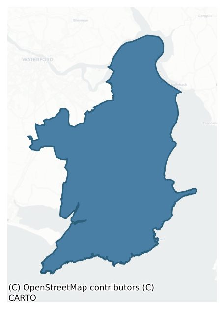
Gaultiere is a barony of County Waterford, in the historical province of Munster (Irish: An Ghailltír), covering 98 km² of land. The barony records 204 NMS archaeological sites and 935 NIAH listed buildings, placing it at around the 58th percentile among 280 ROI baronies for sites per km². This means it is in the upper half of all baronies for sites per km². Dated archaeological evidence runs from the Neolithic through to the Post Medieval, spanning 7 of 9 archaeological periods, placing the barony in the 24th percentile among 280 ROI baronies for chronological depth. This means it is in the bottom third of all baronies for chronological depth. The largest dated subset of recorded sites dates to the Iron Age. Logainm flags 34 placenames in the barony as carrying a recognised heritage root; the largest share — around 88% — are names associated with early Christian church and monastic foundations.
Heritage at a glance
Percentile rankings throughout this profile compare each barony only against the other 279 Republic of Ireland baronies.
The recorded heritage of Gaultiere
The National Monuments Service Sites and Monuments Record (SMR) is the statutory inventory of archaeological sites for the Republic of Ireland, maintained by the Department of Tourism, Culture, Arts, Gaeltacht, Sport and Media. Sites recorded here include earthworks, ringforts, megalithic tombs, ecclesiastical remains, and post-medieval features; not every record is legally protected, but each is registered as a monument of archaeological interest.
The National Monuments Service records 204 archaeological sites in Gaultiere, putting it at the 58th percentile among 280 ROI baronies for sites per km². This means it is in the upper half of all baronies for sites per km². Protection coverage is near-universal — 192 sites (94%) fall within a recorded monument protection zone, indicating an extensively surveyed landscape. The record is dominated by defensive sites — ringforts, enclosures, hillforts, and stone forts (65 sites, 32% of the total), with ecclesiastical sites forming a substantial secondary presence (38 sites, 19%). The most diagnostically specific type is Church (13 records, 6% of the barony's NMS total) — compared to an ROI average of 4% across all baronies where this type occurs. Church is a building used for public Christian worship, of any date from c. 500 AD onwards. The broader 'Enclosure' classification — which catches unclassified ringforts and field enclosures — accounts for a further 41 records (20%) and reflects the difficulty of sub-classifying degraded earthworks from surface evidence alone. Across the barony's 98 km², this gives a recorded density of 2.07 sites per km².
Most common monument types
Hover or tap a monument type to see its definition.
| Type | Count |
|---|---|
| Enclosure a banked or ditched feature of uncertain type, used as a catch-all where the original function cannot be determined from surface evidence | 41 |
| Church a building used for public Christian worship, of any date from c. 500 AD onwards | 13 |
| Burnt mound a heap of fire-cracked stone, ash and charcoal, with no surviving trough, dated Bronze Age to early medieval | 11 |
| Ringfort – unclassified a circular Early Medieval settlement enclosure where surviving evidence does not allow distinction between earthen and stone forms | 11 |
| Graveyard a burial area associated with a church, in use from the medieval period onwards | 10 |
| Fulacht fia a horseshoe-shaped Bronze Age burnt mound built around a sunken trough beside a water source, traditionally interpreted as a cooking site | 8 |
| Bullaun stone a boulder or rock outcrop with hemispherical hollows ('bulláin'), commonly associated with ecclesiastical sites and holy wells | 7 |
| Ritual site – holy well a well or spring traditionally associated with a saint, often credited with healing properties; many trace earlier ritual origins but devotion is documented from the medieval period onwards | 6 |
Chronological distribution
The dated archaeological record for Gaultiere spans from the Neolithic through to the Post Medieval, with activity attested across 7 of 9 archaeological periods. This is the 24th percentile across ROI baronies — a relatively narrow chronological band, with much of Irish prehistory not represented in the dated record. Every period from earliest to latest is represented in the record — an unbroken sequence of dated activity across the full chronological span. Activity concentrates most heavily in the Iron Age (67 sites, 43% of dated material), with the Early Medieval forming a secondary peak (27 sites, 17%). A further 47 recorded sites (23% of the overall NMS register for the barony) carry no period attribution — appearing as 'Unknown' in the bar chart below. This typically reflects either records that pre-date the standardised period vocabulary or sites awaiting specialist dating review, rather than a genuine absence of chronological evidence.
Sample of recorded monuments
Show 25 sample monuments (of 204 total)
A representative sample of 25 recorded monuments drawn from the barony’s 204 total NMS entries. Sites within a recorded monument protection zone and rarer site types are prioritised so the list shows a meaningful cross-section rather than only the most common type. Each entry shows the official Sites and Monuments Record reference number and the description published by the National Monuments Service.
Font
Situated on a gentle NW-facing slope. The font from Faithlegg church (WA010-003001-) is circular (ext. diam. 0.67m; H 0.32m), and has seven outer vertical ribs and two notches to secure the cover. It is now in the…
Situated on a gentle NW-facing slope. The font from Faithlegg church (WA010-003001-) is circular (ext. diam. 0.67m; H 0.32m), and has seven outer vertical ribs and two notches to secure the cover. It is now in the adjacent RC church just to the N. (Power 1890-91, 481-2)
Power, Rev. P. (1890-91) The ancient ruined churches of Co. Waterford. JRSAI 18, 20-21, 475-82.
Compiled by: Michael Moore
Date of upload: 10 November 2010
Castle – motte
Situated on level ground towards the top of a gentle W-facing slope. An earthen mound (diam. of base 25m WNW-ESE; 24m NNE-SSW; H 3m at SSW to 3.75m at NNE) is slightly dished at the summit (diam. of top 14.3m NNE-SSW;…
Situated on level ground towards the top of a gentle W-facing slope. An earthen mound (diam. of base 25m WNW-ESE; 24m NNE-SSW; H 3m at SSW to 3.75m at NNE) is slightly dished at the summit (diam. of top 14.3m NNE-SSW; 13.8m WNW-ESE), but has no evidence of a fosse. A field to the N, known locally as 'the village', produced 'red brick' during land reclamation. A tower house site (WA010-005—-) is adjacent to the E and Faithleg church (WA010-003001-) is c. 240m to N. It is planted with deciduous trees.
The above description is derived from the published 'Archaeological Inventory of County Waterford' (Dublin: Stationery Office, 1999). In certain instances the entries have been revised and updated in the light of recent research.
Date of upload/revision: 23 December 2008
Mill – unclassified
A grist mill is mentioned at Ballycanvan in the Civil Survey of c. 1655 (Simington 1942, 163), and an 'old mill' is marked in Faithlegg on the 1840 ed. of the OS 6-inch map on the E bank of a S-N stream just above the…
A grist mill is mentioned at Ballycanvan in the Civil Survey of c. 1655 (Simington 1942, 163), and an 'old mill' is marked in Faithlegg on the 1840 ed. of the OS 6-inch map on the E bank of a S-N stream just above the high water mark. It is not visible at ground level.
Simington, R. C. (ed.) (1942) The civil Survey AD 1654-1656, vi, the County of Waterford. Irish Manuscripts Commission. Dublin.
Compiled by: Michael Moore
Date of upload: 10 November 2010
Castle – unclassified
Situated on a slight E-facing slope. Ballinamona House, a four bay, two storey over basement 18th century house that was rebuilt after a fire in 1894 is thought to have been built on the site of a castle that was built…
Situated on a slight E-facing slope. Ballinamona House, a four bay, two storey over basement 18th century house that was rebuilt after a fire in 1894 is thought to have been built on the site of a castle that was built in 1488, but there is no documentation (Bence-Jones 1975, 17-18). A single wall in the basement (L c. 6m; T c. 1m) with a base-batter is thought to be from the castle.
Bence-Jones, M. (1975) Burke's guide to country house. Vol. 1, Ireland. Burke's Peerage Ltd. London.
Compiled by: Michael Moore
Date of upload/revision: 06 January 2011
Tide mill – unclassified
Situated on the estuary of the S-N Ballycanvan stream, on the E bank. Described as a 'water-grist mill' in the Civil Survey of c. 1655 (Simington 1942, 163). This is a large rectangular building of three bays with three…
Situated on the estuary of the S-N Ballycanvan stream, on the E bank. Described as a 'water-grist mill' in the Civil Survey of c. 1655 (Simington 1942, 163). This is a large rectangular building of three bays with three floors and an attic (dims. 13m E-W; 6.9m N-S), partly excavated into bedrock. Cut-stone quoins survive and there is an opening for mill-wheel gears and a curved recess for millstones in the W wall. Causeways contain the stream to the S where there is also an intake sluice, an overflow sluice, a millrace and a millpond of c. 1 ha, all of which are stone-revetted. The millpond was filled by the incoming tide. The present remains are probably 17th century in date with later additions to the N and S walls of the original structure, including a corn-drying kiln. A small quay and access laneway with rock-cut yards are adjacent to the N.
Simington, R. C. (ed.) (1942) The Civil Survey AD 1654-1656, vi, the County of Waterford. Irish Manuscripts Commission. Dublin.
The above description is derived from the published 'Archaeological Inventory of County Waterford' (Dublin: Stationery Office, 1999). In certain instances the entries have been revised and updated in the light of recent research.
Date of upload/revision: 23 December 2008
Megalithic structure
Situated in woodland on a slight N-facing slope. Two parallel stones oriented E-W and a displaced lintel form a rough cist (dims. c 1.8m x c. 1.7m), while 3m to the SW two stones form the adjacent sides of a second cist…
Situated in woodland on a slight N-facing slope. Two parallel stones oriented E-W and a displaced lintel form a rough cist (dims. c 1.8m x c. 1.7m), while 3m to the SW two stones form the adjacent sides of a second cist (dims. c. 1.5m x 0.7m). A mound (WA018-004002-) is adjacent to the SE. (Atkins 1896, 1234)
Atkins, R. (1896) The rude stone monuments of our own and other lands. WAJ. Vol. 2, 131-61.
The above description is derived from the published 'Archaeological Inventory of County Waterford' (Dublin: Stationery Office, 1999). In certain instances the entries have been revised and updated in the light of recent research.
Date of upload/revision: 08 February 2011
Moated site
Visible on vertical aerial photographs (ACAP, V165/130-31), and situated at the bottom of a valley on a W-facing slope. Rectangular grass-covered area (dims. 42m N-S; 31m E-W) defined by a fosse (Wth 4m; D 0.1-0.3m) at…
Visible on vertical aerial photographs (ACAP, V165/130-31), and situated at the bottom of a valley on a W-facing slope. Rectangular grass-covered area (dims. 42m N-S; 31m E-W) defined by a fosse (Wth 4m; D 0.1-0.3m) at W and S, a field bank at N and a slope down to the site at E.
The above description is derived from the published 'Archaeological Inventory of County Waterford' (Dublin: Stationery Office, 1999). In certain instances the entries have been revised and updated in the light of recent research.
Compiled by Michael Moore
Date of upload/revision: 31 July 2010
Bastioned fort
A large circular tower was built before 1568. It was extended by Edmund Yorke in 1590 which required the destruction of several houses and then building a mortared wall, probably with corner towers, and an internal…
A large circular tower was built before 1568. It was extended by Edmund Yorke in 1590 which required the destruction of several houses and then building a mortared wall, probably with corner towers, and an internal earthen rampart. The fort was administered by Waterford Corporation until it was captured by Cromwell's forces in November 1649, and over the next year his army successfully resisted attempts by the Confederates to recapture it. Around 1685 Sir Thomas Phillips developed plans for a star-shaped fort on Carrickcannuigh Hill overlooking Passage, but it was never built. Despite continued maintenance of the Passage fort throughout the 17th century it was abandoned in 1711. A survey carried out by Lt Gen. Vallancey led to its brief re-occupation in the 1780s, but the remains were demolished in the late 19th century. A portion of the blockhouse has been preserved by the construction of a breakwater, and the remains of a subcircular corner tower (dims. 3.26m N-S; 3.08m E-W; ext. H 3.3m; int. H 2.1m) with five gun loops survives. (Walton 1979a; 1979b)
Walton, J. (1979a) Aspects of Passage East. Part I. Decies, No. 10, 23-8.
Walton, J. (1979b) Aspects of Passage East. Part II. Decies, No. 11, 17-25.
The above description is derived from the published 'Archaeological Inventory of County Waterford' (Dublin: Stationery Office, 1999). In certain instances the entries have been revised and updated in the light of recent research.
Date of upload/revision: 23 December…
House – 16th/17th century
Situated close to the summit of a low rise. Described as a ruined castle and the property of James Walsh of Little Island (WA010-008—-) in 1640 (Simington 1942, 165). This is a rectangular gabled house (dims. c. 15.5m…
Situated close to the summit of a low rise. Described as a ruined castle and the property of James Walsh of Little Island (WA010-008—-) in 1640 (Simington 1942, 165). This is a rectangular gabled house (dims. c. 15.5m NW- SE; c. 8m NE-SW) of three storeys with five surviving chimney stacks. It was modernised in the 19th century and is still occupied. It retains three double-light, round-headed windows, probably 16th century in date, a plain rectangular light and traces of a slight base-batter.
Simington, R. C. (ed.) (1942) The Civil Survey AD 1654-1656, vi, the County of Waterford. Irish Manuscripts Commission. Dublin.
The above description is derived from the published 'Archaeological Inventory of County Waterford' (Dublin: Stationery Office, 1999). In certain instances the entries have been revised and updated in the light of recent research.
Date of upload/revision: 23 December 2008
Religious house – Knights Hospitallers
Situated on a gentle E-facing slope. A preceptory of the Knights Templar was founded at Crooke before 1180, but its possessions passed to the Knights Hospitallers of Killure (WA017-018001-) in 1327. By the Suppression…
Situated on a gentle E-facing slope. A preceptory of the Knights Templar was founded at Crooke before 1180, but its possessions passed to the Knights Hospitallers of Killure (WA017-018001-) in 1327. By the Suppression in 1541 its possessions were reduced to 120 acres, and the church probably functioned as the parish church of Crooke (Gwynn and Hadcock 1970, 329, 336; Wood 1906-07, 369). As a parish church it was described as in good repair in 1613 (Anon. 1902, 113).
The church is an undifferentiated structure (dims. 24.6m N-S; 6.75m E-W) defined by wall foundations with evidence of one window in the S chancel wall, and a doorway in the S nave wall with a stoup nearby. The chancel arch and a second doorway in the S wall, recorded by O’Donovan c. 1840 (O’Flanagan 1929, 5-6), have been removed. The E gable survives with three lancet windows, now robbed-out and overgrown with ivy. St John’s Well is outside the subrectangular graveyard (dims. c. 60m NW-SE; c. 50m NE-SW) defined by a masonry wall to the SE. There are some cut-stone in the graveyard and near the well, that are 16th/17th century in character and may have originated from tower house (WA018-023002-) c. 70m to the S. (Walton 1979c)
Anon. (1902) Documents illustrating the history of Waterford: 1 – The Protestant diocese of Waterford in 1615. WAJ 8, 103-19.
Gwynn, A. and Hadcock, R. N. (1970) (reprint 1988) Medieval religious houses in Ireland. Irish Academic Press, Dublin.
O’Flanagan, M. (Compiler) (1929) Lette…
Barracks
Situated on top of cliffs on the W side of the Barrow/Suir estuary. An ideal town was planned to accommodate Genevan democrats displaced during the Swiss revolution in 1782. Grants of land at Newtown, Co. Waterford and…
Situated on top of cliffs on the W side of the Barrow/Suir estuary. An ideal town was planned to accommodate Genevan democrats displaced during the Swiss revolution in 1782. Grants of land at Newtown, Co. Waterford and Passage amounting to 11,000 acres, as well as money were made by Lord Temple, the Viceroy, to build 50 houses as well as public buildings and an Academy. However the immigrants never arrived and the town failed to materialise (Butler 1947). A military barracks was erected on the site in the 1780s which functioned as a prison during the 1798 Rebellion, but it was abandoned by 1841. This is a subrectangular area (dims. c. 250m N-S; c. 240m E-W) defined by mortared stone walls (H 3-4m) with corner bastions, all of which survive except that at the SE. The remains of a terrace of buildings survive parallel to the N wall, which also has an entrance gate. (Butler 1912; 1913; 1914; Decie 1983, 46; Dowling 1985)
Butler, H. (1947) New Geneva in Waterford, JRSAI 77, 150-5.
Butler, M. (1912) New Geneva; some correspondence relating to its foundation, WAJ, 15, 181-94.
Butler, M. (1913) New Geneva; some correspondence relating to its foundation (continued), WAJ, 16, 1-17, 86-92.
Butler, M. (1914) New Geneva; some correspondence relating to its foundation, WAJ, 17, 164-9.
Decie (1983) Old Waterford Society Survey, Decies No. 24, 42-57.
Dowling, D. (1985) New Geneva, Decies, No. 29, 32-40
The above description is derived from the published 'Archaeological Invento…
Cross-inscribed stone
Situated at the crest of an E-facing slope on a slight N-S ridge, Power (1952, 215) considered this to be the site of an early church of which practically all trace had disappeared. The visible remains consist of a…
Situated at the crest of an E-facing slope on a slight N-S ridge, Power (1952, 215) considered this to be the site of an early church of which practically all trace had disappeared. The visible remains consist of a sub-circular scrub-covered area (diam. 27m) (WA027-003002-) defined by the remnants of a stone wall (Wth 1.8m) generally reduced to a scarp (H c. 0.6m). This enclosure (WA027-003002-) is traditionally considered to be a burial ground (WA027-003003-), and there is one grave-marker in the interior which is raised and stony. It corresponds with the SE quadrant of a much larger sub-circular tri-vallate monument (WA027-003010-) which was revealed as a result of geophysical survey undertaken in 2007 (Bonsall and Gimson 2007). The survey also indicated the existence of a possible annex to the S.
This pillar stone (dims. 0.55m x 0.35m; H 0.85m) is incised with a plain equal-armed cross and stands on the perimeter of the enclosure. The monument was investigated by M.J. Bowman in 1940 who revealed that the ‘graveyard’ component was in the SE quadrant of the original enclosure. Geophysical survey undertaken in 2007 (Bonsall and Gimson 2007) demonstrated that the monument was a trivallate enclosure with an internal diameter of 95m. A reassessment of Bowman’s excavations (Curtin 2015) indicates a multiphase site. The pottery recovered (B ware and E ware) suggests occupation in the medieval period and the presence of Leinster cooking ware is indicative of occupation in the…
Cross-slab
Situated at the crest of an E-facing slope within a trivallate enclosure (see WA027-003010-) which has been suggested as 'the site of an early church' (Power 1952, 215). In the course of excavations undertaken on the…
Situated at the crest of an E-facing slope within a trivallate enclosure (see WA027-003010-) which has been suggested as 'the site of an early church' (Power 1952, 215). In the course of excavations undertaken on the site in 1940 M.J. Bowman unearthed ‘a small irregularly shaped flagstone bearing an incised cross of Greek type, about six inches in length and rudely cut and lengthened by a later hand into a Latin cross.’ (Power 1941, 63-4). Bowman suggested that ‘this cross-inscribed stone may have been removed from its original position; its presence, however, on a site which resemebled a grave, suggests a burial.’ (Curtin 2015, 93). The present location of this possible cross-slab is unknown: its last know provenance is recorded by Bowman in 1941 as at 'Canon Power's house' (Curtin 2015, 137). (Power 1941; 1952; Moore 1999, 165-6; Curtin 2015)
Compiled by: Michael Moore
Updated by: Paul Walsh
Revised date of upload: 21 December 2015
Well
Situated at the crest of an E-facing slope within a trivallate enclosure (see WA027-003010-) which has been suggested as 'the site of an early church' (Power 1952, 215). In the course of excavations undertaken on the…
Situated at the crest of an E-facing slope within a trivallate enclosure (see WA027-003010-) which has been suggested as 'the site of an early church' (Power 1952, 215). In the course of excavations undertaken on the site in 1940 M.J. Bowman uncovered a stone-line pit or well (diam. c. 0.6m; D 2.63m) (Curtin 2015, 32-3). (Power 1941; 1952; Curtin 2015)
Compiled by: Michael Moore
Updated by: Paul Walsh
Revised date of upload: 21 December 2015
Stone circle
Marked fainlty as a circular enclosure (diam. c. 55m) and described as a 'fairy ring' on the 1840 and 1925 eds. of the OS 6-inch map, and situated on rock outcrop on top of Kilmacomb Hill. Described by Ryland (1824,…
Marked fainlty as a circular enclosure (diam. c. 55m) and described as a 'fairy ring' on the 1840 and 1925 eds. of the OS 6-inch map, and situated on rock outcrop on top of Kilmacomb Hill. Described by Ryland (1824, 243) and Lewis (1837, vol. 2, 164) as five large stones enclosed in a stone circle (diam. c. 30m) on Kilmacomb Hill. It may be a mistaken location for a nearby passage tomb (WA027-007—-) at Harristown, c. 1 km to the ENE. Nothing is visible at ground level.
The above description is derived from the published 'Archaeological Inventory of County Waterford' (Dublin: Stationery Office, 1999). In certain instances the entries have been revised and updated in the light of recent research.
Compiled by: Michael Moore
Date of upload/revision: 31 May 2011
Earthwork
Marked as a circular enclosure (diam. c. 30m) on the 1840 ed. of the OS 6-inch map just S of Kilmacomb church (WA027-006001-). Situated in pasture at the bottom of a S-facing slope, it is not visible at ground…
Marked as a circular enclosure (diam. c. 30m) on the 1840 ed. of the OS 6-inch map just S of Kilmacomb church (WA027-006001-). Situated in pasture at the bottom of a S-facing slope, it is not visible at ground level.
The above description is derived from the published 'Archaeological Inventory of County Waterford' (Dublin: Stationery Office, 1999). In certain instances the entries have been revised and updated in the light of recent research.
Compiled by: Michael Moore
Date of upload/revision: 31 May 2011
Megalithic tomb – passage tomb
Situated in rough pasture towards the S end of the summit of a N-S ridge. This is an undifferentiated passage (L 6.1m; Wth 1.05m at the entrance to 1.37m) opening to the ENE, composed of a sillstone with six sidestones…
Situated in rough pasture towards the S end of the summit of a N-S ridge. This is an undifferentiated passage (L 6.1m; Wth 1.05m at the entrance to 1.37m) opening to the ENE, composed of a sillstone with six sidestones on each side which increase in height towards the W backstone. The side-walls have outer support walls. Two of the original five lintels are in place. The passage is surrounded by a kerb of 27 stones (diam. 9.15m). It was first noted by Ryland (1824, 243), followed by the Halls (Scott 1984, 117-8), and described by Reade (1868-9) who called the ridge Carrick a Dhirra. Later commentators found it unchanged (Atkins 1896; Ó Nualláin and Walsh 1986, 25).
It was excavated in 1939 by J. Hawkes (1941) when the cremated remains of two individuals and a stone pendant were found in the passage, although it had previously been robbed-out (Reade 1868-9, 161-2). The covering cairn (diam. c. 15.25m) had spilled outside the orthostats, and it may have had an outer kerb of dispersed orthostats. The cairn contained secondary burials, all cremations, one with a bowl food vessel (Ó Ríordáin and Waddell 1993, 139), three with cordoned urns (Kavanagh 1976, 374-5), one of which had a pygmy cup (Kavanagh 1977), and an unclassifiable urn. The cremated remains of at least five others were found in two pits. Finds associated with the secondary burials consist of a razor, a faience bead and perforated bone pins.
Atkins, R. (1896) The rude stone monuments of our own and other la…
Ritual site – holy tree/bush
Marked as the site of a Fairy Bush at Fairy Bush crossroads, a five-road junction, on the 1840 ed. of the OS 6-inch map. Situated on a rise with the N-S ridge of Carrickadhirra rising over it c. 600m to the NNE. The…
Marked as the site of a Fairy Bush at Fairy Bush crossroads, a five-road junction, on the 1840 ed. of the OS 6-inch map. Situated on a rise with the N-S ridge of Carrickadhirra rising over it c. 600m to the NNE. The location is known locally and was situated inside the field bank on the NW side of the road junction. According to Power (1906, 39) there may have been a cairn associated with it, but nothing is now visible at ground level.
Power, Rev. P. (1906a) The place-names of the Decies WAJ 9, 12-39, 80-106, 154-70, 228-65.
Compiled by: Michael Moore
Date of upload/revision: 10 June 2011
Ring-ditch
Situated an the crest of a NW-facing slope of the NE-SW ridge leading to Creedan Head. This is the cropmark of a small circular enclosure (diam. c. 10m) visible on aerial photographs (ACAP, V165/65-6).
The above…
Situated an the crest of a NW-facing slope of the NE-SW ridge leading to Creedan Head. This is the cropmark of a small circular enclosure (diam. c. 10m) visible on aerial photographs (ACAP, V165/65-6).
The above description is derived from the published 'Archaeological Inventory of County Waterford' (Dublin: Stationery Office, 1999). In certain instances the entries have been revised and updated in the light of recent research.
Compiled by: Michael Moore
Date of upload/revision: 10 June 2011
Road – road/trackway
Located at the S end of a N-S spur between the estuary of the NE-SW Kilmacleague Pill to the E and the reclaimed lands of the Tramore Back Strand to the W. The parish church of Kilmacleague (WA027-019001-) survives as…
Located at the S end of a N-S spur between the estuary of the NE-SW Kilmacleague Pill to the E and the reclaimed lands of the Tramore Back Strand to the W. The parish church of Kilmacleague (WA027-019001-) survives as foundations, but there is no evidence of a roadway described by Power (1890-1, 477-8) in the slight earthwork banks N of the church.
Power, Rev. P. (1890-91) The ancient ruined churches of Co. Warterford. JRSAI 20-21, 475-82.
Compiled by: Michael Moore
Date of upload/revision: 10 June 2011
House – 17th century
Situated on a NW-facing slope on the E side of Tramore Bay. Ryland (1824, 246) suggests that this is an ancient house, and a large house is marked on the Down Survey map (1655-6) at Corballymore, which was then owned by…
Situated on a NW-facing slope on the E side of Tramore Bay. Ryland (1824, 246) suggests that this is an ancient house, and a large house is marked on the Down Survey map (1655-6) at Corballymore, which was then owned by John Leonard, but this townland was owned by Peter Archdeacon in 1641 (Simington 1942, 155). The present house is a 19th century house, built in the Scottish baronial style. It was burnt in 1935, and is largely re-built since then, but there is no evidence of an older structure.
Ryland, Rev. R. H. (1824) The History, topography and antiquities of the county and city of Waterford. John Murray. London.
Simington, R. C. (ed.) (1942) The Civil Survey AD 1654-1656, vi, the County of Waterford. Irish Manuscripts Commission. Dublin.
Compiled by: Michael Moore
Date of upload/revision: 10 June 2011
Castle – Anglo-Norman masonry castle
Situated on the landward side of a coastal promontory (dims. c. 60m E-W; c. 40m N-S) jutting E into Dunmore Bay between Dunmore Strand to the N and Ladies Cove to the S. This, or the promontory fort (WA027-035001-), c.…
Situated on the landward side of a coastal promontory (dims. c. 60m E-W; c. 40m N-S) jutting E into Dunmore Bay between Dunmore Strand to the N and Ladies Cove to the S. This, or the promontory fort (WA027-035001-), c. 800m to the S, could be the caput of the manor of Dunmore, granted to Heverbricht by Henry II and confirmed by King John in 1203, after which it is frequently mentioned. By the early 14th century much of the manor was owned by the de Boitler and Le Flemming families, the latter becomming embroiled with Robert de Stapleton, the sheriff of Waterford, over possession, (Westropp 1914-16, 212-13). It is described as the 'stump of a ruined castle' and the property of Lord Power of Curraghmore (WA08-005001-) c. 1640 (Simington 1942, 158).
This is a circular structure (ext. diam. 10.5m; int. diam. 5.3m) surviving to the first floor (H 7.7m), with evidence of a base-batter (H 1.35m) NE-E. The outer stonework is dressed back NW-N to accommodate a later building. A rebuilt entrance at E, with part of the original S door-jamb, leads to a lobby protected by a murder-hole with a guardroom to the S. A round-headed doorway leads to the ground floor which has three plank-centered, segmental-arched embrasures with single lights, one of which is round-headed. A double garderobe chute exits the wall at SSE and mural stairs lead from the lobby to the upper floors. A pointed doorway leads to the first floor which was supported on a rebate and has four plank-centered, segmental-…
Hut site
Located inside the coastal promontory (WA027-035001-) jutting E into Waterford Harbour. According to Westropp (1914-16, 214) there was a circular hut site (int. diam. c. 3m) and a low enclosure (WA027-035003-) in the…
Located inside the coastal promontory (WA027-035001-) jutting E into Waterford Harbour. According to Westropp (1914-16, 214) there was a circular hut site (int. diam. c. 3m) and a low enclosure (WA027-035003-) in the interior. The defences were levelled and the topsoil removed in the 1970s to create a carpark. Archaeological testing (01E0344) of the interior (Cleary 2003) produced no related material.
Cleary, R. (2003) Dunmore East. Promontory fort. in I. Bennett (Ed.) Excavations 2001: summary accounts of excavations in Ireland, 388, No. 1243. Wordwell. Bray.
Westropp, T. J. (1914-16) Fortiified headlands and castles on the south coast of Munster. PRIA C vol. 32, 188-227.
Compiled by: Michael Moore
Date of upload/revision: 10 June 2011
Armorial plaque
Situated at the W side of Passage East. The Aylward house (WA018-009002-) has an armorial plaque (dims. 0.88m x 0.63m) with the Alyward crest over the pointed doorway in the NE façade. (Mems. Dead, 1901-03, vol. 5,…
Situated at the W side of Passage East. The Aylward house (WA018-009002-) has an armorial plaque (dims. 0.88m x 0.63m) with the Alyward crest over the pointed doorway in the NE façade. (Mems. Dead, 1901-03, vol. 5, 270)
Compiled by: Michael Moore
Date of upload: 08 February 2011
Enclosure
Situated at the crest of an E-facing slope on a slight N-S ridge. The visible remains consist of a sub-circular scrub-covered area (diam. 27m) defined by the remnants of a stone wall (Wth 1.8m) generally reduced to a…
Situated at the crest of an E-facing slope on a slight N-S ridge. The visible remains consist of a sub-circular scrub-covered area (diam. 27m) defined by the remnants of a stone wall (Wth 1.8m) generally reduced to a scarp (H c. 0.6m). This enclosure (WA027-003002-) is traditionally considered to be a burial ground, and there is one grave-marker in the interior which is raised and stony. It corresponds with the SE quadrant of a much larger sub-circular tri-vallate monument (WA027-003010-) which was revealed as a result of geophysical survey undertaken in 2007 (Bonsall and Gimson 2007). The survey also indicated the existence of a possible annex to the S. A pillar stone (WA027-003003-) incised with a plain equal-armed cross stands on its perimeter at E. The monument was investigated by M.J. Bowman in 1940 who revealed that the ‘graveyard’ component was in the SE quadrant of the original enclosure. Geophysical survey undertaken in 2007 (Bonsall and Gimson 2007) demonstrated that the monument was a trivallate enclosure with an internal diameter of 95m. A reassessment of Bowman’s excavations (Curtin 2015) indicates a multiphase site. The pottery recovered (B ware and E ware) suggests occupation in the medieval period and the presence of Leinster cooking ware is indicative of occupation in the 13th-14th centuries. Evidence of iron working indicates that the site was used during the late medieval or early modern period and a final period of use of the site was as a burial ground…
Listed buildings
The National Inventory of Architectural Heritage (NIAH) is a state survey appraising buildings of architectural, historical, archaeological, artistic, cultural, scientific, social, or technical interest. Each surveyed structure receives a rating from International (the highest, for buildings of European importance) through National, Regional, Local, and Record-Only.
The National Inventory of Architectural Heritage records 935 listed buildings in Gaultiere, placing it in the top 1% of ROI baronies for listed-building density. Among these, 24 are graded National — buildings of interest to the whole of Ireland rather than only its region. The Republic holds 937 National-graded buildings in total, so this barony accounts for around 3% of the national total. Construction dates concentrate most heavily in the Victorian (1830-1900) period. The most-recorded building type is house (697 examples, 75% of the listed stock).
Terrain and environment
Mean elevation across the barony is 40m — the 11th percentile among 280 ROI baronies for elevation. This means it is in the bottom fifth of all baronies for elevation. This is a relatively low-lying landscape by ROI standards. Elevation matters for heritage because higher-altitude baronies typically favour defensive monuments — ringforts and hilltop forts placed on prominent ground — while lowland baronies are more likely to carry the dense settlement and church networks of intensive agricultural landscapes. Mean slope is 4.1° — the 60th percentile among 280 ROI baronies for slope. This means it is in the upper half of all baronies for slope. Slope is a key control on both land use and archaeological preservation: steep ground resists ploughing and tends to preserve earthworks intact, while gentle slopes favour intensive cultivation that damages or destroys surface archaeology over time. The Topographic Wetness Index averages 10.7, the 43rd percentile among 280 ROI baronies for wetness. This means it is in the lower half of all baronies for wetness. Drainage matters for heritage because poorly-drained ground preserves organic archaeology (wooden trackways, leather, textiles, and on rare occasions human remains) far better than free-draining soil; well-drained ground favours arable use but destroys organic material rapidly. The land-cover mosaic combines improved grassland (75%), woodland (13%), and arable farmland (6%), giving a mixed agricultural and semi-natural landscape.
Terrain measurements
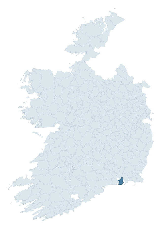
Where this barony sits in the Republic of Ireland
Geology and preservation
Bedrock geology shapes the landscape long before any settlement begins — controlling soil drainage, agricultural potential, the survival of upstanding monuments, and the preservation of buried archaeology. The figures below come from the Geological Survey Ireland 1:100,000 bedrock map.
The bedrock underlying Gaultiere is predominantly conglomerate (32% of the barony by area), with much of the rock dating to the Ordovician period. Conglomerate marks former river-channel or alluvial-fan deposits and weathers to coarse, free-draining soils. Historically these supported pastoralism more than arable agriculture. A substantial secondary geology of mudstone (20%) and slate (16%) adds further variety to the underlying landscape. With 7 distinct rock types mapped, the barony sits in the top third of ROI baronies for geological diversity (68th percentile) — typically a sign of complex tectonic history or coastal mosaics of differing rock units.
Rock type composition
Largest mapped unit: Templetown Formation (20% of the barony)
Placename evidence
Logainm records 34 heritage-diagnostic placenames for Gaultiere, drawn from townland and civil-parish names across the barony. The dominant stratum is Early Christian ecclesiastical — cill-, teampall-, and domhnach-prefixed names that record the dense network of early church foundations established between the fifth and tenth centuries. The leading diagnostic roots are cill- (27 — church), ráth- (2 — earthen ringfort), and gráinseach- (2 — grange). This is broadly in line with the ROI average of 30.7 heritage placenames per barony. Logainm records 138 placenames for Gaultiere (predominantly townland names). Of these, 34 (25%) carry one of the diagnostic Gaelic roots tracked above; the remainder draw on more generic landscape vocabulary that does not encode a heritage period.
Pre-Christian / Early Medieval Defensive
| Root | Count | Meaning |
|---|---|---|
| ráth- | 2 | earthen ringfort |
| lios- | 1 | ringfort or enclosure |
| dún- | 1 | hilltop or promontory fort |
Early Christian Ecclesiastical
| Root | Count | Meaning |
|---|---|---|
| cill- | 27 | church (early) |
| gráinseach- | 2 | monastic farm / grange |
| teampall- | 1 | church (later medieval) |
Other baronies in Waterford
- Upperthird
- Decies Within Drum
- Glenahiry
- Decies Without Drum
- Coshmore And Coshbride
- Middlethird
- Decies Without Drum
- Middlethird
- Burren — Clare
- Ormond Lower — Tipperary
See all 280 baronies in the Republic of Ireland Heritage Tool.

Explore further
Grounding History: 10 Maps of Northern Ireland’s Past
If you’re interested in Irish heritage more widely, the companion report for Northern Ireland brings together the analysis of all 462 NI wards into one place through 10 high-quality maps — covering monument density, archaeological periods, placename heritage, terrain, wetland, and the historic landscape at first survey. Take a look.
About this profile
Click any section below to expand.
What is a barony?
A barony is a historic administrative unit in Ireland, broadly equivalent to an English hundred. The 280 baronies used here are from the OSi 2019 National Statutory Boundaries (generalised 20m), covering the 26 counties of the Republic of Ireland. Baronies derive from the Norman period, were formalised in the 17th century, and have not been redrawn for statistical purposes. They vary enormously in area, from compact urban baronies in Dublin to vast upland baronies in Connacht, and should not be compared by raw site count without accounting for area differences.
What counts as a site?
This profile combines three distinct heritage registers, each with its own definition of what constitutes a recordable site:
- Archaeological sites (NMS). The National Monuments Service Sites and Monuments Record (SMR) catalogues every known archaeological monument or site of archaeological interest in the Republic, from prehistoric burial mounds and ringforts to medieval churches and post-medieval defensive works. Inclusion does not require legal protection — only that the site has been identified, surveyed, and assessed as having archaeological value. A separate subset of these sites lies within a recorded protection zone, which gives them statutory protection under the National Monuments Acts.
- Listed buildings (NIAH). The National Inventory of Architectural Heritage records buildings of architectural, historical, archaeological, artistic, cultural, scientific, social, or technical interest. Each surveyed structure is appraised on a five-tier scale: International, National, Regional, Local, and Record-Only. The NIAH appraisal is informational rather than strictly statutory, but it underpins local-authority Record of Protected Structures (RPS) listings.
- Heritage placenames (Logainm). Logainm is the authoritative database of Irish placenames maintained by the Placenames Branch. This profile applies a heritage-diagnostic classifier to the Irish-language form of each townland name, flagging roots that signal defensive sites (ráth-, lios-, dún-, caiseal-, cathair-), ecclesiastical foundations (cill-, teampall-, domhnach-, mainistir-), prehistoric burial-ritual features (tuaim-, carn-, leaba-), or Norse-contact settlement (gall-). Townlands without one of these diagnostic roots are not flagged here — they may still carry historical significance, but that significance is not encoded in the name itself.
Editorial principles
The narrative sections of this profile follow several explicit principles:
- Evidential. Every claim about this barony’s heritage character is anchored in the underlying register data. Where a site count, a placename count, or a percentile rank is cited, it is computed from the source datasets at export time, not estimated.
- Comparative. Counts and metrics are reported alongside their percentile rank against the other 279 ROI baronies. A barony with 50 ringforts in absolute terms could be unusually high or unusually low depending on its size and regional context; percentile ranking removes that ambiguity.
- Transparent on limits. Where a register has known coverage gaps, survey biases, or data-quality issues that affect this barony’s figures, the profile flags them rather than presenting the numbers as definitive.
- No interpretation beyond what the data supports. The narrative does not speculate about historical events, social dynamics, or cultural meaning beyond what the recorded heritage and placename evidence directly attests.
Data caveats and limits
- NMS Sites and Monuments Record is the product of survey campaigns conducted at different intensities across different counties and decades. Some baronies have been surveyed more thoroughly than others, and absolute counts should be read in that light. Sites destroyed by development before survey are typically not represented; sites in heavily forested or upland terrain are sometimes under-recorded.
- NIAH coverage is broadly complete for the Republic of Ireland but the survey was conducted on a rolling county-by-county basis, and the most recent appraisal date varies. Buildings demolished or substantially altered after their original survey may still appear in the register; conversely, recent buildings of merit may not yet have been appraised.
- Logainm classification applies a deliberately conservative pattern-matching approach to the Irish-language townland forms. The classifier prioritises true positives over recall: a townland may carry a heritage signal that the classifier doesn’t recognise, particularly where the diagnostic root has been heavily anglicised or where the townland name draws on a less common term. The 60,000+ townland records and ~9,800 classified placenames give a substantial signal at barony scale, but individual townland names should be checked against Logainm directly for definitive interpretation.
- Period attribution. The chronological distribution reflects only those NMS sites that carry a recognised period attribution in the source data. Sites listed as “Unknown” period are excluded from the dated subset.
- Boundary changes. Some baronies have undergone minor boundary adjustments since their 19th-century definition; the OSi 2019 generalised boundaries used here are the current statutory definition and may differ slightly from historical maps in border areas.
- Bedrock geology is mapped at 1:100,000 scale, which means local variation within a barony — small pockets of different rock type, mineral veins, alluvium overlying bedrock — is generalised. The dominant-system and rocktype figures are area-weighted, so a barony reading “70% Carboniferous limestone” may still contain small but archaeologically important pockets of older or younger rock. Around 3% of GSI polygons do not match the lexicon and contribute no rocktype or system attribution.
Data sources
- National Monuments Service — Sites and Monuments Record (SMR) https://data.gov.ie/dataset/national-monuments-service-archaeological-survey-of-ireland
- National Inventory of Architectural Heritage (NIAH) https://data.gov.ie/dataset/national-inventory-of-architectural-heritage-niah-national-dataset
- Logainm — Placenames Database of Ireland https://www.logainm.ie/
- Ordnance Survey Ireland — National Statutory Barony Boundaries 2019 https://data-osi.opendata.arcgis.com/
- EURODEM — European Digital Elevation Model https://www.mapsforeurope.org/datasets/euro-dem
- ESA WorldCover https://esa-worldcover.org/en
- Geological Survey Ireland — 1:100,000 Bedrock Geology https://www.gsi.ie/en-ie/data-and-maps/Pages/Bedrock.aspx
Explore more: Search any of the 280 ROI baronies, browse by historical province, or read the methodology and data sources for the full Republic of Ireland Heritage Tool.