
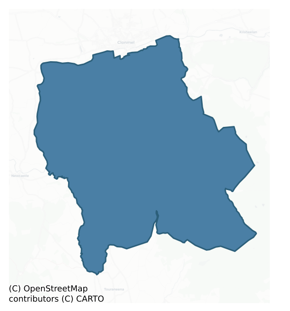
Glenahiry is a barony of County Waterford, in the historical province of Munster (Irish: Gleann na hUidhre), covering 156 km² of land. The barony records 147 NMS archaeological sites and 45 NIAH listed buildings, placing it at around the 10th percentile among 280 ROI baronies for sites per km². This means it is in the bottom fifth of all baronies for sites per km². Dated archaeological evidence runs from the Early Bronze Age through to the Modern, spanning 6 of 9 archaeological periods, placing the barony in the 19th percentile among 280 ROI baronies for chronological depth. This means it is in the bottom fifth of all baronies for chronological depth. The largest dated subset of recorded sites dates to the Iron Age. Logainm flags 15 placenames in the barony as carrying a recognised heritage root; the largest share — around 87% — are names associated with early Christian church and monastic foundations.
Heritage at a glance
Percentile rankings throughout this profile compare each barony only against the other 279 Republic of Ireland baronies.
The recorded heritage of Glenahiry
The National Monuments Service Sites and Monuments Record (SMR) is the statutory inventory of archaeological sites for the Republic of Ireland, maintained by the Department of Tourism, Culture, Arts, Gaeltacht, Sport and Media. Sites recorded here include earthworks, ringforts, megalithic tombs, ecclesiastical remains, and post-medieval features; not every record is legally protected, but each is registered as a monument of archaeological interest.
The National Monuments Service records 147 archaeological sites in Glenahiry, putting it at the 10th percentile among 280 ROI baronies for sites per km². This means it is in the bottom fifth of all baronies for sites per km². A sparse recorded total of this kind in Ireland often reflects survey priority rather than genuine absence of past activity. Protection coverage is near-universal — 144 sites (98%) fall within a recorded monument protection zone, indicating an extensively surveyed landscape. The dominant category is defensive sites — ringforts, enclosures, hillforts, and stone forts (59 sites, 40% of the record). The most diagnostically specific type is Ringfort – rath (20 records, 14% of the barony's NMS total) — compared to an ROI average of 20% across all baronies where this type occurs. Ringfort – rath is an earthen ringfort enclosed by a bank and external ditch — the most common Early Medieval farmstead, broadly dated 500–1000 AD. The broader 'Enclosure' classification — which catches unclassified ringforts and field enclosures — accounts for a further 23 records (16%) and reflects the difficulty of sub-classifying degraded earthworks from surface evidence alone. Across the barony's 156 km², this gives a recorded density of 0.94 sites per km².
Most common monument types
Hover or tap a monument type to see its definition.
| Type | Count |
|---|---|
| Enclosure a banked or ditched feature of uncertain type, used as a catch-all where the original function cannot be determined from surface evidence | 23 |
| Ringfort – rath an earthen ringfort enclosed by a bank and external ditch — the most common Early Medieval farmstead, broadly dated 500–1000 AD | 20 |
| Standing stone a deliberately set upright stone, used variously as a Bronze/Iron Age burial marker, route marker or commemorative monument | 13 |
| Fulacht fia a horseshoe-shaped Bronze Age burnt mound built around a sunken trough beside a water source, traditionally interpreted as a cooking site | 10 |
| Church a building used for public Christian worship, of any date from c. 500 AD onwards | 9 |
| Ringfort – unclassified a circular Early Medieval settlement enclosure where surviving evidence does not allow distinction between earthen and stone forms | 8 |
| Graveyard a burial area associated with a church, in use from the medieval period onwards | 6 |
| Cairn – unclassified a stone mound that cannot be assigned to a specific cairn type | 4 |
Chronological distribution
The dated archaeological record for Glenahiry spans from the Early Bronze Age through to the Modern, with activity attested across 6 of 9 archaeological periods. This is the 19th percentile across ROI baronies — a relatively narrow chronological band, with much of Irish prehistory not represented in the dated record. The record is near-continuous, with only the Post Medieval period falling inside the span without any recorded sites. Activity concentrates most heavily in the Iron Age (40 sites, 33% of dated material), with the Early Medieval forming a secondary peak (33 sites, 28%). A further 27 recorded sites (18% of the overall NMS register for the barony) carry no period attribution — appearing as 'Unknown' in the bar chart below. This typically reflects either records that pre-date the standardised period vocabulary or sites awaiting specialist dating review, rather than a genuine absence of chronological evidence.
Sample of recorded monuments
Show 25 sample monuments (of 147 total)
A representative sample of 25 recorded monuments drawn from the barony’s 147 total NMS entries. Sites within a recorded monument protection zone and rarer site types are prioritised so the list shows a meaningful cross-section rather than only the most common type. Each entry shows the official Sites and Monuments Record reference number and the description published by the National Monuments Service.
House – fortified house
Situted on the W side of a low hill. Reputedly built in the late 16th century by Edward Goff (O'Flanagan 1929, 52), it was owned by Patrick Geogh of Kilmanahan (WA001-016—-) c. 1640 (Simington 1942, 89). Part of the N…
Situted on the W side of a low hill. Reputedly built in the late 16th century by Edward Goff (O'Flanagan 1929, 52), it was owned by Patrick Geogh of Kilmanahan (WA001-016—-) c. 1640 (Simington 1942, 89). Part of the N wall (L 4.75m) containing a spiral staircase survives, as do the fragments of two doorways in the adjacent W wall. This may have been an internal wall in what was originally a large house oriented E-W with a services tower at the E end. There is tradition of a graveyard site (WA001-012002-) 180m to the S and an earthwork site (WA001-010—-) is adjacent to the N.
O'Flanagan, M. (Compiler) (1929) Letters containing information relative to the antiquities of the county of Waterford collected during the progress of the Ordnance Survey in 1841. Typescript. Bray.
Simington, R. C. (ed.) (1942) The Civil Survey AD 1654-1656, vi, the County of Waterford. Irish Manuscripts Commission. Dublin.
The above description is derived from the published 'Archaeological Inventory of County Waterford' (Dublin: Stationery Office, 1999). In certain instances the entries have been revised and updated in the light of recent research.
Date of upload/revision: 23 December 2008
Ogham stone (present location)
An ogham stone (grit, 1.32 x 0.38 x 0.28m; see WA005-014003-), originally from the central structure at Tooracurragh church site (WA005-014001-) and known as the 'stone of Formach' (Lyons 1946), is now at a nearby…
An ogham stone (grit, 1.32 x 0.38 x 0.28m; see WA005-014003-), originally from the central structure at Tooracurragh church site (WA005-014001-) and known as the 'stone of Formach' (Lyons 1946), is now at a nearby farmhouse. The inscription was read by Macalister (1945, 291, no. 301) as DOMOKI. It also has a cart-wheel design in false relief and an incised Latin cross. (Moore 1999, 1500)
Compiled by: Nora White
Date of upload: 12 August 2016
Ecclesiastical enclosure
Situated on a gentle N-NE-facing slope. This is an early ecclesiastical site. The church (WA005-014001-) is now reduced to a low mound (diam. c. 20m; H c. 0.5m) within an oval grass-covered area (dims. c. 165m N-S; c.…
Situated on a gentle N-NE-facing slope. This is an early ecclesiastical site. The church (WA005-014001-) is now reduced to a low mound (diam. c. 20m; H c. 0.5m) within an oval grass-covered area (dims. c. 165m N-S; c. 115m E-W) defined by a curved field bank NW-NE, a straightened field bank NE-SE, a low scarp (H 0.5m) and outer berm (Wth 15m) SE-S and a destroyed field bank S-NW. An ogham stone (WA005-014003-) was moved from the central structure c. 1880 to a nearby farmhouse (WA005-012—-). (Power 1923; Lyons 1946)
Lyons, P. (1946) Notes – The stone of Formach, JCHAS 51, 85-6.
Power, Rev. P (1923) Miscellanea – An early inscribed pillar at Tooracurragh, Co. Waterford. JRSAI 53, 196-7.
Compiled by: Michael Moore. Date of upload: 22nd October, 2010.
Cairn – clearance cairn
A small number of clearance cairns associated with a field system (WA005-021001-).
Compiled by: Michael Moore
Date of upload: 26 October 2010
Castle – unclassified
Situated at a fork in a lane on a slight W-facing slope. It is traditionally thought to have been erected during the reign of Elizabeth I and destroyed by Cromwell c. 1650 (O'Flanagan 1929, 51). It is marked with a…
Situated at a fork in a lane on a slight W-facing slope. It is traditionally thought to have been erected during the reign of Elizabeth I and destroyed by Cromwell c. 1650 (O'Flanagan 1929, 51). It is marked with a cluster of cabins on a Down Survey (1655-6) map and terrier, and described as a 'decayed old castle', the property of John Power of Dunhill (WA025-045—-) c. 1640 (Simington 1942, 95). It is not visible at ground level. Archaeological testing (02E0423) c. 30m to the SW produced no related material, but two quernstones were recovered in dimantelling an existing building (Gregory 2004, 488, No. 1783).
Gregory, N. (2004) Castlereagh/Ballymacarbry: medieval. in I. Bennett (Ed.) Excavations 2002: summary accounts of excavations in Ireland, 488. Wordwell. Bray.
O'Flanagan, M. (Compiler) (1929) Letters containing information relative to the antiquities of the county of Waterford collected during the progress of the Ordnance Survey in 1841. Typescript. Bray.
The above description is derived from the published 'Archaeological Inventory of County Waterford' (Dublin: Stationery Office, 1999). In certain instances the entries have been revised and updated in the light of recent research.
Compiled by: Michael Moore
Date of upload/revision: 26 October 2010
House – 17th century
A thatched house and some cabins at Castlereagh are described on the Down Survey terrier (1655-6). They remain unidentified but are most likely at the castle site (WA005-027001-).
Compiled by: Michael Moore
Date…
A thatched house and some cabins at Castlereagh are described on the Down Survey terrier (1655-6). They remain unidentified but are most likely at the castle site (WA005-027001-).
Compiled by: Michael Moore
Date of upload: 3 June 2011
Bullaun stone
Located on top of a field bank on a N-facing slope overlooking the E-W Nier River, c. 200m to the N. Rectangular conglomerate stone (dims. 0.55m x 0.45m; H 0.3m) with a basin (diam. 0.3m; D 0.15m) towards a corner of…
Located on top of a field bank on a N-facing slope overlooking the E-W Nier River, c. 200m to the N. Rectangular conglomerate stone (dims. 0.55m x 0.45m; H 0.3m) with a basin (diam. 0.3m; D 0.15m) towards a corner of the upper surface. A possible standing stone (WA005-055—-) lies c. 56m to the S.
The above description is derived from the published 'Archaeological Inventory of County Waterford' (Dublin: Stationery Office, 1999). In certain instances the entries have been revised and updated in the light of recent research.
Revised by: Mary Tunney
Date of revision: 5 March 2013
Mine
Located at the bottom of an E-facing rock cliff on the W bank of the S-N Curraghteskin stream. This is an L-shaped, man-made cave (total L c. 3.5m; dims. of opening: Wth 1.4m; H 1.1m) with two modern drill-holes in the…
Located at the bottom of an E-facing rock cliff on the W bank of the S-N Curraghteskin stream. This is an L-shaped, man-made cave (total L c. 3.5m; dims. of opening: Wth 1.4m; H 1.1m) with two modern drill-holes in the back wall.
The above description is derived from the published 'Archaeological Inventory of County Waterford' (Dublin: Stationery Office, 1999). In certain instances the entries have been revised and updated in the light of recent research.
Date of upload/revision: 23 December 2008
Turf stand
Situated on a S-facing, heather-covered slope with N-S streams and valleys to the E and W. A series of features were interpreted as house foundations (Moore 1999, 237, no. 1663 ). A re-inspection has determined that…
Situated on a S-facing, heather-covered slope with N-S streams and valleys to the E and W. A series of features were interpreted as house foundations (Moore 1999, 237, no. 1663 ). A re-inspection has determined that these are turf-stands. These features have been plotted from Bing maps (see SMR file).
The above description is derived from the published 'Archaeological Inventory of County Waterford' (Dublin: Stationery Office, 1999). In certain instances the entries have been revised and updated in the light of recent research.
Revised by: Mary Tunney
Date of revision: 6 March 2013
Earthwork
Marked only on the 1925 ed. of the OS 6-inch map, and reputedly the burial place of unbaptised children and the site of a penal church (OS Name Books). Situated on a severe SW-facing slope down to the E-W Nier River, c.…
Marked only on the 1925 ed. of the OS 6-inch map, and reputedly the burial place of unbaptised children and the site of a penal church (OS Name Books). Situated on a severe SW-facing slope down to the E-W Nier River, c. 70m to the SW. Overgrown subcircular area (dims. 25m NE- SW; 22m NW-SE) defined by a field wall (Wth 1m; H 0.2-0.7m) S-N, an internal scarp (max. H 1.8m) N-E and an external scarp (H 0.5m) E-S (downslope). The interior at S is raised with field stones.
The above description is derived from the published 'Archaeological Inventory of County Waterford' (Dublin: Stationery Office, 1999). In certain instances the entries have been revised and updated in the light of recent research.
Date of upload/revision: 23 December 2008
Kerb circle
Situated on the S-facing slope of Tooreen Hill, in a clearing in a coniferous forest. A circle (int. diam. 5.8m NE-SW; 5.4m NW-SE) of eleven conglomerate stones (dims. 0.4-0.8m x 0.15-0.25m; H 0.2-0.65m) with their long…
Situated on the S-facing slope of Tooreen Hill, in a clearing in a coniferous forest. A circle (int. diam. 5.8m NE-SW; 5.4m NW-SE) of eleven conglomerate stones (dims. 0.4-0.8m x 0.15-0.25m; H 0.2-0.65m) with their long axes on the circumference is open (Wth 2.1m) to the NE. It had an outlier in the 1930s (NMI file) but this cannot be found now.
The above description is derived from the published 'Archaeological Inventory of County Waterford' (Dublin: Stationery Office, 1999). In certain instances the entries have been revised and updated in the light of recent research.
Compiled by: Micahael Moore
Date of upload/revision: 27 October 2010
Ogham stone
Situated on a gentle N-NE-facing slope. An ogham stone (grit, 1.32 x 0.38 x 0.28m), which has been read as DOMOKI (Macalister 1945, 291, no. 301), was moved from the central structure of church (WA005-014001-) c. 1880…
Situated on a gentle N-NE-facing slope. An ogham stone (grit, 1.32 x 0.38 x 0.28m), which has been read as DOMOKI (Macalister 1945, 291, no. 301), was moved from the central structure of church (WA005-014001-) c. 1880 to a nearby farmhouse (WA005-012—-). 'It [also] bears what is apparently intended to be an equal-armed cross pattée in cavo rilievo, with pellets on the arms, enclosed in a circle, as well as a Latin cross with a crescent-shaped expansion at the base' (Macalister 1945, 291, no. 301). (Moore 1999, 1500)
Compiled by: Nora White
Date of upload: 23 July 2016
Children's burial ground
Marked 'Cill' only on the 1925 ed. of the OS 6-inch map, and reputedly the burial place of unbaptised children (WA006-017003-) and the site of a penal church (OS Name Books), although there is no evidence of either.…
Marked 'Cill' only on the 1925 ed. of the OS 6-inch map, and reputedly the burial place of unbaptised children (WA006-017003-) and the site of a penal church (OS Name Books), although there is no evidence of either. Situated on a severe SW-facing slope down to the E-W Nier River, c. 70m to the SW. Overgrown subcircular area (dims. 25m NE- SW; 22m NW-SE) defined by a field wall (Wth 1m; H 0.2-0.7m) S-N, an internal scarp (max. H 1.8m) N-E and an external scarp (H 0.5m) E-S (downslope). The interior at S is raised with field stones.
Date of upload/revision: 27th July, 2010. Compiled by: Michael Moore.
Cist
A cist (dims. 2.75m x 2.3m) is exposed in the centre of the mound of ring-barrow (WA006-022001-).
Compiled by: Michael Moore
Date of upload: 23 December 2008
Cross
Fragments of a cross decorated with the coat of arms of the Leonard family, originally from Kilcreggane burial ground (WA005-011001-) were moved to Tinvane House, Co. Tipperary (Killanin and Duignan 1962, 144), but…
Fragments of a cross decorated with the coat of arms of the Leonard family, originally from Kilcreggane burial ground (WA005-011001-) were moved to Tinvane House, Co. Tipperary (Killanin and Duignan 1962, 144), but cannot now be located.
Compiled by: Michael Moore
Date of upload: 22 October 2010
Ritual site – holy tree/bush
Situated on a shelf on the W side of the deep ravine of a S-N stream at the N foothills of the Comeragh Mountains, with a wide view N-E which is dominated by Slievenamon to the NE. There is a rag tree, a whitethorn bush…
Situated on a shelf on the W side of the deep ravine of a S-N stream at the N foothills of the Comeragh Mountains, with a wide view N-E which is dominated by Slievenamon to the NE. There is a rag tree, a whitethorn bush festooned with cloths, just to the E of Tobar na Gréine holy well (WA001-013—-).
Compiled by: Michael Moore
Date of upload: 1 December 2010
Weir – fish
According to the Civil Survey 1652-54 'There are three weares on the River of Sewer betweene the lands of Abyneslewnaght aforesd and the lands of Gryenane and Kilnamacke aforementioned in ye Bary. of Glaunyhiry in the…
According to the Civil Survey 1652-54 'There are three weares on the River of Sewer betweene the lands of Abyneslewnaght aforesd and the lands of Gryenane and Kilnamacke aforementioned in ye Bary. of Glaunyhiry in the County of Waterford' which had been the property in 1640 of the Cistercian monastery of Inislounaght (TS083-017—-) and owned by Patrick Goegh of Kilmanahan (see WA001-15—-) (Simington 1931, vol. 1, 307). Situated in the River Suir, c. 200m SE of former monastery, the surviving remains consist of a stone-built weir constructed of dry-stone walling: a portion protrudes above water level. It is depicted on the 1st (1840-41) ed. OS 6-inch map where a little island marks the location where the stones are visible. This weir probably extended across the river to the boundaries of Greenan and Kilmacomma, Co. Waterford (WA001-047—-) and may be one of the three weirs mentioned in the Civil Survey.
Compiled by: Jean Farrelly, Paul Walsh
Date of upload: 2 April 2014
Hilltop enclosure
Situated in a coniferous forest at the summit of an E-W ridge. Subcircular area (dims. 78m N-S; 70m E-W) defined by an earthen bank (Wth 3.5-4.5m; int. H 0.3-0.9m; ext. H 1.2-1.4m) and an outer fosse (Wth at base 1-2m;…
Situated in a coniferous forest at the summit of an E-W ridge. Subcircular area (dims. 78m N-S; 70m E-W) defined by an earthen bank (Wth 3.5-4.5m; int. H 0.3-0.9m; ext. H 1.2-1.4m) and an outer fosse (Wth at base 1-2m; ext. D 0.2-0.6m). The entrance cannot be identified.
The above description is derived from the published 'Archaeological Inventory of County Waterford' (Dublin: Stationery Office, 1999). In certain instances the entries have been revised and updated in the light of recent research.
Date of upload/revision: 23 December 2008
Ritual site – holy well
Situated on a shelf on the W side of the deep ravine of the S-N Radcliffern stream at the N foothills of the Comeragh Mountains, with a wide view out N-E which is dominated by Slievenamon to the NE. It is accessed by a…
Situated on a shelf on the W side of the deep ravine of the S-N Radcliffern stream at the N foothills of the Comeragh Mountains, with a wide view out N-E which is dominated by Slievenamon to the NE. It is accessed by a steep path with steps from a gate leading onto a N-S laneway c. 40m to the ENE. Described as a holy well in 1839 by John O'Donovan (O'Flanagan 1929, 53), it is known locally as the Rag Well but there is no record of a pattern. The well, located at the point where a stone-lined underground stream emerges (Wth 1m) and runs off to the ENE, is in a circular enclosure (int. diam. 4.7m) defined by a low masonry wall (Wth 0.5m; H 0.6m) with an entrance (Wth 0.3-0.4m) at SSE. The rag tree (WA001-013001-), a whitethorn bush festooned with cloths, is just to the E.
O'Flanagan, M. (Compiler) (1929) Letters containing information relative to the antiquities of the county of Waterford collected during the progress of the Ordnance Survey in 1841. Typescript. Bray.
The above description is derived from the published 'Archaeological Inventory of County Waterford' (Dublin: Stationery Office, 1999). In certain instances the entries have been revised and updated in the light of recent research.
Date of upload/revision: 27 October 2011. Compiled by: Michael Moore
Ritual site – holy well
Situated on a slight N-facing slope on the floor of an E-W valley at the N foot of Bawnfune Hill. The well is on the NW side of a road approaching the parish church of Kilronan (WA001-024001-) which is c. 70m to the E…
Situated on a slight N-facing slope on the floor of an E-W valley at the N foot of Bawnfune Hill. The well is on the NW side of a road approaching the parish church of Kilronan (WA001-024001-) which is c. 70m to the E within a subrectangular graveyard (WA001-024002-). The well (dims. 1.15m x 1.3m) has a masonry canopy surmounted by a cement cross. (Power 1938a, 58)
Power, Rev. P. (1938a) Some old churches of the Decies, JESAI 68, 55-68.
Compiled by: Michael Moore
Date of upload: 26 August 2010
Field system
Situated in pasture on a broad hilltop. A field system covering c. 10ha consisting of large irregular fields (dims. c. 120m x 60-80m) defined by the remains of stone walls (Wth c. 2m). A number of clearance cairns and…
Situated in pasture on a broad hilltop. A field system covering c. 10ha consisting of large irregular fields (dims. c. 120m x 60-80m) defined by the remains of stone walls (Wth c. 2m). A number of clearance cairns and an enclosure (WA005-021002-) are located within this field system.
The above description is derived from the published 'Archaeological Inventory of County Waterford' (Dublin: Stationery Office, 1999). In certain instances the entries have been revised and updated in the light of recent research.
Date of upload/revision: 23 December 2008
Enclosure – large enclosure
Located at the bottom of a SE-NW valley with a SE-NW stream c. 60m to the SW. Oval grass-covered, slightly raised area (dims. 115m NW-SE; 86m NE-SW) defined by an earthen bank (Wth 3m; int. H 0.4m at NW (downslope) to…
Located at the bottom of a SE-NW valley with a SE-NW stream c. 60m to the SW. Oval grass-covered, slightly raised area (dims. 115m NW-SE; 86m NE-SW) defined by an earthen bank (Wth 3m; int. H 0.4m at NW (downslope) to 1m at SE; ext. H 1m at SE to 1.5m at SW) with external stone-facing, which is replaced by a stone field wall N-SE where there is a road. There is slight evidence of a fosse (Wth at base 5m; D 0.3m) SSE-S, and a possible stone-lined entrance (Wth 2.4m) is at SSE.
The above description is derived from the published 'Archaeological Inventory of County Waterford' (Dublin: Stationery Office, 1999). In certain instances the entries have been revised and updated in the light of recent research.
Revised by: Michael Moore
Date of upload/revision: 27 July 2010
Hilltop enclosure
Located on the shoulder of a hill overlooking the ravine of the S-N Curraghteskin stream to the E and the E-W Nier river valley to the N. Subrectangular grass- and heather-covered area (int. dims 96.8m N-S; 85.5m E-W)…
Located on the shoulder of a hill overlooking the ravine of the S-N Curraghteskin stream to the E and the E-W Nier river valley to the N. Subrectangular grass- and heather-covered area (int. dims 96.8m N-S; 85.5m E-W) defined by a stone spread (Wth 4-7m; int. H 0.3-0.7m; ext. H 0.6-1m) with some facing stones at N. There are entrances at the N end of the E side (Wth 2.7m) and the S end of the E side (Wth 2.3m), which may be original, but breaks at S (Wth 11m) and at W may represent clearance.
The above description is derived from the published 'Archaeological Inventory of County Waterford' (Dublin: Stationery Office, 1999). In certain instances the entries have been revised and updated in the light of recent research.
Compiled by: Michael Moore
Date of upload/revision: 27 October 2010
Hut site
Situated on a knoll towards the bottom of a S-facing slope in the Nier river valley, c. 140m from the E-W stream. Subcircular grass-covered area (diam. 5m) defined by some large stones (dims. c. 0.8m x 0.4m; H 0.35m) on…
Situated on a knoll towards the bottom of a S-facing slope in the Nier river valley, c. 140m from the E-W stream. Subcircular grass-covered area (diam. 5m) defined by some large stones (dims. c. 0.8m x 0.4m; H 0.35m) on the perimeter.
The above description is derived from the published 'Archaeological Inventory of County Waterford' (Dublin: Stationery Office, 1999). In certain instances the entries have been revised and updated in the light of recent research.
Compiled by: Michael Moore
Date of upload/revision: 27 October 2010
Enclosure
Marked faintly as an oval feature (dims. c. 60m N-S; c. 30m E-W) on the 1840 ed. of the OS 6-inch map and as a scarped hillock on the 1922 ed. It is described as 'Greenan Mote' in both. It is situated in pasture on the…
Marked faintly as an oval feature (dims. c. 60m N-S; c. 30m E-W) on the 1840 ed. of the OS 6-inch map and as a scarped hillock on the 1922 ed. It is described as 'Greenan Mote' in both. It is situated in pasture on the W side of a low hill in the flood-plain of the W-E River Suir, and was described by Lyons (1934) as a low, flat and circular 'mote'. It was removed c. 1960, and is not visible at ground level.
Lyons, P. (1934) Miscellanea – Forts etc. near Clonmel. JRSAI 64, 261.
The above description is derived from the published 'Archaeological Inventory of County Waterford' (Dublin: Stationery Office, 1999). In certain instances the entries have been revised and updated in the light of recent research.
Compiled by: Michael Moore
Date of upload/revision: 20 January 2012
Listed buildings
The National Inventory of Architectural Heritage (NIAH) is a state survey appraising buildings of architectural, historical, archaeological, artistic, cultural, scientific, social, or technical interest. Each surveyed structure receives a rating from International (the highest, for buildings of European importance) through National, Regional, Local, and Record-Only.
The NIAH records 45 listed buildings in Glenahiry (21st percentile across ROI baronies). All recorded buildings carry Regional or lower grading; the barony does not contain any structures appraised as being of National or International architectural importance. Construction dates concentrate most heavily in the Victorian (1830-1900) period. The most-recorded building type is farm house (10 examples, 22% of the listed stock).
Terrain and environment
Mean elevation across the barony is 224m — the 97th percentile among 280 ROI baronies for elevation. This means it is in the top tenth of all baronies for elevation. This is a relatively elevated landscape by ROI standards. Elevation matters for heritage because higher-altitude baronies typically favour defensive monuments — ringforts and hilltop forts placed on prominent ground — while lowland baronies are more likely to carry the dense settlement and church networks of intensive agricultural landscapes. The barony reaches 746m at its highest point — a vertical span of more than 522m within its boundary, indicating significant topographic diversity. Mean slope is 8.3° — the 94th percentile among 280 ROI baronies for slope. This means it is in the top tenth of all baronies for slope. This is consistently steep terrain by ROI standards, the kind of landscape that tends to preserve upstanding archaeological features well. Slope is a key control on both land use and archaeological preservation: steep ground resists ploughing and tends to preserve earthworks intact, while gentle slopes favour intensive cultivation that damages or destroys surface archaeology over time. The Topographic Wetness Index averages 9.0, the 4th percentile among 280 ROI baronies for wetness. This means it is in the bottom tenth of all baronies for wetness. This is well-drained ground by ROI standards — typical of upland or steeply-sloping country that sheds water rapidly. Drainage matters for heritage because poorly-drained ground preserves organic archaeology (wooden trackways, leather, textiles, and on rare occasions human remains) far better than free-draining soil; well-drained ground favours arable use but destroys organic material rapidly. The land cover is dominated by improved grassland (70%) and woodland (26%). In overall character, this is an upland landscape of steep, elevated terrain, with land use dominated by improved grassland.
Terrain measurements
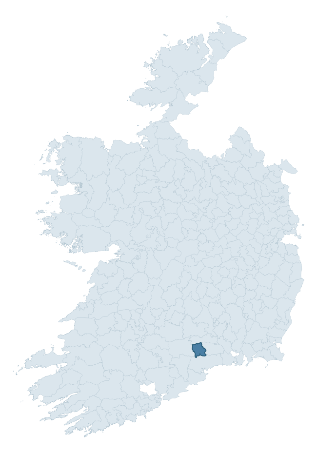
Where this barony sits in the Republic of Ireland
Geology and preservation
Bedrock geology shapes the landscape long before any settlement begins — controlling soil drainage, agricultural potential, the survival of upstanding monuments, and the preservation of buried archaeology. The figures below come from the Geological Survey Ireland 1:100,000 bedrock map.
The bedrock underlying Glenahiry is predominantly sandstone (58% of the barony by area), laid down during the Devonian period (93% by area, around 419 to 359 million years ago). Sandstone weathers to free-draining, moderately fertile soils that supported Early Medieval ringfort agriculture and later manorial estates. The rock itself is a major source of building stone — visible in churches, tower houses, and farm buildings across the barony's historic landscape. A substantial secondary geology of mudstone (27%) adds further variety to the underlying landscape. The single largest mapped unit is the Knockmealdown Sandstone Formation (45% of the barony's bedrock).
Rock type composition
Largest mapped unit: Knockmealdown Sandstone Formation (45% of the barony)
Placename evidence
Logainm records 15 heritage-diagnostic placenames for Glenahiry, drawn from townland and civil-parish names across the barony. The dominant stratum is Early Christian ecclesiastical — cill-, teampall-, and domhnach-prefixed names that record the dense network of early church foundations established between the fifth and tenth centuries. The leading diagnostic roots are cill- (12 — church), caiseal- (2 — stone ringfort), and domhnach- (1 — very early church). This is below the ROI average of 30.7 heritage placenames per barony, suggesting either lighter survey coverage or a townland-naming tradition that draws more on generic landscape vocabulary. Logainm records 73 placenames for Glenahiry (predominantly townland names). Of these, 15 (21%) carry one of the diagnostic Gaelic roots tracked above; the remainder draw on more generic landscape vocabulary that does not encode a heritage period.
Pre-Christian / Early Medieval Defensive
| Root | Count | Meaning |
|---|---|---|
| caiseal- | 2 | stone ringfort |
Early Christian Ecclesiastical
| Root | Count | Meaning |
|---|---|---|
| cill- | 12 | church (early) |
| domhnach- | 1 | pre-Patrician or earliest Patrician church |
Other baronies in Waterford
- Decies Without Drum
- Decies Within Drum
- Upperthird
- Gaultiere
- Middlethird
- Coshmore And Coshbride
- Kenry — Limerick
- Corkaguiny — Kerry
- Leitrim — Clare
- Dunkerron South — Kerry
See all 280 baronies in the Republic of Ireland Heritage Tool.

Explore further
Grounding History: 10 Maps of Northern Ireland’s Past
If you’re interested in Irish heritage more widely, the companion report for Northern Ireland brings together the analysis of all 462 NI wards into one place through 10 high-quality maps — covering monument density, archaeological periods, placename heritage, terrain, wetland, and the historic landscape at first survey. Take a look.
About this profile
Click any section below to expand.
What is a barony?
A barony is a historic administrative unit in Ireland, broadly equivalent to an English hundred. The 280 baronies used here are from the OSi 2019 National Statutory Boundaries (generalised 20m), covering the 26 counties of the Republic of Ireland. Baronies derive from the Norman period, were formalised in the 17th century, and have not been redrawn for statistical purposes. They vary enormously in area, from compact urban baronies in Dublin to vast upland baronies in Connacht, and should not be compared by raw site count without accounting for area differences.
What counts as a site?
This profile combines three distinct heritage registers, each with its own definition of what constitutes a recordable site:
- Archaeological sites (NMS). The National Monuments Service Sites and Monuments Record (SMR) catalogues every known archaeological monument or site of archaeological interest in the Republic, from prehistoric burial mounds and ringforts to medieval churches and post-medieval defensive works. Inclusion does not require legal protection — only that the site has been identified, surveyed, and assessed as having archaeological value. A separate subset of these sites lies within a recorded protection zone, which gives them statutory protection under the National Monuments Acts.
- Listed buildings (NIAH). The National Inventory of Architectural Heritage records buildings of architectural, historical, archaeological, artistic, cultural, scientific, social, or technical interest. Each surveyed structure is appraised on a five-tier scale: International, National, Regional, Local, and Record-Only. The NIAH appraisal is informational rather than strictly statutory, but it underpins local-authority Record of Protected Structures (RPS) listings.
- Heritage placenames (Logainm). Logainm is the authoritative database of Irish placenames maintained by the Placenames Branch. This profile applies a heritage-diagnostic classifier to the Irish-language form of each townland name, flagging roots that signal defensive sites (ráth-, lios-, dún-, caiseal-, cathair-), ecclesiastical foundations (cill-, teampall-, domhnach-, mainistir-), prehistoric burial-ritual features (tuaim-, carn-, leaba-), or Norse-contact settlement (gall-). Townlands without one of these diagnostic roots are not flagged here — they may still carry historical significance, but that significance is not encoded in the name itself.
Editorial principles
The narrative sections of this profile follow several explicit principles:
- Evidential. Every claim about this barony’s heritage character is anchored in the underlying register data. Where a site count, a placename count, or a percentile rank is cited, it is computed from the source datasets at export time, not estimated.
- Comparative. Counts and metrics are reported alongside their percentile rank against the other 279 ROI baronies. A barony with 50 ringforts in absolute terms could be unusually high or unusually low depending on its size and regional context; percentile ranking removes that ambiguity.
- Transparent on limits. Where a register has known coverage gaps, survey biases, or data-quality issues that affect this barony’s figures, the profile flags them rather than presenting the numbers as definitive.
- No interpretation beyond what the data supports. The narrative does not speculate about historical events, social dynamics, or cultural meaning beyond what the recorded heritage and placename evidence directly attests.
Data caveats and limits
- NMS Sites and Monuments Record is the product of survey campaigns conducted at different intensities across different counties and decades. Some baronies have been surveyed more thoroughly than others, and absolute counts should be read in that light. Sites destroyed by development before survey are typically not represented; sites in heavily forested or upland terrain are sometimes under-recorded.
- NIAH coverage is broadly complete for the Republic of Ireland but the survey was conducted on a rolling county-by-county basis, and the most recent appraisal date varies. Buildings demolished or substantially altered after their original survey may still appear in the register; conversely, recent buildings of merit may not yet have been appraised.
- Logainm classification applies a deliberately conservative pattern-matching approach to the Irish-language townland forms. The classifier prioritises true positives over recall: a townland may carry a heritage signal that the classifier doesn’t recognise, particularly where the diagnostic root has been heavily anglicised or where the townland name draws on a less common term. The 60,000+ townland records and ~9,800 classified placenames give a substantial signal at barony scale, but individual townland names should be checked against Logainm directly for definitive interpretation.
- Period attribution. The chronological distribution reflects only those NMS sites that carry a recognised period attribution in the source data. Sites listed as “Unknown” period are excluded from the dated subset.
- Boundary changes. Some baronies have undergone minor boundary adjustments since their 19th-century definition; the OSi 2019 generalised boundaries used here are the current statutory definition and may differ slightly from historical maps in border areas.
- Bedrock geology is mapped at 1:100,000 scale, which means local variation within a barony — small pockets of different rock type, mineral veins, alluvium overlying bedrock — is generalised. The dominant-system and rocktype figures are area-weighted, so a barony reading “70% Carboniferous limestone” may still contain small but archaeologically important pockets of older or younger rock. Around 3% of GSI polygons do not match the lexicon and contribute no rocktype or system attribution.
Data sources
- National Monuments Service — Sites and Monuments Record (SMR) https://data.gov.ie/dataset/national-monuments-service-archaeological-survey-of-ireland
- National Inventory of Architectural Heritage (NIAH) https://data.gov.ie/dataset/national-inventory-of-architectural-heritage-niah-national-dataset
- Logainm — Placenames Database of Ireland https://www.logainm.ie/
- Ordnance Survey Ireland — National Statutory Barony Boundaries 2019 https://data-osi.opendata.arcgis.com/
- EURODEM — European Digital Elevation Model https://www.mapsforeurope.org/datasets/euro-dem
- ESA WorldCover https://esa-worldcover.org/en
- Geological Survey Ireland — 1:100,000 Bedrock Geology https://www.gsi.ie/en-ie/data-and-maps/Pages/Bedrock.aspx
Explore more: Search any of the 280 ROI baronies, browse by historical province, or read the methodology and data sources for the full Republic of Ireland Heritage Tool.