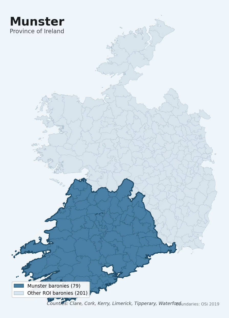
Munster is one of Ireland's four historical provinces, covering 79 of the Republic's 280 baronies across 6 counties: Clare, Cork, Kerry, Limerick, Tipperary, Waterford. The dated archaeological record is dominated by the Iron Age period, which accounts for 31% of period-attributed sites. The most prevalent single monument type is Ringfort – rath (10,691 records). Mean elevation across the province is 121m, between the upland and lowland extremes of the other provinces.
Heritage at a glance
Archaeological character
The National Monuments Service Sites and Monuments Record holds 57,775 archaeological sites across the 79 baronies of Munster, of which 55,181 (96%) sit within a formally recorded protection zone. In absolute terms this is the highest of the four provinces for total recorded archaeological sites. The record is led by defensive sites — ringforts, enclosures, hillforts, and stone forts, making up around 56% of the categorised sites in the province. Within Munster, the distribution is moderately skewed — some baronies carry substantially more archaeological sites than others. The three baronies holding the largest share of the record by absolute count are Corkaguiny (Kerry) (3,290 sites), Duhallow (Cork) (2,304), and Burren (Clare) (2,156) — together accounting for around 13% of the province's archaeological record. Adjusted for area, the highest site density is in Burren (Clare) at 7.2 sites per km², reflecting an unusually heritage-rich landscape rather than simply a large barony with many sites overall.
Most common monument types
| Type | Count |
|---|---|
| Ringfort – rath | 10,691 |
| Enclosure | 7,314 |
| Fulacht fia | 4,027 |
| Hut site | 3,526 |
| Standing stone | 2,391 |
| Souterrain | 2,056 |
| Church | 1,593 |
| Ringfort – cashel | 1,401 |
Chronological character
Dated archaeological evidence across Munster runs from the Mesolithic through to the Modern, spanning 9 of 9 canonical archaeological periods. Activity concentrates most heavily in the Iron Age (13,948 sites, 31% of dated material). This dominant period is unique to Munster among the four provinces. A further 12,919 sites (22% of the overall NMS record for Munster) carry no period attribution — typically records pre-dating the standardised period vocabulary or awaiting specialist dating review.
Architectural heritage
The National Inventory of Architectural Heritage records 16,544 listed buildings across Munster, appraised on a five-tier scale from Record-Only through Local, Regional, National, and International. Of these, 4 carry an International grading (buildings of European architectural importance) and 301 are graded National. This makes Munster the second-highest of the four provinces for listed-building count. The single largest concentration of listed buildings is in Cork (Cork) with 2,964 records — around 18% of the province's NIAH total.
Terrain and environment
The mean elevation across Munster is 121m, the second-highest of the four provinces. Upland terrain of this kind tends to preserve upstanding stone archaeology well and historically favoured pastoralism and defensive monument-building over arable agriculture. Mean slope is 5.4°, the second-highest of the four provinces. Steeper terrain resists ploughing and historically shielded surface archaeology from agricultural damage. The Topographic Wetness Index averages 10.3 across the province. Land cover is dominated by improved grassland (74%) and woodland (19%).
Terrain measurements
Geology and preservation
Bedrock geology shapes the landscape long before any settlement begins — controlling soil drainage, agricultural potential, the survival of upstanding monuments, and the preservation of buried archaeology. The figures below are area-weighted aggregates of the per-barony bedrock data, drawn from the Geological Survey Ireland 1:100,000 bedrock map.
The bedrock underlying Munster is predominantly sandstone (26% of the province by area), laid down during the Carboniferous period (54% of the province). This sandstone dominance is distinctive to Munster among the four provinces. Sandstone weathers to free-draining, moderately fertile soils that supported Early Medieval ringfort agriculture and later manorial estates, and is itself a major source of building stone visible in churches and farmhouses. A substantial secondary geology of limestone (25%) adds further variety to the underlying landscape.
Placename heritage
Logainm records 17,886 placenames across the baronies of Munster, predominantly townland names. Of these, 3,071 (17%) carry one of the diagnostic Gaelic roots tracked by the heritage classifier — defensive (ráth-, lios-, dún-, caiseal-), ecclesiastical (cill-, teampall-, domhnach-), burial-ritual, or Norse-contact terms. The dominant stratum is Early Christian ecclesiastical (1,653 names), with pre-Christian / Early Medieval defensive (1,265) forming a strong secondary layer. The single most common diagnostic root is cill- (church), appearing in 1,322 placenames across the province.
Baronies in Munster
| Barony | County | km² | NMS | NIAH | Dominant period |
|---|---|---|---|---|---|
| Bunratty Lower | Clare | 280 | 713 | 33 | Iron Age |
| Bunratty Upper | Clare | 218 | 834 | 21 | Early Medieval |
| Burren | Clare | 302 | 2,156 | 28 | Middle-Late Bronze Age |
| Clonderalaw | Clare | 398 | 435 | 20 | Early Medieval |
| Corcomroe | Clare | 250 | 722 | 73 | Middle-Late Bronze Age |
| Ibrickan | Clare | 232 | 320 | 24 | Early Medieval |
| Inchiquin | Clare | 358 | 1,133 | 31 | Early Medieval |
| Islands | Clare | 272 | 616 | 94 | Early Medieval |
| Leitrim | Clare | 94 | 246 | 9 | Early Medieval |
| Moyarta | Clare | 338 | 627 | 54 | Early Medieval |
| Tulla Lower | Clare | 317 | 424 | 30 | Iron Age |
| Tulla Upper | Clare | 392 | 358 | 33 | Iron Age |
| Bantry | Cork | 240 | 463 | 116 | Early Bronze Age |
| Barretts | Cork | 128 | 392 | 19 | Middle-Late Bronze Age |
| Barrymore | Cork | 610 | 1,120 | 686 | Early Medieval |
| Bear | Cork | 367 | 1,115 | 136 | Early Bronze Age |
| Carbery East (east Division) | Cork | 278 | 516 | 361 | Early Medieval |
| Carbery East (west Division) | Cork | 426 | 871 | 180 | Early Medieval |
| Carbery West (east Division) | Cork | 329 | 816 | 305 | Early Medieval |
| Carbery West (west Division) | Cork | 445 | 823 | 159 | Early Medieval |
| Condons And Clangibbon | Cork | 318 | 555 | 431 | Early Medieval |
| Cork | Cork | 56 | 152 | 2,964 | Middle-Late Bronze Age |
| Courceys | Cork | 37 | 73 | 20 | Iron Age |
| Duhallow | Cork | 940 | 2,304 | 215 | Middle-Late Bronze Age |
| Fermoy | Cork | 492 | 1,326 | 413 | Iron Age |
| Ibane And Barryroe | Cork | 145 | 421 | 111 | Early Medieval |
| Imokilly | Cork | 384 | 725 | 711 | Iron Age |
| Kerrycurrihy | Cork | 96 | 267 | 438 | Early Medieval |
| Kinalea | Cork | 207 | 288 | 119 | Early Medieval |
| Kinalmeaky | Cork | 147 | 355 | 256 | Early Medieval |
| Kinatalloon | Cork | 112 | 218 | 47 | Early Medieval |
| Kinsale | Cork | 53 | 137 | 218 | Early Medieval |
| Muskerry East | Cork | 460 | 1,455 | 166 | Middle-Late Bronze Age |
| Muskerry West | Cork | 763 | 1,711 | 194 | Early Medieval |
| Orrery And Kilmore | Cork | 281 | 956 | 202 | Iron Age |
| Clanmaurice | Kerry | 490 | 1,016 | 31 | Iron Age |
| Corkaguiny | Kerry | 566 | 3,290 | 67 | Iron Age |
| Dunkerron North | Kerry | 299 | 460 | 9 | Iron Age |
| Dunkerron South | Kerry | 395 | 768 | 25 | Iron Age |
| Glanarought | Kerry | 495 | 1,714 | 43 | Iron Age |
| Iraghticonnor | Kerry | 413 | 544 | 124 | Iron Age |
| Iveragh | Kerry | 665 | 1,976 | 77 | Early Medieval |
| Magunihy | Kerry | 696 | 1,474 | 140 | Early Medieval |
| Trughanacmy | Kerry | 793 | 1,658 | 345 | Early Medieval |
| Clanwilliam | Limerick | 221 | 830 | 191 | Iron Age |
| Connello Lower | Limerick | 205 | 606 | 125 | Early Medieval |
| Connello Upper | Limerick | 248 | 566 | 111 | Early Medieval |
| Coonagh | Limerick | 147 | 608 | 81 | Early Bronze Age |
| Coshlea | Limerick | 385 | 1,127 | 149 | Early Bronze Age |
| Coshma | Limerick | 198 | 663 | 194 | Iron Age |
| Glenquin | Limerick | 390 | 549 | 143 | Early Medieval |
| Kenry | Limerick | 125 | 258 | 51 | Early Medieval |
| Kilmallock | Limerick | 16 | 94 | 57 | Early Medieval |
| North Liberties | Limerick | 31 | 195 | 731 | Medieval |
| Owneybeg | Limerick | 110 | 173 | 53 | Iron Age |
| Pubblebrien | Limerick | 124 | 391 | 65 | Iron Age |
| Shanid | Limerick | 375 | 654 | 139 | Early Medieval |
| Smallcounty | Limerick | 180 | 1,284 | 100 | Early Bronze Age |
| Clanwilliam | Tipperary | 469 | 1,608 | 260 | Iron Age |
| Eliogarty | Tipperary | 365 | 839 | 221 | Iron Age |
| Glenahiry | Tipperary | 1 | 6 | 20 | Iron Age |
| Iffa And Offa East | Tipperary | 232 | 560 | 331 | Iron Age |
| Iffa And Offa West | Tipperary | 474 | 513 | 199 | Iron Age |
| Ikerrin | Tipperary | 282 | 688 | 113 | Early Bronze Age |
| Kilnamanagh Lower | Tipperary | 171 | 173 | 58 | Iron Age |
| Kilnamanagh Upper | Tipperary | 243 | 294 | 51 | Iron Age |
| Middlethird | Tipperary | 460 | 1,428 | 252 | Iron Age |
| Ormond Lower | Tipperary | 550 | 766 | 275 | Iron Age |
| Ormond Upper | Tipperary | 321 | 586 | 70 | Early Medieval |
| Owney And Arra | Tipperary | 363 | 463 | 62 | Early Medieval |
| Slievardagh | Tipperary | 367 | 617 | 115 | Iron Age |
| Upperthird | Tipperary | 4 | 21 | 7 | Middle-Late Bronze Age |
| Coshmore And Coshbride | Waterford | 362 | 254 | 527 | Early Medieval |
| Decies Within Drum | Waterford | 238 | 256 | 151 | Early Medieval |
| Decies Without Drum | Waterford | 532 | 1,058 | 452 | Iron Age |
| Gaultiere | Waterford | 98 | 204 | 935 | Iron Age |
| Glenahiry | Waterford | 156 | 147 | 45 | Iron Age |
| Middlethird | Waterford | 172 | 373 | 294 | Iron Age |
| Upperthird | Waterford | 256 | 380 | 138 | Middle-Late Bronze Age |

Explore further
Grounding History: 10 Maps of Northern Ireland’s Past
If you’re interested in Irish heritage more widely, the companion report for Northern Ireland brings together the analysis of all 462 NI wards into one place through 10 high-quality maps — covering monument density, archaeological periods, placename heritage, terrain, wetland, and the historic landscape at first survey. Take a look.
About this profile
Click any section below to expand.
What is a province?
Ireland’s four historical provinces — Ulster, Munster, Leinster, and Connacht — are pre-modern territorial groupings dating in form to the early medieval period and codified later in the Norman and Tudor administrative reforms. Each province aggregates a fixed set of counties and (for the Republic) a fixed set of baronies. This profile aggregates the per-barony heritage data within Munster to give a province-level analytical picture.
Data coverage
This profile aggregates the per-barony heritage data for the 79 Munster baronies in the Republic of Ireland, covering the counties of Clare, Cork, Kerry, Limerick, Tipperary, Waterford. The underlying data is drawn from three primary state registers: the National Monuments Service (NMS) Sites and Monuments Record for archaeological sites, the National Inventory of Architectural Heritage (NIAH) for listed buildings, and Logainm for placename heritage. Terrain and geology statistics are derived from the EURODEM digital elevation model, ESA WorldCover land-cover classifications, and the Geological Survey Ireland 1:100,000 bedrock map.
What counts as a site?
This profile combines three distinct heritage registers, each with its own definition of what constitutes a recordable site:
- Archaeological sites (NMS). The National Monuments Service Sites and Monuments Record catalogues every known archaeological monument or site of archaeological interest in the Republic — from prehistoric burial mounds and ringforts to medieval churches and post-medieval defensive works. A subset lies within a recorded protection zone, which gives those sites statutory protection under the National Monuments Acts.
- Listed buildings (NIAH). The National Inventory of Architectural Heritage records buildings of architectural, historical, archaeological, artistic, cultural, scientific, social, or technical interest, appraised on a five-tier scale from International through National, Regional, Local, and Record-Only.
- Heritage placenames (Logainm). A heritage-diagnostic classifier flags Irish-language townland names carrying roots that signal defensive sites, ecclesiastical foundations, prehistoric burial-ritual features, or Norse-contact settlement.
Editorial principles
The narrative sections of this profile follow several explicit principles:
- Evidential. Every claim about this province’s heritage character is anchored in the underlying register data. Where a count, share, or comparative ranking is cited, it is computed from the source datasets at export time.
- Comparative. Counts are reported alongside their rank among the four provinces and within-province distribution among baronies, so the reader can see whether a figure is unusual.
- Transparent on limits. Coverage gaps and survey biases are flagged where they meaningfully affect the figures rather than hidden.
- No interpretation beyond what the data supports. The narrative does not speculate about historical events or social dynamics beyond what the recorded heritage and placename evidence directly attests.
Data caveats and limits
- NMS Sites and Monuments Record is the product of survey campaigns at different intensities across counties and decades. Absolute counts should be read in that light.
- NIAH coverage is broadly complete for the Republic but was conducted on a rolling county-by-county basis. Recently built or recently demolished structures may not be reflected.
- Logainm classification applies a deliberately conservative pattern-matching approach. A townland may carry a heritage signal the classifier doesn’t recognise.
- Period attribution. The chronological distribution reflects only NMS sites with a recognised period attribution in the source data; sites listed as “Unknown” are surfaced in the bar chart but excluded from canonical period totals.
- Bedrock geology is mapped at 1:100,000 scale, which means local variation within a barony is generalised. The dominant-system and rocktype figures are area-weighted.
Data sources
- National Monuments Service — Sites and Monuments Record (SMR) https://data.gov.ie/dataset/national-monuments-service-archaeological-survey-of-ireland
- National Inventory of Architectural Heritage (NIAH) https://data.gov.ie/dataset/national-inventory-of-architectural-heritage-niah-national-dataset
- Logainm — Placenames Database of Ireland https://www.logainm.ie/
- Ordnance Survey Ireland — National Statutory Barony Boundaries 2019 https://data-osi.opendata.arcgis.com/
- EURODEM — European Digital Elevation Model https://www.mapsforeurope.org/datasets/euro-dem
- ESA WorldCover https://esa-worldcover.org/en
- Geological Survey Ireland — 1:100,000 Bedrock Geology https://www.gsi.ie/en-ie/data-and-maps/Pages/Bedrock.aspx
Explore more: Browse the other historical provinces, search any of the 280 ROI baronies by name or county, or read the methodology and data sources for the full Republic of Ireland Heritage Tool.