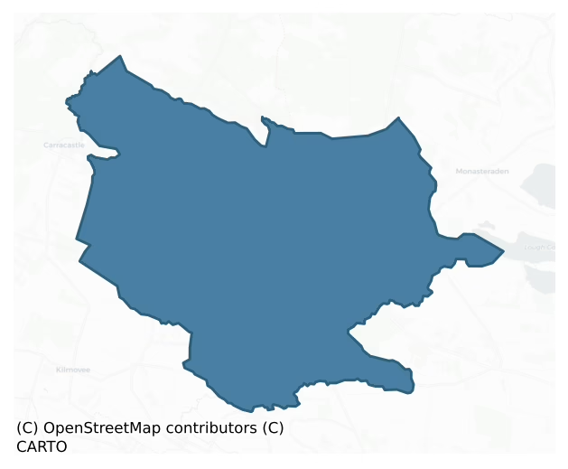
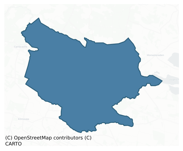
Costello is a barony of County Roscommon, in the historical province of Connacht (Irish: Coistealaigh), covering 78 km² of land. The barony records 130 NMS archaeological sites and 22 NIAH listed buildings, placing it at around the 41st percentile among 280 ROI baronies for sites per km². This means it is in the lower half of all baronies for sites per km². Dated archaeological evidence runs from the Neolithic through to the Modern, spanning 7 of 9 archaeological periods, placing the barony in the 26th percentile among 280 ROI baronies for chronological depth. This means it is in the bottom third of all baronies for chronological depth. The largest dated subset of recorded sites dates to the Early Medieval.
Heritage at a glance
Percentile rankings throughout this profile compare each barony only against the other 279 Republic of Ireland baronies.
The recorded heritage of Costello
The National Monuments Service Sites and Monuments Record (SMR) is the statutory inventory of archaeological sites for the Republic of Ireland, maintained by the Department of Tourism, Culture, Arts, Gaeltacht, Sport and Media. Sites recorded here include earthworks, ringforts, megalithic tombs, ecclesiastical remains, and post-medieval features; not every record is legally protected, but each is registered as a monument of archaeological interest.
The National Monuments Service records 130 archaeological sites in Costello, putting it at the 41st percentile among 280 ROI baronies for sites per km². This means it is in the lower half of all baronies for sites per km². Of these, 110 (85%) fall within a recorded monument protection zone. The dominant category is defensive sites — ringforts, enclosures, hillforts, and stone forts (77 sites, 59% of the record). Ringfort – rath is the most prevalent type, making up 24% of the barony's recorded sites (31 records), broadly in line with the ROI average of 20% across all baronies where this type occurs. Ringfort – rath is an earthen ringfort enclosed by a bank and external ditch — the most common Early Medieval farmstead, broadly dated 500–1000 AD. Other significant types include Ringfort – cashel (18) and Souterrain (13). Ringfort – cashel is the stone-walled equivalent of the rath, found mainly in upland or western areas, broadly dated 500–1000 AD; Souterrain is an underground stone-built passage and chamber, generally Early Medieval and often associated with ringforts as a defensive or storage feature. Across the barony's 78 km², this gives a recorded density of 1.67 sites per km².
Most common monument types
Hover or tap a monument type to see its definition.
| Type | Count |
|---|---|
| Ringfort – rath an earthen ringfort enclosed by a bank and external ditch — the most common Early Medieval farmstead, broadly dated 500–1000 AD | 31 |
| Ringfort – cashel the stone-walled equivalent of the rath, found mainly in upland or western areas, broadly dated 500–1000 AD | 18 |
| Souterrain an underground stone-built passage and chamber, generally Early Medieval and often associated with ringforts as a defensive or storage feature | 13 |
| Fulacht fia a horseshoe-shaped Bronze Age burnt mound built around a sunken trough beside a water source, traditionally interpreted as a cooking site | 12 |
| Children's burial ground an unconsecrated medieval and early-modern burial ground for unbaptised or stillborn children, often called a cillín or ceallúnach | 8 |
| Earthwork an unclassified earthen structure with no diagnostic features that allow a more specific classification | 7 |
| Excavation – miscellaneous | 5 |
Chronological distribution
The dated archaeological record for Costello spans from the Neolithic through to the Modern, with activity attested across 7 of 9 archaeological periods. The record is near-continuous, with only the Medieval period falling inside the span without any recorded sites. Activity concentrates most heavily in the Early Medieval (66 sites, 62% of dated material), with the Iron Age forming a secondary peak (17 sites, 16%). A further 23 recorded sites (18% of the overall NMS register for the barony) carry no period attribution — appearing as 'Unknown' in the bar chart below. This typically reflects either records that pre-date the standardised period vocabulary or sites awaiting specialist dating review, rather than a genuine absence of chronological evidence.
Sample of recorded monuments
Show 25 sample monuments (of 130 total)
A representative sample of 25 recorded monuments drawn from the barony’s 130 total NMS entries. Sites within a recorded monument protection zone and rarer site types are prioritised so the list shows a meaningful cross-section rather than only the most common type. Each entry shows the official Sites and Monuments Record reference number and the description published by the National Monuments Service.
Penal Mass station
Described as 'Monument' on the 1837 ed. of the OS 6-inch map (MA 74), and situated on the NW-facing crest of a hill. This is a conserved rectangular masonry block (dims c. 2.5m x c. 2.5m; H c. 2.5m) surmounted with a…
Described as 'Monument' on the 1837 ed. of the OS 6-inch map (MA 74), and situated on the NW-facing crest of a hill. This is a conserved rectangular masonry block (dims c. 2.5m x c. 2.5m; H c. 2.5m) surmounted with a Maltese cross and with an arch (int. Wth 1.4m; L 1.4m; H 2.5m) attached to each face. There is an altar recess (Wth 1.05m; H 0.75m; D 0.25m) in each face of the central masonry block with an aumbry (Wth c. 0.2m; H 0.35m; D 0.2m) in the wall of the arch to the right of each recess. The structure is within a circular enclosure (diam. c. 9m) defined by a masonry wall with an entrance gate at NW. It commemorates the use of mass-rocks at this location, providing four altars, one of which would be the most sheltered on any particular occasion. There is an arched gateway (RO008-013003-) (Wth 2.8m; H 2.5m) with a rebate on the NE side in a field wall c. 120m to the W.
See the attached general image taken from the W.
Compiled by: Michael Moore
Date of upload: 24 August 2010
Ringfort – unclassified
On a gentle SW-facing slope. Subcircular grass-covered but poached area (int. dims 57m E-W; 53m N-S) defined by a drystone wall WNW-N, and the intermittently visible footing of the wall elsewhere with mature deciduous…
On a gentle SW-facing slope. Subcircular grass-covered but poached area (int. dims 57m E-W; 53m N-S) defined by a drystone wall WNW-N, and the intermittently visible footing of the wall elsewhere with mature deciduous trees planted inside the perimeter. There is an earthen bank (Wth 4.8m; int. H 0.6m; ext. H 0.5m) inside the perimeter S-W. The children's burial ground (RO008-015002-) abuts the inner edge of the perimeter at SE.
Compiled by: Michael Moore
Date of upload: 24 August 2010
Road – class 1 togher
On flat bogland which is partly cut-away on the N bank of the W-E Lung river, c. 1km from where it enters Lough Gara Upper. Investigated in 1966 by E. Rynne. A N-S stone and timber structure (L c. 430m), c. 0.6-1.5m…
On flat bogland which is partly cut-away on the N bank of the W-E Lung river, c. 1km from where it enters Lough Gara Upper. Investigated in 1966 by E. Rynne. A N-S stone and timber structure (L c. 430m), c. 0.6-1.5m below the surface of the bog, led to what must once have been a fording point across the Lung river as it is continued by the wooden togher (RO008-027—-) on the S bank. At the S end of this section the construction consisted of a sub-structure of brushwood overlain by tranverse planks (alder) retained by vertical pegs of oak and birch, with a superstructure of two layers of sandstone flags also retained by vertical pegs, forming a narrow walking surface (Wth c. 0.9m). At the N end a stone paving supported by a sub-structure of longditudional roundwoods and planks (Ash) was retained by pegs (alder and oak) above a layer of brushwood. It provided radiocarbon dates of 1398-1217 BC (3050±25 BP; GrN-14730) (Brindley and Lanting 1998, 55). It is no longer visible at ground level, although it may survive in uncut sections of bog. (NMI File; Golden 1992)
Compiled by: Michael Moore
Date of upload: 24 August 2010
Barrow – ring-barrow
On a low-lying level landscape with a NW-SE stream c. 20m to the NE. Subcircular grass-covered platform (dims 15.5m N-S; 11.8m E-W; H 0.4-0.5m) defined by a fosse (at S: Wth of top 4.7m; Wth of base 3m; D 0.6m; at E:…
On a low-lying level landscape with a NW-SE stream c. 20m to the NE. Subcircular grass-covered platform (dims 15.5m N-S; 11.8m E-W; H 0.4-0.5m) defined by a fosse (at S: Wth of top 4.7m; Wth of base 3m; D 0.6m; at E: Wth of top 7.4m; Wth of base 5.4m; D 0.6m) and outer bank (Wth 3.8-5.2m; ext. H 0.2-0.4m). The platform and bank are quarried at SE, while the bank has been augmented at N (Wth 7.4m) and removed (L 12m) by a NE-SW farm track at NW (max. ext. dims 34.2m N-S; 30.3m E-W).
Compiled by: Michael Moore
Date of upload: 24 August 2010
This monument is subject to a preservation order made under the National Monuments Acts 1930 to 2014 (PO no. 23/1956).
Bawn
On a low knoll with a small N-S stream immediately to W, which joins a NW-SE stream c. 100m to S. References to Castlemore, the principal castles of the Costellos date from 1336 to 1595, and it may be the castle of…
On a low knoll with a small N-S stream immediately to W, which joins a NW-SE stream c. 100m to S. References to Castlemore, the principal castles of the Costellos date from 1336 to 1595, and it may be the castle of Lugha razed by O'Conor in 1270 (Lynn 1986, 98-100).
The castle (RO008-032001-) stands inside the perimeter at the NW angle of the rectangular enclosure (dims 45m E-W; c. 30m N-S) defined by a wall (T 0.9m; ext. H 1.4m) at N, but the S part of the enclosure has been damaged by quarrying and at least one hut site (RO008-032003-) defined by a grass-covered stone spread (Wth 1.7-2.8m; H 0.5-0.9m) is within it. Test excavations (97E0268; 98E0325; 06E0121) in the vicinity failed to produce archaeological material (Walsh 1998; Morahan 1998; Henry 2009b).
Compiled by: Michael Moore
Date of upload: 24 August 2010
This monument is subject to a preservation order made under the National Monuments Acts 1930 to 2014 (PO no. 4/1979).
Megalithic structure
Marked only on the 1915 ed. of the OS 6-inch map where it is described as a 'Dermot and Grania's Bed' and situated on a W-facing slope. A slab (dims 1.2m x 1.1m) is resting on a N stone (dims 0.8m x 0.2m; H 0.4m) and a…
Marked only on the 1915 ed. of the OS 6-inch map where it is described as a 'Dermot and Grania's Bed' and situated on a W-facing slope. A slab (dims 1.2m x 1.1m) is resting on a N stone (dims 0.8m x 0.2m; H 0.4m) and a S stone (dims 0.5m x 0.2m; H 0.2m). Both uprights are aligned E-W, and the feature may be natural. (de Valera and Ó Nualláin 1972, 41-2)
Compiled by: Michael Moore
Date of upload: 24 August 2010
Cairn – clearance cairn
The large cairn (Gannon 1972) inside cashel (RO008C019001-) is in fact a spoil mound.
Compiled by: Michael Moore
Date of upload: 24 August 2010
Ceremonial enclosure
Visible as a subcircular feature on aerial photographs (GSIAP: M, 679-80), and situated on a low knoll. This is a circular domed, grass-covered area (diam. 60m N-S; 55.7m E-W) defined by a stone spread (Wth 3-4m; int. H…
Visible as a subcircular feature on aerial photographs (GSIAP: M, 679-80), and situated on a low knoll. This is a circular domed, grass-covered area (diam. 60m N-S; 55.7m E-W) defined by a stone spread (Wth 3-4m; int. H 0.3-0.4m; ext. H 0.4-1m) with facing stones visible at W (original Wth 2.25m), which is replaced by a field wall NW-NNE. This is separated by a berm (Wth 1-3m) from a second stone spread (Wth 4-5m; H 0.3-0.4m) visible at N, NE and SSE-WNW, beyond which is a berm (Wth 1.2-2m) and a third stone spread (Wth 2.8m; H 0.1-0.4m) WSW-NW. There are some boulders in the interior, and a childrens' burial ground (RO008C020001-) is at the centre. There is no visible entrance but the monument is bisected by a NNE-SSW field wall, and a probable limekiln, visible as an oval area (int. dims 6.2m E-W; 2m N-S) defined by a stone spread (Wth 3-4m; H 0.2-0.7m), is inside the perimeter at WNW.
Compiled by: Michael Moore
Date of upload: 24 August 2010
Chapel
Marked only on the 1915 ed. of the OS 6-inch map, and situated on a broad NW-SE ridge. A private chapel, reputedly built c. 1750 (OS Name Books), is associated with Castlemore House c. 15m to the NW, which has now been…
Marked only on the 1915 ed. of the OS 6-inch map, and situated on a broad NW-SE ridge. A private chapel, reputedly built c. 1750 (OS Name Books), is associated with Castlemore House c. 15m to the NW, which has now been removed. A Plunkett family occupied Castlemore House in the early 19th century (Lewis 1837, 1, 305). A chancel or apse (int. dims 1.65m E-W; 1.45m N-S) of masonry walls (T 0.6m; H c. 4m) with rectangular windows (dims c. 0.8m x c. 0.5m) in each wall and a high chancel arch leads to the E end of a nave or chancel (int. dim. 3.3m N-S), the W end of which does not survive.
Compiled by: Michael Moore
Date of revised upload: 3 June 2015
Ritual site – holy well
Marked only on the 1915 ed. of the OS 6-inch map, and situated at the crest of a S-facing slope. The souterrain (RO008C010001-) is regarded locally as a holy well, but there is no evidence of veneration.
Compiled by:…
Marked only on the 1915 ed. of the OS 6-inch map, and situated at the crest of a S-facing slope. The souterrain (RO008C010001-) is regarded locally as a holy well, but there is no evidence of veneration.
Compiled by: Michael Moore
Date of upload: 24 August 2010
Field system
Located on a gentle S-facing slope. Archaeological excavation (10E0301) in an arc (Wth c. 10-40m) outside the exclusion zone (Wth c. 20m) around the rath (RO008-023—-) SW-W-NE recorded three drains or ditches (Wth…
Located on a gentle S-facing slope. Archaeological excavation (10E0301) in an arc (Wth c. 10-40m) outside the exclusion zone (Wth c. 20m) around the rath (RO008-023—-) SW-W-NE recorded three drains or ditches (Wth 0.6-1.1m; D 0.2-0.25m) with some gaps approaching the rath from the W, N and NE. The last (L c. 40m) would connect the rath with an enclosure (RO008-023002-) that was partly excavated. (Kyle and Delaney 2011a, 4-5; Delaney et al. 2016, 86)
Compiled by: Michael Moore
Date of upload: 9 February, 2012
Mound
There is a grass-covered mound (diam. 5m; H 0.3-0.8m) just E of the centre of cashel (RO008-006001-).
Compiled by: Michael Moore
Date of upload: 24 August 2010
Church
The parish church of Kilcolman, listed as Keilcalman in the ecclesiastical taxation of Achonry in 1306 (Cal. doc. Ire. vol. 5, 219). Situated on a shelf of a gentle S-facing slope. Rectangular structure (int. dims 17m…
The parish church of Kilcolman, listed as Keilcalman in the ecclesiastical taxation of Achonry in 1306 (Cal. doc. Ire. vol. 5, 219). Situated on a shelf of a gentle S-facing slope. Rectangular structure (int. dims 17m E-W; 5.5m N-S) of which most of the N wall is reduced to the foundations and the other ivy-clad walls (T 0.85m; H 0.6m at E to 2m at W) have no architectural features. It is within rath (RO008-021001-), which is now a graveyard (RO008-021003-). Kilcolman castle (RO008-020—-) is c. 130m to the W.
Compiled by: Michael Moore
Date of upload: 24 August 2010
Graveyard
On a shelf of a gentle S-facing slope. Subcircular graveyard (dims 41m NE-SW; 37m NW-SE), which originated as rath (RO008-021001-) and contains the church (RO008-021002-). The graveyard is now extended to the NW (dims…
On a shelf of a gentle S-facing slope. Subcircular graveyard (dims 41m NE-SW; 37m NW-SE), which originated as rath (RO008-021001-) and contains the church (RO008-021002-). The graveyard is now extended to the NW (dims c. 180m NW-SE; c. 60m NE-SW).
Compiled by: Michael Moore
Date of upload: 24 August 2010
Church
The parish church of Castlemore is listed as de Castro Magno in the ecclesiastical taxation of Achonry in 1306 (Cal. doc. Ire. vol. 5, 219). Situated on a low rise. Rectangular grass-covered area (int. dims 12m E-W; 7m…
The parish church of Castlemore is listed as de Castro Magno in the ecclesiastical taxation of Achonry in 1306 (Cal. doc. Ire. vol. 5, 219). Situated on a low rise. Rectangular grass-covered area (int. dims 12m E-W; 7m N-S) defined by the foundations of much of the S wall (T 0.9m) and the S end of the E wall, but the N and W walls are obscured by grass-covered stone spreads. There is no evidence of an enclosure or of burial, although a graveyard (RO008-033002-) is marked on the 1838 ed. of the OS 6-inch map (Mayo 74). However, the childrens burial ground (RO008-033003-) is immediately to the E, and the Castlemore castle (RO008-032001-) is c. 100m to the W, on the other side of a NE-SW road.
Compiled by: Michael Moore
Date of upload: 24 August 2010
Graveyard
On a low rise. Marked 'Grave Yd.' on the 1837 ed. of the OS 6-inch map (MA 74). There is no evidence of an enclosure or of burial around the church (RO008-033001-), apart from the childrens burial ground…
On a low rise. Marked 'Grave Yd.' on the 1837 ed. of the OS 6-inch map (MA 74). There is no evidence of an enclosure or of burial around the church (RO008-033001-), apart from the childrens burial ground (RO008-032003-).
Compiled by: Michael Moore
Date of upload: 24 August 2010
Mound
There is no evidence of the mound (diam. c. 15m) marked just NW of the centre of rath (RO08B001001-) on the 1837 ed. of the OS 6-inch map (MA 63).
Compiled by: Michael Moore
Date of upload: 24 August 2010
Burnt mound
Located towards the bottom of a gentle S and SW-facing slope. Bokagh 3 was identified as a site during the centre-line testing (10E0298) for the N5 Ballaghaderreen bypass (Janes and Delaney 2010a, 9) but this mound…
Located towards the bottom of a gentle S and SW-facing slope. Bokagh 3 was identified as a site during the centre-line testing (10E0298) for the N5 Ballaghaderreen bypass (Janes and Delaney 2010a, 9) but this mound became distinct only during the resolution stage when half of it was exposed and excavated (10E0378).
It appeared as a D-shaped mound of broken and burnt stone (dims 4.2m WNW-ESE; 3.7m NNE-SSW; max. H 0.67m) cut by the limit of the road-take at N. No related features came to light. Fulacht fia (RO008-072002-) is c. 10m to the S and fulacht fia (RO008-072001-) is c. 10m to the SE. N. Further afield the fulacht fia (RO008-071—-) is c. 100m to the W and the fulachta fia (RO008-073001-; RO008-073002-; RO008-073003-) are c. 80m to the ESE. (Kyle, J. and Delaney, S. (2011f, 3)
Compiled by: Michael Moore
Date of upload: 10 February, 2012
Castle – unclassified
There are references to the destruction of the castle of Kilcolman in 1270, 1284 and 1315 (Lynne 1985-6,103), and it was a centre of the Costelloes in 1536 (AFM vol. 5, 1427). By 1635 it was owned by Lord viscount…
There are references to the destruction of the castle of Kilcolman in 1270, 1284 and 1315 (Lynne 1985-6,103), and it was a centre of the Costelloes in 1536 (AFM vol. 5, 1427). By 1635 it was owned by Lord viscount Dillon of Castlerea and Gallen (O'Sullivan, W. 1958, 5). Situated on a low-lying landscape with a NW-SE stream immediately to the N, although it once ran to the S of the site. Described as a rectangular platform (dims 29m N-S; 27m E-W; H 1.5m), which when excavated in 1950 disclosed a perimeter wall (Wth 2m) with an outer base batter and an outer fosse (Wth 6m). There was a destroyed entrance and causeway at W (NMI file). It is no longer visible at ground level in pasture, but Kilcolman church (RO008-021001-) is c. 130m to the E. Archaeological testing (03E0115) c. 70m to the SW (Delaney 2006) and testing (03E1943) immediately to the S and W (Ryan 2007) during 2003 failed to produce any related material. Further testing (06E1062) c. 50m to the SW during 2006 had similar results (Fitzpatrick 2009c) but testing (06E1062) on the monument itself during 2012 identified portion (L 2.8m; H 1.05m; Wth 0.75m) of the base-batter of a turret (original diam. c. 3.5m) together with cairn material. See this web-page accessed on 4 December, 2014:http://www.excavations.ie/report/2012/Roscommon/0023376
Compiled by: Michael Moore
Date of revised upload: 4 December, 2014
Castle – unclassified
References to Castlemore, the principal castle of the Costellos date from 1336 to 1595, and it may be the castle of Lugha razed by O'Conor in 1270 (Lynn 1986, 98-100). In 1580 it was acquired by Theobald Dillon from Mac…
References to Castlemore, the principal castle of the Costellos date from 1336 to 1595, and it may be the castle of Lugha razed by O'Conor in 1270 (Lynn 1986, 98-100). In 1580 it was acquired by Theobald Dillon from Mac Costello (Cronin 1980, 114), and in 1635 it was the property of Lord viscount Dillon of Castlereagh and Gallen (O'Sullivan, W. 1958, 4-5). Situated on a low knoll with a small N-S stream immediately to the W, which joins a NW-SE stream c. 100m to the S.
This is a grass-covered masonry structure (ext. dims c. 16m E-W; c. 11m N-S; H 3.2m at N) with an external base batter at N but it is largely obscured by grass-covered cairn material. It stands inside the perimeter at the NW angle of the rectangular bawn (RO008-032002-) (dims 45m E-W; c. 30m N-S) defined by a wall (T 0.9m; ext. H 1.4m) at N, but the S part of the enclosure has been damaged by quarrying and contained at least one hut-site (RO008-021003-) (int. diam. 2.5m) defined by a grass-covered stone spread (Wth 1.7-2.8m; H 0.5-0.9m) with two other possible hut-sites (RO008-032004-; RO008-032005-). Test excavations (97E0268; 98E0325; 03E0430; 06E0121) in the vicinity failed to produce archaeological material (Walsh 1998; Morahan 2000; Read 2006c; Henry 2009b). There is a church (RO008-033001-) c. 100m to the E on the other side of a NE-SW road.
Compiled by: Michael Moore
Date of upload: 24 August 2010
This monument is subject to a preservation order made under the National Monuments Acts 1930…
Hut site
On a low knoll with a small N-S stream immediately to W which joins a NW-SE stream c. 100m to S. References to Castlemore, the principal castles of the Costellos date from 1336 to 1595, and it may be the castle of Lugha…
On a low knoll with a small N-S stream immediately to W which joins a NW-SE stream c. 100m to S. References to Castlemore, the principal castles of the Costellos date from 1336 to 1595, and it may be the castle of Lugha razed by O'Conor in 1270 (Lynn 1986, 98-100).
The bawn (RO008-032002-) contained at least one hut site (int. diam. 2.5m) defined by a grass-covered stone spread (Wth 1.7-2.8m; H 0.5-0.9m) with two other possible hut-sites (RO008-032004-; RO008-032005-). Test excavations in the vicinity failed to produce archaeological material (Walsh 1998; Morahan 1998; Henry 2009b).
Compiled by: Michael Moore
Date of upload: 24 August 2010
This monument is subject to a preservation order made under the National Monuments Acts 1930 to 2014 (PO no. 4/1979).
Hut site
On a low knoll with a small N-S stream immediately to W which joins a NW-SE stream c. 100m to S. References to Castlemore, the principal castles of the Costellos date from 1336 to 1595, and it may be the castle of Lugha…
On a low knoll with a small N-S stream immediately to W which joins a NW-SE stream c. 100m to S. References to Castlemore, the principal castles of the Costellos date from 1336 to 1595, and it may be the castle of Lugha razed by O'Conor in 1270 (Lynn 1986, 98-100).
The bawn (RO008-032002-) contained at least one hut site (int. diam. 2.5m) defined by a grass-covered stone spread (Wth 1.7-2.8m; H 0.5-0.9m) with two other possible hut-sites (RO008-032004-; RO008-032005-). Test excavations (97E0268; 98E0325; 06E0121) in the vicinity failed to produce archaeological material (Walsh 1998; Morahan 1998; Henry 2009b).
Compiled by: Michael Moore
Date of upload: 24 August 2010
This monument is subject to a preservation order made under the National Monuments Acts 1930 to 2014 (PO no. 4/1979).
Hut site
On a low knoll with a small N-S stream immediately to W which joins a NW-SE stream c. 100m to S. References to Castlemore, the principal castles of the Costellos date from 1336 to 1595, and it may be the castle of Lugha…
On a low knoll with a small N-S stream immediately to W which joins a NW-SE stream c. 100m to S. References to Castlemore, the principal castles of the Costellos date from 1336 to 1595, and it may be the castle of Lugha razed by O'Conor in 1270 (Lynne 1985-6, 98-100).
The bawn (RO008-032002-) at least one hut site (int. diam. 2.5m) defined by a grass-covered stone spread (Wth 1.7-2.8m; H 0.5-0.9m) with two other possible hut-sites (RO008-032004-; RO008-032005-). Test excavations in the vicinity failed to produce archaeological material (Walsh 1979; Morahan 1998)
Compiled by: Michael Moore
Date of upload: 24 August 2010
This monument is subject to a preservation order made under the National Monuments Acts 1930 to 2014 (PO no. 4/1979).
Standing stone
At the S end of a low ridge. A stone (dims of base 0.7m x 0.8m; H 1.2m) with no discernible orientation narrows to a flat top (dims 0.3m x 0.25m).
See the attached view from the N.
Compiled by: Michael…
At the S end of a low ridge. A stone (dims of base 0.7m x 0.8m; H 1.2m) with no discernible orientation narrows to a flat top (dims 0.3m x 0.25m).
See the attached view from the N.
Compiled by: Michael Moore
Date of upload: 24 August 2010
Ringfort – rath
On a gentle S-facing slope. Circular grass-covered area (diam. 40.3m N-S; 37.6m E-W) defined by an overgrown earthen bank (at E: Wth 2.5m; int. H 0.5m; ext. H 0.8m; at N: Wth 5m; int. H 0.3m; ext. H 0.9m) NE-SSE and…
On a gentle S-facing slope. Circular grass-covered area (diam. 40.3m N-S; 37.6m E-W) defined by an overgrown earthen bank (at E: Wth 2.5m; int. H 0.5m; ext. H 0.8m; at N: Wth 5m; int. H 0.3m; ext. H 0.9m) NE-SSE and SW-NNE which is reduced to a scarp (H 0.9m) SSE-SW and is missing (L 17m) NNE-ENE. There is an outer fosse (Wth of base 1.8m at N to 4.4m at W; D 0.3-0.4m) WSW-NE, but there is no visible entrance.
A buffer zone (Wth 20m) was established around the monument in 2009 during the archaeological testing for the N5 Ballaghadereen bypass and for any subsequent construction (O'Neill 2009, 16). An area outside the buffer-zone was excavated (Kyle and Delaney 2011a; Kyle 2011d) when evidence of Neolithic and Early Bronze Age activity was recorded (RO008-065—-) as well as elements of a field system (RO008-023001-) associated with the rath and an enclosure (RO008-023002-).
Further excavation in 2012 by S. Delaney under the same license (10E0301) identified a narrow ditch outside the visible fosse of the rath and curving in line with the perimeter in the S sector. It produced material that provided a C14 date of AD 666-773 (Delaney et al. 2016, 86). Three sections of ditch to the NE were also curved with the perimeter, but there were original gaps between the sections. See this web-page accessed on 4 December, 2014: http://www.excavations.ie/report/2012/Roscommon/0023394/
Compiled by: Michael Moore
Date of revised upload: 2 December, 2014
Listed buildings
The National Inventory of Architectural Heritage (NIAH) is a state survey appraising buildings of architectural, historical, archaeological, artistic, cultural, scientific, social, or technical interest. Each surveyed structure receives a rating from International (the highest, for buildings of European importance) through National, Regional, Local, and Record-Only.
The NIAH records only 22 listed buildings in Costello, the 9th percentile across ROI baronies — a relatively thin architectural record. All recorded buildings carry Regional or lower grading; the barony does not contain any structures appraised as being of National or International architectural importance. Construction dates concentrate most heavily in the Victorian (1830-1900) period. The most-recorded building type is house (8 examples, 36% of the listed stock).
Terrain and environment
Mean elevation across the barony is 118m — the 71st percentile among 280 ROI baronies for elevation. This means it is in the top third of all baronies for elevation. This is a relatively elevated landscape by ROI standards. Elevation matters for heritage because higher-altitude baronies typically favour defensive monuments — ringforts and hilltop forts placed on prominent ground — while lowland baronies are more likely to carry the dense settlement and church networks of intensive agricultural landscapes. A maximum elevation of 224m gives the barony meaningful vertical relief. Mean slope is 2.8° — the 34th percentile among 280 ROI baronies for slope. This means it is in the lower half of all baronies for slope. Slope is a key control on both land use and archaeological preservation: steep ground resists ploughing and tends to preserve earthworks intact, while gentle slopes favour intensive cultivation that damages or destroys surface archaeology over time. The Topographic Wetness Index averages 11.2, the 63rd percentile among 280 ROI baronies for wetness. This means it is in the upper half of all baronies for wetness. Drainage matters for heritage because poorly-drained ground preserves organic archaeology (wooden trackways, leather, textiles, and on rare occasions human remains) far better than free-draining soil; well-drained ground favours arable use but destroys organic material rapidly. The land cover is dominated by improved grassland (81%) and woodland (17%).
Terrain measurements
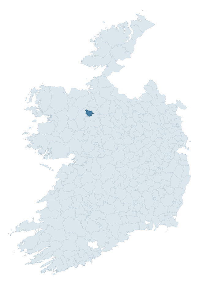
Where this barony sits in the Republic of Ireland
Geology and preservation
Bedrock geology shapes the landscape long before any settlement begins — controlling soil drainage, agricultural potential, the survival of upstanding monuments, and the preservation of buried archaeology. The figures below come from the Geological Survey Ireland 1:100,000 bedrock map.
The bedrock underlying Costello is predominantly sandstones and red green conglomerates (29% of the barony by area), with much of the rock dating to the Carboniferous period. A substantial secondary geology of andesitic lavas (15%) and sandstone (14%) adds further variety to the underlying landscape. The single largest mapped unit is the Boyle Sandstone Formation (29% of the barony's bedrock). With 8 distinct rock types mapped, the barony sits in the top third of ROI baronies for geological diversity (76th percentile) — typically a sign of complex tectonic history or coastal mosaics of differing rock units.
Rock type composition
Largest mapped unit: Boyle Sandstone Formation (29% of the barony)
Placename evidence
Logainm records 12 heritage-diagnostic placenames for Costello, a modest sample drawn predominantly from the townland record. The dominant stratum is early christian ecclesiastical. The most frequent diagnostic roots are cill- (7) and caiseal- (2). With a sample of this size the count should be treated as indicative rather than definitive.
Pre-Christian / Early Medieval Defensive
| Root | Count | Meaning |
|---|---|---|
| caiseal- | 2 | stone ringfort |
| ráth- | 1 | earthen ringfort |
| lios- | 1 | ringfort or enclosure |
Early Christian Ecclesiastical
| Root | Count | Meaning |
|---|---|---|
| cill- | 7 | church (early) |
Burial, Ritual, and Norse-Contact
| Root | Count | Meaning |
|---|---|---|
| tuaim- | 1 | burial mound |
Other baronies in Roscommon
About this profile
Click any section below to expand.
What is a barony?
A barony is a historic administrative unit in Ireland, broadly equivalent to an English hundred. The 280 baronies used here are from the OSi 2019 National Statutory Boundaries (generalised 20m), covering the 26 counties of the Republic of Ireland. Baronies derive from the Norman period, were formalised in the 17th century, and have not been redrawn for statistical purposes. They vary enormously in area, from compact urban baronies in Dublin to vast upland baronies in Connacht, and should not be compared by raw site count without accounting for area differences.
What counts as a site?
This profile combines three distinct heritage registers, each with its own definition of what constitutes a recordable site:
- Archaeological sites (NMS). The National Monuments Service Sites and Monuments Record (SMR) catalogues every known archaeological monument or site of archaeological interest in the Republic, from prehistoric burial mounds and ringforts to medieval churches and post-medieval defensive works. Inclusion does not require legal protection — only that the site has been identified, surveyed, and assessed as having archaeological value. A separate subset of these sites lies within a recorded protection zone, which gives them statutory protection under the National Monuments Acts.
- Listed buildings (NIAH). The National Inventory of Architectural Heritage records buildings of architectural, historical, archaeological, artistic, cultural, scientific, social, or technical interest. Each surveyed structure is appraised on a five-tier scale: International, National, Regional, Local, and Record-Only. The NIAH appraisal is informational rather than strictly statutory, but it underpins local-authority Record of Protected Structures (RPS) listings.
- Heritage placenames (Logainm). Logainm is the authoritative database of Irish placenames maintained by the Placenames Branch. This profile applies a heritage-diagnostic classifier to the Irish-language form of each townland name, flagging roots that signal defensive sites (ráth-, lios-, dún-, caiseal-, cathair-), ecclesiastical foundations (cill-, teampall-, domhnach-, mainistir-), prehistoric burial-ritual features (tuaim-, carn-, leaba-), or Norse-contact settlement (gall-). Townlands without one of these diagnostic roots are not flagged here — they may still carry historical significance, but that significance is not encoded in the name itself.
Editorial principles
The narrative sections of this profile follow several explicit principles:
- Evidential. Every claim about this barony’s heritage character is anchored in the underlying register data. Where a site count, a placename count, or a percentile rank is cited, it is computed from the source datasets at export time, not estimated.
- Comparative. Counts and metrics are reported alongside their percentile rank against the other 279 ROI baronies. A barony with 50 ringforts in absolute terms could be unusually high or unusually low depending on its size and regional context; percentile ranking removes that ambiguity.
- Transparent on limits. Where a register has known coverage gaps, survey biases, or data-quality issues that affect this barony’s figures, the profile flags them rather than presenting the numbers as definitive.
- No interpretation beyond what the data supports. The narrative does not speculate about historical events, social dynamics, or cultural meaning beyond what the recorded heritage and placename evidence directly attests.
Data caveats and limits
- NMS Sites and Monuments Record is the product of survey campaigns conducted at different intensities across different counties and decades. Some baronies have been surveyed more thoroughly than others, and absolute counts should be read in that light. Sites destroyed by development before survey are typically not represented; sites in heavily forested or upland terrain are sometimes under-recorded.
- NIAH coverage is broadly complete for the Republic of Ireland but the survey was conducted on a rolling county-by-county basis, and the most recent appraisal date varies. Buildings demolished or substantially altered after their original survey may still appear in the register; conversely, recent buildings of merit may not yet have been appraised.
- Logainm classification applies a deliberately conservative pattern-matching approach to the Irish-language townland forms. The classifier prioritises true positives over recall: a townland may carry a heritage signal that the classifier doesn’t recognise, particularly where the diagnostic root has been heavily anglicised or where the townland name draws on a less common term. The 60,000+ townland records and ~9,800 classified placenames give a substantial signal at barony scale, but individual townland names should be checked against Logainm directly for definitive interpretation.
- Period attribution. The chronological distribution reflects only those NMS sites that carry a recognised period attribution in the source data. Sites listed as “Unknown” period are excluded from the dated subset.
- Boundary changes. Some baronies have undergone minor boundary adjustments since their 19th-century definition; the OSi 2019 generalised boundaries used here are the current statutory definition and may differ slightly from historical maps in border areas.
- Bedrock geology is mapped at 1:100,000 scale, which means local variation within a barony — small pockets of different rock type, mineral veins, alluvium overlying bedrock — is generalised. The dominant-system and rocktype figures are area-weighted, so a barony reading “70% Carboniferous limestone” may still contain small but archaeologically important pockets of older or younger rock. Around 3% of GSI polygons do not match the lexicon and contribute no rocktype or system attribution.
Data sources
- National Monuments Service — Sites and Monuments Record (SMR) https://data.gov.ie/dataset/national-monuments-service-archaeological-survey-of-ireland
- National Inventory of Architectural Heritage (NIAH) https://data.gov.ie/dataset/national-inventory-of-architectural-heritage-niah-national-dataset
- Logainm — Placenames Database of Ireland https://www.logainm.ie/
- Ordnance Survey Ireland — National Statutory Barony Boundaries 2019 https://data-osi.opendata.arcgis.com/
- EURODEM — European Digital Elevation Model https://www.mapsforeurope.org/datasets/euro-dem
- ESA WorldCover https://esa-worldcover.org/en
- Geological Survey Ireland — 1:100,000 Bedrock Geology https://www.gsi.ie/en-ie/data-and-maps/Pages/Bedrock.aspx
Explore more: Search any of the 280 ROI baronies, browse by historical province, or read the methodology and data sources for the full Republic of Ireland Heritage Tool.