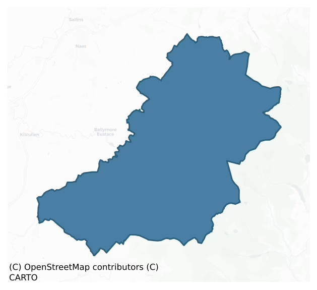
Talbotstown Lower is a barony of County Wicklow, in the historical province of Leinster (Irish: Baile an Talbóidigh Íochtarach), covering 358 km² of land. The barony records 478 NMS archaeological sites and 92 NIAH listed buildings, placing it at around the 25th percentile among 280 ROI baronies for sites per km². This means it is in the bottom third of all baronies for sites per km². Dated archaeological evidence runs from the Neolithic through to the Modern, spanning 8 of 9 archaeological periods, placing the barony in the 82nd percentile among 280 ROI baronies for chronological depth. This means it is in the top fifth of all baronies for chronological depth. The largest dated subset of recorded sites dates to the Iron Age. Logainm flags 30 placenames in the barony as carrying a recognised heritage root; the largest share — around 57% — are names associated with early Christian church and monastic foundations.
Heritage at a glance
Percentile rankings throughout this profile compare each barony only against the other 279 Republic of Ireland baronies.
The recorded heritage of Talbotstown Lower
The National Monuments Service Sites and Monuments Record (SMR) is the statutory inventory of archaeological sites for the Republic of Ireland, maintained by the Department of Tourism, Culture, Arts, Gaeltacht, Sport and Media. Sites recorded here include earthworks, ringforts, megalithic tombs, ecclesiastical remains, and post-medieval features; not every record is legally protected, but each is registered as a monument of archaeological interest.
The National Monuments Service records 478 archaeological sites in Talbotstown Lower, putting it at the 25th percentile among 280 ROI baronies for sites per km². This means it is in the bottom third of all baronies for sites per km². Protection coverage is near-universal — 458 sites (96%) fall within a recorded monument protection zone, indicating an extensively surveyed landscape. The record is dominated by defensive sites — ringforts, enclosures, hillforts, and stone forts (133 sites, 28% of the total), with ecclesiastical sites forming a substantial secondary presence (86 sites, 18%). The most diagnostically specific type is Hut site (37 records, 8% of the barony's NMS total) — compared to an ROI average of 5% across all baronies where this type occurs. Hut site is a low stone or earthen foundation enclosing a small circular or oval area, generally interpreted as a former dwelling, of any date from prehistory to the medieval period. The broader 'Enclosure' classification — which catches unclassified ringforts and field enclosures — accounts for a further 86 records (18%) and reflects the difficulty of sub-classifying degraded earthworks from surface evidence alone. Across the barony's 358 km², this gives a recorded density of 1.34 sites per km².
Most common monument types
Hover or tap a monument type to see its definition.
| Type | Count |
|---|---|
| Enclosure a banked or ditched feature of uncertain type, used as a catch-all where the original function cannot be determined from surface evidence | 86 |
| Hut site a low stone or earthen foundation enclosing a small circular or oval area, generally interpreted as a former dwelling, of any date from prehistory to the medieval period | 37 |
| Cairn – unclassified a stone mound that cannot be assigned to a specific cairn type | 29 |
| Ringfort – rath an earthen ringfort enclosed by a bank and external ditch — the most common Early Medieval farmstead, broadly dated 500–1000 AD | 28 |
| Graveslab a recumbent grave-marking slab, dated 1200–1700 AD | 23 |
| Standing stone a deliberately set upright stone, used variously as a Bronze/Iron Age burial marker, route marker or commemorative monument | 20 |
| Graveyard a burial area associated with a church, in use from the medieval period onwards | 14 |
| Church a building used for public Christian worship, of any date from c. 500 AD onwards | 13 |
Chronological distribution
The dated archaeological record for Talbotstown Lower spans from the Neolithic through to the Modern, with activity attested across 8 of 9 archaeological periods. This is the 82nd percentile across ROI baronies for chronological depth — an above-average span. Every period from earliest to latest is represented in the record — an unbroken sequence of dated activity across the full chronological span. Activity concentrates most heavily in the Iron Age (117 sites, 37% of dated material), with the Early Bronze Age forming a secondary peak (85 sites, 27%). A further 164 recorded sites (34% of the overall NMS register for the barony) carry no period attribution — appearing as 'Unknown' in the bar chart below. This typically reflects either records that pre-date the standardised period vocabulary or sites awaiting specialist dating review, rather than a genuine absence of chronological evidence.
Sample of recorded monuments
Show 25 sample monuments (of 478 total)
A representative sample of 25 recorded monuments drawn from the barony’s 478 total NMS entries. Sites within a recorded monument protection zone and rarer site types are prioritised so the list shows a meaningful cross-section rather than only the most common type. Each entry shows the official Sites and Monuments Record reference number and the description published by the National Monuments Service.
Quarry
This site has been re-assessed and will not be included in the revised RMP. Record created for a possible mound. Delisted from RMP based on field note identifying the site as a quarry of post-1700 date (Geraldine…
This site has been re-assessed and will not be included in the revised RMP. Record created for a possible mound. Delisted from RMP based on field note identifying the site as a quarry of post-1700 date (Geraldine Stout, 05 October 2010). See WI002-001—- as this quarry straddles the county boundary with Wicklow.
Pit-burial
Pit lined with stones, containing a cremation, found just below the surface in a field (Herity 1969, 21-37; NMI 1959-18). Not visible at ground level.
The above description is derived from the published…
Pit lined with stones, containing a cremation, found just below the surface in a field (Herity 1969, 21-37; NMI 1959-18). Not visible at ground level.
The above description is derived from the published 'Archaeological Inventory of County Wicklow' (Dublin: Stationery Office, 1997). In certain instances the entries have been revised and updated in the light of recent research.
Date of upload/revision: 17 December 2008
Water mill – horizontal-wheeled
Situated in the western bank of the Brittas River, 200m upstream of Lisheens House. Three worked oak timbers in situ in the river bank at a depth of 1.2m. The basal timber (max. T 0.34m) is square-cut and has a…
Situated in the western bank of the Brittas River, 200m upstream of Lisheens House. Three worked oak timbers in situ in the river bank at a depth of 1.2m. The basal timber (max. T 0.34m) is square-cut and has a rectangular mortisehole which does not perforate the entire depth of the timber. Resting on top of this is a radially split timber (H 0.28m; Wth 0.14m). The uppermost timber (max. H 0.05m; max. Wth 0.10m) is badly damaged and is unidentifiable from a surface inspection. It does not appear to be in contact with the lower timbers. Two sizeable stones rest on top of the basal timber but their function is unclear. The timbers are in a good state of preservation. (Sullivan 1994)
The above description is derived from the published 'Archaeological Inventory of County Wicklow' (Dublin: Stationery Office, 1997). In certain instances the entries have been revised and updated in the light of recent research.
Date of upload/revision: 17 December 2008
Habitation site
A circular mound excavated by Roe (1946, 1-13). This mound (diam. c. 10m; H 0.6m) was surrounded by a shallow ditch (Wth. c. 1m; D 0.25m) and was likely to have been constructed as an 18thC/19thC landscape feature,…
A circular mound excavated by Roe (1946, 1-13). This mound (diam. c. 10m; H 0.6m) was surrounded by a shallow ditch (Wth. c. 1m; D 0.25m) and was likely to have been constructed as an 18thC/19thC landscape feature, together with four more which are not described. Earlier material was discovered in the immediate vicinity of the excavated mound – 13/14C pottery, 16th/17C pottery (as well as 18C and 19C material). Listed as a 'cemetery mound' in the SMR (1986) and the RMP (1995) at an erroneous location immediately to the W of 'The Piper's Stones' (WI005-014—-). This revised location is the one indicated by Roe (ibid.).
Compiled by: Matt Kelleher
Date of upload: 04 December 2012
House – 16th/17th century
Situated on level ground at the SE end of a gentle slope. A large late seventeenth-century house built by Michael Boyle, Archbishop of Armagh, shown on the 1838 OS 6-inch map as 'Downshire Ho. (in Ruins)'. Described by…
Situated on level ground at the SE end of a gentle slope. A large late seventeenth-century house built by Michael Boyle, Archbishop of Armagh, shown on the 1838 OS 6-inch map as 'Downshire Ho. (in Ruins)'. Described by Bence-Jones (1978, 44) as a 'House of two storeys with dormered attic in its high-pitched roof; of brick, and built on an “H”-plan. Principal front with five-bay centre recessed between two three-bay projecting wings joined by a single-storey balustraded colonnade. Roof on bracket cornice; single-storey wing at one side. The house stood at the end of an avenue in a fine demesne with a deer park'. The house was burnt in 1798. The only surviving portion consists of a brick-built stairwell leading down, with one return, to a barrel-vaulted chamber (dims. c. 8m x 5m). Landscape features possibly associated with the house include a two circular ponds, one (diam. c. 40m; D c. 3.5m) with a path (Wth 3m) around the lip, and another (diam. c. 12m) set at the SE end of a subrectangular enclosure (dims. c. 60m NW-SE; 12m NE-SW), two circular mounds each with external fosses (max. ext. diam. c. 14m and diam. 11.1m; H 1m), are visible on aerial photographs (GSIAP, O 73, N 332-3). (OS Name Books)
In 1998 an archaeological assessment and impact study were undertaken in the area prior to a major residential development (Excavation Licence 98E0425). The assessment showed some of the field boundaries on the site to be contemporary with the occupation of the house (Dunne 2000…
Hilltop enclosure
Atop Woodend Hill. Circular area (diam. 59m) defined by a boulder-faced stone bank (Wth 4.6m); gap (Wth 3.8m) at SSE may be entrance. No visible surface remains of cairn (WI005-037002-) which stood E of…
Atop Woodend Hill. Circular area (diam. 59m) defined by a boulder-faced stone bank (Wth 4.6m); gap (Wth 3.8m) at SSE may be entrance. No visible surface remains of cairn (WI005-037002-) which stood E of centre.
Compiled by: Matt Kelleher
Date of upload: 05 December 2012
Castle – ringwork
Situated on a gentle S/SW-facing slope, on the edge of the Blessington Reservoir which has encroached on the site from S-SE. Circular area (diam. 52m; max. ext. diam. 85m) defined by a bank (Wth 6m; int. H 1-1.5m), an…
Situated on a gentle S/SW-facing slope, on the edge of the Blessington Reservoir which has encroached on the site from S-SE. Circular area (diam. 52m; max. ext. diam. 85m) defined by a bank (Wth 6m; int. H 1-1.5m), an external fosse (everywhere except at the S where it has been washed away) (Wth 9m; D 0.5-1.6m) and an outer counterscarp bank (Wth 9m; H 1-1.8m) from W-NNE. No indication of an entrance or internal features. Limited excavation revealed two hearths and a simple stone lined drainage gully (Macalister 1943, 147-9).
The above description is derived from the published 'Archaeological Inventory of County Wicklow' (Dublin: Stationery Office, 1997). In certain instances the entries have been revised and updated in the light of recent research.
Date of upload/revision: 12 June 2012
Revised by: Claire Breen
Moated site
Situated on a gentle W-facing slope overlooking the Liffey valley; area now under Blessington Reservoir. Enclosure (dims. c. 25m N-S x 20m E-W defined by bank and external fosse, visible as cropmark on aerial…
Situated on a gentle W-facing slope overlooking the Liffey valley; area now under Blessington Reservoir. Enclosure (dims. c. 25m N-S x 20m E-W defined by bank and external fosse, visible as cropmark on aerial photographs (GSIAP, N 332-3).
The above description is derived from the published 'Archaeological Inventory of County Wicklow' (Dublin: Stationery Office, 1997). In certain instances the entries have been revised and updated in the light of recent research.
Revised by: G. Conroy Date of revision: 18 January 2010
Castle – motte and bailey
Situated on the N summit of a steep-sided N-S ridge in a narrow rocky valley S of the Anglo-Norman town of Hollywood (WI009-017—-). The motte consists of a steep-sided mound (dims. 60m N-S; 50m E-W; H 5-6m) which…
Situated on the N summit of a steep-sided N-S ridge in a narrow rocky valley S of the Anglo-Norman town of Hollywood (WI009-017—-). The motte consists of a steep-sided mound (dims. 60m N-S; 50m E-W; H 5-6m) which incorporates the spine of the ridge and has a flat top (diam. 15m). The surrounding fosse and external bank are well defined at the W and S and can be traced at the E. To the N a flat- bottomed fosse (Wth 5m; D 2.5m) divides the motte from the level bailey; and there is a centrally located causeway (Wth 3m). Large sections of collapsed masonry occur on the side of the motte and at the base of the fosse at the SW. The bailey consists of a largely natural platform (dims. 50m N-S; 45m E-W) defined by a steep scarp and with traces of earthworks along the E side.
The above description is derived from the published 'Archaeological Inventory of County Wicklow' (Dublin: Stationery Office, 1997). In certain instances the entries have been revised and updated in the light of recent research.
Date of upload/revision: 17 December 2008
Sweathouse
Situated on the flat bed of a stream gully and built into the steep valley side; the stream is 6m to the NE. An approximately square mound of earth and stone (dims. 4m x 4m; H 2m) covering a square chamber (dims. 1.52m…
Situated on the flat bed of a stream gully and built into the steep valley side; the stream is 6m to the NE. An approximately square mound of earth and stone (dims. 4m x 4m; H 2m) covering a square chamber (dims. 1.52m x 1.52m) with a corbelled roof (H 1.73m) and a beaten earth floor. The top portion of the roof was damaged in 1967 (SMR file). The chamber is entered from the NNE side via a narrow passage (L 1.5m; Wth 0.44m; H 0.57-0.62m) with a slanting slab roof. (Price 1952, 180-81)
The above description is derived from the published 'Archaeological Inventory of County Wicklow' (Dublin: Stationery Office, 1997). In certain instances the entries have been revised and updated in the light of recent research.
Updated by: Paul Walsh
Revised date of upload: 2 March 2015
Fish-pond
Rectangular pond (80m NE-SW; 15m NW-SE) faced with stone walls. There is a water intake at the NE end and a series of sluice gates at the SW.
Compiled by: Matt Kelleher
Date of upload: 19 December 2012
Anomalous stone group
Listed as a 'stone circle' in the SMR (1986) and as a possible 'stone circle' in the RMP (1995). On a gentle SE-facing slope. A disused quarry pit. No visible surface trace of the two granite boulders described in 1931.…
Listed as a 'stone circle' in the SMR (1986) and as a possible 'stone circle' in the RMP (1995). On a gentle SE-facing slope. A disused quarry pit. No visible surface trace of the two granite boulders described in 1931. (Walsh 1931, 128)
Compiled by: Matt Kelleher
Date of upload: 20 December 2012
Stone row
Listed as an 'alignment' in the SMR (1986) and as a possible 'stone alignment' in the RMP (1995). At the summit of a small rock knoll on a steep W-facing slope overlooking a ravine. Two pairs of uprights, c. 5m apart…
Listed as an 'alignment' in the SMR (1986) and as a possible 'stone alignment' in the RMP (1995). At the summit of a small rock knoll on a steep W-facing slope overlooking a ravine. Two pairs of uprights, c. 5m apart along the line of an outcropping ridge. Of the NW pair, the largest stone (H 2m; Wth 1.30m; T 0.70m), leans to the NW. The pairs form an alignment NW-SE. While the stones appear to have been set upright their function is unknown.
Compiled by: Matt Kelleher
Date of upload: 21 December 2012
Clochan
Listed as a 'clochan' in the SMR (1986) and as a possible 'clochan' in the RMP (1995). On a steep W-facing slope overlooking a ravine. A field visit in 1989 failed to locate the clochan due to the area being heavily…
Listed as a 'clochan' in the SMR (1986) and as a possible 'clochan' in the RMP (1995). On a steep W-facing slope overlooking a ravine. A field visit in 1989 failed to locate the clochan due to the area being heavily masked with bracken and gorse.
Compiled by: Matt Kelleher
Date of upload: 24 December 2012
Megalithic tomb – portal tomb
Situated on a very gentle SW-facing slope with the entrance facing SW, and incorporated into the field boundary. The tomb consists of a gable-shaped backstone (H 1.9m; Wth 1.8m) and a single upright portal (H 2m; Wth…
Situated on a very gentle SW-facing slope with the entrance facing SW, and incorporated into the field boundary. The tomb consists of a gable-shaped backstone (H 1.9m; Wth 1.8m) and a single upright portal (H 2m; Wth 1.3m), forming a small chamber (dims. c. 1.9m x 1.4m). The other portal and the capstone (L 3.5m; Wth 2.3m; max. T 1.6m) have fallen forward. There is no trace of a cairn. (Walshe 1931, 125-6)
The above description is derived from the published 'Archaeological Inventory of County Wicklow' (Dublin: Stationery Office, 1997). In certain instances the entries have been revised and updated in the light of recent research.
Date of upload/revision: 17 December 2008
This monument is subject to a preservation order made under the National Monuments Acts 1930 to 2014 (PO no. 107/1940).
Ringfort – cashel
Situated on the NE edge of a gentle slope with higher ground to the W and NW. Part of circular or oval enclosure truncated at the N by a road. Defined at the S by curving earth and stone bank (present L 12m; Wth 1.2m)…
Situated on the NE edge of a gentle slope with higher ground to the W and NW. Part of circular or oval enclosure truncated at the N by a road. Defined at the S by curving earth and stone bank (present L 12m; Wth 1.2m) faced inside and out by a revetment of small boulders surviving, in places, to two courses. No indication of entrance, external fosse or internal features. Shown on the 1838 OS 6-inch map.
The above description is derived from the published 'Archaeological Inventory of County Wicklow' (Dublin: Stationery Office, 1997). In certain instances the entries have been revised and updated in the light of recent research.
Date of upload/revision: 17 December 2008
Decorated stone
Listed as 'Rock art' in the SMR (1986) this is the original location of the stone known as the 'Holywood stone' which was found here in 1908. The stone is carved with a labyrinth pattern and is on display in the Visitor…
Listed as 'Rock art' in the SMR (1986) this is the original location of the stone known as the 'Holywood stone' which was found here in 1908. The stone is carved with a labyrinth pattern and is on display in the Visitor Centre at Glendalough (WI023-009063-). (Orpen 1911; Price and Walshe 1933, 48)
Compiled by: Paul Walsh
Date of upload: 25 February 2014
Ogham stone (present location)
Recorded as 'just near' another (uninscribed) stone (WI021-082—-) 'on the farm called Old Mills, south of the village of Donard' (Macalister 1945, 52, no. 48; Corlett and Weaver 2002, 541), this ogham stone was moved…
Recorded as 'just near' another (uninscribed) stone (WI021-082—-) 'on the farm called Old Mills, south of the village of Donard' (Macalister 1945, 52, no. 48; Corlett and Weaver 2002, 541), this ogham stone was moved to its present location in 1995, having been placed for a time at an interim location north of Donard (marked 'Ogham Stone' on the OS 6-inch map (WI021-083—-)). It is a rectangular block of stone (dims. 1.52m x 0.68m x 0.53m). Macalister (1897, 77) describes the inscription as 'much worn and damaged. . . After it turns on to the top [after the I of KOI] nothing definite can be stated'. He read the inscription as IAQINI KOI MAQI MUC … .' (Grogan and Kilfeather 1997, no. 1007)
This stone has been studied as part of the ‘Ogham in 3D’ project undertaken by the School of Celtic Studies, Dublin Institute for Advanced Studies. To access details go to the following website: https://ogham.celt.dias.ie/search.php?ciic=48
Compiled by: Nora White
Date of upload: 3 September 2016
This monument is subject to a preservation order made under the National Monuments Acts 1930 to 2014 (PO no. 118/1940).
Ogham stone
This record relates to the original location of the ogham stone at Donard (WI021-004—-). It was recorded by Price as originating 'just near' an uninscribed pillar stone (WI021-082—-) in the townland of Ballylion…
This record relates to the original location of the ogham stone at Donard (WI021-004—-). It was recorded by Price as originating 'just near' an uninscribed pillar stone (WI021-082—-) in the townland of Ballylion Lower (Corlett and Weaver 2002, 541). Its original position is recorded by Macalister (1945, 52) as '1 foot 6 inches' (0.45m) from the standing stone. It is a rectangular block of stone (dims. 1.52m x 0.68m x 0.53m) now located in the village of Donard. Macalister (1897, 77) describes the inscription as 'much worn and damaged. . . After it turns on to the top nothing definite can be stated'. He read the inscription as IAQINI KOI MAQI MUC … .' (Macalister 1945, 52, no. 48)
This stone has been studied as part of the ‘Ogham in 3D’ project undertaken by the School of Celtic Studies, Dublin Institute for Advanced Studies. To access details go to the following website:
https://ogham.celt.dias.ie/search.php?ciic=48
Compiled by: Nora White
Date of upload: 28 August 2016
House – Neolithic
Discovered in February 2006 on the W shore of Poulaphuca Reservoir when the water level dropped. On a gentle slope in former agricultural land overlooking the King's River. An almost square structure (int. dims. L 6.6m…
Discovered in February 2006 on the W shore of Poulaphuca Reservoir when the water level dropped. On a gentle slope in former agricultural land overlooking the King's River. An almost square structure (int. dims. L 6.6m N-S; Wth 6.2m E-W) is defined by the burnt clays and charcoal-rich fill of the slot-trench of the building's foundation. Subsequent intermittent investigation (Excavation Licence No. 07E1127), when the water level allowed, revealed a significant amount of Neolithic pottery, a flint axe and a possibly ritually deposited Bann flake. (Corlett 2009, 26-30)
Compiled by: Matt Kelleher
Date of upload: 18 December 2012
Gatehouse
'This [Market Place] is located in the centre of Main St. and has a mid-eighteenth century Court House, which Drury (Mems Dead vi (1904-6), 176) states was formerly a gatehouse into the town, at its northern…
'This [Market Place] is located in the centre of Main St. and has a mid-eighteenth century Court House, which Drury (Mems Dead vi (1904-6), 176) states was formerly a gatehouse into the town, at its northern end.'
The above description is from Bradley, J., et al. 1989 Urban Archaeology Survey Part IX County Wicklow. Unpublished report. Office of Public Works.
Date of upload: 20 December 2012
Standing stone – pair
On a knoll overlooking the Ballydonnell Brook (to the W), in rough mountain bogland. Ground rises to the E; to the W is Sorrell Hill, to the S is Mullaghcleevaun, to the N is Seefin. Two granite standing stones, aligned…
On a knoll overlooking the Ballydonnell Brook (to the W), in rough mountain bogland. Ground rises to the E; to the W is Sorrell Hill, to the S is Mullaghcleevaun, to the N is Seefin. Two granite standing stones, aligned roughly N-S. The northern stone is the larger of the two (dims. H 0.8m high; Wth 0.9m; T 0.4m thick) and is slightly oblong in cross-section). The second, lower stone (dims. H 0.5m; Wth 0.7m; T 0.38m) stands 3.65m to the S and is rectangular in cross section. The long axis of each stone reflects the long axis of the alignment of the pair, which is largely covered in peat. (pers. comm. C. Corlett)
Compiled by: Gearóid Conroy
Date of upload: 30 October 2012
Building
Situated on a gentle to marked S-facing mountain slope in forestry. A small rectangular building (dims. 6m x 3m) immediately outside the W entrance of Templefinan Graveyard (WI016-009001-), identified during a UCD…
Situated on a gentle to marked S-facing mountain slope in forestry. A small rectangular building (dims. 6m x 3m) immediately outside the W entrance of Templefinan Graveyard (WI016-009001-), identified during a UCD School of Archaeology research and teaching project carried out over three seasons (2004-06). The building, which is defined by low earth and stone walls (H 0.3m; Wth 1m), is attached to the external face of the graveyard wall. Its location immediately outside the entrance to a possible ecclesiastical enclosure (WI016-009002-), suggests that it may have been a pilgrims' hostel or sleeping place for visitors. (O'Sullivan and Warren 2005, 4; O'Sullivan and Warren 2007, 474-5; O'Sullivan and Warren 2009; 563-5)
Compiled by: Matt Kelleher
Date of upload: 11 January 2013
Road – road/trackway
Situated on a gentle to marked S-facing mountain slope in forestry. A narrow, crudely defined laneway possibly linking the entrance of the ecclesiatical enclosure (WI016-009002-) to the route of St Kevin's Way c. 100m…
Situated on a gentle to marked S-facing mountain slope in forestry. A narrow, crudely defined laneway possibly linking the entrance of the ecclesiatical enclosure (WI016-009002-) to the route of St Kevin's Way c. 100m to the S. In parts it is defined by a low bank (H 0.3m; Wth 1m) on either side. The laneway was identified during a UCD School of Archaeology research and teaching project carried out over three seasons (2004-06). (O'Sullivan and Warren 2005, 5; O'Sullivan and Warren 2007, 474-5; O'Sullivan and Warren 2009; 563-5)
Compiled by: Matt Kelleher
Date of upload: 11 January 2013
Enclosure
Listed as an 'enclosure' in the SMR (1986) based on aerial photographic evidence (GSIAP O 73/ N 332 (1973)). The enclosure was marked in the wrong location on the published RMP map of Co. Wicklow. A field visit to the…
Listed as an 'enclosure' in the SMR (1986) based on aerial photographic evidence (GSIAP O 73/ N 332 (1973)). The enclosure was marked in the wrong location on the published RMP map of Co. Wicklow. A field visit to the wrong location in 1989 determined that it was an irregular rock-strewn area and not of archaeological significance. This enclosure is visible on the Air Corps aerial photograph taken in 1939 (see attached image) where it is shown in the field to the SE of the published RMP location. The curving arc of a hedgerow or bushes appears to follow the E enclosing element of the enclosure and is visible on Digital Globe aerial photograph and earlier OSI aerial photographs.
Compiled by: Matt Kelleher
Revised by: Caimin O'Brien with details kindly provided by Chris Corlett
Date of revised upload: 5 October 2017
Listed buildings
The National Inventory of Architectural Heritage (NIAH) is a state survey appraising buildings of architectural, historical, archaeological, artistic, cultural, scientific, social, or technical interest. Each surveyed structure receives a rating from International (the highest, for buildings of European importance) through National, Regional, Local, and Record-Only.
The NIAH records 92 listed buildings in Talbotstown Lower (46th percentile across ROI baronies). The highest-graded structures include 3 of National significance. The Republic holds 937 National-graded buildings in total, so this barony accounts for around 0% of the national total. Construction dates concentrate most heavily in the Victorian (1830-1900) period. The most-recorded building type is house (48 examples, 52% of the listed stock).
Terrain and environment
Mean elevation across the barony is 324m — the 100th percentile among 280 ROI baronies for elevation. This means it is in the top tenth of all baronies for elevation. This is a relatively elevated landscape by ROI standards. Elevation matters for heritage because higher-altitude baronies typically favour defensive monuments — ringforts and hilltop forts placed on prominent ground — while lowland baronies are more likely to carry the dense settlement and church networks of intensive agricultural landscapes. The barony reaches 846m at its highest point — a vertical span of more than 522m within its boundary, indicating significant topographic diversity. Mean slope is 7.3° — the 92nd percentile among 280 ROI baronies for slope. This means it is in the top tenth of all baronies for slope. This is consistently steep terrain by ROI standards, the kind of landscape that tends to preserve upstanding archaeological features well. Slope is a key control on both land use and archaeological preservation: steep ground resists ploughing and tends to preserve earthworks intact, while gentle slopes favour intensive cultivation that damages or destroys surface archaeology over time. The Topographic Wetness Index averages 9.4, the 6th percentile among 280 ROI baronies for wetness. This means it is in the bottom tenth of all baronies for wetness. This is well-drained ground by ROI standards — typical of upland or steeply-sloping country that sheds water rapidly. Drainage matters for heritage because poorly-drained ground preserves organic archaeology (wooden trackways, leather, textiles, and on rare occasions human remains) far better than free-draining soil; well-drained ground favours arable use but destroys organic material rapidly. The land-cover mosaic combines improved grassland (71%), woodland (23%), and open water (5%), giving a mixed agricultural and semi-natural landscape. In overall character, this is an upland landscape of steep, elevated terrain, with land use dominated by improved grassland.
Terrain measurements
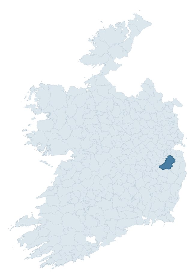
Where this barony sits in the Republic of Ireland
Geology and preservation
Bedrock geology shapes the landscape long before any settlement begins — controlling soil drainage, agricultural potential, the survival of upstanding monuments, and the preservation of buried archaeology. The figures below come from the Geological Survey Ireland 1:100,000 bedrock map.
The bedrock underlying Talbotstown Lower is predominantly granite (61% of the barony by area), laid down during the Caledonian period (63% by area, during the Caledonian orogeny (around 490–390 million years ago)). Granite weathers slowly and produces thin, acidic, often poorly-drained soils that historically limited arable agriculture but favoured pastoralism, upland settlement, and the construction of stone monuments. Granite-dominated landscapes typically carry fewer ringforts but a higher density of megalithic tombs, standing stones, and stone circles, which survive well against the resistant bedrock. A substantial secondary geology of greywacke and shale (17%) adds further variety to the underlying landscape. The single largest mapped unit is the Type 2p microcline porphyritic (Northern and Upper Liffey Valley Plutons) (32% of the barony's bedrock). With 8 distinct rock types mapped, the barony sits in the top third of ROI baronies for geological diversity (84th percentile) — typically a sign of complex tectonic history or coastal mosaics of differing rock units.
Rock type composition
Largest mapped unit: Type 2p microcline porphyritic (Northern and Upper Liffey Valley Plutons) (32% of the barony)
Placename evidence
Logainm records 30 heritage-diagnostic placenames for Talbotstown Lower, drawn from townland and civil-parish names across the barony. The dominant stratum is Early Christian ecclesiastical — cill-, teampall-, and domhnach-prefixed names that record the dense network of early church foundations established between the fifth and tenth centuries. The leading diagnostic roots are cill- (9 — church), dún- (8 — hilltop fort or promontory fort), and ráth- (4 — earthen ringfort). This is broadly in line with the ROI average of 30.7 heritage placenames per barony. The presence of multiple heritage strata side by side indicates layered occupation of the landscape across successive prehistoric and historic periods. Logainm records 197 placenames for Talbotstown Lower (predominantly townland names). Of these, 30 (15%) carry one of the diagnostic Gaelic roots tracked above; the remainder draw on more generic landscape vocabulary that does not encode a heritage period.
Pre-Christian / Early Medieval Defensive
| Root | Count | Meaning |
|---|---|---|
| dún- | 8 | hilltop or promontory fort |
| ráth- | 4 | earthen ringfort |
Early Christian Ecclesiastical
| Root | Count | Meaning |
|---|---|---|
| cill- | 9 | church (early) |
| tobar- | 4 | holy well |
| cillín- | 4 | unconsecrated burial ground |
Burial, Ritual, and Norse-Contact
| Root | Count | Meaning |
|---|---|---|
| carn- | 1 | cairn |
Other baronies in Wicklow
About this profile
Click any section below to expand.
What is a barony?
A barony is a historic administrative unit in Ireland, broadly equivalent to an English hundred. The 280 baronies used here are from the OSi 2019 National Statutory Boundaries (generalised 20m), covering the 26 counties of the Republic of Ireland. Baronies derive from the Norman period, were formalised in the 17th century, and have not been redrawn for statistical purposes. They vary enormously in area, from compact urban baronies in Dublin to vast upland baronies in Connacht, and should not be compared by raw site count without accounting for area differences.
What counts as a site?
This profile combines three distinct heritage registers, each with its own definition of what constitutes a recordable site:
- Archaeological sites (NMS). The National Monuments Service Sites and Monuments Record (SMR) catalogues every known archaeological monument or site of archaeological interest in the Republic, from prehistoric burial mounds and ringforts to medieval churches and post-medieval defensive works. Inclusion does not require legal protection — only that the site has been identified, surveyed, and assessed as having archaeological value. A separate subset of these sites lies within a recorded protection zone, which gives them statutory protection under the National Monuments Acts.
- Listed buildings (NIAH). The National Inventory of Architectural Heritage records buildings of architectural, historical, archaeological, artistic, cultural, scientific, social, or technical interest. Each surveyed structure is appraised on a five-tier scale: International, National, Regional, Local, and Record-Only. The NIAH appraisal is informational rather than strictly statutory, but it underpins local-authority Record of Protected Structures (RPS) listings.
- Heritage placenames (Logainm). Logainm is the authoritative database of Irish placenames maintained by the Placenames Branch. This profile applies a heritage-diagnostic classifier to the Irish-language form of each townland name, flagging roots that signal defensive sites (ráth-, lios-, dún-, caiseal-, cathair-), ecclesiastical foundations (cill-, teampall-, domhnach-, mainistir-), prehistoric burial-ritual features (tuaim-, carn-, leaba-), or Norse-contact settlement (gall-). Townlands without one of these diagnostic roots are not flagged here — they may still carry historical significance, but that significance is not encoded in the name itself.
Editorial principles
The narrative sections of this profile follow several explicit principles:
- Evidential. Every claim about this barony’s heritage character is anchored in the underlying register data. Where a site count, a placename count, or a percentile rank is cited, it is computed from the source datasets at export time, not estimated.
- Comparative. Counts and metrics are reported alongside their percentile rank against the other 279 ROI baronies. A barony with 50 ringforts in absolute terms could be unusually high or unusually low depending on its size and regional context; percentile ranking removes that ambiguity.
- Transparent on limits. Where a register has known coverage gaps, survey biases, or data-quality issues that affect this barony’s figures, the profile flags them rather than presenting the numbers as definitive.
- No interpretation beyond what the data supports. The narrative does not speculate about historical events, social dynamics, or cultural meaning beyond what the recorded heritage and placename evidence directly attests.
Data caveats and limits
- NMS Sites and Monuments Record is the product of survey campaigns conducted at different intensities across different counties and decades. Some baronies have been surveyed more thoroughly than others, and absolute counts should be read in that light. Sites destroyed by development before survey are typically not represented; sites in heavily forested or upland terrain are sometimes under-recorded.
- NIAH coverage is broadly complete for the Republic of Ireland but the survey was conducted on a rolling county-by-county basis, and the most recent appraisal date varies. Buildings demolished or substantially altered after their original survey may still appear in the register; conversely, recent buildings of merit may not yet have been appraised.
- Logainm classification applies a deliberately conservative pattern-matching approach to the Irish-language townland forms. The classifier prioritises true positives over recall: a townland may carry a heritage signal that the classifier doesn’t recognise, particularly where the diagnostic root has been heavily anglicised or where the townland name draws on a less common term. The 60,000+ townland records and ~9,800 classified placenames give a substantial signal at barony scale, but individual townland names should be checked against Logainm directly for definitive interpretation.
- Period attribution. The chronological distribution reflects only those NMS sites that carry a recognised period attribution in the source data. Sites listed as “Unknown” period are excluded from the dated subset.
- Boundary changes. Some baronies have undergone minor boundary adjustments since their 19th-century definition; the OSi 2019 generalised boundaries used here are the current statutory definition and may differ slightly from historical maps in border areas.
- Bedrock geology is mapped at 1:100,000 scale, which means local variation within a barony — small pockets of different rock type, mineral veins, alluvium overlying bedrock — is generalised. The dominant-system and rocktype figures are area-weighted, so a barony reading “70% Carboniferous limestone” may still contain small but archaeologically important pockets of older or younger rock. Around 3% of GSI polygons do not match the lexicon and contribute no rocktype or system attribution.
Data sources
- National Monuments Service — Sites and Monuments Record (SMR) https://data.gov.ie/dataset/national-monuments-service-archaeological-survey-of-ireland
- National Inventory of Architectural Heritage (NIAH) https://data.gov.ie/dataset/national-inventory-of-architectural-heritage-niah-national-dataset
- Logainm — Placenames Database of Ireland https://www.logainm.ie/
- Ordnance Survey Ireland — National Statutory Barony Boundaries 2019 https://data-osi.opendata.arcgis.com/
- EURODEM — European Digital Elevation Model https://www.mapsforeurope.org/datasets/euro-dem
- ESA WorldCover https://esa-worldcover.org/en
- Geological Survey Ireland — 1:100,000 Bedrock Geology https://www.gsi.ie/en-ie/data-and-maps/Pages/Bedrock.aspx
Explore more: Search any of the 280 ROI baronies, browse by historical province, or read the methodology and data sources for the full Republic of Ireland Heritage Tool.