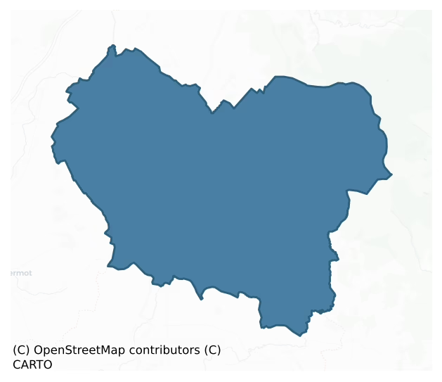
Talbotstown Upper is a barony of County Wicklow, in the historical province of Leinster (Irish: Baile an Talbóidigh Uachtarach), covering 253 km² of land. The barony records 351 NMS archaeological sites and 110 NIAH listed buildings, placing it at around the 27th percentile among 280 ROI baronies for sites per km². This means it is in the bottom third of all baronies for sites per km². Dated archaeological evidence runs from the Neolithic through to the Modern, spanning 8 of 9 archaeological periods, placing the barony in the 82nd percentile among 280 ROI baronies for chronological depth. This means it is in the top fifth of all baronies for chronological depth. The largest dated subset of recorded sites dates to the Iron Age. Logainm flags 44 placenames in the barony as carrying a recognised heritage root; the largest share — around 64% — are names associated with early Christian church and monastic foundations.
Heritage at a glance
Percentile rankings throughout this profile compare each barony only against the other 279 Republic of Ireland baronies.
The recorded heritage of Talbotstown Upper
The National Monuments Service Sites and Monuments Record (SMR) is the statutory inventory of archaeological sites for the Republic of Ireland, maintained by the Department of Tourism, Culture, Arts, Gaeltacht, Sport and Media. Sites recorded here include earthworks, ringforts, megalithic tombs, ecclesiastical remains, and post-medieval features; not every record is legally protected, but each is registered as a monument of archaeological interest.
The National Monuments Service records 351 archaeological sites in Talbotstown Upper, putting it at the 27th percentile among 280 ROI baronies for sites per km². This means it is in the bottom third of all baronies for sites per km². Protection coverage is near-universal — 345 sites (98%) fall within a recorded monument protection zone, indicating an extensively surveyed landscape. The dominant category is defensive sites — ringforts, enclosures, hillforts, and stone forts (138 sites, 39% of the record). The most diagnostically specific type is Hut site (51 records, 15% of the barony's NMS total) — compared to an ROI average of 5% across all baronies where this type occurs. Hut site is a low stone or earthen foundation enclosing a small circular or oval area, generally interpreted as a former dwelling, of any date from prehistory to the medieval period. The broader 'Enclosure' classification — which catches unclassified ringforts and field enclosures — accounts for a further 62 records (18%) and reflects the difficulty of sub-classifying degraded earthworks from surface evidence alone. Across the barony's 253 km², this gives a recorded density of 1.39 sites per km².
Most common monument types
Hover or tap a monument type to see its definition.
| Type | Count |
|---|---|
| Enclosure a banked or ditched feature of uncertain type, used as a catch-all where the original function cannot be determined from surface evidence | 62 |
| Hut site a low stone or earthen foundation enclosing a small circular or oval area, generally interpreted as a former dwelling, of any date from prehistory to the medieval period | 51 |
| Ringfort – rath an earthen ringfort enclosed by a bank and external ditch — the most common Early Medieval farmstead, broadly dated 500–1000 AD | 45 |
| Cairn – unclassified a stone mound that cannot be assigned to a specific cairn type | 20 |
| Ritual site – holy well a well or spring traditionally associated with a saint, often credited with healing properties; many trace earlier ritual origins but devotion is documented from the medieval period onwards | 15 |
| Standing stone a deliberately set upright stone, used variously as a Bronze/Iron Age burial marker, route marker or commemorative monument | 11 |
| Graveyard a burial area associated with a church, in use from the medieval period onwards | 10 |
| Hillfort a large defensive enclosure of one hectare or more on prominent high ground, built mainly in the Late Bronze Age and reoccupied in the Late Iron Age | 8 |
Chronological distribution
The dated archaeological record for Talbotstown Upper spans from the Neolithic through to the Modern, with activity attested across 8 of 9 archaeological periods. This is the 82nd percentile across ROI baronies for chronological depth — an above-average span. Every period from earliest to latest is represented in the record — an unbroken sequence of dated activity across the full chronological span. Activity concentrates most heavily in the Iron Age (130 sites, 42% of dated material), with the Early Medieval forming a secondary peak (85 sites, 27%). A further 41 recorded sites (12% of the overall NMS register for the barony) carry no period attribution — appearing as 'Unknown' in the bar chart below. This typically reflects either records that pre-date the standardised period vocabulary or sites awaiting specialist dating review, rather than a genuine absence of chronological evidence.
Sample of recorded monuments
Show 25 sample monuments (of 351 total)
A representative sample of 25 recorded monuments drawn from the barony’s 351 total NMS entries. Sites within a recorded monument protection zone and rarer site types are prioritised so the list shows a meaningful cross-section rather than only the most common type. Each entry shows the official Sites and Monuments Record reference number and the description published by the National Monuments Service.
Castle – motte and bailey
Situated at the SW end of a narrow steep-sided ridge. Oval platform with a level summit (dims. 20m NNW-SSE; 14m NNE-SSW; H 2.5-4m), separated from the bailey at the SW by a fosse (Wth 3.5m; D 0.8m). The bailey is a…
Situated at the SW end of a narrow steep-sided ridge. Oval platform with a level summit (dims. 20m NNW-SSE; 14m NNE-SSW; H 2.5-4m), separated from the bailey at the SW by a fosse (Wth 3.5m; D 0.8m). The bailey is a level trapezoidal area (max. dims. 32m WNW-ESE; 15m NNE-SSW) defined by an earthen bank (Wth 5-6m; int. H 1m), and an external fosse (max. Wth 5m; D 1m) from SE-W-NW with a further outer bank (max. Wth 5.5m; H 1.7m) at the SW. This fosse, which also encloses the motte along the NE, merges into a berm at the NW and SE along the edges of the ridge. There is a causeway (Wth 2m) across the fosse at the NE extremity. The motte and bailey form one component of a series of earthworks which enclose and divide the ridge summit for a distance of 550m. These include banks along the edge of the ridge, and lateral banks dividing the ridge from NNW-SSE. The most significant are those c. 75m NE of the motte which consist of two banks, 20m apart, cutting the SW end of ridge off from remainder and creating an enclosure around the motte to which three access ramps ascend (from the SW, NW and SE). The SW bank has a central entrance gap (recently widened). A possible moated site (WI020-025—-) occurs within the defenses towards the NE. (CUCAP, AIC 86, BGN 24)
The above description is derived from the published 'Archaeological Inventory of County Wicklow' (Dublin: Stationery Office, 1997). In certain instances the entries have been revised and updated in the light of recent rese…
Cross – Wayside cross (present location)
Limestone 17th-century wayside cross-shaft of the O'Toole family (H 0.78m; Wth 0.26m; T 0.15m), now in the porch of Knockarigg House. The inscriptions, on two opposite faces, read-'… LL O'TOOLEOF CNOCKIRGG AND HIS…
Limestone 17th-century wayside cross-shaft of the O'Toole family (H 0.78m; Wth 0.26m; T 0.15m), now in the porch of Knockarigg House. The inscriptions, on two opposite faces, read-'… LL O'TOOLEOF CNOCKIRGG AND HIS WIFE IOANE CULLEN PRA … S …' and '… O BOTH OURE SOULES FOR AS YOU ARE SOE WEARE WEE AND AS [WEE AR] E SOE SHALL YOU [BEE]'. One of the remaining faces is blank and the other depicts the Instruments of the Passion. (Fitzgerald 1903-5, 249-50)
The above description is derived from the published 'Archaeological Inventory of County Wicklow' (Dublin: Stationery Office, 1997). In certain instances the entries have been revised and updated in the light of recent research.
Date of upload/revision: 17 December 2008
Chapel
Situated on a gentle NE-facing slope overlooking steeper terrain. A wall (L 5m; max. H 2m) beside a farmyard is believed locally to be the restored W wall of the chapel. An associated well (WI020-019—-) lies 250m to…
Situated on a gentle NE-facing slope overlooking steeper terrain. A wall (L 5m; max. H 2m) beside a farmyard is believed locally to be the restored W wall of the chapel. An associated well (WI020-019—-) lies 250m to the NE and part of a farm building 20m NNE of the well is believed locally to be the remnants of a grange.
The above description is derived from the published 'Archaeological Inventory of County Wicklow' (Dublin: Stationery Office, 1997). In certain instances the entries have been revised and updated in the light of recent research.
Date of upload/revision: 17 December 2008
Religious house – unclassified
In a sheltered glade at the foot of a marked E-facing slope. Indicated on the 1839 and 1910 eds. of the OS 6-inch map as the site of a convent. The grass-covered foundations of a rectangular building (c. 18m x c. 16m)…
In a sheltered glade at the foot of a marked E-facing slope. Indicated on the 1839 and 1910 eds. of the OS 6-inch map as the site of a convent. The grass-covered foundations of a rectangular building (c. 18m x c. 16m) are visible at the location indicated on the OS maps. Three bullaun stones (WI021-019—-, WI021-019001- and WI021-019002-) are in the immediate vicinity, one (centrally placed in the glade) having three basins. A disused burial ground (WI021-021—-) lies c. 150m to the NE.
Compiled by: Mary Tunney
Date of upload: 5 December 2012
Linkardstown burial
Situated on a gentle W/SW-facing slope at the foot of a steeper slope. Circular mound (diam. 24m; H 2m) with a central polygonal cist which produced the disarticulated remains of an adult male accompanied by a decorated…
Situated on a gentle W/SW-facing slope at the foot of a steeper slope. Circular mound (diam. 24m; H 2m) with a central polygonal cist which produced the disarticulated remains of an adult male accompanied by a decorated neolithic bowl (Raftery 1973a, 214-19). (Brindley et al 1983; Brindley and Lanting 1989-90; Ryan 1973, 120-27). Not visible at ground level. There is a standing stone (WI021-079—-) 150m to the WSW.
The above description is derived from the published 'Archaeological Inventory of County Wicklow' (Dublin: Stationery Office, 1997). In certain instances the entries have been revised and updated in the light of recent research.
Date of upload/revision: 17 December 2008
Burial mound
Situated on a gentle SW-facing slope in landscaped demesne lands SW of Goldenfort House. Circular platform (diam. 30m; H 1m) with no trace of a bank, fosse or internal features. Human bones, including three skulls, were…
Situated on a gentle SW-facing slope in landscaped demesne lands SW of Goldenfort House. Circular platform (diam. 30m; H 1m) with no trace of a bank, fosse or internal features. Human bones, including three skulls, were found during sand extraction at beginning of this century on the NE side. The site appears to have been utilised as a landscape feature, probably a tree-ring in the 18th century. (Price 1937, 127)
The above description is derived from the published 'Archaeological Inventory of County Wicklow' (Dublin: Stationery Office, 1997). In certain instances the entries have been revised and updated in the light of recent research.
Date of upload/revision: 17 December 2008
Settlement cluster
On the N-facing slopes of Spinans Hill, outside the N rampart of the large contour fort (WI027-078001-/WI021-080001-). Settlement comprising enclosures, hut sites and field walls are evident on aerial photography…
On the N-facing slopes of Spinans Hill, outside the N rampart of the large contour fort (WI027-078001-/WI021-080001-). Settlement comprising enclosures, hut sites and field walls are evident on aerial photography covering an area c. 320m x 145m. (Condit 1992, 16-20)
Compiled by: Mary Tunney
Date of upload: 11 December 2012
House – fortified house
Situated on the S side of a system of small fields enclosed by high, well- constructed walls known as 'the Orchard', of 18th- and 19th-century date. Raised square platform (dims. 50m x 50m; H 0.8m) known locally as the…
Situated on the S side of a system of small fields enclosed by high, well- constructed walls known as 'the Orchard', of 18th- and 19th-century date. Raised square platform (dims. 50m x 50m; H 0.8m) known locally as the site of a fortified house built c. 1700 by Colonel Percy and marked 'Seskin House (in Ruins)' on the 1838 OS 6-inch map. (O'Flanagan 1928, 59)
The above description is derived from the published 'Archaeological Inventory of County Wicklow' (Dublin: Stationery Office, 1997). In certain instances the entries have been revised and updated in the light of recent research.
Date of upload/revision: 17 December 2008
Flat cemetery
Situated on a low E-W ridge with marshy ground immediately to the W and S. Three cists excavated in 1931 (Mahr and Price 1932). (1) Polygonal cist with inverted encrusted urn covering the cremation of a young adult male…
Situated on a low E-W ridge with marshy ground immediately to the W and S. Three cists excavated in 1931 (Mahr and Price 1932). (1) Polygonal cist with inverted encrusted urn covering the cremation of a young adult male with sherds of a vase urn and some cremated bone (probably disturbed burial) c. 0.6m to S. (2) Small square cist (dims. 0.55m x 0.55m) with sherds of a vase and the cremation of an adult. (3) Polygonal cist (dims. 0.48m x 0.41m) with an inverted vase urn covering the cremation of a child (aged 5-6 years) and a biconical cup. Not visible at ground level. (Waddell 1990, 159-60)
The above description is derived from the published 'Archaeological Inventory of County Wicklow' (Dublin: Stationery Office, 1997). In certain instances the entries have been revised and updated in the light of recent research.
Date of upload/revision: 17 December 2008
Barrow – ring-barrow
Situated at a break in a NE-facing slope on the E side of Tinoran Hill and immediately E of the outer rampart of the hillfort (WI026-004—-). Low domed interior (diam. 11m) encircled by a fosse (Wth c. 7m; D 0.2m) and…
Situated at a break in a NE-facing slope on the E side of Tinoran Hill and immediately E of the outer rampart of the hillfort (WI026-004—-). Low domed interior (diam. 11m) encircled by a fosse (Wth c. 7m; D 0.2m) and a low outer bank (Wth c. 10m).
The above description is derived from the published 'Archaeological Inventory of County Wicklow' (Dublin: Stationery Office, 1997). In certain instances the entries have been revised and updated in the light of recent research.
Date of upload/revision: 17 December 2008
Barrow – stepped barrow
Situated at the S end of a ridge running N-S, with marked slopes on the SW and SE sides. Circular mound (diam. 20m; H 4m); the outer portion is formed by a low berm (Wth 3m; H 1.5m) possibly representing an eroded bank…
Situated at the S end of a ridge running N-S, with marked slopes on the SW and SE sides. Circular mound (diam. 20m; H 4m); the outer portion is formed by a low berm (Wth 3m; H 1.5m) possibly representing an eroded bank (Price 1934, 47). A cist (dims. 0.8m x 0.45m; D 0.5m; aligned E-W), S of the centre of the mound, covered by a single capstone was discovered during the destruction of the site in 1958. It contained cremations of three adult females, a newborn and a 6-8 year old child with a flint arrowhead. Not visible at ground level. (Lucas 1960, 84-8)
The above description is derived from the published 'Archaeological Inventory of County Wicklow' (Dublin: Stationery Office, 1997). In certain instances the entries have been revised and updated in the light of recent research.
Date of upload/revision: 17 December 2008
Hilltop enclosure
Situated on a low hill in undulating countryside with good views to the S and W. Shown on the 1907 OS 6-inch map as a large, approximately circular enclosure (diam. c. 120m). When visited in 1989 the W portion of the…
Situated on a low hill in undulating countryside with good views to the S and W. Shown on the 1907 OS 6-inch map as a large, approximately circular enclosure (diam. c. 120m). When visited in 1989 the W portion of the site was on the edge of a pasture field and was well defined, while the E portion, in a barley field, had been destroyed. The bank has been destroyed since then, apart from a slight scarp visible at the S.
The above description is derived from the published 'Archaeological Inventory of County Wicklow' (Dublin: Stationery Office, 1997). In certain instances the entries have been revised and updated in the light of recent research.
Date of upload/revision: 17 December 2008
Historic town
Situated on the river Slaney in the valley between Tinoranhill and Tuckmill Hill. The Cistercian abbey of Baltinglass (WI027-024001-) was founded here in 1148 (Stalley 1987, 242). A tower house (WI027-024002-), known as…
Situated on the river Slaney in the valley between Tinoranhill and Tuckmill Hill. The Cistercian abbey of Baltinglass (WI027-024001-) was founded here in 1148 (Stalley 1987, 242). A tower house (WI027-024002-), known as the Abbot’s castle, was demolished in 1882 to provide materials for the building of a rectory. The foundations of the tower house are visible under an existing garden wall (Fitzgerald 1906-8, 397). A water-mill (WI027-024008-) and mill-race were listed in an Inquisition of 1541 as being part of the possessions of Baltinglass Abbey. Fitzgerald (ibid., 400) refers to the ‘burning of the whole towne’ in an Inquisition held in Newcastle (County Wicklow) in 1604. Also in a county Wicklow Exchequer Inquisition (Nos. 2 and 4 of Charles I) it mentions that in 1617 the abbey lands were created into a manor, by the name of the manor of Baltinglass, with a Court-Baron and Court-Leet, and the institution of a Thursday market and two fairs (ibid., 402). On 10 January 1663 the King, Charles II, directed that Baltinglass ‘which is an ancient village’ ‘shall be made into a corporate town and be henceforth governed by a Sovereign’. He also directed that there would be a Court of Record in addition to the existing courts. He had been informed that the Lord Chancellor (Sir Maurice Eustace) was preparing to build a parish church in the town, and houses for a Minister and School-master, and a bridge over the Slaney and a market and schoolhouse (ibid., 405).
Compiled by: Ma…
Religious house – Cistercian monks
National Monument in state ownership No. 203. Situated at the N end of Baltinglass Town, 100m E of the River Slaney. Only the church survives of the Cistercian abbey founded in 1148. The church has a long nave, with an…
National Monument in state ownership No. 203. Situated at the N end of Baltinglass Town, 100m E of the River Slaney. Only the church survives of the Cistercian abbey founded in 1148. The church has a long nave, with an imposing nave arcade, a choir and a presbytery (with a three-light window) (overall L c. 56m), with two later transepts. The W door has a two-centred granite arch doorway, probably fifteenth century in date, and a three-light window above. The E end of the church has several Romanesque carved capitals, and there is a sedilia in the presbytery. A crossing-tower was built in the later Middle Ages, and subsequently rebuilt in 1815 in the Neo-Gothic style. The 'abbots castle' (WI027-024002-) was demolished in 1882 to provide materials for the building of the rectory. (Stalley 1987, 242)
The above description is derived from the published 'Archaeological Inventory of County Wicklow' (Dublin: Stationery Office, 1997). In certain instances the entries have been revised and updated in the light of recent research.
Date of upload/revision: 17 December 2008
Megalithic tomb – passage tomb
National Monument in state guardianship No. 328. Situated on the summit of Baltinglass Hill in the SE sector of Rathcoran hillfort (WI027-026001-). It was excavated in 1934-6 (Walshe 1941, 221-36) and was found to…
National Monument in state guardianship No. 328. Situated on the summit of Baltinglass Hill in the SE sector of Rathcoran hillfort (WI027-026001-). It was excavated in 1934-6 (Walshe 1941, 221-36) and was found to consist of a multiperiod kerbed cairn (diam. c. 27m) underneath which five structures were identified. The cairn material has been built up to form a massive protective wall around the monument (CUCAP, ASU048). A kerb of large stones surrounded the cairn, and an inner kerb was revealed during excavation. Two stones of the inner kerb and one of the outer bear passage tomb art. The main tomb is on the N side of the cairn; a short passage (L 3.2m) within the cairn is roofed with slabs and leads to a chamber (diam. 2m) which contains three shallow recesses. It contains a stone basin with pecked ornament. On the S side of the cairn is another tomb comprising a chamber divided into three compartments; no evidence for a passage was found. Two of its stones bear passage tomb art. On the NW side of the cairn are the remains of a small corbelled structure, partly overlain by the inner kerb. Immediately SW of this was a small cist-like structure which is no longer visible. A fifth chamber stands inside the kerb to the E of the main tomb. The finds from the site include the cremations of at least three adults and one child, flint scrapers, Carrowkeel pottery, and bone pins. Finds from beneath the cairn included a stone axe, a flint javelin-head, scrapers, an egg-shaped ston…
Ritual site – holy/saint's stone
Situated on a gentle N-facing slope beside a stream, c. 280m SW of 'St. Bridgets Chair' (WI027-031002-). About two-thirds of a large circular stone, part of an unfinished millstone (present dims. Wth 1.4m; H 0.9m; T…
Situated on a gentle N-facing slope beside a stream, c. 280m SW of 'St. Bridgets Chair' (WI027-031002-). About two-thirds of a large circular stone, part of an unfinished millstone (present dims. Wth 1.4m; H 0.9m; T 0.55m). It has a central boring (diam. 0.22m) which contains coins and medals. The stone is sitting on its curved side, propped up with small stones. Possibly associated with the ecclesiastical site at Colvinstown Upper (WI027-034—-) some 700m to the S.
The above description is derived from the published 'Archaeological Inventory of County Wicklow' (Dublin: Stationery Office, 1997). In certain instances the entries have been revised and updated in the light of recent research.
Date of upload/revision: 17 December 2008
This monument is subject to a preservation order made under the National Monuments Acts 1930 to 2014 (PO no. 112/1940).
Penitential station
Situated on a gentle NE-facing slope overlooking a stream, c. 280m NE of 'St. Bridgets Head Stone' (WI027-031001-), and c. 100m W of 'St. Bridgets Well' (WI027-031003-). A flat oval slab surrounded by a low wall of…
Situated on a gentle NE-facing slope overlooking a stream, c. 280m NE of 'St. Bridgets Head Stone' (WI027-031001-), and c. 100m W of 'St. Bridgets Well' (WI027-031003-). A flat oval slab surrounded by a low wall of upright stones, with a gap at the W side (Wth 1.2m). Opposite the gap, on the E wall, is a small cross-slab (H 0.6m; Wth 0.52m), with a simple Latin cross in relief. Possibly associated with the ecclesiastical site at Colvinstown Upper (WI027-034001-).
The above description is derived from the published 'Archaeological Inventory of County Wicklow' (Dublin: Stationery Office, 1997). In certain instances the entries have been revised and updated in the light of recent research.
Date of upload/revision: 17 December 2008
This monument is subject to a preservation order made under the National Monuments Acts 1930 to 2014 (PO no. 111/1940).
Rock art (present location)
Stone with at least seven cup and ring marks described by Price (1934, 31). Discovered c. 1870 during the construction of an artificial lake and placed in front of Humewood Castle. See WI027-080—- for the original…
Stone with at least seven cup and ring marks described by Price (1934, 31). Discovered c. 1870 during the construction of an artificial lake and placed in front of Humewood Castle. See WI027-080—- for the original location of this monument.
The above description is derived from the published 'Archaeological Inventory of County Wicklow' (Dublin: Stationery Office, 1997). In certain instances the entries have been revised and updated in the light of recent research.
Date of upload/revision: 22 September 2010 G. Conroy.
Armorial plaque
Situated to the NE of Grangecon House. An armorial stone on the SW side of the W wall of a tower house (WI020-007—-), with two 'H's over a possible Freemason symbol, and the words 'ANOD 1610'.
Compiled by: Mary…
Situated to the NE of Grangecon House. An armorial stone on the SW side of the W wall of a tower house (WI020-007—-), with two 'H's over a possible Freemason symbol, and the words 'ANOD 1610'.
Compiled by: Mary Tunney
Date of upload: 8 November 2012
Bawn
Situated on level ground at the foot of a steep W-facing slope with gentle slopes to the W and N. A possible small bawn adjoining a tower house (WI021-028—-). The S wall of the tower house continues westward (overall…
Situated on level ground at the foot of a steep W-facing slope with gentle slopes to the W and N. A possible small bawn adjoining a tower house (WI021-028—-). The S wall of the tower house continues westward (overall length of S wall 16m) turning northwards at its W end for 3.5m. This N-S section of wall survives as a single course only. Just W of the S wall is a gap (Wth 1.5m) which may represent a doorway with a small segment of wall running E-W (L c. 2m) beyond it. The tower house and possible bawn lie within an oval enclosure (WI021-028002-).
Compiled by: Mary Tunney
Date of upload: 5 December 2012
Architectural fragment
A square stone (0.3 x 0.3m) with rounded corners and a circular basin with four holes cut through the base. It is probably part of a piscina and may have come from the church (WI027-021001-) c. 100m to the…
A square stone (0.3 x 0.3m) with rounded corners and a circular basin with four holes cut through the base. It is probably part of a piscina and may have come from the church (WI027-021001-) c. 100m to the NW.
Compiled by: Mary Tunney
Date of upload: 15 October 2012
House – 18th/19th century
National Monument in state ownership No. 449. The 'Dwyer-McAllister Cottage' is a fine example of a traditional thatched cottage built with local stone and whitewashed inside and out. It was from this cottage, in the…
National Monument in state ownership No. 449. The 'Dwyer-McAllister Cottage' is a fine example of a traditional thatched cottage built with local stone and whitewashed inside and out. It was from this cottage, in the Winter of 1799, that the famed rebel, Michael Dwyer, fought the encircling British groups and finally made good his escape over the snow covered mountains. The cottage was later destroyed by fire and lay in ruins for almost 150 years. It was restored to its original form as a monument in the late 1940's and again extensively repaired and re-roofed in 1992. It is a National Monument in State care (No. 449).
Compiled by: Gearóid Conroy
Date of upload: 18 September 2012
Bullaun stone (present location)
In a secondary position in the front yard of an old farmhouse. In the vicinity of a church site (WI027-021001-) and castle site (WI027-022—-). An oblong granite boulder (dims. L 0.62m; Wth 0.45m; T 0.25m contains a…
In a secondary position in the front yard of an old farmhouse. In the vicinity of a church site (WI027-021001-) and castle site (WI027-022—-). An oblong granite boulder (dims. L 0.62m; Wth 0.45m; T 0.25m contains a central, circular bowl (diam 0.19m; D 0.7m deep. The surface of bowl is slightly pocked. A possible font (WI027-021005-) was noted previously in the same farmyard (SMR file). The unknown precise original location of the bullaun has been designated (WI027-085001-).
Compiled by: Gearóid Conroy
Date of upload: 23 October 2012
Font (present location)
The font stands in the porch of St Joseph's RC Church in Baltinglass. Its original location (WI027-024005-) is uncertain, local tradition being divided between the graveyards at Kilranelagh (WI027-034002-) and…
The font stands in the porch of St Joseph's RC Church in Baltinglass. Its original location (WI027-024005-) is uncertain, local tradition being divided between the graveyards at Kilranelagh (WI027-034002-) and Coolinarrig (WI027-027003-), the latter being both closer and within the present parish of Baltinglass. The font consists of a large, oblong, granite block (L 0.76m; Wth 0.75m; H 0.3m) containing a straight-sided, oblong basin (diam. 0.56m; D 0.2m) with a central drain-hole (diam. 0. 5m) now filled with concrete. A cross (H 0.23m; Wth 0.18m) is carved in bold relief formed by a raised band (Wth 0.04-0.05m; H 0.015m) on the font's side.
Compiled by: Gearóid Conroy
Date of upload: 15 October 2012
Enclosure
In a largely forested area within the Spinans Hill hillfort complex (WI021-080001-/WI027-078001-). A circular enclosure (diam. 17m) c. 400m SW of Brusselstown Ring. This is located on level ground between two apparently…
In a largely forested area within the Spinans Hill hillfort complex (WI021-080001-/WI027-078001-). A circular enclosure (diam. 17m) c. 400m SW of Brusselstown Ring. This is located on level ground between two apparently natural mounds and may be of ritual significance (Condit 1992, 20). This location has been left unplanted.
Compiled by: Mary Tunney
Date of upload: 10 December 2012
Listed buildings
The National Inventory of Architectural Heritage (NIAH) is a state survey appraising buildings of architectural, historical, archaeological, artistic, cultural, scientific, social, or technical interest. Each surveyed structure receives a rating from International (the highest, for buildings of European importance) through National, Regional, Local, and Record-Only.
The NIAH records 110 listed buildings in Talbotstown Upper (54th percentile across ROI baronies). The highest-graded structures include 2 of National significance. The Republic holds 937 National-graded buildings in total, so this barony accounts for around 0% of the national total. Construction dates concentrate most heavily in the Victorian (1830-1900) period. The most-recorded building type is house (40 examples, 36% of the listed stock).
Terrain and environment
Mean elevation across the barony is 233m — the 98th percentile among 280 ROI baronies for elevation. This means it is in the top tenth of all baronies for elevation. This is a relatively elevated landscape by ROI standards. Elevation matters for heritage because higher-altitude baronies typically favour defensive monuments — ringforts and hilltop forts placed on prominent ground — while lowland baronies are more likely to carry the dense settlement and church networks of intensive agricultural landscapes. The barony reaches 923m at its highest point — a vertical span of more than 689m within its boundary, indicating significant topographic diversity. Mean slope is 6.7° — the 90th percentile among 280 ROI baronies for slope. This means it is in the top tenth of all baronies for slope. This is consistently steep terrain by ROI standards, the kind of landscape that tends to preserve upstanding archaeological features well. Slope is a key control on both land use and archaeological preservation: steep ground resists ploughing and tends to preserve earthworks intact, while gentle slopes favour intensive cultivation that damages or destroys surface archaeology over time. Localised maximum slopes reach 18°, typical of stream-cut valleys, escarpments, or coastal bluffs within the wider landscape. The Topographic Wetness Index averages 9.6, the 10th percentile among 280 ROI baronies for wetness. This means it is in the bottom fifth of all baronies for wetness. This is well-drained ground by ROI standards — typical of upland or steeply-sloping country that sheds water rapidly. Drainage matters for heritage because poorly-drained ground preserves organic archaeology (wooden trackways, leather, textiles, and on rare occasions human remains) far better than free-draining soil; well-drained ground favours arable use but destroys organic material rapidly. The land cover is dominated by improved grassland (75%) and woodland (20%). In overall character, this is an upland landscape of steep, elevated terrain, with land use dominated by improved grassland.
Terrain measurements
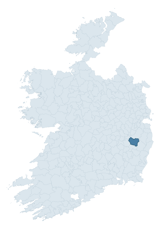
Where this barony sits in the Republic of Ireland
Geology and preservation
Bedrock geology shapes the landscape long before any settlement begins — controlling soil drainage, agricultural potential, the survival of upstanding monuments, and the preservation of buried archaeology. The figures below come from the Geological Survey Ireland 1:100,000 bedrock map.
The bedrock underlying Talbotstown Upper is predominantly slate schist, quartzite, coticule (29% of the barony by area), with much of the rock dating to the Caledonian period. A substantial secondary geology of granite (22%) and greywacke and shale (11%) adds further variety to the underlying landscape. The single largest mapped unit is the Butter Mountain Formation (29% of the barony's bedrock). With 9 distinct rock types mapped, the barony sits in the top third of ROI baronies for geological diversity (88th percentile) — typically a sign of complex tectonic history or coastal mosaics of differing rock units.
Rock type composition
Largest mapped unit: Butter Mountain Formation (29% of the barony)
Placename evidence
Logainm records 44 heritage-diagnostic placenames for Talbotstown Upper, drawn from townland and civil-parish names across the barony. The dominant stratum is Early Christian ecclesiastical — cill-, teampall-, and domhnach-prefixed names that record the dense network of early church foundations established between the fifth and tenth centuries. The leading diagnostic roots are cill- (18 — church), ráth- (12 — earthen ringfort), and gráinseach- (8 — grange). This is above the ROI average of 30.7 heritage placenames per barony. The presence of multiple heritage strata side by side indicates layered occupation of the landscape across successive prehistoric and historic periods. Logainm records 260 placenames for Talbotstown Upper (predominantly townland names). Of these, 44 (17%) carry one of the diagnostic Gaelic roots tracked above; the remainder draw on more generic landscape vocabulary that does not encode a heritage period.
Pre-Christian / Early Medieval Defensive
| Root | Count | Meaning |
|---|---|---|
| ráth- | 12 | earthen ringfort |
| dún- | 3 | hilltop or promontory fort |
Early Christian Ecclesiastical
| Root | Count | Meaning |
|---|---|---|
| cill- | 18 | church (early) |
| gráinseach- | 8 | monastic farm / grange |
| domhnach- | 2 | pre-Patrician or earliest Patrician church |
Burial, Ritual, and Norse-Contact
| Root | Count | Meaning |
|---|---|---|
| dumha- | 1 | mound |
| gall- | 1 | foreigner — Norse settlement marker |
Other baronies in Wicklow
About this profile
Click any section below to expand.
What is a barony?
A barony is a historic administrative unit in Ireland, broadly equivalent to an English hundred. The 280 baronies used here are from the OSi 2019 National Statutory Boundaries (generalised 20m), covering the 26 counties of the Republic of Ireland. Baronies derive from the Norman period, were formalised in the 17th century, and have not been redrawn for statistical purposes. They vary enormously in area, from compact urban baronies in Dublin to vast upland baronies in Connacht, and should not be compared by raw site count without accounting for area differences.
What counts as a site?
This profile combines three distinct heritage registers, each with its own definition of what constitutes a recordable site:
- Archaeological sites (NMS). The National Monuments Service Sites and Monuments Record (SMR) catalogues every known archaeological monument or site of archaeological interest in the Republic, from prehistoric burial mounds and ringforts to medieval churches and post-medieval defensive works. Inclusion does not require legal protection — only that the site has been identified, surveyed, and assessed as having archaeological value. A separate subset of these sites lies within a recorded protection zone, which gives them statutory protection under the National Monuments Acts.
- Listed buildings (NIAH). The National Inventory of Architectural Heritage records buildings of architectural, historical, archaeological, artistic, cultural, scientific, social, or technical interest. Each surveyed structure is appraised on a five-tier scale: International, National, Regional, Local, and Record-Only. The NIAH appraisal is informational rather than strictly statutory, but it underpins local-authority Record of Protected Structures (RPS) listings.
- Heritage placenames (Logainm). Logainm is the authoritative database of Irish placenames maintained by the Placenames Branch. This profile applies a heritage-diagnostic classifier to the Irish-language form of each townland name, flagging roots that signal defensive sites (ráth-, lios-, dún-, caiseal-, cathair-), ecclesiastical foundations (cill-, teampall-, domhnach-, mainistir-), prehistoric burial-ritual features (tuaim-, carn-, leaba-), or Norse-contact settlement (gall-). Townlands without one of these diagnostic roots are not flagged here — they may still carry historical significance, but that significance is not encoded in the name itself.
Editorial principles
The narrative sections of this profile follow several explicit principles:
- Evidential. Every claim about this barony’s heritage character is anchored in the underlying register data. Where a site count, a placename count, or a percentile rank is cited, it is computed from the source datasets at export time, not estimated.
- Comparative. Counts and metrics are reported alongside their percentile rank against the other 279 ROI baronies. A barony with 50 ringforts in absolute terms could be unusually high or unusually low depending on its size and regional context; percentile ranking removes that ambiguity.
- Transparent on limits. Where a register has known coverage gaps, survey biases, or data-quality issues that affect this barony’s figures, the profile flags them rather than presenting the numbers as definitive.
- No interpretation beyond what the data supports. The narrative does not speculate about historical events, social dynamics, or cultural meaning beyond what the recorded heritage and placename evidence directly attests.
Data caveats and limits
- NMS Sites and Monuments Record is the product of survey campaigns conducted at different intensities across different counties and decades. Some baronies have been surveyed more thoroughly than others, and absolute counts should be read in that light. Sites destroyed by development before survey are typically not represented; sites in heavily forested or upland terrain are sometimes under-recorded.
- NIAH coverage is broadly complete for the Republic of Ireland but the survey was conducted on a rolling county-by-county basis, and the most recent appraisal date varies. Buildings demolished or substantially altered after their original survey may still appear in the register; conversely, recent buildings of merit may not yet have been appraised.
- Logainm classification applies a deliberately conservative pattern-matching approach to the Irish-language townland forms. The classifier prioritises true positives over recall: a townland may carry a heritage signal that the classifier doesn’t recognise, particularly where the diagnostic root has been heavily anglicised or where the townland name draws on a less common term. The 60,000+ townland records and ~9,800 classified placenames give a substantial signal at barony scale, but individual townland names should be checked against Logainm directly for definitive interpretation.
- Period attribution. The chronological distribution reflects only those NMS sites that carry a recognised period attribution in the source data. Sites listed as “Unknown” period are excluded from the dated subset.
- Boundary changes. Some baronies have undergone minor boundary adjustments since their 19th-century definition; the OSi 2019 generalised boundaries used here are the current statutory definition and may differ slightly from historical maps in border areas.
- Bedrock geology is mapped at 1:100,000 scale, which means local variation within a barony — small pockets of different rock type, mineral veins, alluvium overlying bedrock — is generalised. The dominant-system and rocktype figures are area-weighted, so a barony reading “70% Carboniferous limestone” may still contain small but archaeologically important pockets of older or younger rock. Around 3% of GSI polygons do not match the lexicon and contribute no rocktype or system attribution.
Data sources
- National Monuments Service — Sites and Monuments Record (SMR) https://data.gov.ie/dataset/national-monuments-service-archaeological-survey-of-ireland
- National Inventory of Architectural Heritage (NIAH) https://data.gov.ie/dataset/national-inventory-of-architectural-heritage-niah-national-dataset
- Logainm — Placenames Database of Ireland https://www.logainm.ie/
- Ordnance Survey Ireland — National Statutory Barony Boundaries 2019 https://data-osi.opendata.arcgis.com/
- EURODEM — European Digital Elevation Model https://www.mapsforeurope.org/datasets/euro-dem
- ESA WorldCover https://esa-worldcover.org/en
- Geological Survey Ireland — 1:100,000 Bedrock Geology https://www.gsi.ie/en-ie/data-and-maps/Pages/Bedrock.aspx
Explore more: Search any of the 280 ROI baronies, browse by historical province, or read the methodology and data sources for the full Republic of Ireland Heritage Tool.