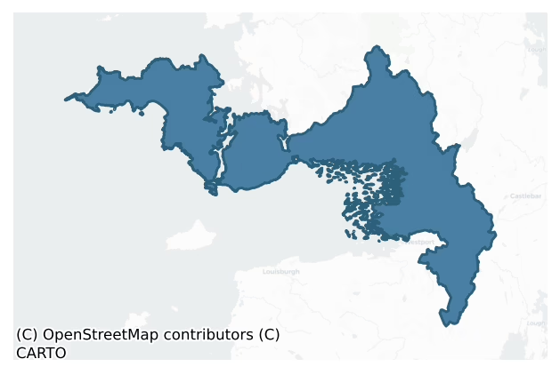
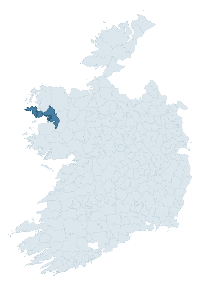
Burrishoole is a barony of County Mayo, in the historical province of Connacht (Irish: Buiríos Umhaill), covering 600 km² of land. The barony records 581 NMS archaeological sites and 128 NIAH listed buildings, placing it at around the 12th percentile among 280 ROI baronies for sites per km². This means it is in the bottom fifth of all baronies for sites per km². Dated archaeological evidence runs from the Neolithic through to the Modern, spanning 8 of 9 archaeological periods, placing the barony in the 52nd percentile among 280 ROI baronies for chronological depth. This means it is in the upper half of all baronies for chronological depth. The largest dated subset of recorded sites dates to the Early Medieval. Logainm flags 55 placenames in the barony as carrying a recognised heritage root; the largest share — around 45% — are names associated with pre-christian defensive.

Heritage at a glance
Percentile rankings throughout this profile compare each barony only against the other 279 Republic of Ireland baronies.
The recorded heritage of Burrishoole
The National Monuments Service Sites and Monuments Record (SMR) is the statutory inventory of archaeological sites for the Republic of Ireland, maintained by the Department of Tourism, Culture, Arts, Gaeltacht, Sport and Media. Sites recorded here include earthworks, ringforts, megalithic tombs, ecclesiastical remains, and post-medieval features; not every record is legally protected, but each is registered as a monument of archaeological interest.
The National Monuments Service records 581 archaeological sites in Burrishoole, putting it at the 12th percentile among 280 ROI baronies for sites per km². This means it is in the bottom fifth of all baronies for sites per km². A sparse recorded total of this kind in Ireland often reflects survey priority rather than genuine absence of past activity. Protection coverage is near-universal — 535 sites (92%) fall within a recorded monument protection zone, indicating an extensively surveyed landscape. The dominant category is defensive sites — ringforts, enclosures, hillforts, and stone forts (216 sites, 37% of the record). The most diagnostically specific type is Ringfort – rath (43 records, 7% of the barony's NMS total) — compared to an ROI average of 20% across all baronies where this type occurs. Ringfort – rath is an earthen ringfort enclosed by a bank and external ditch — the most common Early Medieval farmstead, broadly dated 500–1000 AD. The broader 'Enclosure' classification — which catches unclassified ringforts and field enclosures — accounts for a further 90 records (15%) and reflects the difficulty of sub-classifying degraded earthworks from surface evidence alone. Across the barony's 600 km², this gives a recorded density of 0.97 sites per km².
Most common monument types
Hover or tap a monument type to see its definition.
| Type | Count |
|---|---|
| Enclosure a banked or ditched feature of uncertain type, used as a catch-all where the original function cannot be determined from surface evidence | 90 |
| Ringfort – rath an earthen ringfort enclosed by a bank and external ditch — the most common Early Medieval farmstead, broadly dated 500–1000 AD | 43 |
| House – indeterminate date a habitation building whose date cannot be determined from available evidence | 33 |
| Souterrain an underground stone-built passage and chamber, generally Early Medieval and often associated with ringforts as a defensive or storage feature | 26 |
| Children's burial ground an unconsecrated medieval and early-modern burial ground for unbaptised or stillborn children, often called a cillín or ceallúnach | 20 |
| Hut site a low stone or earthen foundation enclosing a small circular or oval area, generally interpreted as a former dwelling, of any date from prehistory to the medieval period | 18 |
| Church a building used for public Christian worship, of any date from c. 500 AD onwards | 18 |
| Crannog an artificial or partly artificial island built up on a lake or river bed, in use from the 6th to 17th centuries AD | 18 |
Chronological distribution
The dated archaeological record for Burrishoole spans from the Neolithic through to the Modern, with activity attested across 8 of 9 archaeological periods. Every period from earliest to latest is represented in the record — an unbroken sequence of dated activity across the full chronological span. Activity concentrates most heavily in the Early Medieval (151 sites, 42% of dated material), with the Iron Age forming a secondary peak (111 sites, 31%). A further 221 recorded sites (38% of the overall NMS register for the barony) carry no period attribution — appearing as 'Unknown' in the bar chart below. This typically reflects either records that pre-date the standardised period vocabulary or sites awaiting specialist dating review, rather than a genuine absence of chronological evidence.
Sample of recorded monuments
Show 25 sample monuments (of 581 total)
A representative sample of 25 recorded monuments drawn from the barony’s 581 total NMS entries. Sites within a recorded monument protection zone and rarer site types are prioritised so the list shows a meaningful cross-section rather than only the most common type. Each entry shows the official Sites and Monuments Record reference number and the description published by the National Monuments Service.
Megalithic tomb – portal tomb
See linked document with details from Ruaidhrí de Valera and Seán Ó Nualláin, Survey of the Megalithic Tombs of Ireland. Volume II. County Mayo. (Dublin: Stationery Office, 1964)
Date of upload: 3 January 2012
Cairn – burial cairn
Located on a rise in the middle of a plateau bounded by the Goulaun River on one side and by the steep slope of Letterkeen Hill on the other, in an area of mountainous and boggy terrain.
This burial cairn was excavated…
Located on a rise in the middle of a plateau bounded by the Goulaun River on one side and by the steep slope of Letterkeen Hill on the other, in an area of mountainous and boggy terrain.
This burial cairn was excavated (E000015) in 1950 by Ó 'Ríordáin and Mac Dermott (1950-51). The excavators interpreted a stony rise or mound, which appeared to be partly natural and partly artificial, as a possible Bronze Age burial mound or cairn (ibid, 91). Three cists (MA046-004002-; MA046-004003-; MA046-004004-) and two pit burial (MA046-004005-; MA046-004006-) were found, and the stony material of the possible cairn directly overlay one (MA046-004003-) of them. At a later period, a rath (MA046-004007-) was built on this location.
Compiled by: Jane O’Shaughnessy
Date of upload: 9 April 2019
Kiln
Located in the interior of a rath (MA046-004007-).
This feature was excavated (E000015) in 1950 by Ó' Ríordáin and Mac Dermott (1950-1, 103-104). It consisted of a roughly rectangular trench (1.6m X 0.5m; D 0.6m),…
Located in the interior of a rath (MA046-004007-).
This feature was excavated (E000015) in 1950 by Ó' Ríordáin and Mac Dermott (1950-1, 103-104). It consisted of a roughly rectangular trench (1.6m X 0.5m; D 0.6m), with sides lined with upright stones. At its E end two lintel stones remained in position. The fill included charcoal and tiny fragments of burnt animal bone. The excavators interpreted this structure as a type of kiln, although they acknowledging that it was not similar to known kiln types (ibid, 104).
Compiled by: Jane O’Shaughnessy
Date of upload: 9 April 2019
Booley hut
In rough unenclosed grazing, on the western tip of Achill Island, located on the banks of a stream, flowing through a small steep-sided valley, and overlooked at E by the precipitous rocky slopes of Croaghaun mountain.…
In rough unenclosed grazing, on the western tip of Achill Island, located on the banks of a stream, flowing through a small steep-sided valley, and overlooked at E by the precipitous rocky slopes of Croaghaun mountain. The stream flow downslope to N to a short accessible stretch of the rocky shore, flanked by cliffs. This cluster of stone-built hut sites constitutes a booley village, used as temporary shelter for herders while cattle were kept on remote upland grazing. The huts occur in a linear cluster on both banks of the stream. The ruined roofless huts are rectangular or oblong in plan, with long axis N-S. Most have rounded corners but at least one has a true rectangular shape with right-angled corners. The walls (Wth c. 0.6m) are of drystone construction using rough stones and and boulders, and survive largely intact to a height of c. 1-1.4m. Two groupings of huts can be seen within the cluster as a whole. To N there is a linear group of nine huts, surviving in relatively good condition, each measuring c. 6-7m N-S by c. 3-4m E-W. The majority have a doorway in the centre of the W wall but one has a doorway in the E wall. Several have the remains of a central E-W partition wall, dividing the hut into two rooms. Most have a small slab-lined recess, or wall cupboard, built into the thickness of the wall. Some of the two-roomed huts have two cupboards, one in each room. Eight of the huts in this group are freestanding but a smaller ninth hut has one wall built against a n…
Ogham stone
This stone was found in 1958 on the surface of a field some 300m W of the coastguard station at Keem (NMI Finds Register: 1958/126). It is described (Lucas 1960a, 33) as a 'Rectangular slab of stone brought to a point…
This stone was found in 1958 on the surface of a field some 300m W of the coastguard station at Keem (NMI Finds Register: 1958/126). It is described (Lucas 1960a, 33) as a 'Rectangular slab of stone brought to a point at one end. The surfaces are all considerably weather worn so that the inscription cannot be read with confidence. It appears to have been pecked on one of the broad faces of the stone rather than along an angle. Length 80.5cm; greatest width 36cm; maximum thickness 9cm.' It is now in the National Museum of Ireland (DU018-404—-).
This stone has been studied as part of the ‘Ogham in 3D’ project undertaken by the School of Celtic Studies, Dublin Institute for Advanced Studies. To access details go to the following website: https://ogham.celt.dias.ie/search.php?ciic=Keel_West
Compiled by: Nora White
Date of upload: 23 September 2016
Cairn – boundary cairn
Situated on a precipitous mountain ridge. Not shown on the 1840-1 OS 6-inch map; on the1920 edition it is located on the line of the barony boundary and is named ‘Pile of Stones’. It consists of a low, circular cairn…
Situated on a precipitous mountain ridge. Not shown on the 1840-1 OS 6-inch map; on the1920 edition it is located on the line of the barony boundary and is named ‘Pile of Stones’. It consists of a low, circular cairn (diam. 2.6m; H 1.25m) of medium-sized stones, with a pyramidal-shaped profile. There is second boundary cairn (MA058-003—-) c. 177m to SE.
Compiled by: Jane O'Shaughnessy
Date of upload: 13 July 2015
Inscribed stone
The Archaeological Survey of Ireland (ASI) is in the process of providing information on all monuments on The Historic Environment Viewer (HEV). Currently the information for this record has not been uploaded. To…
The Archaeological Survey of Ireland (ASI) is in the process of providing information on all monuments on The Historic Environment Viewer (HEV). Currently the information for this record has not been uploaded. To access available information for research purposes please make an appointment in advance with the Archive Unit (open Fridays 10.00 am – 5.00 pm), Department of Culture, Heritage and the Gaeltacht, The Custom House, Dublin 1 D01W6XO or email nmarchive@chg.gov.ie.
Religious house – Dominican friars
On a low elevation on the shores of a sheltered tidal inlet which opens off the NE end of Clew Bay, and merges at N with a narrow channel connecting with the S end of Furnace Lough. Burrishoole castle (MA067-013001-) is…
On a low elevation on the shores of a sheltered tidal inlet which opens off the NE end of Clew Bay, and merges at N with a narrow channel connecting with the S end of Furnace Lough. Burrishoole castle (MA067-013001-) is 125m to N.
Burrishoole Abbey, a well built, compact 15th-century Dominican priory dedicated to St. Mary, is a National Monument in state guardianship (no. 235). It is located within the ancient territory of Umhall, which at the time the priory was built was a nexus of rivalries, alliances and intermarriage within and between the O’Malleys, a Gaelic clan, and the Bourkes, descendants of the Anglo-Norman de Burgos.
The priory was founded for the mendicant order of the Dominicans in 1469 by Richard Bourke of Turlough, known as Risteard an Cuarscidh (Richard of the Curved Shield). He was elected the Mac William Íochtar, chief of the Mayo Bourkes in 1460, but having established the priory, he resigned his lordship, took the habit and joined the community at Burrishoole, dying there four years later in 1473 (Gwynne and Hadcock 1970, 222).
Initially, the establishment of the priory proved controversial as the Archbishop of Tuam, who granted permission for the foundation, had neglected to obtain the necessary papal approval, thus exposing the friars to the threat of excommunication. This distressing situation was finally resolved in 1486 when Pope Innocent VIII issued a Papal Bull absolving the friars, regularising the status of the priory and authorising the co…
Metalworking site
Iron works in the possession of Burrishoole Dominican priory (MA067-014001-) were first recorded in 1580 when Sir Nicholas Malby, Governor of Connacht included them in a list of the abbey’s assets: ‘Specially it hath a…
Iron works in the possession of Burrishoole Dominican priory (MA067-014001-) were first recorded in 1580 when Sir Nicholas Malby, Governor of Connacht included them in a list of the abbey’s assets: ‘Specially it hath a very plentiful iron mine…’ (Knox 1908, 108). Samuel Lewis (1837) recorded that 'There are two large lakes in the parish called Lough Feagh and Lough Furnace, and on the narrow neck of land between these are the ruins of an old smelting furnace [MA067-045—-]; there is also another at the old abbey '. The exact location of the abbey's iron works is uncertain.
Compiled by: Jane O'Shaughnessy
Date of upload: 12 January 2022
Chapel
This chapel is indicated as 'Site of Old Chapel' on the 1838 OS 6-inch map and as 'Chapel (Site of)' the 1920 edition. The outline of a rectangular building (c. 10m E−W; c. 6m N−S) was still discernible in the first…
This chapel is indicated as 'Site of Old Chapel' on the 1838 OS 6-inch map and as 'Chapel (Site of)' the 1920 edition. The outline of a rectangular building (c. 10m E−W; c. 6m N−S) was still discernible in the first half of the 20th-century, defined by low sod-covered foundations, with a gap in the E wall (SMR file). An inspection in 1987 found no visible trace of the chapel.
Compiled by: Jane O'Shaughnessy
Date of upload: 24 July 2017
Cross-inscribed stone
The Archaeological Survey of Ireland (ASI) is in the process of providing information on all monuments on The Historic Environment Viewer (HEV). Currently the information for this record has not been uploaded. To…
The Archaeological Survey of Ireland (ASI) is in the process of providing information on all monuments on The Historic Environment Viewer (HEV). Currently the information for this record has not been uploaded. To access available information for research purposes please make an appointment in advance with the Archive Unit (open Fridays 10.00 am – 5.00 pm), Department of Culture, Heritage and the Gaeltacht, The Custom House, Dublin 1 D01W6XO or email nmarchive@chg.gov.ie.
Water mill – horizontal-wheeled
The Archaeological Survey of Ireland (ASI) is in the process of providing information on all monuments on The Historic Environment Viewer (HEV). Currently the information for this record has not been uploaded. To…
The Archaeological Survey of Ireland (ASI) is in the process of providing information on all monuments on The Historic Environment Viewer (HEV). Currently the information for this record has not been uploaded. To access available information for research purposes please make an appointment in advance with the Archive Unit (open Fridays 10.00 am – 5.00 pm), Department of Culture, Heritage and the Gaeltacht, The Custom House, Dublin 1 D01W6XO or email nmarchive@chg.gov.ie.
Gatehouse
The Archaeological Survey of Ireland (ASI) is in the process of providing information on all monuments on The Historic Environment Viewer (HEV). Currently the information for this record has not been uploaded. To…
The Archaeological Survey of Ireland (ASI) is in the process of providing information on all monuments on The Historic Environment Viewer (HEV). Currently the information for this record has not been uploaded. To access available information for research purposes please make an appointment in advance with the Archive Unit (open Fridays 10.00 am – 5.00 pm), Department of Culture, Heritage and the Gaeltacht, The Custom House, Dublin 1 D01W6XO or email nmarchive@chg.gov.ie.
Mine
The Archaeological Survey of Ireland (ASI) is in the process of providing information on all monuments on The Historic Environment Viewer (HEV). Currently the information for this record has not been uploaded. To…
The Archaeological Survey of Ireland (ASI) is in the process of providing information on all monuments on The Historic Environment Viewer (HEV). Currently the information for this record has not been uploaded. To access available information for research purposes please make an appointment in advance with the Archive Unit (open Fridays 10.00 am – 5.00 pm), Department of Culture, Heritage and the Gaeltacht, The Custom House, Dublin 1 D01W6XO or email nmarchive@chg.gov.ie.
Icehouse
The Archaeological Survey of Ireland (ASI) is in the process of providing information on all monuments on The Historic Environment Viewer (HEV). Currently the information for this record has not been uploaded. To…
The Archaeological Survey of Ireland (ASI) is in the process of providing information on all monuments on The Historic Environment Viewer (HEV). Currently the information for this record has not been uploaded. To access available information for research purposes please make an appointment in advance with the Archive Unit (open Fridays 10.00 am – 5.00 pm), Department of Culture, Heritage and the Gaeltacht, The Custom House, Dublin 1 D01W6XO or email nmarchive@chg.gov.ie.
House – 16th/17th century
The Archaeological Survey of Ireland (ASI) is in the process of providing information on all monuments on The Historic Environment Viewer (HEV). Currently the information for this record has not been uploaded. To…
The Archaeological Survey of Ireland (ASI) is in the process of providing information on all monuments on The Historic Environment Viewer (HEV). Currently the information for this record has not been uploaded. To access available information for research purposes please make an appointment in advance with the Archive Unit (open Fridays 10.00 am – 5.00 pm), Department of Culture, Heritage and the Gaeltacht, The Custom House, Dublin 1 D01W6XO or email nmarchive@chg.gov.ie.
Sweathouse
The Archaeological Survey of Ireland (ASI) is in the process of providing information on all monuments on The Historic Environment Viewer (HEV). Currently the information for this record has not been uploaded. To…
The Archaeological Survey of Ireland (ASI) is in the process of providing information on all monuments on The Historic Environment Viewer (HEV). Currently the information for this record has not been uploaded. To access available information for research purposes please make an appointment in advance with the Archive Unit (open Fridays 10.00 am – 5.00 pm), Department of Culture, Heritage and the Gaeltacht, The Custom House, Dublin 1 D01W6XO or email nmarchive@chg.gov.ie.
Kiln – corn-drying
The Archaeological Survey of Ireland (ASI) is in the process of providing information on all monuments on The Historic Environment Viewer (HEV). Currently the information for this record has not been uploaded. To…
The Archaeological Survey of Ireland (ASI) is in the process of providing information on all monuments on The Historic Environment Viewer (HEV). Currently the information for this record has not been uploaded. To access available information for research purposes please make an appointment in advance with the Archive Unit (open Fridays 10.00 am – 5.00 pm), Department of Culture, Heritage and the Gaeltacht, The Custom House, Dublin 1 D01W6XO or email nmarchive@chg.gov.ie.
Causeway
The Archaeological Survey of Ireland (ASI) is in the process of providing information on all monuments on The Historic Environment Viewer (HEV). Currently the information for this record has not been uploaded. To…
The Archaeological Survey of Ireland (ASI) is in the process of providing information on all monuments on The Historic Environment Viewer (HEV). Currently the information for this record has not been uploaded. To access available information for research purposes please make an appointment in advance with the Archive Unit (open Fridays 10.00 am – 5.00 pm), Department of Culture, Heritage and the Gaeltacht, The Custom House, Dublin 1 D01W6XO or email nmarchive@chg.gov.ie.
Windmill
The Archaeological Survey of Ireland (ASI) is in the process of providing information on all monuments on The Historic Environment Viewer (HEV). Currently the information for this record has not been uploaded. To…
The Archaeological Survey of Ireland (ASI) is in the process of providing information on all monuments on The Historic Environment Viewer (HEV). Currently the information for this record has not been uploaded. To access available information for research purposes please make an appointment in advance with the Archive Unit (open Fridays 10.00 am – 5.00 pm), Department of Culture, Heritage and the Gaeltacht, The Custom House, Dublin 1 D01W6XO or email nmarchive@chg.gov.ie.
Barrow – pond barrow
The Archaeological Survey of Ireland (ASI) is in the process of providing information on all monuments on The Historic Environment Viewer (HEV). Currently the information for this record has not been uploaded. To…
The Archaeological Survey of Ireland (ASI) is in the process of providing information on all monuments on The Historic Environment Viewer (HEV). Currently the information for this record has not been uploaded. To access available information for research purposes please make an appointment in advance with the Archive Unit (open Fridays 10.00 am – 5.00 pm), Department of Culture, Heritage and the Gaeltacht, The Custom House, Dublin 1 D01W6XO or email nmarchive@chg.gov.ie.
House – 17th century
The Archaeological Survey of Ireland (ASI) is in the process of providing information on all monuments on The Historic Environment Viewer (HEV). Currently the information for this record has not been uploaded. To…
The Archaeological Survey of Ireland (ASI) is in the process of providing information on all monuments on The Historic Environment Viewer (HEV). Currently the information for this record has not been uploaded. To access available information for research purposes please make an appointment in advance with the Archive Unit (open Fridays 10.00 am – 5.00 pm), Department of Culture, Heritage and the Gaeltacht, The Custom House, Dublin 1 D01W6XO or email nmarchive@chg.gov.ie.
Religious house – unclassified
In the N half of a graveyard (MA088-063001-), 3m NE of a round tower (MA088-063003-).
This medieval church is a National Monument in state guardianship (No. 96). It is indicated on the 1838 and 1929 OS 6-inch maps as…
In the N half of a graveyard (MA088-063001-), 3m NE of a round tower (MA088-063003-).
This medieval church is a National Monument in state guardianship (No. 96). It is indicated on the 1838 and 1929 OS 6-inch maps as ‘Abbey (in Ruins)’.
Tírechán, who compiled his biography of St Patrick in the 7th century, claims that St. Patrick founded the first church in Aghagower in the 5th century, and appointed St. Senach as bishop (Gwynne and Hadcock 1970, 28). The location is strategic, mid-way along an ancient routeway, which in the medieval period evolved into the Togher Patrick (MA088-062—-), an important pilgrimage route between Ballintober Abbey (MA089-058001-) and Croagh Patrick (MA087-044001-). Aghagower became a principal stopping point on the route, and this greatly aided the monastery in becoming one of the preeminent ecclesiastical centres in Mayo. It was clearly flourishing in late 11th or 12th century when it had the resources to construct the round tower. One of the earliest mentions of Aghaower is in the Annals of the Four Masters, which records that in 1094 the ‘airchinneach [erenagh or church official] of Achadh-fabhair was killed by the men of Ceara.’ (O’Donovan 1848-51). In the Annals of Connaught the death is recorded on 15th December 1233 of Donn Cathaig, ‘airchinnech’ of Aghagower, who is eulogised as ‘a man reverenced by the clergy and laity for his qualities of mind and body; the most generous bestower of cattle and food in his age; the protector of the…
Round tower
In the village of Aghagower, located in the centre of a graveyard (MA088-063002-), 3m to SW of a medieval church (MA088-063001-).
This round tower is a National Monument in state guardianship (no. 96). It is one of the…
In the village of Aghagower, located in the centre of a graveyard (MA088-063002-), 3m to SW of a medieval church (MA088-063001-).
This round tower is a National Monument in state guardianship (no. 96). It is one of the few visible remains of an early medieval monastery, which traced its roots back to a church said to have been consecrated at Aghagower in the 5th century by St. Patrick. The success of the monastery can at least partly be attributed to its location mid-way along the Togher Patrick (MA088-062—-), an important medieval pilgrimage route to Croagh Patrick (MA087-044001-). The round tower, which was probably built in the late 11th or 12th century, is an expression of the monastery’s prestige and importance, and would have been one of the most impressive landmarks encountered by pilgrims as they walked the route (Corlett 2014, 52)
The remains consists of a circular tower (diam. c. 5m; current H c. 16m) of coursed, roughly dressed mortared stones; it no longer stands to its full height and is missing its conical corbelled roof. The original doorway (Wth 0.7m; H 1.52m), which has a plain round arch formed by three stones, is at E at first floor level, 2.18m above exterior ground level; the stones are spalled and shattered, possibly as a result of fire. A flat-headed doorway (Wth 0.76m; H 1.6m) at ground floor level on the NW side is a late insert. Five rings of stone corbels protrude at evenly spaced intervals from the internal wall face; these supported wooden…
Enclosure
The Archaeological Survey of Ireland (ASI) is in the process of providing information on all monuments on The Historic Environment Viewer (HEV). Currently the information for this record has not been uploaded. To…
The Archaeological Survey of Ireland (ASI) is in the process of providing information on all monuments on The Historic Environment Viewer (HEV). Currently the information for this record has not been uploaded. To access available information for research purposes please make an appointment in advance with the Archive Unit (open Fridays 10.00 am – 5.00 pm), Department of Culture, Heritage and the Gaeltacht, The Custom House, Dublin 1 D01W6XO or email nmarchive@chg.gov.ie.
Listed buildings
The National Inventory of Architectural Heritage (NIAH) is a state survey appraising buildings of architectural, historical, archaeological, artistic, cultural, scientific, social, or technical interest. Each surveyed structure receives a rating from International (the highest, for buildings of European importance) through National, Regional, Local, and Record-Only.
The NIAH records 128 listed buildings in Burrishoole (61st percentile across ROI baronies). The highest-graded structure include 1 of National significance. The Republic holds 937 National-graded buildings in total, so this barony accounts for around 0% of the national total. Construction dates concentrate most heavily in the Victorian (1830-1900) period.
Terrain and environment
Mean elevation across the barony is 102m — the 60th percentile among 280 ROI baronies for elevation. This means it is in the upper half of all baronies for elevation. Elevation matters for heritage because higher-altitude baronies typically favour defensive monuments — ringforts and hilltop forts placed on prominent ground — while lowland baronies are more likely to carry the dense settlement and church networks of intensive agricultural landscapes. The barony reaches 710m at its highest point — a vertical span of more than 609m within its boundary, indicating significant topographic diversity. Mean slope is 8.4° — the 94th percentile among 280 ROI baronies for slope. This means it is in the top tenth of all baronies for slope. This is consistently steep terrain by ROI standards, the kind of landscape that tends to preserve upstanding archaeological features well. Slope is a key control on both land use and archaeological preservation: steep ground resists ploughing and tends to preserve earthworks intact, while gentle slopes favour intensive cultivation that damages or destroys surface archaeology over time. Localised maximum slopes reach 24°, typical of stream-cut valleys, escarpments, or coastal bluffs within the wider landscape. The Topographic Wetness Index averages 9.3, the 6th percentile among 280 ROI baronies for wetness. This means it is in the bottom tenth of all baronies for wetness. This is well-drained ground by ROI standards — typical of upland or steeply-sloping country that sheds water rapidly. Drainage matters for heritage because poorly-drained ground preserves organic archaeology (wooden trackways, leather, textiles, and on rare occasions human remains) far better than free-draining soil; well-drained ground favours arable use but destroys organic material rapidly. The land cover is dominated by improved grassland (85%) and woodland (11%). In overall character, this is steeply-sloping terrain at modest elevation, with land use dominated by improved grassland.
Terrain measurements
Where this barony sits in the Republic of Ireland
Geology and preservation
Bedrock geology shapes the landscape long before any settlement begins — controlling soil drainage, agricultural potential, the survival of upstanding monuments, and the preservation of buried archaeology. The figures below come from the Geological Survey Ireland 1:100,000 bedrock map.
The bedrock underlying Burrishoole is predominantly psammites (13% of the barony by area), with much of the rock dating to the Proterozoic period. With 24 distinct rock types mapped, the barony sits in the top third of ROI baronies for geological diversity (100th percentile) — typically a sign of complex tectonic history or coastal mosaics of differing rock units.
Rock type composition
Largest mapped unit: Anaffrin Formation (13% of the barony)
Placename evidence
Logainm records 55 heritage-diagnostic placenames for Burrishoole, drawn from townland and civil-parish names across the barony. The dominant stratum is pre-Christian and Early Medieval defensive — ráth-, lios-, dún-, and caiseal-prefixed names that mark Iron Age and early historic settlement. The leading diagnostic roots are cill- (16 — church), ráth- (13 — earthen ringfort), and dumha- (10 — burial mound or sandbank). This is above the ROI average of 30.7 heritage placenames per barony. The presence of multiple heritage strata side by side indicates layered occupation of the landscape across successive prehistoric and historic periods. Logainm records 423 placenames for Burrishoole (predominantly townland names). Of these, 55 (13%) carry one of the diagnostic Gaelic roots tracked above; the remainder draw on more generic landscape vocabulary that does not encode a heritage period.
Pre-Christian / Early Medieval Defensive
| Root | Count | Meaning |
|---|---|---|
| ráth- | 13 | earthen ringfort |
| caiseal- | 5 | stone ringfort |
| dún- | 4 | hilltop or promontory fort |
| lios- | 3 | ringfort or enclosure |
Early Christian Ecclesiastical
| Root | Count | Meaning |
|---|---|---|
| cill- | 16 | church (early) |
| tobar- | 1 | holy well |
| bile- | 1 | sacred tree / boundary marker |
Burial, Ritual, and Norse-Contact
| Root | Count | Meaning |
|---|---|---|
| dumha- | 10 | mound |
| gall- | 2 | foreigner — Norse settlement marker |
| sián- | 1 | fairy mound |
| uaimh- | 1 | cave / souterrain |
About this profile
Click any section below to expand.
What is a barony?
A barony is a historic administrative unit in Ireland, broadly equivalent to an English hundred. The 280 baronies used here are from the OSi 2019 National Statutory Boundaries (generalised 20m), covering the 26 counties of the Republic of Ireland. Baronies derive from the Norman period, were formalised in the 17th century, and have not been redrawn for statistical purposes. They vary enormously in area, from compact urban baronies in Dublin to vast upland baronies in Connacht, and should not be compared by raw site count without accounting for area differences.
What counts as a site?
This profile combines three distinct heritage registers, each with its own definition of what constitutes a recordable site:
- Archaeological sites (NMS). The National Monuments Service Sites and Monuments Record (SMR) catalogues every known archaeological monument or site of archaeological interest in the Republic, from prehistoric burial mounds and ringforts to medieval churches and post-medieval defensive works. Inclusion does not require legal protection — only that the site has been identified, surveyed, and assessed as having archaeological value. A separate subset of these sites lies within a recorded protection zone, which gives them statutory protection under the National Monuments Acts.
- Listed buildings (NIAH). The National Inventory of Architectural Heritage records buildings of architectural, historical, archaeological, artistic, cultural, scientific, social, or technical interest. Each surveyed structure is appraised on a five-tier scale: International, National, Regional, Local, and Record-Only. The NIAH appraisal is informational rather than strictly statutory, but it underpins local-authority Record of Protected Structures (RPS) listings.
- Heritage placenames (Logainm). Logainm is the authoritative database of Irish placenames maintained by the Placenames Branch. This profile applies a heritage-diagnostic classifier to the Irish-language form of each townland name, flagging roots that signal defensive sites (ráth-, lios-, dún-, caiseal-, cathair-), ecclesiastical foundations (cill-, teampall-, domhnach-, mainistir-), prehistoric burial-ritual features (tuaim-, carn-, leaba-), or Norse-contact settlement (gall-). Townlands without one of these diagnostic roots are not flagged here — they may still carry historical significance, but that significance is not encoded in the name itself.
Editorial principles
The narrative sections of this profile follow several explicit principles:
- Evidential. Every claim about this barony’s heritage character is anchored in the underlying register data. Where a site count, a placename count, or a percentile rank is cited, it is computed from the source datasets at export time, not estimated.
- Comparative. Counts and metrics are reported alongside their percentile rank against the other 279 ROI baronies. A barony with 50 ringforts in absolute terms could be unusually high or unusually low depending on its size and regional context; percentile ranking removes that ambiguity.
- Transparent on limits. Where a register has known coverage gaps, survey biases, or data-quality issues that affect this barony’s figures, the profile flags them rather than presenting the numbers as definitive.
- No interpretation beyond what the data supports. The narrative does not speculate about historical events, social dynamics, or cultural meaning beyond what the recorded heritage and placename evidence directly attests.
Data caveats and limits
- NMS Sites and Monuments Record is the product of survey campaigns conducted at different intensities across different counties and decades. Some baronies have been surveyed more thoroughly than others, and absolute counts should be read in that light. Sites destroyed by development before survey are typically not represented; sites in heavily forested or upland terrain are sometimes under-recorded.
- NIAH coverage is broadly complete for the Republic of Ireland but the survey was conducted on a rolling county-by-county basis, and the most recent appraisal date varies. Buildings demolished or substantially altered after their original survey may still appear in the register; conversely, recent buildings of merit may not yet have been appraised.
- Logainm classification applies a deliberately conservative pattern-matching approach to the Irish-language townland forms. The classifier prioritises true positives over recall: a townland may carry a heritage signal that the classifier doesn’t recognise, particularly where the diagnostic root has been heavily anglicised or where the townland name draws on a less common term. The 60,000+ townland records and ~9,800 classified placenames give a substantial signal at barony scale, but individual townland names should be checked against Logainm directly for definitive interpretation.
- Period attribution. The chronological distribution reflects only those NMS sites that carry a recognised period attribution in the source data. Sites listed as “Unknown” period are excluded from the dated subset.
- Boundary changes. Some baronies have undergone minor boundary adjustments since their 19th-century definition; the OSi 2019 generalised boundaries used here are the current statutory definition and may differ slightly from historical maps in border areas.
- Bedrock geology is mapped at 1:100,000 scale, which means local variation within a barony — small pockets of different rock type, mineral veins, alluvium overlying bedrock — is generalised. The dominant-system and rocktype figures are area-weighted, so a barony reading “70% Carboniferous limestone” may still contain small but archaeologically important pockets of older or younger rock. Around 3% of GSI polygons do not match the lexicon and contribute no rocktype or system attribution.
Data sources
- National Monuments Service — Sites and Monuments Record (SMR) https://data.gov.ie/dataset/national-monuments-service-archaeological-survey-of-ireland
- National Inventory of Architectural Heritage (NIAH) https://data.gov.ie/dataset/national-inventory-of-architectural-heritage-niah-national-dataset
- Logainm — Placenames Database of Ireland https://www.logainm.ie/
- Ordnance Survey Ireland — National Statutory Barony Boundaries 2019 https://data-osi.opendata.arcgis.com/
- EURODEM — European Digital Elevation Model https://www.mapsforeurope.org/datasets/euro-dem
- ESA WorldCover https://esa-worldcover.org/en
- Geological Survey Ireland — 1:100,000 Bedrock Geology https://www.gsi.ie/en-ie/data-and-maps/Pages/Bedrock.aspx
Explore more: Search any of the 280 ROI baronies, browse by historical province, or read the methodology and data sources for the full Republic of Ireland Heritage Tool.