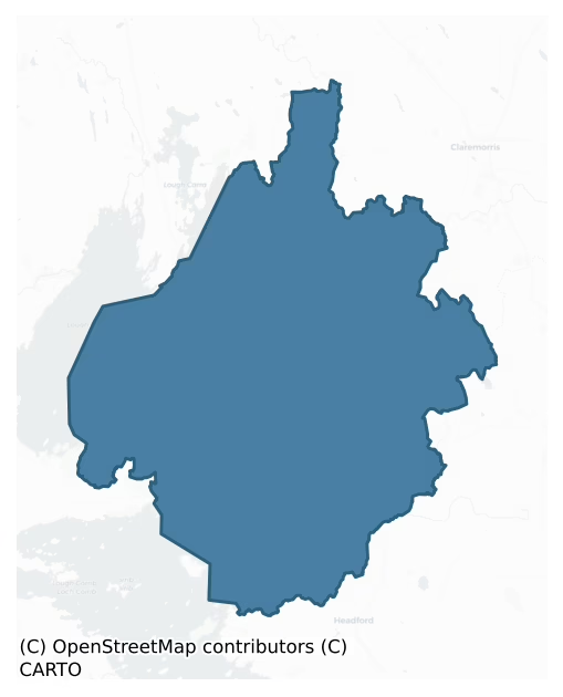
Kilmaine is a barony of County Mayo, in the historical province of Connacht (Irish: Cill Mheáin), covering 429 km² of land. The barony records 1,115 NMS archaeological sites and 230 NIAH listed buildings, placing it at around the 73rd percentile among 280 ROI baronies for sites per km². This means it is in the top third of all baronies for sites per km². Dated archaeological evidence runs from the Neolithic through to the Modern, spanning 8 of 9 archaeological periods, placing the barony in the 72nd percentile among 280 ROI baronies for chronological depth. This means it is in the top third of all baronies for chronological depth. The largest dated subset of recorded sites dates to the Early Medieval. Logainm flags 90 placenames in the barony as carrying a recognised heritage root; the largest share — around 57% — are names associated with pre-christian defensive.

Heritage at a glance
Percentile rankings throughout this profile compare each barony only against the other 279 Republic of Ireland baronies.
The recorded heritage of Kilmaine
The National Monuments Service Sites and Monuments Record (SMR) is the statutory inventory of archaeological sites for the Republic of Ireland, maintained by the Department of Tourism, Culture, Arts, Gaeltacht, Sport and Media. Sites recorded here include earthworks, ringforts, megalithic tombs, ecclesiastical remains, and post-medieval features; not every record is legally protected, but each is registered as a monument of archaeological interest.
The National Monuments Service records 1,115 archaeological sites in Kilmaine, putting it at the 73rd percentile among 280 ROI baronies for sites per km². This means it is in the top third of all baronies for sites per km². Protection coverage is near-universal — 1,080 sites (97%) fall within a recorded monument protection zone, indicating an extensively surveyed landscape. The dominant category is defensive sites — ringforts, enclosures, hillforts, and stone forts (723 sites, 65% of the record). The most diagnostically specific type is Ringfort – rath (155 records, 14% of the barony's NMS total) — compared to an ROI average of 20% across all baronies where this type occurs. Ringfort – rath is an earthen ringfort enclosed by a bank and external ditch — the most common Early Medieval farmstead, broadly dated 500–1000 AD. The broader 'Enclosure' classification — which catches unclassified ringforts and field enclosures — accounts for a further 292 records (26%) and reflects the difficulty of sub-classifying degraded earthworks from surface evidence alone. Other significant types include Ringfort – cashel (72) — the stone-walled equivalent of the rath, found mainly in upland or western areas, broadly dated 500–1000 AD. Across the barony's 429 km², this gives a recorded density of 2.60 sites per km².
Most common monument types
Hover or tap a monument type to see its definition.
| Type | Count |
|---|---|
| Enclosure a banked or ditched feature of uncertain type, used as a catch-all where the original function cannot be determined from surface evidence | 292 |
| Ringfort – rath an earthen ringfort enclosed by a bank and external ditch — the most common Early Medieval farmstead, broadly dated 500–1000 AD | 155 |
| Ringfort – cashel the stone-walled equivalent of the rath, found mainly in upland or western areas, broadly dated 500–1000 AD | 72 |
| Souterrain an underground stone-built passage and chamber, generally Early Medieval and often associated with ringforts as a defensive or storage feature | 66 |
| Crannog an artificial or partly artificial island built up on a lake or river bed, in use from the 6th to 17th centuries AD | 40 |
| Church a building used for public Christian worship, of any date from c. 500 AD onwards | 35 |
| Earthwork an unclassified earthen structure with no diagnostic features that allow a more specific classification | 33 |
| House – indeterminate date a habitation building whose date cannot be determined from available evidence | 32 |
Chronological distribution
The dated archaeological record for Kilmaine spans from the Neolithic through to the Modern, with activity attested across 8 of 9 archaeological periods. This is the 72nd percentile across ROI baronies for chronological depth — an above-average span. Every period from earliest to latest is represented in the record — an unbroken sequence of dated activity across the full chronological span. Activity concentrates most heavily in the Early Medieval (372 sites, 40% of dated material), with the Iron Age forming a secondary peak (349 sites, 38%). A further 187 recorded sites (17% of the overall NMS register for the barony) carry no period attribution — appearing as 'Unknown' in the bar chart below. This typically reflects either records that pre-date the standardised period vocabulary or sites awaiting specialist dating review, rather than a genuine absence of chronological evidence.
Sample of recorded monuments
Show 25 sample monuments (of 1,115 total)
A representative sample of 25 recorded monuments drawn from the barony’s 1,115 total NMS entries. Sites within a recorded monument protection zone and rarer site types are prioritised so the list shows a meaningful cross-section rather than only the most common type. Each entry shows the official Sites and Monuments Record reference number and the description published by the National Monuments Service.
Religious house – Augustinian nuns
On NE shore of Lough Carra in an area of rough grazing. In SE sector of Early Christian enclosure (MA100-113001-), which also encloses church (MA100-112001-) and extensive field system (MA100-113002-). Augustinian abbey…
On NE shore of Lough Carra in an area of rough grazing. In SE sector of Early Christian enclosure (MA100-113001-), which also encloses church (MA100-112001-) and extensive field system (MA100-113002-). Augustinian abbey founded by Walter de Burgo c. 1440 (Gwynn and Hadcock 1970, 312). Heavily overgrown ruins of low rectangular building (13.3m N-S; 6.2m E-W). The walls (Wth 1.3m; H 0.7m) are in poor condition, a noticeable break of 3.2m at the W end of the S wall may indicate the site of the door. Several loose stones are scattered about the building, but a few upright to the SW clearly mark graves. Made subject to Kilcreevanty and became house of nuns. Franciscans recorded here in 1587, may have occupied site after the suppression of Kilcreevanty (1543) (Gwynn and Hadcock 1970, 312).
The above description has been derived from D. Lavelle (compiler), An Archaeological Survey of Ballinrobe and District including Lough Mask and Lough Carra. Lough Mask and Lough Carra Tourist Development Association (1994), No. 634.
Date of upload: 11 February 2013
Barrow – mound barrow
In thistle-covered pasture, with a gradual fall of ground to E and good views over the surrounding gently undulating terrain. The summit of Croagh Patrick rises above the spine of the Partry Mountains on the far horizon…
In thistle-covered pasture, with a gradual fall of ground to E and good views over the surrounding gently undulating terrain. The summit of Croagh Patrick rises above the spine of the Partry Mountains on the far horizon to WSW.
Flat-topped earthen mound (diam. top c. 7m; overall diam. 9.6m N−S, 10m N−S) defined by a low, dilapidated scarp (H 0.3-0.4m). There is a shallow surface depression (diam. c. 1−1.5m) in the top of the mound at the SE. A possible ringbarrow (MA111-037001-) is 10m to NW.
Compiled by: Jane O'Shaughnessy
Date of upload: 21 December 2022
Fortification
On highest point of what may have been an artifically enlarged island in Lough Mask. Known as Castle Hag or Caisleán na Caillighe. It is first mentioned in the Irish annals under the year 1195 when Cathal MacDermot…
On highest point of what may have been an artifically enlarged island in Lough Mask. Known as Castle Hag or Caisleán na Caillighe. It is first mentioned in the Irish annals under the year 1195 when Cathal MacDermot O'Conor brought his spoils here when plundering Connacht; using Castle Hag as a base he committed further ravages on all sides. In 1586 a number of the Burkes' followers were attacked by Richard Bingham and forced to flee. It has been suggested that the enclosing walls may have been added to at this time as there is a difference in the width and masonry style between the upper and lower portions of the wall (Naessens and O'Connor 2012, 119).
The remains consist of a circular stone fortress (diam. 36.5m) strengthened with lime mortar. The wall reaches a height of 8m and is 3m thick at the base. Much of the E side has been levelled; this side probably contained the entrance. The interior is relatively featureless apart from a small beehive-like hut adjoining NE wall. The interior also contains two rectangular-shaped depressions. While it is possible this may originally have been a cashel that subsequently was strengthened in later times the monument has been identified by Naessens and O’Conor as a possible pre-Norman fortification dating to the eleventh- / twelfth century (2012, 118-121). (Wilde 1872, 260; Naessens and O'Conor 2012, 118-9)
The above description has been derived from D. Lavelle (compiler), An Archaeological Survey of Ballinrobe and District…
Sweathouse
In karst with rough grazing, 300m SE is abbey (MA117-024001-). Trapezoidal (5.5m N-S; 5.3m E-W; H 3.2m) mass of rough masonry, with two internal chambers running W to E, accessed from the W through acutely-pointed…
In karst with rough grazing, 300m SE is abbey (MA117-024001-). Trapezoidal (5.5m N-S; 5.3m E-W; H 3.2m) mass of rough masonry, with two internal chambers running W to E, accessed from the W through acutely-pointed doorways (Wth 0.7m; H 1.2m). Floors are raised (H 0.2m) above ground level and consist of slightly spaced stone slabs. N chamber (L 3.1m; Wth 0.9m; H 1.5m) and S chamber (L 3.1m; Wth 0.8m; H 1.5m) are both roofed internally by pointed arches.
The above description has been derived from D. Lavelle (compiler), An Archaeological Survey of Ballinrobe and District including Lough Mask and Lough Carra. Lough Mask and Lough Carra Tourist Development Association (1994), No. 680.
Date of upload: 6 November 2013
Religious house – Augustinian, of Arrouaise nuns
On shore of sheltered bay in Lough Mask; an island in earlier times. Site of an early monastery founded by St. Cormac. Maelísa, son of Turlogh O' Connor, prior of the abbey, died here in 1223. Listed as a cell of…
On shore of sheltered bay in Lough Mask; an island in earlier times. Site of an early monastery founded by St. Cormac. Maelísa, son of Turlogh O' Connor, prior of the abbey, died here in 1223. Listed as a cell of Benedictine monks, later a nunnery. Richard de Burgo burnt Inishmaine in 1227 (Gwynn and Hadcock 1970, 318). Early 13th century church with nave and chancel. Entrance to nave through trabeate doorway in N wall, possibly of early christian origin; S wall contains splayed window with portion of arch remaining on E side. Incomplete chancel arch with base and columns containing decorated capitals. E gable contains pair of round headed windows of transitional date, set in widely splayed round arched embrasure with continuous roll moulding and external hood moulding with decorated terminals. On either side of the chancel are to be found a later N and S transept, both with badly damaged doorways; both lighted by simple splayed windows, while a smaller square structure abuts W wall of S transept.
NE of the abbey is a gate tower marked 'Castle' [MA117-044—-] on OS map (1838). Probably fifteenth century in date. W wall is steeply battered externally. Main chamber with vaulted ceiling had doorway on N leading to stairs. E wall of lst-floor contains fine twin light window but much of the rest of the features are modern reconstructions.
This is a national monument (no. 102) in state care.
The above description has been derived from D. Lavelle (compiler), An Archaeologi…
Flat cemetery
Eight cists and one pit burial discovered between 1933-1944, on a low-lying esker ridge (NMI).
Cist 1: Long, slab-built cist (L 1.5m E-W) with a single floor slab and capstone. It contained an extended skeleton with…
Eight cists and one pit burial discovered between 1933-1944, on a low-lying esker ridge (NMI).
Cist 1: Long, slab-built cist (L 1.5m E-W) with a single floor slab and capstone. It contained an extended skeleton with head facing W (NMI).
Cist 2: Long, rectangular slab-built cist (L 1.4m E-W; Wth 0.7m) with capstone and single floor slab. A pair of cross slabs divided it into three compartments, two of which contained cremated bones (NMI).
Cist 3: 6m N of cist 2. Short, polygonal, slab-built cist (L 0.4m E-W; Wth 0.3m; D 0.3m) with floor slab and capstone. Contained an inverted vase urn which held the cremated bones of an infant (JGAHS 1943, 89-91).
Cist 4: 30m E of cist 3. Short cist; orientated NE-SW, constructed of large side slabs, and divided into two compartments by transverse slab. NE compartment contained cremated bones and a highly decorated lidded vase (H 0.2m). SW compartment contained a cremation and a vase (JGAHS 1945, 100-2).
Cist 5: 5m NW of cist 4. Short slab-built cist orientated NE-SW. Contained a vase, cremated bones and a 'fragment of bronze wire' (not preserved) (NMI).
Cist 6: 8m SE of cist 5 and 3m SW of cist 4. Short cist, orientated NE-SW containing cremated bones and a plano-convex flint knife held in a bowl shaped 'grass container' (NMI).
Cist 7: 6m N of cist 5. Short slab-built cist, orientated NE-SW, divided into two compartments by a transverse slab. No human remains or artifacts were discovered (NMI).
Cist 8: 15m N of cist 7. Short slab-…
Religious house – Knights Hospitallers
In undulating pasture. Church of St. John the Baptist, belonging to Knights Hospitallers; conservation work carried out in 1414, afterwards granted to Augustinian Friars (Gwynn and Hadcock 1970, 339). Very poor remains…
In undulating pasture. Church of St. John the Baptist, belonging to Knights Hospitallers; conservation work carried out in 1414, afterwards granted to Augustinian Friars (Gwynn and Hadcock 1970, 339). Very poor remains of structure containing at least two sectors (8.8m N-S; 2.5m E-W and 4m N-S; 4.1m E-W). Various sod-covered foundations around the site.
The above description has been derived from D. Lavelle (compiler), An Archaeological Survey of Ballinrobe and District including Lough Mask and Lough Carra. Lough Mask and Lough Carra Tourist Development Association (1994), No. 618.
Date of upload: 11 November 2013
Hilltop enclosure
Circular area (101m N-S; 104m E-W), on summit of ridge enclosed by three, and the remains of a fourth, earthen banks with intervening fosses. Stone field fence encloses the site SE to ENE, second fence encloses…
Circular area (101m N-S; 104m E-W), on summit of ridge enclosed by three, and the remains of a fourth, earthen banks with intervening fosses. Stone field fence encloses the site SE to ENE, second fence encloses interior, inside inner bank. Interior rises towards the centre N to S. Inner banks and fosses well preserved and display evidence of stone revetment. Outer bank survives E to SE and WNW to N. Four gaps or entrances through banks and fosses at NNE, ENE, SSW, WNW. Gaps on NNE (Wth 3.5m) and ENE (Wth 3m) contain stonelined causeways.
The above description has been derived from D. Lavelle (compiler), An Archaeological Survey of Ballinrobe and District including Lough Mask and Lough Carra. Lough Mask and Lough Carra Tourist Development Association (1994), No. 88.
Date of upload: 20 December 2013
Designed landscape – avenue
The Archaeological Survey of Ireland (ASI) is in the process of providing information on all monuments on The Historic Environment Viewer (HEV). Currently the information for this record has not been uploaded. To…
The Archaeological Survey of Ireland (ASI) is in the process of providing information on all monuments on The Historic Environment Viewer (HEV). Currently the information for this record has not been uploaded. To access available information for research purposes please make an appointment in advance with the Archive Unit (open Fridays 10.00 am – 5.00 pm), Department of Culture, Heritage and the Gaeltacht, The Custom House, Dublin 1 D01W6XO or email nmarchive@chg.gov.ie.
Fish-pond
The Archaeological Survey of Ireland (ASI) is in the process of providing information on all monuments on The Historic Environment Viewer (HEV). Currently the information for this record has not been uploaded. To…
The Archaeological Survey of Ireland (ASI) is in the process of providing information on all monuments on The Historic Environment Viewer (HEV). Currently the information for this record has not been uploaded. To access available information for research purposes please make an appointment in advance with the Archive Unit (open Fridays 10.00 am – 5.00 pm), Department of Culture, Heritage and the Gaeltacht, The Custom House, Dublin 1 D01W6XO or email nmarchive@chg.gov.ie.
Designed landscape – tree-ring
In good pastureland, originally part of the estate of Annefield House, which was built in 1795 and is located c. 200m to W.
Not indicated on the 1838 OS 6–inch map; indicated on the 1915 edition as a large oval…
In good pastureland, originally part of the estate of Annefield House, which was built in 1795 and is located c. 200m to W.
Not indicated on the 1838 OS 6–inch map; indicated on the 1915 edition as a large oval enclosure (c. 35m E-W; c. 60m N-S), with a wooded interior. At this location is a natural elongated oval hillock. There is now no visible trace of an enclosing element. According to local information, the hillock was once encircled at its base by a field wall and planted with a mix of deciduous and coniferous trees. The trees and the field wall were removed during land reclamation in the 20th-century. This enclosure appears to have been a tree-ring/estate feature in the grounds of Annefield house.
Compiled by: Jane O’ Shaughnessy
Date of upload: 4 October 2017
Ecclesiastical site
The Archaeological Survey of Ireland (ASI) is in the process of providing information on all monuments on The Historic Environment Viewer (HEV). Currently the information for this record has not been uploaded. To…
The Archaeological Survey of Ireland (ASI) is in the process of providing information on all monuments on The Historic Environment Viewer (HEV). Currently the information for this record has not been uploaded. To access available information for research purposes please make an appointment in advance with the Archive Unit (open Fridays 10.00 am – 5.00 pm), Department of Culture, Heritage and the Gaeltacht, The Custom House, Dublin 1 D01W6XO or email nmarchive@chg.gov.ie.
Rock art
The Archaeological Survey of Ireland (ASI) is in the process of providing information on all monuments on The Historic Environment Viewer (HEV). Currently the information for this record has not been uploaded. To…
The Archaeological Survey of Ireland (ASI) is in the process of providing information on all monuments on The Historic Environment Viewer (HEV). Currently the information for this record has not been uploaded. To access available information for research purposes please make an appointment in advance with the Archive Unit (open Fridays 10.00 am – 5.00 pm), Department of Culture, Heritage and the Gaeltacht, The Custom House, Dublin 1 D01W6XO or email nmarchive@chg.gov.ie.
Religious house – Augustinian canons
On river bank, N of Lough Corrib. Site of early monastery founded in 624. St. Feichin is said to have been Abbot for a time. Church burnt in 1114 and 1137. Turlough O'Connor refounded abbey but destroyed it again in…
On river bank, N of Lough Corrib. Site of early monastery founded in 624. St. Feichin is said to have been Abbot for a time. Church burnt in 1114 and 1137. Turlough O'Connor refounded abbey but destroyed it again in 1203; rebuilding began soon afterwards. Augustinian friars may have been in occupation in the mid 17th century. Later held by Binghams, O'Donnells and finally Brownes (Gwynn and Hadcock 1970, 166). Many different phases of construction are evident. Greater part of early 13th century church has disappeared; interior used as graveyard. Part of N and S walls and E gable are original chancel (Wth 7.5m N-S) walls; rest is modern reconstruction. Entered through Romanesque doorway in N wall, a later insertion, possibly moved from S wall of church; three light window in E gable; round-arched sedilia in E end of S wall. Doorway in S wall leads to sacristy and small vaulted room in ground-floor of two storey building; modern stairs in sacristy leads to dormitory in upper storey, much of which is destroyed. Door in small room leads to chapter room; E wall levelled; W wall contains string-coursing, above which are several dormitory windows, two of which are transomed and mullioned (17th century date); the others are small flat headed windows. On lower part of W wall are three large doorways and two windows dating to 13th century, most northerly doorway leads to small vaulted room; central doorway leads to chapter room; southerly part of dormitory range is a closed vault of…
Designed landscape – folly
Located on the margins of deciduous woodland, in the demesne land of the now ruined Neale House, former home of the Browne family.
This whimsical 18th-century folly, named ‘The Gods of the Neale’ on the 1929 OS…
Located on the margins of deciduous woodland, in the demesne land of the now ruined Neale House, former home of the Browne family.
This whimsical 18th-century folly, named ‘The Gods of the Neale’ on the 1929 OS 6-inch map, is a National Monument (no. 359) in state ownership.
It consists of a rectangular mortared limestone structure (1.6m E−W; 2.75m E-W), built in tiers and topped with a small triangular cap, giving the whole a stepped, pyramidal shape. The W side of the monument backs onto a scarp (H 2m), which rises to a flat pasture field. A series of stone steps wrap around the S, W and N sides, providing easy descent from the higher ground to the tall, vertical E façade (H 4m) of the structure.
The monument incorporates four medieval carved stones (MA0121-004002-) of unknown the provenance. A square stone, built into the top of the folly, may be the base of a cross. It has a Latin inscription in a Gothic-style script on three sides, which translates as an injunction to pray for the soul of a named husband and his wife, and bears the date 1526 (Carrigan et al. 1909, 639-45). The inscription is difficult to decipher, and Carrigan et al. (ibid.) offer several possible readings of the personal names, which may be David O’Minacain or O’Muairin and his wife, Norine.
Built into the upper portion of the E façade are three stone slabs bearing medieval-style carvings in relief. The two uppermost slabs are set side by side; at left is the carving (H 0.55m; Wth 0.37m) of a…
Architectural fragment
Incorporated into an 18th-century folly (MA121-004001-). A number of medieval carved stones are incorporated into a stone-built, stepped pyramidal-shaped folly which was erected in 1753. At the top of the folly there is…
Incorporated into an 18th-century folly (MA121-004001-). A number of medieval carved stones are incorporated into a stone-built, stepped pyramidal-shaped folly which was erected in 1753. At the top of the folly there is as block of worked limestone, square (0.06m N−S; 0.6m E−W; H 0.35m) in plan, which has an inscription and date 1526 carved in false relief on three sides of the stone. The E-facing façade of the folly displays three rectangular stone slabs, two of which each bear a carving of an animal, and the third a carving of an angle. The provenance of these stones is unknown. They are described in more detail in the main entry for the folly (MA121-004001-).
Compiled by: Jane O'Shaughnessy
Date of upload: 23 October 2020
Well
In rough pasture, at edge of woodland to E. Dry-stone wall (2.4m N-S; 1.7m E-W) encloses well (D 4m) with stone steps leading down to water level. Water source has been tapped. Shown as ‘Mean Uisge’ on OS map (1929). No…
In rough pasture, at edge of woodland to E. Dry-stone wall (2.4m N-S; 1.7m E-W) encloses well (D 4m) with stone steps leading down to water level. Water source has been tapped. Shown as ‘Mean Uisge’ on OS map (1929). No information recovered on name.
The above description has been derived from D. Lavelle (compiler), An Archaeological Survey of Ballinrobe and District including Lough Mask and Lough Carra. Lough Mask and Lough Carra Tourist Development Association (1994), No. 664.
Date of upload: 7 January 2015
Religious house – Franciscan Third Order Regular
On S slope of prominent ridge in pasture, now surrounded by graveyard. Field system (MA121-154003-) to E. Historically known as Killeenbrennan, founded prior to 1428 for Third Order Regular of St. Francis. Granted to…
On S slope of prominent ridge in pasture, now surrounded by graveyard. Field system (MA121-154003-) to E. Historically known as Killeenbrennan, founded prior to 1428 for Third Order Regular of St. Francis. Granted to Thomas Lewis on 5th April 1574 (Gwynn and Hadcock 1970, 271). Extensive ruins of church with S side chapel; remains of walls and buildings on N side, all enclosed by low wall with original W gateway. Buildings heavily overgrown and ivy-clad. Church (int. dims. 21m N-S; 6m E-W) entered through W doorway with ogee window overhead; late medieval grave slab at E end. To S is side chapel, accessed through remains of round arch overhead (6.3m N-S; 5.5m E-W); with ogee window and piscina on S gable. To N is rectangular two storey building with huge accumulation of earth in ground-floor; lighted by narrow windows. E and N of this are structural remains of several buildings.
The above description has been derived from D. Lavelle (compiler), An Archaeological Survey of Ballinrobe and District including Lough Mask and Lough Carra. Lough Mask and Lough Carra Tourist Development Association (1994), No. 640.
Attached images:
MA121-154001-_01.JPG Viewed from S
MA121-154001-_02.JPG Viewed from SW
MA121-154001-_03.JPG Viewed from SW
MA121-154001-_04.JPG Viewed from W, arched gateway in centre
MA121-154001-_05.JPG W gable of church
MA121-154001-_06.JPG Church viewed from W, with S chapel extending to R
MA121-154001-_07.JPG S chapel viewed from SW
MA121-154001-_08…
Ritual site – holy/saint's stone
In pasture, on the E edge of Shrule village, located at the site of Shrule abbey (MA122A005001-). The name 'Cloghvanaha' is shown on the 1838 OS 6-inch map adjacent to the site of the abbey; it is not shown on later map…
In pasture, on the E edge of Shrule village, located at the site of Shrule abbey (MA122A005001-). The name 'Cloghvanaha' is shown on the 1838 OS 6-inch map adjacent to the site of the abbey; it is not shown on later map editions. The Ordnance Survey Name Books (1838) record it as follows: “The site of an old abbey -near the E corner of the latter is a large stone Cruckvahina or the Blessed stone.”
There is no visible trace of the stone.
Compiled by: Jane O'Shaughnessy
Date of upload: 18 June 2018
Tomb – unclassified
Located slightly W of centre within a graveyard (MA123-005002-). Indicated as 'Vault' on the 1929 OS 6-inch map. A 19th-century stone-built vaulted tomb (3.55m N-S; 3.45m E-W; H 2m), topped by a stepped arrangement of…
Located slightly W of centre within a graveyard (MA123-005002-). Indicated as 'Vault' on the 1929 OS 6-inch map. A 19th-century stone-built vaulted tomb (3.55m N-S; 3.45m E-W; H 2m), topped by a stepped arrangement of finely cut limestone slabs with the apex surmounted by a decorative stone urn. A slab set in the S wall carries a dedication to the D'Arcy family of Houndswood, Castletown and Ballykine. The entrance to the vault is at N and is unsealed, though partly blocked by later drystone walling. The tomb stands within a square enclosure (7.1m E–W; 7.4m N–S) delimited by a roughly-built drystone wall.
Compiled by: Jane O'Shaughnessy
Date of upload: 14 July 2015
Chapel
The Archaeological Survey of Ireland (ASI) is in the process of providing information on all monuments on The Historic Environment Viewer (HEV). Currently the information for this record has not been uploaded. To…
The Archaeological Survey of Ireland (ASI) is in the process of providing information on all monuments on The Historic Environment Viewer (HEV). Currently the information for this record has not been uploaded. To access available information for research purposes please make an appointment in advance with the Archive Unit (open Fridays 10.00 am – 5.00 pm), Department of Culture, Heritage and the Gaeltacht, The Custom House, Dublin 1 D01W6XO or email nmarchive@chg.gov.ie.
Hillfort
The Archaeological Survey of Ireland (ASI) is in the process of providing information on all monuments on The Historic Environment Viewer (HEV). Currently the information for this record has not been uploaded. To…
The Archaeological Survey of Ireland (ASI) is in the process of providing information on all monuments on The Historic Environment Viewer (HEV). Currently the information for this record has not been uploaded. To access available information for research purposes please make an appointment in advance with the Archive Unit (open Fridays 10.00 am – 5.00 pm), Department of Culture, Heritage and the Gaeltacht, The Custom House, Dublin 1 D01W6XO or email nmarchive@chg.gov.ie.
Water mill – horizontal-wheeled
The Archaeological Survey of Ireland (ASI) is in the process of providing information on all monuments on The Historic Environment Viewer (HEV). Currently the information for this record has not been uploaded. To…
The Archaeological Survey of Ireland (ASI) is in the process of providing information on all monuments on The Historic Environment Viewer (HEV). Currently the information for this record has not been uploaded. To access available information for research purposes please make an appointment in advance with the Archive Unit (open Fridays 10.00 am – 5.00 pm), Department of Culture, Heritage and the Gaeltacht, The Custom House, Dublin 1 D01W6XO or email nmarchive@chg.gov.ie.
Religious house – Augustinian friars
On slightly raised ground, just above former flood plains of River Robe. Founded c. 1312, probably by Elizabeth de Clare; first Augustinian house in Connaught. Buildings repaired in 1400 and 1431. Friars in occupation…
On slightly raised ground, just above former flood plains of River Robe. Founded c. 1312, probably by Elizabeth de Clare; first Augustinian house in Connaught. Buildings repaired in 1400 and 1431. Friars in occupation in 1574 and again after rebellion of 1641 (Gwynn and Hadcock 1970, 296). Had its own seal (now in the British Museum). Excavated prior to restoration and conservation (1990-1994) by FAS/LMLCTA. Church (7.1m N-S; 34.6m E-W) consists of a nave and chancel; parts of W doorway with rope fluting are original while window overhead was retrieved from E gable. E tracery window not original; reconstructed based on original fragments. On S wall are two piscinia and a sedilia. Also on S wall, splayed windows contain two distinct mason marks. Building of unknown function on NE external corner of church; accessed through doorway and steps in N wall. Much of S aisle surviving with narrow doorway connecting it to nave; contains piscina. Narrow doorway on N wall gives access to square side chapel with widely splayed embrasure containing narrow light. Cross slab (MA118-022012-) found beneath W doorway during excavations. Surrounded by graveyard (MA118-022003-).
The above description has been derived from D. Lavelle (compiler), An Archaeological Survey of Ballinrobe and District including Lough Mask and Lough Carra. Lough Mask and Lough Carra Tourist Development Association (1994), No. 638.
Date of upload: 14 November 2013
Enclosure
In undulating, cleared pasture. Shown on 1838 OS 6-inch map as a circular enclosure, and on the 1929 OS 6-inch map as a roughly oval walled enclosure (diam. c. 40m N-S; c. 35m E-W) with the interior bisected slightly to…
In undulating, cleared pasture. Shown on 1838 OS 6-inch map as a circular enclosure, and on the 1929 OS 6-inch map as a roughly oval walled enclosure (diam. c. 40m N-S; c. 35m E-W) with the interior bisected slightly to NE of centre by a wall on a NW-SE axis. Also recorded in an aerial photograph (GSI M 118 -9; Roll 198, pr. 29) (SMR file). Levelled; no visible trace. In An Archaeological Survey of Ballinrobe and District (Lavelle 1994; p. 51, no. 342) an oval-shaped mound of clearance material (diam. 38m; H 2.3m) is recorded as occuping the site, possibly overlying the remains. In fact, the mound lies c. 45m to SE of the enclosure.
Compiled by: Jane O'Shaughnessy
Date of upload: 5 November 2013
Listed buildings
The National Inventory of Architectural Heritage (NIAH) is a state survey appraising buildings of architectural, historical, archaeological, artistic, cultural, scientific, social, or technical interest. Each surveyed structure receives a rating from International (the highest, for buildings of European importance) through National, Regional, Local, and Record-Only.
The NIAH records 230 listed buildings in Kilmaine, the 82nd percentile across ROI baronies for listed-building density. The highest-graded structures include 3 of National significance. The Republic holds 937 National-graded buildings in total, so this barony accounts for around 0% of the national total. Construction dates concentrate most heavily in the Victorian (1830-1900) period.
Terrain and environment
Mean elevation across the barony is 32m — the 7th percentile among 280 ROI baronies for elevation. This means it is in the bottom tenth of all baronies for elevation. This is a relatively low-lying landscape by ROI standards. Elevation matters for heritage because higher-altitude baronies typically favour defensive monuments — ringforts and hilltop forts placed on prominent ground — while lowland baronies are more likely to carry the dense settlement and church networks of intensive agricultural landscapes. Mean slope is 2.1° — the 10th percentile among 280 ROI baronies for slope. This means it is in the bottom fifth of all baronies for slope. This is broadly flat terrain, the kind of landscape best suited to intensive agriculture. Slope is a key control on both land use and archaeological preservation: steep ground resists ploughing and tends to preserve earthworks intact, while gentle slopes favour intensive cultivation that damages or destroys surface archaeology over time. The Topographic Wetness Index averages 11.8, the 90th percentile among 280 ROI baronies for wetness. This means it is in the top tenth of all baronies for wetness. This is wet, slow-draining ground by ROI standards — the kind of landscape that may carry waterlogged archaeological sites of unusual preservation value. Drainage matters for heritage because poorly-drained ground preserves organic archaeology (wooden trackways, leather, textiles, and on rare occasions human remains) far better than free-draining soil; well-drained ground favours arable use but destroys organic material rapidly. The land-cover mosaic combines improved grassland (79%), woodland (10%), and open water (9%), giving a mixed agricultural and semi-natural landscape. In overall character, this is low-lying, gently-sloping terrain — characteristic of Ireland's central plain and coastal lowlands, with land use dominated by improved grassland.
Terrain measurements
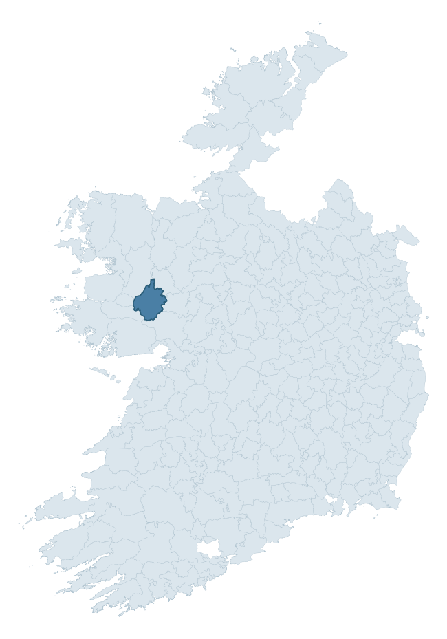
Where this barony sits in the Republic of Ireland
Geology and preservation
Bedrock geology shapes the landscape long before any settlement begins — controlling soil drainage, agricultural potential, the survival of upstanding monuments, and the preservation of buried archaeology. The figures below come from the Geological Survey Ireland 1:100,000 bedrock map.
The bedrock underlying Kilmaine is predominantly calcarenites (32% of the barony by area), laid down during the Carboniferous period (99% by area, around 359 to 299 million years ago). A substantial secondary geology of limestone (30%) and clean calcarenites (25%) adds further variety to the underlying landscape. The single largest mapped unit is the Cong Canal Formation (32% of the barony's bedrock). With 8 distinct rock types mapped, the barony sits in the top third of ROI baronies for geological diversity (81st percentile) — typically a sign of complex tectonic history or coastal mosaics of differing rock units.
Rock type composition
Largest mapped unit: Cong Canal Formation (32% of the barony)
Placename evidence
Logainm records 90 heritage-diagnostic placenames for Kilmaine, drawn from townland and civil-parish names across the barony. The dominant stratum is pre-Christian and Early Medieval defensive — ráth-, lios-, dún-, and caiseal-prefixed names that mark Iron Age and early historic settlement. The leading diagnostic roots are cill- (31 — church), cathair- (18 — stone fort), and ráth- (15 — earthen ringfort). This is well above the ROI average of 30.7 heritage placenames per barony — around 2.9× the typical figure. The presence of multiple heritage strata side by side indicates layered occupation of the landscape across successive prehistoric and historic periods. Logainm records 412 placenames for Kilmaine (predominantly townland names). Of these, 90 (22%) carry one of the diagnostic Gaelic roots tracked above; the remainder draw on more generic landscape vocabulary that does not encode a heritage period.
Pre-Christian / Early Medieval Defensive
| Root | Count | Meaning |
|---|---|---|
| cathair- | 18 | stone fort |
| ráth- | 15 | earthen ringfort |
| lios- | 9 | ringfort or enclosure |
| caiseal- | 6 | stone ringfort |
| dún- | 3 | hilltop or promontory fort |
Early Christian Ecclesiastical
| Root | Count | Meaning |
|---|---|---|
| cill- | 31 | church (early) |
| tobar- | 3 | holy well |
| cillín- | 2 | unconsecrated burial ground |
Burial, Ritual, and Norse-Contact
| Root | Count | Meaning |
|---|---|---|
| carn- | 2 | cairn |
| leacht- | 1 | grave monument |
Other baronies in Mayo
About this profile
Click any section below to expand.
What is a barony?
A barony is a historic administrative unit in Ireland, broadly equivalent to an English hundred. The 280 baronies used here are from the OSi 2019 National Statutory Boundaries (generalised 20m), covering the 26 counties of the Republic of Ireland. Baronies derive from the Norman period, were formalised in the 17th century, and have not been redrawn for statistical purposes. They vary enormously in area, from compact urban baronies in Dublin to vast upland baronies in Connacht, and should not be compared by raw site count without accounting for area differences.
What counts as a site?
This profile combines three distinct heritage registers, each with its own definition of what constitutes a recordable site:
- Archaeological sites (NMS). The National Monuments Service Sites and Monuments Record (SMR) catalogues every known archaeological monument or site of archaeological interest in the Republic, from prehistoric burial mounds and ringforts to medieval churches and post-medieval defensive works. Inclusion does not require legal protection — only that the site has been identified, surveyed, and assessed as having archaeological value. A separate subset of these sites lies within a recorded protection zone, which gives them statutory protection under the National Monuments Acts.
- Listed buildings (NIAH). The National Inventory of Architectural Heritage records buildings of architectural, historical, archaeological, artistic, cultural, scientific, social, or technical interest. Each surveyed structure is appraised on a five-tier scale: International, National, Regional, Local, and Record-Only. The NIAH appraisal is informational rather than strictly statutory, but it underpins local-authority Record of Protected Structures (RPS) listings.
- Heritage placenames (Logainm). Logainm is the authoritative database of Irish placenames maintained by the Placenames Branch. This profile applies a heritage-diagnostic classifier to the Irish-language form of each townland name, flagging roots that signal defensive sites (ráth-, lios-, dún-, caiseal-, cathair-), ecclesiastical foundations (cill-, teampall-, domhnach-, mainistir-), prehistoric burial-ritual features (tuaim-, carn-, leaba-), or Norse-contact settlement (gall-). Townlands without one of these diagnostic roots are not flagged here — they may still carry historical significance, but that significance is not encoded in the name itself.
Editorial principles
The narrative sections of this profile follow several explicit principles:
- Evidential. Every claim about this barony’s heritage character is anchored in the underlying register data. Where a site count, a placename count, or a percentile rank is cited, it is computed from the source datasets at export time, not estimated.
- Comparative. Counts and metrics are reported alongside their percentile rank against the other 279 ROI baronies. A barony with 50 ringforts in absolute terms could be unusually high or unusually low depending on its size and regional context; percentile ranking removes that ambiguity.
- Transparent on limits. Where a register has known coverage gaps, survey biases, or data-quality issues that affect this barony’s figures, the profile flags them rather than presenting the numbers as definitive.
- No interpretation beyond what the data supports. The narrative does not speculate about historical events, social dynamics, or cultural meaning beyond what the recorded heritage and placename evidence directly attests.
Data caveats and limits
- NMS Sites and Monuments Record is the product of survey campaigns conducted at different intensities across different counties and decades. Some baronies have been surveyed more thoroughly than others, and absolute counts should be read in that light. Sites destroyed by development before survey are typically not represented; sites in heavily forested or upland terrain are sometimes under-recorded.
- NIAH coverage is broadly complete for the Republic of Ireland but the survey was conducted on a rolling county-by-county basis, and the most recent appraisal date varies. Buildings demolished or substantially altered after their original survey may still appear in the register; conversely, recent buildings of merit may not yet have been appraised.
- Logainm classification applies a deliberately conservative pattern-matching approach to the Irish-language townland forms. The classifier prioritises true positives over recall: a townland may carry a heritage signal that the classifier doesn’t recognise, particularly where the diagnostic root has been heavily anglicised or where the townland name draws on a less common term. The 60,000+ townland records and ~9,800 classified placenames give a substantial signal at barony scale, but individual townland names should be checked against Logainm directly for definitive interpretation.
- Period attribution. The chronological distribution reflects only those NMS sites that carry a recognised period attribution in the source data. Sites listed as “Unknown” period are excluded from the dated subset.
- Boundary changes. Some baronies have undergone minor boundary adjustments since their 19th-century definition; the OSi 2019 generalised boundaries used here are the current statutory definition and may differ slightly from historical maps in border areas.
- Bedrock geology is mapped at 1:100,000 scale, which means local variation within a barony — small pockets of different rock type, mineral veins, alluvium overlying bedrock — is generalised. The dominant-system and rocktype figures are area-weighted, so a barony reading “70% Carboniferous limestone” may still contain small but archaeologically important pockets of older or younger rock. Around 3% of GSI polygons do not match the lexicon and contribute no rocktype or system attribution.
Data sources
- National Monuments Service — Sites and Monuments Record (SMR) https://data.gov.ie/dataset/national-monuments-service-archaeological-survey-of-ireland
- National Inventory of Architectural Heritage (NIAH) https://data.gov.ie/dataset/national-inventory-of-architectural-heritage-niah-national-dataset
- Logainm — Placenames Database of Ireland https://www.logainm.ie/
- Ordnance Survey Ireland — National Statutory Barony Boundaries 2019 https://data-osi.opendata.arcgis.com/
- EURODEM — European Digital Elevation Model https://www.mapsforeurope.org/datasets/euro-dem
- ESA WorldCover https://esa-worldcover.org/en
- Geological Survey Ireland — 1:100,000 Bedrock Geology https://www.gsi.ie/en-ie/data-and-maps/Pages/Bedrock.aspx
Explore more: Search any of the 280 ROI baronies, browse by historical province, or read the methodology and data sources for the full Republic of Ireland Heritage Tool.