
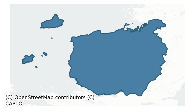
Murrisk is a barony of County Mayo, in the historical province of Connacht (Irish: Muraisc), covering 544 km² of land. The barony records 689 NMS archaeological sites and 303 NIAH listed buildings, placing it at around the 21st percentile among 280 ROI baronies for sites per km². This means it is in the bottom third of all baronies for sites per km². Dated archaeological evidence runs from the Neolithic through to the Modern, spanning 8 of 9 archaeological periods, placing the barony in the 74th percentile among 280 ROI baronies for chronological depth. This means it is in the top third of all baronies for chronological depth. The largest dated subset of recorded sites dates to the Iron Age. Logainm flags 37 placenames in the barony as carrying a recognised heritage root; the largest share — around 49% — are names associated with pre-christian defensive.
Heritage at a glance
Percentile rankings throughout this profile compare each barony only against the other 279 Republic of Ireland baronies.
The recorded heritage of Murrisk
The National Monuments Service Sites and Monuments Record (SMR) is the statutory inventory of archaeological sites for the Republic of Ireland, maintained by the Department of Tourism, Culture, Arts, Gaeltacht, Sport and Media. Sites recorded here include earthworks, ringforts, megalithic tombs, ecclesiastical remains, and post-medieval features; not every record is legally protected, but each is registered as a monument of archaeological interest.
The National Monuments Service records 689 archaeological sites in Murrisk, putting it at the 21st percentile among 280 ROI baronies for sites per km². This means it is in the bottom third of all baronies for sites per km². Protection coverage is near-universal — 671 sites (97%) fall within a recorded monument protection zone, indicating an extensively surveyed landscape. The record is dominated by defensive sites — ringforts, enclosures, hillforts, and stone forts (212 sites, 31% of the total), with agricultural and prehistoric industrial sites forming a substantial secondary presence (101 sites, 15%). The most diagnostically specific type is Fulacht fia (65 records, 9% of the barony's NMS total) — compared to an ROI average of 6% across all baronies where this type occurs. Fulacht fia is a horseshoe-shaped Bronze Age burnt mound built around a sunken trough beside a water source, traditionally interpreted as a cooking site. The broader 'Enclosure' classification — which catches unclassified ringforts and field enclosures — accounts for a further 128 records (19%) and reflects the difficulty of sub-classifying degraded earthworks from surface evidence alone. Other significant types include Hut site (50) — a low stone or earthen foundation enclosing a small circular or oval area, generally interpreted as a former dwelling, of any date from prehistory to the medieval period. Across the barony's 544 km², this gives a recorded density of 1.27 sites per km².
Most common monument types
Hover or tap a monument type to see its definition.
| Type | Count |
|---|---|
| Enclosure a banked or ditched feature of uncertain type, used as a catch-all where the original function cannot be determined from surface evidence | 128 |
| Fulacht fia a horseshoe-shaped Bronze Age burnt mound built around a sunken trough beside a water source, traditionally interpreted as a cooking site | 65 |
| Hut site a low stone or earthen foundation enclosing a small circular or oval area, generally interpreted as a former dwelling, of any date from prehistory to the medieval period | 50 |
| Ringfort – cashel the stone-walled equivalent of the rath, found mainly in upland or western areas, broadly dated 500–1000 AD | 33 |
| House – indeterminate date a habitation building whose date cannot be determined from available evidence | 30 |
| Field boundary a continuous bank, wall or drain marking the limit of a field, of any date from the Neolithic onwards | 28 |
| Standing stone a deliberately set upright stone, used variously as a Bronze/Iron Age burial marker, route marker or commemorative monument | 28 |
Chronological distribution
The dated archaeological record for Murrisk spans from the Neolithic through to the Modern, with activity attested across 8 of 9 archaeological periods. This is the 74th percentile across ROI baronies for chronological depth — an above-average span. Every period from earliest to latest is represented in the record — an unbroken sequence of dated activity across the full chronological span. Activity concentrates most heavily in the Iron Age (164 sites, 38% of dated material), with the Early Medieval forming a secondary peak (114 sites, 26%). A further 257 recorded sites (37% of the overall NMS register for the barony) carry no period attribution — appearing as 'Unknown' in the bar chart below. This typically reflects either records that pre-date the standardised period vocabulary or sites awaiting specialist dating review, rather than a genuine absence of chronological evidence.
Sample of recorded monuments
Show 25 sample monuments (of 689 total)
A representative sample of 25 recorded monuments drawn from the barony’s 689 total NMS entries. Sites within a recorded monument protection zone and rarer site types are prioritised so the list shows a meaningful cross-section rather than only the most common type. Each entry shows the official Sites and Monuments Record reference number and the description published by the National Monuments Service.
Kiln – lime
Located in the SW quadrant of a rectangular enclosure (MA084-001002-). This circular limekiln, now ruined, was built and used during the construction in 1804-6 of a signal tower (NIAH: Reg. No. 31308401), which is…
Located in the SW quadrant of a rectangular enclosure (MA084-001002-). This circular limekiln, now ruined, was built and used during the construction in 1804-6 of a signal tower (NIAH: Reg. No. 31308401), which is located in the centre of the enclosure (Gosling, Manning, Waddell 2007, 137-138).
Compiled by: Jane O'Shaughnessy
Date of upload: 13 July 2015
Clochan
Situated in the north-eastern quadrant of an enclosure (MA085-012001-). It stands 1.5m N of an altar (MA085-012003-). Described variously by Westropp (1911a, 12, 17, pl. III) as a ‘cell’, a ‘hut’, and a ‘clochán’ and…
Situated in the north-eastern quadrant of an enclosure (MA085-012001-). It stands 1.5m N of an altar (MA085-012003-). Described variously by Westropp (1911a, 12, 17, pl. III) as a ‘cell’, a ‘hut’, and a ‘clochán’ and named by him (1911a, 27) as ‘the Labbabreed (Leaba Brighdhe), or St. Bridget’s Bed’. It comprises a small drystone structure, roughly rectangular in plan (NE–SW 2.1m, NW– SE 1.65m externally), with a corbelled stone roof and an entrance on the south-eastern side. The walls are crudely built of angular limestone blocks of varying sizes, gapped in many places. From the roughly rectangular basal course (Wth 0.7m max.), the corbelled sidewalls assume a circular form as they rise towards the roof. The latter con- sists of three flat slabs. The entrance (Wth 0.4m) is crudely defined, having no formal lintel or jambs. The interior is roughly oval in plan (NW–SE 1m, NE–SW 0.8m, H 0.85m max.). It is slightly sunken but dry and is littered with small rounded stones. Westropp (1911, 27) considered this structure ‘as evidently rebuilt, but not so recently as the cashel’ (MA085-012001-) and speculated as to ‘how far the foundation … is old’ (1911, 12). He also records details of a cure effected in the ‘labba’ (1911, 26). No definite surface trace was noted of the ‘lines of set blocks, probably the original foundations, 3 feet south of the present face [of the cell]’ noted and illustrated by him (1911, 27, pl. III). See also Cullen and Gill (1992d, 7–9).
The above desc…
Religious house – Cistercian monks
Located in the E half of a graveyard (MA085-013002-), roughly in the middle of the S side of the Clare Island, 250m N of the rocky shoreline.
Clare Island Abbey is a National Monument (No. 97) in state guardianship.…
Located in the E half of a graveyard (MA085-013002-), roughly in the middle of the S side of the Clare Island, 250m N of the rocky shoreline.
Clare Island Abbey is a National Monument (No. 97) in state guardianship. A full survey and historical assessment of the abbey and its extraordinary wall paintings can be found in:
Conleth Manning, Paul Gosling and John Waddell (eds.) 2005 New Survey of Clare Island. Volume 4: The Abbey.
And a detailed summary account (No. 148, p. 171-176) is included in the ‘catalogue of monuments’ in: Paul Gosling, Conleth Manning and John Waddell (eds.) New Survey of Clare Island Volume 5: The Archaeology.
The summary description below is based on both these publications.
Indicated on the 1840 and 1920 OS 6-inch maps as ‘Abbey’, and habitually referred to as such, this religious foundation did not in fact have the full status of an abbey, but was a ‘cell’ of the Cistercian abbey of Knockmoy (GA058-004001-), Co. Galway (Manning, in Manning et al. 2005, 7). Written documentation from this period of Clare Island’s history is scant, and the nature of the small religious community that existed here is uncertain. The abbey is strongly associated with the Uí Máille (O’Malley) family, Gaelic chiefs of the island, who played the role of patrons over several centuries, and used it as a burial place.
It consists of a stone-built nave and chancel church, with a small, narrow domestic building attached to the N side of the chancel. It was built in…
Graveslab
The Archaeological Survey of Ireland (ASI) is in the process of providing information on all monuments on The Historic Environment Viewer (HEV). Currently the information for this record has not been uploaded. To…
The Archaeological Survey of Ireland (ASI) is in the process of providing information on all monuments on The Historic Environment Viewer (HEV). Currently the information for this record has not been uploaded. To access available information for research purposes please make an appointment in advance with the Archive Unit (open Fridays 10.00 am – 5.00 pm), Department of Culture, Heritage and the Gaeltacht, The Custom House, Dublin 1 D01W6XO or email nmarchive@chg.gov.ie.
Castle – tower house
Located on a short, low promontory on the SE side of Clare Island, overlooking the modern harbour, which lies immediately to N. Before the piers were built, the castle would have dominated this sheltered anchorage, with…
Located on a short, low promontory on the SE side of Clare Island, overlooking the modern harbour, which lies immediately to N. Before the piers were built, the castle would have dominated this sheltered anchorage, with its gently shelving sandy beach, which must always have been the safest landing place on the island.
This tower house is a National Monument (no. 198) in state ownership. As with the island itself, there are few references to the castle before AD 1800. The earliest record of its existence occurs in a list of O’Malley castles dating from 1574 (Knox 1908, 348). The next mention of it is in the Ordnance Survey Name Books (c. 1838): ‘the castle remained in good repair until about the year 1750 when it was allowed to decay and remained in ruin until about [the] year 1826, when it was again roofed and repaired (by Sir S. O’Mally), the owner of the island, and is now occupied by police’ (as quoted in Ó Muraíle 1999, n. 31, 113). This explains its labelling on the first edition of the Ordnance Survey maps as ‘Grania Wael’s Castle & Police Barracks’ (Ordnance Survey 1839).
Externally the tower house has a rather squat appearance, with bartizans on the NE and SW corners at first storey level. In plan it forms an irregular rectangle measuring 9.95-10.4m × 7.95-8.3m externally at ground level. The lower parts of the walls have an outward slope or batter from about first-floor level. Virtually all the opes were altered externally in the nineteenth century or earlier…
Inscribed stone
The Archaeological Survey of Ireland (ASI) is in the process of providing information on all monuments on The Historic Environment Viewer (HEV). Currently the information for this record has not been uploaded. To…
The Archaeological Survey of Ireland (ASI) is in the process of providing information on all monuments on The Historic Environment Viewer (HEV). Currently the information for this record has not been uploaded. To access available information for research purposes please make an appointment in advance with the Archive Unit (open Fridays 10.00 am – 5.00 pm), Department of Culture, Heritage and the Gaeltacht, The Custom House, Dublin 1 D01W6XO or email nmarchive@chg.gov.ie.
Burnt mound
The Archaeological Survey of Ireland (ASI) is in the process of providing information on all monuments on The Historic Environment Viewer (HEV). Currently the information for this record has not been uploaded. To…
The Archaeological Survey of Ireland (ASI) is in the process of providing information on all monuments on The Historic Environment Viewer (HEV). Currently the information for this record has not been uploaded. To access available information for research purposes please make an appointment in advance with the Archive Unit (open Fridays 10.00 am – 5.00 pm), Department of Culture, Heritage and the Gaeltacht, The Custom House, Dublin 1 D01W6XO or email nmarchive@chg.gov.ie.
Standing stone – pair
The Archaeological Survey of Ireland (ASI) is in the process of providing information on all monuments on The Historic Environment Viewer (HEV). Currently the information for this record has not been uploaded. To…
The Archaeological Survey of Ireland (ASI) is in the process of providing information on all monuments on The Historic Environment Viewer (HEV). Currently the information for this record has not been uploaded. To access available information for research purposes please make an appointment in advance with the Archive Unit (open Fridays 10.00 am – 5.00 pm), Department of Culture, Heritage and the Gaeltacht, The Custom House, Dublin 1 D01W6XO or email nmarchive@chg.gov.ie.
Designed landscape – belvedere
In pasture, situated on elevated ground. Indicated as ‘Turret’ on the 1838 and 1920 OS 6-inch maps, this is an early 19th-century folly or belvedere, designed as a location from which to enjoy views of the surrounding…
In pasture, situated on elevated ground. Indicated as ‘Turret’ on the 1838 and 1920 OS 6-inch maps, this is an early 19th-century folly or belvedere, designed as a location from which to enjoy views of the surrounding landscape. It is a squat structure of mortared stone, rectangular in plan (max dim. 6-7m). There are opposing openings in the walls, with flat heads of cutstone limestone voussoirs. The roof is missing, but the decorative battlemented parapet is intact. It appears to have been part of the landscaped grounds of a 19th-century dwelling, named Cherry Cottage on the OS 6-inch maps, which is located c. 100m to N. (see also NIAH, https://www.buildingsofireland.ie/ reg. no. 31211003)
Compiled by: Jane O'Shaughnessy
Date of upload: 19 May 2020
Religious house – Augustinian friars
Named ‘Murrisk Abbey’ on the OS 6-inch map, this 15th-century Augustinian friary stands close to the southern shore of Clew Bay, on a S-facing slope at the foot of Croagh Patrick. It is a National Monument in State…
Named ‘Murrisk Abbey’ on the OS 6-inch map, this 15th-century Augustinian friary stands close to the southern shore of Clew Bay, on a S-facing slope at the foot of Croagh Patrick. It is a National Monument in State ownership (no. 196).
The friary was established in 1456, when Hugh O’Malley, a friar from the Observant Augustinian friary (SL) in Banada, Co. Sligo, received papal permission to build a friary at ‘the place called Leithearmursge [Murrisk] …for the purpose of building a house of the said order with church, cloister, bell-tower, bell, refectory, dorter [dormitory] and other necessary offices…’ (Cal. Papal Letters).
The land was granted by ‘Thady Omaylly [O’Malley]…chief of his sept, for the welfare of his soul and the souls of his progenitors..’ (Cal. Papal Letters). This is likely to have been Tadhg mac Diarmaid Ó Máille (d. 1467), who ruled Umaill at the time, and to whom Hugh O’Malley was probably related (Martin 1956, 378). The O’Malleys (Uí Mháille), a seafaring family, were Lords of Umaill, controlling most of what is now the barony of Murrisk. A 1656 document states that the founder of the friary was Lady Maeve O’Connor, wife of Diarmuid Bacach O’Malley, the latter probably an uncle of Thady O’Malley (McDermott 2008, 25). As often with the mendicant orders, it is likely that several benefactors were involved in the foundation and in funding the various phases of building. In the papal permission, the reason given for the foundation of the friary is that…
Cursing stone
The Archaeological Survey of Ireland (ASI) is in the process of providing information on all monuments on The Historic Environment Viewer (HEV). Currently the information for this record has not been uploaded. To…
The Archaeological Survey of Ireland (ASI) is in the process of providing information on all monuments on The Historic Environment Viewer (HEV). Currently the information for this record has not been uploaded. To access available information for research purposes please make an appointment in advance with the Archive Unit (open Fridays 10.00 am – 5.00 pm), Department of Culture, Heritage and the Gaeltacht, The Custom House, Dublin 1 D01W6XO or email nmarchive@chg.gov.ie.
Barrow – unclassified
The Archaeological Survey of Ireland (ASI) is in the process of providing information on all monuments on The Historic Environment Viewer (HEV). Currently the information for this record has not been uploaded. To…
The Archaeological Survey of Ireland (ASI) is in the process of providing information on all monuments on The Historic Environment Viewer (HEV). Currently the information for this record has not been uploaded. To access available information for research purposes please make an appointment in advance with the Archive Unit (open Fridays 10.00 am – 5.00 pm), Department of Culture, Heritage and the Gaeltacht, The Custom House, Dublin 1 D01W6XO or email nmarchive@chg.gov.ie.
House – 16th/17th century
The Archaeological Survey of Ireland (ASI) is in the process of providing information on all monuments on The Historic Environment Viewer (HEV). Currently the information for this record has not been uploaded. To…
The Archaeological Survey of Ireland (ASI) is in the process of providing information on all monuments on The Historic Environment Viewer (HEV). Currently the information for this record has not been uploaded. To access available information for research purposes please make an appointment in advance with the Archive Unit (open Fridays 10.00 am – 5.00 pm), Department of Culture, Heritage and the Gaeltacht, The Custom House, Dublin 1 D01W6XO or email nmarchive@chg.gov.ie.
Architectural fragment
The Archaeological Survey of Ireland (ASI) is in the process of providing information on all monuments on The Historic Environment Viewer (HEV). Currently the information for this record has not been uploaded. To…
The Archaeological Survey of Ireland (ASI) is in the process of providing information on all monuments on The Historic Environment Viewer (HEV). Currently the information for this record has not been uploaded. To access available information for research purposes please make an appointment in advance with the Archive Unit (open Fridays 10.00 am – 5.00 pm), Department of Culture, Heritage and the Gaeltacht, The Custom House, Dublin 1 D01W6XO or email nmarchive@chg.gov.ie.
Monumental structure
On the SW-facing slope of a high ridge on the S edge of Westport town.
This monumental structure is indicated as ‘Monument’ on the 1838 OS 6-inch map and is recorded as follows in the OS Name Books for Co. Mayo (vol.…
On the SW-facing slope of a high ridge on the S edge of Westport town.
This monumental structure is indicated as ‘Monument’ on the 1838 OS 6-inch map and is recorded as follows in the OS Name Books for Co. Mayo (vol. 6, 121): ‘A remarkable hill called Monument Hill is S of the town of Westport. It has its name from a monument, or little heap of stones collected where a person was killed -at this place is a flag with an inscription.' It is not shown on later maps editions. There is no visible trace at ground level.
Compiled by: Jane O’Shaughnessy
Date of upload: 7 October 2020
Ritual site – holy/saint's stone
The Archaeological Survey of Ireland (ASI) is in the process of providing information on all monuments on The Historic Environment Viewer (HEV). Currently the information for this record has not been uploaded. To…
The Archaeological Survey of Ireland (ASI) is in the process of providing information on all monuments on The Historic Environment Viewer (HEV). Currently the information for this record has not been uploaded. To access available information for research purposes please make an appointment in advance with the Archive Unit (open Fridays 10.00 am – 5.00 pm), Department of Culture, Heritage and the Gaeltacht, The Custom House, Dublin 1 D01W6XO or email nmarchive@chg.gov.ie.
Tomb – unclassified
The Archaeological Survey of Ireland (ASI) is in the process of providing information on all monuments on The Historic Environment Viewer (HEV). Currently the information for this record has not been uploaded. To…
The Archaeological Survey of Ireland (ASI) is in the process of providing information on all monuments on The Historic Environment Viewer (HEV). Currently the information for this record has not been uploaded. To access available information for research purposes please make an appointment in advance with the Archive Unit (open Fridays 10.00 am – 5.00 pm), Department of Culture, Heritage and the Gaeltacht, The Custom House, Dublin 1 D01W6XO or email nmarchive@chg.gov.ie.
Cist
The Archaeological Survey of Ireland (ASI) is in the process of providing information on all monuments on The Historic Environment Viewer (HEV). Currently the information for this record has not been uploaded. To…
The Archaeological Survey of Ireland (ASI) is in the process of providing information on all monuments on The Historic Environment Viewer (HEV). Currently the information for this record has not been uploaded. To access available information for research purposes please make an appointment in advance with the Archive Unit (open Fridays 10.00 am – 5.00 pm), Department of Culture, Heritage and the Gaeltacht, The Custom House, Dublin 1 D01W6XO or email nmarchive@chg.gov.ie.
Bridge
The Archaeological Survey of Ireland (ASI) is in the process of providing information on all monuments on The Historic Environment Viewer (HEV). Currently the information for this record has not been uploaded. To…
The Archaeological Survey of Ireland (ASI) is in the process of providing information on all monuments on The Historic Environment Viewer (HEV). Currently the information for this record has not been uploaded. To access available information for research purposes please make an appointment in advance with the Archive Unit (open Fridays 10.00 am – 5.00 pm), Department of Culture, Heritage and the Gaeltacht, The Custom House, Dublin 1 D01W6XO or email nmarchive@chg.gov.ie.
Ogham stone
Located in marram-grass covered dunes 120m E of the N end of Sruhir Strand. Burials (MA095-032001-) and a midden (MA095-032002-)are located 100m to W.
Macalister (1945, 11, no.8) records a 'limestone slab', 1.32 (above…
Located in marram-grass covered dunes 120m E of the N end of Sruhir Strand. Burials (MA095-032001-) and a midden (MA095-032002-)are located 100m to W.
Macalister (1945, 11, no.8) records a 'limestone slab', 1.32 (above ground) x 0.61 x 0.15m, bearing 'a cross pattée in a circle, pocked' on one face and 'a badly worn and weathered' ogham inscription on the 'sinister edge' (more than half spalled away). He very tentatively read …OVI MAQI and was unable to verify Rhys's (1898, 232) suggestion of CORBAGNI. According to Kelly (1897, 185), who first noted the inscription, the stone was found lying flat but was re-erected where it was found, with more than half buried in the sand. His sketch with measurements indicates that at time the re-erected stone stood to a height of c. 1.67m above ground, and ogham inscription was visible the lower portion of the stone, now deeply sunken in the ground.
An irregular-shaped, angular block of stone (H c. 1m; Wth 0.65m E-W; T 0.23m N-S) set upright in the ground, tilting to W. It bears a cross-in-circle (diam. 0.36m) on the broad S face and an ogham inscription on an angle of the narrow E face. The cross is created by inscribing arcs of a circle, the broadly splayed terminals of the arms and shaft merging with the curve of the enclosing circle. The base of the circle is now only a few centimeters above current ground level. The carving is partly obscured by blotches of lichen. Several scores of the ogham inscription are visible, cutting…
Mass-rock
Situated on the summit of a prominent E– W running ridge that decreases in height a series of steps from W to E. While southern flanks of the ridge are of modest proportions, its northern sides are almost vertical in…
Situated on the summit of a prominent E– W running ridge that decreases in height a series of steps from W to E. While southern flanks of the ridge are of modest proportions, its northern sides are almost vertical in places. The site affords wide views along the eastern coastlands of the island, including clear views of a number of stretches of the Lighthouse Road near Maum and close to the Lighthouse itself. According to Michael Joe O’Malley (RIP) an outcrop of rock on the ridge summit is known as ‘the mass rock’ (Ciara Cullen, pers. comm.). When viewed from S, this outcrop has a table-like appearance, but when viewed from N it blends into the ridge slope that drops away steeply. It is flanked on S by a small but noticeably flat, grassy area. The outcrop itself measures c. 6m on its long axis, which runs E–W and is c. 1.3m wide and c. 1.1m high. Although no traces of any carvings are present, the surface of the outcrop is pitted with erosion lines, some of which do meet at right angles to produce natural cross-like patterns.
The above description is derived from: New Survey of Clare Island. Volume 5: Archaeology. Edited by Paul Gosling, Conleth Manning and John Waddell. (Royal Irish Academy, Dublin. 2007). In certain instances the entries have been revised and updated.
Date of upload: 4 December 2018
Megalithic tomb – unclassified
The Archaeological Survey of Ireland (ASI) is in the process of providing information on all monuments on The Historic Environment Viewer (HEV). Currently the information for this record has not been uploaded. To…
The Archaeological Survey of Ireland (ASI) is in the process of providing information on all monuments on The Historic Environment Viewer (HEV). Currently the information for this record has not been uploaded. To access available information for research purposes please make an appointment in advance with the Archive Unit (open Fridays 10.00 am – 5.00 pm), Department of Culture, Heritage and the Gaeltacht, The Custom House, Dublin 1 D01W6XO or email nmarchive@chg.gov.ie.
Slab-lined burial
Located in the eroding, NW-facing land-edge, bordering the mouth of the Bunowen River, c. 500m N of Louisberg village. The land-edge consists of a low cliff (H c. 3m) which drops from a pasture field to a sand and…
Located in the eroding, NW-facing land-edge, bordering the mouth of the Bunowen River, c. 500m N of Louisberg village. The land-edge consists of a low cliff (H c. 3m) which drops from a pasture field to a sand and cobble beach.
The slab-lined burial is located at a depth of c. 1.2m below the field surface/top of the cliff, and at a height of c. 2m above the beach. The E end of the grave remains in situ within the cliff face but the W end was destroyed by erosion during the winter of 2014/15.
A concave area (c. 1m E–W; H 1m) in the cliff face immediately to W of the intact portion of the grave indicates where a pocket of soil containing part of the grave has collapsed/eroded out. A lintelled opening in the cliff face reveals the surviving portion of the grave which extends E into the body of the cliff. It consists of a roughly rectangular, stone-lined cavity (L 0.8m E–W; Wth 0.18m N–S at E, c. 0.46m N–S at W; max H. 0.33m). The E end is faced with a single upright stone. The N and S sides are partly faced with upright stones, one stone towards the E end of the N side, and two close-set uprights mid-way along the S side. The roof consists of two thin, flat overlapping slabs. Loose, grey-brown sandy soil (D c. 0.15) filled the grave to a level 0.2m below the capstones and overlay a floor paved with two slabs.
A rescue excavation (16E0470) funded by the National Monuments Service was carried out on 29th August-5th September 2016 (Crumlish 2018). Due to concerns about the…
Water mill – unclassified
The Archaeological Survey of Ireland (ASI) is in the process of providing information on all monuments on The Historic Environment Viewer (HEV). Currently the information for this record has not been uploaded. To…
The Archaeological Survey of Ireland (ASI) is in the process of providing information on all monuments on The Historic Environment Viewer (HEV). Currently the information for this record has not been uploaded. To access available information for research purposes please make an appointment in advance with the Archive Unit (open Fridays 10.00 am – 5.00 pm), Department of Culture, Heritage and the Gaeltacht, The Custom House, Dublin 1 D01W6XO or email nmarchive@chg.gov.ie.
Enclosure
Situated on SSW-facing slope overlooking the narrow but flat-bottomed valley that opens out to SE onto the boulder beach at Portly (‘Portlea’ on Ordnance Survey maps). Lassau Wood mantles the opposite slopes of the…
Situated on SSW-facing slope overlooking the narrow but flat-bottomed valley that opens out to SE onto the boulder beach at Portly (‘Portlea’ on Ordnance Survey maps). Lassau Wood mantles the opposite slopes of the valley. Plentiful traces of cultivation ridges are visible in the vicinity and an old trackway, running NW from Portly passes within 14m of the monument on its upslope (northern) side.
The enclosure consists of a small, roughly circular enclosure (NNW–SSE 11.6m, ENE–WSW 11.3m), in poor condition, which sits on a slight break of slope. It is defined by a broad but poorly defined earth and stone bank that is up to 0.9m high externally at S. This bank has been heavily degraded by later cultivation ridges. From E to SSE much of the bank has been removed, and a number of boulders, a well-defined cultivation ridge and a meandering plot boundary partially occupy its line. No trace of a fosse is visible, even on the upslope (northern) side, nor is there any indication of an entrance, although there are modern gaps in the bank at W, NNW and NE. The interior is mantled in bracken but also displays traces of a number of cultivation ridges running on a NNE–SSW axis. Although tentatively classified here as an enclosure, this monument could also, given its diameter, be read as the remains of a large house site.
The above description is derived from: New Survey of Clare Island. Volume 5: Archaeology. Edited by Paul Gosling, Conleth Manning and John Waddell. (Royal Irish…
Listed buildings
The National Inventory of Architectural Heritage (NIAH) is a state survey appraising buildings of architectural, historical, archaeological, artistic, cultural, scientific, social, or technical interest. Each surveyed structure receives a rating from International (the highest, for buildings of European importance) through National, Regional, Local, and Record-Only.
The NIAH records 303 listed buildings in Murrisk, the 88th percentile across ROI baronies for listed-building density. The highest-graded structures include 2 of National significance. The Republic holds 937 National-graded buildings in total, so this barony accounts for around 0% of the national total. Construction dates concentrate most heavily in the Late Georgian (1800-1830) period. The most-recorded building type is house (126 examples, 42% of the listed stock).
Terrain and environment
Mean elevation across the barony is 153m — the 87th percentile among 280 ROI baronies for elevation. This means it is in the top fifth of all baronies for elevation. This is a relatively elevated landscape by ROI standards. Elevation matters for heritage because higher-altitude baronies typically favour defensive monuments — ringforts and hilltop forts placed on prominent ground — while lowland baronies are more likely to carry the dense settlement and church networks of intensive agricultural landscapes. The barony reaches 811m at its highest point — a vertical span of more than 657m within its boundary, indicating significant topographic diversity. Mean slope is 9.6° — the 96th percentile among 280 ROI baronies for slope. This means it is in the top tenth of all baronies for slope. This is consistently steep terrain by ROI standards, the kind of landscape that tends to preserve upstanding archaeological features well. Slope is a key control on both land use and archaeological preservation: steep ground resists ploughing and tends to preserve earthworks intact, while gentle slopes favour intensive cultivation that damages or destroys surface archaeology over time. Localised maximum slopes reach 32°, typical of stream-cut valleys, escarpments, or coastal bluffs within the wider landscape. The Topographic Wetness Index averages 9.2, the 5th percentile among 280 ROI baronies for wetness. This means it is in the bottom tenth of all baronies for wetness. This is well-drained ground by ROI standards — typical of upland or steeply-sloping country that sheds water rapidly. Drainage matters for heritage because poorly-drained ground preserves organic archaeology (wooden trackways, leather, textiles, and on rare occasions human remains) far better than free-draining soil; well-drained ground favours arable use but destroys organic material rapidly. The land cover is dominated by improved grassland (88%) and woodland (9%). In overall character, this is an upland landscape of steep, elevated terrain, with land use dominated by improved grassland.
Terrain measurements
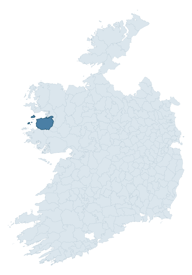
Where this barony sits in the Republic of Ireland
Geology and preservation
Bedrock geology shapes the landscape long before any settlement begins — controlling soil drainage, agricultural potential, the survival of upstanding monuments, and the preservation of buried archaeology. The figures below come from the Geological Survey Ireland 1:100,000 bedrock map.
The bedrock underlying Murrisk is predominantly mudrock, sandstone, tuff (18% of the barony by area), laid down during the Ordovician period (62% by area, around 485 to 444 million years ago). A substantial secondary geology of sandstone, conglomerate, ignimbrite (17%) and greywackes and shales (13%) adds further variety to the underlying landscape. With 18 distinct rock types mapped, the barony sits in the top third of ROI baronies for geological diversity (99th percentile) — typically a sign of complex tectonic history or coastal mosaics of differing rock units.
Rock type composition
Largest mapped unit: Sheeffry Formation (18% of the barony)
Placename evidence
Logainm records 37 heritage-diagnostic placenames for Murrisk, drawn from townland and civil-parish names across the barony. The dominant stratum is pre-Christian and Early Medieval defensive — ráth-, lios-, dún-, and caiseal-prefixed names that mark Iron Age and early historic settlement. The leading diagnostic roots are cill- (13 — church), ráth- (12 — earthen ringfort), and caiseal- (3 — stone ringfort). This is broadly in line with the ROI average of 30.7 heritage placenames per barony. The presence of multiple heritage strata side by side indicates layered occupation of the landscape across successive prehistoric and historic periods. Logainm records 247 placenames for Murrisk (predominantly townland names). Of these, 37 (15%) carry one of the diagnostic Gaelic roots tracked above; the remainder draw on more generic landscape vocabulary that does not encode a heritage period.
Pre-Christian / Early Medieval Defensive
| Root | Count | Meaning |
|---|---|---|
| ráth- | 12 | earthen ringfort |
| caiseal- | 3 | stone ringfort |
| lios- | 1 | ringfort or enclosure |
| dún- | 1 | hilltop or promontory fort |
| cathair- | 1 | stone fort |
Early Christian Ecclesiastical
| Root | Count | Meaning |
|---|---|---|
| cill- | 13 | church (early) |
| cillín- | 1 | unconsecrated burial ground |
Burial, Ritual, and Norse-Contact
| Root | Count | Meaning |
|---|---|---|
| dumha- | 3 | mound |
| leacht- | 2 | grave monument |
Other baronies in Mayo
About this profile
Click any section below to expand.
What is a barony?
A barony is a historic administrative unit in Ireland, broadly equivalent to an English hundred. The 280 baronies used here are from the OSi 2019 National Statutory Boundaries (generalised 20m), covering the 26 counties of the Republic of Ireland. Baronies derive from the Norman period, were formalised in the 17th century, and have not been redrawn for statistical purposes. They vary enormously in area, from compact urban baronies in Dublin to vast upland baronies in Connacht, and should not be compared by raw site count without accounting for area differences.
What counts as a site?
This profile combines three distinct heritage registers, each with its own definition of what constitutes a recordable site:
- Archaeological sites (NMS). The National Monuments Service Sites and Monuments Record (SMR) catalogues every known archaeological monument or site of archaeological interest in the Republic, from prehistoric burial mounds and ringforts to medieval churches and post-medieval defensive works. Inclusion does not require legal protection — only that the site has been identified, surveyed, and assessed as having archaeological value. A separate subset of these sites lies within a recorded protection zone, which gives them statutory protection under the National Monuments Acts.
- Listed buildings (NIAH). The National Inventory of Architectural Heritage records buildings of architectural, historical, archaeological, artistic, cultural, scientific, social, or technical interest. Each surveyed structure is appraised on a five-tier scale: International, National, Regional, Local, and Record-Only. The NIAH appraisal is informational rather than strictly statutory, but it underpins local-authority Record of Protected Structures (RPS) listings.
- Heritage placenames (Logainm). Logainm is the authoritative database of Irish placenames maintained by the Placenames Branch. This profile applies a heritage-diagnostic classifier to the Irish-language form of each townland name, flagging roots that signal defensive sites (ráth-, lios-, dún-, caiseal-, cathair-), ecclesiastical foundations (cill-, teampall-, domhnach-, mainistir-), prehistoric burial-ritual features (tuaim-, carn-, leaba-), or Norse-contact settlement (gall-). Townlands without one of these diagnostic roots are not flagged here — they may still carry historical significance, but that significance is not encoded in the name itself.
Editorial principles
The narrative sections of this profile follow several explicit principles:
- Evidential. Every claim about this barony’s heritage character is anchored in the underlying register data. Where a site count, a placename count, or a percentile rank is cited, it is computed from the source datasets at export time, not estimated.
- Comparative. Counts and metrics are reported alongside their percentile rank against the other 279 ROI baronies. A barony with 50 ringforts in absolute terms could be unusually high or unusually low depending on its size and regional context; percentile ranking removes that ambiguity.
- Transparent on limits. Where a register has known coverage gaps, survey biases, or data-quality issues that affect this barony’s figures, the profile flags them rather than presenting the numbers as definitive.
- No interpretation beyond what the data supports. The narrative does not speculate about historical events, social dynamics, or cultural meaning beyond what the recorded heritage and placename evidence directly attests.
Data caveats and limits
- NMS Sites and Monuments Record is the product of survey campaigns conducted at different intensities across different counties and decades. Some baronies have been surveyed more thoroughly than others, and absolute counts should be read in that light. Sites destroyed by development before survey are typically not represented; sites in heavily forested or upland terrain are sometimes under-recorded.
- NIAH coverage is broadly complete for the Republic of Ireland but the survey was conducted on a rolling county-by-county basis, and the most recent appraisal date varies. Buildings demolished or substantially altered after their original survey may still appear in the register; conversely, recent buildings of merit may not yet have been appraised.
- Logainm classification applies a deliberately conservative pattern-matching approach to the Irish-language townland forms. The classifier prioritises true positives over recall: a townland may carry a heritage signal that the classifier doesn’t recognise, particularly where the diagnostic root has been heavily anglicised or where the townland name draws on a less common term. The 60,000+ townland records and ~9,800 classified placenames give a substantial signal at barony scale, but individual townland names should be checked against Logainm directly for definitive interpretation.
- Period attribution. The chronological distribution reflects only those NMS sites that carry a recognised period attribution in the source data. Sites listed as “Unknown” period are excluded from the dated subset.
- Boundary changes. Some baronies have undergone minor boundary adjustments since their 19th-century definition; the OSi 2019 generalised boundaries used here are the current statutory definition and may differ slightly from historical maps in border areas.
- Bedrock geology is mapped at 1:100,000 scale, which means local variation within a barony — small pockets of different rock type, mineral veins, alluvium overlying bedrock — is generalised. The dominant-system and rocktype figures are area-weighted, so a barony reading “70% Carboniferous limestone” may still contain small but archaeologically important pockets of older or younger rock. Around 3% of GSI polygons do not match the lexicon and contribute no rocktype or system attribution.
Data sources
- National Monuments Service — Sites and Monuments Record (SMR) https://data.gov.ie/dataset/national-monuments-service-archaeological-survey-of-ireland
- National Inventory of Architectural Heritage (NIAH) https://data.gov.ie/dataset/national-inventory-of-architectural-heritage-niah-national-dataset
- Logainm — Placenames Database of Ireland https://www.logainm.ie/
- Ordnance Survey Ireland — National Statutory Barony Boundaries 2019 https://data-osi.opendata.arcgis.com/
- EURODEM — European Digital Elevation Model https://www.mapsforeurope.org/datasets/euro-dem
- ESA WorldCover https://esa-worldcover.org/en
- Geological Survey Ireland — 1:100,000 Bedrock Geology https://www.gsi.ie/en-ie/data-and-maps/Pages/Bedrock.aspx
Explore more: Search any of the 280 ROI baronies, browse by historical province, or read the methodology and data sources for the full Republic of Ireland Heritage Tool.