
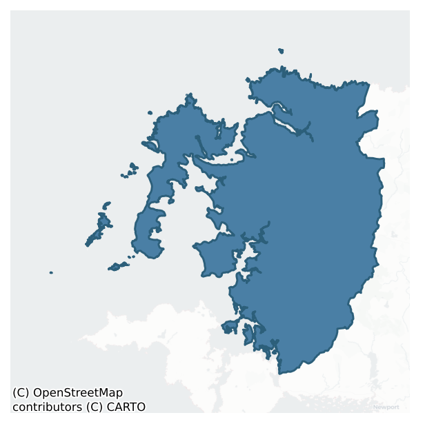
Erris is a barony of County Mayo, in the historical province of Connacht (Irish: Iorras), covering 950 km² of land. The barony records 566 NMS archaeological sites and 67 NIAH listed buildings, placing it at around the 3rd percentile among 280 ROI baronies for sites per km². This means it is in the bottom tenth of all baronies for sites per km². Dated archaeological evidence runs from the Neolithic through to the Modern, spanning 8 of 9 archaeological periods, placing the barony in the 80th percentile among 280 ROI baronies for chronological depth. This means it is in the top fifth of all baronies for chronological depth. The largest dated subset of recorded sites dates to the Early Medieval. Logainm flags 31 placenames in the barony as carrying a recognised heritage root; the largest share — around 35% — are names associated with prehistoric burial/ritual.
Heritage at a glance
Percentile rankings throughout this profile compare each barony only against the other 279 Republic of Ireland baronies.
The recorded heritage of Erris
The National Monuments Service Sites and Monuments Record (SMR) is the statutory inventory of archaeological sites for the Republic of Ireland, maintained by the Department of Tourism, Culture, Arts, Gaeltacht, Sport and Media. Sites recorded here include earthworks, ringforts, megalithic tombs, ecclesiastical remains, and post-medieval features; not every record is legally protected, but each is registered as a monument of archaeological interest.
The National Monuments Service records 566 archaeological sites in Erris, putting it at the 3rd percentile among 280 ROI baronies for sites per km². This means it is in the bottom tenth of all baronies for sites per km². A sparse recorded total of this kind in Ireland often reflects survey priority rather than genuine absence of past activity. Protection coverage is near-universal — 519 sites (92%) fall within a recorded monument protection zone, indicating an extensively surveyed landscape. The record is dominated by defensive sites — ringforts, enclosures, hillforts, and stone forts (107 sites, 19% of the total), with ecclesiastical sites forming a substantial secondary presence (87 sites, 15%). The most diagnostically specific type is Hut site (33 records, 6% of the barony's NMS total) — compared to an ROI average of 5% across all baronies where this type occurs. Hut site is a low stone or earthen foundation enclosing a small circular or oval area, generally interpreted as a former dwelling, of any date from prehistory to the medieval period. The broader 'Enclosure' classification — which catches unclassified ringforts and field enclosures — accounts for a further 38 records (7%) and reflects the difficulty of sub-classifying degraded earthworks from surface evidence alone. Across the barony's 950 km², this gives a recorded density of 0.60 sites per km².
Most common monument types
Hover or tap a monument type to see its definition.
| Type | Count |
|---|---|
| Enclosure a banked or ditched feature of uncertain type, used as a catch-all where the original function cannot be determined from surface evidence | 38 |
| Hut site a low stone or earthen foundation enclosing a small circular or oval area, generally interpreted as a former dwelling, of any date from prehistory to the medieval period | 33 |
| Crannog an artificial or partly artificial island built up on a lake or river bed, in use from the 6th to 17th centuries AD | 26 |
| Cairn – unclassified a stone mound that cannot be assigned to a specific cairn type | 21 |
| Church a building used for public Christian worship, of any date from c. 500 AD onwards | 21 |
| House – indeterminate date a habitation building whose date cannot be determined from available evidence | 21 |
Chronological distribution
The dated archaeological record for Erris spans from the Neolithic through to the Modern, with activity attested across 8 of 9 archaeological periods. This is the 80th percentile across ROI baronies for chronological depth — an above-average span. Every period from earliest to latest is represented in the record — an unbroken sequence of dated activity across the full chronological span. Activity concentrates most heavily in the Early Medieval (101 sites, 31% of dated material), with the Iron Age forming a secondary peak (82 sites, 25%). A further 243 recorded sites (43% of the overall NMS register for the barony) carry no period attribution — appearing as 'Unknown' in the bar chart below. This typically reflects either records that pre-date the standardised period vocabulary or sites awaiting specialist dating review, rather than a genuine absence of chronological evidence.
Sample of recorded monuments
Show 25 sample monuments (of 566 total)
A representative sample of 25 recorded monuments drawn from the barony’s 566 total NMS entries. Sites within a recorded monument protection zone and rarer site types are prioritised so the list shows a meaningful cross-section rather than only the most common type. Each entry shows the official Sites and Monuments Record reference number and the description published by the National Monuments Service.
Ringfort – unclassified
The Archaeological Survey of Ireland (ASI) is in the process of providing information on all monuments on The Historic Environment Viewer (HEV). Currently the information for this record has not been uploaded. To…
The Archaeological Survey of Ireland (ASI) is in the process of providing information on all monuments on The Historic Environment Viewer (HEV). Currently the information for this record has not been uploaded. To access available information for research purposes please make an appointment in advance with the Archive Unit (open Fridays 10.00 am – 5.00 pm), Department of Culture, Heritage and the Gaeltacht, The Custom House, Dublin 1 D01W6XO or email nmarchive@chg.gov.ie.
House – early medieval
The Archaeological Survey of Ireland (ASI) is in the process of providing information on all monuments on The Historic Environment Viewer (HEV). Currently the information for this record has not been uploaded. To…
The Archaeological Survey of Ireland (ASI) is in the process of providing information on all monuments on The Historic Environment Viewer (HEV). Currently the information for this record has not been uploaded. To access available information for research purposes please make an appointment in advance with the Archive Unit (open Fridays 10.00 am – 5.00 pm), Department of Culture, Heritage and the Gaeltacht, The Custom House, Dublin 1 D01W6XO or email nmarchive@chg.gov.ie.
Stone sculpture
The Archaeological Survey of Ireland (ASI) is in the process of providing information on all monuments on The Historic Environment Viewer (HEV). Currently the information for this record has not been uploaded. To…
The Archaeological Survey of Ireland (ASI) is in the process of providing information on all monuments on The Historic Environment Viewer (HEV). Currently the information for this record has not been uploaded. To access available information for research purposes please make an appointment in advance with the Archive Unit (open Fridays 10.00 am – 5.00 pm), Department of Culture, Heritage and the Gaeltacht, The Custom House, Dublin 1 D01W6XO or email nmarchive@chg.gov.ie.
Religious house – Augustinian canons
The Archaeological Survey of Ireland (ASI) is in the process of providing information on all monuments on The Historic Environment Viewer (HEV). Currently the information for this record has not been uploaded. To…
The Archaeological Survey of Ireland (ASI) is in the process of providing information on all monuments on The Historic Environment Viewer (HEV). Currently the information for this record has not been uploaded. To access available information for research purposes please make an appointment in advance with the Archive Unit (open Fridays 10.00 am – 5.00 pm), Department of Culture, Heritage and the Gaeltacht, The Custom House, Dublin 1 D01W6XO or email nmarchive@chg.gov.ie.
Headstone
In a church (MA016-004001-), built into the W side of a stone-built grave structure which spans the width of the church. Listed in the SMR (1991) and the RMP (1997) as ‘inscribed stone’ on the basis of a reference in…
In a church (MA016-004001-), built into the W side of a stone-built grave structure which spans the width of the church. Listed in the SMR (1991) and the RMP (1997) as ‘inscribed stone’ on the basis of a reference in Westropp (1914, 77) which mentions that one of two tall pillars, set close to the N wall in the interior of the church, had 'a long epitaph'. This 19th-century headstone or memorial stone consist of an upright slab (H 1.78m; Wth 0.38m N-S; T 0.15m E−W) of dressed limestone, rectangular in shape with a rounded top, with a memorial inscription inscribed on the W face. An ogham stone (MA016-004004-) stands 2m to E on the opposite side of the grave structure.
Compiled by: Jane O'Shaughnessy
Date of upload: 2 May 2017
Ogham stone
On W shoreline of the Mullet Peninsula, located in the interior of a ruined, medieval church (MA016-004001-), named Cross Abbey on the 1921 OS 6-inch map, which was part of a priory of Augustinian Canons, and a cell of…
On W shoreline of the Mullet Peninsula, located in the interior of a ruined, medieval church (MA016-004001-), named Cross Abbey on the 1921 OS 6-inch map, which was part of a priory of Augustinian Canons, and a cell of Ballintubber Abbey (MA089-058004-). The church stands in the NW end of a roughly D-shaped graveyard (MA016-004002-), which is bordered on the W side by a cliff dropping to a rocky shoreline, at the NE end of a long sweep of beach.
Westropp (1914, 77) recorded this stone as one of two tall stone pillars, one on either side of a ‘walled burial space, 7 feet wide [2.1m],’ which spanned the width of the church. He described this stone, on the E side of the burial space, as follows: ‘6 feet 5 inches high [1.95m] by 8 inches [0.2m] by 6 inches [0.15m], and shows notches on the natural-squared edge and faint traces of straight and slant scores'.
Upright, straight-sided pillar-like stone (H 1.95m; Wth 2.3m N−S; T 0.17m E−W), rectangular in cross-section, with an ogham inscription cut across the NW angle. The top of the stone has an upward slant from N to S. A section of the upper E face has sheared off in a flat plane, reducing the E−W thickness of the upper 0.57m of the stone to 0.1m. The stone tilts very slightly to N.
The ogham stone is built into the E side of a flat-topped, vertical-sided rectangular grave structure (Wth 2.3m E−W; H 0.6-0.7m), built of mortared stone , which is located c. 6m from the E end of the church, and spans the N−S width of the…
Promontory fort – inland
The Archaeological Survey of Ireland (ASI) is in the process of providing information on all monuments on The Historic Environment Viewer (HEV). Currently the information for this record has not been uploaded. To…
The Archaeological Survey of Ireland (ASI) is in the process of providing information on all monuments on The Historic Environment Viewer (HEV). Currently the information for this record has not been uploaded. To access available information for research purposes please make an appointment in advance with the Archive Unit (open Fridays 10.00 am – 5.00 pm), Department of Culture, Heritage and the Gaeltacht, The Custom House, Dublin 1 D01W6XO or email nmarchive@chg.gov.ie.
House – prehistoric
On an elevated terrace overlooking the N end of the beach that fringes the NE shoreline of Inishkea South. It is exposed in a shallow wind-eroded hollow, bordered by shoreline rock outcrop at NE and S and by machair at…
On an elevated terrace overlooking the N end of the beach that fringes the NE shoreline of Inishkea South. It is exposed in a shallow wind-eroded hollow, bordered by shoreline rock outcrop at NE and S and by machair at W and NW.
This prehistoric house is not shown on the 1838 OS 6-inch maps; it is marked as ‘Thurrows’ on the 1921 edition. The remains, which are poorly preserved and difficult to interpret, appear to consist of a large room with a possible annex or entrance portico at E.
A subcircular or subrectangular area (c. 9m E−W; c. 8m N−S) is outlined by exiguous remains of a ‘wall’, which has little structure, being little more than a gapped setting (Wth 1-1.2m) of low jumbled stones, some set on edge. At the E end of the subrectangular area is what appears to be a smaller subrectangular room or annex (4.5m N−S; 3.5m E−W), defined by a setting of large contiguous upright stones, with two close-set uprights remaining in situ on the N side and five uprights on the E side. Two of the uprights at the S end of the E side are set 0.56m apart and appear to serve as jamb stones of an entrance. Both stones taper to a narrow pointed apex, the N jamb measures H 0.92, Wth 0.33m, T 0.2m, and the S jamb H 0.83m S, Wth 0.4m, T 0.12m. The S jamb is set perpendicular to the line of the wall.
The SE side of the house coincides with a low scarp, overlying bedrock, which drops 0.7-1m to the level of the beach. A row of six contiguous upright stones (av. H 0.7m; Wth 0.4m) forms a rev…
Leacht
In level, lowlying ground, 60m NE of a small bay called Porteennadooey, on the SE side of Inishkeas South. The grassed-over road that extends E−W across the island is 8m to N.
The nature and date of this monument is…
In level, lowlying ground, 60m NE of a small bay called Porteennadooey, on the SE side of Inishkeas South. The grassed-over road that extends E−W across the island is 8m to N.
The nature and date of this monument is uncertain. It is not shown on the 1838 OS 6-inch map, but is named ‘Laghta Wirraid’ (Mhuire, Mary) on the 1921 edition, suggesting that it may have been a leacht, although there is little structural evidence of that visible now. It is evident as a low, subcircular rise (8m N−S; 7m E−W; H 0.3-0.4m), with an uneven sod-covered surface from which occasional stones protrude. A low, partly collapsed roughly constructed L-shaped drystone wall (Wth 0.3-0.5m; H 0.4-0.5m) overlies the S edge; it extends E−W (L 2m) with a short return (L 1.6m) to N from the W end. This is clearly a late feature built on top of the mound.
Relict cultivation ridges on a roughly N−S axis traverse the surrounding area.
Attached images:
MA023-025—-_01.JPG Viewed from W
MA023-025—-_02.JPG Viewed from N
Compiled by: Jane O’Shaughnessy
Date of upload: 28 July 2022
Well
Not shown the 1838 OS 6-inch map; named ‘Tober-na-Fairge’ on the 1921 edition. Inspected in 1995, there is no evidence to suggest that this well is of any great antiquity and there is no tradition of its use as a holy…
Not shown the 1838 OS 6-inch map; named ‘Tober-na-Fairge’ on the 1921 edition. Inspected in 1995, there is no evidence to suggest that this well is of any great antiquity and there is no tradition of its use as a holy well.
Compiled by: Jane O'Shaughnessy
Date of upload: 28 January 2015
Ecclesiastical site
The Archaeological Survey of Ireland (ASI) is in the process of providing information on all monuments on The Historic Environment Viewer (HEV). Currently the information for this record has not been uploaded. To…
The Archaeological Survey of Ireland (ASI) is in the process of providing information on all monuments on The Historic Environment Viewer (HEV). Currently the information for this record has not been uploaded. To access available information for research purposes please make an appointment in advance with the Archive Unit (open Fridays 10.00 am – 5.00 pm), Department of Culture, Heritage and the Gaeltacht, The Custom House, Dublin 1 D01W6XO or email nmarchive@chg.gov.ie.
Altar
In a children’s burial ground (MA027-001001-). There is a altar (1.75m E-W; 1.65m N-S; max H 1.2m), crudely constructed of stones, at the NNW end of the burial ground. Aldridge (1969, 86) recorded it as ‘an altar of…
In a children’s burial ground (MA027-001001-). There is a altar (1.75m E-W; 1.65m N-S; max H 1.2m), crudely constructed of stones, at the NNW end of the burial ground. Aldridge (1969, 86) recorded it as ‘an altar of rough stones, with a curiously shaped water worn stone standing at each corner’. Aldridge (1969, 86) noted a cross-inscribed stone (MA027-001003-) on the altar.
Compiled by: Jane O'Shaughnessy and Paddy O’Donovan
Date of upload: 12 December 2017
Inscribed stone
The Archaeological Survey of Ireland (ASI) is in the process of providing information on all monuments on The Historic Environment Viewer (HEV). Currently the information for this record has not been uploaded. To…
The Archaeological Survey of Ireland (ASI) is in the process of providing information on all monuments on The Historic Environment Viewer (HEV). Currently the information for this record has not been uploaded. To access available information for research purposes please make an appointment in advance with the Archive Unit (open Fridays 10.00 am – 5.00 pm), Department of Culture, Heritage and the Gaeltacht, The Custom House, Dublin 1 D01W6XO or email nmarchive@chg.gov.ie.
Shrine
In the NE quadrant of a graveyard (MA033-001002-), 4.5m NNE of a church (MA033-001001-).
The 1838 OS Letters which record the tradition that the 'Virgin Saint Derrivla' was interred in Fallmore graveyard 'in a small…
In the NE quadrant of a graveyard (MA033-001002-), 4.5m NNE of a church (MA033-001001-).
The 1838 OS Letters which record the tradition that the 'Virgin Saint Derrivla' was interred in Fallmore graveyard 'in a small enclosure apart from the church' (O’Flanagan 1927, 214 (112)). A stone-built wall (T 0.8m; ext. H 0.5-0.85m) defines a rectangular area (ext. dims. 3.5m WNW-ESE; 3m NNE-SSW) within which there is a cross-inscribed stone (MA033-001005-), said to mark the saint’s grave.
Compiled by: Jane O'Shaughnessy
Date of upload: 1 July 2019
Slab-lined burial
Located immediately to S of a church (MA033A003004-), in the SE quadrant of a cashel (MA033A003001-), on Duvillaun More Island.
Henry (1937, 272) recorded this as ‘a long rectangular grave which local tradition calls…
Located immediately to S of a church (MA033A003004-), in the SE quadrant of a cashel (MA033A003001-), on Duvillaun More Island.
Henry (1937, 272) recorded this as ‘a long rectangular grave which local tradition calls ‘the Tomb of the Saint.’ It consists of a rectangular area (2.35m E-W; 1.05m N-S) defined by a number of thin upright slabs (L 0.5-0.93m; H 0.2-0.25), set on edge. The long N and S sides are gapped, with only a single long slab (L 0.85m on S side, 0.93m on N side) in situ on each side. Most of the slabs barely protrude above the sod. A cross slab (MA033A003002-) stands at the W end.
Attached image:
MA033A003003-_01 Low slabs outline the grave at foot of cross-slab (MA003A003002-). Viewed from E.
Compiled by: Jane O'Shaughnessy
Date of upload: 27 February 2018
Castle – tower house
The Archaeological Survey of Ireland (ASI) is in the process of providing information on all monuments on The Historic Environment Viewer (HEV). Currently the information for this record has not been uploaded. To…
The Archaeological Survey of Ireland (ASI) is in the process of providing information on all monuments on The Historic Environment Viewer (HEV). Currently the information for this record has not been uploaded. To access available information for research purposes please make an appointment in advance with the Archive Unit (open Fridays 10.00 am – 5.00 pm), Department of Culture, Heritage and the Gaeltacht, The Custom House, Dublin 1 D01W6XO or email nmarchive@chg.gov.ie.
Rock art
At Drumgollagh court tomb (MA056-004001-). Three cup marks are evident on the W edge of a roof stone of the NW chamber of the court tomb (SMR file: NMI Topographical Files).
Compiled by: Jane O’Shaughnessy
Date of…
At Drumgollagh court tomb (MA056-004001-). Three cup marks are evident on the W edge of a roof stone of the NW chamber of the court tomb (SMR file: NMI Topographical Files).
Compiled by: Jane O’Shaughnessy
Date of upload: 16 December 2022
Bawn
The Archaeological Survey of Ireland (ASI) is in the process of providing information on all monuments on The Historic Environment Viewer (HEV). Currently the information for this record has not been uploaded. To…
The Archaeological Survey of Ireland (ASI) is in the process of providing information on all monuments on The Historic Environment Viewer (HEV). Currently the information for this record has not been uploaded. To access available information for research purposes please make an appointment in advance with the Archive Unit (open Fridays 10.00 am – 5.00 pm), Department of Culture, Heritage and the Gaeltacht, The Custom House, Dublin 1 D01W6XO or email nmarchive@chg.gov.ie.
Structure
The Archaeological Survey of Ireland (ASI) is in the process of providing information on all monuments on The Historic Environment Viewer (HEV). Currently the information for this record has not been uploaded. To…
The Archaeological Survey of Ireland (ASI) is in the process of providing information on all monuments on The Historic Environment Viewer (HEV). Currently the information for this record has not been uploaded. To access available information for research purposes please make an appointment in advance with the Archive Unit (open Fridays 10.00 am – 5.00 pm), Department of Culture, Heritage and the Gaeltacht, The Custom House, Dublin 1 D01W6XO or email nmarchive@chg.gov.ie.
Standing stone (present location)
This standing stone was re-erected at this location in 2005. A description of the stone can be viewed under the record for its original location (MA010-024—-), which is located 120m to ENE. It was moved to this…
This standing stone was re-erected at this location in 2005. A description of the stone can be viewed under the record for its original location (MA010-024—-), which is located 120m to ENE. It was moved to this location having been displaced during the construction of a housing development.
Compiled by: Jane O'Shaughnessy
Date of upload: 28 February 2019
Penal Mass station
The Archaeological Survey of Ireland (ASI) is in the process of providing information on all monuments on The Historic Environment Viewer (HEV). Currently the information for this record has not been uploaded. To…
The Archaeological Survey of Ireland (ASI) is in the process of providing information on all monuments on The Historic Environment Viewer (HEV). Currently the information for this record has not been uploaded. To access available information for research purposes please make an appointment in advance with the Archive Unit (open Fridays 10.00 am – 5.00 pm), Department of Culture, Heritage and the Gaeltacht, The Custom House, Dublin 1 D01W6XO or email nmarchive@chg.gov.ie.
Ecclesiastical enclosure
Located on the N side of a graveyard (MA033-001002-).
The drystone enclosing wall (Wth 0.9m; ext. H 0.9m) on the N side of the graveyard, overlies an grass-covered earthen bank (ext. H 0.4m), which projects 2.2m to N…
Located on the N side of a graveyard (MA033-001002-).
The drystone enclosing wall (Wth 0.9m; ext. H 0.9m) on the N side of the graveyard, overlies an grass-covered earthen bank (ext. H 0.4m), which projects 2.2m to N from beneath the graveyard wall. The earthen bank may be the remains of an ecclesiastical enclosure, perhaps contemporary an early phase of religious foundation at this location or with the current Romanesque church (MA033-001001-).
Compiled by: Jane O'Shaughnessy
Date of upload: 19 June 2018
Pit
Visible in section in the eroding, vertical land-edge scarp on the SE shoreline of Inishglora.
A possible pit (Wth 0.4-0.8m; D 0. 35-0.4m) is visible approximately mid-way along the length of a midden layer…
Visible in section in the eroding, vertical land-edge scarp on the SE shoreline of Inishglora.
A possible pit (Wth 0.4-0.8m; D 0. 35-0.4m) is visible approximately mid-way along the length of a midden layer (MA016-020—-), at a point where the midden appears thin and insubstantial. The exact relationship of the pit to the midden is unclear; it certainly cuts into the clean sand layer beneath the midden. The pit appeared to be squarish in cross- section, filled with dark brown, charcoal-flecked sandy soil, with two large stones, lying horizontally, one above the other at the upper E side of the fill. A number of displaced human bones were noted in August 2016 lying exposed on the ground surface at the base of the section face.
Compiled by: Jane O’Shaughnessy
Date of upload: 13 June 2017
House – fortified house
The Archaeological Survey of Ireland (ASI) is in the process of providing information on all monuments on The Historic Environment Viewer (HEV). Currently the information for this record has not been uploaded. To…
The Archaeological Survey of Ireland (ASI) is in the process of providing information on all monuments on The Historic Environment Viewer (HEV). Currently the information for this record has not been uploaded. To access available information for research purposes please make an appointment in advance with the Archive Unit (open Fridays 10.00 am – 5.00 pm), Department of Culture, Heritage and the Gaeltacht, The Custom House, Dublin 1 D01W6XO or email nmarchive@chg.gov.ie.
Enclosure
The Archaeological Survey of Ireland (ASI) is in the process of providing information on all monuments on The Historic Environment Viewer (HEV). Currently the information for this record has not been uploaded. To…
The Archaeological Survey of Ireland (ASI) is in the process of providing information on all monuments on The Historic Environment Viewer (HEV). Currently the information for this record has not been uploaded. To access available information for research purposes please make an appointment in advance with the Archive Unit (open Fridays 10.00 am – 5.00 pm), Department of Culture, Heritage and the Gaeltacht, The Custom House, Dublin 1 D01W6XO or email nmarchive@chg.gov.ie.
Listed buildings
The National Inventory of Architectural Heritage (NIAH) is a state survey appraising buildings of architectural, historical, archaeological, artistic, cultural, scientific, social, or technical interest. Each surveyed structure receives a rating from International (the highest, for buildings of European importance) through National, Regional, Local, and Record-Only.
The NIAH records 67 listed buildings in Erris (36th percentile across ROI baronies). All recorded buildings carry Regional or lower grading; the barony does not contain any structures appraised as being of National or International architectural importance. Construction dates concentrate most heavily in the Victorian (1830-1900) period.
Terrain and environment
Mean elevation across the barony is 78m — the 38th percentile among 280 ROI baronies for elevation. This means it is in the lower half of all baronies for elevation. Elevation matters for heritage because higher-altitude baronies typically favour defensive monuments — ringforts and hilltop forts placed on prominent ground — while lowland baronies are more likely to carry the dense settlement and church networks of intensive agricultural landscapes. The barony reaches 720m at its highest point — a vertical span of more than 642m within its boundary, indicating significant topographic diversity. Mean slope is 4.7° — the 71st percentile among 280 ROI baronies for slope. This means it is in the top third of all baronies for slope. Slope is a key control on both land use and archaeological preservation: steep ground resists ploughing and tends to preserve earthworks intact, while gentle slopes favour intensive cultivation that damages or destroys surface archaeology over time. Localised maximum slopes reach 16°, typical of stream-cut valleys, escarpments, or coastal bluffs within the wider landscape. The Topographic Wetness Index averages 10.5, the 39th percentile among 280 ROI baronies for wetness. This means it is in the lower half of all baronies for wetness. Drainage matters for heritage because poorly-drained ground preserves organic archaeology (wooden trackways, leather, textiles, and on rare occasions human remains) far better than free-draining soil; well-drained ground favours arable use but destroys organic material rapidly. Wetland and bog cover 6% of the barony (the 100th percentile among 280 ROI baronies for wetland cover. This means it is in the top tenth of all baronies for wetland cover). Significant peatland and wetland coverage has two implications for heritage: it preserves organic and wooden archaeology exceptionally well below the water table, but obscures dryland features that may lie beneath later peat growth. The land-cover mosaic combines improved grassland (80%), woodland (11%), and wetland and bog (6%), giving a mixed agricultural and semi-natural landscape.
Terrain measurements
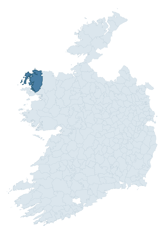
Where this barony sits in the Republic of Ireland
Geology and preservation
Bedrock geology shapes the landscape long before any settlement begins — controlling soil drainage, agricultural potential, the survival of upstanding monuments, and the preservation of buried archaeology. The figures below come from the Geological Survey Ireland 1:100,000 bedrock map.
The bedrock underlying Erris is predominantly psammites (20% of the barony by area), laid down during the Precambrian period (76% by area, over 540 million years ago). A substantial secondary geology of quartzites and schists (16%) and quartzites (14%) adds further variety to the underlying landscape. With 12 distinct rock types mapped, the barony sits in the top third of ROI baronies for geological diversity (96th percentile) — typically a sign of complex tectonic history or coastal mosaics of differing rock units.
Rock type composition
Largest mapped unit: Bangor/Corslieve Formation (13% of the barony)
Placename evidence
Logainm records 31 heritage-diagnostic placenames for Erris, drawn from townland and civil-parish names across the barony. The dominant stratum is prehistoric burial and ritual — tuaim-, carn-, dumha-, and leaba-prefixed names that preserve the memory of Bronze Age and earlier funerary sites in the landscape. The leading diagnostic roots are cill- (10 — church), ráth- (7 — earthen ringfort), and dumha- (5 — burial mound or sandbank). This is broadly in line with the ROI average of 30.7 heritage placenames per barony. The presence of multiple heritage strata side by side indicates layered occupation of the landscape across successive prehistoric and historic periods. Logainm records 243 placenames for Erris (predominantly townland names). Of these, 31 (13%) carry one of the diagnostic Gaelic roots tracked above; the remainder draw on more generic landscape vocabulary that does not encode a heritage period.
Pre-Christian / Early Medieval Defensive
| Root | Count | Meaning |
|---|---|---|
| ráth- | 7 | earthen ringfort |
| dún- | 3 | hilltop or promontory fort |
Early Christian Ecclesiastical
| Root | Count | Meaning |
|---|---|---|
| cill- | 10 | church (early) |
Burial, Ritual, and Norse-Contact
| Root | Count | Meaning |
|---|---|---|
| dumha- | 5 | mound |
| carn- | 3 | cairn |
| sián- | 2 | fairy mound |
| leacht- | 1 | grave monument |
| gall- | 1 | foreigner — Norse settlement marker |
Other baronies in Mayo
About this profile
Click any section below to expand.
What is a barony?
A barony is a historic administrative unit in Ireland, broadly equivalent to an English hundred. The 280 baronies used here are from the OSi 2019 National Statutory Boundaries (generalised 20m), covering the 26 counties of the Republic of Ireland. Baronies derive from the Norman period, were formalised in the 17th century, and have not been redrawn for statistical purposes. They vary enormously in area, from compact urban baronies in Dublin to vast upland baronies in Connacht, and should not be compared by raw site count without accounting for area differences.
What counts as a site?
This profile combines three distinct heritage registers, each with its own definition of what constitutes a recordable site:
- Archaeological sites (NMS). The National Monuments Service Sites and Monuments Record (SMR) catalogues every known archaeological monument or site of archaeological interest in the Republic, from prehistoric burial mounds and ringforts to medieval churches and post-medieval defensive works. Inclusion does not require legal protection — only that the site has been identified, surveyed, and assessed as having archaeological value. A separate subset of these sites lies within a recorded protection zone, which gives them statutory protection under the National Monuments Acts.
- Listed buildings (NIAH). The National Inventory of Architectural Heritage records buildings of architectural, historical, archaeological, artistic, cultural, scientific, social, or technical interest. Each surveyed structure is appraised on a five-tier scale: International, National, Regional, Local, and Record-Only. The NIAH appraisal is informational rather than strictly statutory, but it underpins local-authority Record of Protected Structures (RPS) listings.
- Heritage placenames (Logainm). Logainm is the authoritative database of Irish placenames maintained by the Placenames Branch. This profile applies a heritage-diagnostic classifier to the Irish-language form of each townland name, flagging roots that signal defensive sites (ráth-, lios-, dún-, caiseal-, cathair-), ecclesiastical foundations (cill-, teampall-, domhnach-, mainistir-), prehistoric burial-ritual features (tuaim-, carn-, leaba-), or Norse-contact settlement (gall-). Townlands without one of these diagnostic roots are not flagged here — they may still carry historical significance, but that significance is not encoded in the name itself.
Editorial principles
The narrative sections of this profile follow several explicit principles:
- Evidential. Every claim about this barony’s heritage character is anchored in the underlying register data. Where a site count, a placename count, or a percentile rank is cited, it is computed from the source datasets at export time, not estimated.
- Comparative. Counts and metrics are reported alongside their percentile rank against the other 279 ROI baronies. A barony with 50 ringforts in absolute terms could be unusually high or unusually low depending on its size and regional context; percentile ranking removes that ambiguity.
- Transparent on limits. Where a register has known coverage gaps, survey biases, or data-quality issues that affect this barony’s figures, the profile flags them rather than presenting the numbers as definitive.
- No interpretation beyond what the data supports. The narrative does not speculate about historical events, social dynamics, or cultural meaning beyond what the recorded heritage and placename evidence directly attests.
Data caveats and limits
- NMS Sites and Monuments Record is the product of survey campaigns conducted at different intensities across different counties and decades. Some baronies have been surveyed more thoroughly than others, and absolute counts should be read in that light. Sites destroyed by development before survey are typically not represented; sites in heavily forested or upland terrain are sometimes under-recorded.
- NIAH coverage is broadly complete for the Republic of Ireland but the survey was conducted on a rolling county-by-county basis, and the most recent appraisal date varies. Buildings demolished or substantially altered after their original survey may still appear in the register; conversely, recent buildings of merit may not yet have been appraised.
- Logainm classification applies a deliberately conservative pattern-matching approach to the Irish-language townland forms. The classifier prioritises true positives over recall: a townland may carry a heritage signal that the classifier doesn’t recognise, particularly where the diagnostic root has been heavily anglicised or where the townland name draws on a less common term. The 60,000+ townland records and ~9,800 classified placenames give a substantial signal at barony scale, but individual townland names should be checked against Logainm directly for definitive interpretation.
- Period attribution. The chronological distribution reflects only those NMS sites that carry a recognised period attribution in the source data. Sites listed as “Unknown” period are excluded from the dated subset.
- Boundary changes. Some baronies have undergone minor boundary adjustments since their 19th-century definition; the OSi 2019 generalised boundaries used here are the current statutory definition and may differ slightly from historical maps in border areas.
- Bedrock geology is mapped at 1:100,000 scale, which means local variation within a barony — small pockets of different rock type, mineral veins, alluvium overlying bedrock — is generalised. The dominant-system and rocktype figures are area-weighted, so a barony reading “70% Carboniferous limestone” may still contain small but archaeologically important pockets of older or younger rock. Around 3% of GSI polygons do not match the lexicon and contribute no rocktype or system attribution.
Data sources
- National Monuments Service — Sites and Monuments Record (SMR) https://data.gov.ie/dataset/national-monuments-service-archaeological-survey-of-ireland
- National Inventory of Architectural Heritage (NIAH) https://data.gov.ie/dataset/national-inventory-of-architectural-heritage-niah-national-dataset
- Logainm — Placenames Database of Ireland https://www.logainm.ie/
- Ordnance Survey Ireland — National Statutory Barony Boundaries 2019 https://data-osi.opendata.arcgis.com/
- EURODEM — European Digital Elevation Model https://www.mapsforeurope.org/datasets/euro-dem
- ESA WorldCover https://esa-worldcover.org/en
- Geological Survey Ireland — 1:100,000 Bedrock Geology https://www.gsi.ie/en-ie/data-and-maps/Pages/Bedrock.aspx
Explore more: Search any of the 280 ROI baronies, browse by historical province, or read the methodology and data sources for the full Republic of Ireland Heritage Tool.