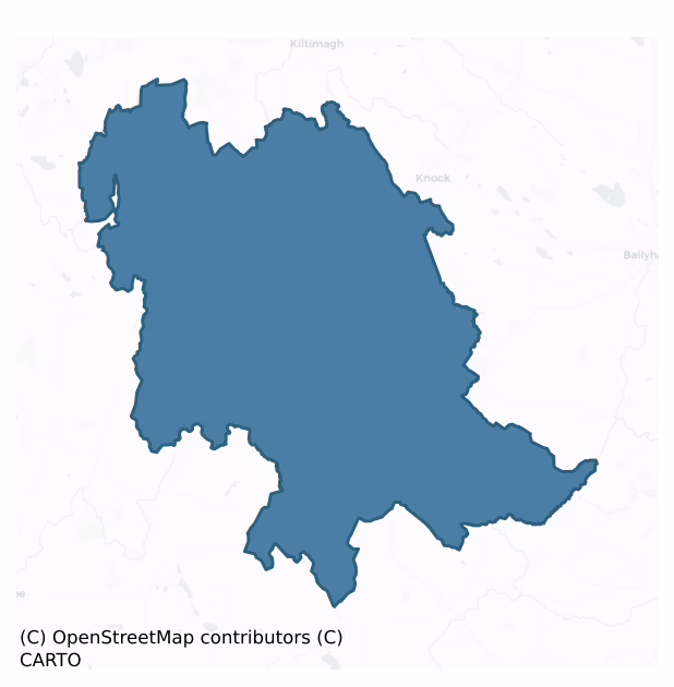
Clanmorris is a barony of County Mayo, in the historical province of Connacht (Irish: Clann Mhuiris), covering 280 km² of land. The barony records 445 NMS archaeological sites and 92 NIAH listed buildings, placing it at around the 38th percentile among 280 ROI baronies for sites per km². This means it is in the lower half of all baronies for sites per km². Dated archaeological evidence runs from the Neolithic through to the Modern, spanning 8 of 9 archaeological periods, placing the barony in the 58th percentile among 280 ROI baronies for chronological depth. This means it is in the upper half of all baronies for chronological depth. The largest dated subset of recorded sites dates to the Iron Age. Logainm flags 29 placenames in the barony as carrying a recognised heritage root; the largest share — around 55% — are names associated with early Christian church and monastic foundations.
Heritage at a glance
Percentile rankings throughout this profile compare each barony only against the other 279 Republic of Ireland baronies.
The recorded heritage of Clanmorris
The National Monuments Service Sites and Monuments Record (SMR) is the statutory inventory of archaeological sites for the Republic of Ireland, maintained by the Department of Tourism, Culture, Arts, Gaeltacht, Sport and Media. Sites recorded here include earthworks, ringforts, megalithic tombs, ecclesiastical remains, and post-medieval features; not every record is legally protected, but each is registered as a monument of archaeological interest.
The National Monuments Service records 445 archaeological sites in Clanmorris, putting it at the 38th percentile among 280 ROI baronies for sites per km². This means it is in the lower half of all baronies for sites per km². Protection coverage is near-universal — 431 sites (97%) fall within a recorded monument protection zone, indicating an extensively surveyed landscape. The dominant category is defensive sites — ringforts, enclosures, hillforts, and stone forts (297 sites, 67% of the record). The most diagnostically specific type is Ringfort – rath (69 records, 16% of the barony's NMS total) — compared to an ROI average of 20% across all baronies where this type occurs. Ringfort – rath is an earthen ringfort enclosed by a bank and external ditch — the most common Early Medieval farmstead, broadly dated 500–1000 AD. The broader 'Enclosure' classification — which catches unclassified ringforts and field enclosures — accounts for a further 152 records (34%) and reflects the difficulty of sub-classifying degraded earthworks from surface evidence alone. Across the barony's 280 km², this gives a recorded density of 1.59 sites per km².
Most common monument types
Hover or tap a monument type to see its definition.
| Type | Count |
|---|---|
| Enclosure a banked or ditched feature of uncertain type, used as a catch-all where the original function cannot be determined from surface evidence | 152 |
| Ringfort – rath an earthen ringfort enclosed by a bank and external ditch — the most common Early Medieval farmstead, broadly dated 500–1000 AD | 69 |
| Souterrain an underground stone-built passage and chamber, generally Early Medieval and often associated with ringforts as a defensive or storage feature | 20 |
| Children's burial ground an unconsecrated medieval and early-modern burial ground for unbaptised or stillborn children, often called a cillín or ceallúnach | 19 |
| Fulacht fia a horseshoe-shaped Bronze Age burnt mound built around a sunken trough beside a water source, traditionally interpreted as a cooking site | 19 |
| Earthwork an unclassified earthen structure with no diagnostic features that allow a more specific classification | 18 |
| Crannog an artificial or partly artificial island built up on a lake or river bed, in use from the 6th to 17th centuries AD | 11 |
| Burnt mound a heap of fire-cracked stone, ash and charcoal, with no surviving trough, dated Bronze Age to early medieval | 9 |
Chronological distribution
The dated archaeological record for Clanmorris spans from the Neolithic through to the Modern, with activity attested across 8 of 9 archaeological periods. Every period from earliest to latest is represented in the record — an unbroken sequence of dated activity across the full chronological span. Activity concentrates most heavily in the Iron Age (170 sites, 48% of dated material), with the Early Medieval forming a secondary peak (117 sites, 33%). A further 89 recorded sites (20% of the overall NMS register for the barony) carry no period attribution — appearing as 'Unknown' in the bar chart below. This typically reflects either records that pre-date the standardised period vocabulary or sites awaiting specialist dating review, rather than a genuine absence of chronological evidence.
Sample of recorded monuments
Show 25 sample monuments (of 445 total)
A representative sample of 25 recorded monuments drawn from the barony’s 445 total NMS entries. Sites within a recorded monument protection zone and rarer site types are prioritised so the list shows a meaningful cross-section rather than only the most common type. Each entry shows the official Sites and Monuments Record reference number and the description published by the National Monuments Service.
Well
In improved pasture, at the base of a gentle S-facing slope. Named ‘Toberkeelty’ on the 1837 and 1919 OS 6-inch maps. Natural spring emerging from the base of the slope, where it collects as a small unenclosed pool,…
In improved pasture, at the base of a gentle S-facing slope. Named ‘Toberkeelty’ on the 1837 and 1919 OS 6-inch maps. Natural spring emerging from the base of the slope, where it collects as a small unenclosed pool, before flowing as a stream to SE through an area of wet ground. A concrete pipe has been inserted into the pool. There is no evidence that this well is of any great antiquity and no local tradition of use as a holy well.
Compiled by: Jane O'Shaughnessy
Date of upload: 13 July 2015
Round tower
In Balla village, located in the SW quadrant of a graveyard (MA090-024005-).
This round tower is a National Monument (no. 403). It no longer stands to its full height and is unroofed. It consists of a circular tower…
In Balla village, located in the SW quadrant of a graveyard (MA090-024005-).
This round tower is a National Monument (no. 403). It no longer stands to its full height and is unroofed. It consists of a circular tower (diam. c. 5m; current H c. 9-10m) constructed of regularly coursed sandstone block, cut to the curve. The basal courses incorporate larger blocks. Two blocks in these lower courses, one at NE and one at W, have shallow circular depressions in them, reminiscent of bullaun stones. The tower rests on a low narrow stone plinth or offset (W 0.15-0.3m; H 0.1-0.2m). At NW−N in the vicinity of the entrance, the offset appears to have a slight step cut into it. The stonework, in general, is regular, with a smooth surface finish, but the uppermost courses, from about second floor level, are noticeably larger and more finely cut, and suggest a phase of rebuilding.
The tower is unusual in having two doorways, at two different levels. The original doorway, a large, lintelled rectangular opening is at second floor level at E. Its position is unusually high; most round tower doorways open onto the first floor. The second, lower, doorway (H c. 1.80m; Wth 0.85m; D 1.15m) is at N. It is set unusually low for a round tower, being only 0.7m above the offset, and it opens onto a raised ground floor level. This doorway is a later insertion, dating to the 15th or 16th century (Rynne 1998, 178). It is round-headed, and has a surround of cut sandstone, chamfered at the outer edge. Th…
Stone circle
The Archaeological Survey of Ireland (ASI) is in the process of providing information on all monuments on The Historic Environment Viewer (HEV). Currently the information for this record has not been uploaded. To…
The Archaeological Survey of Ireland (ASI) is in the process of providing information on all monuments on The Historic Environment Viewer (HEV). Currently the information for this record has not been uploaded. To access available information for research purposes please make an appointment in advance with the Archive Unit (open Fridays 10.00 am – 5.00 pm), Department of Culture, Heritage and the Gaeltacht, The Custom House, Dublin 1 D01W6XO or email nmarchive@chg.gov.ie.
Cross – High cross
The Archaeological Survey of Ireland (ASI) is in the process of providing information on all monuments on The Historic Environment Viewer (HEV). Currently the information for this record has not been uploaded. To…
The Archaeological Survey of Ireland (ASI) is in the process of providing information on all monuments on The Historic Environment Viewer (HEV). Currently the information for this record has not been uploaded. To access available information for research purposes please make an appointment in advance with the Archive Unit (open Fridays 10.00 am – 5.00 pm), Department of Culture, Heritage and the Gaeltacht, The Custom House, Dublin 1 D01W6XO or email nmarchive@chg.gov.ie.
Religious house – unclassified
The Archaeological Survey of Ireland (ASI) is in the process of providing information on all monuments on The Historic Environment Viewer (HEV). Currently the information for this record has not been uploaded. To…
The Archaeological Survey of Ireland (ASI) is in the process of providing information on all monuments on The Historic Environment Viewer (HEV). Currently the information for this record has not been uploaded. To access available information for research purposes please make an appointment in advance with the Archive Unit (open Fridays 10.00 am – 5.00 pm), Department of Culture, Heritage and the Gaeltacht, The Custom House, Dublin 1 D01W6XO or email nmarchive@chg.gov.ie.
Cross
The Archaeological Survey of Ireland (ASI) is in the process of providing information on all monuments on The Historic Environment Viewer (HEV). Currently the information for this record has not been uploaded. To…
The Archaeological Survey of Ireland (ASI) is in the process of providing information on all monuments on The Historic Environment Viewer (HEV). Currently the information for this record has not been uploaded. To access available information for research purposes please make an appointment in advance with the Archive Unit (open Fridays 10.00 am – 5.00 pm), Department of Culture, Heritage and the Gaeltacht, The Custom House, Dublin 1 D01W6XO or email nmarchive@chg.gov.ie.
Graveslab
The Archaeological Survey of Ireland (ASI) is in the process of providing information on all monuments on The Historic Environment Viewer (HEV). Currently the information for this record has not been uploaded. To…
The Archaeological Survey of Ireland (ASI) is in the process of providing information on all monuments on The Historic Environment Viewer (HEV). Currently the information for this record has not been uploaded. To access available information for research purposes please make an appointment in advance with the Archive Unit (open Fridays 10.00 am – 5.00 pm), Department of Culture, Heritage and the Gaeltacht, The Custom House, Dublin 1 D01W6XO or email nmarchive@chg.gov.ie.
Font
The Archaeological Survey of Ireland (ASI) is in the process of providing information on all monuments on The Historic Environment Viewer (HEV). Currently the information for this record has not been uploaded. To…
The Archaeological Survey of Ireland (ASI) is in the process of providing information on all monuments on The Historic Environment Viewer (HEV). Currently the information for this record has not been uploaded. To access available information for research purposes please make an appointment in advance with the Archive Unit (open Fridays 10.00 am – 5.00 pm), Department of Culture, Heritage and the Gaeltacht, The Custom House, Dublin 1 D01W6XO or email nmarchive@chg.gov.ie.
Castle – ringwork
In pasture, encompassing a low rise bordering a lowlying area of wet ground. To NE ground rises to a N–S ridge on which Brees Castle (MA091-010—-) is prominently sited c. 300m to SE. A farmstead lies immediately to…
In pasture, encompassing a low rise bordering a lowlying area of wet ground. To NE ground rises to a N–S ridge on which Brees Castle (MA091-010—-) is prominently sited c. 300m to SE. A farmstead lies immediately to W–NW.
Not indicated on the 1838 OS 6-inch map; hachured on the 1920 edition, with ‘Children’s Burial Ground’ indicated at S. First recorded by Knox (1911-12, 149-153).
This enigmatic earthwork may be a form of ringwork or earthwork castle, perhaps marking the site of an Anglo-Norman settlement prior to the construction of the masonry castle (MA091-010—-) on the nearby hill to SE.
A D-shaped area (81.5m NE–SW; c. 41.5m NW–SE) defined on the curving side SW–ENE by a scarp with an external fosse, and bordered on the straight side to SE by a field wall on a NE–SW axis. At S–W the fosse appears to have been re-cut to serve as a field drain. At NW–N the scarp is reduced to a slight rise, and the fosse is evident as a shallow depression, allowing access from the modern farmyard to NW into the interior of the enclosure. A septic tank is dug into the fosse at NW. The scarp and fosse are again well-defined N–NE but the fosse becomes increasing indistinct NE−ENE.
Within the NE end of the enclosure, there is a sub-rectangular platform (16.5m NNW–SSE; c. 10.6m ENE–WSW), which what appears to be have been created by scarping a natural rise. The NNW side of the platform merges with the ringwork scarp and is topped with a raised stony rim or bank (Wth 3.4m; int. H 0.25…
Castle – Anglo-Norman masonry castle
In pasture, prominently sited on a rocky knoll on a N–S ridge, with the steepest fall of ground to SW overlooking a broad sweep of undulating grassland.
A castle was built at Brees in the second half of the…
In pasture, prominently sited on a rocky knoll on a N–S ridge, with the steepest fall of ground to SW overlooking a broad sweep of undulating grassland.
A castle was built at Brees in the second half of the 13th-century castle by the Anglo-Norman Prendergasts, who later adopted the Irish name, MacMorris or MacMorys. In 1574 the castle was in the possession of Walter oge MacMorris, chief of the clan, who was succeeded by Richard Mac Morys. At the Composition of Connacht in 1585 Richard Mac Morys was granted title under English law to this castle and a large tract of land in the barony of Clanmorris, and in December of that year he transferred ownership to Francis Barkley, Marshal of the Connacht. Subsequently the property came into the possession of John Moore, whose title was confirmed by a patent of King James I in 1607. The property remained with the Moore family until the late19th century.
This greatly ruined castle consists of a sub-rectangular area (16m E–W; c. 24m N–S) enclosed by a ruined masonry wall which encompasses the rocky knoll.
The curtain wall is reduced to a low, sod-covered rubble bank on its inner face. Externally, the wall (H 2-3m) is built onto the scarped knoll slope, taking advantage of its steep slope. A short section of intact external wall face (H 2m) of roughly course limestone, incorporating remnants of a base batter (H 0.8m), can be seen at NNE, and another remnant is evident at S. But elsewhere around the circuit the curtain wall is robbed…
Megalithic tomb – unclassified
In pasture, prominently sited on top of a ridge, overlooking a broad valley to E, and affording extensive views to W where Croagh Patrick is clearly visible on the far horizon.
Not indicated on the 1838 and 1920 OS…
In pasture, prominently sited on top of a ridge, overlooking a broad valley to E, and affording extensive views to W where Croagh Patrick is clearly visible on the far horizon.
Not indicated on the 1838 and 1920 OS 6-inch maps. Single capstone, tilted to E, resting on an upright orthostat/side stone (long axis E–W), to S of which is a second stone, on a NNE–SSW axis, possibly a displaced side stone or end stone. The SE corner of the capstone tips downwards and appears to rest on a number of small stones protruding from the ground. The tomb is located in a slight dip or depression in the ground surface.
Compiled by: Jane O’Shaughnessy
Date of upload: 9 February 2022
Icehouse
The Archaeological Survey of Ireland (ASI) is in the process of providing information on all monuments on The Historic Environment Viewer (HEV). Currently the information for this record has not been uploaded. To…
The Archaeological Survey of Ireland (ASI) is in the process of providing information on all monuments on The Historic Environment Viewer (HEV). Currently the information for this record has not been uploaded. To access available information for research purposes please make an appointment in advance with the Archive Unit (open Fridays 10.00 am – 5.00 pm), Department of Culture, Heritage and the Gaeltacht, The Custom House, Dublin 1 D01W6XO or email nmarchive@chg.gov.ie.
Religious house – Carmelite friars
The Archaeological Survey of Ireland (ASI) is in the process of providing information on all monuments on The Historic Environment Viewer (HEV). Currently the information for this record has not been uploaded. To…
The Archaeological Survey of Ireland (ASI) is in the process of providing information on all monuments on The Historic Environment Viewer (HEV). Currently the information for this record has not been uploaded. To access available information for research purposes please make an appointment in advance with the Archive Unit (open Fridays 10.00 am – 5.00 pm), Department of Culture, Heritage and the Gaeltacht, The Custom House, Dublin 1 D01W6XO or email nmarchive@chg.gov.ie.
Prehistoric site – lithic scatter
The Archaeological Survey of Ireland (ASI) is in the process of providing information on all monuments on The Historic Environment Viewer (HEV). Currently the information for this record has not been uploaded. To…
The Archaeological Survey of Ireland (ASI) is in the process of providing information on all monuments on The Historic Environment Viewer (HEV). Currently the information for this record has not been uploaded. To access available information for research purposes please make an appointment in advance with the Archive Unit (open Fridays 10.00 am – 5.00 pm), Department of Culture, Heritage and the Gaeltacht, The Custom House, Dublin 1 D01W6XO or email nmarchive@chg.gov.ie.
Water mill – horizontal-wheeled
Adjacent to a stream. Components of a horizontal-wheeled water mill were exposed at this location in 1985. Part of a wooden trough (1.5m by 0.4m), through which the water was channelled to the mill house, and a…
Adjacent to a stream. Components of a horizontal-wheeled water mill were exposed at this location in 1985. Part of a wooden trough (1.5m by 0.4m), through which the water was channelled to the mill house, and a millstone were noted (SMR file: OPW Topographical Files 1985). There is a possible metal-working site (MA102-030002-) nearby.
Compiled by: Jane O’Shaughnessy
Date of upload: 26 September 2022
Metalworking site
Quantities of iron slag exposed at roughly this location in Ballykina townland may indicate a metal-working site (SMR file: OPW Topographical Files 1985). There is a horizontal-wheeled water mill (MA102-030001-)…
Quantities of iron slag exposed at roughly this location in Ballykina townland may indicate a metal-working site (SMR file: OPW Topographical Files 1985). There is a horizontal-wheeled water mill (MA102-030001-) nearby.
Compiled by: Jane O’Shaughnessy
Date of upload: 26 September 2022
House – 16th/17th century
The Archaeological Survey of Ireland (ASI) is in the process of providing information on all monuments on The Historic Environment Viewer (HEV). Currently the information for this record has not been uploaded. To…
The Archaeological Survey of Ireland (ASI) is in the process of providing information on all monuments on The Historic Environment Viewer (HEV). Currently the information for this record has not been uploaded. To access available information for research purposes please make an appointment in advance with the Archive Unit (open Fridays 10.00 am – 5.00 pm), Department of Culture, Heritage and the Gaeltacht, The Custom House, Dublin 1 D01W6XO or email nmarchive@chg.gov.ie.
Burial mound
The Archaeological Survey of Ireland (ASI) is in the process of providing information on all monuments on The Historic Environment Viewer (HEV). Currently the information for this record has not been uploaded. To…
The Archaeological Survey of Ireland (ASI) is in the process of providing information on all monuments on The Historic Environment Viewer (HEV). Currently the information for this record has not been uploaded. To access available information for research purposes please make an appointment in advance with the Archive Unit (open Fridays 10.00 am – 5.00 pm), Department of Culture, Heritage and the Gaeltacht, The Custom House, Dublin 1 D01W6XO or email nmarchive@chg.gov.ie.
Structure
The Archaeological Survey of Ireland (ASI) is in the process of providing information on all monuments on The Historic Environment Viewer (HEV). Currently the information for this record has not been uploaded. To…
The Archaeological Survey of Ireland (ASI) is in the process of providing information on all monuments on The Historic Environment Viewer (HEV). Currently the information for this record has not been uploaded. To access available information for research purposes please make an appointment in advance with the Archive Unit (open Fridays 10.00 am – 5.00 pm), Department of Culture, Heritage and the Gaeltacht, The Custom House, Dublin 1 D01W6XO or email nmarchive@chg.gov.ie.
Castle – motte and bailey
The Archaeological Survey of Ireland (ASI) is in the process of providing information on all monuments on The Historic Environment Viewer (HEV). Currently the information for this record has not been uploaded. To…
The Archaeological Survey of Ireland (ASI) is in the process of providing information on all monuments on The Historic Environment Viewer (HEV). Currently the information for this record has not been uploaded. To access available information for research purposes please make an appointment in advance with the Archive Unit (open Fridays 10.00 am – 5.00 pm), Department of Culture, Heritage and the Gaeltacht, The Custom House, Dublin 1 D01W6XO or email nmarchive@chg.gov.ie.
Fish-pond
The Archaeological Survey of Ireland (ASI) is in the process of providing information on all monuments on The Historic Environment Viewer (HEV). Currently the information for this record has not been uploaded. To…
The Archaeological Survey of Ireland (ASI) is in the process of providing information on all monuments on The Historic Environment Viewer (HEV). Currently the information for this record has not been uploaded. To access available information for research purposes please make an appointment in advance with the Archive Unit (open Fridays 10.00 am – 5.00 pm), Department of Culture, Heritage and the Gaeltacht, The Custom House, Dublin 1 D01W6XO or email nmarchive@chg.gov.ie.
Dovecote
The Archaeological Survey of Ireland (ASI) is in the process of providing information on all monuments on The Historic Environment Viewer (HEV). Currently the information for this record has not been uploaded. To…
The Archaeological Survey of Ireland (ASI) is in the process of providing information on all monuments on The Historic Environment Viewer (HEV). Currently the information for this record has not been uploaded. To access available information for research purposes please make an appointment in advance with the Archive Unit (open Fridays 10.00 am – 5.00 pm), Department of Culture, Heritage and the Gaeltacht, The Custom House, Dublin 1 D01W6XO or email nmarchive@chg.gov.ie.
Standing stone
The Archaeological Survey of Ireland (ASI) is in the process of providing information on all monuments on The Historic Environment Viewer (HEV). Currently the information for this record has not been uploaded. To…
The Archaeological Survey of Ireland (ASI) is in the process of providing information on all monuments on The Historic Environment Viewer (HEV). Currently the information for this record has not been uploaded. To access available information for research purposes please make an appointment in advance with the Archive Unit (open Fridays 10.00 am – 5.00 pm), Department of Culture, Heritage and the Gaeltacht, The Custom House, Dublin 1 D01W6XO or email nmarchive@chg.gov.ie.
Monumental structure
In pasture, prominently sited on a roughly circular rise, with a steep fall of ground on the W side.
This late 17th-century monumental structure is indicated on the 1838 and 1915 OS 6-inch maps as a small square…
In pasture, prominently sited on a roughly circular rise, with a steep fall of ground on the W side.
This late 17th-century monumental structure is indicated on the 1838 and 1915 OS 6-inch maps as a small square feature (max. dim. 3-4m), named ‘Monument’. It is evident now as a sod-covered, slumped mound of earth and large stones, with a roughly square base (max. dim. c. 3m; H 0.6m at E, 0.8m at W). It is incorporated into a NE–SW field wall, which overlies the S–SW edge of the mound. It appears originally to have been stone-built or stone-faced, and may have comprised a number of tiers. A memorial stone, now displaced, was originally part of the monument, dedicated to the memory of Bartholomew French, who according to local tradition, died following a fall from a horse. A rectangular stone slab (L 0.7m; Wth 0.55m; T 0.09m) is located 8m to SW of the mound, leaning against a low, lintelled sheep-gap in the field wall. One broad face of the slab has a rough surface, the other face is smooth, but covered by lichen. The edge of one short side of the slab is broken. According to local information, this is the memorial stone, and the inscription is said to have been ‘raised’ or in false relief, rather than inscribed. No carving/inscription can now be discerned on the stone surface.
The monument was, however, recorded in the early 20th-century by Lord Oranmore and Browne (1915-16, 116). He noted a 'small heap of stones' and stated that 'The greater part of the monument had be…
Enclosure
Remains of an enclosure surives as a raised platform-like area (diam. c. 30m) and visible on an aerial photograph (SMR file). (Murphy 1998)
Compiled by: Paul Walsh
Date of upload: 24 February 2014
Listed buildings
The National Inventory of Architectural Heritage (NIAH) is a state survey appraising buildings of architectural, historical, archaeological, artistic, cultural, scientific, social, or technical interest. Each surveyed structure receives a rating from International (the highest, for buildings of European importance) through National, Regional, Local, and Record-Only.
The NIAH records 92 listed buildings in Clanmorris (46th percentile across ROI baronies). All recorded buildings carry Regional or lower grading; the barony does not contain any structures appraised as being of National or International architectural importance. Construction dates concentrate most heavily in the Victorian (1830-1900) period.
Terrain and environment
Mean elevation across the barony is 64m — the 26th percentile among 280 ROI baronies for elevation. This means it is in the bottom third of all baronies for elevation. This is a relatively low-lying landscape by ROI standards. Elevation matters for heritage because higher-altitude baronies typically favour defensive monuments — ringforts and hilltop forts placed on prominent ground — while lowland baronies are more likely to carry the dense settlement and church networks of intensive agricultural landscapes. A maximum elevation of 167m gives the barony meaningful vertical relief. Mean slope is 2.6° — the 29th percentile among 280 ROI baronies for slope. This means it is in the bottom third of all baronies for slope. Slope is a key control on both land use and archaeological preservation: steep ground resists ploughing and tends to preserve earthworks intact, while gentle slopes favour intensive cultivation that damages or destroys surface archaeology over time. The Topographic Wetness Index averages 11.4, the 70th percentile among 280 ROI baronies for wetness. This means it is in the top third of all baronies for wetness. Drainage matters for heritage because poorly-drained ground preserves organic archaeology (wooden trackways, leather, textiles, and on rare occasions human remains) far better than free-draining soil; well-drained ground favours arable use but destroys organic material rapidly. The land cover is dominated by improved grassland (86%) and woodland (12%). In overall character, this is low-lying, gently-sloping terrain — characteristic of Ireland's central plain and coastal lowlands, with land use dominated by improved grassland.
Terrain measurements
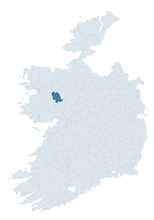
Where this barony sits in the Republic of Ireland
Geology and preservation
Bedrock geology shapes the landscape long before any settlement begins — controlling soil drainage, agricultural potential, the survival of upstanding monuments, and the preservation of buried archaeology. The figures below come from the Geological Survey Ireland 1:100,000 bedrock map.
The bedrock underlying Clanmorris is predominantly black calcarenites and shales (49% of the barony by area), laid down during the Carboniferous period (100% by area, around 359 to 299 million years ago). A substantial secondary geology of limestone (22%) and calcarenites (13%) adds further variety to the underlying landscape. The single largest mapped unit is the Ballymore Limestone Formation (49% of the barony's bedrock). With 7 distinct rock types mapped, the barony sits in the top third of ROI baronies for geological diversity (69th percentile) — typically a sign of complex tectonic history or coastal mosaics of differing rock units.
Rock type composition
Largest mapped unit: Ballymore Limestone Formation (49% of the barony)
Placename evidence
Logainm records 29 heritage-diagnostic placenames for Clanmorris, drawn from townland and civil-parish names across the barony. The dominant stratum is Early Christian ecclesiastical — cill-, teampall-, and domhnach-prefixed names that record the dense network of early church foundations established between the fifth and tenth centuries. The leading diagnostic roots are cill- (11 — church), lios- (8 — ringfort or enclosure), and cillín- (4 — killeen). This is broadly in line with the ROI average of 30.7 heritage placenames per barony. Logainm records 302 placenames for Clanmorris (predominantly townland names). Of these, 29 (10%) carry one of the diagnostic Gaelic roots tracked above; the remainder draw on more generic landscape vocabulary that does not encode a heritage period.
Pre-Christian / Early Medieval Defensive
| Root | Count | Meaning |
|---|---|---|
| lios- | 8 | ringfort or enclosure |
| dún- | 3 | hilltop or promontory fort |
| ráth- | 2 | earthen ringfort |
Early Christian Ecclesiastical
| Root | Count | Meaning |
|---|---|---|
| cill- | 11 | church (early) |
| cillín- | 4 | unconsecrated burial ground |
| teampall- | 1 | church (later medieval) |
About this profile
Click any section below to expand.
What is a barony?
A barony is a historic administrative unit in Ireland, broadly equivalent to an English hundred. The 280 baronies used here are from the OSi 2019 National Statutory Boundaries (generalised 20m), covering the 26 counties of the Republic of Ireland. Baronies derive from the Norman period, were formalised in the 17th century, and have not been redrawn for statistical purposes. They vary enormously in area, from compact urban baronies in Dublin to vast upland baronies in Connacht, and should not be compared by raw site count without accounting for area differences.
What counts as a site?
This profile combines three distinct heritage registers, each with its own definition of what constitutes a recordable site:
- Archaeological sites (NMS). The National Monuments Service Sites and Monuments Record (SMR) catalogues every known archaeological monument or site of archaeological interest in the Republic, from prehistoric burial mounds and ringforts to medieval churches and post-medieval defensive works. Inclusion does not require legal protection — only that the site has been identified, surveyed, and assessed as having archaeological value. A separate subset of these sites lies within a recorded protection zone, which gives them statutory protection under the National Monuments Acts.
- Listed buildings (NIAH). The National Inventory of Architectural Heritage records buildings of architectural, historical, archaeological, artistic, cultural, scientific, social, or technical interest. Each surveyed structure is appraised on a five-tier scale: International, National, Regional, Local, and Record-Only. The NIAH appraisal is informational rather than strictly statutory, but it underpins local-authority Record of Protected Structures (RPS) listings.
- Heritage placenames (Logainm). Logainm is the authoritative database of Irish placenames maintained by the Placenames Branch. This profile applies a heritage-diagnostic classifier to the Irish-language form of each townland name, flagging roots that signal defensive sites (ráth-, lios-, dún-, caiseal-, cathair-), ecclesiastical foundations (cill-, teampall-, domhnach-, mainistir-), prehistoric burial-ritual features (tuaim-, carn-, leaba-), or Norse-contact settlement (gall-). Townlands without one of these diagnostic roots are not flagged here — they may still carry historical significance, but that significance is not encoded in the name itself.
Editorial principles
The narrative sections of this profile follow several explicit principles:
- Evidential. Every claim about this barony’s heritage character is anchored in the underlying register data. Where a site count, a placename count, or a percentile rank is cited, it is computed from the source datasets at export time, not estimated.
- Comparative. Counts and metrics are reported alongside their percentile rank against the other 279 ROI baronies. A barony with 50 ringforts in absolute terms could be unusually high or unusually low depending on its size and regional context; percentile ranking removes that ambiguity.
- Transparent on limits. Where a register has known coverage gaps, survey biases, or data-quality issues that affect this barony’s figures, the profile flags them rather than presenting the numbers as definitive.
- No interpretation beyond what the data supports. The narrative does not speculate about historical events, social dynamics, or cultural meaning beyond what the recorded heritage and placename evidence directly attests.
Data caveats and limits
- NMS Sites and Monuments Record is the product of survey campaigns conducted at different intensities across different counties and decades. Some baronies have been surveyed more thoroughly than others, and absolute counts should be read in that light. Sites destroyed by development before survey are typically not represented; sites in heavily forested or upland terrain are sometimes under-recorded.
- NIAH coverage is broadly complete for the Republic of Ireland but the survey was conducted on a rolling county-by-county basis, and the most recent appraisal date varies. Buildings demolished or substantially altered after their original survey may still appear in the register; conversely, recent buildings of merit may not yet have been appraised.
- Logainm classification applies a deliberately conservative pattern-matching approach to the Irish-language townland forms. The classifier prioritises true positives over recall: a townland may carry a heritage signal that the classifier doesn’t recognise, particularly where the diagnostic root has been heavily anglicised or where the townland name draws on a less common term. The 60,000+ townland records and ~9,800 classified placenames give a substantial signal at barony scale, but individual townland names should be checked against Logainm directly for definitive interpretation.
- Period attribution. The chronological distribution reflects only those NMS sites that carry a recognised period attribution in the source data. Sites listed as “Unknown” period are excluded from the dated subset.
- Boundary changes. Some baronies have undergone minor boundary adjustments since their 19th-century definition; the OSi 2019 generalised boundaries used here are the current statutory definition and may differ slightly from historical maps in border areas.
- Bedrock geology is mapped at 1:100,000 scale, which means local variation within a barony — small pockets of different rock type, mineral veins, alluvium overlying bedrock — is generalised. The dominant-system and rocktype figures are area-weighted, so a barony reading “70% Carboniferous limestone” may still contain small but archaeologically important pockets of older or younger rock. Around 3% of GSI polygons do not match the lexicon and contribute no rocktype or system attribution.
Data sources
- National Monuments Service — Sites and Monuments Record (SMR) https://data.gov.ie/dataset/national-monuments-service-archaeological-survey-of-ireland
- National Inventory of Architectural Heritage (NIAH) https://data.gov.ie/dataset/national-inventory-of-architectural-heritage-niah-national-dataset
- Logainm — Placenames Database of Ireland https://www.logainm.ie/
- Ordnance Survey Ireland — National Statutory Barony Boundaries 2019 https://data-osi.opendata.arcgis.com/
- EURODEM — European Digital Elevation Model https://www.mapsforeurope.org/datasets/euro-dem
- ESA WorldCover https://esa-worldcover.org/en
- Geological Survey Ireland — 1:100,000 Bedrock Geology https://www.gsi.ie/en-ie/data-and-maps/Pages/Bedrock.aspx
Explore more: Search any of the 280 ROI baronies, browse by historical province, or read the methodology and data sources for the full Republic of Ireland Heritage Tool.