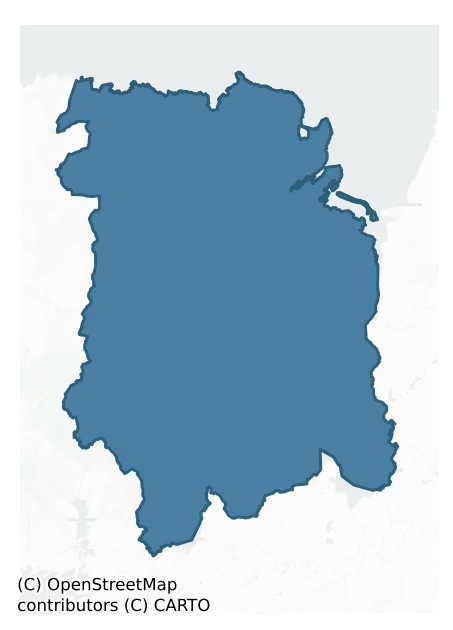
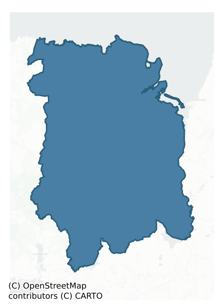
Tirawley is a barony of County Mayo, in the historical province of Connacht (Irish: Tír Amhlaidh), covering 1058 km² of land. The barony records 1,484 NMS archaeological sites and 248 NIAH listed buildings, placing it at around the 28th percentile among 280 ROI baronies for sites per km². This means it is in the bottom third of all baronies for sites per km². Dated archaeological evidence runs from the Neolithic through to the Modern, spanning 8 of 9 archaeological periods, placing the barony in the 56th percentile among 280 ROI baronies for chronological depth. This means it is in the upper half of all baronies for chronological depth. The largest dated subset of recorded sites dates to the Early Medieval. Logainm flags 102 placenames in the barony as carrying a recognised heritage root; the largest share — around 56% — are names associated with pre-christian defensive.
Heritage at a glance
Percentile rankings throughout this profile compare each barony only against the other 279 Republic of Ireland baronies.
The recorded heritage of Tirawley
The National Monuments Service Sites and Monuments Record (SMR) is the statutory inventory of archaeological sites for the Republic of Ireland, maintained by the Department of Tourism, Culture, Arts, Gaeltacht, Sport and Media. Sites recorded here include earthworks, ringforts, megalithic tombs, ecclesiastical remains, and post-medieval features; not every record is legally protected, but each is registered as a monument of archaeological interest.
The National Monuments Service records 1,484 archaeological sites in Tirawley, putting it at the 28th percentile among 280 ROI baronies for sites per km². This means it is in the bottom third of all baronies for sites per km². Protection coverage is near-universal — 1,441 sites (97%) fall within a recorded monument protection zone, indicating an extensively surveyed landscape. The dominant category is defensive sites — ringforts, enclosures, hillforts, and stone forts (784 sites, 53% of the record). Ringfort – rath is the most prevalent type, making up 27% of the barony's recorded sites (407 records) — well above the ROI average of 20% across all baronies where this type occurs. Ringfort – rath is an earthen ringfort enclosed by a bank and external ditch — the most common Early Medieval farmstead, broadly dated 500–1000 AD. Other significant types include Enclosure (227) and House – indeterminate date (46). Enclosure is a banked or ditched feature of uncertain type, used as a catch-all where the original function cannot be determined from surface evidence; House – indeterminate date is a habitation building whose date cannot be determined from available evidence. Across the barony's 1058 km², this gives a recorded density of 1.40 sites per km².
Most common monument types
Hover or tap a monument type to see its definition.
| Type | Count |
|---|---|
| Ringfort – rath an earthen ringfort enclosed by a bank and external ditch — the most common Early Medieval farmstead, broadly dated 500–1000 AD | 407 |
| Enclosure a banked or ditched feature of uncertain type, used as a catch-all where the original function cannot be determined from surface evidence | 227 |
| House – indeterminate date a habitation building whose date cannot be determined from available evidence | 46 |
| Children's burial ground an unconsecrated medieval and early-modern burial ground for unbaptised or stillborn children, often called a cillín or ceallúnach | 42 |
| Crannog an artificial or partly artificial island built up on a lake or river bed, in use from the 6th to 17th centuries AD | 42 |
| Burnt mound a heap of fire-cracked stone, ash and charcoal, with no surviving trough, dated Bronze Age to early medieval | 39 |
| Mound an artificial earthen elevation of unknown date and function that cannot be classified as another known monument type | 36 |
Chronological distribution
The dated archaeological record for Tirawley spans from the Neolithic through to the Modern, with activity attested across 8 of 9 archaeological periods. Every period from earliest to latest is represented in the record — an unbroken sequence of dated activity across the full chronological span. Activity concentrates most heavily in the Early Medieval (560 sites, 47% of dated material), with the Iron Age forming a secondary peak (305 sites, 26%). A further 296 recorded sites (20% of the overall NMS register for the barony) carry no period attribution — appearing as 'Unknown' in the bar chart below. This typically reflects either records that pre-date the standardised period vocabulary or sites awaiting specialist dating review, rather than a genuine absence of chronological evidence.
Sample of recorded monuments
Show 25 sample monuments (of 1,484 total)
A representative sample of 25 recorded monuments drawn from the barony’s 1,484 total NMS entries. Sites within a recorded monument protection zone and rarer site types are prioritised so the list shows a meaningful cross-section rather than only the most common type. Each entry shows the official Sites and Monuments Record reference number and the description published by the National Monuments Service.
Fortification
The Archaeological Survey of Ireland (ASI) is in the process of providing information on all monuments on The Historic Environment Viewer (HEV). Currently the information for this record has not been uploaded. To…
The Archaeological Survey of Ireland (ASI) is in the process of providing information on all monuments on The Historic Environment Viewer (HEV). Currently the information for this record has not been uploaded. To access available information for research purposes please make an appointment in advance with the Archive Unit (open Fridays 10.00 am – 5.00 pm), Department of Culture, Heritage and the Gaeltacht, The Custom House, Dublin 1 D01W6XO or email nmarchive@chg.gov.ie.
House – prehistoric
The Archaeological Survey of Ireland (ASI) is in the process of providing information on all monuments on The Historic Environment Viewer (HEV). Currently the information for this record has not been uploaded. To…
The Archaeological Survey of Ireland (ASI) is in the process of providing information on all monuments on The Historic Environment Viewer (HEV). Currently the information for this record has not been uploaded. To access available information for research purposes please make an appointment in advance with the Archive Unit (open Fridays 10.00 am – 5.00 pm), Department of Culture, Heritage and the Gaeltacht, The Custom House, Dublin 1 D01W6XO or email nmarchive@chg.gov.ie.
Altar
The Archaeological Survey of Ireland (ASI) is in the process of providing information on all monuments on The Historic Environment Viewer (HEV). Currently the information for this record has not been uploaded. To…
The Archaeological Survey of Ireland (ASI) is in the process of providing information on all monuments on The Historic Environment Viewer (HEV). Currently the information for this record has not been uploaded. To access available information for research purposes please make an appointment in advance with the Archive Unit (open Fridays 10.00 am – 5.00 pm), Department of Culture, Heritage and the Gaeltacht, The Custom House, Dublin 1 D01W6XO or email nmarchive@chg.gov.ie.
Signal tower
Situated on level ground to the immediate S of a minor road that runs E-W out of the small modern dispersed rural settlement of Creevagh (73m OD) to the E. The ground to the N of the road slopes gently down to the…
Situated on level ground to the immediate S of a minor road that runs E-W out of the small modern dispersed rural settlement of Creevagh (73m OD) to the E. The ground to the N of the road slopes gently down to the coast (c. 915m N at closest point) and site located c. 1.42kms W of the shores of Killala Bay. The signal tower location is within rough pasture land, and site is enclosed by a rubble stone wall. The surrounding area consists of irregular fields enclosed by rubble stone walls and consists of rough pasture. The signal tower site has unobstructed views to the N, W and E, but restricted views to the S where the ground begins to rise up. Glensky Head Signal Tower, Glinsk, (MA005-012—-), located c. 21.96kms to the to the W, is now largely collapsed and cannot be seen from this site. The low remains of Lenadoon Point Signal Tower, Sligo (SL010-001002-), located c. 14.8kms to the E\ESE, are not clearly visible from the site. Rathlee Signal Tower, Sligo (SL011-025001-), located 15.7kms to the ESE, should be visible from this site by view now obscured by modern buildings in the vicinity. Signal tower at Creevagh is located c. 200m NNE of a megalithic structure (MA007-015003—) and c. 850m NW of a court tomb, both located within the Creevagh townland boundaries.
The site of an early nineteenth-century (c. 1804-6) signal tower. Originally two-storey, square in plan, and probably originally built with roughly coursed rubble stone masonry (as is seen at other nearby…
Cross-inscribed pillar
The Archaeological Survey of Ireland (ASI) is in the process of providing information on all monuments on The Historic Environment Viewer (HEV). Currently the information for this record has not been uploaded. To…
The Archaeological Survey of Ireland (ASI) is in the process of providing information on all monuments on The Historic Environment Viewer (HEV). Currently the information for this record has not been uploaded. To access available information for research purposes please make an appointment in advance with the Archive Unit (open Fridays 10.00 am – 5.00 pm), Department of Culture, Heritage and the Gaeltacht, The Custom House, Dublin 1 D01W6XO or email nmarchive@chg.gov.ie.
Furnace
The Archaeological Survey of Ireland (ASI) is in the process of providing information on all monuments on The Historic Environment Viewer (HEV). Currently the information for this record has not been uploaded. To…
The Archaeological Survey of Ireland (ASI) is in the process of providing information on all monuments on The Historic Environment Viewer (HEV). Currently the information for this record has not been uploaded. To access available information for research purposes please make an appointment in advance with the Archive Unit (open Fridays 10.00 am – 5.00 pm), Department of Culture, Heritage and the Gaeltacht, The Custom House, Dublin 1 D01W6XO or email nmarchive@chg.gov.ie.
Hearth
In a burial mound (MA008-002001-). A hearth, consisting of charcoal in a burnt layer, was noted in the eroding section face on the E-facing, seaward side of the burial mound.
Compiled by: Jane O'Shaughnessy
Date…
In a burial mound (MA008-002001-). A hearth, consisting of charcoal in a burnt layer, was noted in the eroding section face on the E-facing, seaward side of the burial mound.
Compiled by: Jane O'Shaughnessy
Date of upload: 2 July 2019
Shrine
Located in the N half of a graveyard (MA008-0060007-), 15m N of a church (MA008-006001-).
This monument is traditionally known as the grave of St. Cummin, who is said to have founded a monastery here in the 7th…
Located in the N half of a graveyard (MA008-0060007-), 15m N of a church (MA008-006001-).
This monument is traditionally known as the grave of St. Cummin, who is said to have founded a monastery here in the 7th century. It consists of a low, sod-covered stony mound (3.7m N–S; 2.5m E–W; H 0.55m at W). An upright, edge-set slab (L 1.12m N–S; H 0.4m; T 0.05m) borders the E side of the mound, and in line this, is a smaller upright slab, now leaning to E, which is located just beyond the S end of the mound. The W side of the mound is bordered by a N–S row of seven upright slabs, with long axes aligned to the axis of the mound. Amongst the seven uprights there are two tall pillar-like slabs and a cross-slab (MA008-006003-). One of the pillar-like slabs (H 1.85m; L 0.3m N–S; T 0.09m) marks the N end of the row, and is in line with the N end of the mound/grave. The cross-slab and two other low, close-set uprights intervene between this pillar and the second pillar (H 1.7m; L 0.2m N–S; T 0.14m) which is located toward the S end of the row, just beyond the S end of the mound. The row ends with two further low, upright slabs, which are located immediately S of the S pillar slab.
The two pillar stones are rectangular in cross-section with flat tops, and are well matched in size and shape. The low uprights are more variable in form, falling within the following size range: H 0.3-0.7m; W 0.15-0.3m.
According to local tradition, soil taken from the vicinity of the grave confers a bl…
Sundial
Located within the W half of a graveyard (MA008-006007).
This sundial consists of a roughly rectangular or trapezoidal-shaped stone slab (Wth 0.36m at top; T 0.006m) set upright in the ground. The total length of the…
Located within the W half of a graveyard (MA008-006007).
This sundial consists of a roughly rectangular or trapezoidal-shaped stone slab (Wth 0.36m at top; T 0.006m) set upright in the ground. The total length of the stone appears to be at least 0.7m, but only c. 0.4m protrudes above the ground surface.
Just below the top of the slab there is a circular perforation (diam. 0.003m) or gnomon hole. Radiating from gnomon hole are five incised lines or rays, two extending horizontally on either side of the gnomon hole, one extending vertically down from the hole, and two dividing the space between the vertical and horizontal lines. The rays end at an incised arc, which defines the base of the dial, curving from one edge of the slab to the other. A semicircular groove embellishes the ends of the rays, giving the end of each ray a three-pronged appearance; this semicircular feature is found on a number of Irish medieval sundials, the example that most closely resembles this one being at Monasterboice (LH021-0620011-).
Sundials at Early Medieval monastic sites performed the important function of marking the prescribed hours for canonical prayer around which the monastic day revolved. The incised rays correspond to the principal canonical subdivisions of day, with the central vertical line calibrated to noon. The hole held the horizontal gnomon or stick, either wooden or metal, which cast a shadow on the rays of the dial.
Attached image:
MA008-006009-_01.JPG
Compiled by:…
Barrow – bowl-barrow
The Archaeological Survey of Ireland (ASI) is in the process of providing information on all monuments on The Historic Environment Viewer (HEV). Currently the information for this record has not been uploaded. To…
The Archaeological Survey of Ireland (ASI) is in the process of providing information on all monuments on The Historic Environment Viewer (HEV). Currently the information for this record has not been uploaded. To access available information for research purposes please make an appointment in advance with the Archive Unit (open Fridays 10.00 am – 5.00 pm), Department of Culture, Heritage and the Gaeltacht, The Custom House, Dublin 1 D01W6XO or email nmarchive@chg.gov.ie.
Cross – Wayside cross
The Archaeological Survey of Ireland (ASI) is in the process of providing information on all monuments on The Historic Environment Viewer (HEV). Currently the information for this record has not been uploaded. To…
The Archaeological Survey of Ireland (ASI) is in the process of providing information on all monuments on The Historic Environment Viewer (HEV). Currently the information for this record has not been uploaded. To access available information for research purposes please make an appointment in advance with the Archive Unit (open Fridays 10.00 am – 5.00 pm), Department of Culture, Heritage and the Gaeltacht, The Custom House, Dublin 1 D01W6XO or email nmarchive@chg.gov.ie.
Historic town
The Archaeological Survey of Ireland (ASI) is in the process of providing information on all monuments on The Historic Environment Viewer (HEV). Currently the information for this record has not been uploaded. To…
The Archaeological Survey of Ireland (ASI) is in the process of providing information on all monuments on The Historic Environment Viewer (HEV). Currently the information for this record has not been uploaded. To access available information for research purposes please make an appointment in advance with the Archive Unit (open Fridays 10.00 am – 5.00 pm), Department of Culture, Heritage and the Gaeltacht, The Custom House, Dublin 1 D01W6XO or email nmarchive@chg.gov.ie.
Round tower
Enclosed within a small, walled enclosure in the centre of the town of Killala, crowning a low hill on the SW shores of Killala Bay. A cathedral (MA022-017003-) and a souterrain (MA022-017005-) are located within a…
Enclosed within a small, walled enclosure in the centre of the town of Killala, crowning a low hill on the SW shores of Killala Bay. A cathedral (MA022-017003-) and a souterrain (MA022-017005-) are located within a graveyard (MA022-017010-) 65m to S.
This round tower is a National Monument (no. 105) in state guardianship. It consists of a circular tower (diam. c. 5m; H c. 25m) constructed of coursed limestone blocks cut to the curve; it stands to its full height and has a conical cap. There is a plinth-like offset (Wth 0.08-0.15m; H 0.8-0.9m) of large stones at the base of the tower. The doorway (Wth 0.7m at base; H 1.7m) at SSE is at first floor level, 2.98m above the offset, and c. 3.8m above current ground level. Three blocks of pale brown sandstone form the round arch at top, but the rest of the doorway is constructed of limestone. Three square-headed windows light the upper storeys, at ENE just above the second floor, at SSE on the third floor, and at W on the fourth floor. The uppermost storey, just beneath the roof, has four window, facing NNE, ESE, SSW, WNW, all square-headed internally and angle-headed externally. There are offsets in the internal wall face, which once carried timber floors for each storey. (Barrow 1979, 157-9). The stone-built conical cap was reconstructed in the early1840’s, and a noticeable bulge in the external wall face, about mid-way up the tower on the SW side, appears also to be the result of repairs, possibly as a result of a lightning s…
Cathedral
The Archaeological Survey of Ireland (ASI) is in the process of providing information on all monuments on The Historic Environment Viewer (HEV). Currently the information for this record has not been uploaded. To…
The Archaeological Survey of Ireland (ASI) is in the process of providing information on all monuments on The Historic Environment Viewer (HEV). Currently the information for this record has not been uploaded. To access available information for research purposes please make an appointment in advance with the Archive Unit (open Fridays 10.00 am – 5.00 pm), Department of Culture, Heritage and the Gaeltacht, The Custom House, Dublin 1 D01W6XO or email nmarchive@chg.gov.ie.
Ecclesiastical enclosure
The Archaeological Survey of Ireland (ASI) is in the process of providing information on all monuments on The Historic Environment Viewer (HEV). Currently the information for this record has not been uploaded. To…
The Archaeological Survey of Ireland (ASI) is in the process of providing information on all monuments on The Historic Environment Viewer (HEV). Currently the information for this record has not been uploaded. To access available information for research purposes please make an appointment in advance with the Archive Unit (open Fridays 10.00 am – 5.00 pm), Department of Culture, Heritage and the Gaeltacht, The Custom House, Dublin 1 D01W6XO or email nmarchive@chg.gov.ie.
Religious house – Franciscan friars
Located on the western shores of Killala Bay, close to the mouth of the River Moy. Situated immediately to S of a hill, on a low lying ground which slopes down gently towards the shore 100m to E. Killala is 3km to NW,…
Located on the western shores of Killala Bay, close to the mouth of the River Moy. Situated immediately to S of a hill, on a low lying ground which slopes down gently towards the shore 100m to E. Killala is 3km to NW, and Rosserk Fransican friary (MA022-082—-) is 5km to SE on the banks of the River Moy.
Moyne Franciscan friary was established c. 1455 as an Observant friary, and was under the authority of a Conventual Minister Provincial of the order until 1460, when Irish friaries received papal authorisation to follow the Observant reform under their own vicar provincial. It may have been one of the friaries established following papal permission in 1450 to establish Observant houses in the dioceses of Killala, Achonry and Elphin (Mooney 1958, 43). The church was consecrated in 1462 by Donatus O’Connor, Bishop of Killala (O’Hara 1898, 260). The friary was probably established under the patronage of the Mac William Burkes, lords of Lower Connacht, and the friars also benefitted over the centuries from the patronage of local merchants. Provincial chapters of the Irish Franciscan Observants took place in Moyne in 1464, 1498, 1504, 1512, 1541 and 1550.
After the Dissolution, the friars were able to stay in Moyne under the protection of the Mac William Burkes, but still suffered violent English attacks in 1579 and 1582. In 1590 the friary was burnt by Sir Richard Bingham, governor of Connacht, and five years later the property was granted to Edward Barrett. By 1616, it w…
House – 18th century
At Moyne Franciscan friary (MA022-024001-). This 18th-century house, oriented roughly NW–SE, is appended to the E domestic range of the 15th-century friary.
The house dates to the secular occupation of the friary…
At Moyne Franciscan friary (MA022-024001-). This 18th-century house, oriented roughly NW–SE, is appended to the E domestic range of the 15th-century friary.
The house dates to the secular occupation of the friary following the Dissolution, when the property had been confiscated by the English Crown, and was no longer in the ownership of the friars. Parts of the friary appear to have been converted to secular use at that time, such as the refectory, where an oven was inserted into the S end of the W wall, and the friary kitchen in the N range. O’Hara (1898, 262) states that the house was built by James Knox, but the exact date of construction is unknown. It is said to have been built using stones taken from ruined friary buildings.
The house is a two storey building (14. 05m E–W; 5.30m N–S) of mortared stone, now roofless. The main entrance from the exterior was through a large doorway, centrally placed in the N wall; there is a tall cupboard recess immediately to E of it. In the W wall there is another doorway, flanked by two cupboard recesses, which opens into a corridor, connecting the house to the friary. The corridor is integrated on the N side to a narrow building, which was probably the friary garderobe, beneath which a stream flows; an opening, furnished with stone steps, in the N wall of the corridor allows access to the stream.
The house was well lit by large windows. At ground floor level, two large, slightly arched windows flank the doorway in the N wall….
Hospital
In pasture, located 55m NE of Moyne Franciscan friary (MA022-024001-), towards the base of a steep S-facing slope, 15m N of the E−W stream flowing from the friary into Killala bay to E. The shoreline is 25m to…
In pasture, located 55m NE of Moyne Franciscan friary (MA022-024001-), towards the base of a steep S-facing slope, 15m N of the E−W stream flowing from the friary into Killala bay to E. The shoreline is 25m to E.
Indicated simply as ‘Ruin’ on the 1838 and 1929 OS 6-inch maps, located in the NW corner of a subrectangular enclosure (MA022-024006-), this building may have been built in the 15th or 16th century to serve as a hospital or infirmary for the friary. The stonework is plain and without definitively datable architectural features, but an infirmary located close to the shore is mentioned by the Franciscan historian Donatus Mooney in his early 17th-century account of Moyne; he described how at high tide large ships were able to come up as far as the infirmary (Mooney 1958-59, 47). O’ Hara (1898, 262) also mentions an infirmary with an enclosure along the course of the stream to E of the friary, and notes that it was ‘now known as the kennel, as it seems it was used as such by the subsequent owner of the place.’
The remains are comprised of a roofless two-storey rectangular building (int. c. 7.50m E–W; 3.80m N–S) of roughly coursed limestone rubble masonry, with a walled enclosure (MA022-024006-) or courtyard to E and S. The W gable (H c. 3m) and the N (H c. 2m) and S walls are intact, but the E gable (ext. H c. 1.4m) has largely collapsed. The doorway (Wth 1m) is located towards the W end of the S wall; the top of the door and a portion of the wall directly above it…
Gateway
The Archaeological Survey of Ireland (ASI) is in the process of providing information on all monuments on The Historic Environment Viewer (HEV). Currently the information for this record has not been uploaded. To…
The Archaeological Survey of Ireland (ASI) is in the process of providing information on all monuments on The Historic Environment Viewer (HEV). Currently the information for this record has not been uploaded. To access available information for research purposes please make an appointment in advance with the Archive Unit (open Fridays 10.00 am – 5.00 pm), Department of Culture, Heritage and the Gaeltacht, The Custom House, Dublin 1 D01W6XO or email nmarchive@chg.gov.ie.
Designed landscape feature
This feature was listed in the RMP (1997) as a mound based on information received by the SMR from a local source. It is not shown on the 1838 OS 6-inch map. It is depicted on the 1922 edition as a roughly oblong…
This feature was listed in the RMP (1997) as a mound based on information received by the SMR from a local source. It is not shown on the 1838 OS 6-inch map. It is depicted on the 1922 edition as a roughly oblong enclosed area (c. 75-80m NE–SW; c. 35-40m NW–SE), planted with trees. Field inspection in 1997 determined that it consists of the remains of a landscape feature upon which field clearance stones have been heaped.
Compiled by: Jane O'Shaughnessy
Date of upload: 29 January 2015
Architectural fragment
The Archaeological Survey of Ireland (ASI) is in the process of providing information on all monuments on The Historic Environment Viewer (HEV). Currently the information for this record has not been uploaded. To…
The Archaeological Survey of Ireland (ASI) is in the process of providing information on all monuments on The Historic Environment Viewer (HEV). Currently the information for this record has not been uploaded. To access available information for research purposes please make an appointment in advance with the Archive Unit (open Fridays 10.00 am – 5.00 pm), Department of Culture, Heritage and the Gaeltacht, The Custom House, Dublin 1 D01W6XO or email nmarchive@chg.gov.ie.
House – 16th/17th century
The Archaeological Survey of Ireland (ASI) is in the process of providing information on all monuments on The Historic Environment Viewer (HEV). Currently the information for this record has not been uploaded. To…
The Archaeological Survey of Ireland (ASI) is in the process of providing information on all monuments on The Historic Environment Viewer (HEV). Currently the information for this record has not been uploaded. To access available information for research purposes please make an appointment in advance with the Archive Unit (open Fridays 10.00 am – 5.00 pm), Department of Culture, Heritage and the Gaeltacht, The Custom House, Dublin 1 D01W6XO or email nmarchive@chg.gov.ie.
Country house
In gently rolling pasture, overlooking the Deel River which lies 100m to W. This house, named ‘Castle Gore’ on the 1930 OS 6-inch map, was built c. 1790 on the Deel Castle estate by James Cuff, who became the first…
In gently rolling pasture, overlooking the Deel River which lies 100m to W. This house, named ‘Castle Gore’ on the 1930 OS 6-inch map, was built c. 1790 on the Deel Castle estate by James Cuff, who became the first Baron Tirawley, and was a relative of the Gore family through his mother Elizabeth, sister of Arthur Gore, 1st Earl of Arran. The house was built close to the traditional Gore residence at Deel Castle, a tower house (MA030-064001-) and later fortified house (MA030-064002-) located 250m to SW. Following the Williamite War the estate had passed from the Bourkes to the Gores, who leased it to the Cuffs. James Cuff, Baron Tirawley had no legitimate son, and the house was left to his illegitimate son, Colonel James Cuff. Following the latter's death in 1828 ownership of the house reverted to the Gore family.
Castle Gore is described in Bence-Jones (1988, 69-70) as follows: ‘a typical late C18 block of 3 storeys over basement. 3 bay entrance front; tripartite doorway with engaged Tuscan columns and pediment extending over door and sidelights. Plain 5 bay garden front. Hall with frieze of delicate late-Georgian plasterwork. Long and narrow staircase hall at back of main hall, lit by a tall round-headed window; also with plasterwork frieze. Drawing room with niches on either side of fireplace. Low service wing; office-court with stone arcade for coaches; barrel-vaulted underground service tunnel, passing beneath the formal garden.’
The house was severely damaged and…
House – fortified house
The Archaeological Survey of Ireland (ASI) is in the process of providing information on all monuments on The Historic Environment Viewer (HEV). Currently the information for this record has not been uploaded. To…
The Archaeological Survey of Ireland (ASI) is in the process of providing information on all monuments on The Historic Environment Viewer (HEV). Currently the information for this record has not been uploaded. To access available information for research purposes please make an appointment in advance with the Archive Unit (open Fridays 10.00 am – 5.00 pm), Department of Culture, Heritage and the Gaeltacht, The Custom House, Dublin 1 D01W6XO or email nmarchive@chg.gov.ie.
Ringfort – rath
In undulating pasture, located on rise, overlooking lowlying, damp ground fed by a natural spring which is located 40m to S. There is rising ground to N.
When inspected in1996, this rath consisted of a raised circular…
In undulating pasture, located on rise, overlooking lowlying, damp ground fed by a natural spring which is located 40m to S. There is rising ground to N.
When inspected in1996, this rath consisted of a raised circular area (30.5m N-S; 28.4m E-W) defined at SW-NW by remnants of earthen bank (Wth 2.7m; int. H 0.35m; ext. H 1.3m), reduced elsewhere to a scarp (H 1.5m at SE). The level interior appears to have been created by scarping the natural rise, and probably also by building up the ground in parts to N where it backs onto rising ground. The bank at NW-N was subsumed into a field fence bordering an E-W road. At the NE a stone-built shed of relatively recent date abutted the scarp.
In 2002-3 the northern portion of the rath was excavated (02E0598) in advance of road construction (Zajac 2011, 331-343). The excavation revealed that the bank was carefully constructed with alternate layers of material dug out from the fosse and very cohesive material brought in from the lower ground surrounding the rath, all reinforced with a stone revetment on the inner and external face. It was enclosed by an external U-shaped fosse (Wth top 2.3m, base 0.6m; max. D 2.4m), with an entrance causeway (Wth 5m) across the fosse on the E side of the rath.
The occupation levels of the rath were poorly preserved. In the SE sector a large oval fire pit (2m N–S; 1.2m E–W) was found, containing iron slag, fire-reddened stones, and animal bones. It was surrounded by a charcoal-enriched occupation…
Listed buildings
The National Inventory of Architectural Heritage (NIAH) is a state survey appraising buildings of architectural, historical, archaeological, artistic, cultural, scientific, social, or technical interest. Each surveyed structure receives a rating from International (the highest, for buildings of European importance) through National, Regional, Local, and Record-Only.
The NIAH records 248 listed buildings in Tirawley, the 83rd percentile across ROI baronies for listed-building density. The highest-graded structure include 1 of National significance. The Republic holds 937 National-graded buildings in total, so this barony accounts for around 0% of the national total. Construction dates concentrate most heavily in the Victorian (1830-1900) period. The most-recorded building type is house (61 examples, 25% of the listed stock).
Terrain and environment
Mean elevation across the barony is 81m — the 42nd percentile among 280 ROI baronies for elevation. This means it is in the lower half of all baronies for elevation. Elevation matters for heritage because higher-altitude baronies typically favour defensive monuments — ringforts and hilltop forts placed on prominent ground — while lowland baronies are more likely to carry the dense settlement and church networks of intensive agricultural landscapes. The barony reaches 802m at its highest point — a vertical span of more than 720m within its boundary, indicating significant topographic diversity. Mean slope is 4.1° — the 61st percentile among 280 ROI baronies for slope. This means it is in the upper half of all baronies for slope. Slope is a key control on both land use and archaeological preservation: steep ground resists ploughing and tends to preserve earthworks intact, while gentle slopes favour intensive cultivation that damages or destroys surface archaeology over time. The Topographic Wetness Index averages 10.8, the 49th percentile among 280 ROI baronies for wetness. This means it is in the lower half of all baronies for wetness. Drainage matters for heritage because poorly-drained ground preserves organic archaeology (wooden trackways, leather, textiles, and on rare occasions human remains) far better than free-draining soil; well-drained ground favours arable use but destroys organic material rapidly. The land-cover mosaic combines improved grassland (76%), woodland (17%), and open water (5%), giving a mixed agricultural and semi-natural landscape.
Terrain measurements
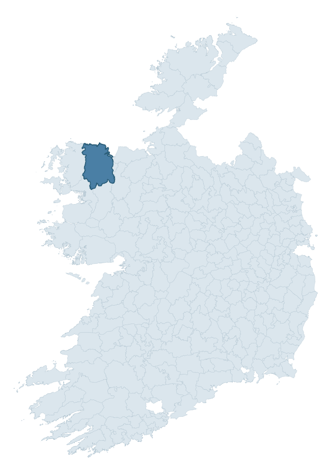
Where this barony sits in the Republic of Ireland
Geology and preservation
Bedrock geology shapes the landscape long before any settlement begins — controlling soil drainage, agricultural potential, the survival of upstanding monuments, and the preservation of buried archaeology. The figures below come from the Geological Survey Ireland 1:100,000 bedrock map.
The bedrock underlying Tirawley is predominantly limestone and shale (33% of the barony by area), laid down during the Carboniferous period (80% by area, around 359 to 299 million years ago). A substantial secondary geology of mudstone and siltstone (28%) adds further variety to the underlying landscape. The single largest mapped unit is the Downpatrick Formation (28% of the barony's bedrock). With 13 distinct rock types mapped, the barony sits in the top third of ROI baronies for geological diversity (96th percentile) — typically a sign of complex tectonic history or coastal mosaics of differing rock units.
Rock type composition
Largest mapped unit: Downpatrick Formation (28% of the barony)
Placename evidence
Logainm records 102 heritage-diagnostic placenames for Tirawley, drawn from townland and civil-parish names across the barony. The dominant stratum is pre-Christian and Early Medieval defensive — ráth-, lios-, dún-, and caiseal-prefixed names that mark Iron Age and early historic settlement. The leading diagnostic roots are ráth- (36 — earthen ringfort), cill- (24 — church), and dún- (12 — hilltop fort or promontory fort). This is well above the ROI average of 30.7 heritage placenames per barony — around 3.3× the typical figure. The presence of multiple heritage strata side by side indicates layered occupation of the landscape across successive prehistoric and historic periods. Logainm records 584 placenames for Tirawley (predominantly townland names). Of these, 102 (17%) carry one of the diagnostic Gaelic roots tracked above; the remainder draw on more generic landscape vocabulary that does not encode a heritage period.
Pre-Christian / Early Medieval Defensive
| Root | Count | Meaning |
|---|---|---|
| ráth- | 36 | earthen ringfort |
| dún- | 12 | hilltop or promontory fort |
| lios- | 7 | ringfort or enclosure |
| caiseal- | 2 | stone ringfort |
Early Christian Ecclesiastical
| Root | Count | Meaning |
|---|---|---|
| cill- | 24 | church (early) |
| cillín- | 6 | unconsecrated burial ground |
| teampall- | 2 | church (later medieval) |
| tobar- | 2 | holy well |
| gráinseach- | 1 | monastic farm / grange |
Burial, Ritual, and Norse-Contact
| Root | Count | Meaning |
|---|---|---|
| leacht- | 4 | grave monument |
| carn- | 3 | cairn |
| dumha- | 2 | mound |
| feart- | 1 | grave mound |
| gall- | 1 | foreigner — Norse settlement marker |
Other baronies in Mayo
About this profile
Click any section below to expand.
What is a barony?
A barony is a historic administrative unit in Ireland, broadly equivalent to an English hundred. The 280 baronies used here are from the OSi 2019 National Statutory Boundaries (generalised 20m), covering the 26 counties of the Republic of Ireland. Baronies derive from the Norman period, were formalised in the 17th century, and have not been redrawn for statistical purposes. They vary enormously in area, from compact urban baronies in Dublin to vast upland baronies in Connacht, and should not be compared by raw site count without accounting for area differences.
What counts as a site?
This profile combines three distinct heritage registers, each with its own definition of what constitutes a recordable site:
- Archaeological sites (NMS). The National Monuments Service Sites and Monuments Record (SMR) catalogues every known archaeological monument or site of archaeological interest in the Republic, from prehistoric burial mounds and ringforts to medieval churches and post-medieval defensive works. Inclusion does not require legal protection — only that the site has been identified, surveyed, and assessed as having archaeological value. A separate subset of these sites lies within a recorded protection zone, which gives them statutory protection under the National Monuments Acts.
- Listed buildings (NIAH). The National Inventory of Architectural Heritage records buildings of architectural, historical, archaeological, artistic, cultural, scientific, social, or technical interest. Each surveyed structure is appraised on a five-tier scale: International, National, Regional, Local, and Record-Only. The NIAH appraisal is informational rather than strictly statutory, but it underpins local-authority Record of Protected Structures (RPS) listings.
- Heritage placenames (Logainm). Logainm is the authoritative database of Irish placenames maintained by the Placenames Branch. This profile applies a heritage-diagnostic classifier to the Irish-language form of each townland name, flagging roots that signal defensive sites (ráth-, lios-, dún-, caiseal-, cathair-), ecclesiastical foundations (cill-, teampall-, domhnach-, mainistir-), prehistoric burial-ritual features (tuaim-, carn-, leaba-), or Norse-contact settlement (gall-). Townlands without one of these diagnostic roots are not flagged here — they may still carry historical significance, but that significance is not encoded in the name itself.
Editorial principles
The narrative sections of this profile follow several explicit principles:
- Evidential. Every claim about this barony’s heritage character is anchored in the underlying register data. Where a site count, a placename count, or a percentile rank is cited, it is computed from the source datasets at export time, not estimated.
- Comparative. Counts and metrics are reported alongside their percentile rank against the other 279 ROI baronies. A barony with 50 ringforts in absolute terms could be unusually high or unusually low depending on its size and regional context; percentile ranking removes that ambiguity.
- Transparent on limits. Where a register has known coverage gaps, survey biases, or data-quality issues that affect this barony’s figures, the profile flags them rather than presenting the numbers as definitive.
- No interpretation beyond what the data supports. The narrative does not speculate about historical events, social dynamics, or cultural meaning beyond what the recorded heritage and placename evidence directly attests.
Data caveats and limits
- NMS Sites and Monuments Record is the product of survey campaigns conducted at different intensities across different counties and decades. Some baronies have been surveyed more thoroughly than others, and absolute counts should be read in that light. Sites destroyed by development before survey are typically not represented; sites in heavily forested or upland terrain are sometimes under-recorded.
- NIAH coverage is broadly complete for the Republic of Ireland but the survey was conducted on a rolling county-by-county basis, and the most recent appraisal date varies. Buildings demolished or substantially altered after their original survey may still appear in the register; conversely, recent buildings of merit may not yet have been appraised.
- Logainm classification applies a deliberately conservative pattern-matching approach to the Irish-language townland forms. The classifier prioritises true positives over recall: a townland may carry a heritage signal that the classifier doesn’t recognise, particularly where the diagnostic root has been heavily anglicised or where the townland name draws on a less common term. The 60,000+ townland records and ~9,800 classified placenames give a substantial signal at barony scale, but individual townland names should be checked against Logainm directly for definitive interpretation.
- Period attribution. The chronological distribution reflects only those NMS sites that carry a recognised period attribution in the source data. Sites listed as “Unknown” period are excluded from the dated subset.
- Boundary changes. Some baronies have undergone minor boundary adjustments since their 19th-century definition; the OSi 2019 generalised boundaries used here are the current statutory definition and may differ slightly from historical maps in border areas.
- Bedrock geology is mapped at 1:100,000 scale, which means local variation within a barony — small pockets of different rock type, mineral veins, alluvium overlying bedrock — is generalised. The dominant-system and rocktype figures are area-weighted, so a barony reading “70% Carboniferous limestone” may still contain small but archaeologically important pockets of older or younger rock. Around 3% of GSI polygons do not match the lexicon and contribute no rocktype or system attribution.
Data sources
- National Monuments Service — Sites and Monuments Record (SMR) https://data.gov.ie/dataset/national-monuments-service-archaeological-survey-of-ireland
- National Inventory of Architectural Heritage (NIAH) https://data.gov.ie/dataset/national-inventory-of-architectural-heritage-niah-national-dataset
- Logainm — Placenames Database of Ireland https://www.logainm.ie/
- Ordnance Survey Ireland — National Statutory Barony Boundaries 2019 https://data-osi.opendata.arcgis.com/
- EURODEM — European Digital Elevation Model https://www.mapsforeurope.org/datasets/euro-dem
- ESA WorldCover https://esa-worldcover.org/en
- Geological Survey Ireland — 1:100,000 Bedrock Geology https://www.gsi.ie/en-ie/data-and-maps/Pages/Bedrock.aspx
Explore more: Search any of the 280 ROI baronies, browse by historical province, or read the methodology and data sources for the full Republic of Ireland Heritage Tool.