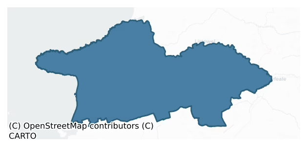
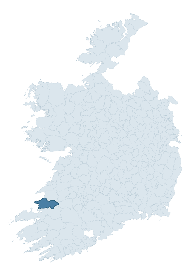
Clanmaurice is a barony of County Kerry, in the historical province of Munster (Irish: Clann Mhuiris), covering 490 km² of land. The barony records 1,016 NMS archaeological sites and 31 NIAH listed buildings, placing it at around the 57th percentile among 280 ROI baronies for sites per km². This means it is in the upper half of all baronies for sites per km². Dated archaeological evidence runs from the Neolithic through to the Modern, spanning 8 of 9 archaeological periods, placing the barony in the 62nd percentile among 280 ROI baronies for chronological depth. This means it is in the upper half of all baronies for chronological depth. The largest dated subset of recorded sites dates to the Iron Age. Logainm flags 58 placenames in the barony as carrying a recognised heritage root; the largest share — around 55% — are names associated with early Christian church and monastic foundations.

Heritage at a glance
Percentile rankings throughout this profile compare each barony only against the other 279 Republic of Ireland baronies.
The recorded heritage of Clanmaurice
The National Monuments Service Sites and Monuments Record (SMR) is the statutory inventory of archaeological sites for the Republic of Ireland, maintained by the Department of Tourism, Culture, Arts, Gaeltacht, Sport and Media. Sites recorded here include earthworks, ringforts, megalithic tombs, ecclesiastical remains, and post-medieval features; not every record is legally protected, but each is registered as a monument of archaeological interest.
The National Monuments Service records 1,016 archaeological sites in Clanmaurice, putting it at the 57th percentile among 280 ROI baronies for sites per km². This means it is in the upper half of all baronies for sites per km². Protection coverage is near-universal — 1,006 sites (99%) fall within a recorded monument protection zone, indicating an extensively surveyed landscape. The dominant category is defensive sites — ringforts, enclosures, hillforts, and stone forts (654 sites, 64% of the record). Ringfort – rath is the most prevalent type, making up 36% of the barony's recorded sites (370 records) — well above the ROI average of 20% across all baronies where this type occurs. Ringfort – rath is an earthen ringfort enclosed by a bank and external ditch — the most common Early Medieval farmstead, broadly dated 500–1000 AD. Other significant types include Enclosure (133) and Souterrain (98). Enclosure is a banked or ditched feature of uncertain type, used as a catch-all where the original function cannot be determined from surface evidence; Souterrain is an underground stone-built passage and chamber, generally Early Medieval and often associated with ringforts as a defensive or storage feature. Across the barony's 490 km², this gives a recorded density of 2.07 sites per km².
Most common monument types
Hover or tap a monument type to see its definition.
| Type | Count |
|---|---|
| Ringfort – rath an earthen ringfort enclosed by a bank and external ditch — the most common Early Medieval farmstead, broadly dated 500–1000 AD | 370 |
| Enclosure a banked or ditched feature of uncertain type, used as a catch-all where the original function cannot be determined from surface evidence | 133 |
| Souterrain an underground stone-built passage and chamber, generally Early Medieval and often associated with ringforts as a defensive or storage feature | 98 |
| Fulacht fia a horseshoe-shaped Bronze Age burnt mound built around a sunken trough beside a water source, traditionally interpreted as a cooking site | 39 |
| Mound an artificial earthen elevation of unknown date and function that cannot be classified as another known monument type | 35 |
| House – indeterminate date a habitation building whose date cannot be determined from available evidence | 33 |
| Hut site a low stone or earthen foundation enclosing a small circular or oval area, generally interpreted as a former dwelling, of any date from prehistory to the medieval period | 30 |
| Ringfort – cashel the stone-walled equivalent of the rath, found mainly in upland or western areas, broadly dated 500–1000 AD | 28 |
Chronological distribution
The dated archaeological record for Clanmaurice spans from the Neolithic through to the Modern, with activity attested across 8 of 9 archaeological periods. Every period from earliest to latest is represented in the record — an unbroken sequence of dated activity across the full chronological span. Activity concentrates most heavily in the Iron Age (602 sites, 66% of dated material), with the Early Medieval forming a secondary peak (208 sites, 23%). A further 107 recorded sites (11% of the overall NMS register for the barony) carry no period attribution — appearing as 'Unknown' in the bar chart below. This typically reflects either records that pre-date the standardised period vocabulary or sites awaiting specialist dating review, rather than a genuine absence of chronological evidence.
Sample of recorded monuments
Show 25 sample monuments (of 1,016 total)
A representative sample of 25 recorded monuments drawn from the barony’s 1,016 total NMS entries. Sites within a recorded monument protection zone and rarer site types are prioritised so the list shows a meaningful cross-section rather than only the most common type. Each entry shows the official Sites and Monuments Record reference number and the description published by the National Monuments Service.
Bridge
Ballingarry Castle. The earliest part of this structure was possibly constructed around 1280 by the Cantillon family. According to sources (Barrington, 1976), it resembled a modern version of a promontory fort…
Ballingarry Castle. The earliest part of this structure was possibly constructed around 1280 by the Cantillon family. According to sources (Barrington, 1976), it resembled a modern version of a promontory fort (KE008-006001-), consisting of a gateway with adjoining curtain walls. The early remains consist of a semi-circular bank on the mainland, measuring c 120m long and c 10m wide.
In 1585 Ballingarry and other lands belonging to the Cantillons were granted to George Isham, who left the occupants undisturbed, taking only the head rents. However, by 1602 Garrett Roe Stack, brother-in-law to Lord Kerry, garrisoned Ballingarry, and Sir Charles Wilmot put the castle under siege for over a year. In 1603 Gerald Mac Morris surrendered the castle and was executed, along with some of the leaders.
During the Cromwellian wars Ballingarry Castle came under Colonel David Crosbie, a loyalist, who, according to Smith (1756), built a small castle. At this time Ballingarry was not confined to the isthmus. Crosbie extended the fortress by constructing the two trenches that lead to the drawbridge, and he also built several houses on the peninsula to house English families. Extended in order to withstand the attacks of the Irish, Crosbie was able to secure the castle with the help of his friend Lord Inchiquin of Clare, who provided the garrison with food and ammunition.
Drawbridge (KE008-006003-): crossing the deep chasm, there is a strong stone wall with cut-stone corners cut into th…
Structure
Ballingarry Castle. The earliest part of this structure was possibly constructed around 1280 by the Cantillon family. According to sources (Barrington, 1976), it resembled a modern version of a promontory fort…
Ballingarry Castle. The earliest part of this structure was possibly constructed around 1280 by the Cantillon family. According to sources (Barrington, 1976), it resembled a modern version of a promontory fort (KE008-006001-), consisting of a gateway with adjoining curtain walls. The early remains consist of a semi-circular bank on the mainland, measuring c 120m long and c 10m wide.
In 1585 Ballingarry and other lands belonging to the Cantillons were granted to George Isham, who left the occupants undisturbed, taking only the head rents. However, by 1602 Garrett Roe Stack, brother-in-law to Lord Kerry, garrisoned Ballingarry, and Sir Charles Wilmot put the castle under siege for over a year. In 1603 Gerald Mac Morris surrendered the castle and was executed, along with some of the leaders.
During the Cromwellian wars Ballingarry Castle came under Colonel David Crosbie, a loyalist, who, according to Smith (1756), built a small castle. At this time Ballingarry was not confined to the isthmus. Crosbie extended the fortress by constructing the two trenches that lead to the drawbridge, and he also built several houses on the peninsula to house English families. Extended in order to withstand the attacks of the Irish, Crosbie was able to secure the castle with the help of his friend Lord Inchiquin of Clare, who provided the garrison with food and ammunition.
From 1641-45 Ballingarry was besieged on several occasions; a truce negotiated in 1644 broke down. On 15 February 1645 C…
Bastioned fort
KE009-001001- is situated on a rise with the land gently sloping NE. A trackway runs immediately W of it. This site is marked on the 1841-42 OS map as a circular enclosure and 'cave' is marked in the interior; on the…
KE009-001001- is situated on a rise with the land gently sloping NE. A trackway runs immediately W of it. This site is marked on the 1841-42 OS map as a circular enclosure and 'cave' is marked in the interior; on the later edition map of 1915-16 the W section of the fort has been levelled. Today this site consists of a semi-circular bank constructed mainly of stones, within which are the remains of a collapsed souterrain.
Enclosing the inner bank on the N and E side is a three-pointed enclosure (KE009-001003-) that could possibly suggest later remains.
At a distance of c 8m from this bank is the three-pointed enclosure (KE009-001003-) already mentioned. The external height of this three-pointed bank above the surrounding land is .3m, the internal height .2m, and the width of the bank at its base is 2m. It runs from the N through E to SE where it curves into the inner bank.
The above description is derived from C. Toal, ‘North Kerry Archaeological Survey’. Dingle. Brandon in association with FAS Training and Employment Authority (1995), no. 806. In certain instances the entries have been revised and updated in the light of recent research.
Date of upload: 3 August 2013
Road – road/trackway
The Archaeological Survey of Ireland (ASI) is in the process of providing information on all monuments on The Historic Environment Viewer (HEV). Currently the information for this record has not been uploaded. To…
The Archaeological Survey of Ireland (ASI) is in the process of providing information on all monuments on The Historic Environment Viewer (HEV). Currently the information for this record has not been uploaded. To access available information for research purposes please make an appointment in advance with the Archive Unit (open Fridays 10.00 am – 5.00 pm), Department of Culture, Heritage and the Gaeltacht, The Custom House, Dublin 1 D01W6XO or email nmarchive@chg.gov.ie.
Habitation site
An old bohareen leads down to the possible habitation site on Pierce's Island and the possible lead mines. The Pierces (descendants of Piers, younger son of Thomas, 1st Lord of Kerry 1280) gave their name to Pierce's…
An old bohareen leads down to the possible habitation site on Pierce's Island and the possible lead mines. The Pierces (descendants of Piers, younger son of Thomas, 1st Lord of Kerry 1280) gave their name to Pierce's Island, a tall rock which is isolated in high water. There would appear to be a rectangular structure on top of the island, but for safety reasons it could not be closely examined or recorded. According to locals, steps once led up to this rectangular structure.
To the E of Pierce's Island there appears to be some sort of enclosure which contains a number of mounds and depressions. According to Sir Richard Cox (1687): 'Tyduff or Kerry Head the south promontory of the River Shenin near which are round Amethysts and Egmerines. Not far from thence is a great cave called Powlaglugger where such a noise is made by the sea before a storm as is heard 60 miles off. Hereabouts is the best Lead mine in Ireland, but hard to Worke (in correction) because it runs into the ocean.' This could possibly refer to this site, and might also support the lead mine tradition at Poultarriff (KE009-092—-). Mr John Pierse has stated that there is also a local tradition of collecting salt in this area.
This enclosure is cut into two unequal parts by a fieldbank running in a NE-SW direction. An earthen enclosing bank surrounds this from the NE through E to S to SW; the rest is a natural cliff drop to the sea. The enclosing bank can best be traced from the S to SW, where it is 5m wide…
Settlement deserted – medieval
The deserted borough of Rattoo was described in the Urban Survey of Kerry as follows; 'The deserted borough of Rattoo is situated about one mile southeast of Ballyduff, twelve miles north of Tralee and seven miles west…
The deserted borough of Rattoo was described in the Urban Survey of Kerry as follows; 'The deserted borough of Rattoo is situated about one mile southeast of Ballyduff, twelve miles north of Tralee and seven miles west of Listowel, on the flat coastal plain of north Kerry. Although it is uninhabited today, Rattoo was the site of an ecclesiastical centre in the Early Historic period and of a borough which was probably founded in the thirteenth
century. The placename is a corruption of Rath Tuaidh, or more fully, Rath maigi tuaidh, i. e. the fort of the northern plain.
The presence of a round tower indicates that Ratoo was the site of a wealthy early ecclesiastical site, but
documentary information on it is very scanty. Gwynn and Hadcock (1970, 43) suggest that it may have been an early sixth century foundation associated with Bishop Lughach. It is likely that the church site continued to function into the thirteenth century because it is otherwise difficult to understand why it was chosen by the Anglo-Normans as a borough site.
The earliest definite evidence for the existence of the borough is in sixteenth century sources but its
be traced to c. 1210, when Meiler Fitzhenry was granted much of north Kerry by King John (Orpen 1911-20, iii, 123; Otway-Ruthven 1968, 86). A hospital dedicated to St. John the Baptist (Fratres Cruciferi) was founded at Rattoo by Saivinus, son of Cynan.
Documentary references are scarce throughout the Middle the Ages. In 1597 a burgage in Rat…
Religious house – Augustinian canons
National Monument No. 55. This site is situated on low-lying pastureland NE of Rattoo round tower (KE009-056001-) and church (KE009-056003-). To the E lies the River Brick, which flows into the River Cashen.
The…
National Monument No. 55. This site is situated on low-lying pastureland NE of Rattoo round tower (KE009-056001-) and church (KE009-056003-). To the E lies the River Brick, which flows into the River Cashen.
The Hospital of St. John the Baptist (Fratres Cruciferi) & Arroasian Abbey of SS. Peter & Paul was described in the Urban Survey of Kerry as follows: ‘The hospital of St. John the Baptist was founded by Brother William c. 1200, during the initial Anglo-Norman settlement of north Kerry (Brooks 1936, xvi; Gwynn and Hadcock 1970, 191, 216). In two charters c. 1200, the hospital was granted the vill of 'Rahtuahe' by Saivinus Son of Canann (Cynan), and confirmed in its endowments by Meiler, son of Meiler FitzHenry (Brooks 1936, 357-9, nos. 563-4).
Ware was the first to State that this hospital subsequently became an Arroasian abbey dedicated to SS Peter and Paul and although this statement is unsubstantiated, the absence of any later references the hospital strongly suggests that it is correct. Gwynn and Hadcock (1970, 191) follow Walsh and O'Sullivan (1949, 56) in dating this transition before 1207, but in fact this statement is without foundation. The transition took place before 1276, however, when the first reference to the arroasians at Rattoo occcurs (Sweetman 1875-86, ii, no. 1227). Little is known of the abbey's history. In 1318 an escheator'S account for its temporalities noted that they were "not sufficient for the maintainance of the monks there, as the t…
Well
Lisnacreev/Lios na gGraobh (ringfort of the bushes) KE009-062—-.
According to Miss Hickson (1883-84), a large flat stone was discovered at some distance below the surface of the ground and when removed it revealed…
Lisnacreev/Lios na gGraobh (ringfort of the bushes) KE009-062—-.
According to Miss Hickson (1883-84), a large flat stone was discovered at some distance below the surface of the ground and when removed it revealed a deep well whose wall was stone lined.
The above description is derived from C. Toal, ‘North Kerry Archaeological Survey’. Dingle. Brandon in association with FAS Training and Employment Authority (1995), no. 808. In certain instances the entries have been revised and updated in the light of recent research.
Date of upload: 1 August 2013
Cross-inscribed stone
St Macadaw's Church (in ruins), graveyard (KE013-023003-). About 3m from the E gable there is a square stone mound, 3.2m x 3.2m, and situated on top of this is a sculptured rock which had a cross painted in red on its…
St Macadaw's Church (in ruins), graveyard (KE013-023003-). About 3m from the E gable there is a square stone mound, 3.2m x 3.2m, and situated on top of this is a sculptured rock which had a cross painted in red on its side. The cross can still be seen. There is an alcove at the top of the sculptured rock to hold the round amulets locally known as 'bauleys'. According to tradition, two round amulets were blessed by St Erc and are believed to be a cure for all evils and ills. One of the bauleys lies in the graveyard, while the other is held in safe-keeping by the local Corridan family, who hold exclusive burial rights to the graveyard. The use and tradition of these amulets is interesting; a quantity of water is taken from the nearby holy well (KE013-026—-) and placed in a vessel with the amulet, and the water is then drunk in honour of St Erc.
Folklore collected from Glenderry School recorded the following details about The Church of the Son of David and the cross-inscribed stone; 'A mile from the point of Kerry head there is a height, and on it there is a church called The church of the son of David." No one is buried there but the Corridons. Before a Corridon dies there is a light seen there. There is a stone there outside the church yard and if any one takes it away it would come back again the following day. It is a very ancient church. There is nothing there now but the walls and ruins of it. They say there is a Bishop buried under this stone by the name of Bishop…
Castle – Anglo-Norman masonry castle
The original Lixnaw Castle was probably built in the 12th or 13th century by the Baron of Lixnaw. Maurice, second Lord of Kerry, sat in the Parliament of 1295; he married Mary, of Scotch descent, and with her he…
The original Lixnaw Castle was probably built in the 12th or 13th century by the Baron of Lixnaw. Maurice, second Lord of Kerry, sat in the Parliament of 1295; he married Mary, of Scotch descent, and with her he acquired the lands of Galey O'Brenan and Cloghan Mac Quin.
According to Miss Hickson (1883-84) Lixnaw was an immensely strong square castle built on slightly elevated land close to the River Brick. The possible site of the original castle can still be traced today. The enclosed mound, which is situated on elevated land, measures 30m N-S and 34m E-W. Immediately NE of this rise is a quarry, while to the SE lies the 'Cock House' (1012) (both being later additions). This raised mound is enclosed by a bank which encircles the whole area. Two gaps are to be noticed, one to the N measuring 22m, the other S to ESE measuring 58m. This was in turn encircled by another bank, but this can only be traced on the W side. There is a large, wide bank, measuring 26m in width, on the W side. This bank is only traceable for 113m, with a gap of 6m which is possibly the original entrance to the castle ground area. It is facing the River Brick, and boats could have come right up to this point, where entrance was probably gained by a drawbridge. Though grass covered, the banks encircling the elevated area would appear to have been constructed of stone. There are also some grass-covered wall foundations adjoining the mound, which may be the remains of other buildings.
This castle was th…
Cross – High cross
Killahan Church (KE015-108001-), graveyard (KE015-108003-).
To the W of this site, across a road, lies the stone cross of Tonaknock (KE015-108002-). This is the original location of the cross, for the present…
Killahan Church (KE015-108001-), graveyard (KE015-108003-).
To the W of this site, across a road, lies the stone cross of Tonaknock (KE015-108002-). This is the original location of the cross, for the present location see KE015-108004.
The above description is derived from C. Toal, ‘North Kerry Archaeological Survey’. Dingle. Brandon in association with FAS Training and Employment Authority (1995), no. 952. In certain instances the entries have been revised and updated in the light of recent research.
Date of upload: 3 August 2013
Monumental structure
The tower (KE016-014002-) was 12m high and 30m in circumference and the walls 1m thick. The tower contained four semi-circular windows. The tomb was circular in shape, c 4.5m in diameter and had a flat stone roof. The…
The tower (KE016-014002-) was 12m high and 30m in circumference and the walls 1m thick. The tower contained four semi-circular windows. The tomb was circular in shape, c 4.5m in diameter and had a flat stone roof. The tomb lay directly under the tower, so the tomb's roof was the tower's floor. The tower was protected by a wall 3.5m high. William died in 1697 and according to tradition was buried here, as were his father and son. The coffin was made of lead and was desecrated by 'Moonlighters for the making of ammunition during the land war. It was demolished by the County Council for quarrying purposes in 1962 and no surface trace of it can be seen today' (O'Ruane). This townland was originally called Kilbinane but was renamed after Fitzmaurice's burial monument.
The above description is derived from C. Toal, ‘North Kerry Archaeological Survey’. Dingle. Brandon in association with FAS Training and Employment Authority (1995), no. 955. In certain instances the entries have been revised and updated in the light of recent research.
Date of upload: 3 August 2013
Stone circle
Marked on the 1841-42 and 1915 OS maps as 'Stone Circle'. It was broken down many years ago and no trace survives.
The above description is derived from C. Toal, ‘North Kerry Archaeological Survey’. Dingle. Brandon…
Marked on the 1841-42 and 1915 OS maps as 'Stone Circle'. It was broken down many years ago and no trace survives.
The above description is derived from C. Toal, ‘North Kerry Archaeological Survey’. Dingle. Brandon in association with FAS Training and Employment Authority (1995), no. 32. In certain instances the entries have been revised and updated in the light of recent research.
Date of upload: 1 August 2013
Megalithic structure
The Archaeological Survey of Ireland (ASI) is in the process of providing information on all monuments on The Historic Environment Viewer (HEV). Currently the information for this record has not been uploaded. To…
The Archaeological Survey of Ireland (ASI) is in the process of providing information on all monuments on The Historic Environment Viewer (HEV). Currently the information for this record has not been uploaded. To access available information for research purposes please make an appointment in advance with the Archive Unit (open Fridays 10.00 am – 5.00 pm), Department of Culture, Heritage and the Gaeltacht, The Custom House, Dublin 1 D01W6XO or email nmarchive@chg.gov.ie.
Historic town
The historic town of Ardfert was described in the Urban Survey of Kerry as follows; ‘Throughout the Middle Ages, however, Ardfert was one of the most important settlement sites in Kerry an episcopal see, and, under the…
The historic town of Ardfert was described in the Urban Survey of Kerry as follows; ‘Throughout the Middle Ages, however, Ardfert was one of the most important settlement sites in Kerry an episcopal see, and, under the Normans, a borough. The placename, "Ard Ferta", means the height of burial mounds. Sometimes it is referred to as Ard Ferta Brenaind, after its patron saint.
The church of Ardfert is generally regarded as a sixth century foundation of St. Brendan of Clonfert but nothing is known of its history until the eleventh century (Gwynn and Hadcock 1970, 62). In 1031 a reference occurs to one MacMara fasting 'aginst' Brendan at Ardfert (Ann. Inisf.) while in 1032 the death of Ailill Ua Flaithim, "erenagh of Ard Ferta …..leading jurist of Mumu" is recorded. In 1046 the stone church (dam liac) Ardfert was destroyed by lightning (Ann. Inisf.) and the burning of Ardfert is recorded in 1089 (AFM). In 1111 at the Synod of Raith Bressail Ratass was chosen as the centre of the diocese of Kerry but it was soon replaced by Ardfert which remained the episcopal see throughout the Middle Ages (Gwynn and Hadcock 1970, 62, 95). In 1117 the death of Anmchadh O hAnmchadha, bishop of Ardfert, is recorded (AFM). In 1152, however, it was burned by O Cuilein, king of Ui Chonaill Gabhra (Ó hInnse 1947, 35). It was burned again in 1179 (Ann. Inisf., AFM) and in 1180 it was plundered by the Clann Charthaigh who "carried off all the livestock they found there….. [and] killed many senior…
Cathedral
National Monument No. 54. St Brendan's Cathedral (in ruins). Situated on an elevated rock outcrop to the S of the River Tyshe (Abhainn na Taibhse – river of the spectre). The complex includes the excavated and…
National Monument No. 54. St Brendan's Cathedral (in ruins). Situated on an elevated rock outcrop to the S of the River Tyshe (Abhainn na Taibhse – river of the spectre). The complex includes the excavated and conserved ruins of a medieval cathedral whose chronology extends between the 11th to the 17th centuries. Ardfert is derived from Ard Fhearta which has several possible meanings. The most likely is ‘the height of the burial mound’ (O’Connor 1990, 5; Moore 2007, 13). The Early Medieval foundation at Ardfert is generally believed to have been founded by St. Brendan of Clonfert in the 6th century, however, there is no contemporary evidence to support this claim and it is most likely that his tutor and mentor St. Erc was the founder in the 5th century (Moore 2007, 16). The cathedral was fully excavated by Fionnbarr Moore, senior archaeologist with the NMS, over a seven year period in tandem with major conservation works carried out by Grellan Rourke of the OPW. These works have now been completed and Ardfert cathedral is now a managed visitor centre open to the public. All excavated interments in the cathedral were reburied in the newer section of the graveyard abutting the old one at the east (Dunne 2012, 5).
St. Brendan's Cathedral was described in the Urban Survey of Kerry as follows; 'Historically almost nothing is known of this building from medieval documentary sources but it can be suggested on architectural grounds that the cathedral was built incorporating o…
Religious house – Franciscan friars
National Monument No. 358. Ardfert Franciscan friary was described in the Urban Survey of Kerry as follows; 'Since at least the seventeenth century the foundation date of this friary has been placed at c. 1253…
National Monument No. 358. Ardfert Franciscan friary was described in the Urban Survey of Kerry as follows; 'Since at least the seventeenth century the foundation date of this friary has been placed at c. 1253 (Jennings 1934, 153) but it is likely that this date is based on the misreading of a fifteenth century inscription (Nicholls 1970, 24-5; FitzMaurice and Little 1920,19). The earliest surviving contemporary reference to the friary occurs in 1307 when grain was stolen from a chest in the church (Mills 1914, 408). Thereafter little is known of the friary's history until 1584 when the friars were expelled by the English (Jennings 1934, 153). Hickson (1895, 33) states that the church tower was subsequently occupied by English soldiers. In 1587 the friary was granted to the English planters, Walshingham and Denny (Brewer and Bullen 1868, 451). Brady (1867, xvii) states that John Crosbie, who was appointed bishop of Ardfert in 1600, settled at the friary, which remained in the hands of the Crosbie family until the twentieth century. In 1629 the Franciscan historian Matthews noted that the family of FitzMaurice of Kerry one of whom was the founder, had their tombs in the friary (Jennings 1934, 153) and later writers also describe the friary as the main burial place of the FitzMaurice lords of Kerry or Lixnaw (FitzMaurice and Little 1920, 20; Gwynn and Hadcock 1970, 242).
The friary consists of a church and a cloister with remains of the claustral buildings on its north…
Stone head
Described by Toal (1995, no. 28) as follows; 'According to the Kerry Field Club Notes (1943), a small gallán lay W of Killeacle (21); a small carved head (KE020-073001-) was found close by and placed on top of the…
Described by Toal (1995, no. 28) as follows; 'According to the Kerry Field Club Notes (1943), a small gallán lay W of Killeacle (21); a small carved head (KE020-073001-) was found close by and placed on top of the gallán. No surviving trace'.
In 1939 Captain D.B. O’Connell of Killarney recorded the following details about a stone head and a door-jamb recovered from the field wall running across the S face of Ardconnell Hill; ‘About 500 yds [457m] W, by S from the prominent landmark, the gallauns [KE020-020001-] on the summit of Ardconnell Hill is a small standing stone. These two stones mark off an area which, at one time, was fairly thickly populated. The large Fort marked as “Caherferta” [KE020-037—-] has been levelled by a former owner of the land but, besides this there are extensive remains of habitation-sites of some kind. Along the S face of the rising ground (shown by the contour-line) attempts at quarrying have been made into the out-crop which forms the hill and the top of the hill shows numerous foundation sites and old field-fences now demolished. The only stone walls now standing is the long one (Marked C.W.) which turns S with the townland boundary, continues S until it turns E below the brow of the hill and so back to the road. I wish to draw attention to “finds” made amongst the stones of this wall where it runs N and South. The most interesting was a block of limestone 14 ins [0.35m] long by 9 ins [0.22m] high by 7 ins [0.17m] thick. This is “dr…
Religious house – Cistercian monks
St. Mary's monastery of Abbeydorney (Abbey of O'Dorney/ Mainistir Ó dTorna) or Kyrieleyson is situated half a mile NE of Abbeydorney village, in the parish of O'Dorney, Diocese of Ardfert (Kerry), Barony of Clanmaurice.…
St. Mary's monastery of Abbeydorney (Abbey of O'Dorney/ Mainistir Ó dTorna) or Kyrieleyson is situated half a mile NE of Abbeydorney village, in the parish of O'Dorney, Diocese of Ardfert (Kerry), Barony of Clanmaurice. This Cistercian Monastery of Kyrie Eleison [Greek word for "Lord have mercy"] (Uí Thorna, a local sept whose tuath was here and who with another sept, the Uí Fhlannáin, gave their name to the rural deanery of Othorna and Offlanan) was founded in 1154, as a daughter house of Monasteranenagh, Co. Limerick [LI031-050004-] possibly under the influence or patronage of King Turlough O'Brien of Thomond (O'Connell and Costello 1958, 18). Abbeydorney was a sister house of Mellifont [LH023-007002-]. The first abbot of Mellifont, Christian O'Conairce, who afterwards became bishop of Lismore, resigned and retired into O'Dorney monastery about 1179, where he died in 1186 (O'Connell and Costello 1958, 18). In 1227 the abbot was deposed for being involved in the conspiracy of Mellifont (Gwynn and Hadcock 1970, 123). Abbot Thomas, a son of Maurice Lord Kerry, who died c. 1303, was also abbot of Fermoy (CO035-024—-); Aeneas O'Cormac was abbot in 1410, and Gerald, a son of Patrick Lord Kerry was abbot perhaps c. 1420 (ibid.). The 1302-06 Ecclesiastical Taxation of the Diocese of Ardfert, listed the 'Deanery of Othorna [O'Dorney] and Offlannan' in which the Cistercian monastery stood (Cal. Doc. Ire. Vol. 5, 296). This taxation recorded that the 'Revenue of the house of…
Penitential station
This is marked on the 1841-42 and 1898 OS maps as 'Tobernamolt' (Tobar na Molt – well of the wethers).
Situation and Description: This well is approached by a path through the fields. This site consists of a small…
This is marked on the 1841-42 and 1898 OS maps as 'Tobernamolt' (Tobar na Molt – well of the wethers).
Situation and Description: This well is approached by a path through the fields. This site consists of a small rectangular enclosure (KE021-115001-) which surrounds the well's small clear pool. There is a small building and an altar with a slab depicting three figures: St Brendan, St Erc and St Ita. The site is the reputed burial place of St Ita (KE021-115005-)
Rounds/Offerings: The well is visited on the Saturdays before May Day, 24 June and 29 September. Three rounds of three rosaries are recited: the first around the 'grave', the second around the well and 'altar', and the third around the well, 'grave' and 'Altar' (KE021-115003-). The water is said to cure all ailments, whether drunk, bathed in or taken away.
Legends: (a) The well sprang up at the prayer of St Ita. (b) St Ita is buried in the 'grave', (c) When St Erc baptised St Brendan at the well, he was presented with three wethers, hence the name, (d) Mass was said at the 'altar' in penal times, (e) A Protestant landlord carried away the stone to Oakpark, Tralee; it was miraculously restored to the well.
The above description is derived from C. Toal, ‘North Kerry Archaeological Survey’. Dingle. Brandon in association with FAS Training and Employment Authority (1995), no. 914. In certain instances the entries have been revised and updated in the light of recent research.
Date of upload: 3 August 2013
Kiln
In pasture, on a S-facing slope. According to O’Connell (1938, 145), on the NW side of the ringfort (KE022-014—-) a number of large pits with charcoal stained sides were visible cutting through the fosse and bank…
In pasture, on a S-facing slope. According to O’Connell (1938, 145), on the NW side of the ringfort (KE022-014—-) a number of large pits with charcoal stained sides were visible cutting through the fosse and bank material. These possibly suggest the presence of a kiln, a localised quarry or the remains of a metalworking site. A disused limekiln is depicted on the OS 25-inch map (1892) map c. 240m ENE.
Compiled by: Matt Kelleher
Date of upload: 28 February 2014
Memorial stone
A stone, which was probably used to repair the wall, has been inserted inside the doorway of Rattoo Church (see KE009-056003-). The stone, measuring .4m by .3m, bears an inscription on its upper part. The inscription…
A stone, which was probably used to repair the wall, has been inserted inside the doorway of Rattoo Church (see KE009-056003-). The stone, measuring .4m by .3m, bears an inscription on its upper part. The inscription may read as follows: 'X MARGARET O'DINIGHEN, EJUS 1666, VXOR, HIC JACET' (Lynch, JRSAI 40, 1910, 244-245). For a full description see Toal (1995, 244, no. 938).
Compiled by: Matt Kelleher
Date of upload: 13 December 2011
Tomb – table tomb
Honora. Lady Dowager of Kerry 1668.
Limestone table tomb. In the vestry. Undecorated. Incised marginal inscription in Roman capitals:
THIS MONVMENT WAS ERECTED AND CHAPPLE REEDIFIED IN THE YEARE 1668 BY THE RIGHT…
Honora. Lady Dowager of Kerry 1668.
Limestone table tomb. In the vestry. Undecorated. Incised marginal inscription in Roman capitals:
THIS MONVMENT WAS ERECTED AND CHAPPLE REEDIFIED IN THE YEARE 1668 BY THE RIGHT HONOVR/ ABLE HANORA LADY DOWAGER OF KERRY FOR HERSELF HER/ CHILDREN AND THEIR POSTERITY ONLY ACCORDING TO HER AGREEMENT [WITH THE DEAN AND CHAPTER]
Dims: L. 213 W. 105 T.11.
Hickson 1888-91, 403-4
The above description is derived from Bradley, J., et al. 1987 Urban Archaeology Survey Part XIV County Kerry (33). Unpublished report. Office of Public Works. In certain instances the entries have been revised and updated in the light of recent research.
Date of upload: 11 January 2012
Tomb – effigial
National Monument No. 358. Episcopal slab. 13th/14th cents. In chancel. Tapering limestone slab with moulded edges, and missing the lower left corner. The wide end of the slab has the head of a bishop under a…
National Monument No. 358. Episcopal slab. 13th/14th cents. In chancel. Tapering limestone slab with moulded edges, and missing the lower left corner. The wide end of the slab has the head of a bishop under a multi-cusped and pinnacled ogee-headed canopy in deep false relief. There are three small heads carved in the cusps, a circular trefoil design in the left spandrel and a worn circular design in the right spandrel.
Dims: L. 144 W 57-38.
Effigy of a bishop or abbot described by Hunt (1974, 152-3) as; 'In the middle of the church lies a wedge
shaped slab carved in flat relief with a mitred head and with five smaller heads disposed beside and above it, beneath an ogee cusped arch. On the dexter an inturned crozier with a decorated head of circular form, on the sinister, a spear (?). The slab is very much worn and defaced and the carving is scarcely visible. The style is provincial, and the slab probably dates to the early fourteenth century'.
The above description is derived from Bradley, J., et al. 1987 Urban Archaeology Survey Part XIV County Kerry (48). Unpublished report. Office of Public Works. In certain instances the entries have been revised and updated in the light of recent research.
See attached drawing of slab by William F, Wakeman dated 1894, taken from Hickson 1895.
Revised by: Caimin O'Brien
Date of revised upload: 9 May 2022
Ringfort – rath
Internal diameter 24.6m N-S, 26m E-W
Lisnamuck/Lios na Muc (ringfort of the pigs). This univallate ringfort consists of a circular area enclosed by a well-defined bank and exterior fosse. The enclosing bank is c 6m…
Internal diameter 24.6m N-S, 26m E-W
Lisnamuck/Lios na Muc (ringfort of the pigs). This univallate ringfort consists of a circular area enclosed by a well-defined bank and exterior fosse. The enclosing bank is c 6m wide, 1.2m-2.4m high externally and on average .8m high above the interior. The external fosse, measuring 1.4m wide and .6m deep, can be traced for most of the site, except to the NE through E to S. The interior, which is at a higher level than the surrounding land, contains the remains of a rectangular house-site (KE008-009002), 14m x 6.6m internally, which is constructed of stone; the walls are 2m in thickness. 4m to the N of this lies a stone-lined circular depression, 2.4m x 2.8m, which is possibly the entrance to a souterrain (KE008-009001-). On the exterior side of the S bank there is a small semi-circular area whose bank is curved inwards towards the S bank and measures 7m internally. The bank is 2.6m wide and .6m high; it is possibly a small hut site connected to the fort. An entrance gap of l0.8m exists to the SE.
The above description is derived from C. Toal, ‘North Kerry Archaeological Survey’. Dingle. Brandon in association with FAS Training and Employment Authority (1995), no. 331. In certain instances the entries have been revised and updated in the light of recent research.
Date of upload: 2 August 2013
Listed buildings
The National Inventory of Architectural Heritage (NIAH) is a state survey appraising buildings of architectural, historical, archaeological, artistic, cultural, scientific, social, or technical interest. Each surveyed structure receives a rating from International (the highest, for buildings of European importance) through National, Regional, Local, and Record-Only.
The NIAH records only 31 listed buildings in Clanmaurice, the 14th percentile across ROI baronies — a relatively thin architectural record. The highest-graded structure include 1 of National significance. The Republic holds 937 National-graded buildings in total, so this barony accounts for around 0% of the national total. Construction dates concentrate most heavily in the Victorian (1830-1900) period. The most-recorded building type is house (10 examples, 32% of the listed stock).
Terrain and environment
Mean elevation across the barony is 71m — the 32nd percentile among 280 ROI baronies for elevation. This means it is in the bottom third of all baronies for elevation. Elevation matters for heritage because higher-altitude baronies typically favour defensive monuments — ringforts and hilltop forts placed on prominent ground — while lowland baronies are more likely to carry the dense settlement and church networks of intensive agricultural landscapes. The barony reaches 334m at its highest point — a vertical span of more than 263m within its boundary, indicating significant topographic diversity. Mean slope is 3.0° — the 36th percentile among 280 ROI baronies for slope. This means it is in the lower half of all baronies for slope. Slope is a key control on both land use and archaeological preservation: steep ground resists ploughing and tends to preserve earthworks intact, while gentle slopes favour intensive cultivation that damages or destroys surface archaeology over time. The Topographic Wetness Index averages 11.2, the 64th percentile among 280 ROI baronies for wetness. This means it is in the upper half of all baronies for wetness. Drainage matters for heritage because poorly-drained ground preserves organic archaeology (wooden trackways, leather, textiles, and on rare occasions human remains) far better than free-draining soil; well-drained ground favours arable use but destroys organic material rapidly. The land cover is dominated by improved grassland (81%) and woodland (13%).
Terrain measurements
Where this barony sits in the Republic of Ireland
Geology and preservation
Bedrock geology shapes the landscape long before any settlement begins — controlling soil drainage, agricultural potential, the survival of upstanding monuments, and the preservation of buried archaeology. The figures below come from the Geological Survey Ireland 1:100,000 bedrock map.
The bedrock underlying Clanmaurice is predominantly sandstone (26% of the barony by area), laid down during the Carboniferous period (80% by area, around 359 to 299 million years ago). Sandstone weathers to free-draining, moderately fertile soils that supported Early Medieval ringfort agriculture and later manorial estates. The rock itself is a major source of building stone — visible in churches, tower houses, and farm buildings across the barony's historic landscape. A substantial secondary geology of limestone (22%) and mudstone, siltstone, sandstone (14%) adds further variety to the underlying landscape. With 8 distinct rock types mapped, the barony sits in the top third of ROI baronies for geological diversity (78th percentile) — typically a sign of complex tectonic history or coastal mosaics of differing rock units.
Rock type composition
Largest mapped unit: Central Clare Group (14% of the barony)
Placename evidence
Logainm records 58 heritage-diagnostic placenames for Clanmaurice, drawn from townland and civil-parish names across the barony. The dominant stratum is Early Christian ecclesiastical — cill-, teampall-, and domhnach-prefixed names that record the dense network of early church foundations established between the fifth and tenth centuries. The leading diagnostic roots are cill- (29 — church), ráth- (14 — earthen ringfort), and lios- (7 — ringfort or enclosure). This is above the ROI average of 30.7 heritage placenames per barony. The presence of multiple heritage strata side by side indicates layered occupation of the landscape across successive prehistoric and historic periods. Logainm records 358 placenames for Clanmaurice (predominantly townland names). Of these, 58 (16%) carry one of the diagnostic Gaelic roots tracked above; the remainder draw on more generic landscape vocabulary that does not encode a heritage period.
Pre-Christian / Early Medieval Defensive
| Root | Count | Meaning |
|---|---|---|
| ráth- | 14 | earthen ringfort |
| lios- | 7 | ringfort or enclosure |
| dún- | 2 | hilltop or promontory fort |
| cathair- | 2 | stone fort |
Early Christian Ecclesiastical
| Root | Count | Meaning |
|---|---|---|
| cill- | 29 | church (early) |
| díseart- | 2 | hermitage |
| mainistir- | 1 | monastery |
Burial, Ritual, and Norse-Contact
| Root | Count | Meaning |
|---|---|---|
| leacht- | 1 | grave monument |
Other baronies in Kerry
- Trughanacmy
- Glanarought
- Iraghticonnor
- Dunkerron North
- Corkaguiny
- Dunkerron South
- Magunihy
- Clanwilliam — Tipperary
- Ikerrin — Tipperary
- Leitrim — Clare
See all 280 baronies in the Republic of Ireland Heritage Tool.

Explore further
Grounding History: 10 Maps of Northern Ireland’s Past
If you’re interested in Irish heritage more widely, the companion report for Northern Ireland brings together the analysis of all 462 NI wards into one place through 10 high-quality maps — covering monument density, archaeological periods, placename heritage, terrain, wetland, and the historic landscape at first survey. Take a look.
About this profile
Click any section below to expand.
What is a barony?
A barony is a historic administrative unit in Ireland, broadly equivalent to an English hundred. The 280 baronies used here are from the OSi 2019 National Statutory Boundaries (generalised 20m), covering the 26 counties of the Republic of Ireland. Baronies derive from the Norman period, were formalised in the 17th century, and have not been redrawn for statistical purposes. They vary enormously in area, from compact urban baronies in Dublin to vast upland baronies in Connacht, and should not be compared by raw site count without accounting for area differences.
What counts as a site?
This profile combines three distinct heritage registers, each with its own definition of what constitutes a recordable site:
- Archaeological sites (NMS). The National Monuments Service Sites and Monuments Record (SMR) catalogues every known archaeological monument or site of archaeological interest in the Republic, from prehistoric burial mounds and ringforts to medieval churches and post-medieval defensive works. Inclusion does not require legal protection — only that the site has been identified, surveyed, and assessed as having archaeological value. A separate subset of these sites lies within a recorded protection zone, which gives them statutory protection under the National Monuments Acts.
- Listed buildings (NIAH). The National Inventory of Architectural Heritage records buildings of architectural, historical, archaeological, artistic, cultural, scientific, social, or technical interest. Each surveyed structure is appraised on a five-tier scale: International, National, Regional, Local, and Record-Only. The NIAH appraisal is informational rather than strictly statutory, but it underpins local-authority Record of Protected Structures (RPS) listings.
- Heritage placenames (Logainm). Logainm is the authoritative database of Irish placenames maintained by the Placenames Branch. This profile applies a heritage-diagnostic classifier to the Irish-language form of each townland name, flagging roots that signal defensive sites (ráth-, lios-, dún-, caiseal-, cathair-), ecclesiastical foundations (cill-, teampall-, domhnach-, mainistir-), prehistoric burial-ritual features (tuaim-, carn-, leaba-), or Norse-contact settlement (gall-). Townlands without one of these diagnostic roots are not flagged here — they may still carry historical significance, but that significance is not encoded in the name itself.
Editorial principles
The narrative sections of this profile follow several explicit principles:
- Evidential. Every claim about this barony’s heritage character is anchored in the underlying register data. Where a site count, a placename count, or a percentile rank is cited, it is computed from the source datasets at export time, not estimated.
- Comparative. Counts and metrics are reported alongside their percentile rank against the other 279 ROI baronies. A barony with 50 ringforts in absolute terms could be unusually high or unusually low depending on its size and regional context; percentile ranking removes that ambiguity.
- Transparent on limits. Where a register has known coverage gaps, survey biases, or data-quality issues that affect this barony’s figures, the profile flags them rather than presenting the numbers as definitive.
- No interpretation beyond what the data supports. The narrative does not speculate about historical events, social dynamics, or cultural meaning beyond what the recorded heritage and placename evidence directly attests.
Data caveats and limits
- NMS Sites and Monuments Record is the product of survey campaigns conducted at different intensities across different counties and decades. Some baronies have been surveyed more thoroughly than others, and absolute counts should be read in that light. Sites destroyed by development before survey are typically not represented; sites in heavily forested or upland terrain are sometimes under-recorded.
- NIAH coverage is broadly complete for the Republic of Ireland but the survey was conducted on a rolling county-by-county basis, and the most recent appraisal date varies. Buildings demolished or substantially altered after their original survey may still appear in the register; conversely, recent buildings of merit may not yet have been appraised.
- Logainm classification applies a deliberately conservative pattern-matching approach to the Irish-language townland forms. The classifier prioritises true positives over recall: a townland may carry a heritage signal that the classifier doesn’t recognise, particularly where the diagnostic root has been heavily anglicised or where the townland name draws on a less common term. The 60,000+ townland records and ~9,800 classified placenames give a substantial signal at barony scale, but individual townland names should be checked against Logainm directly for definitive interpretation.
- Period attribution. The chronological distribution reflects only those NMS sites that carry a recognised period attribution in the source data. Sites listed as “Unknown” period are excluded from the dated subset.
- Boundary changes. Some baronies have undergone minor boundary adjustments since their 19th-century definition; the OSi 2019 generalised boundaries used here are the current statutory definition and may differ slightly from historical maps in border areas.
- Bedrock geology is mapped at 1:100,000 scale, which means local variation within a barony — small pockets of different rock type, mineral veins, alluvium overlying bedrock — is generalised. The dominant-system and rocktype figures are area-weighted, so a barony reading “70% Carboniferous limestone” may still contain small but archaeologically important pockets of older or younger rock. Around 3% of GSI polygons do not match the lexicon and contribute no rocktype or system attribution.
Data sources
- National Monuments Service — Sites and Monuments Record (SMR) https://data.gov.ie/dataset/national-monuments-service-archaeological-survey-of-ireland
- National Inventory of Architectural Heritage (NIAH) https://data.gov.ie/dataset/national-inventory-of-architectural-heritage-niah-national-dataset
- Logainm — Placenames Database of Ireland https://www.logainm.ie/
- Ordnance Survey Ireland — National Statutory Barony Boundaries 2019 https://data-osi.opendata.arcgis.com/
- EURODEM — European Digital Elevation Model https://www.mapsforeurope.org/datasets/euro-dem
- ESA WorldCover https://esa-worldcover.org/en
- Geological Survey Ireland — 1:100,000 Bedrock Geology https://www.gsi.ie/en-ie/data-and-maps/Pages/Bedrock.aspx
Explore more: Search any of the 280 ROI baronies, browse by historical province, or read the methodology and data sources for the full Republic of Ireland Heritage Tool.