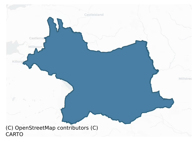
Magunihy is a barony of County Kerry, in the historical province of Munster (Irish: Maigh gCoinchinn), covering 696 km² of land. The barony records 1,474 NMS archaeological sites and 140 NIAH listed buildings, placing it at around the 59th percentile among 280 ROI baronies for sites per km². This means it is in the upper half of all baronies for sites per km². Dated archaeological evidence runs from the Neolithic through to the Modern, spanning 8 of 9 archaeological periods, placing the barony in the 68th percentile among 280 ROI baronies for chronological depth. This means it is in the top third of all baronies for chronological depth. The largest dated subset of recorded sites dates to the Early Medieval. Logainm flags 66 placenames in the barony as carrying a recognised heritage root; the largest share — around 48% — are names associated with pre-christian defensive.
Heritage at a glance
Percentile rankings throughout this profile compare each barony only against the other 279 Republic of Ireland baronies.
The recorded heritage of Magunihy
The National Monuments Service Sites and Monuments Record (SMR) is the statutory inventory of archaeological sites for the Republic of Ireland, maintained by the Department of Tourism, Culture, Arts, Gaeltacht, Sport and Media. Sites recorded here include earthworks, ringforts, megalithic tombs, ecclesiastical remains, and post-medieval features; not every record is legally protected, but each is registered as a monument of archaeological interest.
The National Monuments Service records 1,474 archaeological sites in Magunihy, putting it at the 59th percentile among 280 ROI baronies for sites per km². This means it is in the upper half of all baronies for sites per km². Of these, 1,323 (90%) fall within a recorded monument protection zone. The dominant category is defensive sites — ringforts, enclosures, hillforts, and stone forts (613 sites, 42% of the record). Ringfort – rath is the most prevalent type, making up 24% of the barony's recorded sites (347 records), broadly in line with the ROI average of 20% across all baronies where this type occurs. Ringfort – rath is an earthen ringfort enclosed by a bank and external ditch — the most common Early Medieval farmstead, broadly dated 500–1000 AD. Other significant types include Hut site (162) and Enclosure (138). Hut site is a low stone or earthen foundation enclosing a small circular or oval area, generally interpreted as a former dwelling, of any date from prehistory to the medieval period; Enclosure is a banked or ditched feature of uncertain type, used as a catch-all where the original function cannot be determined from surface evidence. Across the barony's 696 km², this gives a recorded density of 2.12 sites per km².
Most common monument types
Hover or tap a monument type to see its definition.
| Type | Count |
|---|---|
| Ringfort – rath an earthen ringfort enclosed by a bank and external ditch — the most common Early Medieval farmstead, broadly dated 500–1000 AD | 347 |
| Hut site a low stone or earthen foundation enclosing a small circular or oval area, generally interpreted as a former dwelling, of any date from prehistory to the medieval period | 162 |
| Enclosure a banked or ditched feature of uncertain type, used as a catch-all where the original function cannot be determined from surface evidence | 138 |
| Fulacht fia a horseshoe-shaped Bronze Age burnt mound built around a sunken trough beside a water source, traditionally interpreted as a cooking site | 99 |
| Souterrain an underground stone-built passage and chamber, generally Early Medieval and often associated with ringforts as a defensive or storage feature | 95 |
| Standing stone a deliberately set upright stone, used variously as a Bronze/Iron Age burial marker, route marker or commemorative monument | 66 |
| Bridge a built structure spanning a river or ravine to allow crossing, dated medieval onwards | 50 |
Chronological distribution
The dated archaeological record for Magunihy spans from the Neolithic through to the Modern, with activity attested across 8 of 9 archaeological periods. Every period from earliest to latest is represented in the record — an unbroken sequence of dated activity across the full chronological span. Activity concentrates most heavily in the Early Medieval (445 sites, 42% of dated material), with the Iron Age forming a secondary peak (284 sites, 27%). A further 404 recorded sites (27% of the overall NMS register for the barony) carry no period attribution — appearing as 'Unknown' in the bar chart below. This typically reflects either records that pre-date the standardised period vocabulary or sites awaiting specialist dating review, rather than a genuine absence of chronological evidence.
Sample of recorded monuments
Show 25 sample monuments (of 1,474 total)
A representative sample of 25 recorded monuments drawn from the barony’s 1,474 total NMS entries. Sites within a recorded monument protection zone and rarer site types are prioritised so the list shows a meaningful cross-section rather than only the most common type. Each entry shows the official Sites and Monuments Record reference number and the description published by the National Monuments Service.
Castle – ringwork
On a local rise, in an otherwise lowlying level area. A roughly oval platform (c. 40m NW-SE; c. 30m NE-SW; H c. 1.8m), now incorporated into the garden immediately in front of Molahiffe Castle, now known as Castlefarm,…
On a local rise, in an otherwise lowlying level area. A roughly oval platform (c. 40m NW-SE; c. 30m NE-SW; H c. 1.8m), now incorporated into the garden immediately in front of Molahiffe Castle, now known as Castlefarm, a 19th-century country house (Barry 1994, 68). A curving random rubble wall (H c. 1.8m) along the SW arc of the platform may be associated with the country house. The surface of the platform forms a garden lawn. Probably the remains of an earthwork castle built by Thomas Fitzmaurice, who was granted these lands by King John in the late 12th century (ibid., 184). The remains of Molahiffe Castle (KE048-039—-), a late-medieval towerhouse, stand in the SW quadrant of the platform.
Compiled by: Elizabeth Byrne, Ursula Egan and Sheila Ronan, Archaeological Survey Unit, University College, Cork.
Date of upload: 31 January 2011
Stone circle
In pasture, on a NW-facing slope. According to local information, a group of standing stones in a field to the W of farm buildings was removed in the 1960s. There are no visible remains of this group of stones which may…
In pasture, on a NW-facing slope. According to local information, a group of standing stones in a field to the W of farm buildings was removed in the 1960s. There are no visible remains of this group of stones which may have been a stone circle.
Compiled by: Elizabeth Byrne, Ursula Egan and Sheila Ronan, Archaeological Survey Unit, University College, Cork.
Date of upload: 31 January 2011
Castle – unclassified
On top of an elevated limestone outcrop partially covered by deciduous trees and strewn by loose moss-covered stones. The top edge of the outcrop is defined intermittently along its N (L c. 25m) and W (L c. 40m) sides…
On top of an elevated limestone outcrop partially covered by deciduous trees and strewn by loose moss-covered stones. The top edge of the outcrop is defined intermittently along its N (L c. 25m) and W (L c. 40m) sides by a linear bank (Wth c. 1.5m; H 0.5m) (KE048-035002-); the site is depicted by a dotted line enclosing a roughly rectangular area (c. 60m N-S; c. 50m E-W) on the 1840 OS 6-inch map. In the centre of the area defined by the bank is the remains of a rectangular structure (8.8m N-S; 8.4m E-W) defined by the basal courses of a random-rubble wall (T 0.85m; H 0.5m) bonded by a lime mortar. The exact nature of the monument is unclear but the name 'Court' suggests it may be the remains of a late-16th/early 17th-century fortified residence.
Compiled by: Elizabeth Byrne, Ursula Egan and Sheila Ronan, Archaeological Survey Unit, University College, Cork.
Date of upload: 31 January 2011
This monument is subject to a preservation order made under the National Monuments Acts 1930 to 2014 (PO no. 41/1976).
House – 17th century
According to Bary (1994, 57), details 'from an early map' and the 'back roof' of the present Bushmount house indicates a late seventeenth century date. Bary also suggests that the property was originally in the…
According to Bary (1994, 57), details 'from an early map' and the 'back roof' of the present Bushmount house indicates a late seventeenth century date. Bary also suggests that the property was originally in the possession of the O'Dell family (ibid.). The present house, which is occupied, is a two-storey, gable-ended house of 18th/early 19th-century appearance. The front elevation (E-facing) is of five bays with a central rectangular door ope. The door and window frames are replacements. There is a chimney on each gable. A central two-storey return at the rear of the house, as shown on the 1846 OS 6-inch map, is now incorporated into a lean-to addition. Bary (ibid.) states that the house originally had a basement storey and that the main doorway was accessed via a flight of steps. (Castleisland District Archaeological Survey)
Compiled by: Elizabeth Byrne, Ursula Egan and Sheila Ronan, Archaeological Survey Unit, University College, Cork.
Date of upload: 31 January 2011
House – 16th/17th century
In pasture, on a low hillock, to the rear of a farmyard. The overgrown remains of a rectangular structure (int. 17m E-W; 3.6m N-S; wall T 0.53m), known as Browne's Castle. It consists of the E and W gables, each with a…
In pasture, on a low hillock, to the rear of a farmyard. The overgrown remains of a rectangular structure (int. 17m E-W; 3.6m N-S; wall T 0.53m), known as Browne's Castle. It consists of the E and W gables, each with a short return of its N and S walls. The E gable (H c. 3m) has a central fireplace. Two inserted concrete walls (max. L 3.45m) project to the W from the internal face of the E gable. The W gable (H c. 5m) is incorporated into the NE corner of a one-storey vernacular house.
Compiled by: Elizabeth Byrne, Ursula Egan and Sheila Ronan, Archaeological Survey Unit, University College, Cork.
Date of upload: 31 January 2011
Barrow – mound barrow
In pasture, on a gentle E-facing slope. A grass-covered, oval mound (7.65m NW-SE; 5.2m NE-SW; H 0.75m) of earth, gravel and stones. The top of the mound is relatively flat with a slight slope down to the SE. The slope…
In pasture, on a gentle E-facing slope. A grass-covered, oval mound (7.65m NW-SE; 5.2m NE-SW; H 0.75m) of earth, gravel and stones. The top of the mound is relatively flat with a slight slope down to the SE. The slope at NW is longer and more gentle than elsewhere. Numerous stones are visible in the SE half. A rath (KE058-039—-) lies c. 100m to the W.
Compiled by: Elizabeth Byrne, Ursula Egan and Sheila Ronan, Archaeological Survey Unit, University College, Cork.
Date of upload: 31 January 2011
Cursing stone
In pasture, close to the summit of a small rise. A stone (H 0.5m; 0.3m x 0.6m), situated immediately to the NW of a rath (KE059-003—-), is said locally to be a 'cursing stone'.
Compiled by: Elizabeth Byrne, Ursula…
In pasture, close to the summit of a small rise. A stone (H 0.5m; 0.3m x 0.6m), situated immediately to the NW of a rath (KE059-003—-), is said locally to be a 'cursing stone'.
Compiled by: Elizabeth Byrne, Ursula Egan and Sheila Ronan, Archaeological Survey Unit, University College, Cork.
Date of upload: 31 January 2011
Round tower
National Monument No. 53. In the NW corner of a graveyard (KE066-016002-), c. 18.7m from the NW corner of the church (KE066-016001-). The base of a circular tower (SW elevation H c. 5.5m; int. diam. at base c. 2.28m; T…
National Monument No. 53. In the NW corner of a graveyard (KE066-016002-), c. 18.7m from the NW corner of the church (KE066-016001-). The base of a circular tower (SW elevation H c. 5.5m; int. diam. at base c. 2.28m; T c. 1.4m; c. 16.5m) consisting of rectangular sandstones bonded with lime and sand mortar. Stones of different sizes were used in its construction: the larger more uniform stones are well-coursed; the smaller stones are uncoursed. Hitchcock (1854) states that the stones were brought from some distance as none are to be found in the local neighbourhood. According to Allen (1892, 166), when Dr. Petrie first saw the tower it was 'more than twenty feet [6.09m] high, and had a doorway twelve feet [3.65m] above the ground'. The 'Proceedings' of J.R.S.A.I. in 1890 record that 'many of the blocks…which formed part of the outer facing of the wall have been abstracted, and used as headstones in the cemetery adjoining'. O'Donovan (1841) states that it is called by both the 'Bishop's Chair'/Cathair An Easpuig – as Aghadoe is a Bishop's See – and as the 'Pulpit' – because it was used by officiating clergy to address the congregation. According to Barrington (1999, 202), the building of the round tower began in 1027.
Round tower described by Lalor (1999, 155) as follows; 'Without the valuable record of Lord Dunraven's photograph (c. 1875), it would be difficult to form any impression of the true appearance of the tower [H 5.5m; base diam. 4.6m]. Originally, it was con…
Crucifixion plaque
Within a church (KE066-016001-). Set on top of the rebuilt S wall of the church, to the E of an ogham stone (KE066-016005-) and an architectural fragment (KE066-016008-). A sandstone block (L 0.66m; Wth 0.56m; H 0.46m)…
Within a church (KE066-016001-). Set on top of the rebuilt S wall of the church, to the E of an ogham stone (KE066-016005-) and an architectural fragment (KE066-016008-). A sandstone block (L 0.66m; Wth 0.56m; H 0.46m) with a depiction of the crucifixion on one face (set facing N). The carving shows the crucified haloed Christ figure with outstretched arms and crossed feet. The cross itself is not depicted. At a lower level is a haloed female figure whose right hand is shown reaching towards the crucified figure and whose left hand accepts a chalice from a winged angel at the far right-hand side. Kissane (1995, 8) suggests that it is probably a fragmented part of an altar block.
Compiled by: Elizabeth Byrne, Ursula Egan and Sheila Ronan, Archaeological Survey Unit, University College, Cork.
Date of upload: 30 May 2011
Castle – Anglo-Norman masonry castle
National Monument No. 236. Standing in the centre of a rectangular earthwork (KE066-017002-) is a circular tower (H c. 8m; int. diam. 6.4m; T 2.15m), with a slight base-batter, built of uncoursed field stones in a lime…
National Monument No. 236. Standing in the centre of a rectangular earthwork (KE066-017002-) is a circular tower (H c. 8m; int. diam. 6.4m; T 2.15m), with a slight base-batter, built of uncoursed field stones in a lime and sand mortar. The present entrance is through a stile inserted into a breach in the wall at NE; the structure was repaired by the OPW in the 1940s. At this point is a landing in the wall thickness from which a narrow stairs rises through the thickness of the wall to the E where there is a landing at first-floor level (this stairs gave access down to the ground-floor chamber which had no external doorway). The ground floor was lit by a window at SSW. This has a splayed and arched embrasure and a single light. Between the ground and first-floor levels are four opposite joist-holes (dims. 0.55m x 0.35m; D 0.9m) which supported a wooden floor. A lintelled door at E gives access to the first-floor from a mural stairs. At this level are window embrasures at N and S and a very ruined fireplace and flue at WNW. Above this level the walls now end abruptly.
Compiled by: Elizabeth Byrne, Ursula Egan and Sheila Ronan, Archaeological Survey Unit, University College, Cork.
Date of upload: 31 January 2011
Religious house – Augustinian canons
The arrangement of monastic buildings does not conform to the standard layout with the claustral buildings located to the N of the church. The Abbey church consists of an undifferentiated nave and chancel (int. dims.…
The arrangement of monastic buildings does not conform to the standard layout with the claustral buildings located to the N of the church. The Abbey church consists of an undifferentiated nave and chancel (int. dims. 22.4m x 5.2m) with a screen wall added c. 9m from the E gable (max. H 1.6m; T 0.9m). The W two-thirds of the nave represent the remains of an earlier, possibly 10th-century, church with antae. In the W gable is a lintelled, partially restored, doorway with inclining jambs (H 2m; Wth at top 0.95m; Wth at base 1.06m). Door-moulding on the interior at the base of the S jamb (stone: dims. 0.63m x 0.32m; rectangular hole: dims. 0.21m x 0.14m; D 0.05m) possibly for a pintle. The E window comprises a round-headed, twin-light with an internal splay, chamfered and rebated externally (ext. H 2.8m; ext. Wth 0.2m) set within a wide embrasure; the arch is missing (int. H 4m; int. Wth 2.9m). Re-use of incised cut-stone is evident in places. A pillow-stone (SL066-072012-) is built into the splay of the S light. There are three windows in the S wall, two in the chancel and one in the nave. The nave window is contemporary with the early church (heavily restored), is rectangular with a wide internal splay and three inserted steps up to the sill (ext. dims. 0.75m x 0.72m; int. dims. 1.6m x 0.88m). The most westerly window in the chancel is mainly destroyed and comprises a twin-light (ext. dims. 0.5m x 0.93m) with a portion of a chamfered and rebated jamb and sill remaining. The…
Ritual site – holy tree/bush
In the centre of and overshadowing the cloister of Muckross Abbey (KE066-081001-). A tall yew tree, whose branches extend over and beyond the cloister arcade, is surrounded by a metal railing. There is a local legend…
In the centre of and overshadowing the cloister of Muckross Abbey (KE066-081001-). A tall yew tree, whose branches extend over and beyond the cloister arcade, is surrounded by a metal railing. There is a local legend that a miraculous statue is buried beneath it (Moriarity, 1948, 19) and it is also believed locally that that anyone who touches the tree will die shortly afterwards.
Compiled by: Elizabeth Byrne, Ursula Egan and Sheila Ronan, Archaeological Survey Unit, University College, Cork.
Date of upload: 31 January 2011
Stone circle – embanked
In undulating pasture, with views W to Killarney and Macgillycuddy's Reeks. This stone circle (int. diam. c. 4m) lies in the centre of an earthen enclosure (int. diam. c. 20m) (KE067-020001-). The stone circle, which is…
In undulating pasture, with views W to Killarney and Macgillycuddy's Reeks. This stone circle (int. diam. c. 4m) lies in the centre of an earthen enclosure (int. diam. c. 20m) (KE067-020001-). The stone circle, which is comprised of seven stones (L 0.5-1.2m; T 0.4-1m; H 0.9-1.2m), was regarded by Ó Nualláin (1984a, 25, no. 38) as typical of the Cork-Kerry series, with the stones decreasing in height as they appraoch the axial stone at SW. A recent interpretation by O'Brien (2004, 329), however, concluded that the identification of the axial stone and the associated orientation are open to question. The enclosure is defined by an earthen bank (Wth 3.4m; int. H 1m; ext. H 0.8m), partially obscured by trees and bushes, and has breaks at NE and SW. A limited excavation in 1998 revealed the presence of a steep-sided fosse (Wth 3m at top, 1m at base; D 2.5m) directly inside the enclosing bank and also confirmed that the enclosure (KE067-020001-) is prehistoric in date (O'Brien 2000, 94-5; 2004, 323-38). A standing stone-pair (KE067-020004-) is c. 14m to the S.
Compiled by: Elizabeth Byrne, Ursula Egan and Sheila Ronan, Archaeological Survey Unit, University College, Cork.
Date of upload: 31 January 2011
Penitential station
In the N half of a cashel (KE068-022001-) named 'Cathair Craobh Dearg' and known locally as 'The City'. The penitential station consists of a cairn of stones (diam. 1m; H 0.7m) to the N of a mound (KE068-022009-).…
In the N half of a cashel (KE068-022001-) named 'Cathair Craobh Dearg' and known locally as 'The City'. The penitential station consists of a cairn of stones (diam. 1m; H 0.7m) to the N of a mound (KE068-022009-). 'Rounds' were traditionally made here on 1st May, which marked the start of the festival of Bealtaine. Cronin (2001, 42-3) gives a detailed account of the sequence of the 'rounds'. The practice continues today and Mass is celebrated on the cairn on that day. Two possible hut sites (KE068-022010-, KE068-022011-) are to the ENE and NE, respectively.
See attached photographs courtesy of Amanda Clarke
Compiled by: Elizabeth Byrne, Ursula Egan and Sheila Ronan, Archaeological Survey Unit, University College, Cork.
Date of upload: 31 January 2011
School
In pasture, on a N-facing slope. Recorded in the 1940s as 'a much broken down cathairín known as Sean Cúirt' in Denis J. Cremins land (Schools Manuscript, Co. Kerry). It was 'oval in shape 16 feet [4.87m] by 13 feet…
In pasture, on a N-facing slope. Recorded in the 1940s as 'a much broken down cathairín known as Sean Cúirt' in Denis J. Cremins land (Schools Manuscript, Co. Kerry). It was 'oval in shape 16 feet [4.87m] by 13 feet [3.96m]' and the wall was '3.5 feet [1.06m] wide and completely fallen' (Schools Manuscript, Co. Kerry). According to local information, it was removed in the course of field clearance many years ago. It is not visible at ground level, but a large mound of stones and other field clearance rubble is piled up just to the E. Cronin (2001, 124) translates the word ' Cúirt' as 'Court' which were bardic schools or the meeting places of poets. The annual get-together was often on a date which would coinside with a local event in the area and this fits in very well with 'Sean-Chúirt' the 'famous Court … close by the foothills of Dha Chich Danann' not far from 'the City' (KE068-022001-) where 'vast numbers assembled on May Day each year' (Cronin 2001, 125). Cronin (ibid.) goes on to state that 'this famous ruin' is gone but that it was 'oval in shape' and comprised of 'two apartments'.
Compiled by: Elizabeth Byrne, Ursula Egan and Sheila Ronan, Archaeological Survey Unit, University College, Cork.
Date of upload: 31 January 2011
Leacht
In level pasture, in the valley of the Flesk River. A subrectangular mound of stones (5.2m N-S; 4m E-W; H 0.62m) flanked by stone slabs. Four small pillar stones, which are positioned roughly at each corner, protrude…
In level pasture, in the valley of the Flesk River. A subrectangular mound of stones (5.2m N-S; 4m E-W; H 0.62m) flanked by stone slabs. Four small pillar stones, which are positioned roughly at each corner, protrude above the surface of the mound. The pillar stone at the NE corner (H 0.77m; Wth 0.17m; T 0.17m) has a carving of a Latin cross (H 0.37m) with D-shaped terminals (KE076-011005-) on the upper half of its W face. Traces of curved lines and depressions are visible on the lichen-covered W face of the pillar stone (H 0.6m; Wth 0.55m; T 0.35m) near the NW corner. An unmarked slab (L 1.6m; 0.95m x 0.9m) lies prostrate on top of the mound. Loose stones lie along the perimeter.
Compiled by: Elizabeth Byrne, Ursula Egan and Sheila Ronan, Archaeological Survey Unit, University College, Cork.
Date of upload: 31 January 2011
Cairn – radial-stone cairn
In rough hill pasture, on a terrace on a N-facing slope, overlooking the valley of the Loo River. A subcircular cairn (4.4m NW-SE; 3.9m NE-SW; H 0.4m) containing eight stones set radially along its circumference. The…
In rough hill pasture, on a terrace on a N-facing slope, overlooking the valley of the Loo River. A subcircular cairn (4.4m NW-SE; 3.9m NE-SW; H 0.4m) containing eight stones set radially along its circumference. The surface of the cairn is largely grass covered. There is a standing stone (KE086-004002-) c. 9m to the NW and a standing stone-pair (KE086-004001-) c. 12m to the NW.
Compiled by: Elizabeth Byrne, Ursula Egan and Sheila Ronan, Archaeological Survey Unit, University College, Cork.
Date of upload: 31 January 2011
Megalithic structure
In a coniferous wood, on the NE-facing slopes of Inchimore Mountain. An irregular-shaped structure (1.75m NE-SW; 1.4m NW-SE) of boulder-type stones, roofed with stone lintels, on top of which is a mound of smaller…
In a coniferous wood, on the NE-facing slopes of Inchimore Mountain. An irregular-shaped structure (1.75m NE-SW; 1.4m NW-SE) of boulder-type stones, roofed with stone lintels, on top of which is a mound of smaller stones. There is a small, partially collapsed chamber (H 1m) within this structure with an entrance on the E side. Another similar structure (2m N-S; 1.3m E-W) lies c. 2m to the S.
Compiled by: Elizabeth Byrne, Ursula Egan and Sheila Ronan, Archaeological Survey Unit, University College, Cork.
Date of upload: 31 January 2011
Barrow – ditch barrow
Discovered during archaeological excavations in advance of the construction of a housing development in 2002 (Kiely 2004c, 218-9). The ditch barrow (ext. 5.5m x 4m) consisted of a circular area defined by a fosse (Wth…
Discovered during archaeological excavations in advance of the construction of a housing development in 2002 (Kiely 2004c, 218-9). The ditch barrow (ext. 5.5m x 4m) consisted of a circular area defined by a fosse (Wth 0.4-0.5m; D 0.16-0.2m) ESE-N. The entrance (Wth 3.5m) faced NE. A cremation pit (0.25m x 0.16m; D 0.19m), which contained the cremated remains of an adult, occurred under the fosse at S and has been radiocarbon dated to the Iron Age (400-170 BC) (ibid.). A slot-trench, a hearth and a variety of stakeholes were also found to the E of the ditch barrow (ibid.).
Compiled by: Elizabeth Byrne, Ursula Egan and Sheila Ronan, Archaeological Survey Unit, University College, Cork.
Date of upload: 31 January 2011
Moated site
In pasture, on a steep N-facing slope. In the 1840s, 'a remarkable large Danish fort in which is a burial ground for children [KE048-043—-], hence it is called by the inhabitants Killeen' was recorded in this townland…
In pasture, on a steep N-facing slope. In the 1840s, 'a remarkable large Danish fort in which is a burial ground for children [KE048-043—-], hence it is called by the inhabitants Killeen' was recorded in this townland (OSNB, Molahiffe, no. 1, 39). The following description is based on an inspection made in 1986 (CDAS; O'Hare 1997, 15). A roughly rectangular area (69.6m E-W; 60m N-S) enclosed by an earthen bank (int. H 0.75m; ext. H c. 0.9m) on the W, N and E sides and for 20m from the SE corner along the S side. A slight depression noted outside the bank at N may have been the remains of a fosse. The undulating interior sloped steeply down to the N. A grass-covered trackway (Wth 4.3m) crossed the interior E-W, c. 7m from the N bank. Remains of low curving and linear banks and scarps were evident in the S two-thirds of the interior. A sandstone boulder (H 0.5m; 0.6m x 0.57m), outside the NE corner, which had a number of straight lines scored into its upper surface may have been used as a sharpening stone though the lines may also have been plough marks. During a reinspection of the enclosure in 1987, it was found to have been levelled. (Castleisland District Archaeological Survey)
Compiled by: Elizabeth Byrne, Ursula Egan and Sheila Ronan, Archaeological Survey Unit, University College, Cork.
Date of upload: 31 January 2011
Bawn
National Monument No. 534. Ross Castle stands atop a limestone rock outcrop, on the E shoreline of Lough Leane. A rectangular four-storey tower with the remains, on its N side, of an associated bawn (KE066-074003-),…
National Monument No. 534. Ross Castle stands atop a limestone rock outcrop, on the E shoreline of Lough Leane. A rectangular four-storey tower with the remains, on its N side, of an associated bawn (KE066-074003-), and conjoined on its S side by the roofless ruin of a three-storey barracks (KE066-074004-).
The tower underwent major structural alterations from the late 17th century through to recent conservation and restoration work by the State which culminated with its opening as a visitor attraction in 1993.The bawn wall (L 16.58m; H c. 5m; T 1.03m) survives to N with circular corner towers at either end. The remains of return of W bawn wall on S side of NW tower and the E bawn wall (L c. 20m) extending from NE tower is much rebuilt. A wall walk on top of the N bawn wall has a central pointed door ope. A two-storey building depicted here straddling the bawn in a number of 19th-century illustrations. The NE corner tower (int. diam. 2.7m) has a series of gun loops on the ground and first floor levels in wall from NW to SE. There is a fireplace in the SE wall and a lintelled door ope in the SW wall. Similar NW corner tower (int. diam. 2.3m) first floor gun loops in fireplace in the SW wall and in a niche in the NE wall. Wide rectangular window opes in both corner towers were probably inserted the 19th/early 20th century.
Furnace
Discovered during archaeological excavations in advance of the construction of a housing development in 2002 (Kiely 2004c, 218-9). A burnt pit or furnace (0.65m x 1.17m; D 0.18m) contained the base of a shaft furnace. A…
Discovered during archaeological excavations in advance of the construction of a housing development in 2002 (Kiely 2004c, 218-9). A burnt pit or furnace (0.65m x 1.17m; D 0.18m) contained the base of a shaft furnace. A calibrated radiocarbon date from the medieval period (AD 1270-1390) was obtained from one of the fills of the pit. Fragments of charcoal were also recovered from some of the fills. A linear feature was situated directly north-east of the pit and both it and the pit cut a U-shaped NE-SW fosse (5.8m x 1.4m; D 0.44m).
Compiled by: Elizabeth Byrne, Ursula Egan and Sheila Ronan, Archaeological Survey Unit, University College, Cork.
Date of upload: 31 January 2011
Habitation site
Discovered during archaeological excavations in advance of the construction of a housing development in 2002 (Kiely 2004c, 218-9). A trench (6m x 3m) contained four burnt layers, the largest of which measured 1.4m by…
Discovered during archaeological excavations in advance of the construction of a housing development in 2002 (Kiely 2004c, 218-9). A trench (6m x 3m) contained four burnt layers, the largest of which measured 1.4m by 1.6m. It included fragments of charcoal, slag, burnt bone and six end scrapers. A calibrated radiocarbon date from the Early Bronze Age (2030-1870 BC) was obtained. A concentration of thirty-five circular steep-sided round-bottomed stake-holes, some of which contained end scrapers and flint debitage, was also excavated within the trench and the excavator concluded that these may have formed a number of screens or windbreaks.
Compiled by: Elizabeth Byrne, Ursula Egan and Sheila Ronan, Archaeological Survey Unit, University College, Cork.
Date of upload: 31 January 2011
Castle – motte
Reported to the Archaeological Survey of Ireland as extant mounds. Conspicuous oval mound (dims. 18m NW-SE; 8m NE-SW) of which c. 9m has been quarried along the NE-side. Mound is defined by a steep scarp (Wth 11.2m; H…
Reported to the Archaeological Survey of Ireland as extant mounds. Conspicuous oval mound (dims. 18m NW-SE; 8m NE-SW) of which c. 9m has been quarried along the NE-side. Mound is defined by a steep scarp (Wth 11.2m; H 2.75m) S->N, is reduced to a low scarp (Wth 3.2m; H 1.25m) N->SE where partially excavated in antiquity and is gradual SE->S. Top of mound is level in centre and slopes down to SW across the SW-half; small quarried area in S quadrant. Scarp is obscured by dense vegetation S->N.
Compiled by: Alison McQueen and Vera Rahilly
Date of upload: 8 September 2014
Ringfort – rath
In rough pasture, on a SW-facing slope, c. 10m E of a stream. A roughly circular area (diam. c. 30m), covered with overgrowth, defined by an earthen bank SE-E and by a scarp (H 1.45m) E-SE. The bank was difficult to…
In rough pasture, on a SW-facing slope, c. 10m E of a stream. A roughly circular area (diam. c. 30m), covered with overgrowth, defined by an earthen bank SE-E and by a scarp (H 1.45m) E-SE. The bank was difficult to examine due to the overgrowth. A possible fosse (Wth 2.3m) is visible in places, especially along the SW arc and NW-NE. The fosse at NW and SW splays outwards towards the stream to the NW and W, respectively. The external edge of the fosse is covered with overgrowth. There is a possible entrance through the bank at S. Possible stone-facing is evident on the internal face of the bank at either side of the entrance. The bank is broken by a possible cattle gap at W. The interior is completely covered with overgrowth.
Compiled by: Elizabeth Byrne, Ursula Egan and Sheila Ronan, Archaeological Survey Unit, University College, Cork.
Date of upload: 31 January 2011
Listed buildings
The National Inventory of Architectural Heritage (NIAH) is a state survey appraising buildings of architectural, historical, archaeological, artistic, cultural, scientific, social, or technical interest. Each surveyed structure receives a rating from International (the highest, for buildings of European importance) through National, Regional, Local, and Record-Only.
The NIAH records 140 listed buildings in Magunihy (64th percentile across ROI baronies). Among these, 5 are graded National — buildings of interest to the whole of Ireland rather than only its region. The Republic holds 937 National-graded buildings in total, so this barony accounts for around 1% of the national total. Construction dates concentrate most heavily in the Victorian (1830-1900) period. The most-recorded building type is house (63 examples, 45% of the listed stock).
Terrain and environment
Mean elevation across the barony is 168m — the 92nd percentile among 280 ROI baronies for elevation. This means it is in the top tenth of all baronies for elevation. This is a relatively elevated landscape by ROI standards. Elevation matters for heritage because higher-altitude baronies typically favour defensive monuments — ringforts and hilltop forts placed on prominent ground — while lowland baronies are more likely to carry the dense settlement and church networks of intensive agricultural landscapes. The barony reaches 837m at its highest point — a vertical span of more than 668m within its boundary, indicating significant topographic diversity. Mean slope is 6.2° — the 86th percentile among 280 ROI baronies for slope. This means it is in the top fifth of all baronies for slope. This is consistently steep terrain by ROI standards, the kind of landscape that tends to preserve upstanding archaeological features well. Slope is a key control on both land use and archaeological preservation: steep ground resists ploughing and tends to preserve earthworks intact, while gentle slopes favour intensive cultivation that damages or destroys surface archaeology over time. Localised maximum slopes reach 20°, typical of stream-cut valleys, escarpments, or coastal bluffs within the wider landscape. The Topographic Wetness Index averages 10.0, the 22nd percentile among 280 ROI baronies for wetness. This means it is in the bottom third of all baronies for wetness. This is well-drained ground by ROI standards — typical of upland or steeply-sloping country that sheds water rapidly. Drainage matters for heritage because poorly-drained ground preserves organic archaeology (wooden trackways, leather, textiles, and on rare occasions human remains) far better than free-draining soil; well-drained ground favours arable use but destroys organic material rapidly. The land cover is dominated by improved grassland (72%) and woodland (23%). In overall character, this is an upland landscape of steep, elevated terrain, with land use dominated by improved grassland.
Terrain measurements
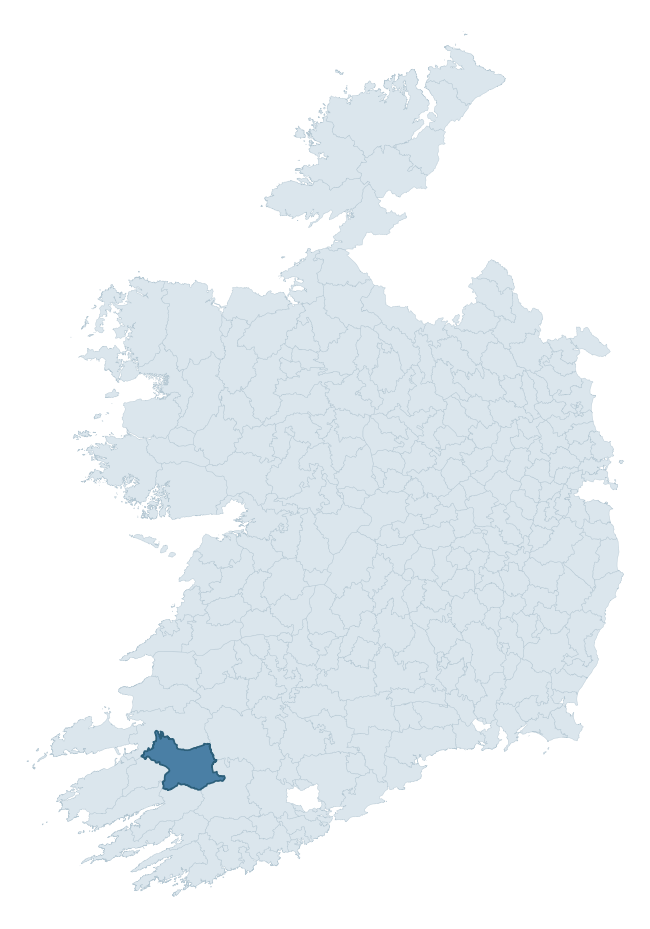
Where this barony sits in the Republic of Ireland
Geology and preservation
Bedrock geology shapes the landscape long before any settlement begins — controlling soil drainage, agricultural potential, the survival of upstanding monuments, and the preservation of buried archaeology. The figures below come from the Geological Survey Ireland 1:100,000 bedrock map.
The bedrock underlying Magunihy is predominantly sandstone (49% of the barony by area), laid down during the Carboniferous period (67% by area, around 359 to 299 million years ago). Sandstone weathers to free-draining, moderately fertile soils that supported Early Medieval ringfort agriculture and later manorial estates. The rock itself is a major source of building stone — visible in churches, tower houses, and farm buildings across the barony's historic landscape. A substantial secondary geology of sandstone, siltstone (28%) and limestone (16%) adds further variety to the underlying landscape. The single largest mapped unit is the Namurian (undifferentiated) (46% of the barony's bedrock).
Rock type composition
Largest mapped unit: Namurian (undifferentiated) (46% of the barony)
Placename evidence
Logainm records 66 heritage-diagnostic placenames for Magunihy, drawn from townland and civil-parish names across the barony. The dominant stratum is pre-Christian and Early Medieval defensive — ráth-, lios-, dún-, and caiseal-prefixed names that mark Iron Age and early historic settlement. The leading diagnostic roots are cill- (26 — church), ráth- (12 — earthen ringfort), and lios- (11 — ringfort or enclosure). This is well above the ROI average of 30.7 heritage placenames per barony — around 2.1× the typical figure. The presence of multiple heritage strata side by side indicates layered occupation of the landscape across successive prehistoric and historic periods. Logainm records 421 placenames for Magunihy (predominantly townland names). Of these, 66 (16%) carry one of the diagnostic Gaelic roots tracked above; the remainder draw on more generic landscape vocabulary that does not encode a heritage period.
Pre-Christian / Early Medieval Defensive
| Root | Count | Meaning |
|---|---|---|
| ráth- | 12 | earthen ringfort |
| lios- | 11 | ringfort or enclosure |
| dún- | 6 | hilltop or promontory fort |
| cathair- | 3 | stone fort |
Early Christian Ecclesiastical
| Root | Count | Meaning |
|---|---|---|
| cill- | 26 | church (early) |
| cillín- | 4 | unconsecrated burial ground |
Burial, Ritual, and Norse-Contact
| Root | Count | Meaning |
|---|---|---|
| gall- | 3 | foreigner — Norse settlement marker |
| uaimh- | 2 | cave / souterrain |
| carn- | 1 | cairn |
| feart- | 1 | grave mound |
Other baronies in Kerry
- Dunkerron South
- Iveragh
- Glanarought
- Dunkerron North
- Iraghticonnor
- Corkaguiny
- Trughanacmy
- Tulla Upper — Clare
- Trughanacmy
- Decies Without Drum — Waterford
See all 280 baronies in the Republic of Ireland Heritage Tool.

Explore further
Grounding History: 10 Maps of Northern Ireland’s Past
If you’re interested in Irish heritage more widely, the companion report for Northern Ireland brings together the analysis of all 462 NI wards into one place through 10 high-quality maps — covering monument density, archaeological periods, placename heritage, terrain, wetland, and the historic landscape at first survey. Take a look.
About this profile
Click any section below to expand.
What is a barony?
A barony is a historic administrative unit in Ireland, broadly equivalent to an English hundred. The 280 baronies used here are from the OSi 2019 National Statutory Boundaries (generalised 20m), covering the 26 counties of the Republic of Ireland. Baronies derive from the Norman period, were formalised in the 17th century, and have not been redrawn for statistical purposes. They vary enormously in area, from compact urban baronies in Dublin to vast upland baronies in Connacht, and should not be compared by raw site count without accounting for area differences.
What counts as a site?
This profile combines three distinct heritage registers, each with its own definition of what constitutes a recordable site:
- Archaeological sites (NMS). The National Monuments Service Sites and Monuments Record (SMR) catalogues every known archaeological monument or site of archaeological interest in the Republic, from prehistoric burial mounds and ringforts to medieval churches and post-medieval defensive works. Inclusion does not require legal protection — only that the site has been identified, surveyed, and assessed as having archaeological value. A separate subset of these sites lies within a recorded protection zone, which gives them statutory protection under the National Monuments Acts.
- Listed buildings (NIAH). The National Inventory of Architectural Heritage records buildings of architectural, historical, archaeological, artistic, cultural, scientific, social, or technical interest. Each surveyed structure is appraised on a five-tier scale: International, National, Regional, Local, and Record-Only. The NIAH appraisal is informational rather than strictly statutory, but it underpins local-authority Record of Protected Structures (RPS) listings.
- Heritage placenames (Logainm). Logainm is the authoritative database of Irish placenames maintained by the Placenames Branch. This profile applies a heritage-diagnostic classifier to the Irish-language form of each townland name, flagging roots that signal defensive sites (ráth-, lios-, dún-, caiseal-, cathair-), ecclesiastical foundations (cill-, teampall-, domhnach-, mainistir-), prehistoric burial-ritual features (tuaim-, carn-, leaba-), or Norse-contact settlement (gall-). Townlands without one of these diagnostic roots are not flagged here — they may still carry historical significance, but that significance is not encoded in the name itself.
Editorial principles
The narrative sections of this profile follow several explicit principles:
- Evidential. Every claim about this barony’s heritage character is anchored in the underlying register data. Where a site count, a placename count, or a percentile rank is cited, it is computed from the source datasets at export time, not estimated.
- Comparative. Counts and metrics are reported alongside their percentile rank against the other 279 ROI baronies. A barony with 50 ringforts in absolute terms could be unusually high or unusually low depending on its size and regional context; percentile ranking removes that ambiguity.
- Transparent on limits. Where a register has known coverage gaps, survey biases, or data-quality issues that affect this barony’s figures, the profile flags them rather than presenting the numbers as definitive.
- No interpretation beyond what the data supports. The narrative does not speculate about historical events, social dynamics, or cultural meaning beyond what the recorded heritage and placename evidence directly attests.
Data caveats and limits
- NMS Sites and Monuments Record is the product of survey campaigns conducted at different intensities across different counties and decades. Some baronies have been surveyed more thoroughly than others, and absolute counts should be read in that light. Sites destroyed by development before survey are typically not represented; sites in heavily forested or upland terrain are sometimes under-recorded.
- NIAH coverage is broadly complete for the Republic of Ireland but the survey was conducted on a rolling county-by-county basis, and the most recent appraisal date varies. Buildings demolished or substantially altered after their original survey may still appear in the register; conversely, recent buildings of merit may not yet have been appraised.
- Logainm classification applies a deliberately conservative pattern-matching approach to the Irish-language townland forms. The classifier prioritises true positives over recall: a townland may carry a heritage signal that the classifier doesn’t recognise, particularly where the diagnostic root has been heavily anglicised or where the townland name draws on a less common term. The 60,000+ townland records and ~9,800 classified placenames give a substantial signal at barony scale, but individual townland names should be checked against Logainm directly for definitive interpretation.
- Period attribution. The chronological distribution reflects only those NMS sites that carry a recognised period attribution in the source data. Sites listed as “Unknown” period are excluded from the dated subset.
- Boundary changes. Some baronies have undergone minor boundary adjustments since their 19th-century definition; the OSi 2019 generalised boundaries used here are the current statutory definition and may differ slightly from historical maps in border areas.
- Bedrock geology is mapped at 1:100,000 scale, which means local variation within a barony — small pockets of different rock type, mineral veins, alluvium overlying bedrock — is generalised. The dominant-system and rocktype figures are area-weighted, so a barony reading “70% Carboniferous limestone” may still contain small but archaeologically important pockets of older or younger rock. Around 3% of GSI polygons do not match the lexicon and contribute no rocktype or system attribution.
Data sources
- National Monuments Service — Sites and Monuments Record (SMR) https://data.gov.ie/dataset/national-monuments-service-archaeological-survey-of-ireland
- National Inventory of Architectural Heritage (NIAH) https://data.gov.ie/dataset/national-inventory-of-architectural-heritage-niah-national-dataset
- Logainm — Placenames Database of Ireland https://www.logainm.ie/
- Ordnance Survey Ireland — National Statutory Barony Boundaries 2019 https://data-osi.opendata.arcgis.com/
- EURODEM — European Digital Elevation Model https://www.mapsforeurope.org/datasets/euro-dem
- ESA WorldCover https://esa-worldcover.org/en
- Geological Survey Ireland — 1:100,000 Bedrock Geology https://www.gsi.ie/en-ie/data-and-maps/Pages/Bedrock.aspx
Explore more: Search any of the 280 ROI baronies, browse by historical province, or read the methodology and data sources for the full Republic of Ireland Heritage Tool.