
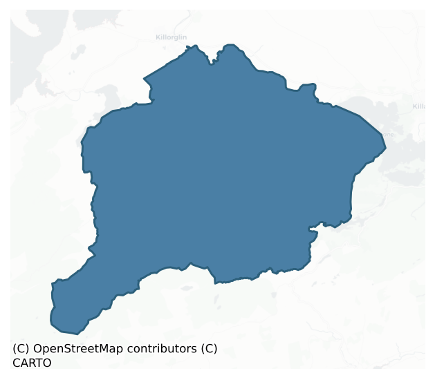
Dunkerron North is a barony of County Kerry, in the historical province of Munster (Irish: Dún Ciaráin Thuaidh), covering 299 km² of land. The barony records 460 NMS archaeological sites and 9 NIAH listed buildings, placing it at around the 35th percentile among 280 ROI baronies for sites per km². This means it is in the lower half of all baronies for sites per km². Dated archaeological evidence runs from the Early Bronze Age through to the Modern, spanning 7 of 9 archaeological periods, placing the barony in the 22nd percentile among 280 ROI baronies for chronological depth. This means it is in the bottom third of all baronies for chronological depth. The largest dated subset of recorded sites dates to the Iron Age. Logainm flags 15 placenames in the barony as carrying a recognised heritage root; the largest share — around 47% — are names associated with pre-christian defensive.
Heritage at a glance
Percentile rankings throughout this profile compare each barony only against the other 279 Republic of Ireland baronies.
The recorded heritage of Dunkerron North
The National Monuments Service Sites and Monuments Record (SMR) is the statutory inventory of archaeological sites for the Republic of Ireland, maintained by the Department of Tourism, Culture, Arts, Gaeltacht, Sport and Media. Sites recorded here include earthworks, ringforts, megalithic tombs, ecclesiastical remains, and post-medieval features; not every record is legally protected, but each is registered as a monument of archaeological interest.
The National Monuments Service records 460 archaeological sites in Dunkerron North, putting it at the 35th percentile among 280 ROI baronies for sites per km². This means it is in the lower half of all baronies for sites per km². Protection coverage is near-universal — 451 sites (98%) fall within a recorded monument protection zone, indicating an extensively surveyed landscape. The record is dominated by defensive sites — ringforts, enclosures, hillforts, and stone forts (165 sites, 36% of the total), with domestic structures forming a substantial secondary presence (123 sites, 27%). Hut site is the most prevalent type, making up 27% of the barony's recorded sites (123 records) — well above the ROI average of 5% across all baronies where this type occurs. Hut site is a low stone or earthen foundation enclosing a small circular or oval area, generally interpreted as a former dwelling, of any date from prehistory to the medieval period. Other significant types include Ringfort – rath (62) and Enclosure (58). Ringfort – rath is an earthen ringfort enclosed by a bank and external ditch — the most common Early Medieval farmstead, broadly dated 500–1000 AD; Enclosure is a banked or ditched feature of uncertain type, used as a catch-all where the original function cannot be determined from surface evidence. Across the barony's 299 km², this gives a recorded density of 1.54 sites per km².
Most common monument types
Hover or tap a monument type to see its definition.
| Type | Count |
|---|---|
| Hut site a low stone or earthen foundation enclosing a small circular or oval area, generally interpreted as a former dwelling, of any date from prehistory to the medieval period | 123 |
| Ringfort – rath an earthen ringfort enclosed by a bank and external ditch — the most common Early Medieval farmstead, broadly dated 500–1000 AD | 62 |
| Enclosure a banked or ditched feature of uncertain type, used as a catch-all where the original function cannot be determined from surface evidence | 58 |
| Souterrain an underground stone-built passage and chamber, generally Early Medieval and often associated with ringforts as a defensive or storage feature | 34 |
| Standing stone a deliberately set upright stone, used variously as a Bronze/Iron Age burial marker, route marker or commemorative monument | 21 |
| Fulacht fia a horseshoe-shaped Bronze Age burnt mound built around a sunken trough beside a water source, traditionally interpreted as a cooking site | 19 |
| Rock art geometric and other motifs carved on earthfast boulders or rock outcrops, mainly Bronze Age but with possible Neolithic origins | 17 |
| Ogham stone a stone bearing an inscription in Ogham script, used as a memorial or boundary marker between the late 4th and early 8th centuries AD | 16 |
Chronological distribution
The dated archaeological record for Dunkerron North spans from the Early Bronze Age through to the Modern, with activity attested across 7 of 9 archaeological periods. This is the 22nd percentile across ROI baronies — a relatively narrow chronological band, with much of Irish prehistory not represented in the dated record. Every period from earliest to latest is represented in the record — an unbroken sequence of dated activity across the full chronological span. Activity concentrates most heavily in the Iron Age (129 sites, 45% of dated material), with the Early Medieval forming a secondary peak (89 sites, 31%). A further 172 recorded sites (37% of the overall NMS register for the barony) carry no period attribution — appearing as 'Unknown' in the bar chart below. This typically reflects either records that pre-date the standardised period vocabulary or sites awaiting specialist dating review, rather than a genuine absence of chronological evidence.
Sample of recorded monuments
Show 25 sample monuments (of 460 total)
A representative sample of 25 recorded monuments drawn from the barony’s 460 total NMS entries. Sites within a recorded monument protection zone and rarer site types are prioritised so the list shows a meaningful cross-section rather than only the most common type. Each entry shows the official Sites and Monuments Record reference number and the description published by the National Monuments Service.
Kiln – lime
In pasture. In the 1930s Capt. D. B. O'Connell recorded a 'slag mount' in the townland of Churchtown (KAS). This would appear to be the same feature which he referred to as a 'curious "site"…on the lands of Mr. T.…
In pasture. In the 1930s Capt. D. B. O'Connell recorded a 'slag mount' in the townland of Churchtown (KAS). This would appear to be the same feature which he referred to as a 'curious "site"…on the lands of Mr. T. Foley of Churchtown' in a general description of 'ancient mines' (O'Connell 1939, 23). There are no visible remains of this possible monument. It is possible that what O'Connell was referring to was the remains of a limekiln which is indicated on the 1846 and 1894 OS 6-inch maps in the immediate vicinity of the 'slag mount'.
Compiled by: Elizabeth Byrne, Ursula Egan and Sheila Ronan, Archaeological Survey Unit, University College, Cork.
Date of upload: 30 May 2011
Earthwork
In gently undulating pasture, to the SW of the Laune River. A slightly raised circular dry area (diam. c. 8m) was noted in an otherwise waterlogged field.
The above description is derived from the published…
In gently undulating pasture, to the SW of the Laune River. A slightly raised circular dry area (diam. c. 8m) was noted in an otherwise waterlogged field.
The above description is derived from the published 'Archaeological Inventory of County Kerry. Volume I: South-West Kerry' (Dublin: Stationery Office, 2009). In certain instances the entries have been revised and updated in the light of recent research.
Date of upload: 30 May 2011
Mass-rock
Mass-Rock (KE064-014004-): Located in the NE corner of the site, this large boulder measures 1.3m long and .65m high. It bears three incised Latin crosses and two motifs that consist of linear grooves terminating in…
Mass-Rock (KE064-014004-): Located in the NE corner of the site, this large boulder measures 1.3m long and .65m high. It bears three incised Latin crosses and two motifs that consist of linear grooves terminating in expansions with radial lines. Resting on its SE end is an irregularly shaped stone (KE064-014003-), measuring .39m x .29m, which features a hemispherical depression, .08m in diameter and .03m deep.
The above description is derived from A. O'Sullivan and J. Sheehan (compilers), 'The Iveragh peninsula: an archaeological survey of South Kerry'. Cork University Press (1996), no. 923. In certain instances the entries have been revised and updated in the light of recent research.
Date of upload: 29 July 2013
Cross-inscribed stone (present location)
O'Sullivan and Sheehan (1996, 354, no. 1089; 428, no. 1480) record that this stone was discovered during the demolition of an old house near Killoughane Church (KE065-058—-) in the late 1980s. However, the precise…
O'Sullivan and Sheehan (1996, 354, no. 1089; 428, no. 1480) record that this stone was discovered during the demolition of an old house near Killoughane Church (KE065-058—-) in the late 1980s. However, the precise location of the house in which it was found is not given and while the stone is likely to have been associated with Killoughane church it is not certain that it was. Therefore its original location (KE065-124—-) must remain unknown. This stone is 18th-century in date (pers. comm. J. Sheehan).
Compiled by: Paul Walsh
Date of upload: 13 January 2012
Decorated stone
A fragment with several scores preserved, reading HATA, was recorded lying on the wall of one of the cells in 1869 (Brash 1879, 288). This may be the same stone that was noted at the site in 1938 by Harris (1939, 178).…
A fragment with several scores preserved, reading HATA, was recorded lying on the wall of one of the cells in 1869 (Brash 1879, 288). This may be the same stone that was noted at the site in 1938 by Harris (1939, 178). Macalister throws doubt on both identifications, however, and suggests that the stone may have been a fragment of a grooved paving slab (1945, 207).
The above description is derived from O'Sullivan, A. and Sheehan, J. (compilers) 'The Iveragh peninsula: an archaeological survey of South Kerry'. Cork University press. (1996), no. 952. In certain instances the entries have been revised and updated in the light of recent research.
Date of upload: 12 June 2013
Burial
A number of bones and skulls, some of which were reputedly human, were found in the souterrain.
The above description is derived from A. O'Sullivan and J. Sheehan (compilers), 'The Iveragh peninsula: an…
A number of bones and skulls, some of which were reputedly human, were found in the souterrain.
The above description is derived from A. O'Sullivan and J. Sheehan (compilers), 'The Iveragh peninsula: an archaeological survey of South Kerry'. Cork University Press (1996), no. 863. In certain instances the entries have been revised and updated in the light of recent research.
Date of upload: 29 July 2013
Metalworking site
In pasture, on the W-facing slope of a hillock near the E bank of the Caragh River. The remains of this iron-working site consist of the ruins of a 17th-century blast furnace. The furnace is a square structure (7.2m…
In pasture, on the W-facing slope of a hillock near the E bank of the Caragh River. The remains of this iron-working site consist of the ruins of a 17th-century blast furnace. The furnace is a square structure (7.2m N-S; 7m E-W) built into the slope. Part of a random rubble wall (T 1.5m; H c. 5m) stands at W while the N and E walls are in ruins. At S the remains of a casting arch is indicated by a splayed opening (Wth 4.4m; L 2m; H 2m) with traces of voussoirs at its W side. Vitrified stones, slag, a block (1.25m x 0.15m x 0.15m) of cast-iron and a U-shaped piece of cast iron lie on the ground nearby to the S. Traces of a ramp, which provided access to the top of the furnace, are visible on the higher ground to the E. Ruins of miners' houses lie c. 50m to the S. The Blackstones Iron Works was in operation for over eighty years between c. 1670 and 1754 (McCracken 1971, 166).
The above description is derived from the published 'Archaeological Inventory of County Kerry. Volume I: South-West Kerry' (Dublin: Stationery Office, 2009). In certain instances the entries have been revised and updated in the light of recent research.
Date of upload: 30 May 2011
Ecclesiastical site
This site is located within the boundaries of Inse Rua graveyard at the mouth of Cloon valley, a short distance E of the Owenroe river. Three names for the site were recorded in the OSNB: Killeennamoyle/Cillín na…
This site is located within the boundaries of Inse Rua graveyard at the mouth of Cloon valley, a short distance E of the Owenroe river. Three names for the site were recorded in the OSNB: Killeennamoyle/Cillín na Maoile, Inehorve/Inse Rua, and Kilnomeel (Knockane, 43). The site was referred to as a vicarage in Papal Letters in 1482 and 1485 (Ó Cíobhán 1985, lxii). The rectangular graveyard contains the foundations of a church, a bullaun stone and three cross-inscribed slabs. To N and W of the church a low L-shaped scarp, .4m high, may define part of the original limits of the site.
The above description is derived from O'Sullivan, A. and Sheehan, J. (compilers) 'The Iveragh peninsula: an archaeological survey of South Kerry'. Cork University press. (1996), no. 969. In certain instances the entries have been revised and updated in the light of recent research.
Date of upload: 13 June 2013
Boulder-burial
The possible boulder-burial was located 24m to the NE of the stone row (KE082-007001-). Before destruction it comprised a large boulder, 1.6m x 1.35m, which rested above four or more small stones (Ó Nualláin 1988,…
The possible boulder-burial was located 24m to the NE of the stone row (KE082-007001-). Before destruction it comprised a large boulder, 1.6m x 1.35m, which rested above four or more small stones (Ó Nualláin 1988, 238-9, Fig. 14). In 1989 an area of 18 sq. m, centering on the original location of the possible boulder burial was excavated (Sheehan 1990, 30). There were no finds and no features survived to identify the nature of the site. (O'Sullivan and Sheehan (1996, 50-51, no. 108).
The above description is derived from the published 'Archaeological Inventory of County Kerry. Volume I: South-West Kerry' (Dublin: Stationery Office, 2009). In certain instances the entries have been revised and updated in the light of recent research.
Date of upload: 30 May 2011
Cross-inscribed pillar (present location)
Cross-Inscribed Pillar Stones: (2) (KE082-020001-): This pillar formerly stood in the NW quadrant of KE079-020007- and was moved to its present position, adjacent to the leacht, by the OPW in 1989. It measures .94m long…
Cross-Inscribed Pillar Stones: (2) (KE082-020001-): This pillar formerly stood in the NW quadrant of KE079-020007- and was moved to its present position, adjacent to the leacht, by the OPW in 1989. It measures .94m long and now stands .63m high above ground level. It tapers gradually in width from .19m to .14m at the top, and averages .08m thick. The greater portion of one face is occupied by a single-line Latin cross with expanded terminals. This surmounts an outline roundel that contains a fret-pattern formed with interlocking T-shapes. At the centre of the design is a small ringed depression. Above the cross is a debased triquetra-knot. On the opposite face is a simple Latin linear cross with expanded terminals. The upper end of each side of the pillar bears a swastika with grooves alternating between the arms, and on its upper surface is a small equal-armed cross.
The above description is derived from A. O'Sullivan and J. Sheehan (compilers), 'The Iveragh peninsula: an archaeological survey of South Kerry'. Cork University Press (1996), no. 938. In certain instances the entries have been revised and updated in the light of recent research.
Date of upload: 30 July 2013
This monument is subject to a preservation order made under the National Monuments Acts 1930 to 2014 (PO no. 4/1976).
Leacht
Leacht (KE082-020002-) is located close to the enclosing element in the SE quadrant of KE079-020007-. It measures approximately 2.75m N-S x 2.3m E-W and is defined at N and W by upright slabs. The mound is composed of…
Leacht (KE082-020002-) is located close to the enclosing element in the SE quadrant of KE079-020007-. It measures approximately 2.75m N-S x 2.3m E-W and is defined at N and W by upright slabs. The mound is composed of rough stone infill and includes much quartz. Lying on its surface are two bullauns (KE082-020003- & KE082-020008-).
The above description is derived from A. O'Sullivan and J. Sheehan (compilers), 'The Iveragh peninsula: an archaeological survey of South Kerry'. Cork University Press (1996), no. 938. In certain instances the entries have been revised and updated in the light of recent research.
Date of upload: 30 July 2013
This monument is subject to a preservation order made under the National Monuments Acts 1930 to 2014 (PO no. 4/1976).
Charcoal-making site
In pasture, on a SE-facing rocky slope overlooking Lough Reagh. A roughly D-shaped area (dim. 7m N-S) with a straight N side (L 8m E-W) has exposed patches of black soil with charcoal inclusions. The area is raised (H…
In pasture, on a SE-facing rocky slope overlooking Lough Reagh. A roughly D-shaped area (dim. 7m N-S) with a straight N side (L 8m E-W) has exposed patches of black soil with charcoal inclusions. The area is raised (H 0.7m) at S and is cut into the upslope (D 1m) at N to compensate for the hillslope. There is a hut site (KE073-053003-) c. 25m to the NW.
The above description is derived from the published 'Archaeological Inventory of County Kerry. Volume I: South-West Kerry' (Dublin: Stationery Office, 2009). In certain instances the entries have been revised and updated in the light of recent research.
Date of upload: 30 May 2011
Standing stone (present location)
The standing stone (KE066-060—-) was moved from its original location in the N half of the field and dumped in its present location in the SW corner of the same field. This record number has been created for the…
The standing stone (KE066-060—-) was moved from its original location in the N half of the field and dumped in its present location in the SW corner of the same field. This record number has been created for the present location of the stone.
Compiled by: Elizabeth Byrne, Ursula Egan and Sheila Ronan, Archaeological Survey Unit, University College, Cork.
Date of upload: 30 May 2011
Bawn
Dunloe Castle / Caisleán Dhún Ló: The building of a Castle (KE065-103—-) at Dun Loich in 1215 by Maurice FitzGerald is recorded in a number of sources (O hlnnse 1947, 91). following the defeat of the Geraldines at the…
Dunloe Castle / Caisleán Dhún Ló: The building of a Castle (KE065-103—-) at Dun Loich in 1215 by Maurice FitzGerald is recorded in a number of sources (O hlnnse 1947, 91). following the defeat of the Geraldines at the battle of Callan in 1261 it was 'demolished and burned' by the MacCarthys (AI). It seems to have been refortified soon afterwards, for in 1280 it was reported to have been 'evacuated by its guards through fear of Desmumu and MacCartagh, and it was burned after they had departed' (AI). The existing ruins at Dunloe, however, are those of a later tower house associated with the O'Sullivan Mores (Butler 1925, 47). 'Dun Loich on the River Leamhain' is noted as having been demolished by the Earl of Ormond in 1570 (AFM), but it appears to have been reoccupied by the O'Sullivans. One Daniel O’Sullivan of Dunloe represented Kerry in Parliament in 1613 (Smith 1756, 298). It was forfeited in 1656, and subsequently was acquired by Sir William Petty (King 1931, 130). In the late 1600s it became the property of the O'Mahony family, one of whom altered and renovated it in the 1820s. A pencil sketch of the renovated title by Westropp, dated 1891, is preserved in RIA MS 3 A 46.
The tower house stands in the landscaped grounds of Dunloe Hotel on the N end of an elevated ridge which directly overlooks a bend of the River Laune at E.
About 30m to SW of the tower house, in dense overgrowth, is a short stretch of what may have been a bawn wall. It stands to an average hei…
Kiln – corn-drying
This possible corn-drying kiln was discovered during licensed archaeological test trenching (16E0136). At the end of a trench a small portion of in-situ burning was identified and the trench was expanded to expose an…
This possible corn-drying kiln was discovered during licensed archaeological test trenching (16E0136). At the end of a trench a small portion of in-situ burning was identified and the trench was expanded to expose an area 5.2m x 4.9m. The burnt deposit extended south and presented as a kiln, 4.9m in overall length. The probable chamber of this kiln was at the northern end, 2.2m east-west x 2m. A linear deposit, representing the flue, extended from the southwestern part of the chamber where a large stone (0.55m x 0.37m) appeared to define the ‘neck’. This flue was 2.9m in length, 0.96m wide at the north end it narrowed to 0.6m before splaying out to 1.35m in width. At the southern end, the mouth of the kiln was filled with mid brown stony silt with charcoal flecks (1.9m x 1.35m). Where the flue narrowed, a concentration of charcoal and silt was evident (0.6m x 0.5m). Brown stony silt with charcoal flecks formed the upper fill of the remainder. The chamber area had been slightly truncated at the northern end and suggested a stone-lining of rounded cobbles over which a layer of charcoal was deposited, 0.1m in thickness. The natural subsoil beneath these layers had been reddened by heat. The same charcoal and heat-effected natural subsoil was evident along the eastern edge of the chamber. The evidence of intense burning, stone-lining and overall shape suggest that this is a key-hole shaped corn-drying kiln. Two possible stake-holes were found 1.65m to the east of the kiln, 1….
Rock shelter
Roughly rectangular area (int. dims. 2.25 NNE-SSW; 2.25m ENE-WSW) defined by a rock-scattered hillslope to NE & SE which supports a substantial, naturally deposited roofing stone (dims. 3.0m NNE-SSW; 2.53m ENE-WSW; max.…
Roughly rectangular area (int. dims. 2.25 NNE-SSW; 2.25m ENE-WSW) defined by a rock-scattered hillslope to NE & SE which supports a substantial, naturally deposited roofing stone (dims. 3.0m NNE-SSW; 2.53m ENE-WSW; max. T 0.5m, at S). This naturally formed rock shelter has been modified by the construction of a man-made stone prop (H 1.46m; max. Wth 0.78m at base) which supports the angled roofing stone at SW and also by the collapsed remains of a linear wall (dims. 3.8m NNE-SSW; max. T 1.1m; max. H 0.73m) along the NW-side. The roofing stone is set at an angle (long-axis NE-SW), much like the capstone of a wedge tomb. This large flag is partially covered by sod at the base, where it rests upon the natural hillslope at NE. The load of the roofing stone is also borne by a large boulder at S, which appears to be in a naturally deposited position. This naturally formed shelter would originally have been open SW->N->NNE. A definite man-made arrangement of four relatively small, irregular sandstones are piled on top of each other and act as a crude form of pillar to further prop the roofing slab at SW. Although appearing roughly constructed, these stones have been selected to fit the space between a large basal stone at ground level and the underside of the roof slab. There is also a small pinning stone on the inner side of the upper prop stone to further secure stability. The remains of the drystone wall enclosing the NW-side are defined by a row of stones which have been deli…
Ecclesiastical enclosure
This D-shaped enclosure is located on the E side of the Caragh river valley, abutting the modern road from Killorglin to Glencar. The land slopes down to SE and the site is located in a clearing in an afforested area.…
This D-shaped enclosure is located on the E side of the Caragh river valley, abutting the modern road from Killorglin to Glencar. The land slopes down to SE and the site is located in a clearing in an afforested area. Modern walls enclose it at N and E, while its S limits are defined by a 3.6m high scarp. At W traces survive of an enclosing bank that measures 1.05m high externally, 2.5m wide and .5m high internally. Remnants of this stony bank also underlie the later wall at N. The enclosed area measures 42m N-S x 39.4m E-W internally. A modern burial-area occupies the central area of the enclosure and is bounded by numerous uninscribed grave-markers to W and S. These average .15m high and .18m wide. Also occurring within the site is a cross-inscribed slab and a boulder which is locally referred to as a mass-rock.
The above description is derived from A. O'Sullivan and J. Sheehan (compilers), 'The Iveragh peninsula: an archaeological survey of South Kerry'. Cork University Press (1996), no. 923. In certain instances the entries have been revised and updated in the light of recent research.
Date of upload: 29 July 2013
Stone row
This site, not marked on the OS maps, is located on the saddle ridge which extends N from Broaghnabinna mountain to Curragh More lake and separates the Black and Bridia valleys. The ridge bears a mantle of peat, c .45m…
This site, not marked on the OS maps, is located on the saddle ridge which extends N from Broaghnabinna mountain to Curragh More lake and separates the Black and Bridia valleys. The ridge bears a mantle of peat, c .45m deep in the vicinity of the monument. The row, 2.7m long, is comprised of three stones and is orientated ESE-WNW. The tallest stone, at E, stands 1.95m high and measures .66m x .55m at base where a number of packing stones are exposed. Standing .8m to W, the central and lowest stone is .72m high and measures .32m x .25m at base. The long axis of the third stone, .44m to W, is aligned N-S; it stands .9m high and is .35m x .26m at base (Ó Nuallain 1988, 238).
The above description is derived from A. O'Sullivan and J. Sheehan (compilers), 'The Iveragh peninsula: an archaeological survey of South Kerry'. Cork University Press (1996), no. 100. In certain instances the entries have been revised and updated in the light of recent research.
Date of upload: 28 July 2013
Burnt spread
Deep ploughing at this location in 1989 resulted in the levelling of a fulacht fiadh. It was located a short distance SW of a stone row (KE082-007001-), and close to two other fulachta fiadh (KE082-005—- &…
Deep ploughing at this location in 1989 resulted in the levelling of a fulacht fiadh. It was located a short distance SW of a stone row (KE082-007001-), and close to two other fulachta fiadh (KE082-005—- & KE082-005001-) at E. It survives as a spread of charcoal and fire-cracked stones, 8m NE-SW x 6m NW-SE.
The above description is derived from A. O'Sullivan and J. Sheehan (compilers), 'The Iveragh peninsula: an archaeological survey of South Kerry'. Cork University Press (1996), no. 427. In certain instances the entries have been revised and updated in the light of recent research.
Date of upload: 28 July 2013
Stone row
This site is situated in reclaimed bogland on the floor of the Bridia valley, 75m S of the Caragh river. The location is encircled by high mountains, except where the valley opens to W. Ó Nualláin recorded a possible…
This site is situated in reclaimed bogland on the floor of the Bridia valley, 75m S of the Caragh river. The location is encircled by high mountains, except where the valley opens to W. Ó Nualláin recorded a possible boulder-burial NE of the site (1988, 239), but the land here was deep-ploughed in 1989 and no trace of this feature survives.
The stone row consists of three orthostats, the smallest of which was levelled in 1989. The other two stand in a ENE-WSW line, 2.25m apart. The taller stone, at ENE, is of trapezoidal plan at base and of somewhat irregular elevation; it stands 2.27m high and has maximum dimensions of .87m x .33m at base. The second stone tapers in elevation towards a flat top, rising to a height of 1.88m; it measures .57 x .46m at base. The third component of the row was a low stone which stood c. 1.2m further to WSW; it measured .4m high and .58m x .3m at base. Analysing the significance of this monument's orientation, Lynch concluded that it was aligned on the rising sun at the summer solstice (1981b, 26).
The possible boulder-burial was located 24m to the NE of the stone row. Before destruction it comprised a large boulder, 1.6m x 1.35m, which rested above four or more small stones (Ó Nuallain 1988, 238-9, Fig. 14).
The stone row was disturbed during land reclamation operations in 1989 and, as a result, was excavated (Sheehan 1990a, 30). The socket of the felled orthostat and the area around the two remaining uprights were investigated. A sh…
Burnt spread
An area of burnt, shattered stones was exposed when this field, on the S side of the Caragh river, was deep ploughed in 1989. Located c. 250m NE of KE082-006—-, it appears to have been a fulacht fiadh.
The above…
An area of burnt, shattered stones was exposed when this field, on the S side of the Caragh river, was deep ploughed in 1989. Located c. 250m NE of KE082-006—-, it appears to have been a fulacht fiadh.
The above description is derived from A. O'Sullivan and J. Sheehan (compilers), 'The Iveragh peninsula: an archaeological survey of South Kerry'. Cork University Press (1996), no. 428. In certain instances the entries have been revised and updated in the light of recent research.
Date of upload: 30 July 2013
Graveyard
Knockane Church/ Teampall an Chnocáin: The remains of this church are located on a slight rise in a graveyard (KE065-012003-) situated a short distance E of the Gaddagh river. Ó Cíobháin suggests that it is to be…
Knockane Church/ Teampall an Chnocáin: The remains of this church are located on a slight rise in a graveyard (KE065-012003-) situated a short distance E of the Gaddagh river. Ó Cíobháin suggests that it is to be identified with the parish church noted in Papal Annates of 1433, 1479, 1487 and 1511 (1985, lxx). It was described in 1615 as 'up and well' (Royal Visitation), and in 1622 was included in a list of parochial churches in the diocese. Its incumbent minister in 1633 was Willmus Lane, who was also minister of ‘Dunlo’ (TCD MS 2158 94, 37).
The graveyard is the burial place of the Macgillycuddy’s of the Reeks, a branch of the O’Sullivan Mores who were associated with nearby Dromaloughane castle (KE065-059—-).
In the late 1980s a cross-inscribed stone from the adjoining townland of Killoughane (KE065-124—-) was built into the boundary wall of the graveyard.
The above description is derived from A. O'Sullivan and J. Sheehan (compilers), 'The Iveragh peninsula: an archaeological survey of South Kerry'. Cork University Press (1996), no. 1089. In certain instances the entries have been revised and updated in the light of recent research.
Date of upload: 31 July 2013
Graveyard
For descriptive account see O'Sullivan and Sheehan (1996, 312-13, no. 969).
Compiled by: Elizabeth Byrne, Ursula Egan and Sheila Ronan, Archaeological Survey Unit, University College, Cork.
Date of upload: 30 May…
For descriptive account see O'Sullivan and Sheehan (1996, 312-13, no. 969).
Compiled by: Elizabeth Byrne, Ursula Egan and Sheila Ronan, Archaeological Survey Unit, University College, Cork.
Date of upload: 30 May 2011
Ecclesiastical enclosure
Killeen Burial Ground (KE082-020004-): Located towards the inner end of the broad floor of Cloon valley are the remains of a circular enclosure in the SE quadrant of which are a leacht, two bullaun stones and a…
Killeen Burial Ground (KE082-020004-): Located towards the inner end of the broad floor of Cloon valley are the remains of a circular enclosure in the SE quadrant of which are a leacht, two bullaun stones and a cross-inscribed pillar stone. A second pillar stone from the site is now in the care of the OPW.
Enclosure: The enclosed area measures approximately 35m N-S x 37m E-W and is defined from N to SSW by a low, overgrown bank which averages .3m high externally and .5m internally. It has a maximum basal width of 1.6m at the well-defined entrance, 1.1m wide, which is located at NNE. From the entrance the internal face of the bank exhibits well-preserved stone-facing which is virtually continuous as far as SSW. From here to N through W only vague traces of the bank are preserved. The interior of the site, particularly the W half, is rushy and overgrown and a modern wire fence crosses it at S.
Leacht and Bullauns: The leacht (KE082-020002-) is located close to the enclosing element in the SE quadrant of the site. It measures approximately 2.75m N-S x 2.3m E-W and is defined at N and W by upright slabs. The mound is composed of rough stone infill and includes much quartz. Lying on its surface are two bullauns. The first (KE082-020003-) of these irregular boulders measures .45m x .4m; its upper surface has a circular depression, .32m in diameter and .lm deep. The second (KE082-020008-) measures .63m x .6m; a large spall has broken from its lower portion, and the circular dep…
Hut site
Two adjoining subrectangular huts abut the inner face of the bank at N. The N example (KE064-002002-) measures 4.3m N-S x 4.8m E-W internally and its sod-covered stone foundations, 1.3m wide, survive to a maximum height…
Two adjoining subrectangular huts abut the inner face of the bank at N. The N example (KE064-002002-) measures 4.3m N-S x 4.8m E-W internally and its sod-covered stone foundations, 1.3m wide, survive to a maximum height of .5m; a 2.5m wide entrance gap occurs at E.
The above description is derived from A. O'Sullivan and J. Sheehan (compilers), 'The Iveragh peninsula: an archaeological survey of South Kerry'. Cork University Press (1996), no. 452. In certain instances the entries have been revised and updated in the light of recent research.
Date of upload: 28 July 2013
Listed buildings
The National Inventory of Architectural Heritage (NIAH) is a state survey appraising buildings of architectural, historical, archaeological, artistic, cultural, scientific, social, or technical interest. Each surveyed structure receives a rating from International (the highest, for buildings of European importance) through National, Regional, Local, and Record-Only.
The NIAH records only 9 listed buildings in Dunkerron North, the 1st percentile across ROI baronies — a relatively thin architectural record. All recorded buildings carry Regional or lower grading; the barony does not contain any structures appraised as being of National or International architectural importance.
Terrain and environment
Mean elevation across the barony is 223m — the 96th percentile among 280 ROI baronies for elevation. This means it is in the top tenth of all baronies for elevation. This is a relatively elevated landscape by ROI standards. Elevation matters for heritage because higher-altitude baronies typically favour defensive monuments — ringforts and hilltop forts placed on prominent ground — while lowland baronies are more likely to carry the dense settlement and church networks of intensive agricultural landscapes. The barony reaches 1033m at its highest point — a vertical span of more than 810m within its boundary, indicating significant topographic diversity. Mean slope is 12.9° — the 100th percentile among 280 ROI baronies for slope. This means it is in the top tenth of all baronies for slope. This is consistently steep terrain by ROI standards, the kind of landscape that tends to preserve upstanding archaeological features well. Slope is a key control on both land use and archaeological preservation: steep ground resists ploughing and tends to preserve earthworks intact, while gentle slopes favour intensive cultivation that damages or destroys surface archaeology over time. Localised maximum slopes reach 36°, typical of stream-cut valleys, escarpments, or coastal bluffs within the wider landscape. The Topographic Wetness Index averages 8.6, the 1st percentile among 280 ROI baronies for wetness. This means it is in the bottom tenth of all baronies for wetness. This is well-drained ground by ROI standards — typical of upland or steeply-sloping country that sheds water rapidly. Drainage matters for heritage because poorly-drained ground preserves organic archaeology (wooden trackways, leather, textiles, and on rare occasions human remains) far better than free-draining soil; well-drained ground favours arable use but destroys organic material rapidly. The land cover is dominated by improved grassland (86%) and woodland (10%). In overall character, this is an upland landscape of steep, elevated terrain, with land use dominated by improved grassland.
Terrain measurements
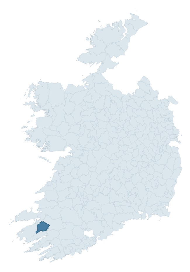
Where this barony sits in the Republic of Ireland
Geology and preservation
Bedrock geology shapes the landscape long before any settlement begins — controlling soil drainage, agricultural potential, the survival of upstanding monuments, and the preservation of buried archaeology. The figures below come from the Geological Survey Ireland 1:100,000 bedrock map.
The bedrock underlying Dunkerron North is predominantly sandstone (74% of the barony by area), laid down during the Devonian period (85% by area, around 419 to 359 million years ago). Sandstone weathers to free-draining, moderately fertile soils that supported Early Medieval ringfort agriculture and later manorial estates. The rock itself is a major source of building stone — visible in churches, tower houses, and farm buildings across the barony's historic landscape. The single largest mapped unit is the Ballinskelligs Formation (32% of the barony's bedrock).
Rock type composition
Largest mapped unit: Ballinskelligs Formation (32% of the barony)
Placename evidence
Logainm records 15 heritage-diagnostic placenames for Dunkerron North, drawn from townland and civil-parish names across the barony. The dominant stratum is pre-Christian and Early Medieval defensive — ráth-, lios-, dún-, and caiseal-prefixed names that mark Iron Age and early historic settlement. The leading diagnostic roots are cill- (5 — church), lios- (3 — ringfort or enclosure), and dún- (2 — hilltop fort or promontory fort). This is below the ROI average of 30.7 heritage placenames per barony, suggesting either lighter survey coverage or a townland-naming tradition that draws more on generic landscape vocabulary. The presence of multiple heritage strata side by side indicates layered occupation of the landscape across successive prehistoric and historic periods. Logainm records 127 placenames for Dunkerron North (predominantly townland names). Of these, 15 (12%) carry one of the diagnostic Gaelic roots tracked above; the remainder draw on more generic landscape vocabulary that does not encode a heritage period.
Pre-Christian / Early Medieval Defensive
| Root | Count | Meaning |
|---|---|---|
| lios- | 3 | ringfort or enclosure |
| dún- | 2 | hilltop or promontory fort |
| ráth- | 1 | earthen ringfort |
| caiseal- | 1 | stone ringfort |
Early Christian Ecclesiastical
| Root | Count | Meaning |
|---|---|---|
| cill- | 5 | church (early) |
| teampall- | 1 | church (later medieval) |
Burial, Ritual, and Norse-Contact
| Root | Count | Meaning |
|---|---|---|
| carn- | 1 | cairn |
| uaimh- | 1 | cave / souterrain |
| gall- | 1 | foreigner — Norse settlement marker |
Other baronies in Kerry
- Iraghticonnor
- Clanmaurice
- Iveragh
- Dunkerron South
- Glanarought
- Magunihy
- Trughanacmy
- Clanmaurice
- Connello Upper — Limerick
- Kinsale — Cork
See all 280 baronies in the Republic of Ireland Heritage Tool.

Explore further
Grounding History: 10 Maps of Northern Ireland’s Past
If you’re interested in Irish heritage more widely, the companion report for Northern Ireland brings together the analysis of all 462 NI wards into one place through 10 high-quality maps — covering monument density, archaeological periods, placename heritage, terrain, wetland, and the historic landscape at first survey. Take a look.
About this profile
Click any section below to expand.
What is a barony?
A barony is a historic administrative unit in Ireland, broadly equivalent to an English hundred. The 280 baronies used here are from the OSi 2019 National Statutory Boundaries (generalised 20m), covering the 26 counties of the Republic of Ireland. Baronies derive from the Norman period, were formalised in the 17th century, and have not been redrawn for statistical purposes. They vary enormously in area, from compact urban baronies in Dublin to vast upland baronies in Connacht, and should not be compared by raw site count without accounting for area differences.
What counts as a site?
This profile combines three distinct heritage registers, each with its own definition of what constitutes a recordable site:
- Archaeological sites (NMS). The National Monuments Service Sites and Monuments Record (SMR) catalogues every known archaeological monument or site of archaeological interest in the Republic, from prehistoric burial mounds and ringforts to medieval churches and post-medieval defensive works. Inclusion does not require legal protection — only that the site has been identified, surveyed, and assessed as having archaeological value. A separate subset of these sites lies within a recorded protection zone, which gives them statutory protection under the National Monuments Acts.
- Listed buildings (NIAH). The National Inventory of Architectural Heritage records buildings of architectural, historical, archaeological, artistic, cultural, scientific, social, or technical interest. Each surveyed structure is appraised on a five-tier scale: International, National, Regional, Local, and Record-Only. The NIAH appraisal is informational rather than strictly statutory, but it underpins local-authority Record of Protected Structures (RPS) listings.
- Heritage placenames (Logainm). Logainm is the authoritative database of Irish placenames maintained by the Placenames Branch. This profile applies a heritage-diagnostic classifier to the Irish-language form of each townland name, flagging roots that signal defensive sites (ráth-, lios-, dún-, caiseal-, cathair-), ecclesiastical foundations (cill-, teampall-, domhnach-, mainistir-), prehistoric burial-ritual features (tuaim-, carn-, leaba-), or Norse-contact settlement (gall-). Townlands without one of these diagnostic roots are not flagged here — they may still carry historical significance, but that significance is not encoded in the name itself.
Editorial principles
The narrative sections of this profile follow several explicit principles:
- Evidential. Every claim about this barony’s heritage character is anchored in the underlying register data. Where a site count, a placename count, or a percentile rank is cited, it is computed from the source datasets at export time, not estimated.
- Comparative. Counts and metrics are reported alongside their percentile rank against the other 279 ROI baronies. A barony with 50 ringforts in absolute terms could be unusually high or unusually low depending on its size and regional context; percentile ranking removes that ambiguity.
- Transparent on limits. Where a register has known coverage gaps, survey biases, or data-quality issues that affect this barony’s figures, the profile flags them rather than presenting the numbers as definitive.
- No interpretation beyond what the data supports. The narrative does not speculate about historical events, social dynamics, or cultural meaning beyond what the recorded heritage and placename evidence directly attests.
Data caveats and limits
- NMS Sites and Monuments Record is the product of survey campaigns conducted at different intensities across different counties and decades. Some baronies have been surveyed more thoroughly than others, and absolute counts should be read in that light. Sites destroyed by development before survey are typically not represented; sites in heavily forested or upland terrain are sometimes under-recorded.
- NIAH coverage is broadly complete for the Republic of Ireland but the survey was conducted on a rolling county-by-county basis, and the most recent appraisal date varies. Buildings demolished or substantially altered after their original survey may still appear in the register; conversely, recent buildings of merit may not yet have been appraised.
- Logainm classification applies a deliberately conservative pattern-matching approach to the Irish-language townland forms. The classifier prioritises true positives over recall: a townland may carry a heritage signal that the classifier doesn’t recognise, particularly where the diagnostic root has been heavily anglicised or where the townland name draws on a less common term. The 60,000+ townland records and ~9,800 classified placenames give a substantial signal at barony scale, but individual townland names should be checked against Logainm directly for definitive interpretation.
- Period attribution. The chronological distribution reflects only those NMS sites that carry a recognised period attribution in the source data. Sites listed as “Unknown” period are excluded from the dated subset.
- Boundary changes. Some baronies have undergone minor boundary adjustments since their 19th-century definition; the OSi 2019 generalised boundaries used here are the current statutory definition and may differ slightly from historical maps in border areas.
- Bedrock geology is mapped at 1:100,000 scale, which means local variation within a barony — small pockets of different rock type, mineral veins, alluvium overlying bedrock — is generalised. The dominant-system and rocktype figures are area-weighted, so a barony reading “70% Carboniferous limestone” may still contain small but archaeologically important pockets of older or younger rock. Around 3% of GSI polygons do not match the lexicon and contribute no rocktype or system attribution.
Data sources
- National Monuments Service — Sites and Monuments Record (SMR) https://data.gov.ie/dataset/national-monuments-service-archaeological-survey-of-ireland
- National Inventory of Architectural Heritage (NIAH) https://data.gov.ie/dataset/national-inventory-of-architectural-heritage-niah-national-dataset
- Logainm — Placenames Database of Ireland https://www.logainm.ie/
- Ordnance Survey Ireland — National Statutory Barony Boundaries 2019 https://data-osi.opendata.arcgis.com/
- EURODEM — European Digital Elevation Model https://www.mapsforeurope.org/datasets/euro-dem
- ESA WorldCover https://esa-worldcover.org/en
- Geological Survey Ireland — 1:100,000 Bedrock Geology https://www.gsi.ie/en-ie/data-and-maps/Pages/Bedrock.aspx
Explore more: Search any of the 280 ROI baronies, browse by historical province, or read the methodology and data sources for the full Republic of Ireland Heritage Tool.