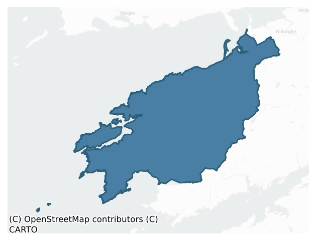
Iveragh is a barony of County Kerry, in the historical province of Munster (Irish: Uíbh Ráthach), covering 665 km² of land. The barony records 1,976 NMS archaeological sites and 77 NIAH listed buildings, placing it at around the 81st percentile among 280 ROI baronies for sites per km². This means it is in the top fifth of all baronies for sites per km². Dated archaeological evidence runs from the Mesolithic through to the Modern, spanning 9 of 9 archaeological periods, placing the barony in the 90th percentile among 280 ROI baronies for chronological depth. This means it is in the top tenth of all baronies for chronological depth. The largest dated subset of recorded sites dates to the Early Medieval. Logainm flags 50 placenames in the barony as carrying a recognised heritage root; the largest share — around 64% — are names associated with early Christian church and monastic foundations.
Heritage at a glance
Percentile rankings throughout this profile compare each barony only against the other 279 Republic of Ireland baronies.
The recorded heritage of Iveragh
The National Monuments Service Sites and Monuments Record (SMR) is the statutory inventory of archaeological sites for the Republic of Ireland, maintained by the Department of Tourism, Culture, Arts, Gaeltacht, Sport and Media. Sites recorded here include earthworks, ringforts, megalithic tombs, ecclesiastical remains, and post-medieval features; not every record is legally protected, but each is registered as a monument of archaeological interest.
The National Monuments Service records 1,976 archaeological sites in Iveragh, putting it at the 81st percentile among 280 ROI baronies for sites per km². This means it is in the top fifth of all baronies for sites per km². Protection coverage is near-universal — 1,932 sites (98%) fall within a recorded monument protection zone, indicating an extensively surveyed landscape. The record is dominated by domestic structures — house sites and settlement remains (555 sites, 28% of the total), with defensive sites forming a substantial secondary presence (354 sites, 18%). Hut site is the most prevalent type, making up 27% of the barony's recorded sites (541 records) — well above the ROI average of 5% across all baronies where this type occurs. Hut site is a low stone or earthen foundation enclosing a small circular or oval area, generally interpreted as a former dwelling, of any date from prehistory to the medieval period. Other significant types include Rock art (194) and Souterrain (111). Rock art is geometric and other motifs carved on earthfast boulders or rock outcrops, mainly Bronze Age but with possible Neolithic origins; Souterrain is an underground stone-built passage and chamber, generally Early Medieval and often associated with ringforts as a defensive or storage feature. Across the barony's 665 km², this gives a recorded density of 2.97 sites per km².
Most common monument types
Hover or tap a monument type to see its definition.
| Type | Count |
|---|---|
| Hut site a low stone or earthen foundation enclosing a small circular or oval area, generally interpreted as a former dwelling, of any date from prehistory to the medieval period | 541 |
| Rock art geometric and other motifs carved on earthfast boulders or rock outcrops, mainly Bronze Age but with possible Neolithic origins | 194 |
| Souterrain an underground stone-built passage and chamber, generally Early Medieval and often associated with ringforts as a defensive or storage feature | 111 |
| Enclosure a banked or ditched feature of uncertain type, used as a catch-all where the original function cannot be determined from surface evidence | 101 |
| Ringfort – rath an earthen ringfort enclosed by a bank and external ditch — the most common Early Medieval farmstead, broadly dated 500–1000 AD | 87 |
| Standing stone a deliberately set upright stone, used variously as a Bronze/Iron Age burial marker, route marker or commemorative monument | 82 |
| Children's burial ground an unconsecrated medieval and early-modern burial ground for unbaptised or stillborn children, often called a cillín or ceallúnach | 67 |
Chronological distribution
The dated archaeological record for Iveragh spans from the Mesolithic through to the Modern, with activity attested across 9 of 9 archaeological periods. This places Iveragh in the top 10% of ROI baronies for chronological depth — few baronies record evidence across as many distinct archaeological periods. Every period from earliest to latest is represented in the record — an unbroken sequence of dated activity across the full chronological span. Activity concentrates most heavily in the Early Medieval (359 sites, 36% of dated material), with the Iron Age forming a secondary peak (314 sites, 32%). A further 988 recorded sites (50% of the overall NMS register for the barony) carry no period attribution — appearing as 'Unknown' in the bar chart below. This typically reflects either records that pre-date the standardised period vocabulary or sites awaiting specialist dating review, rather than a genuine absence of chronological evidence.
Sample of recorded monuments
Show 25 sample monuments (of 1,976 total)
A representative sample of 25 recorded monuments drawn from the barony’s 1,976 total NMS entries. Sites within a recorded monument protection zone and rarer site types are prioritised so the list shows a meaningful cross-section rather than only the most common type. Each entry shows the official Sites and Monuments Record reference number and the description published by the National Monuments Service.
Cupmarked stone
This large angular boulder has three grooves, V-shaped in cross-section, running NE-SW across its NW face. One possible cupmark and two solution pits occur close to the SW ends of the grooves. O’Kelly suggested that the…
This large angular boulder has three grooves, V-shaped in cross-section, running NE-SW across its NW face. One possible cupmark and two solution pits occur close to the SW ends of the grooves. O’Kelly suggested that the grooves were used to sharpen pointed implements (1958a, 3-4, No.5; Finlay 1973, 46-7).
The above description is derived from A. O'Sullivan and J. Sheehan (compilers), 'The Iveragh peninsula: an archaeological survey of South Kerry'. Cork University Press (1996), no. 273. In certain instances the entries have been revised and updated in the light of recent research.
Date of upload: 28 July 2013
Castle – hall-house
Tradition attributes the building of this castle to one Carbery O'Shea (Chatterton 1839, 285), but it is more firmly associated with the MacCarthys. Some form of residence appears to have stood at Ballycarbery in 1398…
Tradition attributes the building of this castle to one Carbery O'Shea (Chatterton 1839, 285), but it is more firmly associated with the MacCarthys. Some form of residence appears to have stood at Ballycarbery in 1398 when Taghd Mac Carthaigh's death there is recorded in the annals (Ó hInnse 1947, 113), but the existing ruins are later in date and are probably those of 'the castle of Valencyen called Ballycarborow', referred to in a document of 1569 (Cal Car MSS 1569, 389). It is noted as a MacCarthy More castle in 1594 (King 1910, 215). Other sixteenth-century sources indicate that it was occupied by the O’Connells in their capacity as MacCarthy wardens (Fiants Eliz No’s. 488,6469, 6569); one Morgan O’Connell of Ballycarbery, for instance, became High Sheriff of Kerry during Elizabethan times. Possession of the castle passed to Sir Valentine Browne following the death of Daniel MacCarthy More – the Earl of Clancar – in 1596 (Hussey 1916a, 252). It appears to have been slighted by parliament forces in 1651-52, when Valencia Harbour was being fortified (Stalley 1991, 127).
The castle is located on a slight eminence on the N shore of the tidal estuary of the River Ferta, just E of Valencia Harbour. Dated by Leask to the fifteenth century (1973, 157), it comprises a fine, ivy-covered tower house surrounded by the remains of a bawn. Much of the S and E walls of both the keep and bawn are destroyed, presumably due to the mid-seventeenth-century slighting, though a portion of…
Bawn
Tradition attributes the building of this castle to one Carbery O'Shea (Chatterton 1839, 285), but it is more firmly associated with the MacCarthys. Some form of residence appears to have stood at Ballycarbery in 1398…
Tradition attributes the building of this castle to one Carbery O'Shea (Chatterton 1839, 285), but it is more firmly associated with the MacCarthys. Some form of residence appears to have stood at Ballycarbery in 1398 when Taghd Mac Carthaigh's death there is recorded in the annals (Ó hInnse 1947, 113), but the existing ruins are later in date and are probably those of 'the castle of Valencyen called Ballycarborow', referred to in a document of 1569 (Cal Car MSS 1569, 389). It is noted as a MacCarthy More castle in 1594 (King 1910, 215). Other sixteenth-century sources indicate that it was occupied by the O’Connells in their capacity as MacCarthy wardens (Fiants Eliz No’s. 488,6469, 6569); one Morgan O’Connell of Ballycarbery, for instance, became High Sheriff of Kerry during Elizabethan times. Possession of the castle passed to Sir Valentine Browne following the death of Daniel MacCarthy More – the Earl of Clancar – in 1596 (Hussey 1916a, 252). It appears to have been slighted by parliament forces in 1651-52, when Valencia Harbour was being fortified (Stalley 1991, 127).
The castle is located on a slight eminence on the N shore of the tidal estuary of the River Ferta, just E of Valencia Harbour. Dated by Leask to the fifteenth century (1973, 157), it comprises a fine, ivy-covered tower house surrounded by the remains of a bawn. Much of the S and E walls of both the keep and bawn are destroyed, presumably due to the mid-seventeenth-century slighting, though a portion of…
Bastioned fort
Cromwell's Fort: This site is located at Fort Point, the NE end of Valencia Island, from which it commands the N entrance into Valencia Harbour. It comprises a well-preserved blockhouse at the rocky tip of the point,…
Cromwell's Fort: This site is located at Fort Point, the NE end of Valencia Island, from which it commands the N entrance into Valencia Harbour. It comprises a well-preserved blockhouse at the rocky tip of the point, within which a nineteenth-century lighthouse stands, and is defended by an earthen bank and fosse of bastioned outline on its landward side. Like KE087-034—-, this fortification was probably built in 1653. It is referred to as 'Fort Fleetwood' in the Ormond MSS. After its disestablishment in 1669 most of its ordnance was shipped to other Munster forts, though the Ormond MSS record that four guns remained buried at the site in 1684 (Pochin Mould 1978, 50). Pococke noted two cannon here in 1758 (Ó Maidin 1959, 39), and these are now located in the lighthouse enclosure.
The blockhouse is a strong masonry enclosure of apsidal plan. Its walls average 2m thick. Eight gun-embrasures survive, with three in each of the seaward facets. Each has a wide external splay. Incorporated into the main structure of the blockhouse on its landward side are two buildings. The NW building contains a small vaulted room which probably served as a magazine. The SE building contains two gunports, now serving as windows, both of which have a slight splay towards the interior. The SW wall of the blockhouse follows an almost demi-bastion shaped outline. A small window in the W flank of its gateway may have been so placed to provide musketry defence (Gowen 1979, 272-6).
On the landward…
Water mill – horizontal-wheeled
The remains of this structure are located 8.5m SE of the enclosure (KE080-046001-). They comprise two parallel drystone-built walls which feature a slight outward curvature of their mid-points. The walls are carefully…
The remains of this structure are located 8.5m SE of the enclosure (KE080-046001-). They comprise two parallel drystone-built walls which feature a slight outward curvature of their mid-points. The walls are carefully constructed of regular coursed flat slabs and corbel inwards, surviving to a maximum internal height of 2.6m. They stand 1.2m apart at base, average 3.5m long and are at least 2m wide. Overgrowth and collapse obscures the structure and there is a considerable build-up of collapse internally. A notched slab, 1.6m long x .6m high x .1m thick, inclines against the S ends of the walls; the rectangular notch, measuring .12m wide, is cut on the upper edge of the stone at the W end. Outside the structure is a massive slab, 2.25m x 1.55m x .12m thick, with a central perforation, .09m in diameter, and a second, smaller perforation located towards its W edge. A pair of ill-defined, diverging stony banks extends for about 12m from the S side of the structure; these banks average 2m wide and 1.5m high.
Lucas interpreted these remains as those of the wheel-house of a horizontal mill (1953, 9-14). He suggested that the large slab with two perforations originally surmounted the parallel walls and formed the floor of the mill-house, that the curvature on the inner face of each wall created sufficient space for the water-wheel to rotate, that the notch on the upright slab was intended to position the fore end of the flume, and that the banks at S were the remains of a headra…
Platform – peatland
This stone feature, of Mesolithic date, was revealed by peat-cutting about 200m E of the inselberg in the Imlagh Basin, Valencia Island. It is preserved in section in a 1.65m high peat-face, .4m above the base of the…
This stone feature, of Mesolithic date, was revealed by peat-cutting about 200m E of the inselberg in the Imlagh Basin, Valencia Island. It is preserved in section in a 1.65m high peat-face, .4m above the base of the bog, and survives as a 6m long spread of flat slabs which incorporates an oak baulk. A thin sheet of sand extends along the peat-face from the N edge of the stone spread. A peat sample from this level yielded a radiocarbon date of 6560±120 BP. The oak baulk was dated to 8910±150 BP. Mitchell interprets this feature as a platform, laid on the surface of the bog c. 6560 BP, into which a piece of fossil oak was incorporated (1989, 78-9).
The above description is derived from A. O'Sullivan and J. Sheehan (compilers), 'The Iveragh peninsula: an archaeological survey of South Kerry'. Cork University Press (1996), no. 25. In certain instances the entries have been revised and updated in the light of recent research.
Date of upload: 28 July 2013
Fortification
Cromwell's Fort: This defended promontory is located close to the SW end of Valencia Island, between Foilhomurrum Bay and the narrowest point of Portmagee Sound – the S entrance into Valencia Harbour. It comprises the…
Cromwell's Fort: This defended promontory is located close to the SW end of Valencia Island, between Foilhomurrum Bay and the narrowest point of Portmagee Sound – the S entrance into Valencia Harbour. It comprises the poorly preserved remains of a blockhouse located at the forward tip of a cliff promontory, known as Sculgaphort, and is defended by a fosse and a large ravelin at its landward side. Westropp suggested that an earlier promontory fort (KE087-034001-) occurred at this location (1912, 306).
A seventeenth-century TCD manuscript records that Cromwellian forces built two forts on Valencia Island in 1653 (Pochin Mould 1978, 48-9). The second example is that at Fort Point, Glanleam (KE079-055001-). A 'Fort' is depicted at Coarha Beg on the Down Survey map of 1655, while in the Book of Survey and Distribution it is stated that 'there stands … a ffort at the south point of Corrabeg, which is security for the Harbour of Valencia' (Westropp 1912, 289). There are several references to both of the Valencia forts in the State Papers during the 1660s, before their disestablishment in 1669 (Gowen 1979, 264; Pochin Mould 1978, 48-50). In 1659 the State compiled a list of garrisons 'which are thought to be fit to be constantly kept if any invasion should be made into Ireland by a foreign enemy', the list suggested that a garrison of 60 men should be kept in the forts at 'Valentia and Dingle' (Cal. S.P. Ire., vol.18, 687). In 1666 the Earl of Orrery wrote to the Lord Lieutena…
Cross (present location)
A stone cross and two uninscribed pillar stones are located on a slight rise close to the E edge of the bog-covered Emlagh Basin, at the NW end of Valencia Island. The site, not marked on the OS maps, affords extensive…
A stone cross and two uninscribed pillar stones are located on a slight rise close to the E edge of the bog-covered Emlagh Basin, at the NW end of Valencia Island. The site, not marked on the OS maps, affords extensive views of the Atlantic and of the Blasket Islands to NW. Delap recorded that they were only recently 'raised to their present position' (1911, 410), and they stood in a roughly N-S line when seen by Westropp (1912, 301). The pillar stones now lie prostrate, adjacent to the upright stone cross.
The stone cross (KE087-004001-) measures 1.64m long. Its lower shaft is .35m wide, while its upper end tapers gently to a straight-edged top. The angles, where the shaft and arms meet, are slightly hollowed. The short rectangular arms extend to a maximum width of .53m. Each face is ornamented by a diagonally disposed linear cross, the upper and lower angles of which are closed.
At a distance of 1.4m to the S of the cross, the smaller (KE087-004002-) of the two pillar stones stood three feet (.91m) high; three feet (.91m) further S stood the taller pillar (KE087-004003-), six feet ten inches (2.1m) high (Westropp, ibid.). At present this pillar lies prostrate, 2.5m W of the cross, in a heap of loose stone. It measures 2.9m x .56m x .16m thick. The smaller stone is not identifiable. A row of low upright stones, 2m in overall length, occurs just E of the cross.
Legend associates the site with St Brendan, the two pillar stones reputedly marking the graves of two men wh…
Gatehouse
The gatehouse and the remains of an adjacent entrance at W occur towards the E end of the stone wall. They appear to be insertions, and are built of coursed split stone and rubble laid in a gravel and shell mortar. The…
The gatehouse and the remains of an adjacent entrance at W occur towards the E end of the stone wall. They appear to be insertions, and are built of coursed split stone and rubble laid in a gravel and shell mortar. The gatehouse measures 6.75 E-W x 4.3m N-S externally and stands to a maximum height of 5m at its NW angle. Its entrance, arched with pitched slabs and approached by three steps of doubtful antiquity, is located central to the N wall; it measures 2.25m high and is 1.65m wide. The sockets for three drawbars are preserved in its E jamb. The entrance communicates through a wide lobby with the exit at S. Only the jambs of the exit survive; in its W jamb a deep drawbar socket is preserved. The N end of the lobby is roofed by a pair of very large, obliquely pitched slabs, one of which has a circular perforation, .16m in diameter.
Access to a ground floor chamber on the E side of the lobby is gained through a flat-headed doorway near the lobby's S end. This doorway is internally rebated and fitted with a drawbar socket in its N jamb. The chamber is roofed with lintels and measures 3m N-S x 1.25m E-W. It is lit by a loop in the N wall, which is set in a rectangular, lintelled embrasure with splayed ingoings. Directly across the lobby from the entrance to the E chamber are the remains of a doorway, of which only the S jamb survives. Access is gained through this doorway to a short lintelled passage, on the N side of which is preserved the W jamb of an entrance to a smal…
Hearth
For descriptive account see O'Sullivan and Sheehan (1996, 23, no. 28, 'It has been interpreted as a hearth by Mitchell.').
The above description is derived from the published 'Archaeological Inventory of County…
For descriptive account see O'Sullivan and Sheehan (1996, 23, no. 28, 'It has been interpreted as a hearth by Mitchell.').
The above description is derived from the published 'Archaeological Inventory of County Kerry. Volume I: South-West Kerry' (Dublin: Stationery Office, 2009). In certain instances the entries have been revised and updated in the light of recent research.
Date of upload: 30 May 2011
Cross-inscribed pillar (present location)
Holy well KE088-051—- was located c. 270m E of Kilpeacan ecclesiastical site (KE088-015001-). It was referred to locally as a holy well and was filled in during the 1940s. No surface trace of it remains.
Lying…
Holy well KE088-051—- was located c. 270m E of Kilpeacan ecclesiastical site (KE088-015001-). It was referred to locally as a holy well and was filled in during the 1940s. No surface trace of it remains.
Lying face down on a field boundary c. 20m to N is a large cross-inscribed slab which formerly stood close to the well (local information). Measuring 2.18m long and .5m in maximum width, it features an equal-armed linear cross close to one end.
The above description is derived from A. O'Sullivan and J. Sheehan (compilers), 'The Iveragh peninsula: an archaeological survey of South Kerry'. Cork University Press (1996), no. 1051. In certain instances the entries have been revised and updated in the light of recent research.
Date of upload: 30 July 2013
Stone circle – multiple-stone
This small monument, not marked on the OS maps, is located on the NW side of the valley of the Cummeragh river, in rough pastureland that overlooks Lough Currane to SW. It consists of an oval arrangement of five stones…
This small monument, not marked on the OS maps, is located on the NW side of the valley of the Cummeragh river, in rough pastureland that overlooks Lough Currane to SW. It consists of an oval arrangement of five stones with its longer axis lying NE-SW. It may have originally consisted of seven stones. Its interior features an infill of field debris, .5m high. The largest stone of the circle is at W; it stands 2m high and measures 1.6m x .4m at base. At SW is a squat, block-like boulder measuring .83m x .9m x .5m. The orthostat at S is 1.8m high, 1.1m wide and .5m thick. The limits of the E side of the circle are defined only by field debris. The stone at NE inclines markedly outwards and stands .8m high, 1.1m wide and .4m thick. A prostrate boulder-like slab occurs adjacent to this at N, and measures 1.9m x 1.2m x .4m. Neither the portals nor the axial stone of the monument can be identified (Ó Nualláin 1984a, 26). The 'bronze staff from the stone row and cairn in this townland (KE089-035—-) was mistakenly associated by Ó Nualláin with this site. An outlying monolith (KE089-053001-), 6.65m NW of the possible stone circle, is incorporated into a field wall. It stands 1.3m high and measures .6m x .5m at base. It is of regular elevation.
The above description is derived from A. O'Sullivan and J. Sheehan (compilers), 'The Iveragh peninsula: an archaeological survey of South Kerry'. Cork University Press (1996), no. 381. In certain instances the entries have been revised a…
Bridge
Rainbow Bridge: This foot-bridge spanned the Inny river at a point 4.3km NE of its estuary and c. 0.5km NE of Dromod medieval church (KE089-027—-). Its location is marked 'site of' on the OS maps, at a point a short…
Rainbow Bridge: This foot-bridge spanned the Inny river at a point 4.3km NE of its estuary and c. 0.5km NE of Dromod medieval church (KE089-027—-). Its location is marked 'site of' on the OS maps, at a point a short distance upstream from 'Ahandrohid' foot-bridge. The field on its N side is titled 'Bridge Field'. Smith noted that the bridge was in good repair when the High Sheriff held court upon it in 1732, and wrote in the mid-eighteenth century that its arch 'hath lately fallen down' (1756, 100). Pococke confirmed this latter point when he recorded in 1758 that this 'fine Bridge of one Arch' had lately been 'suffer'd … to go to decay' (in Ó Maidín 1959, 38). The span of the semicircle arch was 24 feet (7.3m); it measured 1 yard (.91m) wide and rose to 'a considerable height over the river' (Smith, ibid.). A series of steps on both sides led to the level of its haunches. It is unclear from the illustration Smith provided of it whether it was furnished with parapets or not. No surface trace of the bridge survives.
The above description is derived from A. O'Sullivan and J. Sheehan (compilers), 'The Iveragh peninsula: an archaeological survey of South Kerry'. Cork University Press (1996), no. 1455. In certain instances the entries have been revised and updated in the light of recent research.
Date of upload: 1 August 2013
Religious house – Augustinian canons
National Monument No. 168. Ballinskelligs Abbey: The priory of the Arroasian Canons of the Order of St Augustine is located on the W shore of Ballinskelligs Bay. It was founded in 1210, or shortly afterwards,…
National Monument No. 168. Ballinskelligs Abbey: The priory of the Arroasian Canons of the Order of St Augustine is located on the W shore of Ballinskelligs Bay. It was founded in 1210, or shortly afterwards, originating from Rattoo in north Kerry. It is recorded that the early monastery of Skellig Michael (KE104A-001—-) was transferred, due to the hazardous conditions on the rock, to this location prior to the mid-eleventh century (Gwynn and Hadcock 1970, 192; Smith 1756, 103). The priory retained possession of the Great Skellig and of the alias 'de Rupe Michaelis'. Ballinskelligs is recorded in the Papal Taxation Lists for the diocese of Ardfert in 1300 as 'Redditus Priors de Rupe Beati Michis' (Hickson 1891, 310-12). The priory was still Arroasian and occupied by canons in 1555 (Walsh and O'Sullivan 1949, 59), and may still have been in use by 1569 (Cal Car MSS I, 389). It was disbanded by 1578, when a fiant granted the lease of 'the site of the late monastery of Canons of Ballinskilligge’, to Gyles Clinsher for twenty-one years (Hickson 1891, 312). It was leased to John Blake in 1585 (Gwynn and Hadcock, ibid.), and later came into the possession of Richard Harding (Smith 1756, 103). It passed to the Sigerson family in 1615 (Lynch 1902b, 352).
With the exception of the building known as the Prior's House, the priory is poorly preserved. It is located close to the shoreline, the erosion of which since at least the eighteenth century has resulted in the destruction of…
Radial-stone enclosure
Not marked on the OS maps, this poorly preserved site is located at the foot of Canuig mountain in pasture that overlooks St Finan's Bay to W. Five radially set stones, averaging .5m high, form a 6.6m long arc. Its E…
Not marked on the OS maps, this poorly preserved site is located at the foot of Canuig mountain in pasture that overlooks St Finan's Bay to W. Five radially set stones, averaging .5m high, form a 6.6m long arc. Its E end is marked by the two most prominent stones, which are set .9m apart and are contained within a sod-covered stony bank. Adjacent at NW is a low, oval mound of earth and stone, 8.8m in maximum length, which is bisected by a field boundary. A number of stones project from the S side of the surface of the mound. The connection, if any, between this mound and the arc of radially set stones is unclear.
The above description is derived from A. O'Sullivan and J. Sheehan (compilers), 'The Iveragh peninsula: an archaeological survey of South Kerry'. Cork University Press (1996), no. 382. In certain instances the entries have been revised and updated in the light of recent research.
Date of upload: 28 July 2013
Ecclesiastical site
National Monument No. 60. Church Island/Oileán an Teampail described by O'Sullivan and Sheehan (1996, 316-22, no. 974) as follows; 'This large, flat island is located towards the N end of Lough Currane. Measuring a…
National Monument No. 60. Church Island/Oileán an Teampail described by O'Sullivan and Sheehan (1996, 316-22, no. 974) as follows; 'This large, flat island is located towards the N end of Lough Currane. Measuring a maximum of 140m N-S x 190 E W, it is associated with St Finan Cam who is reputed to have founded a monastery on it in the Sixth century (Gwynn and Hadcock 1970, 31). It has been erroneously connected with St Malachy of Armagh since O'Hanlon's suggestion that Ibracense, where Malachy founded a monastery c. 1127, was to be identified as Iveragh (1872, 107-9; Lynch 1908, 368-9). The island is referred to as 'Inis Uasail' sub anno 1058 in the Annals of Inisfallen (Mac Airt 1951, 219), and Hickson (1888, 446) suggested that it was to be identified with the Eccia de ….agh' which was included in the Papal Taxation List (1302-06) for the diocese of Ardfert (Cal Docs Ire, V, 297). The rectory of 'Inis Uasail' is mentioned in 1418 in Regestum Supplicationum (Nicholls 1971, 84), and in 1622 'Inishouele' was noted as being the 'one prebend left of the ruined church of Aghadoe' (TCD MS 2158, 48).
The remains on the island are extensive. At its E end is a small Romanesque church, a burial ground, ten cross-inscribed slabs, three leacht-type structures and a number of uninscribed pillar stones. A narrow causeway runs from here along the N shore of the island to its W end, where a corbelled structure known as St Finan's Cell is located. Occupying much of the remainder of t…
Weir – fish
Near the mouth of the Currane River in a pasture area to the S of Waterville House. According to Went (1974) there is 'a grant from James 1 dated 23rd February 1604 to Donnel or Donough McCarthye …… with a salmon weir…
Near the mouth of the Currane River in a pasture area to the S of Waterville House. According to Went (1974) there is 'a grant from James 1 dated 23rd February 1604 to Donnel or Donough McCarthye …… with a salmon weir on the Curane, rent £10.' According to local information, this is the original weir, with some later minor modifications, built on the Currane River. It consists of a curving, sloping, paved area (L c. 15m) across the river and three well-constructed piers (L c. 5m; Wth 3-3.8m), built with large semi-dressed blocks of stone and with rounded projections on both the upstream and downstream sides. The piers carry a wooden footbridge over the four down-sloping fish traps (Wth c. 1.5m), which are between the piers. According to the local informant, in the past the two middle fish traps were used to catch salmon for the owners of Waterville House and the fish were stored in a rectangular tank (4.2m x 2m) of water, which is no longer in use, on the N bank of the river. The fish trap on the S side was opened only from noon on Friday to noon on the following Monday to allow fish to get up to Lough Currane. The gate on the trap at the N side was normally closed and it was used to relieve floods. Fish counters and cameras are now used to track the movements of fish up and down the river and the fish traps are no longer closed.
The above description is derived from the published 'Archaeological Inventory of County Kerry. Volume I: South-West Kerry' (Dublin: Stationery…
Sundial
KE104A-001041- This cross-inscribed slab tapers regularly in width towards its base from a broad, flat top. It features a circular perforation near the top, from which three radial grooves extend. The central groove is…
KE104A-001041- This cross-inscribed slab tapers regularly in width towards its base from a broad, flat top. It features a circular perforation near the top, from which three radial grooves extend. The central groove is the most pronounced and extends down to the upper terminal of a linear Latin cross. The shaft of the cross features bulbous terminals and the crossing of its arms is ringed by a groove. The slab, which may be a sundial, now serves as the inner lintel of the oratory on the upper terrace (4). Little of its decoration is visible in this position. L: 1.6m. W: 0.25m.
See attached drawing of cross-slab (b) taken from O'Sullivan and Sheehan 1996, 281, Fig. 181.
The above description is derived from A. O'Sullivan and J. Sheehan (compilers), 'The Iveragh peninsula: an archaeological survey of South Kerry'. Cork University Press (1996), no. 948, (74). In certain instances the entries have been revised and updated in the light of recent research.
Revised by: Caimin O'Brien
Date of revised upload: 7 March 2022
Barracks
Situated at the NE end (and at high point\crest) of a NE-SW running ridge that extends out to Bolus Head c. 1.1kms to the SW (OD c. 285m). Located on the wide flat crest of the ridge with downward slopes to the…
Situated at the NE end (and at high point\crest) of a NE-SW running ridge that extends out to Bolus Head c. 1.1kms to the SW (OD c. 285m). Located on the wide flat crest of the ridge with downward slopes to the coastline to the N, W, and S; extensive views over Ballinskelligs Bay to the S and SE and over St. Finian's Bay to the N and NW. Located c. 580m E of coastline at closest point close to sea cliffs at Bolus Point. The surrounding area consists of unenclosed rough pasture with an area of enclosed pasture (defined by mainly linear irregular rubble stone boundary walls, now mostly collapsing) located further down the slope to the E and SE after c. 300m. Site located c. 570m ESE of the associated signal station at Bolus Point (KE096-024—-). The ‘enclosed barrack signal station’ site at Bolus is located c. 1.8kms W\WSW of an ecclesiastical enclosure (KE097-044001-) containing the remains of a church (KE097-044002-) with multiple associated sites located at Cill Rialaigh, and c. 2.6kms S of a coastal promontory fort (KE096-014—-), known as ‘Doongar’ located on a narrow promontory between St. Finan’s Bay and Ducalla Head at Alachaí Mór.
The remains of an early nineteenth-century (c. 1810) three-bay two-storey or single-storey over raised basement rectangular-plan (ext. dims c. 10.5m NW-SE x c. 4.3m NE-SW; wall T c. 0.75m) former enclosed barracks\signal station associated with the signal station\tower network. Possibly\probably originally with a signal mast to site…
Latrine
Latrine described in 1996 as follows; 'The drystone foundations of this subcircular structure measuring 0.9m x 0.8m internally, are located just outside the N end of the upper terrace [KE104A001161-]. An entrance gap…
Latrine described in 1996 as follows; 'The drystone foundations of this subcircular structure measuring 0.9m x 0.8m internally, are located just outside the N end of the upper terrace [KE104A001161-]. An entrance gap faces onto the terrace. A vertically disposed slab crosses the interior of the structure, forming the top of a shaft which debouches into a gully below' (O'Sullivan and Sheehan 1996, 286, no. 948 (16)).
See attached plan of latrine located to N of small oratory (KE104A001040-), taken from Bourke, Hayden and Lynch 2011, 44.
Compiled by: Elizabeth Byrne, Ursula Egan and Sheila Ronan, Archaeological Survey Unit, University College, Cork.
Revised by: Caimin O'Brien
Date of revised upload: 9 March 2022
Causeway
A slightly raised, turfed-over causeway, averaging 3m wide, joins the E end of the island to the area at its W shore. Commencing just outside the graveyard enclosure, it meanders along the N shore of the island and…
A slightly raised, turfed-over causeway, averaging 3m wide, joins the E end of the island to the area at its W shore. Commencing just outside the graveyard enclosure, it meanders along the N shore of the island and terminates close to the building known as St Finan's Cell (KE098-039009-). A number of field boundaries overlie it along its course.
The above description is derived from O'Sullivan, A. and Sheehan, J. (compilers) 'The Iveragh peninsula: an archaeological survey of South Kerry'. Cork University press. (1996), no. 974. In certain instances the entries have been revised and updated in the light of recent research.
Date of upload: 18 June 2013
Burial ground
De Paor (1955, 186) recorded a tradition that the wall enclosed an area used as a burial ground. No corroborating evidence has been found to support this classification (pers. comm. G. Rourke).
This feature was…
De Paor (1955, 186) recorded a tradition that the wall enclosed an area used as a burial ground. No corroborating evidence has been found to support this classification (pers. comm. G. Rourke).
This feature was described in 1996 as follows; 'Christ's Valley: Also known as Christ's Saddle, this broad U-shaped depression occurs 130m above sea level midway between the two peaks of the island. On it occurs the meeting point of the N and S flights of steps, the remains of a wall [KE104A001114-] and a largely natural shelter. The poorly preserved wall, which runs NE-SW, consists of a short row of slabs set on edge. Set into it are two stone crosses [KE104A001023-, KE104A001024-], neither of which would appear to represent the 'Monumental Pillar' marked on Christ's Valley on the OSi 6-inch maps. De Paor records a tradition that the wall enclosed an area used as a burial ground (1955, 186). Smith recorded that this part of the island was 'formerly cultivated' (1756, 113), and Foley noted that the lighthouse keepers grew vegetables here (1903, 12). The largely natural shelter is located near the lower W slope of Christ's Valley. It consists of a very large slab-boulder which inclines against a near vertical rock-face. Three upright slabs have been positioned at its open E end, where an entrance gap, 0.35m wide x 0.9m high, occurs. The interior of the shelter measures 4m N-S x 2.4m E-W. Its floor, now earth-covered, may be stone paved. A Latin cross [KE104A001025-], with INRI sc…
Architectural feature
The cuboid-shaped stone stoup (L 0.2m; Wth 0.15m; T 0.12m) was in the larger oratory (KE104A001039-) on Sceilg Mhichíl (Foley 1903, 18) but is now in the care of the OPW (National Monuments Depot, Killarney). It has a…
The cuboid-shaped stone stoup (L 0.2m; Wth 0.15m; T 0.12m) was in the larger oratory (KE104A001039-) on Sceilg Mhichíl (Foley 1903, 18) but is now in the care of the OPW (National Monuments Depot, Killarney). It has a circular bowl-shaped hollow (diam. 11.5cm; D 6cm) on its upper surface and on one of its sides is carved a stylized angel surmounted by an equal-armed cross. Lavelle (1976, 16) notes that this stoup is considered to be late 17th/early 18th century in date and that its presence on Sceilg Mhichíl 'is not clearly understood'.
The above description is derived from the published 'Archaeological Inventory of County Kerry. Volume I: South-West Kerry' (Dublin: Stationery Office, 2009). In certain instances the entries have been revised and updated in the light of recent research.
Date of upload: 30 May 2011
Mill – unclassified
On the S slopes of Bray Head. A collapsed masonry wall, at the SE side of a mound (diam. c. 20m; H 1m) of rushes and mosses, was interpreted as being the remnants of a possible millpond (Hayden 1997). Upslope from the…
On the S slopes of Bray Head. A collapsed masonry wall, at the SE side of a mound (diam. c. 20m; H 1m) of rushes and mosses, was interpreted as being the remnants of a possible millpond (Hayden 1997). Upslope from the wall there is a mass of waterlain silt (T 1m) with vegetable debris which appears to have accumulated in standing-water. In 1995 a section was cut across the feature and, although the results were inconclusive as little stonework survived, a radiocarbon date of AD 1410-1791 cal. was returned from the silt at the base of the section (ibid.). A boggy spring flows from the mound. Large stones, probably fallen masonry, are on the downslope side of the wall. A narrow trench, interpreted as being a possible tailrace (Mitchell et al. n.d.), is located in the field immediately to the E. There was no surface spread of silt, indicating that clear water, and not hill-wash, flowed down the trench. The evidence of a millpond here suggests that there was a mill at or near this location at one time.
The above description is derived from the published 'Archaeological Inventory of County Kerry. Volume I: South-West Kerry' (Dublin: Stationery Office, 2009). In certain instances the entries have been revised and updated in the light of recent research.
Date of upload: 30 May 2011
Hut site
Described by O'Sullivan and Sheehan (1996, 393, no. 1161) as 'Located on the crest of the ridge that extends W from Mullaghnarakill mountain. A well-preserved circular dry-stone hut of corbelled construction that…
Described by O'Sullivan and Sheehan (1996, 393, no. 1161) as 'Located on the crest of the ridge that extends W from Mullaghnarakill mountain. A well-preserved circular dry-stone hut of corbelled construction that features an external offset of coursed blocks, now largely concealed beneath
collapse. Small slabs were used to line the inner wall-face; at SE a modified lintelled entrance, 0.7m wide, composed of large coursed blocks occurs. A gap, adjacent at E, constitutes the present entrance. 1): 3.9m. H: 1.2m. T: 1.8m.'
Compiled by: Paul Walsh
Date of upload: 3 May 2017
Listed buildings
The National Inventory of Architectural Heritage (NIAH) is a state survey appraising buildings of architectural, historical, archaeological, artistic, cultural, scientific, social, or technical interest. Each surveyed structure receives a rating from International (the highest, for buildings of European importance) through National, Regional, Local, and Record-Only.
The NIAH records 77 listed buildings in Iveragh (40th percentile across ROI baronies). The highest-graded structures include 2 of National significance. The Republic holds 937 National-graded buildings in total, so this barony accounts for around 0% of the national total. Construction dates concentrate most heavily in the Victorian (1830-1900) period. The most-recorded building type is worker's house (23 examples, 30% of the listed stock).
Terrain and environment
Mean elevation across the barony is 146m — the 84th percentile among 280 ROI baronies for elevation. This means it is in the top fifth of all baronies for elevation. This is a relatively elevated landscape by ROI standards. Elevation matters for heritage because higher-altitude baronies typically favour defensive monuments — ringforts and hilltop forts placed on prominent ground — while lowland baronies are more likely to carry the dense settlement and church networks of intensive agricultural landscapes. The barony reaches 772m at its highest point — a vertical span of more than 625m within its boundary, indicating significant topographic diversity. Mean slope is 9.6° — the 96th percentile among 280 ROI baronies for slope. This means it is in the top tenth of all baronies for slope. This is consistently steep terrain by ROI standards, the kind of landscape that tends to preserve upstanding archaeological features well. Slope is a key control on both land use and archaeological preservation: steep ground resists ploughing and tends to preserve earthworks intact, while gentle slopes favour intensive cultivation that damages or destroys surface archaeology over time. Localised maximum slopes reach 29°, typical of stream-cut valleys, escarpments, or coastal bluffs within the wider landscape. The Topographic Wetness Index averages 9.2, the 5th percentile among 280 ROI baronies for wetness. This means it is in the bottom tenth of all baronies for wetness. This is well-drained ground by ROI standards — typical of upland or steeply-sloping country that sheds water rapidly. Drainage matters for heritage because poorly-drained ground preserves organic archaeology (wooden trackways, leather, textiles, and on rare occasions human remains) far better than free-draining soil; well-drained ground favours arable use but destroys organic material rapidly. The land cover is dominated by improved grassland (83%) and woodland (13%). In overall character, this is an upland landscape of steep, elevated terrain, with land use dominated by improved grassland.
Terrain measurements
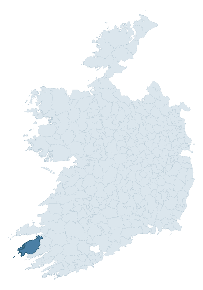
Where this barony sits in the Republic of Ireland
Geology and preservation
Bedrock geology shapes the landscape long before any settlement begins — controlling soil drainage, agricultural potential, the survival of upstanding monuments, and the preservation of buried archaeology. The figures below come from the Geological Survey Ireland 1:100,000 bedrock map.
The bedrock underlying Iveragh is predominantly sandstone (79% of the barony by area), laid down during the Devonian period (95% by area, around 419 to 359 million years ago). Sandstone weathers to free-draining, moderately fertile soils that supported Early Medieval ringfort agriculture and later manorial estates. The rock itself is a major source of building stone — visible in churches, tower houses, and farm buildings across the barony's historic landscape. A substantial secondary geology of siltstone (16%) adds further variety to the underlying landscape. The single largest mapped unit is the St. Finan's Formation (41% of the barony's bedrock).
Rock type composition
Largest mapped unit: St. Finan's Formation (41% of the barony)
Placename evidence
Logainm records 50 heritage-diagnostic placenames for Iveragh, drawn from townland and civil-parish names across the barony. The dominant stratum is Early Christian ecclesiastical — cill-, teampall-, and domhnach-prefixed names that record the dense network of early church foundations established between the fifth and tenth centuries. The leading diagnostic roots are cill- (31 — church), lios- (6 — ringfort or enclosure), and cathair- (5 — stone fort). This is above the ROI average of 30.7 heritage placenames per barony. The presence of multiple heritage strata side by side indicates layered occupation of the landscape across successive prehistoric and historic periods. Logainm records 332 placenames for Iveragh (predominantly townland names). Of these, 50 (15%) carry one of the diagnostic Gaelic roots tracked above; the remainder draw on more generic landscape vocabulary that does not encode a heritage period.
Pre-Christian / Early Medieval Defensive
| Root | Count | Meaning |
|---|---|---|
| lios- | 6 | ringfort or enclosure |
| cathair- | 5 | stone fort |
| caiseal- | 3 | stone ringfort |
| dún- | 2 | hilltop or promontory fort |
| ráth- | 1 | earthen ringfort |
Early Christian Ecclesiastical
| Root | Count | Meaning |
|---|---|---|
| cill- | 31 | church (early) |
| cillín- | 1 | unconsecrated burial ground |
Burial, Ritual, and Norse-Contact
| Root | Count | Meaning |
|---|---|---|
| leaba- | 1 | megalithic tomb |
Other baronies in Kerry
- Dunkerron South
- Magunihy
- Corkaguiny
- Trughanacmy
- Clanmaurice
- Glanarought
- Iraghticonnor
- Carbery West (west Division) — Cork
- Orrery And Kilmore — Cork
- Kilnamanagh Lower — Tipperary
See all 280 baronies in the Republic of Ireland Heritage Tool.

Explore further
Grounding History: 10 Maps of Northern Ireland’s Past
If you’re interested in Irish heritage more widely, the companion report for Northern Ireland brings together the analysis of all 462 NI wards into one place through 10 high-quality maps — covering monument density, archaeological periods, placename heritage, terrain, wetland, and the historic landscape at first survey. Take a look.
About this profile
Click any section below to expand.
What is a barony?
A barony is a historic administrative unit in Ireland, broadly equivalent to an English hundred. The 280 baronies used here are from the OSi 2019 National Statutory Boundaries (generalised 20m), covering the 26 counties of the Republic of Ireland. Baronies derive from the Norman period, were formalised in the 17th century, and have not been redrawn for statistical purposes. They vary enormously in area, from compact urban baronies in Dublin to vast upland baronies in Connacht, and should not be compared by raw site count without accounting for area differences.
What counts as a site?
This profile combines three distinct heritage registers, each with its own definition of what constitutes a recordable site:
- Archaeological sites (NMS). The National Monuments Service Sites and Monuments Record (SMR) catalogues every known archaeological monument or site of archaeological interest in the Republic, from prehistoric burial mounds and ringforts to medieval churches and post-medieval defensive works. Inclusion does not require legal protection — only that the site has been identified, surveyed, and assessed as having archaeological value. A separate subset of these sites lies within a recorded protection zone, which gives them statutory protection under the National Monuments Acts.
- Listed buildings (NIAH). The National Inventory of Architectural Heritage records buildings of architectural, historical, archaeological, artistic, cultural, scientific, social, or technical interest. Each surveyed structure is appraised on a five-tier scale: International, National, Regional, Local, and Record-Only. The NIAH appraisal is informational rather than strictly statutory, but it underpins local-authority Record of Protected Structures (RPS) listings.
- Heritage placenames (Logainm). Logainm is the authoritative database of Irish placenames maintained by the Placenames Branch. This profile applies a heritage-diagnostic classifier to the Irish-language form of each townland name, flagging roots that signal defensive sites (ráth-, lios-, dún-, caiseal-, cathair-), ecclesiastical foundations (cill-, teampall-, domhnach-, mainistir-), prehistoric burial-ritual features (tuaim-, carn-, leaba-), or Norse-contact settlement (gall-). Townlands without one of these diagnostic roots are not flagged here — they may still carry historical significance, but that significance is not encoded in the name itself.
Editorial principles
The narrative sections of this profile follow several explicit principles:
- Evidential. Every claim about this barony’s heritage character is anchored in the underlying register data. Where a site count, a placename count, or a percentile rank is cited, it is computed from the source datasets at export time, not estimated.
- Comparative. Counts and metrics are reported alongside their percentile rank against the other 279 ROI baronies. A barony with 50 ringforts in absolute terms could be unusually high or unusually low depending on its size and regional context; percentile ranking removes that ambiguity.
- Transparent on limits. Where a register has known coverage gaps, survey biases, or data-quality issues that affect this barony’s figures, the profile flags them rather than presenting the numbers as definitive.
- No interpretation beyond what the data supports. The narrative does not speculate about historical events, social dynamics, or cultural meaning beyond what the recorded heritage and placename evidence directly attests.
Data caveats and limits
- NMS Sites and Monuments Record is the product of survey campaigns conducted at different intensities across different counties and decades. Some baronies have been surveyed more thoroughly than others, and absolute counts should be read in that light. Sites destroyed by development before survey are typically not represented; sites in heavily forested or upland terrain are sometimes under-recorded.
- NIAH coverage is broadly complete for the Republic of Ireland but the survey was conducted on a rolling county-by-county basis, and the most recent appraisal date varies. Buildings demolished or substantially altered after their original survey may still appear in the register; conversely, recent buildings of merit may not yet have been appraised.
- Logainm classification applies a deliberately conservative pattern-matching approach to the Irish-language townland forms. The classifier prioritises true positives over recall: a townland may carry a heritage signal that the classifier doesn’t recognise, particularly where the diagnostic root has been heavily anglicised or where the townland name draws on a less common term. The 60,000+ townland records and ~9,800 classified placenames give a substantial signal at barony scale, but individual townland names should be checked against Logainm directly for definitive interpretation.
- Period attribution. The chronological distribution reflects only those NMS sites that carry a recognised period attribution in the source data. Sites listed as “Unknown” period are excluded from the dated subset.
- Boundary changes. Some baronies have undergone minor boundary adjustments since their 19th-century definition; the OSi 2019 generalised boundaries used here are the current statutory definition and may differ slightly from historical maps in border areas.
- Bedrock geology is mapped at 1:100,000 scale, which means local variation within a barony — small pockets of different rock type, mineral veins, alluvium overlying bedrock — is generalised. The dominant-system and rocktype figures are area-weighted, so a barony reading “70% Carboniferous limestone” may still contain small but archaeologically important pockets of older or younger rock. Around 3% of GSI polygons do not match the lexicon and contribute no rocktype or system attribution.
Data sources
- National Monuments Service — Sites and Monuments Record (SMR) https://data.gov.ie/dataset/national-monuments-service-archaeological-survey-of-ireland
- National Inventory of Architectural Heritage (NIAH) https://data.gov.ie/dataset/national-inventory-of-architectural-heritage-niah-national-dataset
- Logainm — Placenames Database of Ireland https://www.logainm.ie/
- Ordnance Survey Ireland — National Statutory Barony Boundaries 2019 https://data-osi.opendata.arcgis.com/
- EURODEM — European Digital Elevation Model https://www.mapsforeurope.org/datasets/euro-dem
- ESA WorldCover https://esa-worldcover.org/en
- Geological Survey Ireland — 1:100,000 Bedrock Geology https://www.gsi.ie/en-ie/data-and-maps/Pages/Bedrock.aspx
Explore more: Search any of the 280 ROI baronies, browse by historical province, or read the methodology and data sources for the full Republic of Ireland Heritage Tool.