
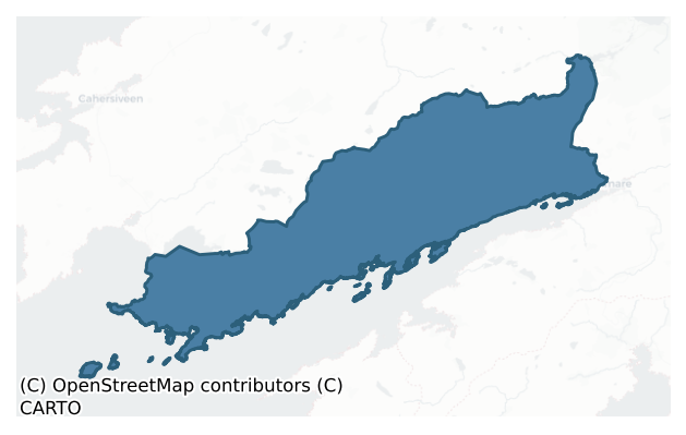
Dunkerron South is a barony of County Kerry, in the historical province of Munster (Irish: Dún Ciaráin Theas), covering 395 km² of land. The barony records 768 NMS archaeological sites and 25 NIAH listed buildings, placing it at around the 53rd percentile among 280 ROI baronies for sites per km². This means it is in the upper half of all baronies for sites per km². Dated archaeological evidence runs from the Neolithic through to the Modern, spanning 8 of 9 archaeological periods, placing the barony in the 54th percentile among 280 ROI baronies for chronological depth. This means it is in the upper half of all baronies for chronological depth. The largest dated subset of recorded sites dates to the Iron Age. Logainm flags 20 placenames in the barony as carrying a recognised heritage root; the largest share — around 60% — are names associated with pre-christian defensive.
Heritage at a glance
Percentile rankings throughout this profile compare each barony only against the other 279 Republic of Ireland baronies.
The recorded heritage of Dunkerron South
The National Monuments Service Sites and Monuments Record (SMR) is the statutory inventory of archaeological sites for the Republic of Ireland, maintained by the Department of Tourism, Culture, Arts, Gaeltacht, Sport and Media. Sites recorded here include earthworks, ringforts, megalithic tombs, ecclesiastical remains, and post-medieval features; not every record is legally protected, but each is registered as a monument of archaeological interest.
The National Monuments Service records 768 archaeological sites in Dunkerron South, putting it at the 53rd percentile among 280 ROI baronies for sites per km². This means it is in the upper half of all baronies for sites per km². Protection coverage is near-universal — 730 sites (95%) fall within a recorded monument protection zone, indicating an extensively surveyed landscape. The record is dominated by defensive sites — ringforts, enclosures, hillforts, and stone forts (268 sites, 35% of the total), with domestic structures forming a substantial secondary presence (140 sites, 18%). Hut site is the most prevalent type, making up 18% of the barony's recorded sites (137 records) — well above the ROI average of 5% across all baronies where this type occurs. Hut site is a low stone or earthen foundation enclosing a small circular or oval area, generally interpreted as a former dwelling, of any date from prehistory to the medieval period. Other significant types include Enclosure (111) and Rock art (92). Enclosure is a banked or ditched feature of uncertain type, used as a catch-all where the original function cannot be determined from surface evidence; Rock art is geometric and other motifs carved on earthfast boulders or rock outcrops, mainly Bronze Age but with possible Neolithic origins. Across the barony's 395 km², this gives a recorded density of 1.95 sites per km².
Most common monument types
Hover or tap a monument type to see its definition.
| Type | Count |
|---|---|
| Hut site a low stone or earthen foundation enclosing a small circular or oval area, generally interpreted as a former dwelling, of any date from prehistory to the medieval period | 137 |
| Enclosure a banked or ditched feature of uncertain type, used as a catch-all where the original function cannot be determined from surface evidence | 111 |
| Rock art geometric and other motifs carved on earthfast boulders or rock outcrops, mainly Bronze Age but with possible Neolithic origins | 92 |
| Souterrain an underground stone-built passage and chamber, generally Early Medieval and often associated with ringforts as a defensive or storage feature | 69 |
| Ringfort – cashel the stone-walled equivalent of the rath, found mainly in upland or western areas, broadly dated 500–1000 AD | 46 |
| Standing stone a deliberately set upright stone, used variously as a Bronze/Iron Age burial marker, route marker or commemorative monument | 41 |
| Ringfort – rath an earthen ringfort enclosed by a bank and external ditch — the most common Early Medieval farmstead, broadly dated 500–1000 AD | 36 |
| Children's burial ground an unconsecrated medieval and early-modern burial ground for unbaptised or stillborn children, often called a cillín or ceallúnach | 35 |
Chronological distribution
The dated archaeological record for Dunkerron South spans from the Neolithic through to the Modern, with activity attested across 8 of 9 archaeological periods. Every period from earliest to latest is represented in the record — an unbroken sequence of dated activity across the full chronological span. Activity concentrates most heavily in the Iron Age (167 sites, 35% of dated material), with the Early Medieval forming a secondary peak (149 sites, 31%). A further 290 recorded sites (38% of the overall NMS register for the barony) carry no period attribution — appearing as 'Unknown' in the bar chart below. This typically reflects either records that pre-date the standardised period vocabulary or sites awaiting specialist dating review, rather than a genuine absence of chronological evidence.
Sample of recorded monuments
Show 25 sample monuments (of 768 total)
A representative sample of 25 recorded monuments drawn from the barony’s 768 total NMS entries. Sites within a recorded monument protection zone and rarer site types are prioritised so the list shows a meaningful cross-section rather than only the most common type. Each entry shows the official Sites and Monuments Record reference number and the description published by the National Monuments Service.
Burial
Temple Dermot / Teampall Diarmada: A rectangular structure is indicated at this location on the first edition of the OS map and is marked ‘site of’ on the second edition. It was located on a level terrace on the S side…
Temple Dermot / Teampall Diarmada: A rectangular structure is indicated at this location on the first edition of the OS map and is marked ‘site of’ on the second edition. It was located on a level terrace on the S side of Mullaghanattin mountain, in a coom known as 'The Pocket'. It affords extensive views to S over Kenmare Bay and the Beara Peninsula. No trace of the site survives.
It was recorded in the OSNB as the 'ruins of a small house' that contained the grave (KE082-022003-) of 'Dearmuid O'Dinna' in its SW corner (Templeno, 22). In the OSRNB it was recorded as 'the site of an ancient church or hermitage of Dermot'. The nature of this site is unclear. The foundations of a small hut (KE082-069—-) are located about 100m to the SE.
The above description is derived from A. O'Sullivan and J. Sheehan (compilers), 'The Iveragh peninsula: an archaeological survey of South Kerry'. Cork University Press (1996), no. 942. In certain instances the entries have been revised and updated in the light of recent research.
Date of upload: 30 July 2013
Rock scribing
According to Barrington (1976, 292), there is a 'large rock with scribings' in Dromtine townland. Despite extensive searching, no rock scribing could be identified here.
The above description is derived from the…
According to Barrington (1976, 292), there is a 'large rock with scribings' in Dromtine townland. Despite extensive searching, no rock scribing could be identified here.
The above description is derived from the published 'Archaeological Inventory of County Kerry. Volume I: South-West Kerry' (Dublin: Stationery Office, 2009). In certain instances the entries have been revised and updated in the light of recent research.
Date of upload: 30 May 2011
Boulder-burial
Not marked on the OS maps, this site is located in marshy land on the W side of the Ardsheelhane river valley, on the lower SE slopes of River Hill. Two examples of rock art (KE091-048—- & KE091-049—-) occur in the…
Not marked on the OS maps, this site is located in marshy land on the W side of the Ardsheelhane river valley, on the lower SE slopes of River Hill. Two examples of rock art (KE091-048—- & KE091-049—-) occur in the adjacent field at S. The boulder-burial is centrally positioned within a subcircular area, c. 9m in diameter, which is defined by a setting of upright stones and stones set on edge. The stones are generally .5m apart and on average stand .5m high. The largest stone occurs at NE and is .6m high, .6m wide and .35m thick; the remainder are more blocklike in appearance and a number of them have fallen. A field wall truncates the enclosure's S side, while an intersecting field boundary abuts it at E.
The boulder-burial consists of a block-like cover-stone supported on three stones that have been partly obscured by overgrowth. The cover-stone is aligned N-S on its longer axis and tilts upwards towards S. It has maximum dimensions of 1.63m x 1m and averages .66m thick. The two support stones at S have average dimensions of .65m x .42m x .1m. The stone at N is barely visible.
The above description is derived from A. O'Sullivan and J. Sheehan (compilers), 'The Iveragh peninsula: an archaeological survey of South Kerry'. Cork University Press (1996), no. 380. In certain instances the entries have been revised and updated in the light of recent research.
Date of upload: 28 July 2013
Kiln – lime
This was formerly classed as 'well' in the SMR (1990) and the RMP (1997). The source of this information appears to be the 1846 OS 6-inch map where two circular features are depicted within the enclosure…
This was formerly classed as 'well' in the SMR (1990) and the RMP (1997). The source of this information appears to be the 1846 OS 6-inch map where two circular features are depicted within the enclosure (KE092-032—-). On closer inspection of the first edition (1846) OS 6-inch map, the feature at the SW appears to be the symbol used for a limekiln. This possible limekiln has been assigned this SMR number KE092-032003-. The second feature, located towards the centre of the enclosure appears to be a possible hut site and has been assigned this SMR record (KE092-032001-). According to the Iveragh Survey Peninsula entry (no. 788), there was no surface trace of either of these features. (O'Sullivan and Sheehan 1996, 218, no. 788)
Compiled by: Elizabeth Byrne, Ursula Egan and Sheila Ronan, Archaeological Survey Unit, University College, Cork.
Date of upload: 30 May 2011
Metalworking site
Sir William Petty acquired a sizeable tract of land along the N shore of Kenmare Bay following the Cromwellian confiscations. It was in this area that he embarked upon his ambitious, though ill-fated, Glanaroughty…
Sir William Petty acquired a sizeable tract of land along the N shore of Kenmare Bay following the Cromwellian confiscations. It was in this area that he embarked upon his ambitious, though ill-fated, Glanaroughty ironworks project, which included building a furnace at Gortamullin. By 1672 this furnace was capable of reaching a weekly output of eleven or twelve tons of bar iron. Some time after 1677 the ironworks was temporarily closed, but it never reopened (Barnard 1982, 18, 31).
The site of the furnace is now occupied by modern bungalows, on the present NW outskirts of Kenmare town. Scattered lumps of vitreous slag are present along a 100m stretch of ground at the base of the steep, 4.5m high, W bank of the Finnihy river. These are mostly concentrated toward the centre of this stretch, at which point they are also to be found on the river-bed.
The above description is derived from A. O'Sullivan and J. Sheehan (compilers), 'The Iveragh peninsula: an archaeological survey of South Kerry'. Cork University Press (1996), no. 1461. In certain instances the entries have been revised and updated in the light of recent research.
Date of upload: 1 August 2013
Cross
Close to the E limit of the site stands a rough, broken, stone cross (KE098-049003-), 1.34m high and .37m wide at base, with only the E arm surviving.
The above description is derived from A. O'Sullivan and J.…
Close to the E limit of the site stands a rough, broken, stone cross (KE098-049003-), 1.34m high and .37m wide at base, with only the E arm surviving.
The above description is derived from A. O'Sullivan and J. Sheehan (compilers), 'The Iveragh peninsula: an archaeological survey of South Kerry'. Cork University Press (1996), no. 930. In certain instances the entries have been revised and updated in the light of recent research.
Date of upload: 30 July 2013
Penitential station
KE098-086—-, locally known as Tobar Na Bearnan, is located just below Windy Gap close to the summit of Eagles Hill.
It was the final station of the Kilcrohane turas or pilgrimage (KE106-032003-), which was…
KE098-086—-, locally known as Tobar Na Bearnan, is located just below Windy Gap close to the summit of Eagles Hill.
It was the final station of the Kilcrohane turas or pilgrimage (KE106-032003-), which was formerly held in late July/early August, and its water was reputed to cure eye conditions (Ó Suilleabháin 1945, 24). The well is located on the SE side of a low cairn of slabs and quartz, and beside it is a slab, .4m x .2m, which features an incised cross with a smaller cross in each of its angles. Lying beside the slab is an elongated stone point, used for making the sign of the cross on it.
The above description is derived from A. O'Sullivan and J. Sheehan (compilers), 'The Iveragh peninsula: an archaeological survey of South Kerry'. Cork University Press (1996), no. 1073. In certain instances the entries have been revised and updated in the light of recent research.
Date of upload: 31 July 2013
Kiln – corn-drying
No trace is now apparent of the 'irregular mound of stones' recorded by O'Connell at this location on the S side of Lough Currane. It measured 18 feet (5.5m) in diameter and 2 feet (.6m) high, and a spread of stone…
No trace is now apparent of the 'irregular mound of stones' recorded by O'Connell at this location on the S side of Lough Currane. It measured 18 feet (5.5m) in diameter and 2 feet (.6m) high, and a spread of stone extended downslope from its N side. There was a lintelled 'chamber', 10 feet (3m) long x 2 feet (.6m) wide x 2 feet (.6m) high, at the centre of the mound. Its sides were constructed of slabs set on edge and one large stone occurred at its 'apsidal' S end. A layer of greasy black earth, 6 inches (.15m) thick, overlay its covering lintels (KAS). This site may have been a corn-drying kiln.
The above description is derived from A. O'Sullivan and J. Sheehan (compilers), 'The Iveragh peninsula: an archaeological survey of South Kerry'. Cork University Press (1996), no. 1458. In certain instances the entries have been revised and updated in the light of recent research.
Date of upload: 1 August 2013
Tomb – unclassified
This record was formerly classed as a 'tomb' in the SMR (1990) and the RMP (1997). However, there is no reference to this tomb in the Iveragh Peninsula Survey entry (For descriptive account see O'Sullivan and Sheehan…
This record was formerly classed as a 'tomb' in the SMR (1990) and the RMP (1997). However, there is no reference to this tomb in the Iveragh Peninsula Survey entry (For descriptive account see O'Sullivan and Sheehan 1996, 252, no. 924). The tomb is named on the 1895-6 OS 6-inch map. A field report in the SMR file describes the tomb as follows: 'abutting the bank at SE is a stone built tomb which contains no dates. It is drystone built aligned E-W on its long axis and is very overgrown and contains some skeletons. No date could be found on it.' It is likely to date to the post-1700 AD period.
Compiled by: Elizabeth Byrne, Ursula Egan and Sheila Ronan, Archaeological Survey Unit, University College, Cork.
Date of upload: 30 May 2011
Barracks
Situated on top of a short undulating E-W running ridge c. 2.15kms ESE\E of the tip of Hog’s Head (OD c. 119m). The terrain slopes sharply down to the W before rising again reaching a high point (OD c. 87m) after c.…
Situated on top of a short undulating E-W running ridge c. 2.15kms ESE\E of the tip of Hog’s Head (OD c. 119m). The terrain slopes sharply down to the W before rising again reaching a high point (OD c. 87m) after c. 475m, and rises sharply to the E before reaching a high point (OD c. 291m) after c. 612m. The landscape surrounding the site of the signal station\barracks also slopes sharply down to the coastline at Ballinskellings Bay, located c. 322m to the NNW, where there are abrupt sea cliffs, and slopes sharply down to the coastline at Coosilenanoon, located c. 240m to the SW, where there are also steep sea cliffs overlooking Kenmare Bay. The site has unobstructed views to the N, S and W with more limited views to the E on account of the rising topography. The surrounding area is characterised by rough unenclosed rocky ground\rough pastureland in the immediate environs of the signal station\barracks with limited areas of enclosed pastureland (possibly historic), defined by linear and irregular rubble stone boundary walls, to the S (after c. 100m) and to the W (after c. 420m). The site is located c. 10.1kms to the E\ESE of the signal station at Bolus Point (KE096-024—-), where the tower survives as a low ruin, and c. 9.42kms E\ESE of the ‘enclosed barracks’ site at Bolus Head (KE104-001—-; survives as a ruin), which is contemporaneous and comparable in form to this signal station\barracks site at Bolus Head, and c. 20.5kms to the N of the signal station\tower on Dur…
Megalithic tomb – unclassified
O'Connell noted a 'cromlech' (KE106-003004-) and an 'Ogham' (KE106-003005-) at this location (OPW), but neither feature can now be identified.
The above description is derived from A. O'Sullivan and J. Sheehan…
O'Connell noted a 'cromlech' (KE106-003004-) and an 'Ogham' (KE106-003005-) at this location (OPW), but neither feature can now be identified.
The above description is derived from A. O'Sullivan and J. Sheehan (compilers), 'The Iveragh peninsula: an archaeological survey of South Kerry'. Cork University Press (1996), no. 608. In certain instances the entries have been revised and updated in the light of recent research.
Date of upload: 29 July 2013
Structure
Associated with the later phase of the site are two roughly built and slightly curving walls which extend to SE and SW from either side of the mine-face. They average 2m long, .4m high and .5m wide. Lying on the surface…
Associated with the later phase of the site are two roughly built and slightly curving walls which extend to SE and SW from either side of the mine-face. They average 2m long, .4m high and .5m wide. Lying on the surface of the E wall is a small slab which bears a deeply scratched linear cross on its upper surface. A series of stones form a step at the rear of the mine and may also be of late date.
The above description is derived from A. O'Sullivan and J. Sheehan (compilers), 'The Iveragh peninsula: an archaeological survey of South Kerry'. Cork University Press (1996), no. 259. In certain instances the entries have been revised and updated in the light of recent research.
Date of upload: 28 July 2013
Ritual site – holy tree/bush
Toberavilla/Tobar an Bhile (KE106-032003-) is spring well is located c. 30m WNW of Kilcrohane Medieval church and graveyard (KE106-032001-).
An ash tree, marked 'Old Tree' on the first edition of the OS map, formerly…
Toberavilla/Tobar an Bhile (KE106-032003-) is spring well is located c. 30m WNW of Kilcrohane Medieval church and graveyard (KE106-032001-).
An ash tree, marked 'Old Tree' on the first edition of the OS map, formerly stood beside the well and was locally reputed to mark the grave of St Crohane.
The well and sacred tree or bile formed the principal assembly point of the three-day pattern formerly held in this parish in honour of St Crohane (OSL; Ó Cíobháin 1984a, 23-4). This is considered by MacNeill to have been originally a Lughnasa pilgrimage-assembly (1962, 648-50), and commenced on July 29th, Oíche Chrócháin. It included a turas or pilgrimage from Kilcrohane up to Windy Gap, close to the summit of Eagles Hill, where another holy well, Tobar na Bearnan (KE098-086—-), is located. En route rounds were also made at Tobercrohane well (KE106-029002-). The pattern has been in decline from the mid-nineteenth century, and since the 1940s Toberavilla has rarely been visited.
See attached photograph of Toberavilla and Turas Chrócháin, Co. Kerry, taken 1946 by Caoimhín Ó Danachair courtesy of and © National Folklore Collection, UCD. The Photographic Collection, F025.18.00005 accessible online at https://www.duchas.ie/en/cbeg/24632.
The above description is derived from A. O'Sullivan and J. Sheehan (compilers), 'The Iveragh peninsula: an archaeological survey of South Kerry'. Cork University Press (1996), no. 1054. In certain instances the entries have been revised…
Country house
In woodland near N shore of Derrynane Bay. Derrynane House was the home of Daniel O'Connell. The oldest part of the house, built in 1702, was demolished in 1967 for safety reasons during the restoration work. Daniel…
In woodland near N shore of Derrynane Bay. Derrynane House was the home of Daniel O'Connell. The oldest part of the house, built in 1702, was demolished in 1967 for safety reasons during the restoration work. Daniel O'Connell built the two-storey south wing facing the sea and the crenellated library wing to the east in 1825, the oldest surviving part of the house. The chapel was added in 1844 and was modelled on the ruined monastery chapel of Ahamore Abbey on nearby Abbey Island (KE106-077—-). From then on Derrynane House was also known as Derrynane Abbey. It is not an abbey in the true sense of the word. By 1964 the two-storey building was in a poor structural condition and was transferred to the Commissioners of Public Works. Restoration work was completed in 1967, when the house was officially opened to the public as a museum by President De Valera. Derrynane House and 300 acres of adjoining land now make up Derynane National Historic Park, under the management of the national Monuments and Historic Properties Service of Dúchas.
Compiled by: Elizabeth Byrne, Ursula Egan and Sheila Ronan, Archaeological Survey Unit, University College, Cork.
Date of upload: 30 May 2011
Well
Ahamore Abbey/Mainistir Achaidh Mhóir commonly called Derrynane Abbey, is situated in a roughly rectangular graveyard (KE106-077002-) on the NE edge of Abbey Island, on the W side of Derrynane Bay. Access to the island,…
Ahamore Abbey/Mainistir Achaidh Mhóir commonly called Derrynane Abbey, is situated in a roughly rectangular graveyard (KE106-077002-) on the NE edge of Abbey Island, on the W side of Derrynane Bay. Access to the island, which is 36ha in area, is gained by crossing a beach, though it is cut off from the mainland by certain high tides. The church is traditionally associated with St Finan (OSNB Kilcrohane, 38), though Smith notes an association with St Finbarr of Cork (1756, 94). The remains are reputedly those of an Augustinian abbey, which was regarded by Cox as a cell of Molana Abbey, Co. Waterford (de Brún 1972, 36). The site contains the family vault of the O'Connells of Darrynane and the grave of the eighteenth-century Gaelic poet, Tomás Rua Ó Suilleabháin. The site is annotated simply as 'Abbey' on the first edition of the OS map, where it is depicted as an unenclosed group of buildings.
In 1985, excavations were undertaken c. 15m outside the present graveyard wall at NW (Power and Doody 1988, 166-70). These uncovered the foundation courses of a slightly curving stone wall, 0.7m below present ground level. The wall may have served as an early boundary for the site. A well (KE106-077004-) and a shell midden (KE106-077005-) were also uncovered, and although their stratigraphic relationships with the other features were not established, they are considered to have been associated with the ecclesiastical remains.
The above description is derived from A. O'Sullivan…
Burial ground
Grave Yard: This site is indicated on the first edition of the OS map as a rectangular area and is marked only as 'site of' on the second edition. It was located close to the cliff-edge on the N coast of the Sherky…
Grave Yard: This site is indicated on the first edition of the OS map as a rectangular area and is marked only as 'site of' on the second edition. It was located close to the cliff-edge on the N coast of the Sherky island. No surface trace survives.
The above description is derived from A. O'Sullivan and J. Sheehan (compilers), 'The Iveragh peninsula: an archaeological survey of South Kerry'. Cork University Press (1996), no. 1049. In certain instances the entries have been revised and updated in the light of recent research.
Date of upload: 30 July 2013
House – 16th/17th century
Dunkerron Castle / Dún Ciaráin: The tower house (KE092-026001-) served as the principal residence of the O'Sullivan Mores (Bulter 1925, 47). In 1580 Owen O'Sullivan was inaugurated as O'Sullivan More, and he and his…
Dunkerron Castle / Dún Ciaráin: The tower house (KE092-026001-) served as the principal residence of the O'Sullivan Mores (Bulter 1925, 47). In 1580 Owen O'Sullivan was inaugurated as O'Sullivan More, and he and his second wife, Sily MacCarthy Riabhach, are reputed to have built the manor house (KE092-026001-) adjoining the castle (RIA MS 24 K 43). In 1588 he was described as 'lord of a great country, the Earl's [of Clancarr] seneschal and marshal' (Cal State Papers, 538). In 1632, during its occupancy by Donal O'Sullivan More, the castle was described as 'a strong and defensible building' (Windele 1858, 296-7). It remained O'Sullivan More property until 1656, when it was confiscated. It was then acquired by Sir William Petty, and subsequent attempts by O'Sullivan More to petition the return of his lands failed (Butler 1925, 43-4).
The castle stands on a low rise of limestone outcrop on the grounds of Dunkerron House, c. 3km W of Kenmare. It overlooks Kenmare Bay to S and commands fine views of the Beara Peninsula beyond. A short distance to N is Dunkerron House and a number of modern buildings, while at E are the remains of Dunkerron Court (KE092-026001-). Close to the base of the castle at its N, E and S sides are the concrete remains of several stages of a crazy golf course.
Dunkerron Court (KE092-026001-): Located 17m E of the tower house is the ivy-clad wall of a manor house reputedly build by Owen O'Sullivan More (OSM; RIA MS 24 K 43). The remains consist of a…
House – indeterminate date
The site at present consists of the overgrown foundations, 1.3m wide, of a rectangular house (KE106-121001-) which measures 6m x 5.2m internally. The inner facing of the foundations is formed by a row of slabs set on…
The site at present consists of the overgrown foundations, 1.3m wide, of a rectangular house (KE106-121001-) which measures 6m x 5.2m internally. The inner facing of the foundations is formed by a row of slabs set on edge, averaging .75m long, while the outer facing, where discernible, appears as roughtly coursed masonry. An entrance, defined by two upright slabs set .8m apart, survives at S. The house is bisected by a field wall and the E half of its interior is filled with stone debris.
The above description is derived from A. O'Sullivan and J. Sheehan (compilers), 'The Iveragh peninsula: an archaeological survey of South Kerry'. Cork University Press (1996), no. 637. In certain instances the entries have been revised and updated in the light of recent research.
Date of upload: 29 July 2013
Burnt spread
In rough pasture, on a S-facing peaty slope. A scatter of burnt material (5m N-S; 4m E-W), resulting from drainage works, is visible on the E bank of a river. Traces of burnt material (L c. 5m) are also visible along…
In rough pasture, on a S-facing peaty slope. A scatter of burnt material (5m N-S; 4m E-W), resulting from drainage works, is visible on the E bank of a river. Traces of burnt material (L c. 5m) are also visible along the face of the riverbank.
The above description is derived from the published 'Archaeological Inventory of County Kerry. Volume I: South-West Kerry' (Dublin: Stationery Office, 2009). In certain instances the entries have been revised and updated in the light of recent research.
Date of upload: 30 May 2011
Cist
O'Connell recorded a caher and souterrain at this location (OPW), but he was apparently referring to the stone fort located 210m to SW (KE098-062—-). There is, however, a small rectangular depression here, measuring…
O'Connell recorded a caher and souterrain at this location (OPW), but he was apparently referring to the stone fort located 210m to SW (KE098-062—-). There is, however, a small rectangular depression here, measuring .4m x .55m x .5m deep, the sides of which are revetted by slabs set on edge. A series of earth-embedded boulders occur outside it at W, where there is also a low, ill-defined mound, c. 5m in diameter and .5m high. The nature of this site remains unclear.
The above description is derived from A. O'Sullivan and J. Sheehan (compilers), 'The Iveragh peninsula: an archaeological survey of South Kerry'. Cork University Press (1996), no. 1476. In certain instances the entries have been revised and updated in the light of recent research.
Date of upload: 1 August 2013
Ogham stone (present location)
National Monument No. 346. This ogham stone lay partly buried on Darrynane strand (see KE106-114—-) prior to being erected in its present position by the OPW in the 1940s. Of sandstone grit, it now stands 2.1m high…
National Monument No. 346. This ogham stone lay partly buried on Darrynane strand (see KE106-114—-) prior to being erected in its present position by the OPW in the 1940s. Of sandstone grit, it now stands 2.1m high and measures .5m x .36m at base. The severely eroded inscription runs up the sinister and down the dexter angles and was read by Macalister (1945, 214-5, no. 220) as: ANM LLATIGNI MAQ M[I]N[E]RC M[UCOI] Q[…]CI. Only three scores of Macalister's double L are apparent, and the first I and G are poorly preserved. The following N and I are not visible, while only the Q in the following word is apparent. The I, N and E of the third word are not visible and only the terminals of the scores representing R survive. None of the inscription recorded by Macalister on the stone's dexter angle is now apparent. (O’Sullivan and Sheehan 1996, no. 913)
This stone has been studied as part of the ‘Ogham in 3D’ project undertaken by the School of Celtic Studies, Dublin Institute for Advanced Studies. To access details go to the following website:
https://ogham.celt.dias.ie/search.php?ciic=220
Compiled by: Nora White
Date of upload: 27 February 2017
This monument is subject to a preservation order made under the National Monuments Acts 1930 to 2014 (PO no. 1/1931).
Architectural fragment
Dunkerron Castle / Dún Ciaráin: Tower house that served as the principal residence of the O'Sullivan Mores (Bulter 1925, 47). In 1580 Owen O'Sullivan was inaugurated as O'Sullivan More, and he and his second wife, Sily…
Dunkerron Castle / Dún Ciaráin: Tower house that served as the principal residence of the O'Sullivan Mores (Bulter 1925, 47). In 1580 Owen O'Sullivan was inaugurated as O'Sullivan More, and he and his second wife, Sily MacCarthy Riabhach, are reputed to have built the manor house adjoining the castle (RIA MS 24 K 43). In 1588 he was described as 'lord of a great country, the Earl's [of Clancarr] seneschal and marshal' (Cal State Papers, 538). In 1632, during its occupancy by Donal O'Sullivan More, the castle was described as 'a strong and defensible building' (Windele 1858, 296-7). It remained O'Sullivan More property until 1656, when it was confiscated. It was then acquired by Sir William Petty, and subsequent attempts by O'Sullivan More to petition the return of his lands failed (Butler 1925, 43-4).
The castle stands on a low rise of limestone outcrop on the grounds of Dunkerron House, c. 3km W of Kenmare. It overlooks Kenmare Bay to S and commands fine views of the Beara Peninsula beyond. A short distance to N is Dunkerron House and a number of modern buildings, while at E are the remains of Dunkerron Court. Close to the base of the castle at its N, E and S sides are the concrete remains of several stages of a crazy golf course.
Some 7.5m SE of Dunkerron Court (KE092-026001-) is a small, masonry-built well-house. Cemented onto its roof is the top of an ogee-headed window which probably derives from the tower house (KE092-026—-).
The above description is deriv…
Bawn
For descriptive account see O'Sullivan and Sheehan (1996, 374-9, no. 1108).
The above description is derived from the published 'Archaeological Inventory of County Kerry. Volume I: South-West Kerry' (Dublin:…
For descriptive account see O'Sullivan and Sheehan (1996, 374-9, no. 1108).
The above description is derived from the published 'Archaeological Inventory of County Kerry. Volume I: South-West Kerry' (Dublin: Stationery Office, 2009). In certain instances the entries have been revised and updated in the light of recent research.
Date of upload: 30 May 2011
Standing stone (present location)
This is the present location of the standing stone which originally stood c. 50m to the N in the yard of Coom Cottage (see KE106-131—-). During building works to the cottage c. 10 years ago, the stone collapsed and…
This is the present location of the standing stone which originally stood c. 50m to the N in the yard of Coom Cottage (see KE106-131—-). During building works to the cottage c. 10 years ago, the stone collapsed and was relocated to the garden of the house where it now stands adjacent to a septic tank.
Compiled by: Matt Kelleher
Date of upload: 22 September 2016
Hut site
On a level shelf towards the centre of The Pocket and SE of KE082-068001-. A subcircular drystone hut flanked by a basal row of uprights. D: 5.5m x 4.7m. H: .8m. A poorly preserved stone wall, c. 30m in length, marks…
On a level shelf towards the centre of The Pocket and SE of KE082-068001-. A subcircular drystone hut flanked by a basal row of uprights. D: 5.5m x 4.7m. H: .8m. A poorly preserved stone wall, c. 30m in length, marks the outer edge of the shelf.
The above description is derived from A. O'Sullivan and J. Sheehan (compilers), 'The Iveragh peninsula: an archaeological survey of South Kerry'. Cork University Press (1996), no. 1219. In certain instances the entries have been revised and updated in the light of recent research.
Date of upload: 31 July 2013
Listed buildings
The National Inventory of Architectural Heritage (NIAH) is a state survey appraising buildings of architectural, historical, archaeological, artistic, cultural, scientific, social, or technical interest. Each surveyed structure receives a rating from International (the highest, for buildings of European importance) through National, Regional, Local, and Record-Only.
The NIAH records only 25 listed buildings in Dunkerron South, the 10th percentile across ROI baronies — a relatively thin architectural record. The highest-graded structures include 3 of National significance. The Republic holds 937 National-graded buildings in total, so this barony accounts for around 0% of the national total. Construction dates concentrate most heavily in the Victorian (1830-1900) period. The most-recorded building type is house (6 examples, 24% of the listed stock).
Terrain and environment
Mean elevation across the barony is 162m — the 90th percentile among 280 ROI baronies for elevation. This means it is in the top tenth of all baronies for elevation. This is a relatively elevated landscape by ROI standards. Elevation matters for heritage because higher-altitude baronies typically favour defensive monuments — ringforts and hilltop forts placed on prominent ground — while lowland baronies are more likely to carry the dense settlement and church networks of intensive agricultural landscapes. The barony reaches 779m at its highest point — a vertical span of more than 617m within its boundary, indicating significant topographic diversity. Mean slope is 11.1° — the 99th percentile among 280 ROI baronies for slope. This means it is in the top tenth of all baronies for slope. This is consistently steep terrain by ROI standards, the kind of landscape that tends to preserve upstanding archaeological features well. Slope is a key control on both land use and archaeological preservation: steep ground resists ploughing and tends to preserve earthworks intact, while gentle slopes favour intensive cultivation that damages or destroys surface archaeology over time. Localised maximum slopes reach 29°, typical of stream-cut valleys, escarpments, or coastal bluffs within the wider landscape. The Topographic Wetness Index averages 8.6, the 1st percentile among 280 ROI baronies for wetness. This means it is in the bottom tenth of all baronies for wetness. This is well-drained ground by ROI standards — typical of upland or steeply-sloping country that sheds water rapidly. Drainage matters for heritage because poorly-drained ground preserves organic archaeology (wooden trackways, leather, textiles, and on rare occasions human remains) far better than free-draining soil; well-drained ground favours arable use but destroys organic material rapidly. The land cover is dominated by improved grassland (78%) and woodland (20%). In overall character, this is an upland landscape of steep, elevated terrain, with land use dominated by improved grassland.
Terrain measurements
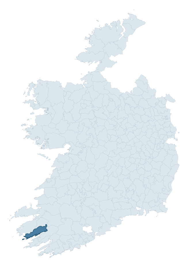
Where this barony sits in the Republic of Ireland
Geology and preservation
Bedrock geology shapes the landscape long before any settlement begins — controlling soil drainage, agricultural potential, the survival of upstanding monuments, and the preservation of buried archaeology. The figures below come from the Geological Survey Ireland 1:100,000 bedrock map.
The bedrock underlying Dunkerron South is predominantly sandstone (45% of the barony by area), laid down during the Devonian period (99% by area, around 419 to 359 million years ago). Sandstone weathers to free-draining, moderately fertile soils that supported Early Medieval ringfort agriculture and later manorial estates. The rock itself is a major source of building stone — visible in churches, tower houses, and farm buildings across the barony's historic landscape. A substantial secondary geology of sandstone, siltstone (28%) and siltstone (25%) adds further variety to the underlying landscape. The single largest mapped unit is the Glenflesk Chloritic Sandstone Formation (28% of the barony's bedrock).
Rock type composition
Largest mapped unit: Glenflesk Chloritic Sandstone Formation (29% of the barony)
Placename evidence
Logainm records 20 heritage-diagnostic placenames for Dunkerron South, drawn from townland and civil-parish names across the barony. The dominant stratum is pre-Christian and Early Medieval defensive — ráth-, lios-, dún-, and caiseal-prefixed names that mark Iron Age and early historic settlement. The leading diagnostic roots are dún- (5 — hilltop fort or promontory fort), cill- (5 — church), and ráth- (2 — earthen ringfort). This is below the ROI average of 30.7 heritage placenames per barony, suggesting either lighter survey coverage or a townland-naming tradition that draws more on generic landscape vocabulary. The presence of multiple heritage strata side by side indicates layered occupation of the landscape across successive prehistoric and historic periods. Logainm records 181 placenames for Dunkerron South (predominantly townland names). Of these, 20 (11%) carry one of the diagnostic Gaelic roots tracked above; the remainder draw on more generic landscape vocabulary that does not encode a heritage period.
Pre-Christian / Early Medieval Defensive
| Root | Count | Meaning |
|---|---|---|
| dún- | 5 | hilltop or promontory fort |
| ráth- | 2 | earthen ringfort |
| caiseal- | 2 | stone ringfort |
| cathair- | 2 | stone fort |
| lios- | 1 | ringfort or enclosure |
Early Christian Ecclesiastical
| Root | Count | Meaning |
|---|---|---|
| cill- | 5 | church (early) |
| cillín- | 1 | unconsecrated burial ground |
Burial, Ritual, and Norse-Contact
| Root | Count | Meaning |
|---|---|---|
| carn- | 1 | cairn |
| uaimh- | 1 | cave / souterrain |
| gall- | 1 | foreigner — Norse settlement marker |
Other baronies in Kerry
- Dunkerron North
- Corkaguiny
- Glanarought
- Iraghticonnor
- Clanmaurice
- Trughanacmy
- Iveragh
- Gaultiere — Waterford
- Connello Upper — Limerick
- Duhallow — Cork
See all 280 baronies in the Republic of Ireland Heritage Tool.

Explore further
Grounding History: 10 Maps of Northern Ireland’s Past
If you’re interested in Irish heritage more widely, the companion report for Northern Ireland brings together the analysis of all 462 NI wards into one place through 10 high-quality maps — covering monument density, archaeological periods, placename heritage, terrain, wetland, and the historic landscape at first survey. Take a look.
About this profile
Click any section below to expand.
What is a barony?
A barony is a historic administrative unit in Ireland, broadly equivalent to an English hundred. The 280 baronies used here are from the OSi 2019 National Statutory Boundaries (generalised 20m), covering the 26 counties of the Republic of Ireland. Baronies derive from the Norman period, were formalised in the 17th century, and have not been redrawn for statistical purposes. They vary enormously in area, from compact urban baronies in Dublin to vast upland baronies in Connacht, and should not be compared by raw site count without accounting for area differences.
What counts as a site?
This profile combines three distinct heritage registers, each with its own definition of what constitutes a recordable site:
- Archaeological sites (NMS). The National Monuments Service Sites and Monuments Record (SMR) catalogues every known archaeological monument or site of archaeological interest in the Republic, from prehistoric burial mounds and ringforts to medieval churches and post-medieval defensive works. Inclusion does not require legal protection — only that the site has been identified, surveyed, and assessed as having archaeological value. A separate subset of these sites lies within a recorded protection zone, which gives them statutory protection under the National Monuments Acts.
- Listed buildings (NIAH). The National Inventory of Architectural Heritage records buildings of architectural, historical, archaeological, artistic, cultural, scientific, social, or technical interest. Each surveyed structure is appraised on a five-tier scale: International, National, Regional, Local, and Record-Only. The NIAH appraisal is informational rather than strictly statutory, but it underpins local-authority Record of Protected Structures (RPS) listings.
- Heritage placenames (Logainm). Logainm is the authoritative database of Irish placenames maintained by the Placenames Branch. This profile applies a heritage-diagnostic classifier to the Irish-language form of each townland name, flagging roots that signal defensive sites (ráth-, lios-, dún-, caiseal-, cathair-), ecclesiastical foundations (cill-, teampall-, domhnach-, mainistir-), prehistoric burial-ritual features (tuaim-, carn-, leaba-), or Norse-contact settlement (gall-). Townlands without one of these diagnostic roots are not flagged here — they may still carry historical significance, but that significance is not encoded in the name itself.
Editorial principles
The narrative sections of this profile follow several explicit principles:
- Evidential. Every claim about this barony’s heritage character is anchored in the underlying register data. Where a site count, a placename count, or a percentile rank is cited, it is computed from the source datasets at export time, not estimated.
- Comparative. Counts and metrics are reported alongside their percentile rank against the other 279 ROI baronies. A barony with 50 ringforts in absolute terms could be unusually high or unusually low depending on its size and regional context; percentile ranking removes that ambiguity.
- Transparent on limits. Where a register has known coverage gaps, survey biases, or data-quality issues that affect this barony’s figures, the profile flags them rather than presenting the numbers as definitive.
- No interpretation beyond what the data supports. The narrative does not speculate about historical events, social dynamics, or cultural meaning beyond what the recorded heritage and placename evidence directly attests.
Data caveats and limits
- NMS Sites and Monuments Record is the product of survey campaigns conducted at different intensities across different counties and decades. Some baronies have been surveyed more thoroughly than others, and absolute counts should be read in that light. Sites destroyed by development before survey are typically not represented; sites in heavily forested or upland terrain are sometimes under-recorded.
- NIAH coverage is broadly complete for the Republic of Ireland but the survey was conducted on a rolling county-by-county basis, and the most recent appraisal date varies. Buildings demolished or substantially altered after their original survey may still appear in the register; conversely, recent buildings of merit may not yet have been appraised.
- Logainm classification applies a deliberately conservative pattern-matching approach to the Irish-language townland forms. The classifier prioritises true positives over recall: a townland may carry a heritage signal that the classifier doesn’t recognise, particularly where the diagnostic root has been heavily anglicised or where the townland name draws on a less common term. The 60,000+ townland records and ~9,800 classified placenames give a substantial signal at barony scale, but individual townland names should be checked against Logainm directly for definitive interpretation.
- Period attribution. The chronological distribution reflects only those NMS sites that carry a recognised period attribution in the source data. Sites listed as “Unknown” period are excluded from the dated subset.
- Boundary changes. Some baronies have undergone minor boundary adjustments since their 19th-century definition; the OSi 2019 generalised boundaries used here are the current statutory definition and may differ slightly from historical maps in border areas.
- Bedrock geology is mapped at 1:100,000 scale, which means local variation within a barony — small pockets of different rock type, mineral veins, alluvium overlying bedrock — is generalised. The dominant-system and rocktype figures are area-weighted, so a barony reading “70% Carboniferous limestone” may still contain small but archaeologically important pockets of older or younger rock. Around 3% of GSI polygons do not match the lexicon and contribute no rocktype or system attribution.
Data sources
- National Monuments Service — Sites and Monuments Record (SMR) https://data.gov.ie/dataset/national-monuments-service-archaeological-survey-of-ireland
- National Inventory of Architectural Heritage (NIAH) https://data.gov.ie/dataset/national-inventory-of-architectural-heritage-niah-national-dataset
- Logainm — Placenames Database of Ireland https://www.logainm.ie/
- Ordnance Survey Ireland — National Statutory Barony Boundaries 2019 https://data-osi.opendata.arcgis.com/
- EURODEM — European Digital Elevation Model https://www.mapsforeurope.org/datasets/euro-dem
- ESA WorldCover https://esa-worldcover.org/en
- Geological Survey Ireland — 1:100,000 Bedrock Geology https://www.gsi.ie/en-ie/data-and-maps/Pages/Bedrock.aspx
Explore more: Search any of the 280 ROI baronies, browse by historical province, or read the methodology and data sources for the full Republic of Ireland Heritage Tool.