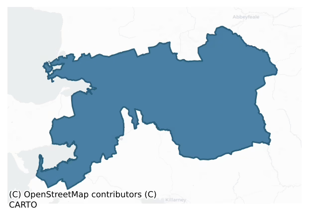
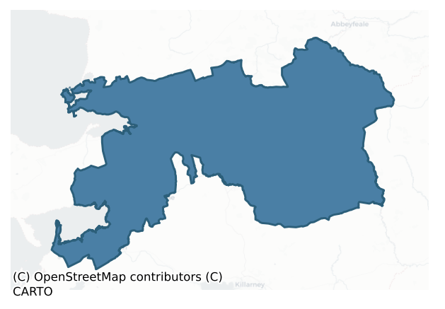
Trughanacmy is a barony of County Kerry, in the historical province of Munster (Irish: Triúcha an Aicme), covering 793 km² of land. The barony records 1,658 NMS archaeological sites and 345 NIAH listed buildings, placing it at around the 59th percentile among 280 ROI baronies for sites per km². This means it is in the upper half of all baronies for sites per km². Dated archaeological evidence runs from the Mesolithic through to the Modern, spanning 9 of 9 archaeological periods, placing the barony in the 99th percentile among 280 ROI baronies for chronological depth. This means it is in the top tenth of all baronies for chronological depth. The largest dated subset of recorded sites dates to the Early Medieval. Logainm flags 90 placenames in the barony as carrying a recognised heritage root; the largest share — around 52% — are names associated with pre-christian defensive.
Heritage at a glance
Percentile rankings throughout this profile compare each barony only against the other 279 Republic of Ireland baronies.
The recorded heritage of Trughanacmy
The National Monuments Service Sites and Monuments Record (SMR) is the statutory inventory of archaeological sites for the Republic of Ireland, maintained by the Department of Tourism, Culture, Arts, Gaeltacht, Sport and Media. Sites recorded here include earthworks, ringforts, megalithic tombs, ecclesiastical remains, and post-medieval features; not every record is legally protected, but each is registered as a monument of archaeological interest.
The National Monuments Service records 1,658 archaeological sites in Trughanacmy, putting it at the 59th percentile among 280 ROI baronies for sites per km². This means it is in the upper half of all baronies for sites per km². Protection coverage is near-universal — 1,616 sites (98%) fall within a recorded monument protection zone, indicating an extensively surveyed landscape. The dominant category is defensive sites — ringforts, enclosures, hillforts, and stone forts (950 sites, 57% of the record). Ringfort – rath is the most prevalent type, making up 26% of the barony's recorded sites (424 records) — well above the ROI average of 20% across all baronies where this type occurs. Ringfort – rath is an earthen ringfort enclosed by a bank and external ditch — the most common Early Medieval farmstead, broadly dated 500–1000 AD. Other significant types include Enclosure (354) and Fulacht fia (121). Enclosure is a banked or ditched feature of uncertain type, used as a catch-all where the original function cannot be determined from surface evidence; Fulacht fia is a horseshoe-shaped Bronze Age burnt mound built around a sunken trough beside a water source, traditionally interpreted as a cooking site. Across the barony's 793 km², this gives a recorded density of 2.09 sites per km².
Most common monument types
Hover or tap a monument type to see its definition.
| Type | Count |
|---|---|
| Ringfort – rath an earthen ringfort enclosed by a bank and external ditch — the most common Early Medieval farmstead, broadly dated 500–1000 AD | 424 |
| Enclosure a banked or ditched feature of uncertain type, used as a catch-all where the original function cannot be determined from surface evidence | 354 |
| Fulacht fia a horseshoe-shaped Bronze Age burnt mound built around a sunken trough beside a water source, traditionally interpreted as a cooking site | 121 |
| Souterrain an underground stone-built passage and chamber, generally Early Medieval and often associated with ringforts as a defensive or storage feature | 116 |
| Hut site a low stone or earthen foundation enclosing a small circular or oval area, generally interpreted as a former dwelling, of any date from prehistory to the medieval period | 61 |
| Burnt mound a heap of fire-cracked stone, ash and charcoal, with no surviving trough, dated Bronze Age to early medieval | 45 |
| Standing stone a deliberately set upright stone, used variously as a Bronze/Iron Age burial marker, route marker or commemorative monument | 41 |
| Church a building used for public Christian worship, of any date from c. 500 AD onwards | 36 |
Chronological distribution
The dated archaeological record for Trughanacmy spans from the Mesolithic through to the Modern, with activity attested across 9 of 9 archaeological periods. This places Trughanacmy in the top 1% of ROI baronies for chronological depth — few baronies record evidence across as many distinct archaeological periods. Every period from earliest to latest is represented in the record — an unbroken sequence of dated activity across the full chronological span. Activity concentrates most heavily in the Early Medieval (581 sites, 42% of dated material), with the Iron Age forming a secondary peak (408 sites, 29%). A further 274 recorded sites (17% of the overall NMS register for the barony) carry no period attribution — appearing as 'Unknown' in the bar chart below. This typically reflects either records that pre-date the standardised period vocabulary or sites awaiting specialist dating review, rather than a genuine absence of chronological evidence.
Sample of recorded monuments
Show 25 sample monuments (of 1,658 total)
A representative sample of 25 recorded monuments drawn from the barony’s 1,658 total NMS entries. Sites within a recorded monument protection zone and rarer site types are prioritised so the list shows a meaningful cross-section rather than only the most common type. Each entry shows the official Sites and Monuments Record reference number and the description published by the National Monuments Service.
Ceremonial enclosure
The Archaeological Survey of Ireland (ASI) is in the process of providing information on all monuments on The Historic Environment Viewer (HEV). Currently the information for this record has not been uploaded. To…
The Archaeological Survey of Ireland (ASI) is in the process of providing information on all monuments on The Historic Environment Viewer (HEV). Currently the information for this record has not been uploaded. To access available information for research purposes please make an appointment in advance with the Archive Unit (open Fridays 10.00 am – 5.00 pm), Department of Culture, Heritage and the Gaeltacht, The Custom House, Dublin 1 D01W6XO or email nmarchive@chg.gov.ie.
Promontory fort – coastal
Promontory fort enclosing Barrow Round Castle (KE028-002001-) described by the SMR in 1989 as follows; 'The head land here has been developed into a golf course, so a great deal of landscaping has been undertaken. A…
Promontory fort enclosing Barrow Round Castle (KE028-002001-) described by the SMR in 1989 as follows; 'The head land here has been developed into a golf course, so a great deal of landscaping has been undertaken. A definite ditch is visible running roughly N-S across the head, running out midway cross where it had been backfilled. This is c. 4' (1.2m) deep, U-shaped and c. 5m wide. It appears to have been rock cut in places. There is a low bank visible on the eastern side of the ditch c. 4m wide and c. 0.4m high' (SMR File). Ditch of promontory fort visible on air corps aerial photograph (V. 163/47) taken 10/05/1949 and on Hunting Surveys aerial photograph (7945/6) taken June 1962. Traces of promontory fort ditch visible c. 60m E of Barrow round castle on modern golf course.
Barrow Round Castle standing inside a possible promontory fort (KE028-028002-) reused as a bawn was described by Roe (1989, 407-17) as follows; 'The castle stands on the rocky south-western extremity of the townland, at the narrow entrance to an inlet of the sea which is bounded on its southern side by Fenit Island, near where part of the main channel is fully thirteen feet deep at low water of spring tides. This was the creek of Fenit, to which reference was frequently made in former centuries.
I am quite sure that this side of the castle was not protected by outer curtain-walling, which was almost certainly employed to cut off the building, and the rocky projection on which it stands, from…
Mill – unclassified
The Archaeological Survey of Ireland (ASI) is in the process of providing information on all monuments on The Historic Environment Viewer (HEV). Currently the information for this record has not been uploaded. To…
The Archaeological Survey of Ireland (ASI) is in the process of providing information on all monuments on The Historic Environment Viewer (HEV). Currently the information for this record has not been uploaded. To access available information for research purposes please make an appointment in advance with the Archive Unit (open Fridays 10.00 am – 5.00 pm), Department of Culture, Heritage and the Gaeltacht, The Custom House, Dublin 1 D01W6XO or email nmarchive@chg.gov.ie.
Settlement deserted – medieval
Possible medieval settlement near the SE corner of Fenit Island associated with an old mill site has not been located. Folklore collected from Chapeltown (Baile na hEaglaise) School recorded the following tradition; '…
Possible medieval settlement near the SE corner of Fenit Island associated with an old mill site has not been located. Folklore collected from Chapeltown (Baile na hEaglaise) School recorded the following tradition; ' In ancient times two large villages were in Fenit Island – one in the west [KE028-096—-] in a place called Cuan [harbour] Garsons [?] and another in the east near where the old mill [KE028-0897001-] is indicated on the map. No trace of these exists today only the ruins which are occasionally turned up by the plough. The Teampaillín [KE028-023001-] would thus be centrally situated between both villages' (The Schools’ Collection, Volume 0438, Page 271; https://www.duchas.ie/en/cbes/4706321/4702383).
A second story collected from Chapeltown School recorded details about the mill and the associated settlement on Fenit Island; 'At the South-east corner of the Island I was told there once was a mill for grinding corn. It is marked on the enclosed sketch-map, no trace of it exists today. I was told by John Slattery in whose land the mill was that the driving power was the sea-water which was trapped at high-water in Spring-tide on this low beach and the mill wheel was turned by the escaping water as the tide went out. There once was a big village at this part of the island as the owner of the land often met with foundations of houses and lots of cockle-shell dumps in this area. About 100yds [91m] from where the village stood is a spring well about 8ft [2.4m…
Kiln – lime
This record was listed as 'Earthwork' in the SMR (1990) and the RMP (1997). Fieldwork, carried out in 1999, established it as the remains of a post-1700 AD limekiln.
Compiled by: Matt Kelleher
Date of upload: 27…
This record was listed as 'Earthwork' in the SMR (1990) and the RMP (1997). Fieldwork, carried out in 1999, established it as the remains of a post-1700 AD limekiln.
Compiled by: Matt Kelleher
Date of upload: 27 January 2012
Historic town
The historic town of Tralee was described in the Urban Survey of Kerry as follows; 'Tralee, the county town of Kerry, is situated on fertile low-lying ground near the southern end of the north Kerry coastal plain. The…
The historic town of Tralee was described in the Urban Survey of Kerry as follows; 'Tralee, the county town of Kerry, is situated on fertile low-lying ground near the southern end of the north Kerry coastal plain. The placename is derived from Trá Lí, "the strand of the Lee". In fact, the town sits not on the Lee but on the Gyle or Big river, which is now largely covered over but which was an important topographical feature in the towns development (Hickson 1894, 257).
In 1121 the annals cord that Toirdhelbhach Ua Conchobhair plundered Des-Mumha "from Magh Feimhin to Traigh-Li, both church and territory(ALC, AU), there is no evidence or any settlement at Tralee before the foundation of the Anglo-Norman borough there in the thirteenth century. Hickson's (1879-89, 578) claim that 'Gwyar's burgage', which is mentioned in a late sixteenth century document, preserves the memory is very unlikely and must be regarded as unproven. Tralee was, apparently an Anglo-Norman foundation on virgin soil. Details of the initial foundation have not survived and it is not known whether it was Meiler FitzHenry, who was granted north Kerry by King John c. 1200 (Orpen 1911-20, iii,123) or John FitzThomas, ancestor of the earls of Desmond, who was the founder of the town. It may be assumed that some form of settlement was in existence by 1234 when "the defeat of Tralee was inflicted by the Galls on the Gaels" in an attack by the Mac Carthaigh and Ui hEidirsgeoil (AI; Ó hInnse 1947, 99; Orp…
Barrow – mound barrow
The Archaeological Survey of Ireland (ASI) is in the process of providing information on all monuments on The Historic Environment Viewer (HEV). Currently the information for this record has not been uploaded. To…
The Archaeological Survey of Ireland (ASI) is in the process of providing information on all monuments on The Historic Environment Viewer (HEV). Currently the information for this record has not been uploaded. To access available information for research purposes please make an appointment in advance with the Archive Unit (open Fridays 10.00 am – 5.00 pm), Department of Culture, Heritage and the Gaeltacht, The Custom House, Dublin 1 D01W6XO or email nmarchive@chg.gov.ie.
Wall monument
A seventeenth-century coat of arms of the Creagh family fixed into the inner face of the north wall of the nave of Ratass Church (KE029-157001-). According to Harbison (1972, 13) 'It was probably during the work of…
A seventeenth-century coat of arms of the Creagh family fixed into the inner face of the north wall of the nave of Ratass Church (KE029-157001-). According to Harbison (1972, 13) 'It was probably during the work of 1908 that the seventeenth-century coat of arms of the Creagh family was fixed into the inner face of the north wall of the nave. It was possibly also at the same time that a stone was reset about 2.5m above ground level near the western end of the north wall of the nave on which there is a mason's mark of uncertain date, though possibly the reconstruction of around 1700'.
See attached photograph courtesy of Laurence Dunne
Compiled by: Matt Kelleher
Revised by: Caimin O'Brien
Date of revised upload: 27 April 2022
Cross-slab
Cross slab discovered in 1975 and described by Fanning and Ó Corráin (1972, 14-16) as follows; 'This stone is also of the local purple-red sandstone but has a sightly more gritty appearance than the ogham pillar and…
Cross slab discovered in 1975 and described by Fanning and Ó Corráin (1972, 14-16) as follows; 'This stone is also of the local purple-red sandstone but has a sightly more gritty appearance than the ogham pillar and measures 80cms in length, 40cms in width and 15cms in thickness. It is decorated on one face only, with a rather poorly-executed ringed-cross from which is appended a double-grooved stem. The arms of the cross are also composed of double grooves which intersect at the centre and extend to meet the ring. One of the two vertical lines of the cross is not in line with the stem. The grooving is similar to that on the cross placed on the ogham stone and is clear and fairly deep averaging 5mms in depth and 7mms in thickness. The stone itself is well dressed, with rounded edges along the sides. Both the upper and lower ends are broken off and so the upper portion of the ringed-cross and the base of the stem are missing, The high, rounded, right-hand corner seems untouched, and this suggests that the top of the stone may have had a semi-circular or gabled shape originally. Both the ogham stone and cross-slab have been re-erected and secured to the internal north wall of the nave of the church. A possible tenth/eleventh century dating, coeval perhaps with the first stone church, might be tentatively assigned to the re-use of the stone as a cross-slab and the smaller cross-slab may also belong to the same period [KE029-157001-].
See attached plan and photograph cou…
House – 17th century
According to a local history book from Ballymacelligott (published c. 1998) by Active retirement group (poss), the present Ballyseedy (Bailte Ó Síoda) House is built on location of an earlier castle (SMR file). However…
According to a local history book from Ballymacelligott (published c. 1998) by Active retirement group (poss), the present Ballyseedy (Bailte Ó Síoda) House is built on location of an earlier castle (SMR file). However the ruins of a building in Ballyseedy Wood is locally believed to represent the remains of Ballyseedy Castle built c. 1627 by Robert Blennerhassett of Ballycarty Castle, possibly on the site of a medieval Geraldine castle. There is no historical evidence to suggest that there was a medieval castle in the townland of Ballyseedy. The lands of Ballyseedy formed part of the estate of the medieval castle of Ballycarty located in the adjoining townland. Col. John Blennerhassett was possibly the last to live at old Ballyseedy Castle (KE029-183—). He was living there as of 1756. Soon after the death of Col. John Blennerhassett in 1775 (or maybe even before) Ballyseedy Castle was abandoned and fell into ruin.The name "Ballyseedy" was adopted c.1821 by the new Ballyseedy House (formerly Elm Grove) a mile to the E.
Sir Edward Denny, Knt, of Tralee on 14th August 1590 granted lands in Co.Kerry, including the adjoining townlands of Ballycarty and Ballyseedy, to Thomas Blennerhassett of Flimby, Cumberland, on rendering “one red rose at the festival [of the martyrdom of] Saint John the Baptist" (29th August) and payment of “six pounds sterling” per year rent. Following this grant, Thomas’ son Robert Blennerhassett settled in Co.Kerry, initially at Ballycarty Castl…
Burial mound
The Archaeological Survey of Ireland (ASI) is in the process of providing information on all monuments on The Historic Environment Viewer (HEV). Currently the information for this record has not been uploaded. To…
The Archaeological Survey of Ireland (ASI) is in the process of providing information on all monuments on The Historic Environment Viewer (HEV). Currently the information for this record has not been uploaded. To access available information for research purposes please make an appointment in advance with the Archive Unit (open Fridays 10.00 am – 5.00 pm), Department of Culture, Heritage and the Gaeltacht, The Custom House, Dublin 1 D01W6XO or email nmarchive@chg.gov.ie.
Standing stone (present location)
Standing stone described in 1987 by the 'Castleisland District Archaeological Survey' as a 'large blocklike sandstone [dims. 2.2m x 0.65m x 0.65m] is [now] lying horizontally forming the upper portion of a field fence.…
Standing stone described in 1987 by the 'Castleisland District Archaeological Survey' as a 'large blocklike sandstone [dims. 2.2m x 0.65m x 0.65m] is [now] lying horizontally forming the upper portion of a field fence. The landowner recalled the standing stone standing upright 20-30 feet [6 – 9m] to the south of its present location' (SMR File).
See original location KE032-019001-
Compiled by: Caimin O'Brien
Date of upload: 27 April 2022
Stone sculpture
Church and graveyard survey commissioned by Kerry Co. Co. which was carried out in 2008 recorded that; 'A decorated sandstone has been incorporated into the fabric of the interior southern elevation, to the immediate…
Church and graveyard survey commissioned by Kerry Co. Co. which was carried out in 2008 recorded that; 'A decorated sandstone has been incorporated into the fabric of the interior southern elevation, to the immediate east of the doorway' (Buckley and Dunne 2008, 10). In 1854 the carved stone was described as lying 'inside against the south wall of the church. It is a block of coarse red sand-stone, the same material of which the church is built, and which the adjacent mountain range furnishes; and measures, in length, eighteen inches [0.45m] at one side, and fifteen inches [0.38m] at the other; and the greatest thickness is about seven inches [0.17m]. The resemblance between this equestrian figure and that on the seal of Strongbow, may be worth mentioning here, although the latter is turned the opposite way' (Hitchcock 1854, 5-6).
Carved figure of an Anglo-Norman knight probably dating from the first half of the 14th century was described by Harbison (1973, 11-12) as follows; 'Built into the interior face of the south wall of the ruined medieval parish church [KE038-003001-] at Annagh, a few miles west of Tralee, is a small carving of a knight on horseback. He is clad in a surcoat loose coat worn over armour which is to be imagined as hiding a suit of armour and a sword scabbard beneath it. He stretches his right arm out behind him and brandishes a short sword with straight cross. What can only be taken to be his left arm (though its connection with the left shoulder…
Hillfort
'The Hillfort at Glanbane is by far the largest enclosure in the area and would when intact have been an impressive site. The site has been ploughed out since the mid 1960's and is now only visible as a crop mark on…
'The Hillfort at Glanbane is by far the largest enclosure in the area and would when intact have been an impressive site. The site has been ploughed out since the mid 1960's and is now only visible as a crop mark on aerial photographs. The site stands on the last high point at the eastern end of the Sliabh Mis, overlooking the approaches from the east into both the valley of the River Lee and that of the River Maine.
Raftery (1994,43) places the fort at Glanbane in his Class 2 hillforts and suggests that it is bivallate and encloses 12 hectares. A sub-circular inner enclosure measuring approximately 114m in diameter, is visible on aerial photography. Outside this a second bank or rampart of the site is clearly visible as a crop mark and enclosing sub-circular, almost thumbnail shaped area, measuring 267m NW-SE and 248m NE-SW.
An outer bank/rampart is only visible on two photographs, one published by Raftery (1994, Pl. 12) and a photograph from 1986. This rampart is visible intermittently around the site and conforms to the modern townland boundary between Glanbane and Garraundarragh to the south. This rampart suggests the site was trivallate, measured approximately 314m by 310m and enclosed an area of approximately 10 hectares.'
Description from ‘The Prehistoric Settlement of the Lee Valley, Tralee, Co. Kerry; A Landscape Perspective’ by Michael Connolly. PhD Thesis UCC 2008
Glanbane hillfort in Co. Kerry, Ireland has been dated to the Late Bronze Age (O’Brien and…
Cliff-edge fort
The Archaeological Survey of Ireland (ASI) is in the process of providing information on all monuments on The Historic Environment Viewer (HEV). Currently the information for this record has not been uploaded. To…
The Archaeological Survey of Ireland (ASI) is in the process of providing information on all monuments on The Historic Environment Viewer (HEV). Currently the information for this record has not been uploaded. To access available information for research purposes please make an appointment in advance with the Archive Unit (open Fridays 10.00 am – 5.00 pm), Department of Culture, Heritage and the Gaeltacht, The Custom House, Dublin 1 D01W6XO or email nmarchive@chg.gov.ie.
Religious house – Augustinian canons
The church of 'the Abbey of Our Lady of the Beautiful Place' is situated in The Demesne of Kilcoman Abbey/Killaha Abbey ‘properly The Priory De Bello Loco’ (Harbison 1981:99). This was built by the Anglo-Norman…
The church of 'the Abbey of Our Lady of the Beautiful Place' is situated in The Demesne of Kilcoman Abbey/Killaha Abbey ‘properly The Priory De Bello Loco’ (Harbison 1981:99). This was built by the Anglo-Norman Justiciar , Geoffrey de Marisco in 1215, for The Canons Regular of St. Augustine. It stands on the site of the pre-norman church of St. Coleman. It was restored and extended in 1445 when the finely tracered east window was inserted. The Abbey survived until 1576 when The Priory was suppressed and its possessions passed through various hands. In 1588 the Crown granted Thomas Springe 'the site of the abbey of Killaha, alias our Lady Abbey de Bello Loco, co. Kerry, land in Callynyffrry, Killderrey, Ballioughtraghe, Clownemore, Brackill, Kiltnlaghe, Killynyfynxn, Ballynymonye, Kilremyn, Inche, and a piece of land in the Dingill, the rectory of Killaha, a moiety of the rectories of Kiltalaghe and Garrinlondrye, the rectories of Dingill, Killoriglyne, Kilmacollock Ocester, a moiety of the rectories of Keannarey, Templenooe alias Newechurche, Kilcrokane, Dromede, Kilmonane, Kilmore, Cahirbegg, Rincaharraghe, Glanbehie, and Kilvonane, co. Kerry. To hold for 21 years from the determination of the previous lease Rent, £17 1s. 9d. 9d. Maintaining 2 English horsemen. The abbey to be strongly rebuilt castlewise' (Nicholls 1994, 53). The domestic buildings which enclosed the Cloister garth south of the church were destroyed in 1649 (Harbison 1981:99, O.P.W. Fógra in situ).
We…
Cross
In 1940 the minute book of the County Kerry Field Club recorded during their visit to St. Colman's Abbey that 'the party also found a few stones of cloister arches as well as a tenth century stone cross' (SMR File). …
In 1940 the minute book of the County Kerry Field Club recorded during their visit to St. Colman's Abbey that 'the party also found a few stones of cloister arches as well as a tenth century stone cross' (SMR File). The location of this cross within the graveyard has not been identified.
Compiled by: Caimin O'Brien
Date of upload: 23 May 2022
Inscribed stone
In 1939 Captain Donal B. O'Connell recorded the following details; 'In the same wood [Killaclohane Wood] is a large table-like rock known as a Mass Rock [KE047-061—-] and Rounds have evidently been "paid" there quite…
In 1939 Captain Donal B. O'Connell recorded the following details; 'In the same wood [Killaclohane Wood] is a large table-like rock known as a Mass Rock [KE047-061—-] and Rounds have evidently been "paid" there quite recently. The rock is bespattered with initials but I think I can trace pattern of sorts underneath' (SMR File). No inscribed stone could be found in the location marked on the OS 6-inch map. However the reference from Captain O'Connell seems to describe the mass rock (KE047-061—) as the inscribed stone.
Compiled by: Caimin O'Brien
Date of upload: 24 May 2022
Mass-rock
Folklore collected from Castlemaine School about the the mass rock in Killaclohane known locally as Carrig an Aifrinn (Mass Rock) or Poll an Aifrinn (Mass Pit) recorded the following tradition; 'Carrig an Aifrinn or…
Folklore collected from Castlemaine School about the the mass rock in Killaclohane known locally as Carrig an Aifrinn (Mass Rock) or Poll an Aifrinn (Mass Pit) recorded the following tradition; 'Carrig an Aifrinn or (Stony Church) is situated south of Castlemaine and east of Milltown. Many tales, some tragic are told concerning this ancient Mass rock. Records tell us that on the 7th June 1651 two priests, one Father Cornelius Mc Carthy and the other Fr. Thaddeus Moriarty were captured while holding there a general station. Both were taken under escort to Fair Hill, now known as Martyrs Hill and were executed there. Those were the only arrests, as the people and the other priests escaped safely. This place is also known as Poll an Aifrinn, because of the many holes which are shaped like birds' nests surrounding it. Those hollows were capable of holding hundreds of people secretly from view even from a person standing ten yards away. The Mass rock is a beautiful rock shape of a heart and stands on the brink of two holes. It affords a nice hiding place as it is surrounded by a large wood, which at that time was densely planted with larch and oak. In the vicinity is also seen mounds and curious stones which are believed to be grave marks of early days. A few Cromlechs are to be seen also there. Mass was celebrated there as late as 64 years ago by the late Rev. Batt OConor P. P. Milltown when a convert was received into the church. She was an Indian Princess who came on a holid…
Standing stone – pair
Stone pair described by O'Hare (1996, 11) as follows; 'This pair of standing stones, both of which are aligned east west, stand close together on a break in a south facing slope, in an area of wet marshy upland. The…
Stone pair described by O'Hare (1996, 11) as follows; 'This pair of standing stones, both of which are aligned east west, stand close together on a break in a south facing slope, in an area of wet marshy upland. The site commands a fine view over the lowlying land to the southeast, south and southwest and also over the slope of Slievebrickan, which rises to the west and upon which site is situated. Stone 1, standing to the west, measures 65cm in height, 75cm in breadth and 35cm in width. This flat topped stone is roughly rectangular in section and is separated by a distance of 95cm from Stone 2 which is more pointed in profile and measures 70cm in height, 80cm in breadth and 25cm in width. Stone 2 stands slightly to the south of stone 1. Both stones are
aligned east west'.
Compiled by: Caimin O'Brien
Date of upload: 21 April 2022
Well
The Archaeological Survey of Ireland (ASI) is in the process of providing information on all monuments on The Historic Environment Viewer (HEV). Currently the information for this record has not been uploaded. To…
The Archaeological Survey of Ireland (ASI) is in the process of providing information on all monuments on The Historic Environment Viewer (HEV). Currently the information for this record has not been uploaded. To access available information for research purposes please make an appointment in advance with the Archive Unit (open Fridays 10.00 am – 5.00 pm), Department of Culture, Heritage and the Gaeltacht, The Custom House, Dublin 1 D01W6XO or email nmarchive@chg.gov.ie.
Exhibitionist figure
Located above S window of medieval church (KE049-086001-). Described by Freitag as a sheela-na-gig with 'big triangular head with rope-like hair and prominent jug ears; bulbous eyes, wedge nose and small open mouth. …
Located above S window of medieval church (KE049-086001-). Described by Freitag as a sheela-na-gig with 'big triangular head with rope-like hair and prominent jug ears; bulbous eyes, wedge nose and small open mouth. Body divides below neck; no arms; very broad genital area which shows signs of rubbing; legs spread horizontally, stretching out over spandrels of window; feet turned outwards; left leg slightly raised' (Freitag 2004, 135).
In 1942 the following details about this exhibitionist figure was recorded; 'In Kilsarcon graveyard the gable end of an early Church still stands. Over the window a chiselled-out image can be clearly seen in a limestone square. Local folklore tales state that the image is that of St. Arcon, patron of the parish to whom rounds are paid every May. The public can enter at any time through a swing gate. An old custom still surviving is the practice of paying "Rounds" in Kilsarkan graveyard. In a cavity in the wall of the old Church a number of holy pictures have been placed. persons come during the month of May (Friday, Saturday and Sunday) and walk around the graveyard three times. Each time a Rosary is to be recited. On the completion of the third Rosary, the pilgrim goes to the remaining window to touch the engraved image of St. Arcon. The pilgrim then goes to the holy pictures to say any prayer in conclusion. Before departing something is left at the foot of the old wall preferably a holy book (Messenger, etc.). many of these are…
Megalithic tomb – wedge tomb
See linked document with details from Ruaidhrí de Valera and Seán Ó Nualláin, Survey of the Megalithic Tombs of Ireland. Volume IV. Counties Cork, Kerry, Limerick, Tipperary. (Dublin: Stationery Office, 1982)
Date of…
See linked document with details from Ruaidhrí de Valera and Seán Ó Nualláin, Survey of the Megalithic Tombs of Ireland. Volume IV. Counties Cork, Kerry, Limerick, Tipperary. (Dublin: Stationery Office, 1982)
Date of upload: 7 January 2012
Pier/Jetty
This record was formerly classed as fortifications in the RMP. Following a site inspection, its class has been changed to possible jetty. See description below
According to John Sheehan (20/3/2008), Dr. R. Devoy,…
This record was formerly classed as fortifications in the RMP. Following a site inspection, its class has been changed to possible jetty. See description below
According to John Sheehan (20/3/2008), Dr. R. Devoy, U.C.C., mentions this area in his chapter in the Iveragh Atlas book (forthcoming). Devoy says that an attempt was made in the 18th to reclaim much of this area. So John Sheehan thinks it is possible that the walls etc. in this area were part of that reclamation. John says that it was the townland name suggested a longphort. If the remains at Lonart are associated with C18th activity, it is best that this is considered a post 1700 monument, pending more definite evidence. (Sheila Ronan 20/3/2008)
According to Devoy, 'Political and social upheavals apart, this sea dependent rural life has continued for millennia in coastal Iveragh much the same, in essence, to the present. But, with the eighteenth century, and thereafter, began a change in the scale of human impacts. Many coastal areas around Ireland at this time came under the influence of formal land reclamation schemes and building projects, following an earlier medieval pattern of more localised reclamation, as in the Shannon estuary. On Iveragh, some of the inner areas of bays and estuaries were embanked and the contained marsh and saltings drained and used for agriculture, with variable success. The marshes of Castlemaine Harbour provide a good example of this process. Low earth and stone embankments wer…
Ringfort – rath
The location of this monument was incorrectly marked on the RMP for Co. Kerry (issued 1998). The correct location was identified by Laurence Dunne (pers. comm. 16 February 2015). The monument is situated in pasture that…
The location of this monument was incorrectly marked on the RMP for Co. Kerry (issued 1998). The correct location was identified by Laurence Dunne (pers. comm. 16 February 2015). The monument is situated in pasture that slopes gently to the E. It consists of the much degraded remains of a ringfort (external dims. 43m E-W by 41m N-S; internal dims. 26m E-W by 21m N-S) which are visible as a grass-covered earthen and stone bank reaching a max. height of 0.5m at the E or downslope side. There is no evidence of an external fosse. A number of bumps, hollows and other undulations most likely reflect the incomplete clearance of the monument sometime shortly before 1945 when an account of a visit was included in the minute book of the County Kerry Field Club for that year (Vol. 1, 31st March 1945, pp. 580-2). The report makes reference to four chambers which could be interpreted as either hut-sites or a souterrain or both (KE039-126001-). Given that the limestone bedrock is close to the surface the possibility that the monument might have been a cashel cannot be discounted. (Dunne 2015)
The attached image (KE039-126—-_01.jpg), a view of the remains from the west, was taken on 6 February 2015, and is uploaded courtesy of Laurence Dunne.
Compiled by: Paul Walsh based on details kindly provided by Laurence Dunne (16 February 2015)
Date of upload: 17 February 2015
Listed buildings
The National Inventory of Architectural Heritage (NIAH) is a state survey appraising buildings of architectural, historical, archaeological, artistic, cultural, scientific, social, or technical interest. Each surveyed structure receives a rating from International (the highest, for buildings of European importance) through National, Regional, Local, and Record-Only.
The National Inventory of Architectural Heritage records 345 listed buildings in Trughanacmy, placing it in the top 10% of ROI baronies for listed-building density. Among these, 11 are graded National — buildings of interest to the whole of Ireland rather than only its region. The Republic holds 937 National-graded buildings in total, so this barony accounts for around 1% of the national total. Construction dates concentrate most heavily in the Victorian (1830-1900) period. The most-recorded building type is house (220 examples, 64% of the listed stock).
Terrain and environment
Mean elevation across the barony is 138m — the 82nd percentile among 280 ROI baronies for elevation. This means it is in the top fifth of all baronies for elevation. This is a relatively elevated landscape by ROI standards. Elevation matters for heritage because higher-altitude baronies typically favour defensive monuments — ringforts and hilltop forts placed on prominent ground — while lowland baronies are more likely to carry the dense settlement and church networks of intensive agricultural landscapes. The barony reaches 848m at its highest point — a vertical span of more than 710m within its boundary, indicating significant topographic diversity. Mean slope is 5.0° — the 75th percentile among 280 ROI baronies for slope. This means it is in the top third of all baronies for slope. Slope is a key control on both land use and archaeological preservation: steep ground resists ploughing and tends to preserve earthworks intact, while gentle slopes favour intensive cultivation that damages or destroys surface archaeology over time. The Topographic Wetness Index averages 10.2, the 28th percentile among 280 ROI baronies for wetness. This means it is in the bottom third of all baronies for wetness. Drainage matters for heritage because poorly-drained ground preserves organic archaeology (wooden trackways, leather, textiles, and on rare occasions human remains) far better than free-draining soil; well-drained ground favours arable use but destroys organic material rapidly. The land cover is dominated by improved grassland (75%) and woodland (22%). In overall character, this is elevated but relatively gentle terrain — typical of plateau country, with land use dominated by improved grassland.
Terrain measurements
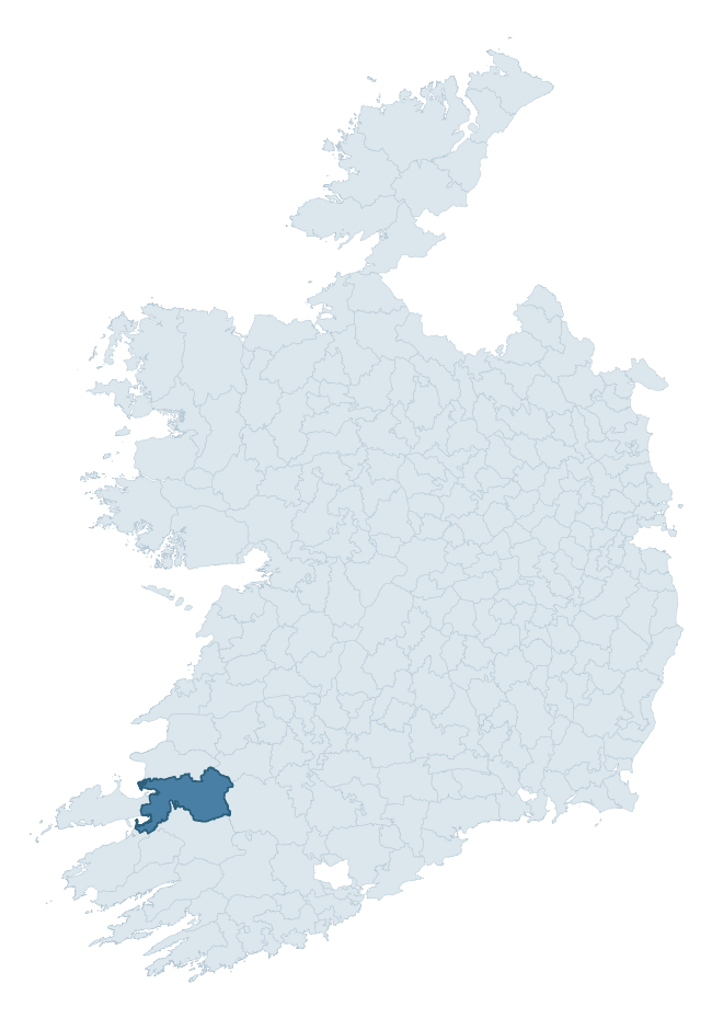
Where this barony sits in the Republic of Ireland
Geology and preservation
Bedrock geology shapes the landscape long before any settlement begins — controlling soil drainage, agricultural potential, the survival of upstanding monuments, and the preservation of buried archaeology. The figures below come from the Geological Survey Ireland 1:100,000 bedrock map.
The bedrock underlying Trughanacmy is predominantly sandstone (29% of the barony by area), laid down during the Carboniferous period (88% by area, around 359 to 299 million years ago). Sandstone weathers to free-draining, moderately fertile soils that supported Early Medieval ringfort agriculture and later manorial estates. The rock itself is a major source of building stone — visible in churches, tower houses, and farm buildings across the barony's historic landscape. A substantial secondary geology of limestone (26%) and sandstone, siltstone, shale (16%) adds further variety to the underlying landscape. With 10 distinct rock types mapped, the barony sits in the top third of ROI baronies for geological diversity (91st percentile) — typically a sign of complex tectonic history or coastal mosaics of differing rock units.
Rock type composition
Largest mapped unit: Namurian (undifferentiated) (19% of the barony)
Placename evidence
Logainm records 90 heritage-diagnostic placenames for Trughanacmy, drawn from townland and civil-parish names across the barony. The dominant stratum is pre-Christian and Early Medieval defensive — ráth-, lios-, dún-, and caiseal-prefixed names that mark Iron Age and early historic settlement. The leading diagnostic roots are cill- (31 — church), lios- (15 — ringfort or enclosure), and cathair- (11 — stone fort). This is well above the ROI average of 30.7 heritage placenames per barony — around 2.9× the typical figure. The presence of multiple heritage strata side by side indicates layered occupation of the landscape across successive prehistoric and historic periods. Logainm records 504 placenames for Trughanacmy (predominantly townland names). Of these, 90 (18%) carry one of the diagnostic Gaelic roots tracked above; the remainder draw on more generic landscape vocabulary that does not encode a heritage period.
Pre-Christian / Early Medieval Defensive
| Root | Count | Meaning |
|---|---|---|
| lios- | 15 | ringfort or enclosure |
| cathair- | 11 | stone fort |
| ráth- | 10 | earthen ringfort |
| dún- | 6 | hilltop or promontory fort |
| caiseal- | 5 | stone ringfort |
Early Christian Ecclesiastical
| Root | Count | Meaning |
|---|---|---|
| cill- | 31 | church (early) |
| cillín- | 4 | unconsecrated burial ground |
| tobar- | 2 | holy well |
| domhnach- | 1 | pre-Patrician or earliest Patrician church |
| díseart- | 1 | hermitage |
Burial, Ritual, and Norse-Contact
| Root | Count | Meaning |
|---|---|---|
| leacht- | 2 | grave monument |
| uaimh- | 2 | cave / souterrain |
| gall- | 1 | foreigner — Norse settlement marker |
Other baronies in Kerry
- Dunkerron South
- Iveragh
- Magunihy
- Glanarought
- Clanmaurice
- Corkaguiny
- Iraghticonnor
- Corkaguiny
- Glenahiry — Waterford
- North Liberties — Limerick
See all 280 baronies in the Republic of Ireland Heritage Tool.

Explore further
Grounding History: 10 Maps of Northern Ireland’s Past
If you’re interested in Irish heritage more widely, the companion report for Northern Ireland brings together the analysis of all 462 NI wards into one place through 10 high-quality maps — covering monument density, archaeological periods, placename heritage, terrain, wetland, and the historic landscape at first survey. Take a look.
About this profile
Click any section below to expand.
What is a barony?
A barony is a historic administrative unit in Ireland, broadly equivalent to an English hundred. The 280 baronies used here are from the OSi 2019 National Statutory Boundaries (generalised 20m), covering the 26 counties of the Republic of Ireland. Baronies derive from the Norman period, were formalised in the 17th century, and have not been redrawn for statistical purposes. They vary enormously in area, from compact urban baronies in Dublin to vast upland baronies in Connacht, and should not be compared by raw site count without accounting for area differences.
What counts as a site?
This profile combines three distinct heritage registers, each with its own definition of what constitutes a recordable site:
- Archaeological sites (NMS). The National Monuments Service Sites and Monuments Record (SMR) catalogues every known archaeological monument or site of archaeological interest in the Republic, from prehistoric burial mounds and ringforts to medieval churches and post-medieval defensive works. Inclusion does not require legal protection — only that the site has been identified, surveyed, and assessed as having archaeological value. A separate subset of these sites lies within a recorded protection zone, which gives them statutory protection under the National Monuments Acts.
- Listed buildings (NIAH). The National Inventory of Architectural Heritage records buildings of architectural, historical, archaeological, artistic, cultural, scientific, social, or technical interest. Each surveyed structure is appraised on a five-tier scale: International, National, Regional, Local, and Record-Only. The NIAH appraisal is informational rather than strictly statutory, but it underpins local-authority Record of Protected Structures (RPS) listings.
- Heritage placenames (Logainm). Logainm is the authoritative database of Irish placenames maintained by the Placenames Branch. This profile applies a heritage-diagnostic classifier to the Irish-language form of each townland name, flagging roots that signal defensive sites (ráth-, lios-, dún-, caiseal-, cathair-), ecclesiastical foundations (cill-, teampall-, domhnach-, mainistir-), prehistoric burial-ritual features (tuaim-, carn-, leaba-), or Norse-contact settlement (gall-). Townlands without one of these diagnostic roots are not flagged here — they may still carry historical significance, but that significance is not encoded in the name itself.
Editorial principles
The narrative sections of this profile follow several explicit principles:
- Evidential. Every claim about this barony’s heritage character is anchored in the underlying register data. Where a site count, a placename count, or a percentile rank is cited, it is computed from the source datasets at export time, not estimated.
- Comparative. Counts and metrics are reported alongside their percentile rank against the other 279 ROI baronies. A barony with 50 ringforts in absolute terms could be unusually high or unusually low depending on its size and regional context; percentile ranking removes that ambiguity.
- Transparent on limits. Where a register has known coverage gaps, survey biases, or data-quality issues that affect this barony’s figures, the profile flags them rather than presenting the numbers as definitive.
- No interpretation beyond what the data supports. The narrative does not speculate about historical events, social dynamics, or cultural meaning beyond what the recorded heritage and placename evidence directly attests.
Data caveats and limits
- NMS Sites and Monuments Record is the product of survey campaigns conducted at different intensities across different counties and decades. Some baronies have been surveyed more thoroughly than others, and absolute counts should be read in that light. Sites destroyed by development before survey are typically not represented; sites in heavily forested or upland terrain are sometimes under-recorded.
- NIAH coverage is broadly complete for the Republic of Ireland but the survey was conducted on a rolling county-by-county basis, and the most recent appraisal date varies. Buildings demolished or substantially altered after their original survey may still appear in the register; conversely, recent buildings of merit may not yet have been appraised.
- Logainm classification applies a deliberately conservative pattern-matching approach to the Irish-language townland forms. The classifier prioritises true positives over recall: a townland may carry a heritage signal that the classifier doesn’t recognise, particularly where the diagnostic root has been heavily anglicised or where the townland name draws on a less common term. The 60,000+ townland records and ~9,800 classified placenames give a substantial signal at barony scale, but individual townland names should be checked against Logainm directly for definitive interpretation.
- Period attribution. The chronological distribution reflects only those NMS sites that carry a recognised period attribution in the source data. Sites listed as “Unknown” period are excluded from the dated subset.
- Boundary changes. Some baronies have undergone minor boundary adjustments since their 19th-century definition; the OSi 2019 generalised boundaries used here are the current statutory definition and may differ slightly from historical maps in border areas.
- Bedrock geology is mapped at 1:100,000 scale, which means local variation within a barony — small pockets of different rock type, mineral veins, alluvium overlying bedrock — is generalised. The dominant-system and rocktype figures are area-weighted, so a barony reading “70% Carboniferous limestone” may still contain small but archaeologically important pockets of older or younger rock. Around 3% of GSI polygons do not match the lexicon and contribute no rocktype or system attribution.
Data sources
- National Monuments Service — Sites and Monuments Record (SMR) https://data.gov.ie/dataset/national-monuments-service-archaeological-survey-of-ireland
- National Inventory of Architectural Heritage (NIAH) https://data.gov.ie/dataset/national-inventory-of-architectural-heritage-niah-national-dataset
- Logainm — Placenames Database of Ireland https://www.logainm.ie/
- Ordnance Survey Ireland — National Statutory Barony Boundaries 2019 https://data-osi.opendata.arcgis.com/
- EURODEM — European Digital Elevation Model https://www.mapsforeurope.org/datasets/euro-dem
- ESA WorldCover https://esa-worldcover.org/en
- Geological Survey Ireland — 1:100,000 Bedrock Geology https://www.gsi.ie/en-ie/data-and-maps/Pages/Bedrock.aspx
Explore more: Search any of the 280 ROI baronies, browse by historical province, or read the methodology and data sources for the full Republic of Ireland Heritage Tool.