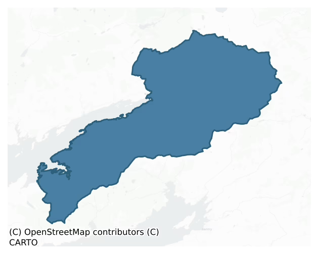
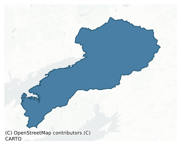
Glanarought is a barony of County Kerry, in the historical province of Munster (Irish: Gleann na Ruachtaí), covering 495 km² of land. The barony records 1,714 NMS archaeological sites and 43 NIAH listed buildings, placing it at around the 89th percentile among 280 ROI baronies for sites per km². This means it is in the top fifth of all baronies for sites per km². Dated archaeological evidence runs from the Neolithic through to the Modern, spanning 8 of 9 archaeological periods, placing the barony in the 79th percentile among 280 ROI baronies for chronological depth. This means it is in the top third of all baronies for chronological depth. The largest dated subset of recorded sites dates to the Iron Age. Logainm flags 34 placenames in the barony as carrying a recognised heritage root; the largest share — around 59% — are names associated with early Christian church and monastic foundations.
Heritage at a glance
Percentile rankings throughout this profile compare each barony only against the other 279 Republic of Ireland baronies.
The recorded heritage of Glanarought
The National Monuments Service Sites and Monuments Record (SMR) is the statutory inventory of archaeological sites for the Republic of Ireland, maintained by the Department of Tourism, Culture, Arts, Gaeltacht, Sport and Media. Sites recorded here include earthworks, ringforts, megalithic tombs, ecclesiastical remains, and post-medieval features; not every record is legally protected, but each is registered as a monument of archaeological interest.
The National Monuments Service records 1,714 archaeological sites in Glanarought, putting it at the 89th percentile among 280 ROI baronies for sites per km². This means it is in the top fifth of all baronies for sites per km². Of these, 1,514 (88%) fall within a recorded monument protection zone. The record is dominated by domestic structures — house sites and settlement remains (552 sites, 32% of the total), with defensive sites forming a substantial secondary presence (395 sites, 23%). Hut site is the most prevalent type, making up 32% of the barony's recorded sites (549 records) — well above the ROI average of 5% across all baronies where this type occurs. Hut site is a low stone or earthen foundation enclosing a small circular or oval area, generally interpreted as a former dwelling, of any date from prehistory to the medieval period. Other significant types include Enclosure (262) and Field boundary (174). Enclosure is a banked or ditched feature of uncertain type, used as a catch-all where the original function cannot be determined from surface evidence; Field boundary is a continuous bank, wall or drain marking the limit of a field, of any date from the Neolithic onwards. Across the barony's 495 km², this gives a recorded density of 3.47 sites per km².
Most common monument types
Hover or tap a monument type to see its definition.
| Type | Count |
|---|---|
| Hut site a low stone or earthen foundation enclosing a small circular or oval area, generally interpreted as a former dwelling, of any date from prehistory to the medieval period | 549 |
| Enclosure a banked or ditched feature of uncertain type, used as a catch-all where the original function cannot be determined from surface evidence | 262 |
| Field boundary a continuous bank, wall or drain marking the limit of a field, of any date from the Neolithic onwards | 174 |
| Fulacht fia a horseshoe-shaped Bronze Age burnt mound built around a sunken trough beside a water source, traditionally interpreted as a cooking site | 107 |
| Ringfort – rath an earthen ringfort enclosed by a bank and external ditch — the most common Early Medieval farmstead, broadly dated 500–1000 AD | 72 |
| Cairn – unclassified a stone mound that cannot be assigned to a specific cairn type | 68 |
| Standing stone a deliberately set upright stone, used variously as a Bronze/Iron Age burial marker, route marker or commemorative monument | 60 |
| Bridge a built structure spanning a river or ravine to allow crossing, dated medieval onwards | 46 |
Chronological distribution
The dated archaeological record for Glanarought spans from the Neolithic through to the Modern, with activity attested across 8 of 9 archaeological periods. This is the 79th percentile across ROI baronies for chronological depth — an above-average span. Every period from earliest to latest is represented in the record — an unbroken sequence of dated activity across the full chronological span. Activity concentrates most heavily in the Iron Age (344 sites, 37% of dated material), with the Middle Late Bronze Age forming a secondary peak (204 sites, 22%). A further 793 recorded sites (46% of the overall NMS register for the barony) carry no period attribution — appearing as 'Unknown' in the bar chart below. This typically reflects either records that pre-date the standardised period vocabulary or sites awaiting specialist dating review, rather than a genuine absence of chronological evidence.
Sample of recorded monuments
Show 25 sample monuments (of 1,714 total)
A representative sample of 25 recorded monuments drawn from the barony’s 1,714 total NMS entries. Sites within a recorded monument protection zone and rarer site types are prioritised so the list shows a meaningful cross-section rather than only the most common type. Each entry shows the official Sites and Monuments Record reference number and the description published by the National Monuments Service.
Chapel
Lewis (1837, vol. 2, 38) noted that the ruins of 'a small chapel supposed to have been built by Sir Wm. Petty on the establishment of the English colony' were visible in the graveyard (KE093-035002-). This was in…
Lewis (1837, vol. 2, 38) noted that the ruins of 'a small chapel supposed to have been built by Sir Wm. Petty on the establishment of the English colony' were visible in the graveyard (KE093-035002-). This was in addition to the ruins of the old church (KE093-035001-) in the graveyard. There are no visible remains of the chapel. In 1942 the ITA survey suggested that the 'The difference in style and age as between the choir (20' 6" long by 13' 3" broad) and the nave (40' long by 24' broad); is probably due, to the fact that the structure was originally Catholic, but confiscated and made a Protestant church during the Penal Days' (ITA Survey)
Compiled by: Elizabeth Byrne, Ursula Egan and Sheila Ronan, Archaeological Survey Unit, University College, Cork.
Revised by: Caimin O'Brien
Date of revised upload: 26 September 2022
Fortification
In a public park on a peninsula projecting from the N side of Kenmare Bay with extensive views in all directions. Not visible at ground level. Lewis (1849, 6) states: "Near the ferry, or Sound, are the remains of a…
In a public park on a peninsula projecting from the N side of Kenmare Bay with extensive views in all directions. Not visible at ground level. Lewis (1849, 6) states: "Near the ferry, or Sound, are the remains of a tower, called Cromwell's Fort". Also named 'Site of Cromwell's Fort' on 1841 OS 6-inch map. See KE093-036002-.
Compiled by: Elizabeth Byrne, Ursula Egan and Sheila Ronan, Archaeological Survey Unit, University College, Cork.
Date of upload: 30 May 2011
Bastioned fort
In a public park at the head of Kenmare Bay and on a narrow promontory projecting S into the bay. The town of Kenmare lies immediately to the N. This fort is named 'Neeleene [Nedeen] forte' on the Down Survey barony map…
In a public park at the head of Kenmare Bay and on a narrow promontory projecting S into the bay. The town of Kenmare lies immediately to the N. This fort is named 'Neeleene [Nedeen] forte' on the Down Survey barony map (1655-6) of Glanarought (Hib. Reg.). It is indicated as the site of Cromwell's Fort on the 1841 and 1892 OS 6-inch maps on the W side of the road which runs the length of the promontory. There are no visible remains of the fort on the W side of the road but in a field on the E side of the road there are traces of a fosse and a level platform which may have formed part of a bastioned fort. According to Kerrigan (1995, 99), 'the fort was an earthwork and was only used for a short time' and 'a description of about 1685 notes it as ruined, having been built in Cromwellian times'. There are no visible remains of the 'tower' [KE093-036001-] called 'Cromwell's Fort' which was mentioned by Lewis (1837, vol. 2, 38) as being 'near the ferry, or Sound'.
In 1841 the Ordnance Survey recorded the following details about this fort; 'Close to this little town of Kenmare which is popularly called Nedeen is shown the site of a fort which was erected by Cromwell for subduing the O'Sullivans. This fort is mentioned in a manuscript Account of Kerry written about a century and a half since and now preserved in the manuscript library of Trinity College Dublin. I.L.3 p. 11. This barony, as also the forementioned barony of Magunihi, was formerly very woody, affording most stately…
Almshouse
In rough pasture, on a S-facing slope overlooking the valley of the Sheen River. This system of relict field walls extends over an area c. 180m E-W x c. 50m N-S and consists of small fields enclosed by collapsed…
In rough pasture, on a S-facing slope overlooking the valley of the Sheen River. This system of relict field walls extends over an area c. 180m E-W x c. 50m N-S and consists of small fields enclosed by collapsed drystone walls, which are partly obscured by shallow peat. Some stones may have been removed from the walls to build recent field boundaries to the S. A fulacht fia (KE093-052001-) and a hut site (KE093-052002-) are in the immediate vicinity.
The above description is derived from the published 'Archaeological Inventory of County Kerry. Volume I: South-West Kerry' (Dublin: Stationery Office, 2009). In certain instances the entries have been revised and updated in the light of recent research.
Date of upload: 30 May 2011
Mine
In level pasture in the Roughty River valley, 7km NE of Kenmare town. There are historical sources for silver-lead mining in this area in the 17th century (Cowman 1990, 197). Historical records also confirm 18th-century…
In level pasture in the Roughty River valley, 7km NE of Kenmare town. There are historical sources for silver-lead mining in this area in the 17th century (Cowman 1990, 197). Historical records also confirm 18th-century lead mining and 19th-century copper mining here (Cowman 1990, 198-206). The possibility of early copper mining is also suggested by an 18th-century reference to a large 'Danish Mine' (Lansdowne 1937, 12). The only surviving structures date to the 19th century.
The above description is derived from the published 'Archaeological Inventory of County Kerry. Volume I: South-West Kerry' (Dublin: Stationery Office, 2009). In certain instances the entries have been revised and updated in the light of recent research.
Date of upload: 30 May 2011
Ecclesiastical site
In pasture within Ardtully Demesne and c. 60m SW of Fussa Bridge. Listed by Gwynn and Hadcock (1970, 398) as an early monastic site, which probably ceased to exist before the 11th century. The only possible evident…
In pasture within Ardtully Demesne and c. 60m SW of Fussa Bridge. Listed by Gwynn and Hadcock (1970, 398) as an early monastic site, which probably ceased to exist before the 11th century. The only possible evident trace of the monastic site is a curving depression (Wth at top 5.2m, Wth at base 1.2m; D 0.3m) N-ESE, possibly the remains of a fosse. This feature is situated c. 75m NE of the NE corner of Ardtully House. According to Smith (1756, 46), stones from this site were used in the building of Ardtully Castle (KE094-002002-).
The above description is derived from the published 'Archaeological Inventory of County Kerry. Volume I: South-West Kerry' (Dublin: Stationery Office, 2009). In certain instances the entries have been revised and updated in the light of recent research.
Date of upload: 30 May 2011
Bullaun stone (present location)
In Kilgarvan, at the N gable of a house, on the S side of the street opposite Kilgarvan graveyard (KE094-004003-). An irregular boulder (1.4m x 0.85m; H 1m) with two bowl-shaped hollows on its upper surface. The W…
In Kilgarvan, at the N gable of a house, on the S side of the street opposite Kilgarvan graveyard (KE094-004003-). An irregular boulder (1.4m x 0.85m; H 1m) with two bowl-shaped hollows on its upper surface. The W hollow (diam. 0.25m; D 0.14m) is 0.2m from the E hollow (diam. 0.23m; D 0.14m). According to popular legend, the hollows in the bullaun stone were formed by St Garvan and other saints as they knelt to pray and stagnant water in the hollows is said to cure warts (Twomey 1997, 28). This bullaun stone was formerly in the corner of a garden wall, on the S side of the street in Kilgarvan but was moved to its present location due to road widening. Its original location is not known.
The above description is derived from the published 'Archaeological Inventory of County Kerry. Volume I: South-West Kerry' (Dublin: Stationery Office, 2009). In certain instances the entries have been revised and updated in the light of recent research.
Date of upload: 30 May 2011
Kiln – corn-drying
In rough pasture, near the NW bank of the Sheen River. A circular bowl-shaped pit (1m NW-SE; 1m NE-SW; D 0.67m) is faced with small upright slabs. A rectangular lintelled funnel (L 0.42m; H 0.41m; Wth 0.26m), at the SE…
In rough pasture, near the NW bank of the Sheen River. A circular bowl-shaped pit (1m NW-SE; 1m NE-SW; D 0.67m) is faced with small upright slabs. A rectangular lintelled funnel (L 0.42m; H 0.41m; Wth 0.26m), at the SE end of the pit, leads to an oval pit (1.14m NW-SE; 0.68m NE-SW; D 0.25m) faced with stone SE-NW. The interior of both pits is uneven and grass covered. Stones are scattered on the ground to the SE. A cliff-edge fort (KE102-101001-) and a souterrain (KE102-101002-) are c. 25m to the SE.
The above description is derived from the published 'Archaeological Inventory of County Kerry. Volume I: South-West Kerry' (Dublin: Stationery Office, 2009). In certain instances the entries have been revised and updated in the light of recent research.
Date of upload: 30 May 2011
Mass-house
In rough pasture, in a sheltered hollow. The remains of a rectangular structure (13.7m E-W; 3.8m N-S) of drystone-built walls (T 1m; H 1.3m), covered by dense overgrowth. A pile of rubble at the E end may be the remains…
In rough pasture, in a sheltered hollow. The remains of a rectangular structure (13.7m E-W; 3.8m N-S) of drystone-built walls (T 1m; H 1.3m), covered by dense overgrowth. A pile of rubble at the E end may be the remains of a collapsed gable. The interior is divided into two compartments by a cross wall (T 0.9m): the larger room (8.8m E-W) is at the E end and has a door (Wth 0.8m) in the W end of its N wall; the smaller room (4m E-W) is at the W end. According to local information, this structure was used as a mass-house during 'Penal Times'.
The above description is derived from the published 'Archaeological Inventory of County Kerry. Volume I: South-West Kerry' (Dublin: Stationery Office, 2009). In certain instances the entries have been revised and updated in the light of recent research.
Date of upload: 30 May 2011
Stone circle
In rough pasture, on bog near the SW bank of the Ameen River. Three upright stones which protrude above the surface of the bog in an arc ESE-WSW may be the remains of a stone circle. The stone at ESE (H 1.12m; 1.1m x…
In rough pasture, on bog near the SW bank of the Ameen River. Three upright stones which protrude above the surface of the bog in an arc ESE-WSW may be the remains of a stone circle. The stone at ESE (H 1.12m; 1.1m x 0.3m) stands 0.9m from the stone at S. The stone at S (H 0.9m; 1m x 0.3m) stands 0.8m from the stone at WSW (H 0.15m; 1.05m x 0.15m).
The above description is derived from the published 'Archaeological Inventory of County Kerry. Volume I: South-West Kerry' (Dublin: Stationery Office, 2009). In certain instances the entries have been revised and updated in the light of recent research.
Date of upload: 30 May 2011
Font (present location)
Formerly in the chancel of the Catholic Church in Dawros and currently mounted on three stone slabs on the lawn, c. 20m E of the church. A plain, subrectangular, flat-bottomed, sandstone baptismal font (0.77m x 0.54m; H…
Formerly in the chancel of the Catholic Church in Dawros and currently mounted on three stone slabs on the lawn, c. 20m E of the church. A plain, subrectangular, flat-bottomed, sandstone baptismal font (0.77m x 0.54m; H c. 0.25m) with rounded corners and a flat rim. The wall of the font is 0.1m in thickness and internally the basin measures 0.57m x 0.34m and is 0.13m deep. Its original location could not be established.
The above description is derived from the published 'Archaeological Inventory of County Kerry. Volume I: South-West Kerry' (Dublin: Stationery Office, 2009). In certain instances the entries have been revised and updated in the light of recent research.
Date of upload: 30 May 2011
Ritual site – holy tree/bush
In rough pasture, in a river valley. A 'blessed bush' was recorded near Temple Feaghna (KE102-038001-) (SMR file). While a dense clump of gorse bushes, up to 2m high, was noted there was nothing to distinguish any bush…
In rough pasture, in a river valley. A 'blessed bush' was recorded near Temple Feaghna (KE102-038001-) (SMR file). While a dense clump of gorse bushes, up to 2m high, was noted there was nothing to distinguish any bush as being the blessed bush. According to local information, the bush was associated with St Feaghna. The ruins of Temple Feaghna (KE102-038001-) and Toberfeaghna (KE102-038004-) lie c. 200m and c. 150m to the NW, respectively.
The above description is derived from the published 'Archaeological Inventory of County Kerry. Volume I: South-West Kerry' (Dublin: Stationery Office, 2009). In certain instances the entries have been revised and updated in the light of recent research.
Date of upload: 30 May 2011
Hermitage
In mixed pasture, on top of a knoll immediately E of Lough Mackeenlaun and c. 350m NE of Kilmakilloge church (KE108-002002-). Indicated on the 1846 OS 6-inch map as a roughly oval area (diam. c. 6m) on the edge of…
In mixed pasture, on top of a knoll immediately E of Lough Mackeenlaun and c. 350m NE of Kilmakilloge church (KE108-002002-). Indicated on the 1846 OS 6-inch map as a roughly oval area (diam. c. 6m) on the edge of marshy ground surrounding the lake and named 'Site of Cell'. It consists of a rectangular structure (int. dims. 4.6m E-W; 3.2m N-S), covered by overgrowth, defined by a low grass-covered bank (Wth c. 0.9m; H 0.6m) of earth and stone. Stones are visible intermittently along the inner wall-face and grass-covered stones are scattered in the interior. 'Rounds' are made here on 7/8th July and traces of a pilgrimage path encircling the knoll are visible. The structure was recorded by Cusack (1871, 420) as 'the ruin of a small building, measuring 121/2 by 9 feet [3.81m x 2.74m], evidently a hermit's cell, which doubtless had some connection with the old church of Kilmakillage not far off'. Two cross-inscribed stones (KE108-004002-, KE108-004003-) are 6m to the E and 4m to the W of this hermitage, respectively and the adjacent lake is regarded locally as a holy well (KE108-004001-).
See attached colour photograph courtesy of Amanda Clarke.
The above description is derived from the published 'Archaeological Inventory of County Kerry. Volume I: South-West Kerry' (Dublin: Stationery Office, 2009). In certain instances the entries have been revised and updated in the light of recent research.
Date of upload: 30 May 2011
Fish palace
At the N side of the road at Kilmakilloge Pier. The Marquis of Lansdowne, writing in 1937, states that 'a pallice was still in existence though not in use at Bunaw in recent times' (Went 1946, 150). This is probably one…
At the N side of the road at Kilmakilloge Pier. The Marquis of Lansdowne, writing in 1937, states that 'a pallice was still in existence though not in use at Bunaw in recent times' (Went 1946, 150). This is probably one of the 'fish houses' indicated on a map of Kilmakilloge Harbour in Smith (1756, 74). According to local information, the ruined walls of the fish palace stood at the roadside until recently, a modern house now stands on the site and there are no visible remains of the fish palace.
The above description is derived from the published 'Archaeological Inventory of County Kerry. Volume I: South-West Kerry' (Dublin: Stationery Office, 2009). In certain instances the entries have been revised and updated in the light of recent research.
Date of upload: 30 May 2011
Pit-burial
In rough hill pasture, on a terrace on the lower NE-facing slopes of Knocknaveacal. This burial, which is in the centre of a five-stone circle (KE108-013004-), was excavated and described by Lynch (1981, 66) as a pit…
In rough hill pasture, on a terrace on the lower NE-facing slopes of Knocknaveacal. This burial, which is in the centre of a five-stone circle (KE108-013004-), was excavated and described by Lynch (1981, 66) as a pit containing a cremated burial and covered by a single slab. On analysis, the burial, which was in a primary position, was found to be probably that of an individual aged between 25 and 30 years (ibid.).
The above description is derived from the published 'Archaeological Inventory of County Kerry. Volume I: South-West Kerry' (Dublin: Stationery Office, 2009). In certain instances the entries have been revised and updated in the light of recent research.
Date of upload: 30 May 2011
Pound
In a rugged, gorse-covered area, on a W-facing slope overlooking Glanmore Lake. A square enclosure (c. 10m x c. 10m) is indicated and named 'pound' on the 1846 OS 6-inch map. This possible enclosure is not visible at…
In a rugged, gorse-covered area, on a W-facing slope overlooking Glanmore Lake. A square enclosure (c. 10m x c. 10m) is indicated and named 'pound' on the 1846 OS 6-inch map. This possible enclosure is not visible at ground level. A laneway connects this pound with the road. It is also named 'pound' on the OS Fair Plan.
Compiled by: Elizabeth Byrne, Ursula Egan and Sheila Ronan, Archaeological Survey Unit, University College, Cork.
Date of upload: 30 May 2011
Radial-stone enclosure
In rough pasture, on the SE-facing slopes of Knockbeg. A circular area (17.35m N-S; 16.5m E-W) defined by twelve radially set stones (max. dims.: L 1m; T 0.5m; H 0.75m), which protrude above a low bank (H 0.2m) and are…
In rough pasture, on the SE-facing slopes of Knockbeg. A circular area (17.35m N-S; 16.5m E-W) defined by twelve radially set stones (max. dims.: L 1m; T 0.5m; H 0.75m), which protrude above a low bank (H 0.2m) and are best preserved along the N arc. A scatter of loose stones occurs in the NE quadrant of the interior. Within the interior, off-centre to the NW, are the remains of an enclosure (KE109-004001-) which protrude intermittently above the surface of the bog. A cairn (KE109-004002-) lies c. 4m to the N and a network of field boundaries (KE109-004003-) is further to the N.
The above description is derived from the published 'Archaeological Inventory of County Kerry. Volume I: South-West Kerry' (Dublin: Stationery Office, 2009). In certain instances the entries have been revised and updated in the light of recent research.
Date of upload: 30 May 2011
House – indeterminate date
In rough pasture, at foot of the NW-facing slope of Baurearagh Mountain. The remains of a rectangular house (4m NE-SW; 3.1m NW-SE) built on a platform cut (D 0.6m) into the upslope. The house consists of a well-built,…
In rough pasture, at foot of the NW-facing slope of Baurearagh Mountain. The remains of a rectangular house (4m NE-SW; 3.1m NW-SE) built on a platform cut (D 0.6m) into the upslope. The house consists of a well-built, drystone wall (T c. 0.65m; H 1m) which is partly collapsed; both the SW and NE walls have collapsed inwards, covering part of the interior. There is a door ope (Wth 0.7m) in the centre of the NW wall.
The above description is derived from the published 'Archaeological Inventory of County Kerry. Volume I: South-West Kerry' (Dublin: Stationery Office, 2009). In certain instances the entries have been revised and updated in the light of recent research.
Date of upload: 30 May 2011
Rock scribing
In rough hill pasture, on the SE-facing slope of Cummeenbaun Mountain. A large upright slab (c. 8m x c. 5m x c. 1m) leans against a large roughly cuboid-shaped boulder (L c. 12m E-W; Wth c. 4m N-S; H c. 3m) forming a…
In rough hill pasture, on the SE-facing slope of Cummeenbaun Mountain. A large upright slab (c. 8m x c. 5m x c. 1m) leans against a large roughly cuboid-shaped boulder (L c. 12m E-W; Wth c. 4m N-S; H c. 3m) forming a shelter that can be entered from either the E or W sides. The relatively smooth vertical N face of the boulder is inscribed with clusters of straight lines, which extend from 0.3 to 2.2m above ground level and cover an area 5.8m x 1.9m. Most of the inscribed lines (L 0.04-0.15m) are vertical and are frequently grouped by horizontal or diagonal lines scored across them. The inscriptions are too numerous to count and appear to have been created with V-shaped tools to depths of 1-4mm. This is known locally as 'Pluais na Scríob' (the cave of the inscribing). (Grant 1999, 18-21; Shee Twohig 2004, 224-5)
The above description is derived from the published 'Archaeological Inventory of County Kerry. Volume I: South-West Kerry' (Dublin: Stationery Office, 2009). In certain instances the entries have been revised and updated in the light of recent research.
Date of upload: 30 May 2011
Road – road/trackway
In rough pasture, on the lower N-facing slopes of Knocknaveacal. This road runs along the lower slopes of the hills between Kenmare and Castletownbere. A grassed-over, disused stretch of this road (Wth 3-4m) runs…
In rough pasture, on the lower N-facing slopes of Knocknaveacal. This road runs along the lower slopes of the hills between Kenmare and Castletownbere. A grassed-over, disused stretch of this road (Wth 3-4m) runs immediately N of the Cashelkeelty complex of monuments (KE108-013001-, KE108-013002-, KE108-013005-, KE108-013006-). The road is described by Lynch (1981, 65) as the remains of a medieval roadway. Parts of it have been incorporated into the modern road which was built in the mid 1800s. Other sections form part of the 'Beara Way' walking route.
The above description is derived from the published 'Archaeological Inventory of County Kerry. Volume I: South-West Kerry' (Dublin: Stationery Office, 2009). In certain instances the entries have been revised and updated in the light of recent research.
Date of upload: 30 May 2011
Well
Adjacent to a house on Dinish Island and c. 60m to the SE of a church (KE101-004—-). According to local information, this well, which is now closed in, was associated with the church.
The above description is…
Adjacent to a house on Dinish Island and c. 60m to the SE of a church (KE101-004—-). According to local information, this well, which is now closed in, was associated with the church.
The above description is derived from the published 'Archaeological Inventory of County Kerry. Volume I: South-West Kerry' (Dublin: Stationery Office, 2009). In certain instances the entries have been revised and updated in the light of recent research.
Date of upload: 30 May 2011
Graveslab
In the SW corner of the interior of Kilgarvan church (KE094-004001-). The graveslab (2.2m x 0.68m; T 0.09m) covers a partially collapsed chest-tomb (2.2m x 0.68m; H 0.8m) the sides of which are drystone-built. On the…
In the SW corner of the interior of Kilgarvan church (KE094-004001-). The graveslab (2.2m x 0.68m; T 0.09m) covers a partially collapsed chest-tomb (2.2m x 0.68m; H 0.8m) the sides of which are drystone-built. On the rectangular block of stone is a plain carving consisting of a narrow shaft (Wth 0.07m; L 1.04m) on a triangular base (Wth 0.3m) with a disc (diam. 0.19m) at the top of the shaft.
Compiled by: Elizabeth Byrne, Ursula Egan and Sheila Ronan, Archaeological Survey Unit, University College, Cork.
Date of upload: 30 May 2011
Megalithic tomb – unclassified
Possible megalithic tomb identified by Miriam Carroll, Tobar Archaeological Services following monitoring of a wind farm at Lettercannon, Co. Kerry 17 February 2009. Two possible sites, located within 5m of each other,…
Possible megalithic tomb identified by Miriam Carroll, Tobar Archaeological Services following monitoring of a wind farm at Lettercannon, Co. Kerry 17 February 2009. Two possible sites, located within 5m of each other, which were described as comprising 'of a possible stone hut site and a possible ruinous megalithic tomb, the latter is a very tentative suggestion'. Both are located within a windfarm (under construction) but are fenced off. Monuments described by Miriam Carroll as; 'The site consists of a stone feature in a small clearing surrounded by coniferous trees. It is comprised of three large stones situated on a low rise and was somewhat obscured by vegetation, The upper stone measures approximately 3m in length and rests on two underlying stones of similar length which may have fallen from an upright position. The precise nature of the site is unclear but may represent the remains of a small megalithic tomb.'
Compiled by: Caimin O'Brien based on details provided by Miriam Carroll
Date of upload: 27 September 2022
Platform
This rectangular earthen platform is located 10m to the NW of hut [KE101-142—-]. The platform measures 6.75m E-W by 3.4m, surrounded by a 0.9m earth-cut ditch which is 0.35m below the platform and surrounding ground…
This rectangular earthen platform is located 10m to the NW of hut [KE101-142—-]. The platform measures 6.75m E-W by 3.4m, surrounded by a 0.9m earth-cut ditch which is 0.35m below the platform and surrounding ground level.
Compiled by: Frank Coyne
Date of upload: 1 September 2016
Hut site
In rough heather-covered pasture, on a terrace on the SW-facing slope of Mangerton Mountain. The remains of a circular hut site (3.4m E-W; 3.2m N-S) defined by a collapsed drystone wall (T 0.7m; H 0.6m). The wall is…
In rough heather-covered pasture, on a terrace on the SW-facing slope of Mangerton Mountain. The remains of a circular hut site (3.4m E-W; 3.2m N-S) defined by a collapsed drystone wall (T 0.7m; H 0.6m). The wall is well preserved along the N and S arcs. There is a scatter of loose stones outside the perimeter of the hut site. A relict field boundary (KE084-001002-) lies c. 60m W of this hut site.
The above description is derived from the published 'Archaeological Inventory of County Kerry. Volume I: South-West Kerry' (Dublin: Stationery Office, 2009). In certain instances the entries have been revised and updated in the light of recent research.
Date of upload: 30 May 2011
Listed buildings
The National Inventory of Architectural Heritage (NIAH) is a state survey appraising buildings of architectural, historical, archaeological, artistic, cultural, scientific, social, or technical interest. Each surveyed structure receives a rating from International (the highest, for buildings of European importance) through National, Regional, Local, and Record-Only.
The NIAH records 43 listed buildings in Glanarought (20th percentile across ROI baronies). All recorded buildings carry Regional or lower grading; the barony does not contain any structures appraised as being of National or International architectural importance. Construction dates concentrate most heavily in the Victorian (1830-1900) period. The most-recorded building type is house (18 examples, 42% of the listed stock).
Terrain and environment
Mean elevation across the barony is 227m — the 98th percentile among 280 ROI baronies for elevation. This means it is in the top tenth of all baronies for elevation. This is a relatively elevated landscape by ROI standards. Elevation matters for heritage because higher-altitude baronies typically favour defensive monuments — ringforts and hilltop forts placed on prominent ground — while lowland baronies are more likely to carry the dense settlement and church networks of intensive agricultural landscapes. The barony reaches 837m at its highest point — a vertical span of more than 610m within its boundary, indicating significant topographic diversity. Mean slope is 11.7° — the 100th percentile among 280 ROI baronies for slope. This means it is in the top tenth of all baronies for slope. This is consistently steep terrain by ROI standards, the kind of landscape that tends to preserve upstanding archaeological features well. Slope is a key control on both land use and archaeological preservation: steep ground resists ploughing and tends to preserve earthworks intact, while gentle slopes favour intensive cultivation that damages or destroys surface archaeology over time. The Topographic Wetness Index averages 8.3, the 0th percentile among 280 ROI baronies for wetness. This means it is in the bottom tenth of all baronies for wetness. This is well-drained ground by ROI standards — typical of upland or steeply-sloping country that sheds water rapidly. Drainage matters for heritage because poorly-drained ground preserves organic archaeology (wooden trackways, leather, textiles, and on rare occasions human remains) far better than free-draining soil; well-drained ground favours arable use but destroys organic material rapidly. The land cover is dominated by improved grassland (79%) and woodland (20%). In overall character, this is an upland landscape of steep, elevated terrain, with land use dominated by improved grassland.
Terrain measurements
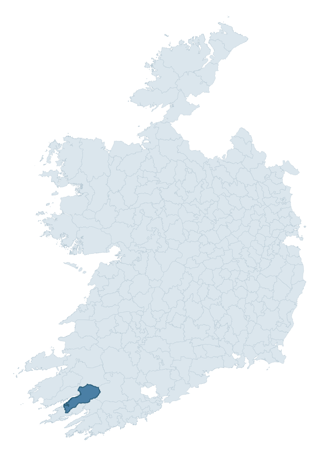
Where this barony sits in the Republic of Ireland
Geology and preservation
Bedrock geology shapes the landscape long before any settlement begins — controlling soil drainage, agricultural potential, the survival of upstanding monuments, and the preservation of buried archaeology. The figures below come from the Geological Survey Ireland 1:100,000 bedrock map.
The bedrock underlying Glanarought is predominantly sandstone (69% of the barony by area), laid down during the Devonian period (97% by area, around 419 to 359 million years ago). Sandstone weathers to free-draining, moderately fertile soils that supported Early Medieval ringfort agriculture and later manorial estates. The rock itself is a major source of building stone — visible in churches, tower houses, and farm buildings across the barony's historic landscape. The single largest mapped unit is the Caha Mountain Formation (43% of the barony's bedrock).
Rock type composition
Largest mapped unit: Caha Mountain Formation (43% of the barony)
Placename evidence
Logainm records 34 heritage-diagnostic placenames for Glanarought, drawn from townland and civil-parish names across the barony. The dominant stratum is Early Christian ecclesiastical — cill-, teampall-, and domhnach-prefixed names that record the dense network of early church foundations established between the fifth and tenth centuries. The leading diagnostic roots are cill- (19 — church), lios- (5 — ringfort or enclosure), and caiseal- (5 — stone ringfort). This is broadly in line with the ROI average of 30.7 heritage placenames per barony. The presence of multiple heritage strata side by side indicates layered occupation of the landscape across successive prehistoric and historic periods. Logainm records 226 placenames for Glanarought (predominantly townland names). Of these, 34 (15%) carry one of the diagnostic Gaelic roots tracked above; the remainder draw on more generic landscape vocabulary that does not encode a heritage period.
Pre-Christian / Early Medieval Defensive
| Root | Count | Meaning |
|---|---|---|
| lios- | 5 | ringfort or enclosure |
| caiseal- | 5 | stone ringfort |
| ráth- | 2 | earthen ringfort |
| dún- | 1 | hilltop or promontory fort |
Early Christian Ecclesiastical
| Root | Count | Meaning |
|---|---|---|
| cill- | 19 | church (early) |
| díseart- | 1 | hermitage |
Burial, Ritual, and Norse-Contact
| Root | Count | Meaning |
|---|---|---|
| leacht- | 1 | grave monument |
Other baronies in Kerry
- Clanmaurice
- Corkaguiny
- Dunkerron North
- Iraghticonnor
- Iveragh
- Magunihy
- Dunkerron South
- Bunratty Upper — Clare
- Coshmore And Coshbride — Waterford
- Bantry — Cork
See all 280 baronies in the Republic of Ireland Heritage Tool.

Explore further
Grounding History: 10 Maps of Northern Ireland’s Past
If you’re interested in Irish heritage more widely, the companion report for Northern Ireland brings together the analysis of all 462 NI wards into one place through 10 high-quality maps — covering monument density, archaeological periods, placename heritage, terrain, wetland, and the historic landscape at first survey. Take a look.
About this profile
Click any section below to expand.
What is a barony?
A barony is a historic administrative unit in Ireland, broadly equivalent to an English hundred. The 280 baronies used here are from the OSi 2019 National Statutory Boundaries (generalised 20m), covering the 26 counties of the Republic of Ireland. Baronies derive from the Norman period, were formalised in the 17th century, and have not been redrawn for statistical purposes. They vary enormously in area, from compact urban baronies in Dublin to vast upland baronies in Connacht, and should not be compared by raw site count without accounting for area differences.
What counts as a site?
This profile combines three distinct heritage registers, each with its own definition of what constitutes a recordable site:
- Archaeological sites (NMS). The National Monuments Service Sites and Monuments Record (SMR) catalogues every known archaeological monument or site of archaeological interest in the Republic, from prehistoric burial mounds and ringforts to medieval churches and post-medieval defensive works. Inclusion does not require legal protection — only that the site has been identified, surveyed, and assessed as having archaeological value. A separate subset of these sites lies within a recorded protection zone, which gives them statutory protection under the National Monuments Acts.
- Listed buildings (NIAH). The National Inventory of Architectural Heritage records buildings of architectural, historical, archaeological, artistic, cultural, scientific, social, or technical interest. Each surveyed structure is appraised on a five-tier scale: International, National, Regional, Local, and Record-Only. The NIAH appraisal is informational rather than strictly statutory, but it underpins local-authority Record of Protected Structures (RPS) listings.
- Heritage placenames (Logainm). Logainm is the authoritative database of Irish placenames maintained by the Placenames Branch. This profile applies a heritage-diagnostic classifier to the Irish-language form of each townland name, flagging roots that signal defensive sites (ráth-, lios-, dún-, caiseal-, cathair-), ecclesiastical foundations (cill-, teampall-, domhnach-, mainistir-), prehistoric burial-ritual features (tuaim-, carn-, leaba-), or Norse-contact settlement (gall-). Townlands without one of these diagnostic roots are not flagged here — they may still carry historical significance, but that significance is not encoded in the name itself.
Editorial principles
The narrative sections of this profile follow several explicit principles:
- Evidential. Every claim about this barony’s heritage character is anchored in the underlying register data. Where a site count, a placename count, or a percentile rank is cited, it is computed from the source datasets at export time, not estimated.
- Comparative. Counts and metrics are reported alongside their percentile rank against the other 279 ROI baronies. A barony with 50 ringforts in absolute terms could be unusually high or unusually low depending on its size and regional context; percentile ranking removes that ambiguity.
- Transparent on limits. Where a register has known coverage gaps, survey biases, or data-quality issues that affect this barony’s figures, the profile flags them rather than presenting the numbers as definitive.
- No interpretation beyond what the data supports. The narrative does not speculate about historical events, social dynamics, or cultural meaning beyond what the recorded heritage and placename evidence directly attests.
Data caveats and limits
- NMS Sites and Monuments Record is the product of survey campaigns conducted at different intensities across different counties and decades. Some baronies have been surveyed more thoroughly than others, and absolute counts should be read in that light. Sites destroyed by development before survey are typically not represented; sites in heavily forested or upland terrain are sometimes under-recorded.
- NIAH coverage is broadly complete for the Republic of Ireland but the survey was conducted on a rolling county-by-county basis, and the most recent appraisal date varies. Buildings demolished or substantially altered after their original survey may still appear in the register; conversely, recent buildings of merit may not yet have been appraised.
- Logainm classification applies a deliberately conservative pattern-matching approach to the Irish-language townland forms. The classifier prioritises true positives over recall: a townland may carry a heritage signal that the classifier doesn’t recognise, particularly where the diagnostic root has been heavily anglicised or where the townland name draws on a less common term. The 60,000+ townland records and ~9,800 classified placenames give a substantial signal at barony scale, but individual townland names should be checked against Logainm directly for definitive interpretation.
- Period attribution. The chronological distribution reflects only those NMS sites that carry a recognised period attribution in the source data. Sites listed as “Unknown” period are excluded from the dated subset.
- Boundary changes. Some baronies have undergone minor boundary adjustments since their 19th-century definition; the OSi 2019 generalised boundaries used here are the current statutory definition and may differ slightly from historical maps in border areas.
- Bedrock geology is mapped at 1:100,000 scale, which means local variation within a barony — small pockets of different rock type, mineral veins, alluvium overlying bedrock — is generalised. The dominant-system and rocktype figures are area-weighted, so a barony reading “70% Carboniferous limestone” may still contain small but archaeologically important pockets of older or younger rock. Around 3% of GSI polygons do not match the lexicon and contribute no rocktype or system attribution.
Data sources
- National Monuments Service — Sites and Monuments Record (SMR) https://data.gov.ie/dataset/national-monuments-service-archaeological-survey-of-ireland
- National Inventory of Architectural Heritage (NIAH) https://data.gov.ie/dataset/national-inventory-of-architectural-heritage-niah-national-dataset
- Logainm — Placenames Database of Ireland https://www.logainm.ie/
- Ordnance Survey Ireland — National Statutory Barony Boundaries 2019 https://data-osi.opendata.arcgis.com/
- EURODEM — European Digital Elevation Model https://www.mapsforeurope.org/datasets/euro-dem
- ESA WorldCover https://esa-worldcover.org/en
- Geological Survey Ireland — 1:100,000 Bedrock Geology https://www.gsi.ie/en-ie/data-and-maps/Pages/Bedrock.aspx
Explore more: Search any of the 280 ROI baronies, browse by historical province, or read the methodology and data sources for the full Republic of Ireland Heritage Tool.