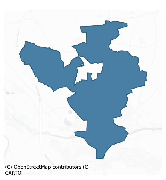
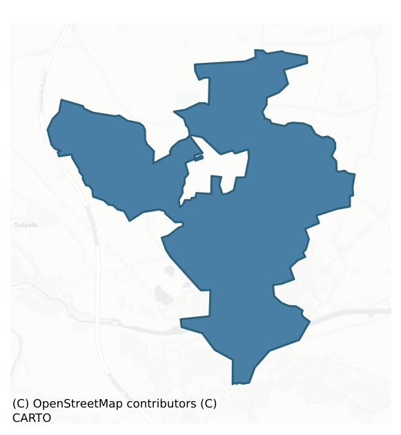
Drogheda is a barony of County Louth, in the historical province of Leinster (Irish: Droichead Átha), covering 18.6 km² of land. The barony records 109 NMS archaeological sites and 306 NIAH listed buildings, placing it at around the 98th percentile among 280 ROI baronies for sites per km². This means it is in the top tenth of all baronies for sites per km². Dated archaeological evidence runs from the Early Bronze Age through to the Post Medieval, spanning 5 of 9 archaeological periods, placing the barony in the 7th percentile among 280 ROI baronies for chronological depth. This means it is in the bottom tenth of all baronies for chronological depth. The largest dated subset of recorded sites dates to the Medieval.
Heritage at a glance
Percentile rankings throughout this profile compare each barony only against the other 279 Republic of Ireland baronies.
The recorded heritage of Drogheda
The National Monuments Service Sites and Monuments Record (SMR) is the statutory inventory of archaeological sites for the Republic of Ireland, maintained by the Department of Tourism, Culture, Arts, Gaeltacht, Sport and Media. Sites recorded here include earthworks, ringforts, megalithic tombs, ecclesiastical remains, and post-medieval features; not every record is legally protected, but each is registered as a monument of archaeological interest.
The National Monuments Service records 109 archaeological sites in Drogheda, putting it at the 98th percentile among 280 ROI baronies for sites per km². This means it is in the top tenth of all baronies for sites per km². Protection coverage is near-universal — 108 sites (99%) fall within a recorded monument protection zone, indicating an extensively surveyed landscape. The record is dominated by ecclesiastical sites — churches, graveyards, and holy wells (20 sites, 18% of the total), with domestic structures forming a substantial secondary presence (9 sites, 8%). Graveslab is the most prevalent type, making up 8% of the barony's recorded sites (9 records) — well above the ROI average of 4% across all baronies where this type occurs. Graveslab is a recumbent grave-marking slab, dated 1200–1700 AD. Other significant types include Excavation – miscellaneous (8) and Church (5). Church is a building used for public Christian worship, of any date from c. 500 AD onwards. Across the barony's 18.6 km², this gives a recorded density of 5.86 sites per km².
Most common monument types
Hover or tap a monument type to see its definition.
| Type | Count |
|---|---|
| Graveslab a recumbent grave-marking slab, dated 1200–1700 AD | 9 |
| Excavation – miscellaneous | 8 |
| Church a building used for public Christian worship, of any date from c. 500 AD onwards | 5 |
| Kiln a furnace or oven for burning, baking or drying, dated medieval onwards | 3 |
| Graveyard a burial area associated with a church, in use from the medieval period onwards | 3 |
Chronological distribution
The dated archaeological record for Drogheda spans from the Early Bronze Age through to the Post Medieval, with activity attested across 5 of 9 archaeological periods. This is the 7th percentile across ROI baronies — a relatively narrow chronological band, with much of Irish prehistory not represented in the dated record. The record is near-continuous, with only the Middle Late Bronze Age period falling inside the span without any recorded sites. Activity concentrates most heavily in the Medieval (44 sites, 75% of dated material), with the Iron Age forming a secondary peak (7 sites, 12%). A further 50 recorded sites (46% of the overall NMS register for the barony) carry no period attribution — appearing as 'Unknown' in the bar chart below. This typically reflects either records that pre-date the standardised period vocabulary or sites awaiting specialist dating review, rather than a genuine absence of chronological evidence.
Sample of recorded monuments
Show 25 sample monuments (of 109 total)
A representative sample of 25 recorded monuments drawn from the barony’s 109 total NMS entries. Sites within a recorded monument protection zone and rarer site types are prioritised so the list shows a meaningful cross-section rather than only the most common type. Each entry shows the official Sites and Monuments Record reference number and the description published by the National Monuments Service.
Barrow – unclassified
The following description is derived from both the published 'Archaeological Inventory of County Louth' (Dublin: Stationery Office, 1986) and the 'Archaeological Survey of County Louth' (Dublin: Stationery Office,…
The following description is derived from both the published 'Archaeological Inventory of County Louth' (Dublin: Stationery Office, 1986) and the 'Archaeological Survey of County Louth' (Dublin: Stationery Office, 1991). In certain instances the entries have been revised and updated in the light of recent research.
Date of upload/revision: 17 July 2007
Situated at the NW foot of Red Mt. Circular, round-topped mound (diam. 13m, H 1.5-2m) enclosed by a fosse, of which slight traces only remain at N. On top of the mound is a slight depression, owing to modern disturbance, in which lies a slab (L 0.7m, Wth 0.5m). Under this slab was found a large portion of an urn and fragments of cremated bone (see LH021-041002-). These are now in the National Museum (NMI reg. nos 1967: 198-9). Site known locally as 'Cooney's Moat'. (JRSAI 1970, 152)
Pit-burial
The following description is derived from both the published 'Archaeological Inventory of County Louth' (Dublin: Stationery Office, 1986) and the 'Archaeological Survey of County Louth' (Dublin: Stationery Office,…
The following description is derived from both the published 'Archaeological Inventory of County Louth' (Dublin: Stationery Office, 1986) and the 'Archaeological Survey of County Louth' (Dublin: Stationery Office, 1991). In certain instances the entries have been revised and updated in the light of recent research.
Date of upload/revision: 17 July 2007
Pit covered by flagstone, containing cremated bones and portion of a Cordoned Urn (Kavanagh 1976, 368, no. 35) (NMI reg. nos 1967:198-9). This is probably a secondary insertion into barrow LH021-041001-.
Castle – tower house
This tower house has a slight base batter and is built of roughly coursed rubble, greywacke and limestone; it was originally three storeys high but the second- floor level has been truncated to accommodate a pitched…
This tower house has a slight base batter and is built of roughly coursed rubble, greywacke and limestone; it was originally three storeys high but the second- floor level has been truncated to accommodate a pitched roof in line with that of a modern dwelling attached to its W wall. The original entrance, now blocked, was through a doorway at the S end of the W wall. The arch of the doorway is a two-stone pointed one of punch-dressed limestone with the stones cut at an obtuse angle to sit on the supporting jambs. It has large slab stone lintels over the entrance passage. The stairwell is situated in the SW angle but is not accessible. The top portion of the tower house was destroyed by the building of a more modern roof and by the use of its W wall as the gable end of the house. The remains of the stair tower project slightly westwards but it also has been broken away to facilitate the later building. The NE angle had a tower which projected eastwards but this has been completely removed and only part of its broken E wall remains. Since the stairwell is in the SW angle the destroyed tower at the NE must have contained the garderobes.
The first and second floors must have been constructed of wood since there is no evidence of a barrel vault. There is a two-light window of punch-dressed limestone with small rounded arch over each ope in the N wall at first-floor level. There is a three-light window in the E wall constructed in the same manner, and a two-light one directly…
Cross
A gargoyle was noted lying beside the N wall of the mortuary chapel when inspected by ASI in 1966, it may originally have belonged to the church (LH024-030001-). Composed of sandstone (L 0.88m; Wth of face 0.32m; D of…
A gargoyle was noted lying beside the N wall of the mortuary chapel when inspected by ASI in 1966, it may originally have belonged to the church (LH024-030001-). Composed of sandstone (L 0.88m; Wth of face 0.32m; D of channel 0.22m), only the upper part of the face remains and the underneath side has human arms carved on it.
Compiled by: Claire Breen
Date of upload: 28 August 2012
Cross – Market cross
A rectangular, heavily weathered, fragment of limestone (0.44m by 0.40m by 0.24m) built into the N return of the E gable of Cord church (LH024-030001-). The two visible sides are decorated, one side with a head and the…
A rectangular, heavily weathered, fragment of limestone (0.44m by 0.40m by 0.24m) built into the N return of the E gable of Cord church (LH024-030001-). The two visible sides are decorated, one side with a head and the other with the pietà (Our Lady's Pity) scene. Thought by King (CLAJ 1984, 334-9) to be part of a market cross (LH024-030004-) and could be of late medieval date.
Compiled by: Claire Breen
Date of upload: 28 August 2012
Historic town
The Archaeological Survey of Ireland (ASI) is in the process of providing information on all monuments on The Historic Environment Viewer (HEV). Currently the information for this record has not been uploaded. To…
The Archaeological Survey of Ireland (ASI) is in the process of providing information on all monuments on The Historic Environment Viewer (HEV). Currently the information for this record has not been uploaded. To access available information for research purposes please make an appointment in advance with the Archive Unit (open Fridays 10.00 am – 5.00 pm), Department of Culture, Heritage and the Gaeltacht, The Custom House, Dublin 1 D01W6XO or email nmarchive@chg.gov.ie.
Religious house – Dominican friars
A priory of the Dominican order founded c. 1224 by Luke Netterville, archbishop of Armagh. The only standing remains now to be seen are those of the central tower, built of coursed limestone blocks, greywacke and rough…
A priory of the Dominican order founded c. 1224 by Luke Netterville, archbishop of Armagh. The only standing remains now to be seen are those of the central tower, built of coursed limestone blocks, greywacke and rough stone. It has two floor levels above the arch, the lower one having a twin-light window with transom and tracery in each of the four walls. The window arches are two-centred, are constructed of hard grey sandstone and are typical of the late medieval period. The windows of the upper floor level are also twin-lighted with transom and Y-shaped tracery but are taller than those of the lower stage. The stairwell is contained in the NW angle which projects northwards. In its N façade it has a doorway c. 6m above the present ground level. It has a two-centred arch of limestone with cut limestone jambs and several plain window slits for light. The lower floor level is roofed with a ribbed vault which springs from stylised human heads.
The arch of the tower at both the nave and chancel sides is constructed of hard grey moulded sandstone in three orders which descend onto single jambs of chamfered limestone. The remains of jambs of a sandstone arch can be seen in the SW angle of the tower, presumably part of the original arcading at the S side of the nave. The line of the roofs of the nave and chancel is also clearly to be seen in the E and W façades of the tower. The treatment of the stonework in the windows and the doorway to the stairwell indicates a late medie…
Religious house – Franciscan friars
Franciscan Friary situated close to the customs house at Drogheda and thought to have been established about 1245 (Gwynn and Hadcock 1988, 247-8). No visible surface trace. (Bradley 1984b, 107-8; D'Alton 1844, 128-31;…
Franciscan Friary situated close to the customs house at Drogheda and thought to have been established about 1245 (Gwynn and Hadcock 1988, 247-8). No visible surface trace. (Bradley 1984b, 107-8; D'Alton 1844, 128-31; CLAJ 1941, 36-41; CLAJ 1943, 257-8)
The above description is derived from both the published 'Archaeological Inventory of County Louth' (Dublin: Stationery Office, 1986) and the 'Archaeological Survey of County Louth' (Dublin: Stationery Office, 1991). In certain instances the entries have been revised and updated in the light of recent research.
Date of upload: 17 July 2007
Castle – unclassified
Probable tower house, commonly called the Old Tholsel or Castle of Comfort (D'Alton 1844, vol. 1, 100-1), lay at the foot of the hill on the Meath side of the River Boyne and is shown on Newcomen's map of 1657 (D'Alton…
Probable tower house, commonly called the Old Tholsel or Castle of Comfort (D'Alton 1844, vol. 1, 100-1), lay at the foot of the hill on the Meath side of the River Boyne and is shown on Newcomen's map of 1657 (D'Alton 1844, vol. 1, 285). No visible surface trace.
The above description is derived from both the published 'Archaeological Inventory of County Louth' (Dublin: Stationery Office, 1986) and the 'Archaeological Survey of County Louth' (Dublin: Stationery Office, 1991). In certain instances the entries have been revised and updated in the light of recent research.
Date of upload: 17 July 2007
Castle – motte and bailey
The following description is derived from both the published 'Archaeological Inventory of County Louth' (Dublin: Stationery Office, 1986) and the 'Archaeological Survey of County Louth' (Dublin: Stationery Office,…
The following description is derived from both the published 'Archaeological Inventory of County Louth' (Dublin: Stationery Office, 1986) and the 'Archaeological Survey of County Louth' (Dublin: Stationery Office, 1991). In certain instances the entries have been revised and updated in the light of recent research.
Date of upload/revision: 17 July 2007
Situated on high ground to the S of the River Boyne within the medieval walls of Drogheda and consisting of a high steep mound (H 14.7-16m, max. diam. at base 62.5m, at summit 27.6m) with the remains of a D-shaped bailey (Wth 68m by 50m) at the W. Orpen (1908; fig. on p. 249) illustrates the bailey fosse and the line of part of another one at the SE side of the motte which is now occupied by a roadway. He also illustrates a sub-rectangular lower bailey at the NW but there is no surface evidence of this. The name 'Millmount' (the name applied to the site on the OS 6-inch map) is apparently derived from the fact that there was a windmill erected on the motte in the fifteenth century. This was replaced in 1810 by a Martello tower (IFC Schools MSS vol. 680, 200), the remains of which still stand on the summit of the motte. The bailey is clearly defined on all but the N side by a steep escarpment and is now occupied by a housing development. A wall marking the line of the so-called lower bailey is of modern origin and is hardly part of the original defences as the N side of the D-shaped bailey is likely to have returned onto…
Religious house – Augustinian friars
A house of Augustinian friars was established at Drogheda in the reign of Edward I (1272-1307) according to Ware (1705, 90), and it was sometimes known as Pontanense because of its associated with the bridge (Archdall…
A house of Augustinian friars was established at Drogheda in the reign of Edward I (1272-1307) according to Ware (1705, 90), and it was sometimes known as Pontanense because of its associated with the bridge (Archdall 1722, 314). An Irish chapter of the order was held there in 1359, and it was decided to introduce the Observant rule in 1517 (Gwynn and Hadcock 1970, 298). At the suppression in 1540 it was described as the church and certain superfluous buildings, an orchard and a garden amounting to one and a half acres (White 1943, 246-7). The ruins survive, although they have been mistakenly called the hospital of Mary d’Urso beginning with D’Alton (1844, vol. 1, 111-16), but this is now firmly identified as the house of the Augustinian friars (McHugh 2019).
The standing remains consist of part of the nave, chancel, the W gable of the N aisle, and the central bell-tower. It is built of roughly coursed limestone blocks, greywacke and rubble. There is virtually nothing left of the nave except for portions of the S wall which have been disturbed and in places rebuilt with brick. To the N of where the W end of the nave should be there are the remains of a gable wall containing a window, now filled in, which is presumably the W end of a destroyed N aisle. It is a two-centred arch of moulded sandstone and its W façade has the remains of carved heads at the base of the arch, that at the N side being almost completely eroded. The N jamb is missing while that at the S side is…
Town defences
The following description is derived from both the published 'Archaeological Inventory of County Louth' (Dublin: Stationery Office, 1986) and the 'Archaeological Survey of County Louth' (Dublin: Stationery Office,…
The following description is derived from both the published 'Archaeological Inventory of County Louth' (Dublin: Stationery Office, 1986) and the 'Archaeological Survey of County Louth' (Dublin: Stationery Office, 1991). In certain instances the entries have been revised and updated in the light of recent research.
Date of upload/revision: 16 July 2010
These enclosed an area of c. 45 hectares and had a circumference of 2.35km. We are fortunate that a sixteenth-century plan of Drogheda survives (Bradley 1978, 100) on which the main medieval features are represented, though this must be treated with some caution. The town is divided E-W by the River Boyne which also acted at one time as the county boundary between Louth and Meath. There appear to have been ten gateways, six in the N sector and four in the S. The remains of only two survive, St Laurence's Gate (LH024-041005-) and the Butter Gate (LH024-041007-). Besides the gateways there were also a number of towers along the walls and the N bank of the river (Bradley 1978, map opp. p. 98). Six or seven of the mural towers were S of the river while in the N sector there appear to have been between seven and ten. No remains of these can be seen on the ground and the only surviving portions of the wall are a large stretch at the W side of the town, a short fragment close to St Laurence's Gate, and a long section to the S of St Mary's Church. A subsidy was conceded in 1279 for a stone enclosure and one in 1316 for the repai…
Kiln – tile
A fourteenth-century line-impressed tile kiln, discovered during archaeological monitoring (Excavation Licence E0430) in a garden on the site of the Dominican Friary (LH024-041001-). (Campbell 1987, 56)
Compiled by:…
A fourteenth-century line-impressed tile kiln, discovered during archaeological monitoring (Excavation Licence E0430) in a garden on the site of the Dominican Friary (LH024-041001-). (Campbell 1987, 56)
Compiled by: Claire Breen
Date of upload: 28 August 2012
Well
Discovered during pre-development excavation in 1996 (Excavation Licence No. 96E0161). Found in association with a possible medieval house (LH024-041049-) and a stone lined pit (LH024-041051-). (pers. comm. Eoin…
Discovered during pre-development excavation in 1996 (Excavation Licence No. 96E0161). Found in association with a possible medieval house (LH024-041049-) and a stone lined pit (LH024-041051-). (pers. comm. Eoin Corcoran (Archaeological Consultancy Services Limited))
Compiled by: Claire Breen
Date of upload: 28 August 2012
House – 16th century
Commonly known as 'Bathe House' since it was erected by Nicholas Bathe in 1570. It occupied the angle formed by the junction of Shop Street and Laurence Street. It was three storeys high and built of wood. In 1824 it…
Commonly known as 'Bathe House' since it was erected by Nicholas Bathe in 1570. It occupied the angle formed by the junction of Shop Street and Laurence Street. It was three storeys high and built of wood. In 1824 it was condemned by Drogheda Corporation and demolished. . . The house was built mainly of oak and was three storeys high, with the upper storey projecting beyond the one immediately underneath. The upper storey had a strong, square oak framing with spandril pieces each forming a quadrant; the interstices were filled with plaster. The second storey, which contained the drawing room, was finished with panelling, each panel being about one foot square and decorated with carving. In the angle of the drawing room, which looked out onto Shop Street and Laurence Street, there was a semi-circular bay window with four divisions. It contained in a panel of its pedestal the arms of Bathe. On the bressimer (a load-bearing beam that extends the length of the building) facing Laurence St. was an inscription, stating the building to have been "MADE *BI *NICHOLAS *BATHE *IN *THE *IEARE *OF *OUR *LORD *GOD *1570 *BI *HIV *MOR *CARPENTER". This oak beam is now preserved in the National Museum of Ireland. (CLAJ 1905, 32; CLAJ 1941, 67; CLAJ 1936, frontispiece)
The above description is derived from the 'Archaeological Survey of County Louth' (Dublin: Stationery Office, 1991). In this instance the entry has been revised and updated in the light of recent research.
Date of uplo…
House – 17th century
According to Kelly (CLAJ 1941, 68), a wooden house was located on the E side of Peter Street, the eight house from Laurence St. corner. Constructed of wooden beams in the 'bird cage' fashion, with the upper storey…
According to Kelly (CLAJ 1941, 68), a wooden house was located on the E side of Peter Street, the eight house from Laurence St. corner. Constructed of wooden beams in the 'bird cage' fashion, with the upper storey projecting over the lower.
Compiled by: Claire Breen
Date of upload: 29 August 2012
Tannery
Discovered during archaeological test trenching in 1999 (Excavation Licence 98E0250). The remains of two tannery buildings were uncovered and recorded together with deposits of cinder and charcoal contained within…
Discovered during archaeological test trenching in 1999 (Excavation Licence 98E0250). The remains of two tannery buildings were uncovered and recorded together with deposits of cinder and charcoal contained within wood-lined tanning pits. (Conway 2000, 197)
Compiled by: Claire Breen
Date of upload: 29 August 2012
Ecclesiastical residence
Remains of the archbishop's palace were exposed during pre-development excavation at the site of the former Drogheda Grammar School in 1998 (Excavation Licence No. 98E0544). Built by Primate Christopher Hampton in…
Remains of the archbishop's palace were exposed during pre-development excavation at the site of the former Drogheda Grammar School in 1998 (Excavation Licence No. 98E0544). Built by Primate Christopher Hampton in 1613. Little of the residence survived save the external W wall and part of its bricked floor. This floor sealed the remains of earlier medieval structures (LH024-041076-). Found in association with a number of other medieval buildings (LH024-041068-, LH024-041069-, LH024-041072- and LH024-041077-), two medieval corn-drying kilns (LH024-041070- and LH024-041074-) and a lime kiln (LH024-041073-). (Murphy 2000, 199)
Compiled by: Claire Breen
Date of upload: 29 August 2012
Font (present location)
The following description is derived from both the published 'Archaeological Inventory of County Louth' (Dublin: Stationery Office, 1986) and the 'Archaeological Survey of County Louth' (Dublin: Stationery Office,…
The following description is derived from both the published 'Archaeological Inventory of County Louth' (Dublin: Stationery Office, 1986) and the 'Archaeological Survey of County Louth' (Dublin: Stationery Office, 1991). In certain instances the entries have been revised and updated in the light of recent research.
Date of upload/revision: 17 July 2007
Situated at the main door of St. Peter's Church, West St., but thought to have come from Killineer, County Louth (Bassett 1886, 89), and consisting of an octagonal bowl mounted on a modern pedestal and plinth. It is so small that it might be considered as a stoup except for the fact that it had a central drain hole. The bowl has eight equal sides, is slightly chamfered around the rim, and has decorated panels. These have been fully described and illlustrated by Roe (1976, 255-62) but consist basically of eight angels standing beneath ornate canopies and holding shields with various devices carved in very low relief. The font is late medieval in date, and probably belongs to the sixteenth century (Roe 1976, 255-62).
Sheela-na-gig
Thought to have come originally from the Priory of St. John (LH024-041008-) but more recently removed from the front of a house at 18 John Street and now stored in Millmount Museum (LH024-041109-), Drogheda. It is of…
Thought to have come originally from the Priory of St. John (LH024-041008-) but more recently removed from the front of a house at 18 John Street and now stored in Millmount Museum (LH024-041109-), Drogheda. It is of badly worn sandstone and its more obvious sexual overtones, despite a hole near its base, are missing. It is, however, in the general tradition of these grotesque figures. (CLAJ 1977, 69-70, pl. 4)
Described by Freitag as a figure, 'carved in high relief on block of sandstone and quite weathered. Behind head of figure three contiguous hollow ovals. Large neckless head, two irregular depressions for eyes, no nose, mouth indicated by slit. No breasts; necklace with pendant pointing at long narrow slit, indicating vulva. Arms in front of body with hands touching vulva, and deep touch-hole underneath' (Freitag 2004, 131).
The above description is derived from both the published 'Archaeological Inventory of County Louth' (Dublin: Stationery Office, 1986) and the 'Archaeological Survey of County Louth' (Dublin: Stationery Office, 1991). In certain instances the entries have been revised and updated in the light of recent research.
Date of upload/revision: 06 June 2012
Road – road/trackway
The Archaeological Survey of Ireland (ASI) is in the process of providing information on all monuments on The Historic Environment Viewer (HEV). Currently the information for this record has not been uploaded. To…
The Archaeological Survey of Ireland (ASI) is in the process of providing information on all monuments on The Historic Environment Viewer (HEV). Currently the information for this record has not been uploaded. To access available information for research purposes please make an appointment in advance with the Archive Unit (open Fridays 10.00 am – 5.00 pm), Department of Culture, Heritage and the Gaeltacht, The Custom House, Dublin 1 D01W6XO or email nmarchive@chg.gov.ie.
Architectural fragment
A chimney-piece lintel with the arms of Elcock and Duffe, dated 1584, which originally came from their house in Patrickswell Lane, Drogheda (Garner 1986, 13).
The above description is derived from the published…
A chimney-piece lintel with the arms of Elcock and Duffe, dated 1584, which originally came from their house in Patrickswell Lane, Drogheda (Garner 1986, 13).
The above description is derived from the published 'Archaeological Survey of County Louth' (entry 958) (Dublin: Stationery Office, 1991). In certain instances the entries have been revised and updated in the light of recent research.
Date of upload: 21 June 2013
Cross-slab (present location)
In the porch of St. Peter's church is a cross-slab originally from Marlay graveyard (see LH018-041001- for original location record). The slab is roughly circular (max. L 0.82m; max. Wth 0.82m) with very irregular…
In the porch of St. Peter's church is a cross-slab originally from Marlay graveyard (see LH018-041001- for original location record). The slab is roughly circular (max. L 0.82m; max. Wth 0.82m) with very irregular edges. It bears two crudely incised Latin crosses placed side by side. One is a linear cross with slightly curving bifid terminals. The other is a more elaborate version, with a linear circle joining the shaft and arms and a single incised line partly outlining the cross. The outer line is slightly convex rather than forked at three of the terminals and is missing above the upper terminal. An Irish inscription above and below the crosses reads 'Tnudach Cocmanf'. The crosses and inscription are enclosed by a roughly circular linear frame which is now partly defaced (Lionard 1961, 102, fig. l: 10; Macalister 1949, 31).
The above description is derived from the published 'Archaeological Survey of County Louth' (entry 958) (Dublin: Stationery Office, 1991). In certain instances the entries have been revised and updated in the light of recent research.
Date of upload: 21 June 2013
Sheela-na-gig (present location)
Thought to have come originally from the Priory of St. John (LH024-041008-) and in Millmount Museum.
It consists of a figure 'carved in high relief on block of sandstone and quite weathered. Behind head of figure…
Thought to have come originally from the Priory of St. John (LH024-041008-) and in Millmount Museum.
It consists of a figure 'carved in high relief on block of sandstone and quite weathered. Behind head of figure three contiguous hollow ovals. Large neckless head, two irregular depressions for eyes, no nose, mouth indicated by slit. No breasts; necklace with pendant pointing at long narrow slit, indicating vulva. Arms in front of body with hands touching vulva, and deep touch-hole underneath' (Freitag 2004, 131). (CLAJ 1977, 69-70, pl. 4)
Compiled by: Paul Walsh
Date of upload: 16 October 2017
House – medieval
Discovered during pre-development excavation in 1996 (Excavation Licence No. 96E0161). The remains of a medieval house and its associated burgage plot were uncovered. Two walls, one aligned N-S and one E-W, were exposed…
Discovered during pre-development excavation in 1996 (Excavation Licence No. 96E0161). The remains of a medieval house and its associated burgage plot were uncovered. Two walls, one aligned N-S and one E-W, were exposed along with the walls bounding the burgage plot. Organic deposits of garden soil were found in the area of the plot along with a well (LH024-041050-) and a stone lined pit (LH024-041051-). Finds recovered included medieval ridge tiles, medieval pottery, wood and leather. ((pers. comm. Eoin Corcoran (Archaeological Consultancy Services Limited))
Compiled by: Claire Breen
Date of upload: 28 August 2012
Listed buildings
The National Inventory of Architectural Heritage (NIAH) is a state survey appraising buildings of architectural, historical, archaeological, artistic, cultural, scientific, social, or technical interest. Each surveyed structure receives a rating from International (the highest, for buildings of European importance) through National, Regional, Local, and Record-Only.
The NIAH records 306 listed buildings in Drogheda, the 88th percentile across ROI baronies for listed-building density. Among these, 7 are graded National — buildings of interest to the whole of Ireland rather than only its region. The Republic holds 937 National-graded buildings in total, so this barony accounts for around 1% of the national total. Construction dates concentrate most heavily in the Victorian (1830-1900) period. The most-recorded building type is house (197 examples, 64% of the listed stock).
Terrain and environment
Mean elevation across the barony is 53m — the 18th percentile among 280 ROI baronies for elevation. This means it is in the bottom fifth of all baronies for elevation. This is a relatively low-lying landscape by ROI standards. Elevation matters for heritage because higher-altitude baronies typically favour defensive monuments — ringforts and hilltop forts placed on prominent ground — while lowland baronies are more likely to carry the dense settlement and church networks of intensive agricultural landscapes. Mean slope is 3.0° — the 37th percentile among 280 ROI baronies for slope. This means it is in the lower half of all baronies for slope. Slope is a key control on both land use and archaeological preservation: steep ground resists ploughing and tends to preserve earthworks intact, while gentle slopes favour intensive cultivation that damages or destroys surface archaeology over time. The Topographic Wetness Index averages 11.0, the 58th percentile among 280 ROI baronies for wetness. This means it is in the upper half of all baronies for wetness. Drainage matters for heritage because poorly-drained ground preserves organic archaeology (wooden trackways, leather, textiles, and on rare occasions human remains) far better than free-draining soil; well-drained ground favours arable use but destroys organic material rapidly. Urban land covers 12% of the barony (the 95th percentile among 280 ROI baronies for urban cover. This means it is in the top tenth of all baronies for urban cover). Heavy urban coverage compresses heritage analysis: many archaeological features have been buried or destroyed by development, but the surviving record is concentrated in protected city-centre cores, and the NIAH listed-buildings count is typically high. The land-cover mosaic combines improved grassland (62%), arable farmland (14%), and urban land (12%), giving a mixed agricultural and semi-natural landscape.
Terrain measurements
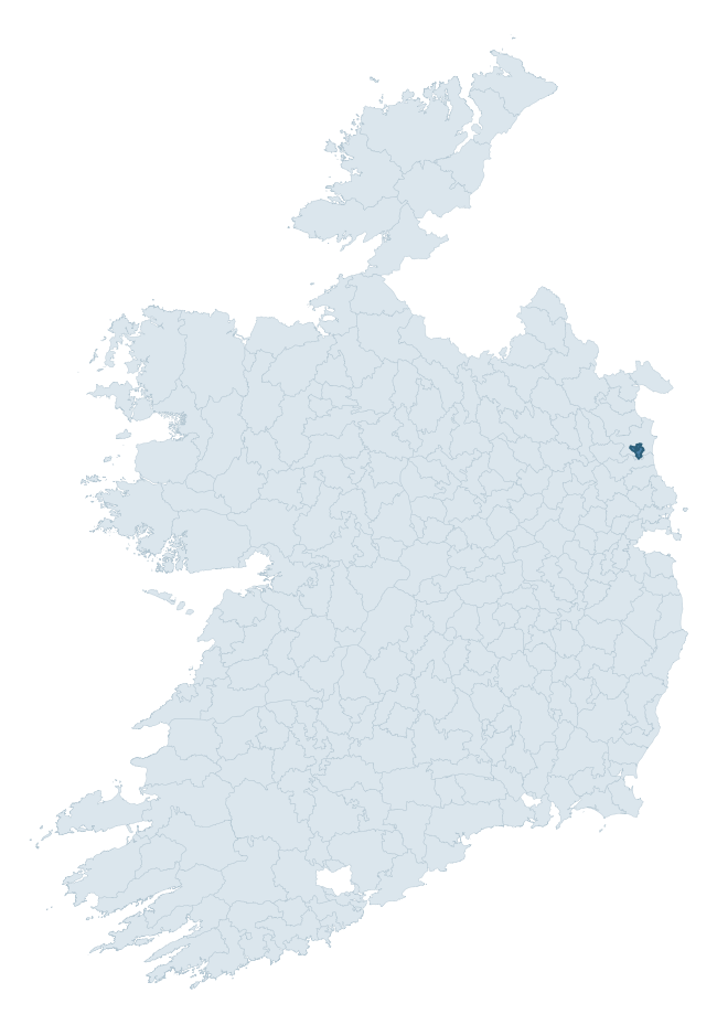
Where this barony sits in the Republic of Ireland
Geology and preservation
Bedrock geology shapes the landscape long before any settlement begins — controlling soil drainage, agricultural potential, the survival of upstanding monuments, and the preservation of buried archaeology. The figures below come from the Geological Survey Ireland 1:100,000 bedrock map.
The bedrock underlying Drogheda is predominantly mudstone and sandstone (46% of the barony by area), laid down during the Silurian period (54% by area, around 444 to 419 million years ago). A substantial secondary geology of limestone (46%) adds further variety to the underlying landscape. The single largest mapped unit is the Glaspistol Formation (46% of the barony's bedrock).
Rock type composition
Largest mapped unit: Glaspistol Formation (47% of the barony)
Placename evidence
Logainm records 5 heritage-diagnostic placenames for Drogheda, a modest sample drawn predominantly from the townland record. The dominant stratum is pre-christian defensive. The most frequent diagnostic roots are lios- (2) and ráth- (1). With a sample of this size the count should be treated as indicative rather than definitive.
Pre-Christian / Early Medieval Defensive
| Root | Count | Meaning |
|---|---|---|
| lios- | 2 | ringfort or enclosure |
| ráth- | 1 | earthen ringfort |
Early Christian Ecclesiastical
| Root | Count | Meaning |
|---|---|---|
| cill- | 1 | church (early) |
Burial, Ritual, and Norse-Contact
| Root | Count | Meaning |
|---|---|---|
| carn- | 1 | cairn |
Other baronies in Louth
About this profile
Click any section below to expand.
What is a barony?
A barony is a historic administrative unit in Ireland, broadly equivalent to an English hundred. The 280 baronies used here are from the OSi 2019 National Statutory Boundaries (generalised 20m), covering the 26 counties of the Republic of Ireland. Baronies derive from the Norman period, were formalised in the 17th century, and have not been redrawn for statistical purposes. They vary enormously in area, from compact urban baronies in Dublin to vast upland baronies in Connacht, and should not be compared by raw site count without accounting for area differences.
What counts as a site?
This profile combines three distinct heritage registers, each with its own definition of what constitutes a recordable site:
- Archaeological sites (NMS). The National Monuments Service Sites and Monuments Record (SMR) catalogues every known archaeological monument or site of archaeological interest in the Republic, from prehistoric burial mounds and ringforts to medieval churches and post-medieval defensive works. Inclusion does not require legal protection — only that the site has been identified, surveyed, and assessed as having archaeological value. A separate subset of these sites lies within a recorded protection zone, which gives them statutory protection under the National Monuments Acts.
- Listed buildings (NIAH). The National Inventory of Architectural Heritage records buildings of architectural, historical, archaeological, artistic, cultural, scientific, social, or technical interest. Each surveyed structure is appraised on a five-tier scale: International, National, Regional, Local, and Record-Only. The NIAH appraisal is informational rather than strictly statutory, but it underpins local-authority Record of Protected Structures (RPS) listings.
- Heritage placenames (Logainm). Logainm is the authoritative database of Irish placenames maintained by the Placenames Branch. This profile applies a heritage-diagnostic classifier to the Irish-language form of each townland name, flagging roots that signal defensive sites (ráth-, lios-, dún-, caiseal-, cathair-), ecclesiastical foundations (cill-, teampall-, domhnach-, mainistir-), prehistoric burial-ritual features (tuaim-, carn-, leaba-), or Norse-contact settlement (gall-). Townlands without one of these diagnostic roots are not flagged here — they may still carry historical significance, but that significance is not encoded in the name itself.
Editorial principles
The narrative sections of this profile follow several explicit principles:
- Evidential. Every claim about this barony’s heritage character is anchored in the underlying register data. Where a site count, a placename count, or a percentile rank is cited, it is computed from the source datasets at export time, not estimated.
- Comparative. Counts and metrics are reported alongside their percentile rank against the other 279 ROI baronies. A barony with 50 ringforts in absolute terms could be unusually high or unusually low depending on its size and regional context; percentile ranking removes that ambiguity.
- Transparent on limits. Where a register has known coverage gaps, survey biases, or data-quality issues that affect this barony’s figures, the profile flags them rather than presenting the numbers as definitive.
- No interpretation beyond what the data supports. The narrative does not speculate about historical events, social dynamics, or cultural meaning beyond what the recorded heritage and placename evidence directly attests.
Data caveats and limits
- NMS Sites and Monuments Record is the product of survey campaigns conducted at different intensities across different counties and decades. Some baronies have been surveyed more thoroughly than others, and absolute counts should be read in that light. Sites destroyed by development before survey are typically not represented; sites in heavily forested or upland terrain are sometimes under-recorded.
- NIAH coverage is broadly complete for the Republic of Ireland but the survey was conducted on a rolling county-by-county basis, and the most recent appraisal date varies. Buildings demolished or substantially altered after their original survey may still appear in the register; conversely, recent buildings of merit may not yet have been appraised.
- Logainm classification applies a deliberately conservative pattern-matching approach to the Irish-language townland forms. The classifier prioritises true positives over recall: a townland may carry a heritage signal that the classifier doesn’t recognise, particularly where the diagnostic root has been heavily anglicised or where the townland name draws on a less common term. The 60,000+ townland records and ~9,800 classified placenames give a substantial signal at barony scale, but individual townland names should be checked against Logainm directly for definitive interpretation.
- Period attribution. The chronological distribution reflects only those NMS sites that carry a recognised period attribution in the source data. Sites listed as “Unknown” period are excluded from the dated subset.
- Boundary changes. Some baronies have undergone minor boundary adjustments since their 19th-century definition; the OSi 2019 generalised boundaries used here are the current statutory definition and may differ slightly from historical maps in border areas.
- Bedrock geology is mapped at 1:100,000 scale, which means local variation within a barony — small pockets of different rock type, mineral veins, alluvium overlying bedrock — is generalised. The dominant-system and rocktype figures are area-weighted, so a barony reading “70% Carboniferous limestone” may still contain small but archaeologically important pockets of older or younger rock. Around 3% of GSI polygons do not match the lexicon and contribute no rocktype or system attribution.
Data sources
- National Monuments Service — Sites and Monuments Record (SMR) https://data.gov.ie/dataset/national-monuments-service-archaeological-survey-of-ireland
- National Inventory of Architectural Heritage (NIAH) https://data.gov.ie/dataset/national-inventory-of-architectural-heritage-niah-national-dataset
- Logainm — Placenames Database of Ireland https://www.logainm.ie/
- Ordnance Survey Ireland — National Statutory Barony Boundaries 2019 https://data-osi.opendata.arcgis.com/
- EURODEM — European Digital Elevation Model https://www.mapsforeurope.org/datasets/euro-dem
- ESA WorldCover https://esa-worldcover.org/en
- Geological Survey Ireland — 1:100,000 Bedrock Geology https://www.gsi.ie/en-ie/data-and-maps/Pages/Bedrock.aspx
Explore more: Search any of the 280 ROI baronies, browse by historical province, or read the methodology and data sources for the full Republic of Ireland Heritage Tool.