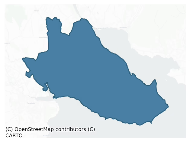
Dundalk Lower is a barony of County Louth, in the historical province of Leinster (Irish: Dún Dealgan Íochtarach), covering 155 km² of land. The barony records 447 NMS archaeological sites and 186 NIAH listed buildings, placing it at around the 78th percentile among 280 ROI baronies for sites per km². This means it is in the top third of all baronies for sites per km². Dated archaeological evidence runs from the Neolithic through to the Modern, spanning 8 of 9 archaeological periods, placing the barony in the 61st percentile among 280 ROI baronies for chronological depth. This means it is in the upper half of all baronies for chronological depth. The largest dated subset of recorded sites dates to the Early Medieval.

Heritage at a glance
Percentile rankings throughout this profile compare each barony only against the other 279 Republic of Ireland baronies.
The recorded heritage of Dundalk Lower
The National Monuments Service Sites and Monuments Record (SMR) is the statutory inventory of archaeological sites for the Republic of Ireland, maintained by the Department of Tourism, Culture, Arts, Gaeltacht, Sport and Media. Sites recorded here include earthworks, ringforts, megalithic tombs, ecclesiastical remains, and post-medieval features; not every record is legally protected, but each is registered as a monument of archaeological interest.
The National Monuments Service records 447 archaeological sites in Dundalk Lower, putting it at the 78th percentile among 280 ROI baronies for sites per km². This means it is in the top third of all baronies for sites per km². Protection coverage is near-universal — 434 sites (97%) fall within a recorded monument protection zone, indicating an extensively surveyed landscape. The dominant category is defensive sites — ringforts, enclosures, hillforts, and stone forts (224 sites, 50% of the record). Ringfort – rath is the most prevalent type, making up 19% of the barony's recorded sites (86 records), broadly in line with the ROI average of 20% across all baronies where this type occurs. Ringfort – rath is an earthen ringfort enclosed by a bank and external ditch — the most common Early Medieval farmstead, broadly dated 500–1000 AD. Other significant types include Enclosure (61) and Hut site (48). Enclosure is a banked or ditched feature of uncertain type, used as a catch-all where the original function cannot be determined from surface evidence; Hut site is a low stone or earthen foundation enclosing a small circular or oval area, generally interpreted as a former dwelling, of any date from prehistory to the medieval period. Across the barony's 155 km², this gives a recorded density of 2.89 sites per km².
Most common monument types
Hover or tap a monument type to see its definition.
| Type | Count |
|---|---|
| Ringfort – rath an earthen ringfort enclosed by a bank and external ditch — the most common Early Medieval farmstead, broadly dated 500–1000 AD | 86 |
| Enclosure a banked or ditched feature of uncertain type, used as a catch-all where the original function cannot be determined from surface evidence | 61 |
| Hut site a low stone or earthen foundation enclosing a small circular or oval area, generally interpreted as a former dwelling, of any date from prehistory to the medieval period | 48 |
| Souterrain an underground stone-built passage and chamber, generally Early Medieval and often associated with ringforts as a defensive or storage feature | 45 |
| Earthwork an unclassified earthen structure with no diagnostic features that allow a more specific classification | 20 |
| Church a building used for public Christian worship, of any date from c. 500 AD onwards | 11 |
| Fulacht fia a horseshoe-shaped Bronze Age burnt mound built around a sunken trough beside a water source, traditionally interpreted as a cooking site | 8 |
Chronological distribution
The dated archaeological record for Dundalk Lower spans from the Neolithic through to the Modern, with activity attested across 8 of 9 archaeological periods. Every period from earliest to latest is represented in the record — an unbroken sequence of dated activity across the full chronological span. Activity concentrates most heavily in the Early Medieval (177 sites, 54% of dated material), with the Iron Age forming a secondary peak (72 sites, 22%). A further 121 recorded sites (27% of the overall NMS register for the barony) carry no period attribution — appearing as 'Unknown' in the bar chart below. This typically reflects either records that pre-date the standardised period vocabulary or sites awaiting specialist dating review, rather than a genuine absence of chronological evidence.
Sample of recorded monuments
Show 25 sample monuments (of 447 total)
A representative sample of 25 recorded monuments drawn from the barony’s 447 total NMS entries. Sites within a recorded monument protection zone and rarer site types are prioritised so the list shows a meaningful cross-section rather than only the most common type. Each entry shows the official Sites and Monuments Record reference number and the description published by the National Monuments Service.
Ecclesiastical site
The following description is derived from both the published 'Archaeological Inventory of County Louth' (Dublin: Stationery Office, 1986) and the 'Archaeological Survey of County Louth' (Dublin: Stationery Office,…
The following description is derived from both the published 'Archaeological Inventory of County Louth' (Dublin: Stationery Office, 1986) and the 'Archaeological Survey of County Louth' (Dublin: Stationery Office, 1991). In certain instances the entries have been revised and updated in the light of recent research.
Date of upload/revision: 17 July 2007
Situated on E side of a natural ridge to the SW of the Newry River and consisting of a sub-rectangular low platform of stones (max. dims. 20m N-S, 17m E-W, H 0.35m). It is reputedly the site of the monastery of Killansnamh which is said to have stood opposite Narrowwater Castle (CLAJ 1908, 73). About 150 years ago (i.e. c. 1837) some remains of the abbey were still to be seen and it was customary to inter unbaptised infants there. (CLAJ 1914, 232)
Ringfort – unclassified
IFC Schools MSS (Vol. 657, 226) mentions a fort called 'Lios Luimneach'. No reliable remains visible in 1968 (SMR file).
Compiled by: Claire Breen
Date of upload: 9 November 2011
Stone circle
The following description is derived from both the published 'Archaeological Inventory of County Louth' (Dublin: Stationery Office, 1986) and the 'Archaeological Survey of County Louth' (Dublin: Stationery Office,…
The following description is derived from both the published 'Archaeological Inventory of County Louth' (Dublin: Stationery Office, 1986) and the 'Archaeological Survey of County Louth' (Dublin: Stationery Office, 1991). In certain instances the entries have been revised and updated in the light of recent research.
Date of upload/revision: 17 July 2007
Eight regularly-spaced stones enclosing an oval area (7m by 4m), reputedly exposed by Lord Clermont c. 1840 (CLAJ 1906, 96). The OS 1:2500 sheet (1907) shows five stones, concentric with the circle, to the E. The sites of four standing stones (LH004-002002-, LH004-002003-, LH004-002004- and LH004-002005-) lie 40m SW of the monument. Tempest (CLAJ 1942, 128-32) suggests that the origins of the monument may be doubtful owing to the small area of the circle, the surface mobility of the stones and the irregular spacing. This may be partly explained by the original lowering of the ground level around the stones to reveal them and their constant re-setting by estate workmen.
Borlase (1897, vol. 2, 421) records the location of the site, or one exactly similar, as being at Dromiskin. This was also a Clermont estate, and thus confusion may have arisen. The site has been suggested as part of landscaping by Lord Clermont, but may equally be part of a genuine prehistoric site, though Davies (UJA 1939, 13) does note that it does not conform to any known circle type.
Megalithic tomb – passage tomb
This circular hilltop cairn, 21m in diameter and over 4m in height, contains the remains of a megalithic structure 3.5m long, in the SW quadrant. It is open to the SW and narrows from 1m wide to 0.5m at the rear. Three…
This circular hilltop cairn, 21m in diameter and over 4m in height, contains the remains of a megalithic structure 3.5m long, in the SW quadrant. It is open to the SW and narrows from 1m wide to 0.5m at the rear. Three lintels are in position; the rear 0.7m of the structure is corbelled. The remains would seem to be those of a passage-tomb of uncertain design. Near the centre of the cairn are the remains of a drystone-walled circular structure, 3.3m in diameter, with an entrance passage opening to the SE, which may have been built by Lord Clermont. (CLAJ 1941, 77-9; Herity 1974, 232).
This is a National Monument, in state ownership: No. 597.
The above description is derived from both the published 'Archaeological Inventory of County Louth' (Dublin: Stationery Office, 1986) and the 'Archaeological Survey of County Louth' (Dublin: Stationery Office, 1991). In certain instances the entries have been revised and updated in the light of recent research.
Date of upload: 17 July 2007
Structure
Known as 'Claret Rock Tower'. The name Claret Rock is later than 1815 and is so called 'from a hogshead of wine that bursted there' (CLAJ 2, 1909, 129). Consists of ruins of circular tower (diam. NW-SE 6.50m) which was…
Known as 'Claret Rock Tower'. The name Claret Rock is later than 1815 and is so called 'from a hogshead of wine that bursted there' (CLAJ 2, 1909, 129). Consists of ruins of circular tower (diam. NW-SE 6.50m) which was built on large outcrop. Poorly coursed, rubble masonry held together by rough mortar. (SMR file)
Compiled by: Claire Breen
Date of upload: 10 November 2011
Anomalous stone group
A row of four large stones located on the outer edge of ringfort (LH004-027001-).
Compiled by: Claire Breen
Date of upload: 11 November 2011
Megalithic tomb – wedge tomb
This wedge-tomb is situated some 80m ESE of wedge-tomb (LH004-074—-). It consists of a wedge-shaped gallery 6m long, orientated WSW-ENE, and narrowing from 1.5m at the W to 1.1m at the E. It is closed at the W by a…
This wedge-tomb is situated some 80m ESE of wedge-tomb (LH004-074—-). It consists of a wedge-shaped gallery 6m long, orientated WSW-ENE, and narrowing from 1.5m at the W to 1.1m at the E. It is closed at the W by a large septal stone and contiguous with this to the N is a single facade stone. The sides of the gallery are each represented by eight stones and the back stone is set outside the ends of the gallery walls. A single roof stone is in position near the E end of the gallery. There is no visible trace of an outer wall or cairn. (de Valera and Ó Nualláin 1982, 130)
This is a National Monument, in state guardianship: No. 476.
See the attached view from SE.
The above description is derived from both the published 'Archaeological Inventory of County Louth' (Dublin: Stationery Office, 1986) and the 'Archaeological Survey of County Louth' (Dublin: Stationery Office, 1991). In certain instances the entries have been revised and updated in the light of recent research.
Date of upload: 17 July 2007
Watchtower
Marked 'Watch Ho' on the 1835 'OS 6-inch' map (not in type face used to denote antiquities).
Compiled by: Claire Breen
Date of upload: 17 November 2011
Round tower
Two mounds in graveyard (LH004-097003-) were partially investigated by L. Connor (CLAJ 1966, 125-9). The results of these excavations were inconclusive but it has been suggested by Barrow (1979, 154) that one of them…
Two mounds in graveyard (LH004-097003-) were partially investigated by L. Connor (CLAJ 1966, 125-9). The results of these excavations were inconclusive but it has been suggested by Barrow (1979, 154) that one of them may be the base of a round tower (CLAJ 1941, 7).
References:
Barrow, G.L. 1979 The round towers of Ireland: a study and gazetteer. Dublin. The Academy Press.
CLAJ County Louth Archaeological Journal
Compiled by: Claire Breen
Date of upload: 17 November 2011
Cross – High cross
This stands roughly at the centre of a circular mound (LH004-097004-). Excavations in 1966 indicated that this must have been relocated to this position within the graveyard in modern times. It consists of a squarish…
This stands roughly at the centre of a circular mound (LH004-097004-). Excavations in 1966 indicated that this must have been relocated to this position within the graveyard in modern times. It consists of a squarish granite block with a flat top in which there is a socket for tenon, most probably for a high cross. A fragment of what appears to have been the remains of this cross was recovered during the restoration of a small portion of the graveyard wall c. 1997. The fragment (dims. 0.34m by 0.31m) consists of a portion of carved granite, representing the central part of a small high cross. On one side there is a prominent boss (diam. 0.1m), which stands proud of the surface. The decoration on the other sides cosnsits of a circular area (diam. 0.14m) defined by a ring with a central ‘cupmark’. This fragment is in Dundalk Museum (LH007-190—-).
Compiled by: Paul Walsh
Date of upload: 26 June 2014
Settlement cluster
The Archaeological Survey of Ireland (ASI) is in the process of providing information on all monuments on The Historic Environment Viewer (HEV). Currently the information for this record has not been uploaded. To…
The Archaeological Survey of Ireland (ASI) is in the process of providing information on all monuments on The Historic Environment Viewer (HEV). Currently the information for this record has not been uploaded. To access available information for research purposes please make an appointment in advance with the Archive Unit (open Fridays 10.00 am – 5.00 pm), Department of Culture, Heritage and the Gaeltacht, The Custom House, Dublin 1 D01W6XO or email nmarchive@chg.gov.ie.
Historic town
The town of Carlingford is situated at the foot of Slieve Foy along a narrow ledge of land where the mountain slopes meet the sea. The earliest mention of the Carlingford area is with reference to Viking raids in the…
The town of Carlingford is situated at the foot of Slieve Foy along a narrow ledge of land where the mountain slopes meet the sea. The earliest mention of the Carlingford area is with reference to Viking raids in the 9th century but nothing is known of any settlement which they might have made. The placename Carlingford is Scandinavian in origin translating into the 'Fjord of Carlinn' and it is possible that the Vikings may have used the sheltered natural harbour of Carlingford as a temporary base. Apart from the name, no other Viking evidence has been recovered to date. The next mention of Carlingford is in relation to the Anglo-Normans who arrived in Ireland in 1169 as allies supporting King Dermot MacMurragh in his bid for the throne. By 1184 they had made their way as far north as Carlingford and a Norman knight, John de Courcy, claimed this part of Louth for himself. In this year he gave the rights of the ferry at Carlingford to the Abbot of Downpatrick which indicates that the harbour or somewhere near it was in use as a crossing point. However, the town of Carlingford only developed after the castle, known as King John's Castle (LH005-042002-), was built c. 1200. The castle commanded an important defensive position on the Lough and it was under its shadow and protection that the town gradually developed.
The layout of the town has a distinctive linear pattern forming an elongated H-plan with a centrally placed market place. It began to be enclosed with a town w…
Town defences
The Carlingford town defences appear to have enclosed a roughly rectangular area of about 8 hectares, but the precise course of the wall is not known. According to Bradley (1984b, 35) there are no known early maps of…
The Carlingford town defences appear to have enclosed a roughly rectangular area of about 8 hectares, but the precise course of the wall is not known. According to Bradley (1984b, 35) there are no known early maps of topographical importance for Carlingford. The supposed line of the wall is based on remaining fragments and the position of the Tholsel Gate. A large section of the wall exists at the NW side of the town at Back Lane and to the SE of the Tholsel. The wall at Back Lane is built on a slope, is constructed of uncoursed rubble, stands to a height of c. 3m and is c. 1m thick. This section of wall contains four loops which indicate that it is late medieval in date. The section of wall to the SE of the Tholsel Gate is similar to the portion at Back Lane and also contains loops.
(1) Bradley (1984B, 43) suggests that there may have been a town gate at the N end of Newry Street.
(2) To the SE side of the town a gate usually referred to as the Tholsel, stands at and gave access to the main street, as it does today. It is a sub-rectangular gatehouse and has a flattened barrel-vaulted entranceway with segmental arch of small greywacke slabs and keystone. It is built of limestone blocks, boulders and greywacke, roughly coursed, and was originally three storeys high. The third storey has been truncated and a modern slate roof now covers it. In the NE angle at ground level there is a small rectangular chamber (c. 15m by 3m) with flat arched doorway and barrel vault over. Th…
Castle – Anglo-Norman masonry castle
Built on rock overlooking Carlingford Lough and commanding a very strong position, it is built on an older monument, possibly a promontory fort, as the remains of a souterrain (LH005-042022-) was found in the W…
Built on rock overlooking Carlingford Lough and commanding a very strong position, it is built on an older monument, possibly a promontory fort, as the remains of a souterrain (LH005-042022-) was found in the W courtyard during 2016 (Halpin 2017). The castle is constructed of roughly coursed limestone blocks and greywacke, has a D-shaped curtain wall with rectangular gate-building at the W side, and a N-S internal cross-wall. King John is credited with its building, but the type of gateway and the shape of the tower at the SW angle suggest a slightly earlier date, and possibly around the turn of the twelfth century would be more appropriate for the W half of the structure. The E portion is considerably later, probably dating to c. 1262; this is based on a record in a Pipe Roll (Cassidy 1983, 3) which states that a payment was made for quarrying and transport of stone to Carlingford and Greencastle.
The W or courtyard portion of the castle is polygonal and roughly D-shaped. At the W side are the remains of a rectangular gate-tower which must have had a centrally-pierced narrow entranceway c. 1.7m wide. Its S portion has been destroyed and built over by a modern wall. The walls of the courtyard, which follow a very irregular line, are pierced by small single-splayed opes set in very large, almost square embrasures; there are four in the N portion at ground level and four S of the gateway, two being placed on either side of a projecting square tower in the SW angle.
The…
Gatehouse
To the SE side of the town a gate usually referred to as the Tholsel, stands at and gave access to the main street, as it does today. It is a sub-rectangular gatehouse and has a flattened barrel-vaulted entranceway with…
To the SE side of the town a gate usually referred to as the Tholsel, stands at and gave access to the main street, as it does today. It is a sub-rectangular gatehouse and has a flattened barrel-vaulted entranceway with segmental arch of small greywacke slabs and keystone. It is built of limestone blocks, boulders and greywacke, roughly coursed, and was originally three storeys high. The third storey has been truncated and a modern slate roof now covers it. In the NE angle at ground level there is a small rectangular chamber (c. 15m by 3m) with flat arched doorway and barrel vault over. The first-floor level is reached by modern steps through a doorway at the E end of the N wall, but the original access to this level must have been from a spiral stairwell, part of which is now discernible just above the entrance to the small rectangular chamber mentioned above. The upper portion of the NE angle has obviously been rebuilt and an early window head incorporated. The N wall has an opening with a two centred arch directly over the main entranceway. This opening is a later alteration and has no original cut stone remaining. The S wall also has an opening with a two-centred arch, but it has an original window jamb on its W side of hammer-dressed limestone with glazing bar holes and is chamfered. At the E end of the S wall there is a plain slit ope which gave light to the garderobe in the SE angle. The remains of the garderobe with a small rectangular chute are to be seen in the E…
Graveslab
'A chamfered coffin shaped slab is set upside down at the head of a grave in the south of the graveyard. Only the lower portion is visible but it would appear to bear a cross design in relief springing from a decorated…
'A chamfered coffin shaped slab is set upside down at the head of a grave in the south of the graveyard. Only the lower portion is visible but it would appear to bear a cross design in relief springing from a decorated base consisting of a pointed reticulated arch' (Bradley and King 1985, 45).
Compiled by: Claire Breen
Date of upload: 22 November 2011
House – 18th/19th century
This building is known as 'Ghan House'. It is described by Casey and Rowan (1993, 178) as 'an early to mid 18th century house already begun by Mr. Stannus in 1726 when he is reported to have stolen the flagstones from…
This building is known as 'Ghan House'. It is described by Casey and Rowan (1993, 178) as 'an early to mid 18th century house already begun by Mr. Stannus in 1726 when he is reported to have stolen the flagstones from the nearby Abbey and used them as a pavement before his own front door . . .' It is a very fine representative of architectural developments during the Georgian era. (Gosling 1992, 65-6)
Compiled by: Claire Breen
Date of upload: 22 November 2011
Religious house – Dominican friars
This priory is thought to have been founded by Richard de Burgh c. 1305 (Gwynn and Hadcock 1970, 222). Its remains consist of a nave and chancel divided by a tower with possible parts of the domestic range c. 20m to the…
This priory is thought to have been founded by Richard de Burgh c. 1305 (Gwynn and Hadcock 1970, 222). Its remains consist of a nave and chancel divided by a tower with possible parts of the domestic range c. 20m to the S. The church is built of roughly coursed limestone blocks and greywacke. The chancel had the remains of a large E window, three windows in the N wall and one in the S. The E window has been almost completely destroyed and is partially blocked up. It has a two-centred pointed arch of moulded and chamfered sandstone on the outside, while the inner one is constructed with small limestone slabs and has a keystone. There is no evidence of tracery or any indication of the original number of lights in the window. The three windows in the N wall of the chancel are either completely or partially blocked up. The easternmost one has been altered and has now a flat arch, whereas the other two have two-centred arches of small greywacke slabs with keystones. None have remains of carved or moulded stone, though cut sandstone blocks have been used in the jambs of the embrasures. In the S wall there is only one window. It has a flat arch and is at the E end of the wall. There is a blocked doorway almost in the centre of the S wall of the chancel with an arch of small greywacke slabs and keystone.
The central tower, which is a later addition, probably dating to the first half of the fourteenth century (CLAJ 1968, 253), is rectangular in plan with the remains of a stairwe…
Religious house – Knights Templars
The following description is derived from both the published 'Archaeological Inventory of County Louth' (Dublin: Stationery Office, 1986) and the 'Archaeological Survey of County Louth' (Dublin: Stationery Office,…
The following description is derived from both the published 'Archaeological Inventory of County Louth' (Dublin: Stationery Office, 1986) and the 'Archaeological Survey of County Louth' (Dublin: Stationery Office, 1991). In certain instances the entries have been revised and updated in the light of recent research.
Date of upload/revision: 17 July 2007
'Roosky', possibly a Knights Templars' foundation (Gwynn and Hadcock 1988, 368), represented by extensive earth-covered remains of walls and a small portion of the standing remains of a church, is situated on the lower slopes of the Carlingford mountains overlooking the town and the lough to the N and NE. The standing remains of the church consist of a c. 20m length of the N wall and c. 8.5m of its W gable. The latter has a gap in it marked by a large, upright, transversely-set granite slab which may represent the N jamb of the original doorway. A large granite stone, which is almost certainly the original lintel of the doorway, lies just to the SW of the jamb stone (?) in the W gable. The lintel is 2.16m long, 0.74m wide and 0.39m thick and has been cut back for a length of 1.75m, leaving its extremities to act as the upper portions of the jamb. It has been carefully punch-dressed and decorated on its border with two shallow incised lines.
The church is built from blocks and slabs of uncoursed rubble greywacke and granite. Its E end has been completely destroyed down to near ground level. At a point 14m E of the W ga…
Bullaun stone
Indicated on the 1938-9 ed. of the 'OS 6-inch' map. Large boulder with a circular, smooth, round bottomed artificial hollow (diam. 0.35m; D 0.17m) on exposed upper face. Suggestion that it may be on the site of a church…
Indicated on the 1938-9 ed. of the 'OS 6-inch' map. Large boulder with a circular, smooth, round bottomed artificial hollow (diam. 0.35m; D 0.17m) on exposed upper face. Suggestion that it may be on the site of a church (CLAJ 1910, 287).
Compiled by: Claire Breen
Date of upload: 6 March 2012
Castle – motte and bailey
Almost completely quarried out in 1965, it was sited on high ground close to the S bank of the Castletown River and is shown on the 1939 ed. of the OS 25-inch map with a crescentic bailey at the S defined by scarping, a…
Almost completely quarried out in 1965, it was sited on high ground close to the S bank of the Castletown River and is shown on the 1939 ed. of the OS 25-inch map with a crescentic bailey at the S defined by scarping, a fosse between the bailey and the motte, with a bank at its NW side. It is also illustrated by Wright (1758, bk I, pl. XIX) as having a high bailey and steep-sided motte, while Tempest (Morris 1906, opp. p. 40) has a photo taken of it in 1906 from almost the same position. In 1911 a small portion of the motte was cut away (Morris 1911, 440) on the river side and some large stones, which were apparently part of the foundations of the motte, were found during the course of this digging. (Wright 1758, bk. I, pl. XIX; Morris 1908, 43; 1911, 440)
The above description is derived from both the published 'Archaeological Inventory of County Louth' (Dublin: Stationery Office, 1986) and the 'Archaeological Survey of County Louth' (Dublin: Stationery Office, 1991). In certain instances the entries have been revised and updated in the light of recent research.
Date of upload: 17 July 2007
Promontory fort – coastal
Situated in commanding position with old river-bed to E and Dundalk Bay to S. Triangular neck of land (max. dims. 55m by 31m, H 18m above sea-level) cut off by much-degraded bank and fosse (Wth 9.5m, D 2m) from the…
Situated in commanding position with old river-bed to E and Dundalk Bay to S. Triangular neck of land (max. dims. 55m by 31m, H 18m above sea-level) cut off by much-degraded bank and fosse (Wth 9.5m, D 2m) from the landward side. A small V-shaped fosse (Wth 5m, D 2m) cut off the apex of the site on the seaward side. The interior of the site has been bulldozed level (Field Survey, 1966).
The following description is derived from both the published 'Archaeological Inventory of County Louth' (Dublin: Stationery Office, 1986) and the 'Archaeological Survey of County Louth' (Dublin: Stationery Office, 1991). In certain instances the entries have been revised and updated in the light of recent research.
Date of upload/revision: 17 July 2007
House – indeterminate date
The remains of a house, now ruined, are attached to the N wall of 'Ballug Castle' (LH008-088001-).
Compiled by: Claire Breen
Date of upload: 6 March 2012
House – 17th century
Two-storeyed, five-gabled structure built of roughly-coursed rubble masonry with some brick. It was in existence by 1697 (Tempest 1952b, vol. 1, 75) and is now ruinous. The front of the house, which faces SSW, has a…
Two-storeyed, five-gabled structure built of roughly-coursed rubble masonry with some brick. It was in existence by 1697 (Tempest 1952b, vol. 1, 75) and is now ruinous. The front of the house, which faces SSW, has a flat-headed doorway and nine large windows. The doorway is constructed of large granite blocks decorated with a simple moulding. The windows, which are situated four on each side of the doorway and one over, have hammer-dressed granite sills and large wooden lintels. Some of the windows have been totally blocked while the rest are partially blocked. There are four small windows in the W gable and two at first-floor level in the E, while the back of NNE wall of the house has only two small windows. The rear wall of the house had a doorway with rounded head, but this was later blocked and had a brick chimney and fireplace built against it. Nothing remains of its stonework and it merely shows as straight joints in the masonry. There are the remains of an enclosing wall or small bawn (LH008-102002-) attached at the rear of the house with two gun loops at the E side. (CLAJ 1924, 267)
The above description is derived from both the published 'Archaeological Inventory of County Louth' (Dublin: Stationery Office, 1986) and the 'Archaeological Survey of County Louth' (Dublin: Stationery Office, 1991). In certain instances the entries have been revised and updated in the light of recent research.
Date of revision: 17 July 2007
Ringfort – rath
Sub-circular area (int. dims. 27m N-S, 22.5m E-W) enclosed by earthen bank (Wth 3.5m, H 0.5m internally, 1.1m externally) with internal boulder facing at the NE quadrant. Widening of bank at W to form a platform with…
Sub-circular area (int. dims. 27m N-S, 22.5m E-W) enclosed by earthen bank (Wth 3.5m, H 0.5m internally, 1.1m externally) with internal boulder facing at the NE quadrant. Widening of bank at W to form a platform with remains of stone structure, possibly a lime kiln (LH004-022001-). Possible ancient entrance gap (Wth 1.4m) at NW, now obscured by modern field walls. From the N side of this gap a curvilinear earth and stone bank extends S to the W of the perimeter bank. The visible signature of the monument had been removed by 1995 (OSAP).
The above description is derived from both the published 'Archaeological Inventory of County Louth' (Dublin: Stationery Office, 1986) and the 'Archaeological Survey of County Louth' (Dublin: Stationery Office, 1991). In certain instances the entries have been revised and updated in the light of recent research.
Date of upload: 17 July 2007
Amended: 28 October 2020
Listed buildings
The National Inventory of Architectural Heritage (NIAH) is a state survey appraising buildings of architectural, historical, archaeological, artistic, cultural, scientific, social, or technical interest. Each surveyed structure receives a rating from International (the highest, for buildings of European importance) through National, Regional, Local, and Record-Only.
The NIAH records 186 listed buildings in Dundalk Lower, the 76th percentile across ROI baronies for listed-building density. The highest-graded structure include 1 of National significance. The Republic holds 937 National-graded buildings in total, so this barony accounts for around 0% of the national total. Construction dates concentrate most heavily in the Victorian (1830-1900) period. The most-recorded building type is house (79 examples, 42% of the listed stock).
Terrain and environment
Mean elevation across the barony is 127m — the 77th percentile among 280 ROI baronies for elevation. This means it is in the top third of all baronies for elevation. This is a relatively elevated landscape by ROI standards. Elevation matters for heritage because higher-altitude baronies typically favour defensive monuments — ringforts and hilltop forts placed on prominent ground — while lowland baronies are more likely to carry the dense settlement and church networks of intensive agricultural landscapes. The barony reaches 584m at its highest point — a vertical span of more than 456m within its boundary, indicating significant topographic diversity. Mean slope is 7.7° — the 93rd percentile among 280 ROI baronies for slope. This means it is in the top tenth of all baronies for slope. This is consistently steep terrain by ROI standards, the kind of landscape that tends to preserve upstanding archaeological features well. Slope is a key control on both land use and archaeological preservation: steep ground resists ploughing and tends to preserve earthworks intact, while gentle slopes favour intensive cultivation that damages or destroys surface archaeology over time. Localised maximum slopes reach 22°, typical of stream-cut valleys, escarpments, or coastal bluffs within the wider landscape. The Topographic Wetness Index averages 9.5, the 8th percentile among 280 ROI baronies for wetness. This means it is in the bottom tenth of all baronies for wetness. This is well-drained ground by ROI standards — typical of upland or steeply-sloping country that sheds water rapidly. Drainage matters for heritage because poorly-drained ground preserves organic archaeology (wooden trackways, leather, textiles, and on rare occasions human remains) far better than free-draining soil; well-drained ground favours arable use but destroys organic material rapidly. The land-cover mosaic combines improved grassland (73%), woodland (17%), and arable farmland (8%), giving a mixed agricultural and semi-natural landscape. In overall character, this is an upland landscape of steep, elevated terrain, with land use dominated by improved grassland.
Terrain measurements
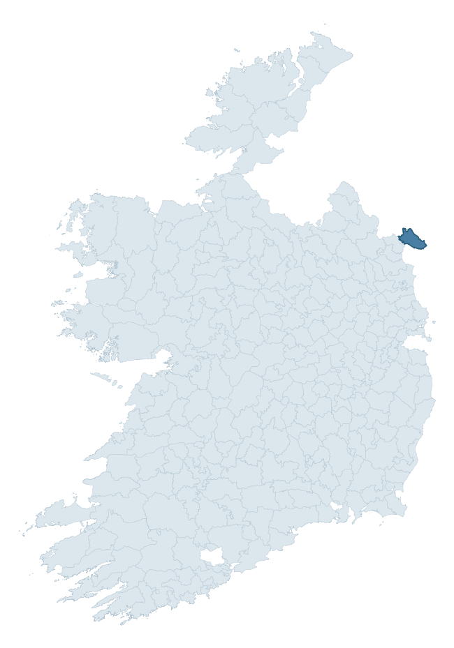
Where this barony sits in the Republic of Ireland
Geology and preservation
Bedrock geology shapes the landscape long before any settlement begins — controlling soil drainage, agricultural potential, the survival of upstanding monuments, and the preservation of buried archaeology. The figures below come from the Geological Survey Ireland 1:100,000 bedrock map.
The bedrock underlying Dundalk Lower is predominantly limestone (34% of the barony by area), with much of the rock dating to the Tertiary period. Limestone is the most heritage-rich bedrock in Ireland. It supports fertile, well-drained soils that favoured dense Early Medieval settlement and Norman manorial agriculture, and it weathers into karst features — sinkholes, caves, swallow holes, and souterrains — that frequently carry archaeology. Where peat overlies limestone, organic preservation can be exceptional. A substantial secondary geology of microgranite with granophyric texture (29%) and greywacke (20%) adds further variety to the underlying landscape. The single largest mapped unit is the Dinantian (Undifferentiated) (34% of the barony's bedrock). With 8 distinct rock types mapped, the barony sits in the top third of ROI baronies for geological diversity (78th percentile) — typically a sign of complex tectonic history or coastal mosaics of differing rock units.
Rock type composition
Largest mapped unit: Dinantian (Undifferentiated) (34% of the barony)
Placename evidence
Logainm records 11 heritage-diagnostic placenames for Dundalk Lower, a modest sample drawn predominantly from the townland record. The dominant stratum is early christian ecclesiastical. The most frequent diagnostic roots are gráinseach- (4) and ráth- (3). With a sample of this size the count should be treated as indicative rather than definitive.
Pre-Christian / Early Medieval Defensive
| Root | Count | Meaning |
|---|---|---|
| ráth- | 3 | earthen ringfort |
| lios- | 1 | ringfort or enclosure |
Early Christian Ecclesiastical
| Root | Count | Meaning |
|---|---|---|
| gráinseach- | 4 | monastic farm / grange |
| cill- | 1 | church (early) |
| teampall- | 1 | church (later medieval) |
Burial, Ritual, and Norse-Contact
| Root | Count | Meaning |
|---|---|---|
| carn- | 1 | cairn |
Other baronies in Louth
About this profile
Click any section below to expand.
What is a barony?
A barony is a historic administrative unit in Ireland, broadly equivalent to an English hundred. The 280 baronies used here are from the OSi 2019 National Statutory Boundaries (generalised 20m), covering the 26 counties of the Republic of Ireland. Baronies derive from the Norman period, were formalised in the 17th century, and have not been redrawn for statistical purposes. They vary enormously in area, from compact urban baronies in Dublin to vast upland baronies in Connacht, and should not be compared by raw site count without accounting for area differences.
What counts as a site?
This profile combines three distinct heritage registers, each with its own definition of what constitutes a recordable site:
- Archaeological sites (NMS). The National Monuments Service Sites and Monuments Record (SMR) catalogues every known archaeological monument or site of archaeological interest in the Republic, from prehistoric burial mounds and ringforts to medieval churches and post-medieval defensive works. Inclusion does not require legal protection — only that the site has been identified, surveyed, and assessed as having archaeological value. A separate subset of these sites lies within a recorded protection zone, which gives them statutory protection under the National Monuments Acts.
- Listed buildings (NIAH). The National Inventory of Architectural Heritage records buildings of architectural, historical, archaeological, artistic, cultural, scientific, social, or technical interest. Each surveyed structure is appraised on a five-tier scale: International, National, Regional, Local, and Record-Only. The NIAH appraisal is informational rather than strictly statutory, but it underpins local-authority Record of Protected Structures (RPS) listings.
- Heritage placenames (Logainm). Logainm is the authoritative database of Irish placenames maintained by the Placenames Branch. This profile applies a heritage-diagnostic classifier to the Irish-language form of each townland name, flagging roots that signal defensive sites (ráth-, lios-, dún-, caiseal-, cathair-), ecclesiastical foundations (cill-, teampall-, domhnach-, mainistir-), prehistoric burial-ritual features (tuaim-, carn-, leaba-), or Norse-contact settlement (gall-). Townlands without one of these diagnostic roots are not flagged here — they may still carry historical significance, but that significance is not encoded in the name itself.
Editorial principles
The narrative sections of this profile follow several explicit principles:
- Evidential. Every claim about this barony’s heritage character is anchored in the underlying register data. Where a site count, a placename count, or a percentile rank is cited, it is computed from the source datasets at export time, not estimated.
- Comparative. Counts and metrics are reported alongside their percentile rank against the other 279 ROI baronies. A barony with 50 ringforts in absolute terms could be unusually high or unusually low depending on its size and regional context; percentile ranking removes that ambiguity.
- Transparent on limits. Where a register has known coverage gaps, survey biases, or data-quality issues that affect this barony’s figures, the profile flags them rather than presenting the numbers as definitive.
- No interpretation beyond what the data supports. The narrative does not speculate about historical events, social dynamics, or cultural meaning beyond what the recorded heritage and placename evidence directly attests.
Data caveats and limits
- NMS Sites and Monuments Record is the product of survey campaigns conducted at different intensities across different counties and decades. Some baronies have been surveyed more thoroughly than others, and absolute counts should be read in that light. Sites destroyed by development before survey are typically not represented; sites in heavily forested or upland terrain are sometimes under-recorded.
- NIAH coverage is broadly complete for the Republic of Ireland but the survey was conducted on a rolling county-by-county basis, and the most recent appraisal date varies. Buildings demolished or substantially altered after their original survey may still appear in the register; conversely, recent buildings of merit may not yet have been appraised.
- Logainm classification applies a deliberately conservative pattern-matching approach to the Irish-language townland forms. The classifier prioritises true positives over recall: a townland may carry a heritage signal that the classifier doesn’t recognise, particularly where the diagnostic root has been heavily anglicised or where the townland name draws on a less common term. The 60,000+ townland records and ~9,800 classified placenames give a substantial signal at barony scale, but individual townland names should be checked against Logainm directly for definitive interpretation.
- Period attribution. The chronological distribution reflects only those NMS sites that carry a recognised period attribution in the source data. Sites listed as “Unknown” period are excluded from the dated subset.
- Boundary changes. Some baronies have undergone minor boundary adjustments since their 19th-century definition; the OSi 2019 generalised boundaries used here are the current statutory definition and may differ slightly from historical maps in border areas.
- Bedrock geology is mapped at 1:100,000 scale, which means local variation within a barony — small pockets of different rock type, mineral veins, alluvium overlying bedrock — is generalised. The dominant-system and rocktype figures are area-weighted, so a barony reading “70% Carboniferous limestone” may still contain small but archaeologically important pockets of older or younger rock. Around 3% of GSI polygons do not match the lexicon and contribute no rocktype or system attribution.
Data sources
- National Monuments Service — Sites and Monuments Record (SMR) https://data.gov.ie/dataset/national-monuments-service-archaeological-survey-of-ireland
- National Inventory of Architectural Heritage (NIAH) https://data.gov.ie/dataset/national-inventory-of-architectural-heritage-niah-national-dataset
- Logainm — Placenames Database of Ireland https://www.logainm.ie/
- Ordnance Survey Ireland — National Statutory Barony Boundaries 2019 https://data-osi.opendata.arcgis.com/
- EURODEM — European Digital Elevation Model https://www.mapsforeurope.org/datasets/euro-dem
- ESA WorldCover https://esa-worldcover.org/en
- Geological Survey Ireland — 1:100,000 Bedrock Geology https://www.gsi.ie/en-ie/data-and-maps/Pages/Bedrock.aspx
Explore more: Search any of the 280 ROI baronies, browse by historical province, or read the methodology and data sources for the full Republic of Ireland Heritage Tool.