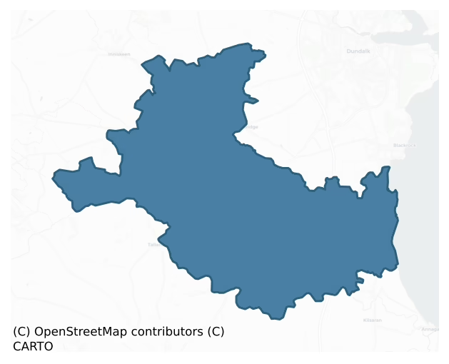
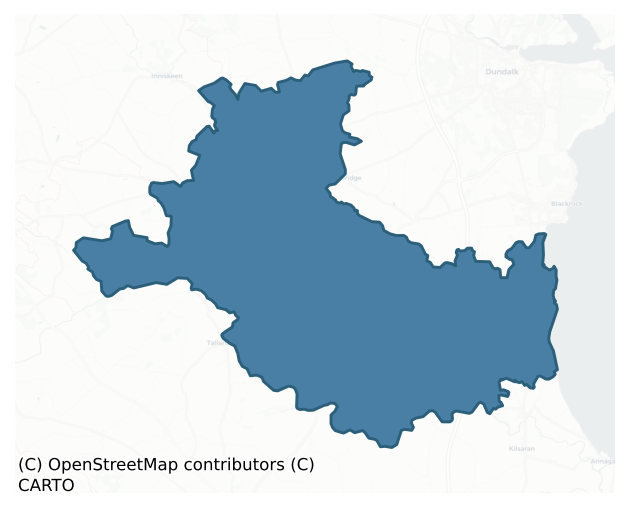
Louth is a barony of County Louth, in the historical province of Leinster (Irish: Lú), covering 104 km² of land. The barony records 308 NMS archaeological sites and 48 NIAH listed buildings, placing it at around the 80th percentile among 280 ROI baronies for sites per km². This means it is in the top fifth of all baronies for sites per km². Dated archaeological evidence runs from the Early Bronze Age through to the Modern, spanning 7 of 9 archaeological periods, placing the barony in the 47th percentile among 280 ROI baronies for chronological depth. This means it is in the lower half of all baronies for chronological depth. The largest dated subset of recorded sites dates to the Early Medieval. Logainm flags 19 placenames in the barony as carrying a recognised heritage root; the largest share — around 47% — are names associated with pre-christian defensive.
Heritage at a glance
Percentile rankings throughout this profile compare each barony only against the other 279 Republic of Ireland baronies.
The recorded heritage of Louth
The National Monuments Service Sites and Monuments Record (SMR) is the statutory inventory of archaeological sites for the Republic of Ireland, maintained by the Department of Tourism, Culture, Arts, Gaeltacht, Sport and Media. Sites recorded here include earthworks, ringforts, megalithic tombs, ecclesiastical remains, and post-medieval features; not every record is legally protected, but each is registered as a monument of archaeological interest.
The National Monuments Service records 308 archaeological sites in Louth, putting it at the 80th percentile among 280 ROI baronies for sites per km². This means it is in the top fifth of all baronies for sites per km². Protection coverage is near-universal — 301 sites (98%) fall within a recorded monument protection zone, indicating an extensively surveyed landscape. The dominant category is defensive sites — ringforts, enclosures, hillforts, and stone forts (170 sites, 55% of the record). The most diagnostically specific type is Souterrain (58 records, 19% of the barony's NMS total) — compared to an ROI average of 4% across all baronies where this type occurs. Souterrain is an underground stone-built passage and chamber, generally Early Medieval and often associated with ringforts as a defensive or storage feature. The broader 'Enclosure' classification — which catches unclassified ringforts and field enclosures — accounts for a further 69 records (22%) and reflects the difficulty of sub-classifying degraded earthworks from surface evidence alone. Across the barony's 104 km², this gives a recorded density of 2.96 sites per km².
Most common monument types
Hover or tap a monument type to see its definition.
| Type | Count |
|---|---|
| Enclosure a banked or ditched feature of uncertain type, used as a catch-all where the original function cannot be determined from surface evidence | 69 |
| Souterrain an underground stone-built passage and chamber, generally Early Medieval and often associated with ringforts as a defensive or storage feature | 58 |
| Ringfort – rath an earthen ringfort enclosed by a bank and external ditch — the most common Early Medieval farmstead, broadly dated 500–1000 AD | 20 |
| Ring-ditch a circular ditch under 20m across, often the ploughed-out remains of a barrow, ring-barrow or roundhouse | 19 |
| Church a building used for public Christian worship, of any date from c. 500 AD onwards | 14 |
| Field system a group of related fields forming a coherent agricultural landscape, of any date from the Neolithic onwards | 13 |
| Graveyard a burial area associated with a church, in use from the medieval period onwards | 11 |
| Rock art geometric and other motifs carved on earthfast boulders or rock outcrops, mainly Bronze Age but with possible Neolithic origins | 8 |
Chronological distribution
The dated archaeological record for Louth spans from the Early Bronze Age through to the Modern, with activity attested across 7 of 9 archaeological periods. Every period from earliest to latest is represented in the record — an unbroken sequence of dated activity across the full chronological span. Activity concentrates most heavily in the Early Medieval (92 sites, 40% of dated material), with the Iron Age forming a secondary peak (83 sites, 36%). A further 79 recorded sites (26% of the overall NMS register for the barony) carry no period attribution — appearing as 'Unknown' in the bar chart below. This typically reflects either records that pre-date the standardised period vocabulary or sites awaiting specialist dating review, rather than a genuine absence of chronological evidence.
Sample of recorded monuments
Show 25 sample monuments (of 308 total)
A representative sample of 25 recorded monuments drawn from the barony’s 308 total NMS entries. Sites within a recorded monument protection zone and rarer site types are prioritised so the list shows a meaningful cross-section rather than only the most common type. Each entry shows the official Sites and Monuments Record reference number and the description published by the National Monuments Service.
Rock art (present location)
The following description is derived from both the published 'Archaeological Inventory of County Louth' (Dublin: Stationery Office, 1986) and the 'Archaeological Survey of County Louth' (Dublin: Stationery Office,…
The following description is derived from both the published 'Archaeological Inventory of County Louth' (Dublin: Stationery Office, 1986) and the 'Archaeological Survey of County Louth' (Dublin: Stationery Office, 1991). In certain instances the entries have been revised and updated in the light of recent research.
Date of upload/revision: 17 July 2007
Two sets of multiple circles with radial grooves found on a large stone discovered several inches below the field surface, 30m E of Tullagee house. Subsequently erected on the lawn of Tullagee house. (Tempest 1933, 72-4).
Mass-rock
Local tradition of a Mass Rock at SE of possible burial ground (LH006-047001-).
Compiled by: Claire Breen
Date of upload: 9 December 2011
Children's burial ground
The following description is derived from both the published 'Archaeological Inventory of County Louth' (Dublin: Stationery Office, 1986) and the 'Archaeological Survey of County Louth' (Dublin: Stationery Office,…
The following description is derived from both the published 'Archaeological Inventory of County Louth' (Dublin: Stationery Office, 1986) and the 'Archaeological Survey of County Louth' (Dublin: Stationery Office, 1991). In certain instances the entries have been revised and updated in the light of recent research.
Date of upload/revision: 17 July 2007
A trapezoidal platform (max. dims. 26m E-W, 23m N-S, H c. 1m) with a very slight, and in places much-degraded, bank around its perimeter. The platform is quite steep-sided in places and its surface is strewn with large stones. There is no obvious evidence of any structure within the enclosed area. Souterrain LH006-052002- is situated just to the E of the site. (CLAJ 1942, 106; CLAJ 1961, 5)
Windmill
Indicated on Taylor and Skinner's map (1777) and 'Ruins of Windmill' noted on the 1835 'OS 6-inch' map.
Compiled by: Claire Breen
Date of upload: 13 December 2011
Building
Wright (1758, bk I, pl. XIII) depicts a hexagonal feature on top of motte (LH006-076001-), and there is a slight bank still on its perimeter.
Reference:
Compiled by: Claire Breen
Date of upload: 23 November 2011
Cairn – unclassified
The following description is derived from both the published 'Archaeological Inventory of County Louth' (Dublin: Stationery Office, 1986) and the 'Archaeological Survey of County Louth' (Dublin: Stationery Office,…
The following description is derived from both the published 'Archaeological Inventory of County Louth' (Dublin: Stationery Office, 1986) and the 'Archaeological Survey of County Louth' (Dublin: Stationery Office, 1991). In certain instances the entries have been revised and updated in the light of recent research.
Date of upload/revision: 17 July 2007
Circular cairn (diam. c. 8m) conjoined with cropmark ring (LH011-044003-) (diam. c. 15m). (CUCAP, BDP 45)
Well
Marked on the 1835 OS 6-inch' map as 'Sunday Well'.
Compiled by: Claire Breen
Date of upload: 5 April 2012
Bullaun stone
The following description is derived from both the published 'Archaeological Inventory of County Louth' (Dublin: Stationery Office, 1986) and the 'Archaeological Survey of County Louth' (Dublin: Stationery Office,…
The following description is derived from both the published 'Archaeological Inventory of County Louth' (Dublin: Stationery Office, 1986) and the 'Archaeological Survey of County Louth' (Dublin: Stationery Office, 1991). In certain instances the entries have been revised and updated in the light of recent research.
Date of upload/revision: 17 July 2007
In grounds of present church is said to be the site of an earlier church which is recorded as being ruinous in 1692. There are no visible remains. Bullaun stone (LH011-076002-) in SE corner of graveyard. (CLAJ 1942, 103)
Historic town
The Archaeological Survey of Ireland (ASI) is in the process of providing information on all monuments on The Historic Environment Viewer (HEV). Currently the information for this record has not been uploaded. To…
The Archaeological Survey of Ireland (ASI) is in the process of providing information on all monuments on The Historic Environment Viewer (HEV). Currently the information for this record has not been uploaded. To access available information for research purposes please make an appointment in advance with the Archive Unit (open Fridays 10.00 am – 5.00 pm), Department of Culture, Heritage and the Gaeltacht, The Custom House, Dublin 1 D01W6XO or email nmarchive@chg.gov.ie.
Religious house – Augustinian canons
The following description is derived from both the published 'Archaeological Inventory of County Louth' (Dublin: Stationery Office, 1986) and the 'Archaeological Survey of County Louth' (Dublin: Stationery Office,…
The following description is derived from both the published 'Archaeological Inventory of County Louth' (Dublin: Stationery Office, 1986) and the 'Archaeological Survey of County Louth' (Dublin: Stationery Office, 1991). In certain instances the entries have been revised and updated in the light of recent research.
Date of upload/revision: 17 July 2007
The only standing remains are parts of a large medieval church. The site is thought to have been founded by St Mochta in the sixth century but the monastery of the Virgin Mary (the present remains) was refounded in 1148 (CLAJ 1942, 103). The church is very long (c. 46.5m); the basal portion of a wall projecting from the S wall is possibly the remains of a central tower or a rood screen with loft over. In the Visitation Books of 1690 there is mention of a steeple with three bells therein (Leslie 1908, 195), which may refer to a central bell-tower. The standing remains are built of roughly coursed limestone, rubble and greywacke. Two thirds of the N wall have been destroyed down to ground level and replaced with a modern one. The nave has the remains of a three-light traceried window high up in the W gable, constructed of grey sandstone dressed by diagonal tooling. The remains of a doorway, now narrowed and rebuilt, are situated in the S wall c. 8m from the SW angle. It is flat-headed with large plain lintels and limestone slab sill stones. There are the remains of one window in the S wall near the cross-wall but it has be…
Holed stone
A holed stone located in graveyard (LH011-115006-), used as a grave marker.
Compiled by: Claire Breen
Date of upload: 12 April 2012
Moated site
Sub-rectangular enclosure (38m E-W, 30m N-S) defined by two closely spaced fosses visible on aerial photographs (CUCAP, AJZ 2; GB89.B.15).
Compiled by: Claire Breen
Date of upload: 13 April 2012
Barrow – unclassified
The following description is derived from both the published 'Archaeological Inventory of County Louth' (Dublin: Stationery Office, 1986) and the 'Archaeological Survey of County Louth' (Dublin: Stationery Office,…
The following description is derived from both the published 'Archaeological Inventory of County Louth' (Dublin: Stationery Office, 1986) and the 'Archaeological Survey of County Louth' (Dublin: Stationery Office, 1991). In certain instances the entries have been revised and updated in the light of recent research.
Date of upload/revision: 17 July 2007
Situated on a level plain, immediately S of the old course of the River Fane. Originally a rougly circular, earthen, flat-topped mound (diam. 12.5m N-S, 8.8m E-W on top; overall dims. 20m N-S, 17.5m E-W; H 1.8m) enclosed by three fosses and three banks from E-S-W. Innermost fosse Wth 3.7m, D 0.3m; first intervening bank Wth 7m, H 0.3m; middle fosse Wth 5m, D 1m. The second intervening bank (Wth 6.5m, H 0.5m) is enclosed by a shallow outer fosse (Wth 3m, D 0.3m) and a large but degraded outer bank (Wth 8m, H 0.2m).
The outer bank may have been added to by alluvial deposits in the course of flooding, and Wright (1758, pl. 5) shows the ditches as flooded. The central mound has been affected by erosion, particularly on the N side, and though Wright records that part of the mound was cut away in deepening the river it is clear that the earthworks did not extend to the N of the river.
The site is variously referred to as 'Cnoc-an-innse' (CLAJ 1925, 46) or'Dundugan'. Owing to its location and nature it has been variously described as a ringfort or a motte. The site may be a hybrid form of large ring-barrow and bell-barrow…
Cross – High cross
Part of the head of a high cross erected on a modern shaft and base, is situated in the graveyard (LH012-046002-) to the E of the round tower (LH012-046003-). It is made of granite with arms and ring surviving, but not…
Part of the head of a high cross erected on a modern shaft and base, is situated in the graveyard (LH012-046002-) to the E of the round tower (LH012-046003-). It is made of granite with arms and ring surviving, but not the top or lower portions of the head. The E face has a central square panel with relief decoration of four coiling dragons emanating from a central boss. A sunken panel on the S arm shows a horseman and deer; that on the N arm has a horse with prostate headless body preceded by two human figures. A winged figure in a sunken panel is seen below the central panel. The W face has a large central boss with spiral pattern. A double ribbon cross carved in light relief extends across the arms, head and below the boss. It is knotted at the extremities and where the head, shaft and arms meet the central boss. This is a national monument in State Care (no. 92). (Buckley and Sweetman 1991, 226-7; Harbison 1992, 69)
See the attached view from ESE
Revised by: Paul Walsh
Revised date of upload: 31 August 2015
Chapel
The following description is derived from both the published 'Archaeological Inventory of County Louth' (Dublin: Stationery Office, 1986) and the 'Archaeological Survey of County Louth' (Dublin: Stationery Office,…
The following description is derived from both the published 'Archaeological Inventory of County Louth' (Dublin: Stationery Office, 1986) and the 'Archaeological Survey of County Louth' (Dublin: Stationery Office, 1991). In certain instances the entries have been revised and updated in the light of recent research.
Date of upload/revision: 17 July 2007
According to the Visitation of 1622 there was a chapel at 'Lurgan'. No visible surface trace. (Leslie 1908, 188, 196, 208).
Ecclesiastical site
The following description is derived from both the published 'Archaeological Inventory of County Louth' (Dublin: Stationery Office, 1986) and the 'Archaeological Survey of County Louth' (Dublin: Stationery Office,…
The following description is derived from both the published 'Archaeological Inventory of County Louth' (Dublin: Stationery Office, 1986) and the 'Archaeological Survey of County Louth' (Dublin: Stationery Office, 1991). In certain instances the entries have been revised and updated in the light of recent research.
Date of upload/revision: 17 July 2007
Site of Baltray abbey traditionally located in haggard close to sea. No visible surface trace. Down Survey records a tower at this site. (CLAJ 1942, 102)
Platform – peatland
Exposed during pre-development archaeological testing (Excavation Licence No. 99E0330). Excavation initially uncovered a layer of irregularly arranged branches, root fragments and possible reeds or rushes. Below this…
Exposed during pre-development archaeological testing (Excavation Licence No. 99E0330). Excavation initially uncovered a layer of irregularly arranged branches, root fragments and possible reeds or rushes. Below this layer were a number of longitudinal and transverse timbers and more irregularly arranged roots and branches set in peat. The exact function of this feature is not clear as no diagnostic artefacts were found. (Murphy and Conway 2000, 205-7)
Compiled by: Claire Breen
Date of upload: 4 May 2012
Road – unclassified togher
Exposed during pre-development archaeological testing (Excavation Licence No. 99E0330). Excavation uncovered a series of timbers lying in a N-S direction set on irregularly placed branches which in turn sat on peaty…
Exposed during pre-development archaeological testing (Excavation Licence No. 99E0330). Excavation uncovered a series of timbers lying in a N-S direction set on irregularly placed branches which in turn sat on peaty soil. (Murphy and Conway 2000, 205-7)
Compiled by: Claire Breen
Date of upload: 4 May 2012
Cross-slab
This slab was discovered by chance in 2001 in a field in Babeswood. The slab is broken and its extremity mesures are 0.13 H, 0.26m W and 0.045m T. Each of the four sides is broken but the cross-design is almost…
This slab was discovered by chance in 2001 in a field in Babeswood. The slab is broken and its extremity mesures are 0.13 H, 0.26m W and 0.045m T. Each of the four sides is broken but the cross-design is almost complete. The cross is set inside a rame which formed by a double incised margin: only parts of two sides of the frame remains. The cross is similarly formed with double incesed lines and comprises the remains of an equal-armed Maltese cross with rounded armpits. Within each remaining terminal are set three dots and outside the cross, within each armpit, is a further dot. At the centre of the cross is the remains of an inscription comprising four or five letters. These are incised in one horizontal line and the following has been read: da[ic.]. The reading of the letters within the square brackets is uncertain and the dot indicates a possible remnant of a fith letter. The letters are likely to represent a person's name. This slab is on display in the County Museum, Dundalk (see LH007-189—-). (Okasha 2005)
Compiled by: Paul Walsh
Date of upload: 14 November 2012
Gatehouse
Darver castle (LH011-096—-) occupies the NW side of a bawn (LH011-096001-), of which nothing else remains except the gatehouse. This is an ivy-covered structure with a barrel-vault over the entrance avenue to the…
Darver castle (LH011-096—-) occupies the NW side of a bawn (LH011-096001-), of which nothing else remains except the gatehouse. This is an ivy-covered structure with a barrel-vault over the entrance avenue to the castle, which would have been on the NE wall of the bawn.
Compiled by: Michael Moore
Date of upload: 16 November 2015
Linear earthwork
Linear cropmarks of uncertain significance visible on aerial photograph (CUCAP, AYM 38). Located c. 50m SE of enclosure (LH006-051001-).
Ritual site – holy well
Marked 'St. Patrick's Well' on the 1835 and 1910 'OS 6-inch' maps. According to the OS Letters a station was held here. It is an almost square pool, 1.5m across, surrounded by outcrop and a stone setting. Various local…
Marked 'St. Patrick's Well' on the 1835 and 1910 'OS 6-inch' maps. According to the OS Letters a station was held here. It is an almost square pool, 1.5m across, surrounded by outcrop and a stone setting. Various local legends and cures associated with it (IFC Schools MSS 933, 128-9) and it was noted that rags, medals and walking sticks were left on a bush alongside, long ago (IFC Schools MSS 665, 175). By 1966 it was no longer visited.
Compiled by: Claire Breen
Date of upload: 23 November 2011
Castle – motte
A roughly circular mound (max. diam. c. 51m at base, c. 29m at top, H 5.8m-6.8m) with remains of fosse (max. Wth at top 11.5m, Wth at base 2m) all around. There is a large bank (Wth c. 3.7m originally, now max. Wth…
A roughly circular mound (max. diam. c. 51m at base, c. 29m at top, H 5.8m-6.8m) with remains of fosse (max. Wth at top 11.5m, Wth at base 2m) all around. There is a large bank (Wth c. 3.7m originally, now max. Wth 7.2m) outside the fosse from NE-NW. The surface of the top of the mound is uneven and slopes downwards towards the centre where it has been quarried. Stone facing can be seen in the S face of the mound in its mid section. The outside of the bank is faced with drystone work, probably modern, which extends across the fosse at the W and NE sides of the mound and forms a facing to the base of the motte where the bank is absent. The site was partially excavated in 1872 (Reade 1875, 322), and pottery and a bronze prick spur were found near the base of the mound. A souterrain (LH006-073002-) is situated in the W portion of the motte and another (LH006-072—-) is c. 50m to the W. (Orpen 1908, 254-5; M W 1908, 85; Wright 1758, bk I, pl. VI)
The above description is derived from both the published 'Archaeological Inventory of County Louth' (Dublin: Stationery Office, 1986) and the 'Archaeological Survey of County Louth' (Dublin: Stationery Office, 1991). In certain instances the entries have been revised and updated in the light of recent research.
Date of upload: 17 July 2007
Cross
Marked 'The White Cross' on the 1835 and 1911 'OS 6-inch' maps. A small wayside cross (H 0.77m, Wth 0.27m, T 0.18m) resting on a square base which in turn is set into a modern concrete plinth. It bears the inscription…
Marked 'The White Cross' on the 1835 and 1911 'OS 6-inch' maps. A small wayside cross (H 0.77m, Wth 0.27m, T 0.18m) resting on a square base which in turn is set into a modern concrete plinth. It bears the inscription 'Pray for the soul of Mr. George Taaffe, who departed this life 10th March Anuis Domini 1723'. A large heart is engraved on the front lower part of the shaft and a linear ornament on its upper part. A triangle is inscribed on its back. (ASI field notes, 1966)
Compiled by: Claire Breen
Date of upload: 5 April 2012
Enclosure
The following description is derived from both the published 'Archaeological Inventory of County Louth' (Dublin: Stationery Office, 1986) and the 'Archaeological Survey of County Louth' (Dublin: Stationery Office,…
The following description is derived from both the published 'Archaeological Inventory of County Louth' (Dublin: Stationery Office, 1986) and the 'Archaeological Survey of County Louth' (Dublin: Stationery Office, 1991). In certain instances the entries have been revised and updated in the light of recent research.
Date of upload/revision: 17 July 2007
Cropmark arc probably representing roughly circular enclosure (max. diam. c. 38m NE-SW) on aerial photograph (CUCAP, AYM 38). Some 50m SE of site are linear cropmarks (LH006-051002-) of uncertain significance.
Listed buildings
The National Inventory of Architectural Heritage (NIAH) is a state survey appraising buildings of architectural, historical, archaeological, artistic, cultural, scientific, social, or technical interest. Each surveyed structure receives a rating from International (the highest, for buildings of European importance) through National, Regional, Local, and Record-Only.
The NIAH records 48 listed buildings in Louth (23rd percentile across ROI baronies). All recorded buildings carry Regional or lower grading; the barony does not contain any structures appraised as being of National or International architectural importance. Construction dates concentrate most heavily in the Victorian (1830-1900) period. The most-recorded building type is house (20 examples, 42% of the listed stock).
Terrain and environment
Mean elevation across the barony is 24m — the 2nd percentile among 280 ROI baronies for elevation. This means it is in the bottom tenth of all baronies for elevation. This is a relatively low-lying landscape by ROI standards. Elevation matters for heritage because higher-altitude baronies typically favour defensive monuments — ringforts and hilltop forts placed on prominent ground — while lowland baronies are more likely to carry the dense settlement and church networks of intensive agricultural landscapes. Mean slope is 2.8° — the 35th percentile among 280 ROI baronies for slope. This means it is in the lower half of all baronies for slope. Slope is a key control on both land use and archaeological preservation: steep ground resists ploughing and tends to preserve earthworks intact, while gentle slopes favour intensive cultivation that damages or destroys surface archaeology over time. The Topographic Wetness Index averages 11.2, the 65th percentile among 280 ROI baronies for wetness. This means it is in the upper half of all baronies for wetness. Drainage matters for heritage because poorly-drained ground preserves organic archaeology (wooden trackways, leather, textiles, and on rare occasions human remains) far better than free-draining soil; well-drained ground favours arable use but destroys organic material rapidly. The land-cover mosaic combines improved grassland (53%), arable farmland (38%), and woodland (7%), giving a mixed agricultural and semi-natural landscape.
Terrain measurements
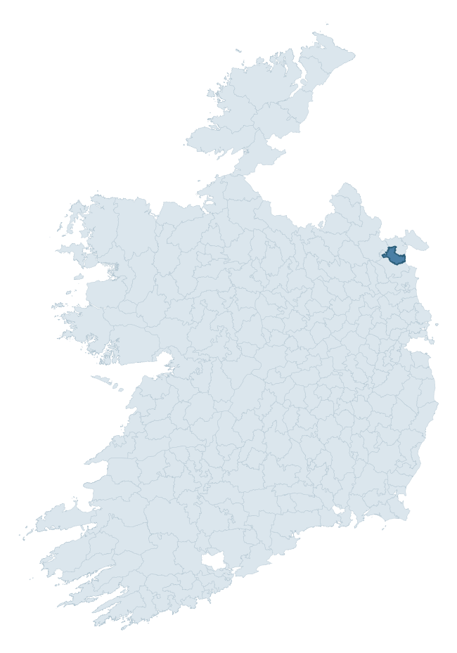
Where this barony sits in the Republic of Ireland
Geology and preservation
Bedrock geology shapes the landscape long before any settlement begins — controlling soil drainage, agricultural potential, the survival of upstanding monuments, and the preservation of buried archaeology. The figures below come from the Geological Survey Ireland 1:100,000 bedrock map.
The bedrock underlying Louth is predominantly greywacke (100% of the barony by area), laid down during the Silurian period (100% by area, around 444 to 419 million years ago). Greywacke is a hard, dark, fine-grained sandstone that weathers to thin upland soils. Greywacke baronies typically carry sparser settlement archaeology but provide high-quality building stone visible in older field walls and farm buildings. The single largest mapped unit is the Clontail Formation (100% of the barony's bedrock). With only 1 distinct rock type mapped, the barony is geologically uniform compared to the rest of the Republic (5th percentile for diversity) — a single coherent bedrock landscape.
Largest mapped unit: Clontail Formation (100% of the barony)
Placename evidence
Logainm records 19 heritage-diagnostic placenames for Louth, drawn from townland and civil-parish names across the barony. The dominant stratum is pre-Christian and Early Medieval defensive — ráth-, lios-, dún-, and caiseal-prefixed names that mark Iron Age and early historic settlement. The leading diagnostic roots are ráth- (9 — earthen ringfort), cill- (3 — church), and cillín- (3 — killeen). This is below the ROI average of 30.7 heritage placenames per barony, suggesting either lighter survey coverage or a townland-naming tradition that draws more on generic landscape vocabulary. The presence of multiple heritage strata side by side indicates layered occupation of the landscape across successive prehistoric and historic periods. Logainm records 96 placenames for Louth (predominantly townland names). Of these, 19 (20%) carry one of the diagnostic Gaelic roots tracked above; the remainder draw on more generic landscape vocabulary that does not encode a heritage period.
Pre-Christian / Early Medieval Defensive
| Root | Count | Meaning |
|---|---|---|
| ráth- | 9 | earthen ringfort |
Early Christian Ecclesiastical
| Root | Count | Meaning |
|---|---|---|
| cill- | 3 | church (early) |
| cillín- | 3 | unconsecrated burial ground |
| gráinseach- | 2 | monastic farm / grange |
Burial, Ritual, and Norse-Contact
| Root | Count | Meaning |
|---|---|---|
| tuaim- | 1 | burial mound |
| carn- | 1 | cairn |
Other baronies in Louth
About this profile
Click any section below to expand.
What is a barony?
A barony is a historic administrative unit in Ireland, broadly equivalent to an English hundred. The 280 baronies used here are from the OSi 2019 National Statutory Boundaries (generalised 20m), covering the 26 counties of the Republic of Ireland. Baronies derive from the Norman period, were formalised in the 17th century, and have not been redrawn for statistical purposes. They vary enormously in area, from compact urban baronies in Dublin to vast upland baronies in Connacht, and should not be compared by raw site count without accounting for area differences.
What counts as a site?
This profile combines three distinct heritage registers, each with its own definition of what constitutes a recordable site:
- Archaeological sites (NMS). The National Monuments Service Sites and Monuments Record (SMR) catalogues every known archaeological monument or site of archaeological interest in the Republic, from prehistoric burial mounds and ringforts to medieval churches and post-medieval defensive works. Inclusion does not require legal protection — only that the site has been identified, surveyed, and assessed as having archaeological value. A separate subset of these sites lies within a recorded protection zone, which gives them statutory protection under the National Monuments Acts.
- Listed buildings (NIAH). The National Inventory of Architectural Heritage records buildings of architectural, historical, archaeological, artistic, cultural, scientific, social, or technical interest. Each surveyed structure is appraised on a five-tier scale: International, National, Regional, Local, and Record-Only. The NIAH appraisal is informational rather than strictly statutory, but it underpins local-authority Record of Protected Structures (RPS) listings.
- Heritage placenames (Logainm). Logainm is the authoritative database of Irish placenames maintained by the Placenames Branch. This profile applies a heritage-diagnostic classifier to the Irish-language form of each townland name, flagging roots that signal defensive sites (ráth-, lios-, dún-, caiseal-, cathair-), ecclesiastical foundations (cill-, teampall-, domhnach-, mainistir-), prehistoric burial-ritual features (tuaim-, carn-, leaba-), or Norse-contact settlement (gall-). Townlands without one of these diagnostic roots are not flagged here — they may still carry historical significance, but that significance is not encoded in the name itself.
Editorial principles
The narrative sections of this profile follow several explicit principles:
- Evidential. Every claim about this barony’s heritage character is anchored in the underlying register data. Where a site count, a placename count, or a percentile rank is cited, it is computed from the source datasets at export time, not estimated.
- Comparative. Counts and metrics are reported alongside their percentile rank against the other 279 ROI baronies. A barony with 50 ringforts in absolute terms could be unusually high or unusually low depending on its size and regional context; percentile ranking removes that ambiguity.
- Transparent on limits. Where a register has known coverage gaps, survey biases, or data-quality issues that affect this barony’s figures, the profile flags them rather than presenting the numbers as definitive.
- No interpretation beyond what the data supports. The narrative does not speculate about historical events, social dynamics, or cultural meaning beyond what the recorded heritage and placename evidence directly attests.
Data caveats and limits
- NMS Sites and Monuments Record is the product of survey campaigns conducted at different intensities across different counties and decades. Some baronies have been surveyed more thoroughly than others, and absolute counts should be read in that light. Sites destroyed by development before survey are typically not represented; sites in heavily forested or upland terrain are sometimes under-recorded.
- NIAH coverage is broadly complete for the Republic of Ireland but the survey was conducted on a rolling county-by-county basis, and the most recent appraisal date varies. Buildings demolished or substantially altered after their original survey may still appear in the register; conversely, recent buildings of merit may not yet have been appraised.
- Logainm classification applies a deliberately conservative pattern-matching approach to the Irish-language townland forms. The classifier prioritises true positives over recall: a townland may carry a heritage signal that the classifier doesn’t recognise, particularly where the diagnostic root has been heavily anglicised or where the townland name draws on a less common term. The 60,000+ townland records and ~9,800 classified placenames give a substantial signal at barony scale, but individual townland names should be checked against Logainm directly for definitive interpretation.
- Period attribution. The chronological distribution reflects only those NMS sites that carry a recognised period attribution in the source data. Sites listed as “Unknown” period are excluded from the dated subset.
- Boundary changes. Some baronies have undergone minor boundary adjustments since their 19th-century definition; the OSi 2019 generalised boundaries used here are the current statutory definition and may differ slightly from historical maps in border areas.
- Bedrock geology is mapped at 1:100,000 scale, which means local variation within a barony — small pockets of different rock type, mineral veins, alluvium overlying bedrock — is generalised. The dominant-system and rocktype figures are area-weighted, so a barony reading “70% Carboniferous limestone” may still contain small but archaeologically important pockets of older or younger rock. Around 3% of GSI polygons do not match the lexicon and contribute no rocktype or system attribution.
Data sources
- National Monuments Service — Sites and Monuments Record (SMR) https://data.gov.ie/dataset/national-monuments-service-archaeological-survey-of-ireland
- National Inventory of Architectural Heritage (NIAH) https://data.gov.ie/dataset/national-inventory-of-architectural-heritage-niah-national-dataset
- Logainm — Placenames Database of Ireland https://www.logainm.ie/
- Ordnance Survey Ireland — National Statutory Barony Boundaries 2019 https://data-osi.opendata.arcgis.com/
- EURODEM — European Digital Elevation Model https://www.mapsforeurope.org/datasets/euro-dem
- ESA WorldCover https://esa-worldcover.org/en
- Geological Survey Ireland — 1:100,000 Bedrock Geology https://www.gsi.ie/en-ie/data-and-maps/Pages/Bedrock.aspx
Explore more: Search any of the 280 ROI baronies, browse by historical province, or read the methodology and data sources for the full Republic of Ireland Heritage Tool.