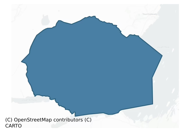
Ross is a barony of County Mayo, in the historical province of Connacht (Irish: An Ros), covering 105 km² of land. The barony records 24 NMS archaeological sites and 4 NIAH listed buildings, placing it at around the 0th percentile among 280 ROI baronies for sites per km². This means it is in the bottom tenth of all baronies for sites per km². Dated archaeological evidence runs from the Neolithic through to the Modern, spanning 8 of 9 archaeological periods, placing the barony in the 51st percentile among 280 ROI baronies for chronological depth. This means it is in the upper half of all baronies for chronological depth. The largest dated subset of recorded sites dates to the Early Medieval.
Heritage at a glance
Percentile rankings throughout this profile compare each barony only against the other 279 Republic of Ireland baronies.
The recorded heritage of Ross
The National Monuments Service Sites and Monuments Record (SMR) is the statutory inventory of archaeological sites for the Republic of Ireland, maintained by the Department of Tourism, Culture, Arts, Gaeltacht, Sport and Media. Sites recorded here include earthworks, ringforts, megalithic tombs, ecclesiastical remains, and post-medieval features; not every record is legally protected, but each is registered as a monument of archaeological interest.
The National Monuments Service records 24 archaeological sites in Ross, putting it at the 0th percentile among 280 ROI baronies for sites per km². This means it is in the bottom tenth of all baronies for sites per km². A sparse recorded total of this kind in Ireland often reflects survey priority rather than genuine absence of past activity. Protection coverage is near-universal — 23 sites (96%) fall within a recorded monument protection zone, indicating an extensively surveyed landscape. The record is dominated by ecclesiastical sites — churches, graveyards, and holy wells (9 sites, 38% of the total), with defensive sites forming a substantial secondary presence (6 sites, 25%). The most diagnostically specific type is Church (2 records, 8% of the barony's NMS total) — compared to an ROI average of 4% across all baronies where this type occurs. Church is a building used for public Christian worship, of any date from c. 500 AD onwards. The broader 'Enclosure' classification — which catches unclassified ringforts and field enclosures — accounts for a further 6 records (25%) and reflects the difficulty of sub-classifying degraded earthworks from surface evidence alone.
Most common monument types
Hover or tap a monument type to see its definition.
| Type | Count |
|---|---|
| Enclosure a banked or ditched feature of uncertain type, used as a catch-all where the original function cannot be determined from surface evidence | 6 |
| Church a building used for public Christian worship, of any date from c. 500 AD onwards | 2 |
| Children's burial ground an unconsecrated medieval and early-modern burial ground for unbaptised or stillborn children, often called a cillín or ceallúnach | 2 |
| Graveyard a burial area associated with a church, in use from the medieval period onwards | 2 |
| Ritual site – holy well a well or spring traditionally associated with a saint, often credited with healing properties; many trace earlier ritual origins but devotion is documented from the medieval period onwards | 2 |
Chronological distribution
The dated archaeological record for Ross spans from the Neolithic through to the Modern, with activity attested across 8 of 9 archaeological periods. Every period from earliest to latest is represented in the record — an unbroken sequence of dated activity across the full chronological span. Activity concentrates most heavily in the Early Medieval (36 sites, 48% of dated material), with the Iron Age forming a secondary peak (17 sites, 23%). A further 54 recorded sites (42% of the overall NMS register for the barony) carry no period attribution — appearing as 'Unknown' in the bar chart below. This typically reflects either records that pre-date the standardised period vocabulary or sites awaiting specialist dating review, rather than a genuine absence of chronological evidence.
Sample of recorded monuments
Show all 24 recorded monuments
All 24 recorded monuments in the barony. Each entry shows the official Sites and Monuments Record reference number and the description published by the National Monuments Service.
Building
The Archaeological Survey of Ireland (ASI) is in the process of providing information on all monuments on The Historic Environment Viewer (HEV). Currently the information for this record has not been uploaded. To…
The Archaeological Survey of Ireland (ASI) is in the process of providing information on all monuments on The Historic Environment Viewer (HEV). Currently the information for this record has not been uploaded. To access available information for research purposes please make an appointment in advance with the Archive Unit (open Fridays 10.00 am – 5.00 pm), Department of Culture, Heritage and the Gaeltacht, The Custom House, Dublin 1 D01W6XO or email nmarchive@chg.gov.ie.
Megalithic tomb – wedge tomb
The Archaeological Survey of Ireland (ASI) is in the process of providing information on all monuments on The Historic Environment Viewer (HEV). Currently the information for this record has not been uploaded. To…
The Archaeological Survey of Ireland (ASI) is in the process of providing information on all monuments on The Historic Environment Viewer (HEV). Currently the information for this record has not been uploaded. To access available information for research purposes please make an appointment in advance with the Archive Unit (open Fridays 10.00 am – 5.00 pm), Department of Culture, Heritage and the Gaeltacht, The Custom House, Dublin 1 D01W6XO or email nmarchive@chg.gov.ie.
Bullaun stone
Located at the site of a church (MA117-009001-), in the N half of a graveyard (MA117-009002-).
This bullaun stone consists of a block of sandstone (Wth 0.4m by 0.42m at top, 0.14m by 0.3m at base; H 0.26m) with a…
Located at the site of a church (MA117-009001-), in the N half of a graveyard (MA117-009002-).
This bullaun stone consists of a block of sandstone (Wth 0.4m by 0.42m at top, 0.14m by 0.3m at base; H 0.26m) with a bowl-shaped, circular depression (diam. 0.25m; D 0.1m) in the upper surface. The stone is roughly square in horizontal cross-section at top but narrows at the base, so that in vertical cross-section it is roughly V-shaped, with a blunted base. It has rounded or gently curved edges, except on one side (now at W) where there is a sheer vertical face. The top of the circular depression grades gently into the top surface of the stone; the sides incline inwards steeply to a narrow base. The bullaun stone is set on a small pedestal of cement, on top of the low rebuilt E wall of a church (MA117-009001-).
Images:
MA117-009003-_01.JPG
MA117-009003-_02.JPG
Compiled by: Jane O'Shaughnessy
Date of revised upload: 25 July 2017
Barrow – ring-barrow
In rough pasture, located on a natural rise or terrace on the lower S-facing slopes of the Partry Mountains, overlooking the western shores of Lough Mask, with the skyline at S−SW dominated by the dramatic ridges of…
In rough pasture, located on a natural rise or terrace on the lower S-facing slopes of the Partry Mountains, overlooking the western shores of Lough Mask, with the skyline at S−SW dominated by the dramatic ridges of Maumtrasna Mountain. This ringbarrow consists of a flat circular area (diam. 2m; H 0.2m above fosse) enclosed by a fosse. The fosse (Wth 0.8m) is sharply defined and also deeper (D 0.5m) relative to external ground level at SSW−NW, where it cuts through a slight natural rise in surrounding ground level; elsewhere it is evident as a poorly defined, shallow depression (ext. D 0.2m). It was noted during an inspection in 1999 that the barrow lacked a clearly defined outer bank. An inspection in 2017, found a hint of a rise (Wth c. 0.6m) immediately outside the fosse at W−NW. It is marked by shorter grass growth, and might represent the remnants of a levelled external bank, but it cannot be traced elsewhere around the circuit. The diameter of the barrow to the external edge of the fosse is 4m. There is a stone row (MA116A005001-) 2m to W. Another stone row (MA116A006001-) and a cairn (MA116A006002-) are located 300m to WSW.
Images:
MA116A005002-_01.JPG Viewed from N
MA116A005002-_02.JPG Viewed from E
Compiled by: Jane O’ Shaughnessy
Date of upload: 27 September 2017
Cairn – unclassified
Located in an area of damp, rough pasture of rushes, sedges and upland grasses, on the lower SE-facing slopes of the Partry Mountains. The location overlooks the western shores of Lough Mask, with the skyline at S−SW…
Located in an area of damp, rough pasture of rushes, sedges and upland grasses, on the lower SE-facing slopes of the Partry Mountains. The location overlooks the western shores of Lough Mask, with the skyline at S−SW dominated by the dramatic ridges of Maumtrasna Mountain. Ground falls away gradually immediately to S.
This cairn consists of a circular mound (diam. 8m NE−SW; 8.5m NW−SE) of large and medium-sized stones, largely sod-covered. It appears gently domed in profile, but has a slightly flattened top (2m NE−SW; 3m NW−SE). It rises to a height of 0.6m above surrounding ground level on the NE half, and 1.1m on the SW half where it slumps more broadly, reflecting the natural fall of ground on that side. The upper levels appear to have a relatively loose structure. Granite and gneiss stones, which occur in the local geology, are visible in the cairn.
This cairn differs in form from the elongated or linear-shaped cairns or heaps of stones which are widespread on these slopes, and which appear to be of relatively recent date. Its association with a stone row (MA116A006001-), located 4.8m to N, suggests that it may be prehistoric. Another stone row (MA116A005001-) and a ringbarrow (MA116A005002-) are located on an elevation 300m to ENE.
Images:
MA116A006002-_01.JPG viewed from SW
MA116A006002-_02.JPG viewed from NE, with stone row (MA116A006001-) in foreground.
MA116A006002-_03.JPG viewed from NW
Compiled by: Jane O’ Shaughnessy
Date of upload: 5 October 2017
Hilltop enclosure
In rough upland pasture, located towards the W end of a broad, steep-sloped E-W spur of the Partry/Maumtrasna Mountains, which projects bluntly eastwards into the SW end of Lough Mask, and overlooks to S the county…
In rough upland pasture, located towards the W end of a broad, steep-sloped E-W spur of the Partry/Maumtrasna Mountains, which projects bluntly eastwards into the SW end of Lough Mask, and overlooks to S the county boundary between Mayo and Galway. The hilltop enclosure encompasses a broad, subrectangular rocky knoll, which is located on a hidden terrace on the spur. The terrace is backed on its N side by a steeply rising slope, and bordered on its S edge by a naturally raised bedrock rim from which ground falls steeply in a series of terraces into a glacial valley. To E, views are restricted by steep rising hill slopes; to W ground falls away gradually providing an easy access route to the enclosure, as well as open views into the deep, steep-sided valley of Lough Nafooey. Also to W there is access to natural routeways through the Partry/Maumturk Mountain ranges.
This hilltop enclosure consists of a subrectangular area (80m N–S; 60m E–W) defined by a ruined drystone wall (Wth c. 2m; H 0.4-0.6m). It encompasses the full width and length of a roughly rectangular-shaped rocky knoll/elevation, which rises in irregular undulations from the terrace. The circuit of the wall follows the perimeter contours of the knoll, mirroring its undulations and incorporating its rocky protrusions. The wall appears to have been c. 2m in width originally; it is evident now as a low, largely sod-covered, tumbled stone bank (Wth 2-2.5m). It incorporates large stones and boulders, some of which s…
Ritual site – holy/saint's stone
Located in upland rocky terrain on a SE-facing slope, with extensive views to W, overlooking the valley of Lough Nafooey, which is backed by the Maumturk mountains to SW and the Partry Mountains to NE.
This saint’s…
Located in upland rocky terrain on a SE-facing slope, with extensive views to W, overlooking the valley of Lough Nafooey, which is backed by the Maumturk mountains to SW and the Partry Mountains to NE.
This saint’s stone or traditional shrine is not recorded on the OS 6-inch maps. It is known locally as 'Lorg Padraig'. It consists of a small, low bedrock slab (0.5m NNE-SSW; 0.25m WNW−ESE) which protrudes from the ground surface. On the flat, upper surface of the stone there is a natural, shallow indentation (L 0.16m E-W; Wth 0.11m at E, 0.04m at W end; D 0.02m), trapezoidal in plan, which roughly resembles a footprint. According to local tradition, the indentation was made by the foot of St. Patrick.
At the time of visit, the ‘saint’s footprint’ was filled with small votive offerings, including coins, a plastic rosary beads, a small metal cross, and religious medallions.
The stone is enclosed by a roughly built drystone wall (Wth 0.25m; H 0.3-0.4m, 0.6m on the downslope side). The wall tightly hugs the outline of the saint’s stone, enclosing it in a rough U-shape, closed at E by a single upright stone (H 0.6m; Wth 0.5m).
Attached images:
MA120A011—-_01.JPG Shrine viewed from E
MA120A011—-_01.JPG The 'footprint' surrounded by religious artefacts/offerings.
This monument was notified to NMS by Michael Gibbons.
Compiled by: Jane O’Shaughnessy
Date of upload: 18 April 2019
Children's burial ground
The Archaeological Survey of Ireland (ASI) is in the process of providing information on all monuments on The Historic Environment Viewer (HEV). Currently the information for this record has not been uploaded. To…
The Archaeological Survey of Ireland (ASI) is in the process of providing information on all monuments on The Historic Environment Viewer (HEV). Currently the information for this record has not been uploaded. To access available information for research purposes please make an appointment in advance with the Archive Unit (open Fridays 10.00 am – 5.00 pm), Department of Culture, Heritage and the Gaeltacht, The Custom House, Dublin 1 D01W6XO or email nmarchive@chg.gov.ie.
Church
Located in the N half of a graveyard (MA117-009002-), on the W shores of Lough Mask. There are scant remains of the church: A rectangular area (c. 6m N−S; c. 8m E−W) is defined on the N, E and S by a low, mortared stone…
Located in the N half of a graveyard (MA117-009002-), on the W shores of Lough Mask. There are scant remains of the church: A rectangular area (c. 6m N−S; c. 8m E−W) is defined on the N, E and S by a low, mortared stone wall (Wth 0.8m; H 0.3-0.4m), capped with concrete, which appears to be a 20th-century rebuild, possibly incorporating original foundations. There is a 20th-century rectangular grave plot, bordered by a concrete surround, at the W end of the S wall, and a similar grave plot at the W end of the N wall. The W wall of the church is missing. Several low, uninscribed irregular-shaped stone gravemarkers protrude from the level, sod-covered interior. A bullaun stone (MA117-009003-) is cemented on to the top of the E wall. A possible spud stone consisting of rectangular block of stone (L 0.4m; Wth 0.18m; T 0.08m) with a shallow circular depression (diam. 0.08m; D 0.03m) on one flat surface, is located on the ground at the E end of the church.
The church is shown as a rectangular building, marked ‘Church in Ruins’ on the 1838 OS 6-inch map; it is named ‘Teampull na Macaire (in Ruins)’ on the 1929 edition, with only the E and W walls indicated. A 19th-century account records the church as follows: ‘The church is a rectangular building, measuring externally forty-two feet in length [12.8m] by twenty-two feet eight inches in width [6.7m], and the walls are two feet six inches thick [0.75m]. Most of the eastern gable is standing; it is about twenty-four feet high [7.3m…
Graveyard
Located on the W shores of Lough Mask. This graveyard is shown on the 1838 OS 6-inch map as a trapezoidal walled area (c. 35M N−S; c. 40m E−W at N end, c. 20m at S end) with a church (MA117-009001-) indicated in the N…
Located on the W shores of Lough Mask. This graveyard is shown on the 1838 OS 6-inch map as a trapezoidal walled area (c. 35M N−S; c. 40m E−W at N end, c. 20m at S end) with a church (MA117-009001-) indicated in the N half; on the 1929 edition it is shown as a somewhat larger, rectangular walled area (48m E−W; 57m N−S). The W, N and E walls are stone-built, with stone and mortar coping. The S wall of the graveyard has been removed and the graveyard extended to S and SE. The interior is grass-covered. There are 19th and 20th−century headstones, occasional graveslabs, and rectangular graveplots with concrete surrounds. The graveyard underwent a ‘clean-up’ in the second half of the in the 20th-century; there are multiple N−S rows of low, plain concrete crosses, which appear to have replaced traditional uninscribed, stone gravemarkers, a few of which are extant at the site of the church (MA117-009001-). There is a bullaun stone (MA117-009003-) in the grave yard.
Image: MA117-009002-_01.JPG viewed from NW
Compiled by: Jane O'Shaughnessy
Date of upload: 24 July 2017
Children's burial ground
In rough, upland pasture, located on a SE-facing slope just below the summit of a rocky hill.
This children’s burial ground is shown on the 1838 and 1920 OS 6-inch maps where it is named ‘Knockaunnabausty’. It consists…
In rough, upland pasture, located on a SE-facing slope just below the summit of a rocky hill.
This children’s burial ground is shown on the 1838 and 1920 OS 6-inch maps where it is named ‘Knockaunnabausty’. It consists of a roughly square area (16m N−S; 16m E−W) enclosed by a post-and-wire fence, with a wooden gate at the SE corner. The ground surface in the interior is thickly covered in heather. Low, rough uninscribed stones can be seen protruding above the heather in parts, and other stones can be felt underfoot; some of these may be gravemarkers. A modern cross of ‘Celtic’ design, stands in the NE corner of the enclosure, and has the following engraved inscription: ‘Ciúin. Cruacán na bpáiste. Children’s burial ground’.
Attached image:
MA120A001—-_01.JPG Viewed from NW
Compiled by: Jane O’Shaughnessy
Date of upload: 18 April 2019
Church
The Archaeological Survey of Ireland (ASI) is in the process of providing information on all monuments on The Historic Environment Viewer (HEV). Currently the information for this record has not been uploaded. To…
The Archaeological Survey of Ireland (ASI) is in the process of providing information on all monuments on The Historic Environment Viewer (HEV). Currently the information for this record has not been uploaded. To access available information for research purposes please make an appointment in advance with the Archive Unit (open Fridays 10.00 am – 5.00 pm), Department of Culture, Heritage and the Gaeltacht, The Custom House, Dublin 1 D01W6XO or email nmarchive@chg.gov.ie.
Graveyard
The Archaeological Survey of Ireland (ASI) is in the process of providing information on all monuments on The Historic Environment Viewer (HEV). Currently the information for this record has not been uploaded. To…
The Archaeological Survey of Ireland (ASI) is in the process of providing information on all monuments on The Historic Environment Viewer (HEV). Currently the information for this record has not been uploaded. To access available information for research purposes please make an appointment in advance with the Archive Unit (open Fridays 10.00 am – 5.00 pm), Department of Culture, Heritage and the Gaeltacht, The Custom House, Dublin 1 D01W6XO or email nmarchive@chg.gov.ie.
Ritual site – holy well
The Archaeological Survey of Ireland (ASI) is in the process of providing information on all monuments on The Historic Environment Viewer (HEV). Currently the information for this record has not been uploaded. To…
The Archaeological Survey of Ireland (ASI) is in the process of providing information on all monuments on The Historic Environment Viewer (HEV). Currently the information for this record has not been uploaded. To access available information for research purposes please make an appointment in advance with the Archive Unit (open Fridays 10.00 am – 5.00 pm), Department of Culture, Heritage and the Gaeltacht, The Custom House, Dublin 1 D01W6XO or email nmarchive@chg.gov.ie.
Stone row
In rough pasture, located on a natural rise or terrace on the lower S-facing slopes of the Partry Mountains. The location overlooks the western shores of Lough Mask, with the skyline at S−SW dominated by the dramatic…
In rough pasture, located on a natural rise or terrace on the lower S-facing slopes of the Partry Mountains. The location overlooks the western shores of Lough Mask, with the skyline at S−SW dominated by the dramatic ridges of Maumtrasna Mountain. This stone row consists of three close-set, earth-fast upright stones in a NE−SW row, 4m in total length. The central stone, a gneiss boulder, is noticeably larger and taller than the two rounded granite stones which flank it. The long axis of each stone mirrors that of the row as a whole.
SW stone (L 0.6m NE−SW; T 0.4m; H 0.65m): a rounded granite boulder, roughly oval or lozenge-shaped in cross-section, narrowing at top to a rough peak.
Middle stone (L 1.45m NE−SW; T 0.7m; H 1.3m): a gneiss boulder, seamed with natural cracks, relatively straight-sided, with a flattish surface on top, sloping slightly to N; roughly lozenge-shaped cross-section. It is 0.45m to NE of the SW stone.
NE stone (L 1m NE−SW; T 0.7m; H 0.75m): a rounded granite boulder, roughly oval or lozenge-shaped in cross-section. It is 0.9m NE of the middle stone.
A random scatter of small stones around the base of the row appears to be have accumulated here relatively recently.
A ringbarrow (MA116A005002-) is located 2m to E of the stone row. Another stone row (MA116A006001-) and a cairn (MA116A006002-) are located 300m to WSW.
Images:
MA116A005001-_01.JPG viewed from E
MA116A005001-_02.JPG viewed from S
MA116A005001-_03.JPG viewed from SE, with rang…
Stone row
This monument was discovered by Michael O’Sullivan, Dooroy, Clonbur, Co. Galway, who brought Eamon Cody, NMS, to see it in 1999. Eamon did not have OS maps with him, and was unable to record a precise location. An…
This monument was discovered by Michael O’Sullivan, Dooroy, Clonbur, Co. Galway, who brought Eamon Cody, NMS, to see it in 1999. Eamon did not have OS maps with him, and was unable to record a precise location. An inspection in 2017 established the exact location.
———————————————————–
Located an area of damp, rough pasture of rushes, sedges and upland grasses, on the lower SE-facing slopes of the Partry Mountains. The location provides extensive views over the western shores of Lough Mask, with the skyline at S−SW dominated by the dramatic ridges of Maumtrasna Mountain.
This stone row consists of three close-set stones in a NNE−SSW row, 3.8m in total length. The two outermost stones are earth-fast and upright, with their long axes mirroring that of the row as a whole. The middle stone lies prostrate on the ground surface, and at odds with the alignment of the row. All three stones appear to be gneiss, a local stone type.
SW stone (L 0.58m NNE−SSW; T 0.35-0.4m; H 0.55m): roughly oval in cross-section; the top at the N end forms a small peak.
Middle stone (L 1.15m N−S; Wth c. 0.25m; T c. 0.25m): This lies on the ground surface in a slight hollow. It appears rather angular and sharp-edged in form, differing from the more rounded shape of the two upright stones. It is 0.7m to NNE of the SW stone.
NE stone (L 0.66m NNE−SSW; T 0.36m; H 0.35m): a straight-sided, relatively flat-topped stone, sub-rectangular in cross-section. It…
Enclosure
Located on a gentle S-facing slope in wet, boggy pasture. A stream skirts the S and W side of the enclosure. Not shown on the 1838 OS 6-inch map but indicated on the 1920 edition. Listed in the 1996 RMP on the basis of…
Located on a gentle S-facing slope in wet, boggy pasture. A stream skirts the S and W side of the enclosure. Not shown on the 1838 OS 6-inch map but indicated on the 1920 edition. Listed in the 1996 RMP on the basis of a rectangular enclosure visible in an aerial photograph (GSI M 186 -5; Roll 198, pr. 24). A field inspection in 1990’s determined it to be a field or garden plot of relatively recent date, consisting of a roughly square area (25m N-S; 23m E-W) defined by an embankment (H 0.3-0.6m).
Compiled by: Jane O'Shaughnessy
Date of upload: 14 July 2015
Enclosure
In rough, bracken-covered pasture, located at the base of a steep N-facing slope overlooking Lough Mask. Indicated on the 1838 and the 1920 editions of the OS 6-inch map. This enclosure consists of a D-shaped area (int.…
In rough, bracken-covered pasture, located at the base of a steep N-facing slope overlooking Lough Mask. Indicated on the 1838 and the 1920 editions of the OS 6-inch map. This enclosure consists of a D-shaped area (int. 13m E-W; 8m N-S) defined by a drystone wall (Wth 0.4m; H 0.6-1.1m). A field inspection determined that it is most likely to be an enclosure for farm stock associated with a 19th-century settlement.
Compiled by: Jane O'Shaughnessy
Date of upload: 14 July 2015
Enclosure
The Archaeological Survey of Ireland (ASI) is in the process of providing information on all monuments on The Historic Environment Viewer (HEV). Currently the information for this record has not been uploaded. To…
The Archaeological Survey of Ireland (ASI) is in the process of providing information on all monuments on The Historic Environment Viewer (HEV). Currently the information for this record has not been uploaded. To access available information for research purposes please make an appointment in advance with the Archive Unit (open Fridays 10.00 am – 5.00 pm), Department of Culture, Heritage and the Gaeltacht, The Custom House, Dublin 1 D01W6XO or email nmarchive@chg.gov.ie.
Mound
In pasture, located on a plateau or terrace on the lower SE-facing foothills of the Partry Mountains, in Churchfield Lower townland. The location provides excellent views which encompass the rising slopes of the Party…
In pasture, located on a plateau or terrace on the lower SE-facing foothills of the Partry Mountains, in Churchfield Lower townland. The location provides excellent views which encompass the rising slopes of the Party Mountains to W-N, the broad expanse of Lough Mask to E, and the mountains of Connemara to SE−S. A stream skirts the W and N sides of the plateau. Ground falls away steeply 6m to E of the mound, dropping to flat ground bordering the shore of Lough Mask c. 400m to E. This mound is not listed in the RMP (1997). It was first noted by the Ballinrobe Survey, who recorded it as a ‘tumulus’ (Lavelle et al. 1994, 8, no. 32). Roughly circular, grass-covered mound (diam. 30-35m; H c. 3m), gently domed in profile, but with a somewhat flattened top (diam c. 6m) which grades seamlessly into well-defined, steeply-sloping sides. There is a shallow, scoop or depression (max. dims. c. 6m N-S; c. 3m E−W) in the SE slope, probably the result of past disturbance/quarrying. A loose heap (max. dim. 4.5m) of small and medium sized stones slumps from the E edge of the depression to the base of the mound. The stones are not sod-covered, and are probably the result of field clearance.
The nature of this mound is uncertain. It is not shown on the 1838 and 1929 OS 6-inch maps; it is shown on the 25-inch plan as a natural feature, indicated in outline by a dotted line, with an arc of hachuring on the SE side, probably indicating the depression/area of quarrying noted above. Where small…
Listed buildings
The National Inventory of Architectural Heritage (NIAH) is a state survey appraising buildings of architectural, historical, archaeological, artistic, cultural, scientific, social, or technical interest. Each surveyed structure receives a rating from International (the highest, for buildings of European importance) through National, Regional, Local, and Record-Only.
The NIAH records only 4 listed buildings in Ross, the 0th percentile across ROI baronies — a relatively thin architectural record. All recorded buildings carry Regional or lower grading; the barony does not contain any structures appraised as being of National or International architectural importance. With so few listed buildings on record, the architectural profile should be read as indicative rather than representative of the barony's full historic building stock.
Terrain and environment
Mean elevation across the barony is 130m — the 77th percentile among 280 ROI baronies for elevation. This means it is in the top third of all baronies for elevation. This is a relatively elevated landscape by ROI standards. Elevation matters for heritage because higher-altitude baronies typically favour defensive monuments — ringforts and hilltop forts placed on prominent ground — while lowland baronies are more likely to carry the dense settlement and church networks of intensive agricultural landscapes. The barony reaches 697m at its highest point — a vertical span of more than 567m within its boundary, indicating significant topographic diversity. Mean slope is 10.8° — the 98th percentile among 280 ROI baronies for slope. This means it is in the top tenth of all baronies for slope. This is consistently steep terrain by ROI standards, the kind of landscape that tends to preserve upstanding archaeological features well. Slope is a key control on both land use and archaeological preservation: steep ground resists ploughing and tends to preserve earthworks intact, while gentle slopes favour intensive cultivation that damages or destroys surface archaeology over time. Localised maximum slopes reach 33°, typical of stream-cut valleys, escarpments, or coastal bluffs within the wider landscape. The Topographic Wetness Index averages 9.4, the 7th percentile among 280 ROI baronies for wetness. This means it is in the bottom tenth of all baronies for wetness. This is well-drained ground by ROI standards — typical of upland or steeply-sloping country that sheds water rapidly. Drainage matters for heritage because poorly-drained ground preserves organic archaeology (wooden trackways, leather, textiles, and on rare occasions human remains) far better than free-draining soil; well-drained ground favours arable use but destroys organic material rapidly. The land-cover mosaic combines improved grassland (70%), open water (22%), and woodland (8%), giving a mixed agricultural and semi-natural landscape. In overall character, this is an upland landscape of steep, elevated terrain, with land use dominated by improved grassland.
Terrain measurements
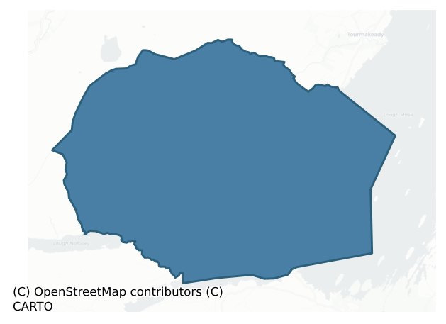
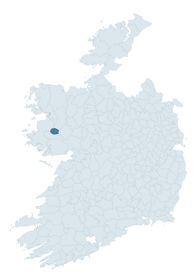
Where this barony sits in the Republic of Ireland
Geology and preservation
Bedrock geology shapes the landscape long before any settlement begins — controlling soil drainage, agricultural potential, the survival of upstanding monuments, and the preservation of buried archaeology. The figures below come from the Geological Survey Ireland 1:100,000 bedrock map.
The bedrock underlying Ross is predominantly sandstone, conglomerate, ignimbrite (36% of the barony by area), laid down during the Ordovician period (58% by area, around 485 to 444 million years ago). The single largest mapped unit is the Mweelrea Formation (36% of the barony's bedrock). With 14 distinct rock types mapped, the barony sits in the top third of ROI baronies for geological diversity (96th percentile) — typically a sign of complex tectonic history or coastal mosaics of differing rock units.
Rock type composition
Largest mapped unit: Mweelrea Formation (36% of the barony)
Placename evidence
The Logainm record for Ross contains only 3 heritage-diagnostic placenames — 3 cill-names. With this few records, the count should be read as indicative rather than as a firm characterisation of the linguistic heritage layers; a larger sample would be needed to reliably distinguish defensive, ecclesiastical, or other stratigraphic signals from chance occurrence.
Early Christian Ecclesiastical
| Root | Count | Meaning |
|---|---|---|
| cill- | 3 | church (early) |
About this profile
Click any section below to expand.
What is a barony?
A barony is a historic administrative unit in Ireland, broadly equivalent to an English hundred. The 280 baronies used here are from the OSi 2019 National Statutory Boundaries (generalised 20m), covering the 26 counties of the Republic of Ireland. Baronies derive from the Norman period, were formalised in the 17th century, and have not been redrawn for statistical purposes. They vary enormously in area, from compact urban baronies in Dublin to vast upland baronies in Connacht, and should not be compared by raw site count without accounting for area differences.
What counts as a site?
This profile combines three distinct heritage registers, each with its own definition of what constitutes a recordable site:
- Archaeological sites (NMS). The National Monuments Service Sites and Monuments Record (SMR) catalogues every known archaeological monument or site of archaeological interest in the Republic, from prehistoric burial mounds and ringforts to medieval churches and post-medieval defensive works. Inclusion does not require legal protection — only that the site has been identified, surveyed, and assessed as having archaeological value. A separate subset of these sites lies within a recorded protection zone, which gives them statutory protection under the National Monuments Acts.
- Listed buildings (NIAH). The National Inventory of Architectural Heritage records buildings of architectural, historical, archaeological, artistic, cultural, scientific, social, or technical interest. Each surveyed structure is appraised on a five-tier scale: International, National, Regional, Local, and Record-Only. The NIAH appraisal is informational rather than strictly statutory, but it underpins local-authority Record of Protected Structures (RPS) listings.
- Heritage placenames (Logainm). Logainm is the authoritative database of Irish placenames maintained by the Placenames Branch. This profile applies a heritage-diagnostic classifier to the Irish-language form of each townland name, flagging roots that signal defensive sites (ráth-, lios-, dún-, caiseal-, cathair-), ecclesiastical foundations (cill-, teampall-, domhnach-, mainistir-), prehistoric burial-ritual features (tuaim-, carn-, leaba-), or Norse-contact settlement (gall-). Townlands without one of these diagnostic roots are not flagged here — they may still carry historical significance, but that significance is not encoded in the name itself.
Editorial principles
The narrative sections of this profile follow several explicit principles:
- Evidential. Every claim about this barony’s heritage character is anchored in the underlying register data. Where a site count, a placename count, or a percentile rank is cited, it is computed from the source datasets at export time, not estimated.
- Comparative. Counts and metrics are reported alongside their percentile rank against the other 279 ROI baronies. A barony with 50 ringforts in absolute terms could be unusually high or unusually low depending on its size and regional context; percentile ranking removes that ambiguity.
- Transparent on limits. Where a register has known coverage gaps, survey biases, or data-quality issues that affect this barony’s figures, the profile flags them rather than presenting the numbers as definitive.
- No interpretation beyond what the data supports. The narrative does not speculate about historical events, social dynamics, or cultural meaning beyond what the recorded heritage and placename evidence directly attests.
Data caveats and limits
- NMS Sites and Monuments Record is the product of survey campaigns conducted at different intensities across different counties and decades. Some baronies have been surveyed more thoroughly than others, and absolute counts should be read in that light. Sites destroyed by development before survey are typically not represented; sites in heavily forested or upland terrain are sometimes under-recorded.
- NIAH coverage is broadly complete for the Republic of Ireland but the survey was conducted on a rolling county-by-county basis, and the most recent appraisal date varies. Buildings demolished or substantially altered after their original survey may still appear in the register; conversely, recent buildings of merit may not yet have been appraised.
- Logainm classification applies a deliberately conservative pattern-matching approach to the Irish-language townland forms. The classifier prioritises true positives over recall: a townland may carry a heritage signal that the classifier doesn’t recognise, particularly where the diagnostic root has been heavily anglicised or where the townland name draws on a less common term. The 60,000+ townland records and ~9,800 classified placenames give a substantial signal at barony scale, but individual townland names should be checked against Logainm directly for definitive interpretation.
- Period attribution. The chronological distribution reflects only those NMS sites that carry a recognised period attribution in the source data. Sites listed as “Unknown” period are excluded from the dated subset.
- Boundary changes. Some baronies have undergone minor boundary adjustments since their 19th-century definition; the OSi 2019 generalised boundaries used here are the current statutory definition and may differ slightly from historical maps in border areas.
- Bedrock geology is mapped at 1:100,000 scale, which means local variation within a barony — small pockets of different rock type, mineral veins, alluvium overlying bedrock — is generalised. The dominant-system and rocktype figures are area-weighted, so a barony reading “70% Carboniferous limestone” may still contain small but archaeologically important pockets of older or younger rock. Around 3% of GSI polygons do not match the lexicon and contribute no rocktype or system attribution.
Data sources
- National Monuments Service — Sites and Monuments Record (SMR) https://data.gov.ie/dataset/national-monuments-service-archaeological-survey-of-ireland
- National Inventory of Architectural Heritage (NIAH) https://data.gov.ie/dataset/national-inventory-of-architectural-heritage-niah-national-dataset
- Logainm — Placenames Database of Ireland https://www.logainm.ie/
- Ordnance Survey Ireland — National Statutory Barony Boundaries 2019 https://data-osi.opendata.arcgis.com/
- EURODEM — European Digital Elevation Model https://www.mapsforeurope.org/datasets/euro-dem
- ESA WorldCover https://esa-worldcover.org/en
- Geological Survey Ireland — 1:100,000 Bedrock Geology https://www.gsi.ie/en-ie/data-and-maps/Pages/Bedrock.aspx
Explore more: Search any of the 280 ROI baronies, browse by historical province, or read the methodology and data sources for the full Republic of Ireland Heritage Tool.