
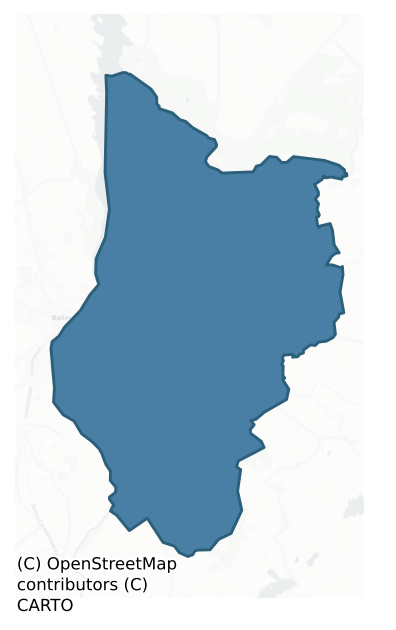
Tireragh is a barony of County Mayo, in the historical province of Connacht (Irish: Tír Fhiachrach), covering 39.6 km² of land. The barony records 73 NMS archaeological sites and 25 NIAH listed buildings, placing it at around the 48th percentile among 280 ROI baronies for sites per km². This means it is in the lower half of all baronies for sites per km². Dated archaeological evidence runs from the Neolithic through to the Modern, spanning 8 of 9 archaeological periods, placing the barony in the 56th percentile among 280 ROI baronies for chronological depth. This means it is in the upper half of all baronies for chronological depth. The largest dated subset of recorded sites dates to the Early Medieval.
Heritage at a glance
Percentile rankings throughout this profile compare each barony only against the other 279 Republic of Ireland baronies.
The recorded heritage of Tireragh
The National Monuments Service Sites and Monuments Record (SMR) is the statutory inventory of archaeological sites for the Republic of Ireland, maintained by the Department of Tourism, Culture, Arts, Gaeltacht, Sport and Media. Sites recorded here include earthworks, ringforts, megalithic tombs, ecclesiastical remains, and post-medieval features; not every record is legally protected, but each is registered as a monument of archaeological interest.
The National Monuments Service records 73 archaeological sites in Tireragh, putting it at the 48th percentile among 280 ROI baronies for sites per km². This means it is in the lower half of all baronies for sites per km². Protection coverage is near-universal — 72 sites (99%) fall within a recorded monument protection zone, indicating an extensively surveyed landscape. The dominant category is defensive sites — ringforts, enclosures, hillforts, and stone forts (52 sites, 71% of the record). Ringfort – rath is the most prevalent type, making up 37% of the barony's recorded sites (27 records) — well above the ROI average of 20% across all baronies where this type occurs. Ringfort – rath is an earthen ringfort enclosed by a bank and external ditch — the most common Early Medieval farmstead, broadly dated 500–1000 AD. Other significant types include Souterrain (10) and Enclosure (8). Souterrain is an underground stone-built passage and chamber, generally Early Medieval and often associated with ringforts as a defensive or storage feature; Enclosure is a banked or ditched feature of uncertain type, used as a catch-all where the original function cannot be determined from surface evidence. Across the barony's 39.6 km², this gives a recorded density of 1.84 sites per km².
Most common monument types
Hover or tap a monument type to see its definition.
| Type | Count |
|---|---|
| Ringfort – rath an earthen ringfort enclosed by a bank and external ditch — the most common Early Medieval farmstead, broadly dated 500–1000 AD | 27 |
| Souterrain an underground stone-built passage and chamber, generally Early Medieval and often associated with ringforts as a defensive or storage feature | 10 |
| Enclosure a banked or ditched feature of uncertain type, used as a catch-all where the original function cannot be determined from surface evidence | 8 |
| Earthwork an unclassified earthen structure with no diagnostic features that allow a more specific classification | 4 |
| Children's burial ground an unconsecrated medieval and early-modern burial ground for unbaptised or stillborn children, often called a cillín or ceallúnach | 2 |
| House – indeterminate date a habitation building whose date cannot be determined from available evidence | 2 |
| Moated site | 2 |
Chronological distribution
The dated archaeological record for Tireragh spans from the Neolithic through to the Modern, with activity attested across 8 of 9 archaeological periods. Every period from earliest to latest is represented in the record — an unbroken sequence of dated activity across the full chronological span. Activity concentrates most heavily in the Early Medieval (494 sites, 47% of dated material), with the Iron Age forming a secondary peak (263 sites, 25%). A further 133 recorded sites (11% of the overall NMS register for the barony) carry no period attribution — appearing as 'Unknown' in the bar chart below. This typically reflects either records that pre-date the standardised period vocabulary or sites awaiting specialist dating review, rather than a genuine absence of chronological evidence.
Sample of recorded monuments
Show 25 sample monuments (of 73 total)
A representative sample of 25 recorded monuments drawn from the barony’s 73 total NMS entries. Sites within a recorded monument protection zone and rarer site types are prioritised so the list shows a meaningful cross-section rather than only the most common type. Each entry shows the official Sites and Monuments Record reference number and the description published by the National Monuments Service.
Promontory fort – inland
The Archaeological Survey of Ireland (ASI) is in the process of providing information on all monuments on The Historic Environment Viewer (HEV). Currently the information for this record has not been uploaded. To…
The Archaeological Survey of Ireland (ASI) is in the process of providing information on all monuments on The Historic Environment Viewer (HEV). Currently the information for this record has not been uploaded. To access available information for research purposes please make an appointment in advance with the Archive Unit (open Fridays 10.00 am – 5.00 pm), Department of Culture, Heritage and the Gaeltacht, The Custom House, Dublin 1 D01W6XO or email nmarchive@chg.gov.ie.
Gatehouse
The Archaeological Survey of Ireland (ASI) is in the process of providing information on all monuments on The Historic Environment Viewer (HEV). Currently the information for this record has not been uploaded. To…
The Archaeological Survey of Ireland (ASI) is in the process of providing information on all monuments on The Historic Environment Viewer (HEV). Currently the information for this record has not been uploaded. To access available information for research purposes please make an appointment in advance with the Archive Unit (open Fridays 10.00 am – 5.00 pm), Department of Culture, Heritage and the Gaeltacht, The Custom House, Dublin 1 D01W6XO or email nmarchive@chg.gov.ie.
Castle – hall-house
The Archaeological Survey of Ireland (ASI) is in the process of providing information on all monuments on The Historic Environment Viewer (HEV). Currently the information for this record has not been uploaded. To…
The Archaeological Survey of Ireland (ASI) is in the process of providing information on all monuments on The Historic Environment Viewer (HEV). Currently the information for this record has not been uploaded. To access available information for research purposes please make an appointment in advance with the Archive Unit (open Fridays 10.00 am – 5.00 pm), Department of Culture, Heritage and the Gaeltacht, The Custom House, Dublin 1 D01W6XO or email nmarchive@chg.gov.ie.
Standing stone
In an area of undulating grassland, on the outskirts of Ballina Town, prominently sited on top of a knoll, overlooking the valley of the River Moy to W, with excellent views of Nephin and the Nephin Beg range in the…
In an area of undulating grassland, on the outskirts of Ballina Town, prominently sited on top of a knoll, overlooking the valley of the River Moy to W, with excellent views of Nephin and the Nephin Beg range in the distance to SW. There is a spring/area of wet ground at the base of the slope to SW.
This standing stone is not shown on the 1837 OS 6-inch map, but is indicated and named ‘Standing Stone’ on the 1930 edition. An upright, pillar-like stone (H 2.5m; Wth 0.7m, 0.55m at top; T 0.26-0.36m), with a rectangular cross-section. It narrows slightly towards the top, which gives it a slightly ‘shouldered’ appearance. It leans gently to N, and is encircled by a few small stones, and by a slight depression, probably the result of farm stock using the stone as a scratching post.
Compiled by: Jane O’Shaughnessy
Date of upload: 16 April 2018
Megalithic tomb – court tomb
See linked document with details from Ruaidhrí de Valera and Seán Ó Nualláin, Survey of the Megalithic Tombs of Ireland. Volume II. County Mayo. (Dublin: Stationery Office, 1964)
Date of upload: 3 January 2012
Religious house – Augustinian friars
The Archaeological Survey of Ireland (ASI) is in the process of providing information on all monuments on The Historic Environment Viewer (HEV). Currently the information for this record has not been uploaded. To…
The Archaeological Survey of Ireland (ASI) is in the process of providing information on all monuments on The Historic Environment Viewer (HEV). Currently the information for this record has not been uploaded. To access available information for research purposes please make an appointment in advance with the Archive Unit (open Fridays 10.00 am – 5.00 pm), Department of Culture, Heritage and the Gaeltacht, The Custom House, Dublin 1 D01W6XO or email nmarchive@chg.gov.ie.
Graveyard
The Archaeological Survey of Ireland (ASI) is in the process of providing information on all monuments on The Historic Environment Viewer (HEV). Currently the information for this record has not been uploaded. To…
The Archaeological Survey of Ireland (ASI) is in the process of providing information on all monuments on The Historic Environment Viewer (HEV). Currently the information for this record has not been uploaded. To access available information for research purposes please make an appointment in advance with the Archive Unit (open Fridays 10.00 am – 5.00 pm), Department of Culture, Heritage and the Gaeltacht, The Custom House, Dublin 1 D01W6XO or email nmarchive@chg.gov.ie.
Megalithic tomb – unclassified
In undulating, average pasture, straddling SE side of low rise. Good views to E-S
This unclassified megalithic tomb is not shown on any edition of the OS 6-inch maps. A roughly rectangular chamber or gallery (4.5-5m…
In undulating, average pasture, straddling SE side of low rise. Good views to E-S
This unclassified megalithic tomb is not shown on any edition of the OS 6-inch maps. A roughly rectangular chamber or gallery (4.5-5m NW−SE; 1.8m NE−SW) is outlined by six earthfast, upright boulders and large stones. The spacing between the stones is irregularly, varying from 0.25m to 1.5m. They range in length from 1-1.7m, and in thickness from 0.3-0.5m, and stand to a relatively uniform height of 0.4-0.5m. A few smaller stones, barely protruding above ground level are evident at the SE end of the chamber. The chamber is centrally located on a low, subrectangular grass-covered platform (12.5m NW−SE; 10.8m NE−SW), which might incorporate remnants of a cairn. The platform is defined by a scarp, which is well defined at S−W (ext. H 0.8m at W; 1.5m at SE), but is low (H 0.4-0.6m) elsewhere. A large, semi-prostrate slab (L 2.2m) protrudes from the ESE edge of the platform, 2.8m from the SE end of the chamber, and 4.2m to E of that, there is a large boulder (L 2.6m; Wth 2.5m; H 0.5m) on the field surface.
Compiled by: Jane O'Shaughnessy
Date of upload: 4 July 2018
Hut site
In pasture, located at the junction of field walls on a low N-S ridge.
Shown on the 1838 OS 6-inch map as a small circular feature at the junction of three field boundaries; not shown on later map editions. Roughly…
In pasture, located at the junction of field walls on a low N-S ridge.
Shown on the 1838 OS 6-inch map as a small circular feature at the junction of three field boundaries; not shown on later map editions. Roughly square feature (7m E-W, c. 5-7m N-S) defined on E, S and W sides by a bank (Wth 2.2m; int. H 0.75m; ext. H 0.7m) of earth and stone, and on the N side by a field wall. Another field wall on a N-S axis abuts the bank at the S. The function of this feature is unclear –it may be the remains of a small structure or hut. It is partly obscured by gorse and hawthorn. A rath (MA040-040—-) and souterrain (MA040-040001-) are located 50m to N.
Compiled by: Jane O’Shaughnessy
Date of upload: 12 June 2020
House – indeterminate date
The Archaeological Survey of Ireland (ASI) is in the process of providing information on all monuments on The Historic Environment Viewer (HEV). Currently the information for this record has not been uploaded. To…
The Archaeological Survey of Ireland (ASI) is in the process of providing information on all monuments on The Historic Environment Viewer (HEV). Currently the information for this record has not been uploaded. To access available information for research purposes please make an appointment in advance with the Archive Unit (open Fridays 10.00 am – 5.00 pm), Department of Culture, Heritage and the Gaeltacht, The Custom House, Dublin 1 D01W6XO or email nmarchive@chg.gov.ie.
Moated site
In pasture, located on a slight rise in an area of gently undulating grassland. A rath (MA030-015) is visible c. 200m to SW.
This moated site consists of a raised, rectangular platform (36.8m E–W; 34m N–S) defined by…
In pasture, located on a slight rise in an area of gently undulating grassland. A rath (MA030-015) is visible c. 200m to SW.
This moated site consists of a raised, rectangular platform (36.8m E–W; 34m N–S) defined by remnants of a bank, and enclosed by a fosse and external bank. The inner bank survives mainly as a scarp (Wth slope 3.4m; ext. H 2m) with a low internal rim (Wth 0.6m; int. H 0.2m). The fosse (Wth 4.5m) is broad and well defined. The external bank (Wth 5.9m; H ext. 0.9m, at N) remains substantial on the N side, but is rather degraded elsewhere. There is a break (Wth 6m) in the external bank at the NE angle, and it is also largely eroded at the SE angle. At W the external bank has been reduced to, or possibly replaced by, a low stony bank, topped with a post and wire fence, which flanks the E side of a grassed-over, disused laneway. The laneway skirts the W site of the moated site, respecting its outline.
In the NW quadrant of the interior there is a shallow, sub-rectangular depression or area of disturbance (8.4m E–W; 4.5m N–S). In the SE quadrant there is an L-shaped depression or shallow trench (Wth 1.4m), which extends E–W for c. 7-8m and turns at its E end for c. 8m to the S. It is bordered on its outer edge at N and E by a low raised rim (Wth 1.2m; H 0.2m).
A later field fence, on a roughly E–W axis, cuts across the external bank and fosse at NE. Interior grass covered; dense hawthorn and brambles on the banks and fosse.
Compiled by: Jane O'Shaughne…
Building
The Archaeological Survey of Ireland (ASI) is in the process of providing information on all monuments on The Historic Environment Viewer (HEV). Currently the information for this record has not been uploaded. To…
The Archaeological Survey of Ireland (ASI) is in the process of providing information on all monuments on The Historic Environment Viewer (HEV). Currently the information for this record has not been uploaded. To access available information for research purposes please make an appointment in advance with the Archive Unit (open Fridays 10.00 am – 5.00 pm), Department of Culture, Heritage and the Gaeltacht, The Custom House, Dublin 1 D01W6XO or email nmarchive@chg.gov.ie.
Children's burial ground
In pasture, straddling the break of slope on the SE-facing side of a NE−SW ridge, overlooking the Brusna River, which is located c. 100m to E.
Shown on the 1837-8 OS 6-inch map as a circular enclosure (diam. c. 20m),…
In pasture, straddling the break of slope on the SE-facing side of a NE−SW ridge, overlooking the Brusna River, which is located c. 100m to E.
Shown on the 1837-8 OS 6-inch map as a circular enclosure (diam. c. 20m), marked as Grave Yd.’, and on the 1922 edition as a rectangular area (c. 14m NE−SW; c. 7m NW−SE), delimited by a dotted line, marked as ‘Children’s Burial Ground’.
The outline of the burial ground can no longer be clearly traced. The SE side of the rectangular area shown on the 1922 map may be preserved in the remnants of a scarp (L c. 22m NE-SW), topped with a stony rise (Wth c. 5m), which coincides with the natural ridge slope. The stony rise appears to be the remains of a collapsed wall; stone tumble is evident on the slope. At the NE end of the scarp, a bank (Wth c. 3m; H 0.4m), perpendicular to the scarp, extends to NW for 4m then peters out. Small, upright stones protrude from the top of the scarp at S. It is possible that they are gravemarkers, but they could also be remnants of a wall topping the scarp. The area is covered with blackthorn and hawthorn, and difficult to examine. According to local information, burials continued here into the 1940’s/1950’s.
Compiled by: Jane O'Shaughnessy
Date of upload: 29 June 2018
Moated site
In level, lowlying pasture flanking the SE bank of the Brusna River, located at a marked bend or loop of the river. There are good views to NE and SW along the line of the shallow river valley, with gently rising ground…
In level, lowlying pasture flanking the SE bank of the Brusna River, located at a marked bend or loop of the river. There are good views to NE and SW along the line of the shallow river valley, with gently rising ground to NW and SE.
Rectangular raised area or platform (28.4m NE-SW; 60m NW-SE) defined by remnants of an earthen bank, and enclosed by a fosse, with remnants of an outer bank. It is located on the E side of a rectangular bay of level ground bounded on the SE, NW and NE sides by a loop in the river. The NE corner of the site is a mere 4m from a steep slope that drops to the river bank.
The substantial inner enclosing bank (Wth 4.2m-5.8m; int. H 1.2m; ext. H 0.7m on SE, 2m on S), of hard-packed gravelly soil, is well-preserved on the SE third of the site. It retains a low internal rim along the SW side, but is reduced to a well-defined scarp (H 0.95m to NE) on the NW and NE sides. Roughly in the middle of the NW side, a semicircular section (L c. 7m) of the enclosing scarp has been dug out. The broad, flat-bottomed fosse (Wth 3m; ext. D 1.5m) is well-defined, except on the NW side. Remnants of an outer bank (Wth c. 3m; ext. H 0.4m) survive on the S corner and along the SW side, and at NW, but it has been levelled elsewhere.
The interior is level and featureless, with a slight slope down to NE. There is an eroded break (Wth 2.4m) in the inner bank at S. Grass cover, with a clump of blackthorn established in the SE quadrant of the interior.
An enclosure (MA031…
Barrow – ring-barrow
The Archaeological Survey of Ireland (ASI) is in the process of providing information on all monuments on The Historic Environment Viewer (HEV). Currently the information for this record has not been uploaded. To…
The Archaeological Survey of Ireland (ASI) is in the process of providing information on all monuments on The Historic Environment Viewer (HEV). Currently the information for this record has not been uploaded. To access available information for research purposes please make an appointment in advance with the Archive Unit (open Fridays 10.00 am – 5.00 pm), Department of Culture, Heritage and the Gaeltacht, The Custom House, Dublin 1 D01W6XO or email nmarchive@chg.gov.ie.
Building
In lowlying pasture reclaimed from bog, on slight rise. The confluence of the Black River and the Srafaungal River is located c. 300m to S, and the larger Brusna River is 550m to W.
No archaeological monument is shown…
In lowlying pasture reclaimed from bog, on slight rise. The confluence of the Black River and the Srafaungal River is located c. 300m to S, and the larger Brusna River is 550m to W.
No archaeological monument is shown at this location on the 1837-8 OS 6-inch map. An earthwork (MA031-054001-) consisting of a small central hachured area encircled by a double ring of hachuring (overall diam. c. 20m) is shown on the 25-inch plan and on the 1922 OS 6-inch map. It was recorded in OPW field notes (1958) as an ‘old house or byre, partly stone, partly turf, with a collapsed bank all around’. It was deemed to be of no archaeological interest and permission was given to the landowner to reclaim the land. When inspected in 1995, the location consisted of a pasture field with no visible remains of an archaeological monument. A house now stands on the location.
Compiled by: Jane O'Shaughnessy
Date of upload: 4 July 2018
Barrow – mound barrow
In gently undulating, improved pasture, crowning the top of a low hillock, which provides extensive views, with the Ox Mountains dominating the skyline to E and SE.
This possible mound barrow is not shown on the…
In gently undulating, improved pasture, crowning the top of a low hillock, which provides extensive views, with the Ox Mountains dominating the skyline to E and SE.
This possible mound barrow is not shown on the 1837-8 and the 1922 OS 6-inch maps. It consists of a low, degraded circular mound (10m N-S; 9m E-W), with a flattish top, defined by a slight scarp (H 0.3m), which is barely distinguishable from the natural slope. A slab (Wth at least 0.55m; T 0.1m) protruding from the top of the mound at NE. The mound is known in local tradition as an ancient gravesite. There is a ringbarrow (MA031-069—-) 150m to SW.
Compiled by: Jane O'Shaughnessy
Date of upload: 5 July 2018
Barrow – ring-barrow
In undulating pasture, located in a slight dip on the N side of a hillock. There are excellent views of the surrounding countryside, with the Ox Mountains dominating the skyline to E and SE.
This ringbarrow is not…
In undulating pasture, located in a slight dip on the N side of a hillock. There are excellent views of the surrounding countryside, with the Ox Mountains dominating the skyline to E and SE.
This ringbarrow is not shown on the 1837-8 and the 1922 OS 6-inch maps. It consists of a low, circular platform (6m N-S; 5.5m E-W; H 0.6m) enclosed by a well-defined fosse (Wth 2.2; ext. D 0.95m) and remnants of an external bank. The bank has been largely levelled; a slight rise is still evident in parts, but it is evident mainly as a cropmark (Wth 1.6m). The central platform appears to be earthen, composed of fine sandy soil. A concentration of boulders occupies most of the platform. The largest boulder (H 1.2m; circ. 4.45m) is slightly off-centre to S. It occupies a shallow depression and appears to rest on a number of smaller stones. Adjacent to the NE, is a narrow, recumbent stone (L 1.3m; Wth 0.4m), oval in cross-section. To N of this, is an upright boulder (H 1.05m; circ. 2.4m), which appears to be set in the ground. Several smaller stones are scattered over the surface. The haphazard arrangement of the boulders and stones suggests that some, at least, are the result of field clearance. The depth and sharp definition of the fosse contrasts with the degraded nature of the bank, and may be result of modern activity; OPW field notes record a number of channels or drains cutting through the bank (SMR file). The ringbarrow was enclosed within a rectilinear enclosure (c. 33m E−W; c….
Children's burial ground
In a rath (MA039-030001). In the SMR (1991) and the RMP (1997) a children’s burial ground is listed at his location, the source of information being a reference in Aldridge (1969, 85): ‘In Breaghwy (Mayo 39) the rath…
In a rath (MA039-030001). In the SMR (1991) and the RMP (1997) a children’s burial ground is listed at his location, the source of information being a reference in Aldridge (1969, 85): ‘In Breaghwy (Mayo 39) the rath marked has been levelled except for the northern portion cut off by a fence; this remains as a CBG.’
This rath (MA039-030001-), which is fully intact, does not match Aldridge’s description. This would suggest that an error was made by the SMR, and that this rath is not the location of the children’s burial ground recorded by Aldridge.
Compiled by: Jane O’Shaughnessy
Date of upload: 27 January 2020
House – indeterminate date
In pasture, located on low ridge. There is a gradual fall of ground to S towards a stream.
Not shown on the 1838 OS 6-inch map; shown as a small circular hachured feature on the 1922 edition. This possible house or hut…
In pasture, located on low ridge. There is a gradual fall of ground to S towards a stream.
Not shown on the 1838 OS 6-inch map; shown as a small circular hachured feature on the 1922 edition. This possible house or hut site consists of a slightly raised subcircular area (5.5m E−W; 4.6m N−S) defined by an earthen bank (Wth 1.3m; int. H 0.4m; ext. H 0.7m), faced internally, and in parts externally on the W arc, by rounded stones and boulders. The interior is level, and appears almost square rather than circular in plan. There is a low eroded area (Wth 1.2m) in the enclosing bank at NNW. It is engulfed in blackthorn and brambles. There is a N−S field fence immediately to W. There is rath (MA040-036—-) 260m to NE.
Compiled by: Jane O’Shaughnessy
Date of upload: 22 May 2020
Fulacht fia
In rough, damp pasture, close to a natural spring now diverted into an underground pipe. A road borders the E side of the field. Low, sod-covered horseshoe-shaped mound (15.5m N-S; 8.5m E-W; H 0.4m) with a depression…
In rough, damp pasture, close to a natural spring now diverted into an underground pipe. A road borders the E side of the field. Low, sod-covered horseshoe-shaped mound (15.5m N-S; 8.5m E-W; H 0.4m) with a depression (Wth 5m) between the arms of the mound at SW, possibly indicating the position of a trough. There is a rath (MA039-030—-) c. 90m to NW.
Compiled by: Jane O’Shaughnessy
Date of upload: 27 January 2020
Barrow – mound barrow
In a housing estate on the outskirts of Ballina town. Originally situated on a low knoll, providing good views of the surrounding undulating landscape, with the Ox Mountains defining the far horizon to the SE, and…
In a housing estate on the outskirts of Ballina town. Originally situated on a low knoll, providing good views of the surrounding undulating landscape, with the Ox Mountains defining the far horizon to the SE, and Nephin Mountain prominently visible to SW. The confluence of the River Moy with its tributary the Brusna River is located 700m to SW.
In 2007 this mound barrow was archaeologically tested in advance of a housing development (Fitzpatrick and Rooney 2007; 070E0627), and it was subsequently fully excavated (Wallace 2018; 070E0627 extension). Following the excavation, the knoll on which the barrow was sited was completely removed.
Prior to excavation, the barrow consisted of a circular earthen mound (diam. 12m E-W; 13.8m N-S; H c. 1mm) defined by a scarp. The scarp (H 0.8m at E; 0.7m at W) was lower, and broadly slumped on the N half, but was significantly steeper (H c. 1.7m) at S where it was enhanced by the natural fall of ground. The top of the mound (diam. 9m E-W; 10.8m N-S) was relatively flat, but an almost seamless break of slope with the scarp gave it a gently domed profile when viewed from a distance. An ash tree and a whitethorn tree were growing on the eastern side of the mound, and their root systems disturbed the stratigraphy of the mound.
Excavation revealed that a fosse (Wth 0.40-0.50m; D 0.30-0.40m) curved around the mound at NW−E; it could not be traced on the steeply sloping S side, where there was much scree and mudstone bedrock. It was difficu…
Fulacht fia
In a hollow adjacent to a water course, in terrain characterised by drumlins with wet, lowlying areas in between the higher ground. This fulacht fia was excavated (Licence: 05E1201) in November 2005 in advance of Mayo…
In a hollow adjacent to a water course, in terrain characterised by drumlins with wet, lowlying areas in between the higher ground. This fulacht fia was excavated (Licence: 05E1201) in November 2005 in advance of Mayo county council road-widening works along a stretch of the N59 (Zajac 2009). The fulacht fia had been greatly damaged in the past: it was truncated on its E edge by the N59 road, on its W edge by a modern land drain, and at SW by another land drain. The patchy, surviving remnants of the burnt mound (c. 12m N-S; max Wth 5.2m at NE) consisted of heat-fractured stones in a dark gritty charcoal-rich soil, with the greatest concentration (c. 1.8m N–S; 2.2m E–W; H 0.7m) at the NE. Underlying the burnt stone, to N of centre, was an unlined, subcircular trough pit (1.2m E–W; 1m N–S; D 0.4-0.6m), somewhat truncated at its NE edge, which was cut into subsoil. It was surrounded by an irregular area of subsoil (1.9m NE–SW; 1.75m NW–SE), interpreted as a possible attempt to enlarge the existing trough area. A circular posthole (diam. 0.1m; D 0.2m) was located 0.4m E of the trough. Small pieces of decayed wood were incorporated into the burnt stones surrounding the trough. A piece of oak wood on the natural subsoil adjacent to the trough appears to have been a tree root. A narrow band of the burnt mound was visible in the section face along the existing road edge, and may continue beneath the road. Also visible towards the N end of this section face, was a pit (0.3m N–S; D…
Earthwork
The Archaeological Survey of Ireland (ASI) is in the process of providing information on all monuments on The Historic Environment Viewer (HEV). Currently the information for this record has not been uploaded. To…
The Archaeological Survey of Ireland (ASI) is in the process of providing information on all monuments on The Historic Environment Viewer (HEV). Currently the information for this record has not been uploaded. To access available information for research purposes please make an appointment in advance with the Archive Unit (open Fridays 10.00 am – 5.00 pm), Department of Culture, Heritage and the Gaeltacht, The Custom House, Dublin 1 D01W6XO or email nmarchive@chg.gov.ie.
Ringfort – rath
In pasture, located on the S end of a roughly N–S rise in gently undulating terrain, with good views.
This rath consists of a circular area (c. 20m N–S), not noticeably raised, defined by an earthen bank. Dense…
In pasture, located on the S end of a roughly N–S rise in gently undulating terrain, with good views.
This rath consists of a circular area (c. 20m N–S), not noticeably raised, defined by an earthen bank. Dense overgrowth impeded the inspection. The bank appears most substantial (Wth over 3m; int. H 1.2m; ext. H 0.8m) on the N half; at SE it is rather low and degraded internally, but has a more pronounced external slope (ext. H 1.3m). The bank includes, and is topped by stones, which may be the result of its incorporation into a later system of field boundaries. A field fence abuts the bank at W, and another field fence lies immediately adjacent at N–NE. A possible gap (Wth c. 1.5-2m), largely obscured by overgrowth, at E may be the original entrance. Interior obscured by scrub; perimeter ringed with ash and hawthorn trees, gorse and brambles.
Compiled by: Jane O'Shaughnessy
Date of upload: 12 April 2018
Listed buildings
The National Inventory of Architectural Heritage (NIAH) is a state survey appraising buildings of architectural, historical, archaeological, artistic, cultural, scientific, social, or technical interest. Each surveyed structure receives a rating from International (the highest, for buildings of European importance) through National, Regional, Local, and Record-Only.
The NIAH records only 25 listed buildings in Tireragh, the 10th percentile across ROI baronies — a relatively thin architectural record. The highest-graded structure include 1 of National significance. The Republic holds 937 National-graded buildings in total, so this barony accounts for around 0% of the national total. Construction dates concentrate most heavily in the Modern (post-1900) period. The most-recorded building type is house (11 examples, 44% of the listed stock).
Terrain and environment
Mean elevation across the barony is 99m — the 59th percentile among 280 ROI baronies for elevation. This means it is in the upper half of all baronies for elevation. Elevation matters for heritage because higher-altitude baronies typically favour defensive monuments — ringforts and hilltop forts placed on prominent ground — while lowland baronies are more likely to carry the dense settlement and church networks of intensive agricultural landscapes. The barony reaches 539m at its highest point — a vertical span of more than 439m within its boundary, indicating significant topographic diversity. Mean slope is 3.7° — the 51st percentile among 280 ROI baronies for slope. This means it is in the upper half of all baronies for slope. Slope is a key control on both land use and archaeological preservation: steep ground resists ploughing and tends to preserve earthworks intact, while gentle slopes favour intensive cultivation that damages or destroys surface archaeology over time. The Topographic Wetness Index averages 11.0, the 56th percentile among 280 ROI baronies for wetness. This means it is in the upper half of all baronies for wetness. Drainage matters for heritage because poorly-drained ground preserves organic archaeology (wooden trackways, leather, textiles, and on rare occasions human remains) far better than free-draining soil; well-drained ground favours arable use but destroys organic material rapidly. The land cover is dominated by improved grassland (86%) and woodland (12%).
Terrain measurements
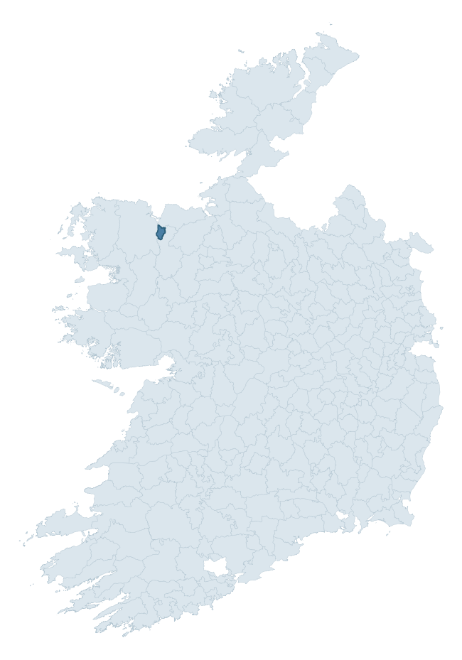
Where this barony sits in the Republic of Ireland
Geology and preservation
Bedrock geology shapes the landscape long before any settlement begins — controlling soil drainage, agricultural potential, the survival of upstanding monuments, and the preservation of buried archaeology. The figures below come from the Geological Survey Ireland 1:100,000 bedrock map.
The bedrock underlying Tireragh is predominantly limestone and shale (100% of the barony by area), laid down during the Carboniferous period (100% by area, around 359 to 299 million years ago). The single largest mapped unit is the Ballina Limestone Formation (Upper) (72% of the barony's bedrock). With only 1 distinct rock type mapped, the barony is geologically uniform compared to the rest of the Republic (0th percentile for diversity) — a single coherent bedrock landscape.
Largest mapped unit: Ballina Limestone Formation (Upper) (72% of the barony)
Placename evidence
Logainm records 5 heritage-diagnostic placenames for Tireragh, a modest sample drawn predominantly from the townland record. The dominant stratum is pre-christian defensive. The most frequent diagnostic roots are ráth- (3) and cill- (1). With a sample of this size the count should be treated as indicative rather than definitive.
Pre-Christian / Early Medieval Defensive
| Root | Count | Meaning |
|---|---|---|
| ráth- | 3 | earthen ringfort |
Early Christian Ecclesiastical
| Root | Count | Meaning |
|---|---|---|
| cill- | 1 | church (early) |
Burial, Ritual, and Norse-Contact
| Root | Count | Meaning |
|---|---|---|
| dumha- | 1 | mound |
About this profile
Click any section below to expand.
What is a barony?
A barony is a historic administrative unit in Ireland, broadly equivalent to an English hundred. The 280 baronies used here are from the OSi 2019 National Statutory Boundaries (generalised 20m), covering the 26 counties of the Republic of Ireland. Baronies derive from the Norman period, were formalised in the 17th century, and have not been redrawn for statistical purposes. They vary enormously in area, from compact urban baronies in Dublin to vast upland baronies in Connacht, and should not be compared by raw site count without accounting for area differences.
What counts as a site?
This profile combines three distinct heritage registers, each with its own definition of what constitutes a recordable site:
- Archaeological sites (NMS). The National Monuments Service Sites and Monuments Record (SMR) catalogues every known archaeological monument or site of archaeological interest in the Republic, from prehistoric burial mounds and ringforts to medieval churches and post-medieval defensive works. Inclusion does not require legal protection — only that the site has been identified, surveyed, and assessed as having archaeological value. A separate subset of these sites lies within a recorded protection zone, which gives them statutory protection under the National Monuments Acts.
- Listed buildings (NIAH). The National Inventory of Architectural Heritage records buildings of architectural, historical, archaeological, artistic, cultural, scientific, social, or technical interest. Each surveyed structure is appraised on a five-tier scale: International, National, Regional, Local, and Record-Only. The NIAH appraisal is informational rather than strictly statutory, but it underpins local-authority Record of Protected Structures (RPS) listings.
- Heritage placenames (Logainm). Logainm is the authoritative database of Irish placenames maintained by the Placenames Branch. This profile applies a heritage-diagnostic classifier to the Irish-language form of each townland name, flagging roots that signal defensive sites (ráth-, lios-, dún-, caiseal-, cathair-), ecclesiastical foundations (cill-, teampall-, domhnach-, mainistir-), prehistoric burial-ritual features (tuaim-, carn-, leaba-), or Norse-contact settlement (gall-). Townlands without one of these diagnostic roots are not flagged here — they may still carry historical significance, but that significance is not encoded in the name itself.
Editorial principles
The narrative sections of this profile follow several explicit principles:
- Evidential. Every claim about this barony’s heritage character is anchored in the underlying register data. Where a site count, a placename count, or a percentile rank is cited, it is computed from the source datasets at export time, not estimated.
- Comparative. Counts and metrics are reported alongside their percentile rank against the other 279 ROI baronies. A barony with 50 ringforts in absolute terms could be unusually high or unusually low depending on its size and regional context; percentile ranking removes that ambiguity.
- Transparent on limits. Where a register has known coverage gaps, survey biases, or data-quality issues that affect this barony’s figures, the profile flags them rather than presenting the numbers as definitive.
- No interpretation beyond what the data supports. The narrative does not speculate about historical events, social dynamics, or cultural meaning beyond what the recorded heritage and placename evidence directly attests.
Data caveats and limits
- NMS Sites and Monuments Record is the product of survey campaigns conducted at different intensities across different counties and decades. Some baronies have been surveyed more thoroughly than others, and absolute counts should be read in that light. Sites destroyed by development before survey are typically not represented; sites in heavily forested or upland terrain are sometimes under-recorded.
- NIAH coverage is broadly complete for the Republic of Ireland but the survey was conducted on a rolling county-by-county basis, and the most recent appraisal date varies. Buildings demolished or substantially altered after their original survey may still appear in the register; conversely, recent buildings of merit may not yet have been appraised.
- Logainm classification applies a deliberately conservative pattern-matching approach to the Irish-language townland forms. The classifier prioritises true positives over recall: a townland may carry a heritage signal that the classifier doesn’t recognise, particularly where the diagnostic root has been heavily anglicised or where the townland name draws on a less common term. The 60,000+ townland records and ~9,800 classified placenames give a substantial signal at barony scale, but individual townland names should be checked against Logainm directly for definitive interpretation.
- Period attribution. The chronological distribution reflects only those NMS sites that carry a recognised period attribution in the source data. Sites listed as “Unknown” period are excluded from the dated subset.
- Boundary changes. Some baronies have undergone minor boundary adjustments since their 19th-century definition; the OSi 2019 generalised boundaries used here are the current statutory definition and may differ slightly from historical maps in border areas.
- Bedrock geology is mapped at 1:100,000 scale, which means local variation within a barony — small pockets of different rock type, mineral veins, alluvium overlying bedrock — is generalised. The dominant-system and rocktype figures are area-weighted, so a barony reading “70% Carboniferous limestone” may still contain small but archaeologically important pockets of older or younger rock. Around 3% of GSI polygons do not match the lexicon and contribute no rocktype or system attribution.
Data sources
- National Monuments Service — Sites and Monuments Record (SMR) https://data.gov.ie/dataset/national-monuments-service-archaeological-survey-of-ireland
- National Inventory of Architectural Heritage (NIAH) https://data.gov.ie/dataset/national-inventory-of-architectural-heritage-niah-national-dataset
- Logainm — Placenames Database of Ireland https://www.logainm.ie/
- Ordnance Survey Ireland — National Statutory Barony Boundaries 2019 https://data-osi.opendata.arcgis.com/
- EURODEM — European Digital Elevation Model https://www.mapsforeurope.org/datasets/euro-dem
- ESA WorldCover https://esa-worldcover.org/en
- Geological Survey Ireland — 1:100,000 Bedrock Geology https://www.gsi.ie/en-ie/data-and-maps/Pages/Bedrock.aspx
Explore more: Search any of the 280 ROI baronies, browse by historical province, or read the methodology and data sources for the full Republic of Ireland Heritage Tool.