Athenry is a barony of County Galway, in the historical province of Connacht (Irish: Baile Átha an Rí), covering 104 km² of land. The barony records 424 NMS archaeological sites and 62 NIAH listed buildings, placing it at around the 93rd percentile among 280 ROI baronies for sites per km². This means it is in the top tenth of all baronies for sites per km². Dated archaeological evidence runs from the Neolithic through to the Modern, spanning 8 of 9 archaeological periods, placing the barony in the 59th percentile among 280 ROI baronies for chronological depth. This means it is in the upper half of all baronies for chronological depth. The largest dated subset of recorded sites dates to the Early Medieval. Logainm flags 20 placenames in the barony as carrying a recognised heritage root; the largest share — around 50% — are names associated with early Christian church and monastic foundations.
Heritage at a glance
Percentile rankings throughout this profile compare each barony only against the other 279 Republic of Ireland baronies.
The recorded heritage of Athenry
The National Monuments Service Sites and Monuments Record (SMR) is the statutory inventory of archaeological sites for the Republic of Ireland, maintained by the Department of Tourism, Culture, Arts, Gaeltacht, Sport and Media. Sites recorded here include earthworks, ringforts, megalithic tombs, ecclesiastical remains, and post-medieval features; not every record is legally protected, but each is registered as a monument of archaeological interest.
The National Monuments Service records 424 archaeological sites in Athenry, putting it at the 93rd percentile among 280 ROI baronies for sites per km². This means it is in the top tenth of all baronies for sites per km². Of these, 370 (87%) fall within a recorded monument protection zone. The record is dominated by defensive sites — ringforts, enclosures, hillforts, and stone forts (141 sites, 33% of the total), with ecclesiastical sites forming a substantial secondary presence (78 sites, 18%). Ringfort – rath is the most prevalent type, making up 12% of the barony's recorded sites (49 records) — below the ROI average of 20% across all baronies where this type occurs. Ringfort – rath is an earthen ringfort enclosed by a bank and external ditch — the most common Early Medieval farmstead, broadly dated 500–1000 AD. Other significant types include Graveslab (43) and Ringfort – cashel (29). Graveslab is a recumbent grave-marking slab, dated 1200–1700 AD; Ringfort – cashel is the stone-walled equivalent of the rath, found mainly in upland or western areas, broadly dated 500–1000 AD. Across the barony's 104 km², this gives a recorded density of 4.06 sites per km².
Most common monument types
Hover or tap a monument type to see its definition.
| Type | Count |
|---|---|
| Ringfort – rath an earthen ringfort enclosed by a bank and external ditch — the most common Early Medieval farmstead, broadly dated 500–1000 AD | 49 |
| Graveslab a recumbent grave-marking slab, dated 1200–1700 AD | 43 |
| Ringfort – cashel the stone-walled equivalent of the rath, found mainly in upland or western areas, broadly dated 500–1000 AD | 29 |
| Enclosure a banked or ditched feature of uncertain type, used as a catch-all where the original function cannot be determined from surface evidence | 25 |
| Souterrain an underground stone-built passage and chamber, generally Early Medieval and often associated with ringforts as a defensive or storage feature | 15 |
| Fulacht fia a horseshoe-shaped Bronze Age burnt mound built around a sunken trough beside a water source, traditionally interpreted as a cooking site | 14 |
| Quarry a place where stone, sand, gravel or clay was extracted | 14 |
Chronological distribution
The dated archaeological record for Athenry spans from the Neolithic through to the Modern, with activity attested across 8 of 9 archaeological periods. Every period from earliest to latest is represented in the record — an unbroken sequence of dated activity across the full chronological span. Activity concentrates most heavily in the Early Medieval (128 sites, 48% of dated material), with the Iron Age forming a secondary peak (60 sites, 22%). A further 156 recorded sites (37% of the overall NMS register for the barony) carry no period attribution — appearing as 'Unknown' in the bar chart below. This typically reflects either records that pre-date the standardised period vocabulary or sites awaiting specialist dating review, rather than a genuine absence of chronological evidence.
Sample of recorded monuments
Show 25 sample monuments (of 424 total)
A representative sample of 25 recorded monuments drawn from the barony’s 424 total NMS entries. Sites within a recorded monument protection zone and rarer site types are prioritised so the list shows a meaningful cross-section rather than only the most common type. Each entry shows the official Sites and Monuments Record reference number and the description published by the National Monuments Service.
Historic town
The Archaeological Survey of Ireland (ASI) is in the process of providing information on all monuments on The Historic Environment Viewer (HEV). Currently the information for this record has not been uploaded. To…
The Archaeological Survey of Ireland (ASI) is in the process of providing information on all monuments on The Historic Environment Viewer (HEV). Currently the information for this record has not been uploaded. To access available information for research purposes please make an appointment in advance with the Archive Unit (open Fridays 10.00 am – 5.00 pm), Department of Culture, Heritage and the Gaeltacht, The Custom House, Dublin 1 D01W6XO or email nmarchive@chg.gov.ie.
Castle – ringwork
On a prominent hillock in gently undulating pastureland, c. 4km to the NNW of Athenry town (GA084-001—-). Though named 'Convent (in Ruins)' on the 1838 and 1933 editions of the OS maps, the extant remains appear to be…
On a prominent hillock in gently undulating pastureland, c. 4km to the NNW of Athenry town (GA084-001—-). Though named 'Convent (in Ruins)' on the 1838 and 1933 editions of the OS maps, the extant remains appear to be those of a castle. Furthermore, the 1574 list of Galway castles includes one at 'Carnan' then in the possession of a 'John Oge fitz John fitz Ed' (Nolan 1901, 119). What survives is a roughly oval enclosure (c. 50m E-W; c. 32m N-S) on the hill summit. This is defined from SE to S by a mortared stone wall (L 21m; Wth 0.9m; H 4m max.) with an almost square turret (ext. dims. 2.9m E-W; 2.8m N-S), of 16th-century date, projecting 2.2m beyond it at its SE end. The turret survives to a height of two storeys. The ground floor is filled with grass-covered rubble. It was lit by rectangular loops in the E and W walls. Traces of the spiral stairs survive in the NE corner at 1st-floor level and this floor was also lit by a rectangular loop in each wall. A pencilled note in the OS Name Books of 1838 suggests that the turret was in fact called 'the nunnery tower' (Cody 1989, 346, 350). However, there is no documentary evidence for a nunnery at this location: the castle was possibly occupied by nuns for a time in the post-Reformation period. To its W, the line of the enclosure continues as a ruined wall (Wth 1.8m; H 0.5m) in three straight lengths from S to W. From W through N to E, it is defined by a substantial stony bank but no trace of the enclosing element survives f…
Windmill
The Archaeological Survey of Ireland (ASI) is in the process of providing information on all monuments on The Historic Environment Viewer (HEV). Currently the information for this record has not been uploaded. To…
The Archaeological Survey of Ireland (ASI) is in the process of providing information on all monuments on The Historic Environment Viewer (HEV). Currently the information for this record has not been uploaded. To access available information for research purposes please make an appointment in advance with the Archive Unit (open Fridays 10.00 am – 5.00 pm), Department of Culture, Heritage and the Gaeltacht, The Custom House, Dublin 1 D01W6XO or email nmarchive@chg.gov.ie.
Burnt mound
On a gentle S-facing slope in pastureland, overlooking a turlough to the SE. This low roughly circular grassed-over mound of burnt stone (diam. 4m; H 0.4m) is cut across from NW to SE by a livestock trackway. A field…
On a gentle S-facing slope in pastureland, overlooking a turlough to the SE. This low roughly circular grassed-over mound of burnt stone (diam. 4m; H 0.4m) is cut across from NW to SE by a livestock trackway. A field wall overlies it at N. There is a fulacht fia (GA096-138—-) c. 55m to the SE. (Cody 1989, 161, no. 20)
Compiled by: Galway Archaeological Survey, UCG
Date of upload: 26 November 2019
Settlement cluster
The Archaeological Survey of Ireland (ASI) is in the process of providing information on all monuments on The Historic Environment Viewer (HEV). Currently the information for this record has not been uploaded. To…
The Archaeological Survey of Ireland (ASI) is in the process of providing information on all monuments on The Historic Environment Viewer (HEV). Currently the information for this record has not been uploaded. To access available information for research purposes please make an appointment in advance with the Archive Unit (open Fridays 10.00 am – 5.00 pm), Department of Culture, Heritage and the Gaeltacht, The Custom House, Dublin 1 D01W6XO or email nmarchive@chg.gov.ie.
Barrow – bowl-barrow
On the N-facing slope of a ridge in grassland. Described by Coffey (1904, 14-20), prior to his excavation in 1903, as a circular ‘tumulus’ that was ‘40 feet in diameter and 9 feet in height [diam. 12.2m; H 2.7m]’.
The…
On the N-facing slope of a ridge in grassland. Described by Coffey (1904, 14-20), prior to his excavation in 1903, as a circular ‘tumulus’ that was ‘40 feet in diameter and 9 feet in height [diam. 12.2m; H 2.7m]’.
The excavation revealed that it was constructed of stones and earth with a layer of sandy soil at a depth of c. 0.9m. Beneath this layer, in the centre of the mound, lay the unprotected extended skeleton of an adult female whose head faced W. On one side, and to the S of the skeleton were a number of red deer bones and the skeleton of a horse. At the centre of the mound, on the old ground level, was an unprotected inverted cordoned urn containing cremated human bone, which rested on a flat slab (Waddell 1990, 93). When surveyed by Cody (1989, 152-3) it appeared as a disturbed circular inverted bowl-shaped mound with traces of a possible encircling fosse (Wth 2-3m; max. D 0.5m) on its W side. The E side had been partly removed, possibly as a result of the excavation. It was subsequently levelled and a barn was built on it. Probably a bowl-barrow. (Knox 1916c, 192-3 may also be referring to this mound; Waddell 1975, 16)
Compiled by: Galway Archaeological Survey, UCG
Date of upload: 12 November 2019
House – 17th century
The Archaeological Survey of Ireland (ASI) is in the process of providing information on all monuments on The Historic Environment Viewer (HEV). Currently the information for this record has not been uploaded. To…
The Archaeological Survey of Ireland (ASI) is in the process of providing information on all monuments on The Historic Environment Viewer (HEV). Currently the information for this record has not been uploaded. To access available information for research purposes please make an appointment in advance with the Archive Unit (open Fridays 10.00 am – 5.00 pm), Department of Culture, Heritage and the Gaeltacht, The Custom House, Dublin 1 D01W6XO or email nmarchive@chg.gov.ie.
Stone sculpture – aniconic (present location)
Originally located in the vicinity of the 'Rath of Feewore' (GA097-150001-). Known as the Turoe Stone, this National Monument consists of a glacial erratic (H 1.2m) shaped into a flattened cylinder with a domed top. Its…
Originally located in the vicinity of the 'Rath of Feewore' (GA097-150001-). Known as the Turoe Stone, this National Monument consists of a glacial erratic (H 1.2m) shaped into a flattened cylinder with a domed top. Its upper 0.8m is covered with a well-preserved quadripartite arrangement of three-plane curvilinear ornament of La Tène style. This is bounded below by a horizontal band, 0.2m deep, of incised step-pattern. See GA097-150006- for its original location. (Redington 1902, 118; Raftery 1944, 23-52; Killanin and Duignan 1967, 132; Harbison 1975, 102; Cody 1989, 166-70, no. 29)
The stone has been temporarily removed to the Office of Public Works depot in Athenry for conservation purposes.
Compiled by: Galway Archaeological Survey, UCG
Date of upload: 9 September 2016
This monument is subject to a preservation order made under the National Monuments Acts 1930 to 2014 (PO no. 11/1933).
The monument was taken into Ownership under the National Monuments Acts 1930 to 2014 – National Monument 327.
Memorial stone (present location)
This memorial stone is set into the roadside face of the wall to the left of the gate leading into the church (GA084-021—-). It consists of a rectangular plaque (H 0.43m; Wth 0.33m; T 0.13m) bearing a male figure…
This memorial stone is set into the roadside face of the wall to the left of the gate leading into the church (GA084-021—-). It consists of a rectangular plaque (H 0.43m; Wth 0.33m; T 0.13m) bearing a male figure standing with raised, spread arms in the top left quarter and a kneeling figure, in profile, with raised hands joined and looking towards the standing figure in the top right quarter. The figures appear to represent Christ on the cross and Mary alongside (Cody 1989, 381-2, no. 166). The lower half of the plaque bears the following inscription:
PRAY FOR THE SOUL
OF THOMAS [O'KELLY/O'REILLY?]
HIS WIFE MARY
HYNES & THEIR POS
TERITY WHO EREC[T]
ED THIS IMAGE IN R[E]
MEMBERANCE OF SA[I]
NT BRIDGET 1728
Compiled by: Galway Archaeological Survey, UCG
Date of upload: 24 January 2020
Architectural feature
The Archaeological Survey of Ireland (ASI) is in the process of providing information on all monuments on The Historic Environment Viewer (HEV). Currently the information for this record has not been uploaded. To…
The Archaeological Survey of Ireland (ASI) is in the process of providing information on all monuments on The Historic Environment Viewer (HEV). Currently the information for this record has not been uploaded. To access available information for research purposes please make an appointment in advance with the Archive Unit (open Fridays 10.00 am – 5.00 pm), Department of Culture, Heritage and the Gaeltacht, The Custom House, Dublin 1 D01W6XO or email nmarchive@chg.gov.ie.
Burial
Within the ‘Rath of Feewore’ (GA097-150001-). During the course of an excavation carried out by Raftery (1944, 23-52) an incomplete extended female burial was found in the NW quadrant of the interior. The lower portion…
Within the ‘Rath of Feewore’ (GA097-150001-). During the course of an excavation carried out by Raftery (1944, 23-52) an incomplete extended female burial was found in the NW quadrant of the interior. The lower portion of the skeleton was missing as a result of previous disturbance of the site by quarrying. No grave goods were found and the skeleton was protected by a cist-like arrangement of stones around its sides and head (ibid., 28, 30, 46-8).
A slightly charred fragment of a human skull was also found in this quadrant and a deposit of bones was found in the NE quadrant (ibid., 48-9).
Compiled by: Olive Alcock
Date of upload: 3 August 2018
Megalithic tomb – unclassified
The Archaeological Survey of Ireland (ASI) is in the process of providing information on all monuments on The Historic Environment Viewer (HEV). Currently the information for this record has not been uploaded. To…
The Archaeological Survey of Ireland (ASI) is in the process of providing information on all monuments on The Historic Environment Viewer (HEV). Currently the information for this record has not been uploaded. To access available information for research purposes please make an appointment in advance with the Archive Unit (open Fridays 10.00 am – 5.00 pm), Department of Culture, Heritage and the Gaeltacht, The Custom House, Dublin 1 D01W6XO or email nmarchive@chg.gov.ie.
Cairn – unclassified
On level ground at W edge of a field system (GA084-040002-). A low subcircular grassed-over cairn (23m N-S; 20m E-W; H c. 1m) irregular in outline and quarried out at NW. Close by, to E, is a small D-shaped grassed-over…
On level ground at W edge of a field system (GA084-040002-). A low subcircular grassed-over cairn (23m N-S; 20m E-W; H c. 1m) irregular in outline and quarried out at NW. Close by, to E, is a small D-shaped grassed-over cairn (3m E-W; 1m N-S; H 0.4m); its significance and relationship, if any, to the larger cairn is unclear. A natural spring well lies immediately to W.
Compiled by: Galway Archaeology Survey, UCG
Date of upload: 1 March 2017
Bullaun stone
The Archaeological Survey of Ireland (ASI) is in the process of providing information on all monuments on The Historic Environment Viewer (HEV). Currently the information for this record has not been uploaded. To…
The Archaeological Survey of Ireland (ASI) is in the process of providing information on all monuments on The Historic Environment Viewer (HEV). Currently the information for this record has not been uploaded. To access available information for research purposes please make an appointment in advance with the Archive Unit (open Fridays 10.00 am – 5.00 pm), Department of Culture, Heritage and the Gaeltacht, The Custom House, Dublin 1 D01W6XO or email nmarchive@chg.gov.ie.
Settlement deserted – medieval
The Archaeological Survey of Ireland (ASI) is in the process of providing information on all monuments on The Historic Environment Viewer (HEV). Currently the information for this record has not been uploaded. To…
The Archaeological Survey of Ireland (ASI) is in the process of providing information on all monuments on The Historic Environment Viewer (HEV). Currently the information for this record has not been uploaded. To access available information for research purposes please make an appointment in advance with the Archive Unit (open Fridays 10.00 am – 5.00 pm), Department of Culture, Heritage and the Gaeltacht, The Custom House, Dublin 1 D01W6XO or email nmarchive@chg.gov.ie.
Stone head
The Archaeological Survey of Ireland (ASI) is in the process of providing information on all monuments on The Historic Environment Viewer (HEV). Currently the information for this record has not been uploaded. To…
The Archaeological Survey of Ireland (ASI) is in the process of providing information on all monuments on The Historic Environment Viewer (HEV). Currently the information for this record has not been uploaded. To access available information for research purposes please make an appointment in advance with the Archive Unit (open Fridays 10.00 am – 5.00 pm), Department of Culture, Heritage and the Gaeltacht, The Custom House, Dublin 1 D01W6XO or email nmarchive@chg.gov.ie.
Town defences
The Archaeological Survey of Ireland (ASI) is in the process of providing information on all monuments on The Historic Environment Viewer (HEV). Currently the information for this record has not been uploaded. To…
The Archaeological Survey of Ireland (ASI) is in the process of providing information on all monuments on The Historic Environment Viewer (HEV). Currently the information for this record has not been uploaded. To access available information for research purposes please make an appointment in advance with the Archive Unit (open Fridays 10.00 am – 5.00 pm), Department of Culture, Heritage and the Gaeltacht, The Custom House, Dublin 1 D01W6XO or email nmarchive@chg.gov.ie.
Castle – Anglo-Norman masonry castle
This castle, a conserved National Monument, is situated in the NE end of the Anglo-Norman town of Athenry (GA084-001—-). It was built by Meiler de Bermingham between 1235 and 1240 and it occupies a slight rise that…
This castle, a conserved National Monument, is situated in the NE end of the Anglo-Norman town of Athenry (GA084-001—-). It was built by Meiler de Bermingham between 1235 and 1240 and it occupies a slight rise that controlled a ford over the River Clareen (Bradley and Dunne 1992, 22-3). Rectangular in plan (int. dims. 13.1m NE-SW; 7.25m NW-SE; wall T c. 1.7m) and of random-rubble construction with dressed quoin stones, it is three storeys high with a gabled attic; it has a pronounced base-batter (H 2.1m; base Wth 1.2m). It occupies the W half of the surrounding D-shaped bawn (GA084-001085-), some of the walls of which act as part of the town defences (GA084-001001-). The late Professor Rynne suggested a three-phase construction sequence (Papazian 1991, 2). The original castle was two storeys high and consisted of the ground floor and a first-floor hall. It was accessed by a decorated pointed arch doorway (Wth 1.3m; H 2.6m) at 1st-floor level. The doorway was reached by a flight of external steps/stairs or a forebuilding as indicated by the two beam slots in the external wall-face to its left and the projecting slabs above it. The hall was lit by four tall windows, each centrally located in a deeply splayed embrasure, one in each wall. Decorated capitals on top of the columns of the doorway and the embrasures in the SE and SW walls indicate that this chamber was intended to be displayed to the public (Sweetman 1999, 70).The original floor was wooden. A garderobe chamber i…
Religious house – Dominican friars
This Dominican priory, dedicated to Saints Peter and Paul, is located on the E bank of the Clarin River, in the NE of quarter of the medieval town of Athenry (GA084-014—-). It is c. 190m to the S of the medieval…
This Dominican priory, dedicated to Saints Peter and Paul, is located on the E bank of the Clarin River, in the NE of quarter of the medieval town of Athenry (GA084-014—-). It is c. 190m to the S of the medieval castle (GA084-001006-) and c. 160m to the SE of the parish church (GA084-001005-). It occupies the SW end of an associated graveyard (GA084-001025-). The priory was founded in 1241 by Meiler de Birmingham and received significant patronage from local Anglo-Norman and Gaelic lords. The survival of a manuscript known as the ‘Register of the Dominican Order of Athenry’, which is now housed in the British Museum but was published by Coleman (1912, 201-21), has made it possible to identify various patrons and to help trace its structural development. The church became a celebrated burial place for its founder and his descendants, as well as several bishops of Clonfert and Kilmacduagh. Thirty friars are recorded as being here in1445. The priory was granted to the Earl of Clanricard in 1568 by Elizabeth 1 and subsequently to the town of Athenry in 1574. During the latter year both it and the town were sacked by Clanricarde’s sons. In 1595 friars reoccupied the buildings but the town and priory suffered severely in the wars at the end of that century (Gwynn and Hadcock 1970, 221-2). In the 18th century it was gutted to provide materials for the military barracks that that formerly stood to its south (www.monastic.ie last accessed 22 October 2018). The barracks has since…
Cross – Market cross
The Archaeological Survey of Ireland (ASI) is in the process of providing information on all monuments on The Historic Environment Viewer (HEV). Currently the information for this record has not been uploaded. To…
The Archaeological Survey of Ireland (ASI) is in the process of providing information on all monuments on The Historic Environment Viewer (HEV). Currently the information for this record has not been uploaded. To access available information for research purposes please make an appointment in advance with the Archive Unit (open Fridays 10.00 am – 5.00 pm), Department of Culture, Heritage and the Gaeltacht, The Custom House, Dublin 1 D01W6XO or email nmarchive@chg.gov.ie.
Dovecote
The Archaeological Survey of Ireland (ASI) is in the process of providing information on all monuments on The Historic Environment Viewer (HEV). Currently the information for this record has not been uploaded. To…
The Archaeological Survey of Ireland (ASI) is in the process of providing information on all monuments on The Historic Environment Viewer (HEV). Currently the information for this record has not been uploaded. To access available information for research purposes please make an appointment in advance with the Archive Unit (open Fridays 10.00 am – 5.00 pm), Department of Culture, Heritage and the Gaeltacht, The Custom House, Dublin 1 D01W6XO or email nmarchive@chg.gov.ie.
Font
In the SW section of a graveyard (GA097-114001-). This font (H 0.37m; Wth 0.43m; T 0.28m) is embedded in the soil with the bowl (diam. 0.29m; D 0.06m) facing E. It is being used as a grave-marker. Its surface is smooth…
In the SW section of a graveyard (GA097-114001-). This font (H 0.37m; Wth 0.43m; T 0.28m) is embedded in the soil with the bowl (diam. 0.29m; D 0.06m) facing E. It is being used as a grave-marker. Its surface is smooth but the base is roughly hewn. It is likely to have come from the church (GA097-114—-) that lies to the NE.
Compiled by: Olive Alcock
Date of upload: 11 March 2020
The following images have been uploaded:
GA097-114002-_02.jpg View from E
GA097-114003-_03.jpg View from W
Cross – Tau Cross (present location)
This record is for the present location of portion of a cross shaft depicted leaning against a Tau cross (CL016-052002-/CL017-116003-) on a S-facing slope, c. 15m to the S of the Leamaneh to Kilnaboy road in Co. Clare.…
This record is for the present location of portion of a cross shaft depicted leaning against a Tau cross (CL016-052002-/CL017-116003-) on a S-facing slope, c. 15m to the S of the Leamaneh to Kilnaboy road in Co. Clare. The stone fragment ‘may have formed the bottom of the shaft of the [tau] cross’ (Harbison 2009, 32). The fragment (L 0.48m; Wth 0.28m; T 0.1m) is stored in the OPW depot in Athenry. The upper, decorated portion of the tau cross is currently on display in the old protestant church of Corofin (CL017-116001-), which serves as an interpretative centre.
Compiled by: Mary Tunney
Date of upload: 12 May 2022
Sundial (present location)
This sundial (L 1.46m; Wth at top 0.4m; Wth at base 0.36m; T 0.1m) is currently located in the OPW depot in Athenry, Co. Galway. When recorded by Macalister (1916-17, 167, no. 92, and plate XXIV), it was on the S wall…
This sundial (L 1.46m; Wth at top 0.4m; Wth at base 0.36m; T 0.1m) is currently located in the OPW depot in Athenry, Co. Galway. When recorded by Macalister (1916-17, 167, no. 92, and plate XXIV), it was on the S wall of the nave of St Caimin’s Church (CL029-009011-) on Inis Cealtra (Holy Island), Co. Clare. It consisted of 'a slab with a hole for the gnomon, pierced through the stone, and a semicircle with five rays below it.’ See CL029-009034—- for original location.
Compiled by: Olive Alcock
Date of upload: 16 February 2023
Ringfort – rath
At the S end of a NE-SW running esker ridge in gently undulating pastureland. Marked on the 1838 edition of the OS 6-inch map as an embanked enclosure (diam. c. 40m). A plan published by Knox (1918b, 113, no. 12)…
At the S end of a NE-SW running esker ridge in gently undulating pastureland. Marked on the 1838 edition of the OS 6-inch map as an embanked enclosure (diam. c. 40m). A plan published by Knox (1918b, 113, no. 12) indicates a large enclosure (diam. c. 70m) defined by a bank from WSW through N to ENE. The central area of the interior was naturally raised. However, Cody (1989, 269-70, no. 92) classifies the monument as a ringfort. No visible surface trace survives.
Compiled by: Galway Archaeological Survey, UCG
Date of upload: 26 August 2019
Listed buildings
The National Inventory of Architectural Heritage (NIAH) is a state survey appraising buildings of architectural, historical, archaeological, artistic, cultural, scientific, social, or technical interest. Each surveyed structure receives a rating from International (the highest, for buildings of European importance) through National, Regional, Local, and Record-Only.
The NIAH records 62 listed buildings in Athenry (32nd percentile across ROI baronies). All recorded buildings carry Regional or lower grading; the barony does not contain any structures appraised as being of National or International architectural importance. Construction dates concentrate most heavily in the Victorian (1830-1900) period. The most-recorded building type is house (21 examples, 34% of the listed stock).
Terrain and environment
Mean elevation across the barony is 46m — the 15th percentile among 280 ROI baronies for elevation. This means it is in the bottom fifth of all baronies for elevation. This is a relatively low-lying landscape by ROI standards. Elevation matters for heritage because higher-altitude baronies typically favour defensive monuments — ringforts and hilltop forts placed on prominent ground — while lowland baronies are more likely to carry the dense settlement and church networks of intensive agricultural landscapes. Mean slope is 2.3° — the 18th percentile among 280 ROI baronies for slope. This means it is in the bottom fifth of all baronies for slope. This is broadly flat terrain, the kind of landscape best suited to intensive agriculture. Slope is a key control on both land use and archaeological preservation: steep ground resists ploughing and tends to preserve earthworks intact, while gentle slopes favour intensive cultivation that damages or destroys surface archaeology over time. The Topographic Wetness Index averages 11.7, the 83rd percentile among 280 ROI baronies for wetness. This means it is in the top fifth of all baronies for wetness. This is wet, slow-draining ground by ROI standards — the kind of landscape that may carry waterlogged archaeological sites of unusual preservation value. Drainage matters for heritage because poorly-drained ground preserves organic archaeology (wooden trackways, leather, textiles, and on rare occasions human remains) far better than free-draining soil; well-drained ground favours arable use but destroys organic material rapidly. The land cover is dominated by improved grassland (83%) and woodland (13%). In overall character, this is low-lying, gently-sloping terrain — characteristic of Ireland's central plain and coastal lowlands, with land use dominated by improved grassland.
Terrain measurements
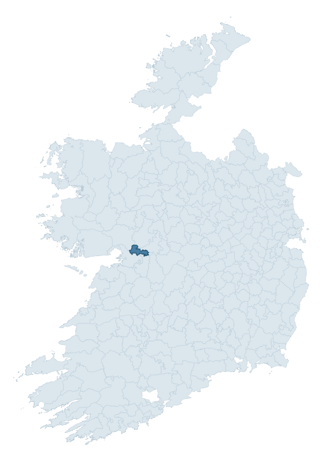
Where this barony sits in the Republic of Ireland
Geology and preservation
Bedrock geology shapes the landscape long before any settlement begins — controlling soil drainage, agricultural potential, the survival of upstanding monuments, and the preservation of buried archaeology. The figures below come from the Geological Survey Ireland 1:100,000 bedrock map.
The bedrock underlying Athenry is predominantly limestone (100% of the barony by area), laid down during the Carboniferous period (100% by area, around 359 to 299 million years ago). Limestone is the most heritage-rich bedrock in Ireland. It supports fertile, well-drained soils that favoured dense Early Medieval settlement and Norman manorial agriculture, and it weathers into karst features — sinkholes, caves, swallow holes, and souterrains — that frequently carry archaeology. Where peat overlies limestone, organic preservation can be exceptional. The single largest mapped unit is the Burren Formation (59% of the barony's bedrock). With only 1 distinct rock type mapped, the barony is geologically uniform compared to the rest of the Republic (1st percentile for diversity) — a single coherent bedrock landscape.
Largest mapped unit: Burren Formation (59% of the barony)
Placename evidence
Logainm records 20 heritage-diagnostic placenames for Athenry, drawn from townland and civil-parish names across the barony. The dominant stratum is Early Christian ecclesiastical — cill-, teampall-, and domhnach-prefixed names that record the dense network of early church foundations established between the fifth and tenth centuries. The leading diagnostic roots are cill- (7 — church), ráth- (5 — earthen ringfort), and cathair- (2 — stone fort). This is below the ROI average of 30.7 heritage placenames per barony, suggesting either lighter survey coverage or a townland-naming tradition that draws more on generic landscape vocabulary. The presence of multiple heritage strata side by side indicates layered occupation of the landscape across successive prehistoric and historic periods. Logainm records 100 placenames for Athenry (predominantly townland names). Of these, 20 (20%) carry one of the diagnostic Gaelic roots tracked above; the remainder draw on more generic landscape vocabulary that does not encode a heritage period.
Pre-Christian / Early Medieval Defensive
| Root | Count | Meaning |
|---|---|---|
| ráth- | 5 | earthen ringfort |
| cathair- | 2 | stone fort |
Early Christian Ecclesiastical
| Root | Count | Meaning |
|---|---|---|
| cill- | 7 | church (early) |
| tobar- | 2 | holy well |
| teampall- | 1 | church (later medieval) |
Burial, Ritual, and Norse-Contact
| Root | Count | Meaning |
|---|---|---|
| carn- | 2 | cairn |
| feart- | 1 | grave mound |
Other baronies in Galway
About this profile
Click any section below to expand.
What is a barony?
A barony is a historic administrative unit in Ireland, broadly equivalent to an English hundred. The 280 baronies used here are from the OSi 2019 National Statutory Boundaries (generalised 20m), covering the 26 counties of the Republic of Ireland. Baronies derive from the Norman period, were formalised in the 17th century, and have not been redrawn for statistical purposes. They vary enormously in area, from compact urban baronies in Dublin to vast upland baronies in Connacht, and should not be compared by raw site count without accounting for area differences.
What counts as a site?
This profile combines three distinct heritage registers, each with its own definition of what constitutes a recordable site:
- Archaeological sites (NMS). The National Monuments Service Sites and Monuments Record (SMR) catalogues every known archaeological monument or site of archaeological interest in the Republic, from prehistoric burial mounds and ringforts to medieval churches and post-medieval defensive works. Inclusion does not require legal protection — only that the site has been identified, surveyed, and assessed as having archaeological value. A separate subset of these sites lies within a recorded protection zone, which gives them statutory protection under the National Monuments Acts.
- Listed buildings (NIAH). The National Inventory of Architectural Heritage records buildings of architectural, historical, archaeological, artistic, cultural, scientific, social, or technical interest. Each surveyed structure is appraised on a five-tier scale: International, National, Regional, Local, and Record-Only. The NIAH appraisal is informational rather than strictly statutory, but it underpins local-authority Record of Protected Structures (RPS) listings.
- Heritage placenames (Logainm). Logainm is the authoritative database of Irish placenames maintained by the Placenames Branch. This profile applies a heritage-diagnostic classifier to the Irish-language form of each townland name, flagging roots that signal defensive sites (ráth-, lios-, dún-, caiseal-, cathair-), ecclesiastical foundations (cill-, teampall-, domhnach-, mainistir-), prehistoric burial-ritual features (tuaim-, carn-, leaba-), or Norse-contact settlement (gall-). Townlands without one of these diagnostic roots are not flagged here — they may still carry historical significance, but that significance is not encoded in the name itself.
Editorial principles
The narrative sections of this profile follow several explicit principles:
- Evidential. Every claim about this barony’s heritage character is anchored in the underlying register data. Where a site count, a placename count, or a percentile rank is cited, it is computed from the source datasets at export time, not estimated.
- Comparative. Counts and metrics are reported alongside their percentile rank against the other 279 ROI baronies. A barony with 50 ringforts in absolute terms could be unusually high or unusually low depending on its size and regional context; percentile ranking removes that ambiguity.
- Transparent on limits. Where a register has known coverage gaps, survey biases, or data-quality issues that affect this barony’s figures, the profile flags them rather than presenting the numbers as definitive.
- No interpretation beyond what the data supports. The narrative does not speculate about historical events, social dynamics, or cultural meaning beyond what the recorded heritage and placename evidence directly attests.
Data caveats and limits
- NMS Sites and Monuments Record is the product of survey campaigns conducted at different intensities across different counties and decades. Some baronies have been surveyed more thoroughly than others, and absolute counts should be read in that light. Sites destroyed by development before survey are typically not represented; sites in heavily forested or upland terrain are sometimes under-recorded.
- NIAH coverage is broadly complete for the Republic of Ireland but the survey was conducted on a rolling county-by-county basis, and the most recent appraisal date varies. Buildings demolished or substantially altered after their original survey may still appear in the register; conversely, recent buildings of merit may not yet have been appraised.
- Logainm classification applies a deliberately conservative pattern-matching approach to the Irish-language townland forms. The classifier prioritises true positives over recall: a townland may carry a heritage signal that the classifier doesn’t recognise, particularly where the diagnostic root has been heavily anglicised or where the townland name draws on a less common term. The 60,000+ townland records and ~9,800 classified placenames give a substantial signal at barony scale, but individual townland names should be checked against Logainm directly for definitive interpretation.
- Period attribution. The chronological distribution reflects only those NMS sites that carry a recognised period attribution in the source data. Sites listed as “Unknown” period are excluded from the dated subset.
- Boundary changes. Some baronies have undergone minor boundary adjustments since their 19th-century definition; the OSi 2019 generalised boundaries used here are the current statutory definition and may differ slightly from historical maps in border areas.
- Bedrock geology is mapped at 1:100,000 scale, which means local variation within a barony — small pockets of different rock type, mineral veins, alluvium overlying bedrock — is generalised. The dominant-system and rocktype figures are area-weighted, so a barony reading “70% Carboniferous limestone” may still contain small but archaeologically important pockets of older or younger rock. Around 3% of GSI polygons do not match the lexicon and contribute no rocktype or system attribution.
Data sources
- National Monuments Service — Sites and Monuments Record (SMR) https://data.gov.ie/dataset/national-monuments-service-archaeological-survey-of-ireland
- National Inventory of Architectural Heritage (NIAH) https://data.gov.ie/dataset/national-inventory-of-architectural-heritage-niah-national-dataset
- Logainm — Placenames Database of Ireland https://www.logainm.ie/
- Ordnance Survey Ireland — National Statutory Barony Boundaries 2019 https://data-osi.opendata.arcgis.com/
- EURODEM — European Digital Elevation Model https://www.mapsforeurope.org/datasets/euro-dem
- ESA WorldCover https://esa-worldcover.org/en
- Geological Survey Ireland — 1:100,000 Bedrock Geology https://www.gsi.ie/en-ie/data-and-maps/Pages/Bedrock.aspx
Explore more: Search any of the 280 ROI baronies, browse by historical province, or read the methodology and data sources for the full Republic of Ireland Heritage Tool.