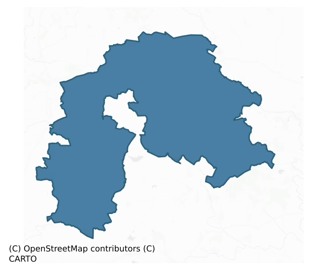
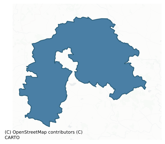
Ballymoe is a barony of County Galway, in the historical province of Connacht (Irish: Béal Átha Mó), covering 342 km² of land. The barony records 680 NMS archaeological sites and 39 NIAH listed buildings, placing it at around the 55th percentile among 280 ROI baronies for sites per km². This means it is in the upper half of all baronies for sites per km². Dated archaeological evidence runs from the Neolithic through to the Modern, spanning 8 of 9 archaeological periods, placing the barony in the 85th percentile among 280 ROI baronies for chronological depth. This means it is in the top fifth of all baronies for chronological depth. The largest dated subset of recorded sites dates to the Early Medieval. Logainm flags 44 placenames in the barony as carrying a recognised heritage root; the largest share — around 61% — are names associated with early Christian church and monastic foundations.
Heritage at a glance
Percentile rankings throughout this profile compare each barony only against the other 279 Republic of Ireland baronies.
The recorded heritage of Ballymoe
The National Monuments Service Sites and Monuments Record (SMR) is the statutory inventory of archaeological sites for the Republic of Ireland, maintained by the Department of Tourism, Culture, Arts, Gaeltacht, Sport and Media. Sites recorded here include earthworks, ringforts, megalithic tombs, ecclesiastical remains, and post-medieval features; not every record is legally protected, but each is registered as a monument of archaeological interest.
The National Monuments Service records 680 archaeological sites in Ballymoe, putting it at the 55th percentile among 280 ROI baronies for sites per km². This means it is in the upper half of all baronies for sites per km². Of these, 531 (78%) fall within a recorded monument protection zone. The dominant category is defensive sites — ringforts, enclosures, hillforts, and stone forts (390 sites, 57% of the record). Ringfort – rath is the most prevalent type, making up 29% of the barony's recorded sites (196 records) — well above the ROI average of 20% across all baronies where this type occurs. Ringfort – rath is an earthen ringfort enclosed by a bank and external ditch — the most common Early Medieval farmstead, broadly dated 500–1000 AD. Other significant types include Enclosure (101) and Quarry (76). Enclosure is a banked or ditched feature of uncertain type, used as a catch-all where the original function cannot be determined from surface evidence; Quarry is a place where stone, sand, gravel or clay was extracted. Across the barony's 342 km², this gives a recorded density of 1.99 sites per km².
Most common monument types
Hover or tap a monument type to see its definition.
| Type | Count |
|---|---|
| Ringfort – rath an earthen ringfort enclosed by a bank and external ditch — the most common Early Medieval farmstead, broadly dated 500–1000 AD | 196 |
| Enclosure a banked or ditched feature of uncertain type, used as a catch-all where the original function cannot be determined from surface evidence | 101 |
| Quarry a place where stone, sand, gravel or clay was extracted | 76 |
| Ringfort – unclassified a circular Early Medieval settlement enclosure where surviving evidence does not allow distinction between earthen and stone forms | 32 |
| Souterrain an underground stone-built passage and chamber, generally Early Medieval and often associated with ringforts as a defensive or storage feature | 27 |
| Children's burial ground an unconsecrated medieval and early-modern burial ground for unbaptised or stillborn children, often called a cillín or ceallúnach | 24 |
| Church a building used for public Christian worship, of any date from c. 500 AD onwards | 17 |
| Graveyard a burial area associated with a church, in use from the medieval period onwards | 13 |
Chronological distribution
The dated archaeological record for Ballymoe spans from the Neolithic through to the Modern, with activity attested across 8 of 9 archaeological periods. This is the 85th percentile across ROI baronies for chronological depth — an above-average span. Every period from earliest to latest is represented in the record — an unbroken sequence of dated activity across the full chronological span. Activity concentrates most heavily in the Early Medieval (260 sites, 54% of dated material), with the Iron Age forming a secondary peak (169 sites, 35%). A further 196 recorded sites (29% of the overall NMS register for the barony) carry no period attribution — appearing as 'Unknown' in the bar chart below. This typically reflects either records that pre-date the standardised period vocabulary or sites awaiting specialist dating review, rather than a genuine absence of chronological evidence.
Sample of recorded monuments
Show 25 sample monuments (of 680 total)
A representative sample of 25 recorded monuments drawn from the barony’s 680 total NMS entries. Sites within a recorded monument protection zone and rarer site types are prioritised so the list shows a meaningful cross-section rather than only the most common type. Each entry shows the official Sites and Monuments Record reference number and the description published by the National Monuments Service.
Megalithic structure
Some 50m E of a ringfort (GA005-091—-). Locally believed to be a grave, it consists of a large rectangular boulder (L 3.3m, Wth 2.6m), its long axis running NE-SW. This is supported at S end by a smaller boulder set…
Some 50m E of a ringfort (GA005-091—-). Locally believed to be a grave, it consists of a large rectangular boulder (L 3.3m, Wth 2.6m), its long axis running NE-SW. This is supported at S end by a smaller boulder set at right angles to it, and there is a possible sidestone (L 2.5m) on W side. A field wall overlies the monument at N.
The above description is derived from the published 'Archaeological Inventory of County Galway Vol. II – North Galway'. Compiled by Olive Alcock, Kathy de hÓra and Paul Gosling (Dublin: Stationery Office, 1999).
Date of upload: 05 August 2010
Altar
The Archaeological Survey of Ireland (ASI) is in the process of providing information on all monuments on The Historic Environment Viewer (HEV). Currently the information for this record has not been uploaded. To…
The Archaeological Survey of Ireland (ASI) is in the process of providing information on all monuments on The Historic Environment Viewer (HEV). Currently the information for this record has not been uploaded. To access available information for research purposes please make an appointment in advance with the Archive Unit (open Fridays 10.00 am – 5.00 pm), Department of Culture, Heritage and the Gaeltacht, The Custom House, Dublin 1 D01W6XO or email nmarchive@chg.gov.ie.
Barrow – unclassified
In a low-lying area surrounded by bogland. An oval barrow (N-S 37.5m, E-W 33.5m), in fair condition, consisting of a flat central area encircled by a low flat-topped earthen bank immediately outside of which is a fosse,…
In a low-lying area surrounded by bogland. An oval barrow (N-S 37.5m, E-W 33.5m), in fair condition, consisting of a flat central area encircled by a low flat-topped earthen bank immediately outside of which is a fosse, possibly recut for drainage purposes. A gap (Wth 2m) at S could be original. (Knight c. 1975, 107)
The above description is derived from the published 'Archaeological Inventory of County Galway Vol. II – North Galway'. Compiled by Olive Alcock, Kathy de hÓra and Paul Gosling (Dublin: Stationery Office, 1999).
Date of upload: 05 August 2010
Shrine
Situated on the W bank of a stream. No visible surface trace of the 'St. Patrick's Shrine' recorded on the 1930 edition of the OS 6-inch map survives. It has been replaced by a modern shrine consisting of a statue of…
Situated on the W bank of a stream. No visible surface trace of the 'St. Patrick's Shrine' recorded on the 1930 edition of the OS 6-inch map survives. It has been replaced by a modern shrine consisting of a statue of the saint and a water-filled trough, set in a circular concrete surround, which were erected in 1962.
The above description is derived from the published 'Archaeological Inventory of County Galway Vol. II – North Galway'. Compiled by Olive Alcock, Kathy de hÓra and Paul Gosling (Dublin: Stationery Office, 1999). In certain instances the entries have been revised and updated in the light of recent research.
Updated by: Olive Alcock
Date of revised upload: 8 August 2019
Kiln – lime
The Archaeological Survey of Ireland (ASI) is in the process of providing information on all monuments on The Historic Environment Viewer (HEV). Currently the information for this record has not been uploaded. To…
The Archaeological Survey of Ireland (ASI) is in the process of providing information on all monuments on The Historic Environment Viewer (HEV). Currently the information for this record has not been uploaded. To access available information for research purposes please make an appointment in advance with the Archive Unit (open Fridays 10.00 am – 5.00 pm), Department of Culture, Heritage and the Gaeltacht, The Custom House, Dublin 1 D01W6XO or email nmarchive@chg.gov.ie.
Penitential station
On N-facing slope of a low hill in pastureland. Known locally as 'St Patrick's Footprints', it consists of a heavily eroded earthfast limestone slab (L 1.3m, Wth 0.8m, H 0.3m). A foot-like groove and two other irregular…
On N-facing slope of a low hill in pastureland. Known locally as 'St Patrick's Footprints', it consists of a heavily eroded earthfast limestone slab (L 1.3m, Wth 0.8m, H 0.3m). A foot-like groove and two other irregular depressions are visible in its surface but all of them appear to be natural.
The above description is derived from the published 'Archaeological Inventory of County Galway Vol. II – North Galway'. Compiled by Olive Alcock, Kathy de hÓra and Paul Gosling (Dublin: Stationery Office, 1999).
Date of upload: 05 August 2010
Moated site
In a shallow valley in grassland, some 25m S of a stream. Well-preserved almost square moated site (E-W 27m, N-S 26m) defined by two banks and two fosse. The outer bank does not survive along N side, and the outer fosse…
In a shallow valley in grassland, some 25m S of a stream. Well-preserved almost square moated site (E-W 27m, N-S 26m) defined by two banks and two fosse. The outer bank does not survive along N side, and the outer fosse is only visible along E and S sides. A deep channel on W side, possible on the site of a leat, links the outer fosse with the stream.
The above description is derived from the published 'Archaeological Inventory of County Galway Vol. II – North Galway'. Compiled by Olive Alcock, Kathy de hÓra and Paul Gosling (Dublin: Stationery Office, 1999).
Date of upload: 05 August 2010
Megalithic tomb – unclassified
On a tract of flat land in an area of gently sloping pasture. The tomb is eccentrically incorporated in a circular cairn (D c. 10m) which has been reused as a CBG (GA006-005—-). A large roofstone rests above a…
On a tract of flat land in an area of gently sloping pasture. The tomb is eccentrically incorporated in a circular cairn (D c. 10m) which has been reused as a CBG (GA006-005—-). A large roofstone rests above a collapsed chamber, aligned E-W, represented by at least four stones. The remains are insufficient to allow classification. (Melvin c. 1971, 8; Ó Nuallain 1989, 142)
The above description is derived from the published 'Archaeological Inventory of County Galway Vol. II – North Galway'. Compiled by Olive Alcock, Kathy de hÓra and Paul Gosling (Dublin: Stationery Office, 1999).
Date of upload: 05 August 2010
Wall monument – effigial
The Archaeological Survey of Ireland (ASI) is in the process of providing information on all monuments on The Historic Environment Viewer (HEV). Currently the information for this record has not been uploaded. To…
The Archaeological Survey of Ireland (ASI) is in the process of providing information on all monuments on The Historic Environment Viewer (HEV). Currently the information for this record has not been uploaded. To access available information for research purposes please make an appointment in advance with the Archive Unit (open Fridays 10.00 am – 5.00 pm), Department of Culture, Heritage and the Gaeltacht, The Custom House, Dublin 1 D01W6XO or email nmarchive@chg.gov.ie.
Architectural fragment
A fragment of an ogee-headed window visible protruding from the base of the N wall, just E of the doorway of the 17th-century house (GA007-062001-) may originally have come from the castle (GA007-062—-).
Compiled…
A fragment of an ogee-headed window visible protruding from the base of the N wall, just E of the doorway of the 17th-century house (GA007-062001-) may originally have come from the castle (GA007-062—-).
Compiled by: Olive Alcock
Date of upload: 20 December 2017
Cross
The Archaeological Survey of Ireland (ASI) is in the process of providing information on all monuments on The Historic Environment Viewer (HEV). Currently the information for this record has not been uploaded. To…
The Archaeological Survey of Ireland (ASI) is in the process of providing information on all monuments on The Historic Environment Viewer (HEV). Currently the information for this record has not been uploaded. To access available information for research purposes please make an appointment in advance with the Archive Unit (open Fridays 10.00 am – 5.00 pm), Department of Culture, Heritage and the Gaeltacht, The Custom House, Dublin 1 D01W6XO or email nmarchive@chg.gov.ie.
Penal Mass station
In undulating pastureland. The source of this record is a hachured area indicated on the 1930 edition of the OS 6-inch map. This is named 'Quarry (disused)' on the OS 1:2500 plan (surveyed 1912-16). According to local…
In undulating pastureland. The source of this record is a hachured area indicated on the 1930 edition of the OS 6-inch map. This is named 'Quarry (disused)' on the OS 1:2500 plan (surveyed 1912-16). According to local information, this pit was used as a place for celebrating mass during penal times.
Compiled by: Paul Walsh
Date of upload: 9 January 2014
Cross (present location)
The Archaeological Survey of Ireland (ASI) is in the process of providing information on all monuments on The Historic Environment Viewer (HEV). Currently the information for this record has not been uploaded. To…
The Archaeological Survey of Ireland (ASI) is in the process of providing information on all monuments on The Historic Environment Viewer (HEV). Currently the information for this record has not been uploaded. To access available information for research purposes please make an appointment in advance with the Archive Unit (open Fridays 10.00 am – 5.00 pm), Department of Culture, Heritage and the Gaeltacht, The Custom House, Dublin 1 D01W6XO or email nmarchive@chg.gov.ie.
Architectural feature
This mantle stone was originally located over a fireplace in Park Castle (GA018-058—-) which was the home of the Mac Egans, hereditary brehons of the O Conors of Connacht (Killanin and Duignan 1967, 267). It is now…
This mantle stone was originally located over a fireplace in Park Castle (GA018-058—-) which was the home of the Mac Egans, hereditary brehons of the O Conors of Connacht (Killanin and Duignan 1967, 267). It is now incorporated into one of the walls of the National School in Clonbern. The stone is dated 1627 and bears an inscription in Irish which translates ‘Cormac Mac Aodhagáin made this work at the time of the age of the Lord, one thousand six hundred and twenty seven’ (information from Prof. E. FitzPatrick 20 March 2019). (Melvin c. 1971, 12-13)
Compiled by: Olive Alcock
Date of upload: 28 March 2019
Water mill – vertical-wheeled
The Archaeological Survey of Ireland (ASI) is in the process of providing information on all monuments on The Historic Environment Viewer (HEV). Currently the information for this record has not been uploaded. To…
The Archaeological Survey of Ireland (ASI) is in the process of providing information on all monuments on The Historic Environment Viewer (HEV). Currently the information for this record has not been uploaded. To access available information for research purposes please make an appointment in advance with the Archive Unit (open Fridays 10.00 am – 5.00 pm), Department of Culture, Heritage and the Gaeltacht, The Custom House, Dublin 1 D01W6XO or email nmarchive@chg.gov.ie.
Megalithic tomb – court tomb
On SE-facing slopes of Slieve Dart overlooking gently undulating farmland. The monument consists of a pair of galleries set back to back and 1.75m apart. They are aligned roughly E-W and are incorporated in a cairn of…
On SE-facing slopes of Slieve Dart overlooking gently undulating farmland. The monument consists of a pair of galleries set back to back and 1.75m apart. They are aligned roughly E-W and are incorporated in a cairn of uncertain outline (c. 22m E-W, c. 15m N-S). The E gallery (L 6.7m, Wth c. 1.5m), which consists of two chambers, is preceded by a short ante-chamber. In front, and to S of this, are the meagre remains of a court represented by two orthostats. The W gallery is poorly preserved; only its E end survives (L 2.5m, Wth c. 1.1m). There are no indications of a court at this end of the monument, (de Valera and Ó Nualláin 1972, 1-2; Ó Nualláin 1989, 118)
The above description is derived from the published 'Archaeological Inventory of County Galway Vol. II – North Galway'. Compiled by Olive Alcock, Kathy de hÓra and Paul Gosling (Dublin: Stationery Office, 1999).
Date of upload: 05 August 2010
See linked document with details from Ruaidhrí de Valera and Seán Ó Nualláin, Survey of the Megalithic Tombs of Ireland. Volume III. Counties Galway, Roscommon, Leitrim, Longford, Westmeath, Laoighis, Offaly, Kildare, Cavan. (Dublin: Stationery Office, 1972).
House – 17th century
On S-facing slope of a ridge in grassland. Poorly preserved shell of a rectangular two-storey building (E-W; L 22.7m, Wth 8.6m), possibly of late 17th/18th-C date. The upper storey is contained within the pitch of the…
On S-facing slope of a ridge in grassland. Poorly preserved shell of a rectangular two-storey building (E-W; L 22.7m, Wth 8.6m), possibly of late 17th/18th-C date. The upper storey is contained within the pitch of the roof. Only fragmentary sections of S wall still stand, in which at least three opes are visible; the N wall is completely gone. The main architectural features are the steeply pitched gables, each crowned by a tall rectangular chimney stack. There are two flues on ground floor, in both gables, possibly for fireplaces and ovens. Above these, on 1st floor, are separate flues, probably for fireplaces, each flanked by rectangular windows.
The above description is derived from the published 'Archaeological Inventory of County Galway Vol. II – North Galway'. Compiled by Olive Alcock, Kathy de hÓra and Paul Gosling (Dublin: Stationery Office, 1999).
Date of upload: 05 August 2010
Hilltop enclosure
Just off summit of a NW-SE running ridge in undulating grassland, overlooking the village of Williamstown to SE. Circular enclosure (D 110m), in fair condition, defined by two earthen banks and an intervening fosse. The…
Just off summit of a NW-SE running ridge in undulating grassland, overlooking the village of Williamstown to SE. Circular enclosure (D 110m), in fair condition, defined by two earthen banks and an intervening fosse. The inner bank is present from N through E to S; elsewhere a degraded scarp forms the enclosing element. The fosse and outer bank are best preserved from E to S. Either of two gaps at W or E could be original.
The above description is derived from the published 'Archaeological Inventory of County Galway Vol. II – North Galway'. Compiled by Olive Alcock, Kathy de hÓra and Paul Gosling (Dublin: Stationery Office, 1999).
Date of upload: 05 August 2010
Bullaun stone
This bullaun stone lies to the NNW of the graveyard (GA006-12200-) and c. 3m to the W of a small stream.
It is visible in the N half of a subrectangular limestone slab (L 1.5m; Wth 0.8m; T 0.2m). The basin (0.35m E-W;…
This bullaun stone lies to the NNW of the graveyard (GA006-12200-) and c. 3m to the W of a small stream.
It is visible in the N half of a subrectangular limestone slab (L 1.5m; Wth 0.8m; T 0.2m). The basin (0.35m E-W; 0.3m N-S; D 0.18m) is subcircular in plan and narrows towards the base (diam. 0.15m). A small fissure runs off it at NW.
Compiled by: Olive Alcock
Date of upload: 8 August 2019
Water mill – vertical-wheeled
The Archaeological Survey of Ireland (ASI) is in the process of providing information on all monuments on The Historic Environment Viewer (HEV). Currently the information for this record has not been uploaded. To…
The Archaeological Survey of Ireland (ASI) is in the process of providing information on all monuments on The Historic Environment Viewer (HEV). Currently the information for this record has not been uploaded. To access available information for research purposes please make an appointment in advance with the Archive Unit (open Fridays 10.00 am – 5.00 pm), Department of Culture, Heritage and the Gaeltacht, The Custom House, Dublin 1 D01W6XO or email nmarchive@chg.gov.ie.
Hilltop enclosure
On a hill summit in pastureland. A large poorly preserved subcircular enclosure (NW-SE 85m, NE-SW 65m) defined by a fosse, divided in two by a modern field bank running NNE-SSW. A site inspection in 1967 (Topgr. Files,…
On a hill summit in pastureland. A large poorly preserved subcircular enclosure (NW-SE 85m, NE-SW 65m) defined by a fosse, divided in two by a modern field bank running NNE-SSW. A site inspection in 1967 (Topgr. Files, OPW) recorded that it was 'bounded by a collapsed stone wall (overgrown and giving superficial appearance of a bank). Big wide deep fosse inside'. Subsequently levelled, it is now defined by a broad shallow fosse (Wth 5m). Outside the fosse, a band of nettles and thistles is visible from WNW to N, possibly indicating the line of the outer bank/wall. Traces of a possible causeway across the fosse are visible at N. The interior is flat but is slightly lower than the exterior. A battlefield (GA007-042—-) lies immediately to E.
The above description is derived from the published 'Archaeological Inventory of County Galway Vol. II – North Galway'. Compiled by Olive Alcock, Kathy de hÓra and Paul Gosling (Dublin: Stationery Office, 1999).
Date of upload: 05 August 2010
Burial ground
On a slight rise in pastureland, overlooking the River Suck to the N. On the 3rd edition of the OS 6-inch map (1930) the term 'Caltra' is depicted within a large roughly subrectangular unenclosed area (c. 80m by c.…
On a slight rise in pastureland, overlooking the River Suck to the N. On the 3rd edition of the OS 6-inch map (1930) the term 'Caltra' is depicted within a large roughly subrectangular unenclosed area (c. 80m by c. 75m), which is delimited by a broken line. The name may be derived from the Irish 'Cealtrach' meaning an old burial ground (Joyce 1923, 98). There is no visible evidence of burial. According to local tradition, a sword was found here.
The above description is derived from the published 'Archaeological Inventory of County Galway Vol. II – North Galway'. Compiled by Olive Alcock, Kathy de hÓra and Paul Gosling (Dublin: Stationery Office, 1999). In certain instances the entries have been revised and updated in the light of recent research.
Revised by: Olive Alcock
Date of upload: 25 May 2016
Burial ground
In undulating grassland, immediately NE of the site of Glennamaddy Union Workhouse. Poorly preserved circular rath (D 39m) defined by a bank and external fosse from NW through N to ENE; elsewhere a scarp forms the…
In undulating grassland, immediately NE of the site of Glennamaddy Union Workhouse. Poorly preserved circular rath (D 39m) defined by a bank and external fosse from NW through N to ENE; elsewhere a scarp forms the enclosing element. A field bank cuts the monument at SSE and SW. The interior is flat and featureless. On 3rd ed. of OS 6-inch map (1933), the words 'Burial Ground (Disused)' appear adjacent to this monument but this is more likely to have been associated with the workhouse than the ringfort. (Knight c. 1975, 112)
The above description is derived from the published 'Archaeological Inventory of County Galway Vol. II – North Galway'. Compiled by Olive Alcock, Kathy de hÓra and Paul Gosling (Dublin: Stationery Office, 1999).
Date of upload: 05 August 2010
Kiln
The Archaeological Survey of Ireland (ASI) is in the process of providing information on all monuments on The Historic Environment Viewer (HEV). Currently the information for this record has not been uploaded. To…
The Archaeological Survey of Ireland (ASI) is in the process of providing information on all monuments on The Historic Environment Viewer (HEV). Currently the information for this record has not been uploaded. To access available information for research purposes please make an appointment in advance with the Archive Unit (open Fridays 10.00 am – 5.00 pm), Department of Culture, Heritage and the Gaeltacht, The Custom House, Dublin 1 D01W6XO or email nmarchive@chg.gov.ie.
Ringfort – rath
On an E-facing slope in grassland overlooking bogland to SW. On inspection in June 1984, this subcircular rath (N-S 35.5m, E-W 33m) , known locally as 'Lisduff' (Neary 1914, 117, no. 3), was defined by an overgrown bank…
On an E-facing slope in grassland overlooking bogland to SW. On inspection in June 1984, this subcircular rath (N-S 35.5m, E-W 33m) , known locally as 'Lisduff' (Neary 1914, 117, no. 3), was defined by an overgrown bank (Wth 2.8m; int. H 0.4m; ext. H 1.2m) with traces of an external fosse surviving only at SW. A gap (Wth 2m) at NE may have been original. On re-inspection in January 2010, it was found that the rath had been completely levelled.
The above description is derived from the published 'Archaeological Inventory of County Galway Vol. II – North Galway'. Compiled by Olive Alcock, Kathy de hÓra and Paul Gosling (Dublin: Stationery Office, 1999).
The following image has been uploaded: GA006-036—-.jpg
Edited by: Olive Alcock
Date of revised upload: 22 June 2023
Listed buildings
The National Inventory of Architectural Heritage (NIAH) is a state survey appraising buildings of architectural, historical, archaeological, artistic, cultural, scientific, social, or technical interest. Each surveyed structure receives a rating from International (the highest, for buildings of European importance) through National, Regional, Local, and Record-Only.
The NIAH records only 39 listed buildings in Ballymoe, the 19th percentile across ROI baronies — a relatively thin architectural record. The highest-graded structure include 1 of National significance. The Republic holds 937 National-graded buildings in total, so this barony accounts for around 0% of the national total. Construction dates concentrate most heavily in the Victorian (1830-1900) period. The most-recorded building type is house (9 examples, 23% of the listed stock).
Terrain and environment
Mean elevation across the barony is 82m — the 43rd percentile among 280 ROI baronies for elevation. This means it is in the lower half of all baronies for elevation. Elevation matters for heritage because higher-altitude baronies typically favour defensive monuments — ringforts and hilltop forts placed on prominent ground — while lowland baronies are more likely to carry the dense settlement and church networks of intensive agricultural landscapes. Mean slope is 2.2° — the 16th percentile among 280 ROI baronies for slope. This means it is in the bottom fifth of all baronies for slope. This is broadly flat terrain, the kind of landscape best suited to intensive agriculture. Slope is a key control on both land use and archaeological preservation: steep ground resists ploughing and tends to preserve earthworks intact, while gentle slopes favour intensive cultivation that damages or destroys surface archaeology over time. The Topographic Wetness Index averages 11.7, the 85th percentile among 280 ROI baronies for wetness. This means it is in the top fifth of all baronies for wetness. This is wet, slow-draining ground by ROI standards — the kind of landscape that may carry waterlogged archaeological sites of unusual preservation value. Drainage matters for heritage because poorly-drained ground preserves organic archaeology (wooden trackways, leather, textiles, and on rare occasions human remains) far better than free-draining soil; well-drained ground favours arable use but destroys organic material rapidly. The land cover is dominated by improved grassland (86%) and woodland (12%).
Terrain measurements
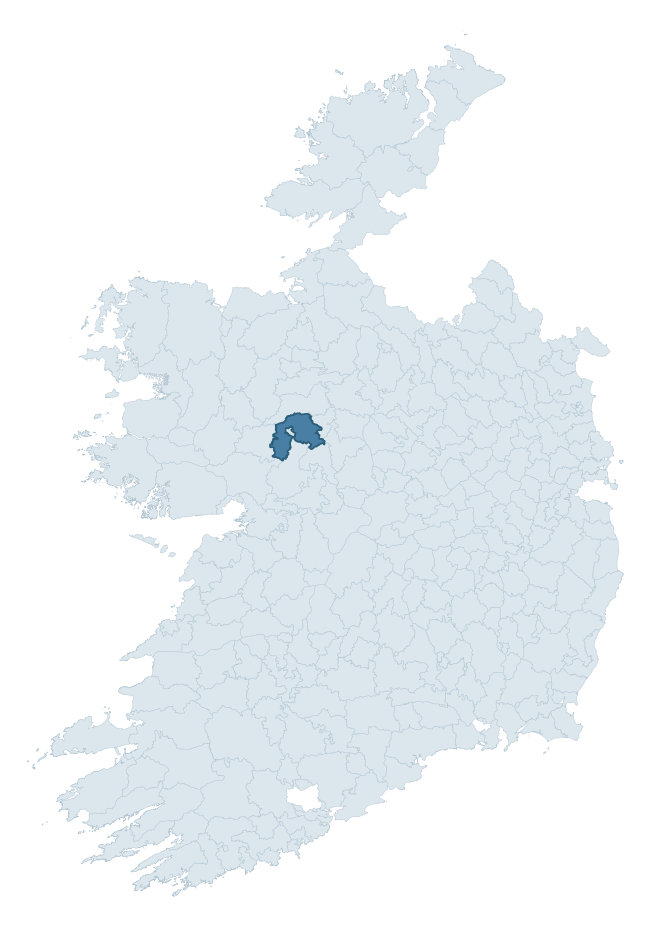
Where this barony sits in the Republic of Ireland
Geology and preservation
Bedrock geology shapes the landscape long before any settlement begins — controlling soil drainage, agricultural potential, the survival of upstanding monuments, and the preservation of buried archaeology. The figures below come from the Geological Survey Ireland 1:100,000 bedrock map.
The bedrock underlying Ballymoe is predominantly black calcarenites and shales (48% of the barony by area), laid down during the Carboniferous period (100% by area, around 359 to 299 million years ago). A substantial secondary geology of limestone (45%) adds further variety to the underlying landscape. The single largest mapped unit is the Ballymore Limestone Formation (48% of the barony's bedrock).
Rock type composition
Largest mapped unit: Ballymore Limestone Formation (48% of the barony)
Placename evidence
Logainm records 44 heritage-diagnostic placenames for Ballymoe, drawn from townland and civil-parish names across the barony. The dominant stratum is Early Christian ecclesiastical — cill-, teampall-, and domhnach-prefixed names that record the dense network of early church foundations established between the fifth and tenth centuries. The leading diagnostic roots are cill- (20 — church), lios- (7 — ringfort or enclosure), and tobar- (4 — holy well). This is above the ROI average of 30.7 heritage placenames per barony. The presence of multiple heritage strata side by side indicates layered occupation of the landscape across successive prehistoric and historic periods. Logainm records 272 placenames for Ballymoe (predominantly townland names). Of these, 44 (16%) carry one of the diagnostic Gaelic roots tracked above; the remainder draw on more generic landscape vocabulary that does not encode a heritage period.
Pre-Christian / Early Medieval Defensive
| Root | Count | Meaning |
|---|---|---|
| lios- | 7 | ringfort or enclosure |
| ráth- | 1 | earthen ringfort |
| dún- | 1 | hilltop or promontory fort |
| caiseal- | 1 | stone ringfort |
Early Christian Ecclesiastical
| Root | Count | Meaning |
|---|---|---|
| cill- | 20 | church (early) |
| tobar- | 4 | holy well |
| teampall- | 2 | church (later medieval) |
| mainistir- | 1 | monastery |
Burial, Ritual, and Norse-Contact
| Root | Count | Meaning |
|---|---|---|
| tuaim- | 3 | burial mound |
| feart- | 1 | grave mound |
Other baronies in Galway
About this profile
Click any section below to expand.
What is a barony?
A barony is a historic administrative unit in Ireland, broadly equivalent to an English hundred. The 280 baronies used here are from the OSi 2019 National Statutory Boundaries (generalised 20m), covering the 26 counties of the Republic of Ireland. Baronies derive from the Norman period, were formalised in the 17th century, and have not been redrawn for statistical purposes. They vary enormously in area, from compact urban baronies in Dublin to vast upland baronies in Connacht, and should not be compared by raw site count without accounting for area differences.
What counts as a site?
This profile combines three distinct heritage registers, each with its own definition of what constitutes a recordable site:
- Archaeological sites (NMS). The National Monuments Service Sites and Monuments Record (SMR) catalogues every known archaeological monument or site of archaeological interest in the Republic, from prehistoric burial mounds and ringforts to medieval churches and post-medieval defensive works. Inclusion does not require legal protection — only that the site has been identified, surveyed, and assessed as having archaeological value. A separate subset of these sites lies within a recorded protection zone, which gives them statutory protection under the National Monuments Acts.
- Listed buildings (NIAH). The National Inventory of Architectural Heritage records buildings of architectural, historical, archaeological, artistic, cultural, scientific, social, or technical interest. Each surveyed structure is appraised on a five-tier scale: International, National, Regional, Local, and Record-Only. The NIAH appraisal is informational rather than strictly statutory, but it underpins local-authority Record of Protected Structures (RPS) listings.
- Heritage placenames (Logainm). Logainm is the authoritative database of Irish placenames maintained by the Placenames Branch. This profile applies a heritage-diagnostic classifier to the Irish-language form of each townland name, flagging roots that signal defensive sites (ráth-, lios-, dún-, caiseal-, cathair-), ecclesiastical foundations (cill-, teampall-, domhnach-, mainistir-), prehistoric burial-ritual features (tuaim-, carn-, leaba-), or Norse-contact settlement (gall-). Townlands without one of these diagnostic roots are not flagged here — they may still carry historical significance, but that significance is not encoded in the name itself.
Editorial principles
The narrative sections of this profile follow several explicit principles:
- Evidential. Every claim about this barony’s heritage character is anchored in the underlying register data. Where a site count, a placename count, or a percentile rank is cited, it is computed from the source datasets at export time, not estimated.
- Comparative. Counts and metrics are reported alongside their percentile rank against the other 279 ROI baronies. A barony with 50 ringforts in absolute terms could be unusually high or unusually low depending on its size and regional context; percentile ranking removes that ambiguity.
- Transparent on limits. Where a register has known coverage gaps, survey biases, or data-quality issues that affect this barony’s figures, the profile flags them rather than presenting the numbers as definitive.
- No interpretation beyond what the data supports. The narrative does not speculate about historical events, social dynamics, or cultural meaning beyond what the recorded heritage and placename evidence directly attests.
Data caveats and limits
- NMS Sites and Monuments Record is the product of survey campaigns conducted at different intensities across different counties and decades. Some baronies have been surveyed more thoroughly than others, and absolute counts should be read in that light. Sites destroyed by development before survey are typically not represented; sites in heavily forested or upland terrain are sometimes under-recorded.
- NIAH coverage is broadly complete for the Republic of Ireland but the survey was conducted on a rolling county-by-county basis, and the most recent appraisal date varies. Buildings demolished or substantially altered after their original survey may still appear in the register; conversely, recent buildings of merit may not yet have been appraised.
- Logainm classification applies a deliberately conservative pattern-matching approach to the Irish-language townland forms. The classifier prioritises true positives over recall: a townland may carry a heritage signal that the classifier doesn’t recognise, particularly where the diagnostic root has been heavily anglicised or where the townland name draws on a less common term. The 60,000+ townland records and ~9,800 classified placenames give a substantial signal at barony scale, but individual townland names should be checked against Logainm directly for definitive interpretation.
- Period attribution. The chronological distribution reflects only those NMS sites that carry a recognised period attribution in the source data. Sites listed as “Unknown” period are excluded from the dated subset.
- Boundary changes. Some baronies have undergone minor boundary adjustments since their 19th-century definition; the OSi 2019 generalised boundaries used here are the current statutory definition and may differ slightly from historical maps in border areas.
- Bedrock geology is mapped at 1:100,000 scale, which means local variation within a barony — small pockets of different rock type, mineral veins, alluvium overlying bedrock — is generalised. The dominant-system and rocktype figures are area-weighted, so a barony reading “70% Carboniferous limestone” may still contain small but archaeologically important pockets of older or younger rock. Around 3% of GSI polygons do not match the lexicon and contribute no rocktype or system attribution.
Data sources
- National Monuments Service — Sites and Monuments Record (SMR) https://data.gov.ie/dataset/national-monuments-service-archaeological-survey-of-ireland
- National Inventory of Architectural Heritage (NIAH) https://data.gov.ie/dataset/national-inventory-of-architectural-heritage-niah-national-dataset
- Logainm — Placenames Database of Ireland https://www.logainm.ie/
- Ordnance Survey Ireland — National Statutory Barony Boundaries 2019 https://data-osi.opendata.arcgis.com/
- EURODEM — European Digital Elevation Model https://www.mapsforeurope.org/datasets/euro-dem
- ESA WorldCover https://esa-worldcover.org/en
- Geological Survey Ireland — 1:100,000 Bedrock Geology https://www.gsi.ie/en-ie/data-and-maps/Pages/Bedrock.aspx
Explore more: Search any of the 280 ROI baronies, browse by historical province, or read the methodology and data sources for the full Republic of Ireland Heritage Tool.