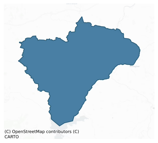
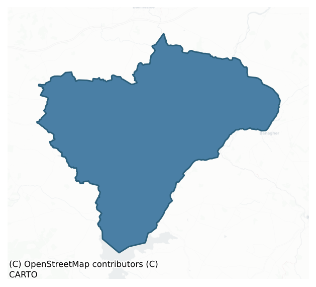
Longford is a barony of County Galway, in the historical province of Connacht (Irish: An Longfort), covering 403 km² of land. The barony records 993 NMS archaeological sites and 168 NIAH listed buildings, placing it at around the 71st percentile among 280 ROI baronies for sites per km². This means it is in the top third of all baronies for sites per km². Dated archaeological evidence runs from the Neolithic through to the Modern, spanning 8 of 9 archaeological periods, placing the barony in the 81st percentile among 280 ROI baronies for chronological depth. This means it is in the top fifth of all baronies for chronological depth. The largest dated subset of recorded sites dates to the Early Medieval. Logainm flags 74 placenames in the barony as carrying a recognised heritage root; the largest share — around 53% — are names associated with early Christian church and monastic foundations.
Heritage at a glance
Percentile rankings throughout this profile compare each barony only against the other 279 Republic of Ireland baronies.
The recorded heritage of Longford
The National Monuments Service Sites and Monuments Record (SMR) is the statutory inventory of archaeological sites for the Republic of Ireland, maintained by the Department of Tourism, Culture, Arts, Gaeltacht, Sport and Media. Sites recorded here include earthworks, ringforts, megalithic tombs, ecclesiastical remains, and post-medieval features; not every record is legally protected, but each is registered as a monument of archaeological interest.
The National Monuments Service records 993 archaeological sites in Longford, putting it at the 71st percentile among 280 ROI baronies for sites per km². This means it is in the top third of all baronies for sites per km². Of these, 635 (64%) fall within a recorded monument protection zone. The record is dominated by defensive sites — ringforts, enclosures, hillforts, and stone forts (291 sites, 29% of the total), with industrial sites forming a substantial secondary presence (205 sites, 21%). Quarry is the most prevalent type, making up 20% of the barony's recorded sites (194 records) — well above the ROI average of 4% across all baronies where this type occurs. Quarry is a place where stone, sand, gravel or clay was extracted. Other significant types include Ringfort – rath (181) and Enclosure (66). Ringfort – rath is an earthen ringfort enclosed by a bank and external ditch — the most common Early Medieval farmstead, broadly dated 500–1000 AD; Enclosure is a banked or ditched feature of uncertain type, used as a catch-all where the original function cannot be determined from surface evidence. Across the barony's 403 km², this gives a recorded density of 2.47 sites per km².
Most common monument types
Hover or tap a monument type to see its definition.
| Type | Count |
|---|---|
| Quarry a place where stone, sand, gravel or clay was extracted | 194 |
| Ringfort – rath an earthen ringfort enclosed by a bank and external ditch — the most common Early Medieval farmstead, broadly dated 500–1000 AD | 181 |
| Enclosure a banked or ditched feature of uncertain type, used as a catch-all where the original function cannot be determined from surface evidence | 66 |
| Children's burial ground an unconsecrated medieval and early-modern burial ground for unbaptised or stillborn children, often called a cillín or ceallúnach | 33 |
| Graveslab a recumbent grave-marking slab, dated 1200–1700 AD | 33 |
| Church a building used for public Christian worship, of any date from c. 500 AD onwards | 31 |
Chronological distribution
The dated archaeological record for Longford spans from the Neolithic through to the Modern, with activity attested across 8 of 9 archaeological periods. This is the 81st percentile across ROI baronies for chronological depth — an above-average span. Every period from earliest to latest is represented in the record — an unbroken sequence of dated activity across the full chronological span. Activity concentrates most heavily in the Early Medieval (246 sites, 48% of dated material), with the Iron Age forming a secondary peak (155 sites, 30%). A further 482 recorded sites (49% of the overall NMS register for the barony) carry no period attribution — appearing as 'Unknown' in the bar chart below. This typically reflects either records that pre-date the standardised period vocabulary or sites awaiting specialist dating review, rather than a genuine absence of chronological evidence.
Sample of recorded monuments
Show 25 sample monuments (of 993 total)
A representative sample of 25 recorded monuments drawn from the barony’s 993 total NMS entries. Sites within a recorded monument protection zone and rarer site types are prioritised so the list shows a meaningful cross-section rather than only the most common type. Each entry shows the official Sites and Monuments Record reference number and the description published by the National Monuments Service.
Monumental structure
The Archaeological Survey of Ireland (ASI) is in the process of providing information on all monuments on The Historic Environment Viewer (HEV). Currently the information for this record has not been uploaded. To…
The Archaeological Survey of Ireland (ASI) is in the process of providing information on all monuments on The Historic Environment Viewer (HEV). Currently the information for this record has not been uploaded. To access available information for research purposes please make an appointment in advance with the Archive Unit (open Fridays 10.00 am – 5.00 pm), Department of Culture, Heritage and the Gaeltacht, The Custom House, Dublin 1 D01W6XO or email nmarchive@chg.gov.ie.
House – vernacular house
The Archaeological Survey of Ireland (ASI) is in the process of providing information on all monuments on The Historic Environment Viewer (HEV). Currently the information for this record has not been uploaded. To…
The Archaeological Survey of Ireland (ASI) is in the process of providing information on all monuments on The Historic Environment Viewer (HEV). Currently the information for this record has not been uploaded. To access available information for research purposes please make an appointment in advance with the Archive Unit (open Fridays 10.00 am – 5.00 pm), Department of Culture, Heritage and the Gaeltacht, The Custom House, Dublin 1 D01W6XO or email nmarchive@chg.gov.ie.
Gate lodge
The Archaeological Survey of Ireland (ASI) is in the process of providing information on all monuments on The Historic Environment Viewer (HEV). Currently the information for this record has not been uploaded. To…
The Archaeological Survey of Ireland (ASI) is in the process of providing information on all monuments on The Historic Environment Viewer (HEV). Currently the information for this record has not been uploaded. To access available information for research purposes please make an appointment in advance with the Archive Unit (open Fridays 10.00 am – 5.00 pm), Department of Culture, Heritage and the Gaeltacht, The Custom House, Dublin 1 D01W6XO or email nmarchive@chg.gov.ie.
Cenotaph
The Archaeological Survey of Ireland (ASI) is in the process of providing information on all monuments on The Historic Environment Viewer (HEV). Currently the information for this record has not been uploaded. To…
The Archaeological Survey of Ireland (ASI) is in the process of providing information on all monuments on The Historic Environment Viewer (HEV). Currently the information for this record has not been uploaded. To access available information for research purposes please make an appointment in advance with the Archive Unit (open Fridays 10.00 am – 5.00 pm), Department of Culture, Heritage and the Gaeltacht, The Custom House, Dublin 1 D01W6XO or email nmarchive@chg.gov.ie.
Road – road/trackway
Possibly associated with the large enclosure (GA100-106001-). This trackway (L c. 135m), running ENE-WSW, is defined by two heavily degraded parallel banks of earth which are 11.5m apart. The banks fade out just short…
Possibly associated with the large enclosure (GA100-106001-). This trackway (L c. 135m), running ENE-WSW, is defined by two heavily degraded parallel banks of earth which are 11.5m apart. The banks fade out just short of the enclosure at W. (ASGAP 172:27)
Compiled by: Galway Archaeological Survey, UCG
Date of upload: 27 August 2019
Religious house – unclassified
In marshy pastureland; an E-W running stream flows to the S. According local information, this is the site of a nunnery. It consists of the remains of a rectangular structure (10.8m N-S; 5m E-W). Only the grassed-over N…
In marshy pastureland; an E-W running stream flows to the S. According local information, this is the site of a nunnery. It consists of the remains of a rectangular structure (10.8m N-S; 5m E-W). Only the grassed-over N wall (Wth 0.9m; int. H 0.5m; ext. H 0.3m) and the return of the W wall (Wth 1.1m; int. H 0.1m; ext. H 0.7m) as well as a short stretch (L 5.4m) of the S end of the latter wall survive. There is no visible surface trace of the E or S walls; a N-S running field boundary overlies the line of the E wall. While the walls are obscured by grass and rubble, where visible they consist of double-faced walls with a rubble core and they are roughly coursed and composed of limestone.
Compiled by: Olive Alcock
Date of upload: 1 April 2020
Mass-rock (present location)
The Archaeological Survey of Ireland (ASI) is in the process of providing information on all monuments on The Historic Environment Viewer (HEV). Currently the information for this record has not been uploaded. To…
The Archaeological Survey of Ireland (ASI) is in the process of providing information on all monuments on The Historic Environment Viewer (HEV). Currently the information for this record has not been uploaded. To access available information for research purposes please make an appointment in advance with the Archive Unit (open Fridays 10.00 am – 5.00 pm), Department of Culture, Heritage and the Gaeltacht, The Custom House, Dublin 1 D01W6XO or email nmarchive@chg.gov.ie.
Cathedral
The Archaeological Survey of Ireland (ASI) is in the process of providing information on all monuments on The Historic Environment Viewer (HEV). Currently the information for this record has not been uploaded. To…
The Archaeological Survey of Ireland (ASI) is in the process of providing information on all monuments on The Historic Environment Viewer (HEV). Currently the information for this record has not been uploaded. To access available information for research purposes please make an appointment in advance with the Archive Unit (open Fridays 10.00 am – 5.00 pm), Department of Culture, Heritage and the Gaeltacht, The Custom House, Dublin 1 D01W6XO or email nmarchive@chg.gov.ie.
Religious house – Augustinian nuns
The Archaeological Survey of Ireland (ASI) is in the process of providing information on all monuments on The Historic Environment Viewer (HEV). Currently the information for this record has not been uploaded. To…
The Archaeological Survey of Ireland (ASI) is in the process of providing information on all monuments on The Historic Environment Viewer (HEV). Currently the information for this record has not been uploaded. To access available information for research purposes please make an appointment in advance with the Archive Unit (open Fridays 10.00 am – 5.00 pm), Department of Culture, Heritage and the Gaeltacht, The Custom House, Dublin 1 D01W6XO or email nmarchive@chg.gov.ie.
Hilltop enclosure
On a rise in otherwise level grassland. Poorly preserved oval enclosure (87.5m E-W; 64.5m N-S)
defined by a scarp overlain by a field wall from S through W to N. A possible entrance gap (Wth 3m) is evident at N.…
On a rise in otherwise level grassland. Poorly preserved oval enclosure (87.5m E-W; 64.5m N-S)
defined by a scarp overlain by a field wall from S through W to N. A possible entrance gap (Wth 3m) is evident at N.
Compiled by: Galway Archaeological Survey, UCG
Date of upload: 13 December 2017
Altar
On a hummock in gently undulating grassland. Named 'R.C. Chapel & Altar' on the 1838 edition of the OS 6-inch map. No visible surface trace survives. According to the landowner the chapel was a penal chapel.…
On a hummock in gently undulating grassland. Named 'R.C. Chapel & Altar' on the 1838 edition of the OS 6-inch map. No visible surface trace survives. According to the landowner the chapel was a penal chapel.
Compiled by: Olive Alcock
Date of upload: 3 April 2020
Brewery
The Archaeological Survey of Ireland (ASI) is in the process of providing information on all monuments on The Historic Environment Viewer (HEV). Currently the information for this record has not been uploaded. To…
The Archaeological Survey of Ireland (ASI) is in the process of providing information on all monuments on The Historic Environment Viewer (HEV). Currently the information for this record has not been uploaded. To access available information for research purposes please make an appointment in advance with the Archive Unit (open Fridays 10.00 am – 5.00 pm), Department of Culture, Heritage and the Gaeltacht, The Custom House, Dublin 1 D01W6XO or email nmarchive@chg.gov.ie.
Religious house – Franciscan friars
On a low hill overlooking the River Shannon to the E, on or close to the site of the medieval borough of Meelick (GA108-234—-). This Franciscan friary was certainly in existence c. 1414 and was probably founded by…
On a low hill overlooking the River Shannon to the E, on or close to the site of the medieval borough of Meelick (GA108-234—-). This Franciscan friary was certainly in existence c. 1414 and was probably founded by Braswell(?) O'Madden. In 1445 Pope Eugenius IV granted an indulgence for its repair. Though it was ruinous after the Dissolution, it was reoccupied and repaired a number of times in the late 16th and 17th centuries (Gwynn and Hadcock 1970, 254-5). The Jacobite soldier, John Stevens, visited Meelick en route to Athlone in June 1691. He records in his journal that ‘Here is also the residence of a few Franciscan friars only remarkable for the poverty of their house and chapel which are nothing but long thatched cabins. The walls of a handsome chapel designed by these friars are standing, but never roofed or further finished than the raising of them to their full height.’ (Murray 1912, 202).
The surviving monument consists of a restored rectangular church (35m E-W; 7.5m N-S), which is still in use. The original doorway, in the W gable, is surmounted by a 17th-century round-headed window of three lights. The whole E gable has been rebuilt since the time of the OS Letters (O'Flanagan 1927, Vol. 2, 55-7). A blocked arch at the E end of the S side-wall led to a transept (L c. 7m; W 4.5m), which is now reduced to its foundations. A pair of blocked arches about mid-point along the S wall may also have led to a transept or a short S aisle. A carved figure of St Francis…
Water mill – horizontal-wheeled
The Archaeological Survey of Ireland (ASI) is in the process of providing information on all monuments on The Historic Environment Viewer (HEV). Currently the information for this record has not been uploaded. To…
The Archaeological Survey of Ireland (ASI) is in the process of providing information on all monuments on The Historic Environment Viewer (HEV). Currently the information for this record has not been uploaded. To access available information for research purposes please make an appointment in advance with the Archive Unit (open Fridays 10.00 am – 5.00 pm), Department of Culture, Heritage and the Gaeltacht, The Custom House, Dublin 1 D01W6XO or email nmarchive@chg.gov.ie.
Burial mound
On a gentle W-facing slope in grassland. A poorly preserved subcircular flat-topped earthen mound (base Wth 13.5m N-S; top 2.8m; max. H 1.7m). Hawthorn trees are growing on it at NE, SE and W. According to local…
On a gentle W-facing slope in grassland. A poorly preserved subcircular flat-topped earthen mound (base Wth 13.5m N-S; top 2.8m; max. H 1.7m). Hawthorn trees are growing on it at NE, SE and W. According to local information, unbaptised children were buried here (see GA108-204002-); the area underwent extensive field clearance and the mound was formerly surrounded by trees.
Compiled by: Galway Archaeological Survey, UCG
Updated by: Olive Alcock
Date of revised upload: 15 November 2019
Theatre
The Archaeological Survey of Ireland (ASI) is in the process of providing information on all monuments on The Historic Environment Viewer (HEV). Currently the information for this record has not been uploaded. To…
The Archaeological Survey of Ireland (ASI) is in the process of providing information on all monuments on The Historic Environment Viewer (HEV). Currently the information for this record has not been uploaded. To access available information for research purposes please make an appointment in advance with the Archive Unit (open Fridays 10.00 am – 5.00 pm), Department of Culture, Heritage and the Gaeltacht, The Custom House, Dublin 1 D01W6XO or email nmarchive@chg.gov.ie.
Castle – ringwork
In level poorly drained pastureland, c. 100m to the NNE of Meelick friary (GA108-124) and the possible site of a medieval borough (GA108-234—-). Prior to drainage works on the river Shannon, this ringwork stood right…
In level poorly drained pastureland, c. 100m to the NNE of Meelick friary (GA108-124) and the possible site of a medieval borough (GA108-234—-). Prior to drainage works on the river Shannon, this ringwork stood right on the W bank of the old course of the river. It consists of a well-preserved large irregularly shaped platform (53m NE-SW; 40m NW-SE) which is defined by an earthen bank from SE through S to N; elsewhere a scarp forms the enclosing element. There is an entrance gap (Wth 10m) at SW, where the bank splays slightly outwards with possible traces of an approach ramp externally. A small roughly circular depression (diam. c. 3.5m) is visible in the interior to the E of centre. A smaller earthwork (GA108-124003-) lies immediately to the W. According to Madden (1902, 21), the monument was ‘surrounded by tall and stately trees’ but these have since been removed. Possibly the site of the 13th-C de Burgo castle (Sweetman 1999, 9) but see also GA108-124009-. (CUCAP AVN 93)
Compiled by: Galway Archaeological Survey, UCG
Updated by: Olive Alcock
Date of revised upload: 10 December 2019
Bee-boles
The Archaeological Survey of Ireland (ASI) is in the process of providing information on all monuments on The Historic Environment Viewer (HEV). Currently the information for this record has not been uploaded. To…
The Archaeological Survey of Ireland (ASI) is in the process of providing information on all monuments on The Historic Environment Viewer (HEV). Currently the information for this record has not been uploaded. To access available information for research purposes please make an appointment in advance with the Archive Unit (open Fridays 10.00 am – 5.00 pm), Department of Culture, Heritage and the Gaeltacht, The Custom House, Dublin 1 D01W6XO or email nmarchive@chg.gov.ie.
Megalithic tomb – wedge tomb
In gently rolling farmland, some 4km to the NW of Portumna. Overgrown with thorn and bramble, this tomb has been used as a dump for field stones. The remains comprise a gallery (L 4m; Wth 1m), aligned approximately E-W,…
In gently rolling farmland, some 4km to the NW of Portumna. Overgrown with thorn and bramble, this tomb has been used as a dump for field stones. The remains comprise a gallery (L 4m; Wth 1m), aligned approximately E-W, represented by three stones at N and two at S. Two outer-wall stones stand to the S of the gallery and a displaced slab lies at its W end. The structure is embedded in a mound (L 12m; Wth 8m
average). (de Valera and Ó Nualláin 1972, 18–19)
See linked document with details from Ruaidhrí de Valera and Seán Ó Nualláin, Survey of the Megalithic Tombs of Ireland. Volume III. Counties Galway, Roscommon, Leitrim, Longford, Westmeath, Laoighis, Offaly, Kildare, Cavan. (Dublin: Stationery Office, 1972).
Compiled by: Galway Archaeological Survey, UCG
Date of upload: 19 August 2019
Henge
On a rise in hilly grassland. Marked on the 1838 edition of the OS 6-inch map as a subcircular enclosure (c. 70m N-S; c. 68m E-W) clipped by a N-S running field boundary at NNE and SSE; partially levelled by the time of…
On a rise in hilly grassland. Marked on the 1838 edition of the OS 6-inch map as a subcircular enclosure (c. 70m N-S; c. 68m E-W) clipped by a N-S running field boundary at NNE and SSE; partially levelled by the time of the 1947 edition. All that survives is the arc of a low bank from W to N, directly inside of which is a shallow but wide fosse (Wth 4m); otherwise no visible surface trace survives. A children's burial ground (GA117-049001-) lies within SE sector of the interior.
Compiled by: Galway Archaeological Survey, UCG
Date of upload: 2 April 2019
Cairn – clearance cairn
The Archaeological Survey of Ireland (ASI) is in the process of providing information on all monuments on The Historic Environment Viewer (HEV). Currently the information for this record has not been uploaded. To…
The Archaeological Survey of Ireland (ASI) is in the process of providing information on all monuments on The Historic Environment Viewer (HEV). Currently the information for this record has not been uploaded. To access available information for research purposes please make an appointment in advance with the Archive Unit (open Fridays 10.00 am – 5.00 pm), Department of Culture, Heritage and the Gaeltacht, The Custom House, Dublin 1 D01W6XO or email nmarchive@chg.gov.ie.
House – fortified house
Within Portumna Demesne, some 300m N of Lough Derg. This semi-fortified Jacobean house (c. 25m E-W; c. 18m N-S), now a National Monument, was built in 1618 by Richard Burke, 4th Earl of Clanricard; it was occupied by…
Within Portumna Demesne, some 300m N of Lough Derg. This semi-fortified Jacobean house (c. 25m E-W; c. 18m N-S), now a National Monument, was built in 1618 by Richard Burke, 4th Earl of Clanricard; it was occupied by his successors until 1826 when it was gutted by fire. Rectangular in plan and two rooms wide, it comprises three storeys over a basement with a projecting square tower on each corner. The doorway in the N wall is accessed via two walled forecourts with gateways and a defended Tuscan doorway. Formal gardens (GA127-018001-) occupy the forecourts and the kitchen garden is to the NE. As a result of a major conservation project, undertaken by the Office of Public Works between 1989 and 1995, the house has been re-roofed and floored and all the windows have been reinstated. The latter comprise single lights, and two- and three-light transom and mullioned windows. String courses are visible between the 2nd and 3rd floors of the towers and below the base of the parapet. While the house retains some defensive features, such as the machicolation over the doorway at the 2nd-floor level and shot holes in the projecting towers, it marks the transition from the fortified castles of the medieval period to the country houses of the 18th and 19th centuries. As such it is one of the most important 17th-century houses in Ireland (www.buildingsofireland.ie Reg. No. 30343048, accessed 8 September 2016). The ground floor is now open to the public. Some 370m to SSE is the site of B…
Designed landscape – summer house
The Archaeological Survey of Ireland (ASI) is in the process of providing information on all monuments on The Historic Environment Viewer (HEV). Currently the information for this record has not been uploaded. To…
The Archaeological Survey of Ireland (ASI) is in the process of providing information on all monuments on The Historic Environment Viewer (HEV). Currently the information for this record has not been uploaded. To access available information for research purposes please make an appointment in advance with the Archive Unit (open Fridays 10.00 am – 5.00 pm), Department of Culture, Heritage and the Gaeltacht, The Custom House, Dublin 1 D01W6XO or email nmarchive@chg.gov.ie.
Walled garden
The Archaeological Survey of Ireland (ASI) is in the process of providing information on all monuments on The Historic Environment Viewer (HEV). Currently the information for this record has not been uploaded. To…
The Archaeological Survey of Ireland (ASI) is in the process of providing information on all monuments on The Historic Environment Viewer (HEV). Currently the information for this record has not been uploaded. To access available information for research purposes please make an appointment in advance with the Archive Unit (open Fridays 10.00 am – 5.00 pm), Department of Culture, Heritage and the Gaeltacht, The Custom House, Dublin 1 D01W6XO or email nmarchive@chg.gov.ie.
Quarry
In reclaimed grassland. Named 'Gravel Pit (Disused)' on the OS 1:2500 plan (surveyed 1912-16). No visible surface trace survives.
Compiled by: Galway Archaeological Survey, UCG
Date of upload: 21 June 2019
Listed buildings
The National Inventory of Architectural Heritage (NIAH) is a state survey appraising buildings of architectural, historical, archaeological, artistic, cultural, scientific, social, or technical interest. Each surveyed structure receives a rating from International (the highest, for buildings of European importance) through National, Regional, Local, and Record-Only.
The NIAH records 168 listed buildings in Longford, the 71st percentile across ROI baronies for listed-building density. Among these, 6 are graded National — buildings of interest to the whole of Ireland rather than only its region. The Republic holds 937 National-graded buildings in total, so this barony accounts for around 1% of the national total. Construction dates concentrate most heavily in the Victorian (1830-1900) period. The most-recorded building type is house (51 examples, 30% of the listed stock).
Terrain and environment
Mean elevation across the barony is 55m — the 19th percentile among 280 ROI baronies for elevation. This means it is in the bottom fifth of all baronies for elevation. This is a relatively low-lying landscape by ROI standards. Elevation matters for heritage because higher-altitude baronies typically favour defensive monuments — ringforts and hilltop forts placed on prominent ground — while lowland baronies are more likely to carry the dense settlement and church networks of intensive agricultural landscapes. Mean slope is 1.9° — the 5th percentile among 280 ROI baronies for slope. This means it is in the bottom tenth of all baronies for slope. This is broadly flat terrain, the kind of landscape best suited to intensive agriculture. Slope is a key control on both land use and archaeological preservation: steep ground resists ploughing and tends to preserve earthworks intact, while gentle slopes favour intensive cultivation that damages or destroys surface archaeology over time. The Topographic Wetness Index averages 11.9, the 96th percentile among 280 ROI baronies for wetness. This means it is in the top tenth of all baronies for wetness. This is wet, slow-draining ground by ROI standards — the kind of landscape that may carry waterlogged archaeological sites of unusual preservation value. Drainage matters for heritage because poorly-drained ground preserves organic archaeology (wooden trackways, leather, textiles, and on rare occasions human remains) far better than free-draining soil; well-drained ground favours arable use but destroys organic material rapidly. The land cover is dominated by improved grassland (82%) and woodland (10%). In overall character, this is low-lying, gently-sloping terrain — characteristic of Ireland's central plain and coastal lowlands, with land use dominated by improved grassland.
Terrain measurements
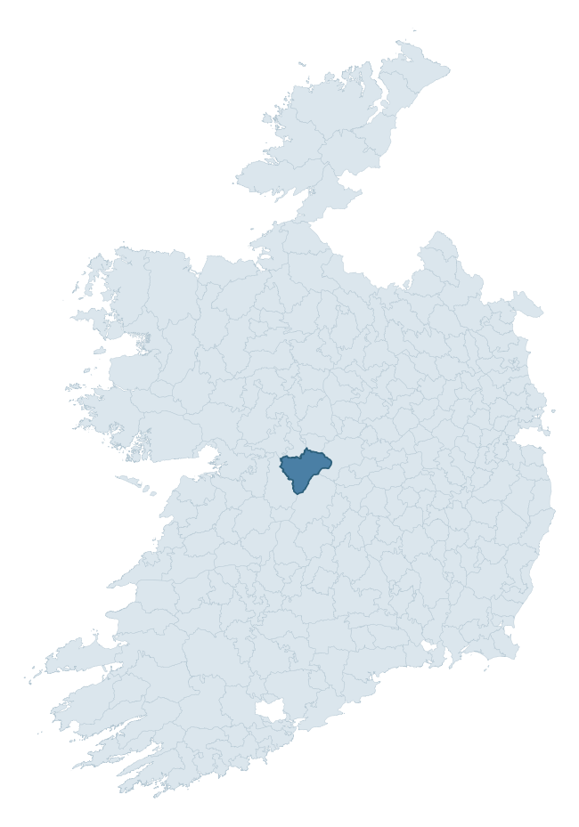
Where this barony sits in the Republic of Ireland
Geology and preservation
Bedrock geology shapes the landscape long before any settlement begins — controlling soil drainage, agricultural potential, the survival of upstanding monuments, and the preservation of buried archaeology. The figures below come from the Geological Survey Ireland 1:100,000 bedrock map.
The bedrock underlying Longford is predominantly limestone (100% of the barony by area), laid down during the Carboniferous period (100% by area, around 359 to 299 million years ago). Limestone is the most heritage-rich bedrock in Ireland. It supports fertile, well-drained soils that favoured dense Early Medieval settlement and Norman manorial agriculture, and it weathers into karst features — sinkholes, caves, swallow holes, and souterrains — that frequently carry archaeology. Where peat overlies limestone, organic preservation can be exceptional. The single largest mapped unit is the Lucan Formation (90% of the barony's bedrock). With only 1 distinct rock type mapped, the barony is geologically uniform compared to the rest of the Republic (4th percentile for diversity) — a single coherent bedrock landscape.
Largest mapped unit: Lucan Formation (90% of the barony)
Placename evidence
Logainm records 74 heritage-diagnostic placenames for Longford, drawn from townland and civil-parish names across the barony. The dominant stratum is Early Christian ecclesiastical — cill-, teampall-, and domhnach-prefixed names that record the dense network of early church foundations established between the fifth and tenth centuries. The leading diagnostic roots are cill- (31 — church), lios- (19 — ringfort or enclosure), and feart- (6 — grave mound). This is well above the ROI average of 30.7 heritage placenames per barony — around 2.4× the typical figure. The presence of multiple heritage strata side by side indicates layered occupation of the landscape across successive prehistoric and historic periods. Logainm records 361 placenames for Longford (predominantly townland names). Of these, 74 (20%) carry one of the diagnostic Gaelic roots tracked above; the remainder draw on more generic landscape vocabulary that does not encode a heritage period.
Pre-Christian / Early Medieval Defensive
| Root | Count | Meaning |
|---|---|---|
| lios- | 19 | ringfort or enclosure |
| ráth- | 4 | earthen ringfort |
| caiseal- | 2 | stone ringfort |
| dún- | 1 | hilltop or promontory fort |
Early Christian Ecclesiastical
| Root | Count | Meaning |
|---|---|---|
| cill- | 31 | church (early) |
| cillín- | 4 | unconsecrated burial ground |
| domhnach- | 1 | pre-Patrician or earliest Patrician church |
| mainistir- | 1 | monastery |
| gráinseach- | 1 | monastic farm / grange |
| bile- | 1 | sacred tree / boundary marker |
Burial, Ritual, and Norse-Contact
| Root | Count | Meaning |
|---|---|---|
| feart- | 6 | grave mound |
| sián- | 2 | fairy mound |
| gall- | 2 | foreigner — Norse settlement marker |
| leacht- | 1 | grave monument |
Other baronies in Galway
About this profile
Click any section below to expand.
What is a barony?
A barony is a historic administrative unit in Ireland, broadly equivalent to an English hundred. The 280 baronies used here are from the OSi 2019 National Statutory Boundaries (generalised 20m), covering the 26 counties of the Republic of Ireland. Baronies derive from the Norman period, were formalised in the 17th century, and have not been redrawn for statistical purposes. They vary enormously in area, from compact urban baronies in Dublin to vast upland baronies in Connacht, and should not be compared by raw site count without accounting for area differences.
What counts as a site?
This profile combines three distinct heritage registers, each with its own definition of what constitutes a recordable site:
- Archaeological sites (NMS). The National Monuments Service Sites and Monuments Record (SMR) catalogues every known archaeological monument or site of archaeological interest in the Republic, from prehistoric burial mounds and ringforts to medieval churches and post-medieval defensive works. Inclusion does not require legal protection — only that the site has been identified, surveyed, and assessed as having archaeological value. A separate subset of these sites lies within a recorded protection zone, which gives them statutory protection under the National Monuments Acts.
- Listed buildings (NIAH). The National Inventory of Architectural Heritage records buildings of architectural, historical, archaeological, artistic, cultural, scientific, social, or technical interest. Each surveyed structure is appraised on a five-tier scale: International, National, Regional, Local, and Record-Only. The NIAH appraisal is informational rather than strictly statutory, but it underpins local-authority Record of Protected Structures (RPS) listings.
- Heritage placenames (Logainm). Logainm is the authoritative database of Irish placenames maintained by the Placenames Branch. This profile applies a heritage-diagnostic classifier to the Irish-language form of each townland name, flagging roots that signal defensive sites (ráth-, lios-, dún-, caiseal-, cathair-), ecclesiastical foundations (cill-, teampall-, domhnach-, mainistir-), prehistoric burial-ritual features (tuaim-, carn-, leaba-), or Norse-contact settlement (gall-). Townlands without one of these diagnostic roots are not flagged here — they may still carry historical significance, but that significance is not encoded in the name itself.
Editorial principles
The narrative sections of this profile follow several explicit principles:
- Evidential. Every claim about this barony’s heritage character is anchored in the underlying register data. Where a site count, a placename count, or a percentile rank is cited, it is computed from the source datasets at export time, not estimated.
- Comparative. Counts and metrics are reported alongside their percentile rank against the other 279 ROI baronies. A barony with 50 ringforts in absolute terms could be unusually high or unusually low depending on its size and regional context; percentile ranking removes that ambiguity.
- Transparent on limits. Where a register has known coverage gaps, survey biases, or data-quality issues that affect this barony’s figures, the profile flags them rather than presenting the numbers as definitive.
- No interpretation beyond what the data supports. The narrative does not speculate about historical events, social dynamics, or cultural meaning beyond what the recorded heritage and placename evidence directly attests.
Data caveats and limits
- NMS Sites and Monuments Record is the product of survey campaigns conducted at different intensities across different counties and decades. Some baronies have been surveyed more thoroughly than others, and absolute counts should be read in that light. Sites destroyed by development before survey are typically not represented; sites in heavily forested or upland terrain are sometimes under-recorded.
- NIAH coverage is broadly complete for the Republic of Ireland but the survey was conducted on a rolling county-by-county basis, and the most recent appraisal date varies. Buildings demolished or substantially altered after their original survey may still appear in the register; conversely, recent buildings of merit may not yet have been appraised.
- Logainm classification applies a deliberately conservative pattern-matching approach to the Irish-language townland forms. The classifier prioritises true positives over recall: a townland may carry a heritage signal that the classifier doesn’t recognise, particularly where the diagnostic root has been heavily anglicised or where the townland name draws on a less common term. The 60,000+ townland records and ~9,800 classified placenames give a substantial signal at barony scale, but individual townland names should be checked against Logainm directly for definitive interpretation.
- Period attribution. The chronological distribution reflects only those NMS sites that carry a recognised period attribution in the source data. Sites listed as “Unknown” period are excluded from the dated subset.
- Boundary changes. Some baronies have undergone minor boundary adjustments since their 19th-century definition; the OSi 2019 generalised boundaries used here are the current statutory definition and may differ slightly from historical maps in border areas.
- Bedrock geology is mapped at 1:100,000 scale, which means local variation within a barony — small pockets of different rock type, mineral veins, alluvium overlying bedrock — is generalised. The dominant-system and rocktype figures are area-weighted, so a barony reading “70% Carboniferous limestone” may still contain small but archaeologically important pockets of older or younger rock. Around 3% of GSI polygons do not match the lexicon and contribute no rocktype or system attribution.
Data sources
- National Monuments Service — Sites and Monuments Record (SMR) https://data.gov.ie/dataset/national-monuments-service-archaeological-survey-of-ireland
- National Inventory of Architectural Heritage (NIAH) https://data.gov.ie/dataset/national-inventory-of-architectural-heritage-niah-national-dataset
- Logainm — Placenames Database of Ireland https://www.logainm.ie/
- Ordnance Survey Ireland — National Statutory Barony Boundaries 2019 https://data-osi.opendata.arcgis.com/
- EURODEM — European Digital Elevation Model https://www.mapsforeurope.org/datasets/euro-dem
- ESA WorldCover https://esa-worldcover.org/en
- Geological Survey Ireland — 1:100,000 Bedrock Geology https://www.gsi.ie/en-ie/data-and-maps/Pages/Bedrock.aspx
Explore more: Search any of the 280 ROI baronies, browse by historical province, or read the methodology and data sources for the full Republic of Ireland Heritage Tool.