
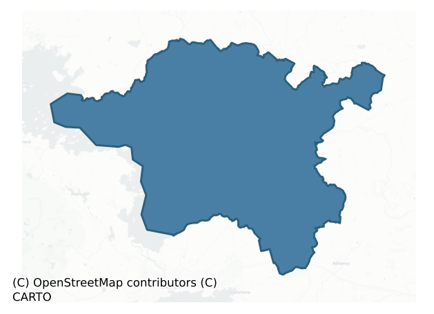
Clare is a barony of County Galway, in the historical province of Connacht (Irish: Baile Chláir), covering 555 km² of land. The barony records 1,289 NMS archaeological sites and 185 NIAH listed buildings, placing it at around the 66th percentile among 280 ROI baronies for sites per km². This means it is in the upper half of all baronies for sites per km². Dated archaeological evidence runs from the Neolithic through to the Modern, spanning 8 of 9 archaeological periods, placing the barony in the 70th percentile among 280 ROI baronies for chronological depth. This means it is in the top third of all baronies for chronological depth. The largest dated subset of recorded sites dates to the Early Medieval. Logainm flags 70 placenames in the barony as carrying a recognised heritage root; the largest share — around 60% — are names associated with early Christian church and monastic foundations.
Heritage at a glance
Percentile rankings throughout this profile compare each barony only against the other 279 Republic of Ireland baronies.
The recorded heritage of Clare
The National Monuments Service Sites and Monuments Record (SMR) is the statutory inventory of archaeological sites for the Republic of Ireland, maintained by the Department of Tourism, Culture, Arts, Gaeltacht, Sport and Media. Sites recorded here include earthworks, ringforts, megalithic tombs, ecclesiastical remains, and post-medieval features; not every record is legally protected, but each is registered as a monument of archaeological interest.
The National Monuments Service records 1,289 archaeological sites in Clare, putting it at the 66th percentile among 280 ROI baronies for sites per km². This means it is in the upper half of all baronies for sites per km². Of these, 1,137 (88%) fall within a recorded monument protection zone. The dominant category is defensive sites — ringforts, enclosures, hillforts, and stone forts (586 sites, 45% of the record). The most diagnostically specific type is Ringfort – unclassified (122 records, 9% of the barony's NMS total) — compared to an ROI average of 4% across all baronies where this type occurs. Ringfort – unclassified is a circular Early Medieval settlement enclosure where surviving evidence does not allow distinction between earthen and stone forms. The broader 'Enclosure' classification — which catches unclassified ringforts and field enclosures — accounts for a further 147 records (11%) and reflects the difficulty of sub-classifying degraded earthworks from surface evidence alone. Other significant types include House – indeterminate date (95) — a habitation building whose date cannot be determined from available evidence. Across the barony's 555 km², this gives a recorded density of 2.32 sites per km².
Most common monument types
Hover or tap a monument type to see its definition.
| Type | Count |
|---|---|
| Enclosure a banked or ditched feature of uncertain type, used as a catch-all where the original function cannot be determined from surface evidence | 147 |
| Ringfort – unclassified a circular Early Medieval settlement enclosure where surviving evidence does not allow distinction between earthen and stone forms | 122 |
| House – indeterminate date a habitation building whose date cannot be determined from available evidence | 95 |
| Ringfort – cashel the stone-walled equivalent of the rath, found mainly in upland or western areas, broadly dated 500–1000 AD | 93 |
| Ringfort – rath an earthen ringfort enclosed by a bank and external ditch — the most common Early Medieval farmstead, broadly dated 500–1000 AD | 89 |
| Children's burial ground an unconsecrated medieval and early-modern burial ground for unbaptised or stillborn children, often called a cillín or ceallúnach | 77 |
| Souterrain an underground stone-built passage and chamber, generally Early Medieval and often associated with ringforts as a defensive or storage feature | 64 |
| Church a building used for public Christian worship, of any date from c. 500 AD onwards | 42 |
Chronological distribution
The dated archaeological record for Clare spans from the Neolithic through to the Modern, with activity attested across 8 of 9 archaeological periods. Every period from earliest to latest is represented in the record — an unbroken sequence of dated activity across the full chronological span. Activity concentrates most heavily in the Early Medieval (394 sites, 43% of dated material), with the Iron Age forming a secondary peak (280 sites, 31%). A further 372 recorded sites (29% of the overall NMS register for the barony) carry no period attribution — appearing as 'Unknown' in the bar chart below. This typically reflects either records that pre-date the standardised period vocabulary or sites awaiting specialist dating review, rather than a genuine absence of chronological evidence.
Sample of recorded monuments
Show 25 sample monuments (of 1,289 total)
A representative sample of 25 recorded monuments drawn from the barony’s 1,289 total NMS entries. Sites within a recorded monument protection zone and rarer site types are prioritised so the list shows a meaningful cross-section rather than only the most common type. Each entry shows the official Sites and Monuments Record reference number and the description published by the National Monuments Service.
Historic town
On a steep rise on S bank of the River Nanny overlooking a fording point, the site is flanked to E and W by extensive bogs. St Jarlath founded a monastery at 'Tuaim-da-ghualann' in the early 6th C (Gwynn and Hadcock…
On a steep rise on S bank of the River Nanny overlooking a fording point, the site is flanked to E and W by extensive bogs. St Jarlath founded a monastery at 'Tuaim-da-ghualann' in the early 6th C (Gwynn and Hadcock 1970, 98). Under the patronage of the Kings of Connacht (O'Conors) in the 11th-12th C, the settlement expanded rapidly and was named as one of four metropolitan sees at the Synod of Kells in 1152 (Killanin and Duignan 1967, 443-5; Stalley 1981, 179-80; Bradley and Dunne 1992, 166-8). The O'Conors built a 'castle' (GA029-173—-: see also GA029-199003-) here in 1161 and by the first half of the 13th C documentary sources are referring to 'the suburbs' and 'houses of the … town' as well as the granting of a licence for an annual fair (see GA029-178—-, GA029-184001-; Lewis 1837, Vol. 2, 646). The numerous early Christian and medieval ecclesiastical remains comprise: (a) the chancel of a Romanesque church (GA029-179001-) and (b) a 14th-C 'Synod Hall' (GA029-179002-), both now incorporated into the gothic revival cathedral of St Mary; (c) 100m to NW lies the site of the 'Abbey of the Holy Trinity' (GA029-178—-); (d) 150m to NW, in High St., is a probable early ecclesiastical enclosure (GA029-180003-) within which stands 'Temple Jarlath' (GA029-180001-); (e) 550m to NE, in Bishop St., is a second enclosure (GA029-068001-) within which stood 'Templenascreen' (GA029-068002-); (f) 325m to E, in Circular Rd, lies the site of 'St. John's Priory' (GA029-184001-); (g) 1…
Standing stone – pair
On a slight rise in grassland. Marked on 3rd ed. of OS 6-inch map (1920) as three small dots aligned NE-SW. It consists two large eroded limestone slabs aligned as on map and set 2.2m apart. Both are subrectangular in…
On a slight rise in grassland. Marked on 3rd ed. of OS 6-inch map (1920) as three small dots aligned NE-SW. It consists two large eroded limestone slabs aligned as on map and set 2.2m apart. Both are subrectangular in plan, but N stone (L 1.9m) is now prostrate. Like S stone (H 1.8m), it appears to have been formerly held in place by basal-packing stones. An unclassified stone structure (GA042-011—-) lay 325m to S.
The above description is derived from the published 'Archaeological Inventory of County Galway Vol. II – North Galway'. Compiled by Olive Alcock, Kathy de hÓra and Paul Gosling (Dublin: Stationery Office, 1999).
Date of upload: 05 August 2010
Watchtower
On a hill in undulating grassland. An enigmatic subcircular building (N-S 2.05m, E-W 1.97m, H 3.8m) constructed of stone and mortar. It is capped by a corbelled stone roof, conical in form, which springs from the inner…
On a hill in undulating grassland. An enigmatic subcircular building (N-S 2.05m, E-W 1.97m, H 3.8m) constructed of stone and mortar. It is capped by a corbelled stone roof, conical in form, which springs from the inner edge of the side walls. A small chimney stack surmounts its apex. There is a robbed-out doorway at E, a small splayed window at W, and a fireplace at NE, to E of which are traces of a second window. Traces of a mortared floor survive in SW sector. The building is plastered internally, and the roof both externally and internally. According to local information, it was used as a lookout post to watch over flocks of sheep. Adjoining the monument at E is a small trapezoidal field (L 8m, Wth 1.5m) enclosed by a stone wall; possibly associated.
The above description is derived from the published 'Archaeological Inventory of County Galway Vol. II – North Galway'. Compiled by Olive Alcock, Kathy de hÓra and Paul Gosling (Dublin: Stationery Office, 1999).
Date of upload: 05 August 2010
Barrow – bowl-barrow
In level grassland. A well-preserved subcircular barrow (N-S 28.65m, E-W 25.9m) comprising a central mound (H c. 1.5m max.) encircled by an internal fosse and external bank. The bank is overlain by a field wall at E,…
In level grassland. A well-preserved subcircular barrow (N-S 28.65m, E-W 25.9m) comprising a central mound (H c. 1.5m max.) encircled by an internal fosse and external bank. The bank is overlain by a field wall at E, and disturbed internally at E and S by a pathway. The mound, which is denuded at S, contains a slight central depression. Two other barrows (GA042-216—-, GA042-217—-) lie to SW.
The above description is derived from the published 'Archaeological Inventory of County Galway Vol. II – North Galway'. Compiled by Olive Alcock, Kathy de hÓra and Paul Gosling (Dublin: Stationery Office, 1999).
Date of upload: 05 August 2010
Castle – Anglo-Norman masonry castle
On the shore of a small bay on E shore of Lough Corrib. According to Nolan (1901a, 28-9), this castle was already in existence in 1324, and in 1574 it was held by 'Moyler McReamon (a Burke)'. It consists of a…
On the shore of a small bay on E shore of Lough Corrib. According to Nolan (1901a, 28-9), this castle was already in existence in 1324, and in 1574 it was held by 'Moyler McReamon (a Burke)'. It consists of a rectangular keep (L 15.5m, Wth 105.m) of 13th-C date, in fair condition, originally of two storeys with a later tower. The original doorway was on 1st floor at E end of SE wall. There are also doorways in SE and NW walls on ground floor. Intramural stairways in NE wall connected the ground/1st floors and the 1st floor to the wall-walks (now gone). There is also an intramural stairs in SW wall at 1st-floor level. A doorway in NW corner on 1st floor gave access to a later addition at W end of NW wall. This comprises an almost square three-storey latrine tower (L 5m, Wth 4m), vaulted between ground/1st and 1st/2nd floors. Its construction may have coincided with the addition of a third storey at W end of the keep. Apart from a small lintelled ope in SW wall, all the windows dressings are robbed out. An enigmatic alcove is also visible on outer face of this wall on ground floor. There is a fragment of masonry (L 9m), possibly another building or a bawn wall, running NE-SW, just SW of the tower. (Fahey 1893, 170; Nolan 1901b, 118; O'Flanagan 1927, Vol. 1, 181)
In February 2014 a carved stone head was noted on the the SE wall of the castle at 2nd-floor level as well as another possible one that was overgrown with ivy (pers. comm. S. Aylward).
The above description is de…
Megalithic tomb – court tomb
On a low knoll amidst gently rolling pasture, 1.2km from E shores of Lough Corrib. The monument is very ruined. It consists of a gallery (L 5.5m), aligned roughly E-W, represented by two entrance jambs at E, two…
On a low knoll amidst gently rolling pasture, 1.2km from E shores of Lough Corrib. The monument is very ruined. It consists of a gallery (L 5.5m), aligned roughly E-W, represented by two entrance jambs at E, two sidestones on N and a backstone at W. A single courtstone flanks N jamb, and a stone in a similar position adjoining the opposite jamb may also be a courtstone. The overall length of the gallery would indicate that it had at least two chambers. The structure is incorporated in a subrectangular mound (L 12.5m, Wth 10m). There is an unclassified megalithic tomb (GA055-070—-) c. 130m to NW and an anomalous stone group (GA055-069—-) c. 160m to NNW. (Aldridge 1965, 15; de Valera and Ó Nualláin 1972, 12; Ó Nualláin 1989, 118)
The above description is derived from the published 'Archaeological Inventory of County Galway Vol. II – North Galway'. Compiled by Olive Alcock, Kathy de hÓra and Paul Gosling (Dublin: Stationery Office, 1999).
Date of upload: 05 August 2010
See linked document with details from Ruaidhrí de Valera and Seán Ó Nualláin, Survey of the Megalithic Tombs of Ireland. Volume III. Counties Galway, Roscommon, Leitrim, Longford, Westmeath, Laoighis, Offaly, Kildare, Cavan. (Dublin: Stationery Office, 1972).
Fortification
This enclosure is situated towards the centre of Illauncarbry, a small island in a sheltered inlet close to the E shore of Lough Corrib. The entire island has been planted with hardwoods which have reached maturity. It…
This enclosure is situated towards the centre of Illauncarbry, a small island in a sheltered inlet close to the E shore of Lough Corrib. The entire island has been planted with hardwoods which have reached maturity. It consists of a well-preserved inner subcircular enclosure (35m N-S; 30m E-W) defined by a mortared masonry wall. This is surrounded by a deep wide fosse filled with collapsed rubble which in turn is enclosed by a low counterscarp outer bank. A narrow opening in the inner cashel-like wall at ENE appears to be modern which together with the remnants of two walls projecting from the interior at the ESE may date to the late 18th/early 19th century when the island was inhabited by a recluse named Carbry (from whom the island takes its modern name) (Naessens & O’Conor 2012, 117). A sample of mortar from the inner enclosing wall returned a radiocarbon determination indicating a construction date ranging from AD 1020-1180 (ibid., 118). The remains of the 13th-century Cargin Castle (GA055-028—-) lie 450m to the NE. The monument has been identified by Naessens and O’Conor (ibid., 117) as a possible pre-Norman fortification dating to the 11th/12th century. (Wilde 1872, 89-90; Kelly 1897, 387; Killanin and Duignan 1967, 304-5; Gosling 1993, No. 177)
Revised by: Paul Walsh
Revised date of upload: 18 April 2017
Megalithic tomb – unclassified
On S-facing slope of a low hill in gently rolling pasture. It comprises a gallery (L c. 2.2m, Wth 1.75m), aligned E-W, represented by two stones on N side, one on S and a tall backstone (H 1.8m) at W. There is an…
On S-facing slope of a low hill in gently rolling pasture. It comprises a gallery (L c. 2.2m, Wth 1.75m), aligned E-W, represented by two stones on N side, one on S and a tall backstone (H 1.8m) at W. There is an upright stone at E which appears to have been displaced from the tomb. A large displaced stone protrudes from the field stones which fill the chamber. The remains are incorporated into a field wall beside an outhouse. A court tomb (GA055-034—-) stands c. 130m to SE. (Aldridge 1965, 15)
The above description is derived from the published 'Archaeological Inventory of County Galway Vol. II – North Galway'. Compiled by Olive Alcock, Kathy de hÓra and Paul Gosling (Dublin: Stationery Office, 1999).
Date of upload: 05 August 2010
Sweathouse
This sweathouse (max. Wth 8.5m; H 1.5m) is built into a small ridge in an area of rough overgrown ground and woodland. The roughly wedge-shaped drystone chamber (Wth 2.47m tapering to 0.82m at roof level; H 1.7-1.9m) is…
This sweathouse (max. Wth 8.5m; H 1.5m) is built into a small ridge in an area of rough overgrown ground and woodland. The roughly wedge-shaped drystone chamber (Wth 2.47m tapering to 0.82m at roof level; H 1.7-1.9m) is accessed by a narrow lintelled opening (Wth 0.5m; H 0.89m) at WSW. The walls of the chamber are fairly straight sided and the roof is corbelled. Externally the chamber is enclosed with grass-covered earth.
The following images have been uploaded courtesy of Shirley Hope-Sweeny
GA056-016—-_01.jpg
GA056-016—-_02.jpg
GA056-016—-_03.jpg
Compiled by: Olive Alcock
Date of upload: 27 June 2023
Enclosure – large enclosure
In rough scrub and grassland. When visited in September 1983, this monument consisted of a large roughly D-shaped enclosure (N-S 85m, E-W 80m) defined by a well-preserved drystone wall (Wth 2.9m, H 1.7m max.). A sketch…
In rough scrub and grassland. When visited in September 1983, this monument consisted of a large roughly D-shaped enclosure (N-S 85m, E-W 80m) defined by a well-preserved drystone wall (Wth 2.9m, H 1.7m max.). A sketch plan by Westropp (1919, 168) shows a gap at NNE, probably the same point at which he noted 'a slight trace of a mortar-built gateway' (ibid., 182-3): no definite surface traces of either were found. The monument was almost completely levelled in April/May 1991 as a result of land clearance. A castle (GA056-042—-) stood in the interior and a ringfort (GA056-043002-) lies 25m to NW. (Anon. 1919, 165)
The above description is derived from the published 'Archaeological Inventory of County Galway Vol. II – North Galway'. Compiled by Olive Alcock, Kathy de hÓra and Paul Gosling (Dublin: Stationery Office, 1999).
Date of upload: 05 August 2010
This monument is subject to a preservation order made under the National Monuments Acts 1930 to 2014 (PO no. 1/1991).
Inscribed stone
The Archaeological Survey of Ireland (ASI) is in the process of providing information on all monuments on The Historic Environment Viewer (HEV). Currently the information for this record has not been uploaded. To…
The Archaeological Survey of Ireland (ASI) is in the process of providing information on all monuments on The Historic Environment Viewer (HEV). Currently the information for this record has not been uploaded. To access available information for research purposes please make an appointment in advance with the Archive Unit (open Fridays 10.00 am – 5.00 pm), Department of Culture, Heritage and the Gaeltacht, The Custom House, Dublin 1 D01W6XO or email nmarchive@chg.gov.ie.
Cairn – wayside cairn
At a road junction on W side of the Galway-Tuam road, c. 210m NE of a church (GA057-085001-). Indicated on OS Fair Plan as a small rectangular roadside recess and named 'Monument' and 'Cahill na can Dherg' in Gothic…
At a road junction on W side of the Galway-Tuam road, c. 210m NE of a church (GA057-085001-). Indicated on OS Fair Plan as a small rectangular roadside recess and named 'Monument' and 'Cahill na can Dherg' in Gothic script. On 1st ed. of OS 6-inch map, it is shown as a circular dot and labelled simply as 'Monument' in Roman script. By the time of 3rd ed. (1933), it has been renamed 'Leacht Chill Chathail' but no location is indicated. According to local information, it was 'an eight-sided flagstone' c. 3m in diameter. It was removed during road-widening work. No visible surface trace survives.
The above description is derived from the published 'Archaeological Inventory of County Galway Vol. II – North Galway'. Compiled by Olive Alcock, Kathy de hÓra and Paul Gosling (Dublin: Stationery Office, 1999).
Date of upload: 05 August 2010
House – 17th century
Some 90m NNE of a castle (GA058-010001-). Very poorly preserved two-storey rectangular house (NE-SW; L 21m, Wth 9m), probably of late 17th/18th-C date. The upper storey is contained within the pitch of the roof. All…
Some 90m NNE of a castle (GA058-010001-). Very poorly preserved two-storey rectangular house (NE-SW; L 21m, Wth 9m), probably of late 17th/18th-C date. The upper storey is contained within the pitch of the roof. All that survives is NE gable crowned by a rectangular chimney, along with short returns of SE and NW side-walls. There are two robbed-out fireplaces and two wall recesses on ground floor, and a third fireplace on 1st floor, flanked by four rectangular windows.
The above description is derived from the published 'Archaeological Inventory of County Galway Vol. II – North Galway'. Compiled by Olive Alcock, Kathy de hÓra and Paul Gosling (Dublin: Stationery Office, 1999).
Date of upload: 05 August 2010
Icehouse
The Archaeological Survey of Ireland (ASI) is in the process of providing information on all monuments on The Historic Environment Viewer (HEV). Currently the information for this record has not been uploaded. To…
The Archaeological Survey of Ireland (ASI) is in the process of providing information on all monuments on The Historic Environment Viewer (HEV). Currently the information for this record has not been uploaded. To access available information for research purposes please make an appointment in advance with the Archive Unit (open Fridays 10.00 am – 5.00 pm), Department of Culture, Heritage and the Gaeltacht, The Custom House, Dublin 1 D01W6XO or email nmarchive@chg.gov.ie.
Barrow – stepped barrow
In a slight hollow in flat pastureland. A well-preserved circular earthen mound (D 13.8m, H 1.9m) with a flat-topped summit and stepped profile. It has been partially dug into at NNE.
The above description is derived…
In a slight hollow in flat pastureland. A well-preserved circular earthen mound (D 13.8m, H 1.9m) with a flat-topped summit and stepped profile. It has been partially dug into at NNE.
The above description is derived from the published 'Archaeological Inventory of County Galway Vol. II – North Galway'. Compiled by Olive Alcock, Kathy de hÓra and Paul Gosling (Dublin: Stationery Office, 1999).
Date of upload: 05 August 2010
The following image has been uploaded: GA070-064—-_01.jpg
Battlefield
On a N-facing slope in scrubland. Described on 3rd ed. of OS 6-inch map (1934) as the 'Site of Battle fought by the Lord Deputy against the Earl of Clanrickard in 1504' (see O'Flanagan 1927, Vol. 1, 217-22). The same…
On a N-facing slope in scrubland. Described on 3rd ed. of OS 6-inch map (1934) as the 'Site of Battle fought by the Lord Deputy against the Earl of Clanrickard in 1504' (see O'Flanagan 1927, Vol. 1, 217-22). The same map also depicts a small circular enclosure (GA070-080001-) visible as a low circular mound (D 10m, H 1m). According to tradition, the battle was fought between this hill and Turloughmore, 1.5km to ENE, and 'some musquet balls, and one cannon ball, was found on the side of the hill' (Holt 1910, 135).
The above description is derived from the published 'Archaeological Inventory of County Galway Vol. II – North Galway'. Compiled by Olive Alcock, Kathy de hÓra and Paul Gosling (Dublin: Stationery Office, 1999).
Date of upload: 05 August 2010
Settlement deserted – medieval
In flat open farmland at the lowest fording point on the River Clare, probably on S bank in the area now occupied by the modern village. The borough is likely to have been established by John de Cogan c. 1240. He…
In flat open farmland at the lowest fording point on the River Clare, probably on S bank in the area now occupied by the modern village. The borough is likely to have been established by John de Cogan c. 1240. He received a licence to hold a weekly market and an annual fair there in 1252 by which time a Franciscan friary (GA070-035001-) had also been established (Bradley and Dunne 1992, 53). The 'provost' of Claregalway is mentioned in 1307 (Graham 1978, 42) suggesting the presence of a borough corporation. The settlement may have been abandoned by the 14th C, though the existence of the modern village, which may partly occupy its site, suggests at least some continuity. The extant remains comprise a probable medieval parish church (GA070-012001-) close to S bank of the river, and the Franciscan friary 150m to NW, on opposite bank. There is also a tower house (GA070-036—-), 100m to NE of the church, also on N bank of the river, probably sited to command the river crossing. Adjoining the latter are the remains of a 19th-C watermill (see photo in Anon. 1919, 164), possibly also of medieval ancestry. (Holland 1988, 77-81)
The above description is derived from the published 'Archaeological Inventory of County Galway Vol. II – North Galway'. Compiled by Olive Alcock, Kathy de hÓra and Paul Gosling (Dublin: Stationery Office, 1999).
Date of upload: 05 August 2010
Leacht cuimhne
Adjacent to a road immediately N of Caherateemore crossroads. Well-preserved square mortared limestone pier (Wth 1.37m, H 3.5m) capped by a pyramidal top resting on a low plinth (Wth 3m max.). It is named 'Monument' on…
Adjacent to a road immediately N of Caherateemore crossroads. Well-preserved square mortared limestone pier (Wth 1.37m, H 3.5m) capped by a pyramidal top resting on a low plinth (Wth 3m max.). It is named 'Monument' on both the OS 1st ed. 6-inch map and the 1:2500 survey (1912-16) and was renamed 'Laghta Oliver Brown' on the following revision (surveyed 1925-31). The accompanying name book for the 1:2500 map series records that the monument, was erected to the memory of Oliver Brown who was killed off his horse at this spot in 1628. The plaque recording this has been removed and a rectangular recess at S marks its former position. (Alcock et al. 1999, no. 3611).
Compiled by: Paul Walsh
Date of upload: 4 April 2016
Hilltop enclosure
On the summit of a prominent hillock in gently undulating pastureland. Poorly preserved circular enclosure (D c. 80m) defined by an earthen bank and external fosse. The bank, which is planted with ash trees, is visible…
On the summit of a prominent hillock in gently undulating pastureland. Poorly preserved circular enclosure (D c. 80m) defined by an earthen bank and external fosse. The bank, which is planted with ash trees, is visible from N through E to SSE, while the fosse survives from WSW through N to S. From WSW to N it has been widened deepened and straightened off: A drain at WSW leads S to a small pond. A collapsed field wall runs around its outer edge from N to ESE. Two small gaps in the bank at NNE and NE appear modern. A wall cuts across enclosure from N to S marking both the td. and B. boundaries.
The above description is derived from the published 'Archaeological Inventory of County Galway Vol. II – North Galway'. Compiled by Olive Alcock, Kathy de hÓra and Paul Gosling (Dublin: Stationery Office, 1999).
Date of upload: 05 August 2010
Bullaun stone
The Archaeological Survey of Ireland (ASI) is in the process of providing information on all monuments on The Historic Environment Viewer (HEV). Currently the information for this record has not been uploaded. To…
The Archaeological Survey of Ireland (ASI) is in the process of providing information on all monuments on The Historic Environment Viewer (HEV). Currently the information for this record has not been uploaded. To access available information for research purposes please make an appointment in advance with the Archive Unit (open Fridays 10.00 am – 5.00 pm), Department of Culture, Heritage and the Gaeltacht, The Custom House, Dublin 1 D01W6XO or email nmarchive@chg.gov.ie.
Water mill – vertical-wheeled
On S bank of the River Nanny, in Chapel Lane, close to the centre of Tuam town (GA029-199—-). Known locally as the 'Bridge or Little Mill', this is a four-storey vertical undershot watermill fed by a short race.…
On S bank of the River Nanny, in Chapel Lane, close to the centre of Tuam town (GA029-199—-). Known locally as the 'Bridge or Little Mill', this is a four-storey vertical undershot watermill fed by a short race. According to Mayer-Jones (1974, 1-14), it 'was first built in the 17th century by a man called Corcoran' but it may occupy the site of a medieval mill. It originally consisted of two storeys until its renovation in 1922 when it was raised to its present height. Still in working order and open seasonally as a mill museum.
The above description is derived from the published 'Archaeological Inventory of County Galway Vol. II – North Galway'. Compiled by Olive Alcock, Kathy de hÓra and Paul Gosling (Dublin: Stationery Office, 1999).
Date of upload: 05 August 2010
Font (present location)
Presently located in the yard of a farmhouse, this lugged font (max. base Wth 0.38m; Wth at top 0.46m; H 0.35m) may have been originally located at ‘Ross Abbey’ (GA041-047—-), which lies c. 670m to the NNW. Only the…
Presently located in the yard of a farmhouse, this lugged font (max. base Wth 0.38m; Wth at top 0.46m; H 0.35m) may have been originally located at ‘Ross Abbey’ (GA041-047—-), which lies c. 670m to the NNW. Only the bowl (base Wth 0.1-0.28m; Wth at top 0.3m; D 0.28m)survives. It was fashioned out of a single block of limestone which is now in three fragments as a result of shattering during a spell of severe frosts. See GA041-047005- for possible original location.
Compiled by: Olive Alcock
Date of upload: 26 July 2018
Gatehouse
Some 218m S of Ross Errilly Friary (GA041-047—-), on the line of a causeway (see GA041-047003-). Named 'Gateway (in ruins)' on the 1838 edition of the OS 6-inch map and depicted c. 80m to the N of its actual location.…
Some 218m S of Ross Errilly Friary (GA041-047—-), on the line of a causeway (see GA041-047003-). Named 'Gateway (in ruins)' on the 1838 edition of the OS 6-inch map and depicted c. 80m to the N of its actual location. All that survives is a section of a mortared stone wall (L >9m, Wth 1.15m, H c. 3m), aligned SE-NW, in which the outlines of a number of blocked opes are visible. A modern wall abuts it at SE end. According to Fahey (1901, 335-6), this gateway was on the line of 'the enclosing wall and ditch which surrounded the … monastery' (see GA041-047004-).
The above description is derived from the published 'Archaeological Inventory of County Galway Vol. II – North Galway'. Compiled by Olive Alcock, Kathy de hÓra and Paul Gosling (Dublin: Stationery Office, 1999). In certain instances the entries have been revised and updated in the light of recent research.
Updated by: Olive Alcock
Date of revised upload: 26 July 2018
Burial (present location)
The Archaeological Survey of Ireland (ASI) is in the process of providing information on all monuments on The Historic Environment Viewer (HEV). Currently the information for this record has not been uploaded. To…
The Archaeological Survey of Ireland (ASI) is in the process of providing information on all monuments on The Historic Environment Viewer (HEV). Currently the information for this record has not been uploaded. To access available information for research purposes please make an appointment in advance with the Archive Unit (open Fridays 10.00 am – 5.00 pm), Department of Culture, Heritage and the Gaeltacht, The Custom House, Dublin 1 D01W6XO or email nmarchive@chg.gov.ie.
Enclosure
The Archaeological Survey of Ireland (ASI) is in the process of providing information on all monuments on The Historic Environment Viewer (HEV). Currently the information for this record has not been uploaded. To…
The Archaeological Survey of Ireland (ASI) is in the process of providing information on all monuments on The Historic Environment Viewer (HEV). Currently the information for this record has not been uploaded. To access available information for research purposes please make an appointment in advance with the Archive Unit (open Fridays 10.00 am – 5.00 pm), Department of Culture, Heritage and the Gaeltacht, The Custom House, Dublin 1 D01W6XO or email nmarchive@chg.gov.ie.
Listed buildings
The National Inventory of Architectural Heritage (NIAH) is a state survey appraising buildings of architectural, historical, archaeological, artistic, cultural, scientific, social, or technical interest. Each surveyed structure receives a rating from International (the highest, for buildings of European importance) through National, Regional, Local, and Record-Only.
The NIAH records 185 listed buildings in Clare, the 76th percentile across ROI baronies for listed-building density. The highest-graded structures include 2 of National significance. The Republic holds 937 National-graded buildings in total, so this barony accounts for around 0% of the national total. Construction dates concentrate most heavily in the Victorian (1830-1900) period. The most-recorded building type is house (86 examples, 46% of the listed stock).
Terrain and environment
Mean elevation across the barony is 29m — the 5th percentile among 280 ROI baronies for elevation. This means it is in the bottom tenth of all baronies for elevation. This is a relatively low-lying landscape by ROI standards. Elevation matters for heritage because higher-altitude baronies typically favour defensive monuments — ringforts and hilltop forts placed on prominent ground — while lowland baronies are more likely to carry the dense settlement and church networks of intensive agricultural landscapes. A maximum elevation of 165m gives the barony meaningful vertical relief. Mean slope is 1.8° — the 2nd percentile among 280 ROI baronies for slope. This means it is in the bottom tenth of all baronies for slope. This is broadly flat terrain, the kind of landscape best suited to intensive agriculture. Slope is a key control on both land use and archaeological preservation: steep ground resists ploughing and tends to preserve earthworks intact, while gentle slopes favour intensive cultivation that damages or destroys surface archaeology over time. The Topographic Wetness Index averages 12.1, the 99th percentile among 280 ROI baronies for wetness. This means it is in the top tenth of all baronies for wetness. This is wet, slow-draining ground by ROI standards — the kind of landscape that may carry waterlogged archaeological sites of unusual preservation value. Drainage matters for heritage because poorly-drained ground preserves organic archaeology (wooden trackways, leather, textiles, and on rare occasions human remains) far better than free-draining soil; well-drained ground favours arable use but destroys organic material rapidly. The land-cover mosaic combines improved grassland (85%), open water (6%), and woodland (5%), giving a mixed agricultural and semi-natural landscape. In overall character, this is low-lying, gently-sloping terrain — characteristic of Ireland's central plain and coastal lowlands, with land use dominated by improved grassland.
Terrain measurements
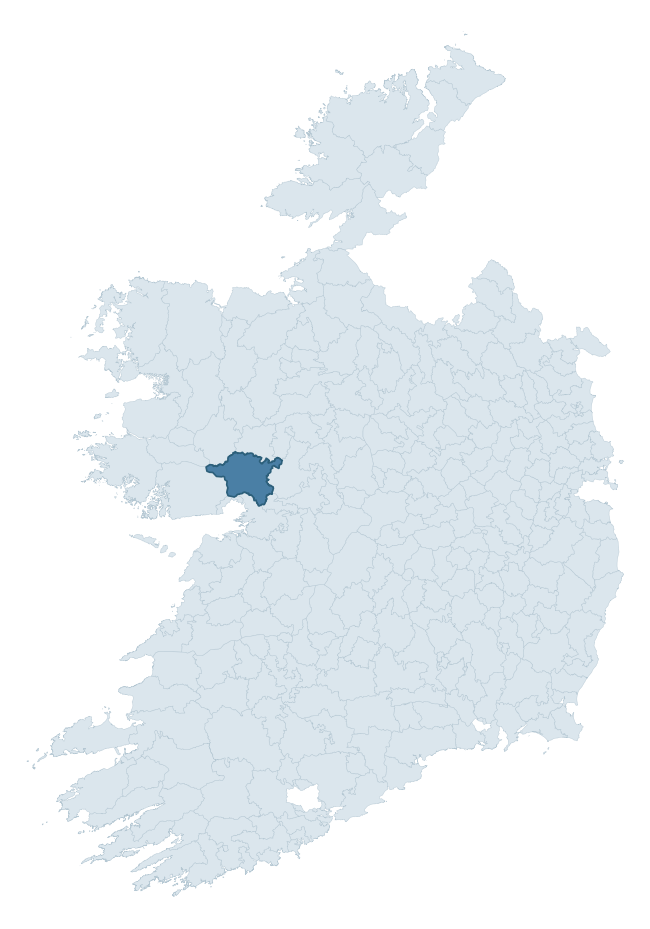
Where this barony sits in the Republic of Ireland
Geology and preservation
Bedrock geology shapes the landscape long before any settlement begins — controlling soil drainage, agricultural potential, the survival of upstanding monuments, and the preservation of buried archaeology. The figures below come from the Geological Survey Ireland 1:100,000 bedrock map.
The bedrock underlying Clare is predominantly limestone (90% of the barony by area), laid down during the Carboniferous period (100% by area, around 359 to 299 million years ago). Limestone is the most heritage-rich bedrock in Ireland. It supports fertile, well-drained soils that favoured dense Early Medieval settlement and Norman manorial agriculture, and it weathers into karst features — sinkholes, caves, swallow holes, and souterrains — that frequently carry archaeology. Where peat overlies limestone, organic preservation can be exceptional. The single largest mapped unit is the Burren Formation (57% of the barony's bedrock).
Rock type composition
Largest mapped unit: Burren Formation (57% of the barony)
Placename evidence
Logainm records 70 heritage-diagnostic placenames for Clare, drawn from townland and civil-parish names across the barony. The dominant stratum is Early Christian ecclesiastical — cill-, teampall-, and domhnach-prefixed names that record the dense network of early church foundations established between the fifth and tenth centuries. The leading diagnostic roots are cill- (31 — church), cathair- (12 — stone fort), and ráth- (5 — earthen ringfort). This is well above the ROI average of 30.7 heritage placenames per barony — around 2.3× the typical figure. The presence of multiple heritage strata side by side indicates layered occupation of the landscape across successive prehistoric and historic periods. Logainm records 413 placenames for Clare (predominantly townland names). Of these, 70 (17%) carry one of the diagnostic Gaelic roots tracked above; the remainder draw on more generic landscape vocabulary that does not encode a heritage period.
Pre-Christian / Early Medieval Defensive
| Root | Count | Meaning |
|---|---|---|
| cathair- | 12 | stone fort |
| ráth- | 5 | earthen ringfort |
| lios- | 3 | ringfort or enclosure |
| caiseal- | 3 | stone ringfort |
| dún- | 1 | hilltop or promontory fort |
Early Christian Ecclesiastical
| Root | Count | Meaning |
|---|---|---|
| cill- | 31 | church (early) |
| tobar- | 4 | holy well |
| gráinseach- | 3 | monastic farm / grange |
| domhnach- | 2 | pre-Patrician or earliest Patrician church |
| teampall- | 1 | church (later medieval) |
| bile- | 1 | sacred tree / boundary marker |
Burial, Ritual, and Norse-Contact
| Root | Count | Meaning |
|---|---|---|
| carn- | 2 | cairn |
| leacht- | 1 | grave monument |
| sián- | 1 | fairy mound |
Other baronies in Galway
About this profile
Click any section below to expand.
What is a barony?
A barony is a historic administrative unit in Ireland, broadly equivalent to an English hundred. The 280 baronies used here are from the OSi 2019 National Statutory Boundaries (generalised 20m), covering the 26 counties of the Republic of Ireland. Baronies derive from the Norman period, were formalised in the 17th century, and have not been redrawn for statistical purposes. They vary enormously in area, from compact urban baronies in Dublin to vast upland baronies in Connacht, and should not be compared by raw site count without accounting for area differences.
What counts as a site?
This profile combines three distinct heritage registers, each with its own definition of what constitutes a recordable site:
- Archaeological sites (NMS). The National Monuments Service Sites and Monuments Record (SMR) catalogues every known archaeological monument or site of archaeological interest in the Republic, from prehistoric burial mounds and ringforts to medieval churches and post-medieval defensive works. Inclusion does not require legal protection — only that the site has been identified, surveyed, and assessed as having archaeological value. A separate subset of these sites lies within a recorded protection zone, which gives them statutory protection under the National Monuments Acts.
- Listed buildings (NIAH). The National Inventory of Architectural Heritage records buildings of architectural, historical, archaeological, artistic, cultural, scientific, social, or technical interest. Each surveyed structure is appraised on a five-tier scale: International, National, Regional, Local, and Record-Only. The NIAH appraisal is informational rather than strictly statutory, but it underpins local-authority Record of Protected Structures (RPS) listings.
- Heritage placenames (Logainm). Logainm is the authoritative database of Irish placenames maintained by the Placenames Branch. This profile applies a heritage-diagnostic classifier to the Irish-language form of each townland name, flagging roots that signal defensive sites (ráth-, lios-, dún-, caiseal-, cathair-), ecclesiastical foundations (cill-, teampall-, domhnach-, mainistir-), prehistoric burial-ritual features (tuaim-, carn-, leaba-), or Norse-contact settlement (gall-). Townlands without one of these diagnostic roots are not flagged here — they may still carry historical significance, but that significance is not encoded in the name itself.
Editorial principles
The narrative sections of this profile follow several explicit principles:
- Evidential. Every claim about this barony’s heritage character is anchored in the underlying register data. Where a site count, a placename count, or a percentile rank is cited, it is computed from the source datasets at export time, not estimated.
- Comparative. Counts and metrics are reported alongside their percentile rank against the other 279 ROI baronies. A barony with 50 ringforts in absolute terms could be unusually high or unusually low depending on its size and regional context; percentile ranking removes that ambiguity.
- Transparent on limits. Where a register has known coverage gaps, survey biases, or data-quality issues that affect this barony’s figures, the profile flags them rather than presenting the numbers as definitive.
- No interpretation beyond what the data supports. The narrative does not speculate about historical events, social dynamics, or cultural meaning beyond what the recorded heritage and placename evidence directly attests.
Data caveats and limits
- NMS Sites and Monuments Record is the product of survey campaigns conducted at different intensities across different counties and decades. Some baronies have been surveyed more thoroughly than others, and absolute counts should be read in that light. Sites destroyed by development before survey are typically not represented; sites in heavily forested or upland terrain are sometimes under-recorded.
- NIAH coverage is broadly complete for the Republic of Ireland but the survey was conducted on a rolling county-by-county basis, and the most recent appraisal date varies. Buildings demolished or substantially altered after their original survey may still appear in the register; conversely, recent buildings of merit may not yet have been appraised.
- Logainm classification applies a deliberately conservative pattern-matching approach to the Irish-language townland forms. The classifier prioritises true positives over recall: a townland may carry a heritage signal that the classifier doesn’t recognise, particularly where the diagnostic root has been heavily anglicised or where the townland name draws on a less common term. The 60,000+ townland records and ~9,800 classified placenames give a substantial signal at barony scale, but individual townland names should be checked against Logainm directly for definitive interpretation.
- Period attribution. The chronological distribution reflects only those NMS sites that carry a recognised period attribution in the source data. Sites listed as “Unknown” period are excluded from the dated subset.
- Boundary changes. Some baronies have undergone minor boundary adjustments since their 19th-century definition; the OSi 2019 generalised boundaries used here are the current statutory definition and may differ slightly from historical maps in border areas.
- Bedrock geology is mapped at 1:100,000 scale, which means local variation within a barony — small pockets of different rock type, mineral veins, alluvium overlying bedrock — is generalised. The dominant-system and rocktype figures are area-weighted, so a barony reading “70% Carboniferous limestone” may still contain small but archaeologically important pockets of older or younger rock. Around 3% of GSI polygons do not match the lexicon and contribute no rocktype or system attribution.
Data sources
- National Monuments Service — Sites and Monuments Record (SMR) https://data.gov.ie/dataset/national-monuments-service-archaeological-survey-of-ireland
- National Inventory of Architectural Heritage (NIAH) https://data.gov.ie/dataset/national-inventory-of-architectural-heritage-niah-national-dataset
- Logainm — Placenames Database of Ireland https://www.logainm.ie/
- Ordnance Survey Ireland — National Statutory Barony Boundaries 2019 https://data-osi.opendata.arcgis.com/
- EURODEM — European Digital Elevation Model https://www.mapsforeurope.org/datasets/euro-dem
- ESA WorldCover https://esa-worldcover.org/en
- Geological Survey Ireland — 1:100,000 Bedrock Geology https://www.gsi.ie/en-ie/data-and-maps/Pages/Bedrock.aspx
Explore more: Search any of the 280 ROI baronies, browse by historical province, or read the methodology and data sources for the full Republic of Ireland Heritage Tool.