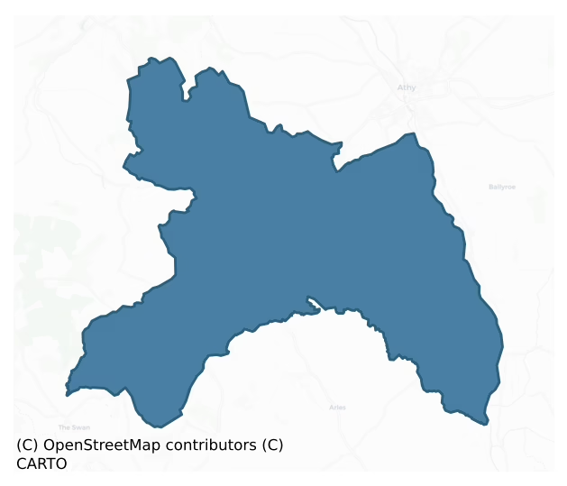
Ballyadams is a barony of County Laois, in the historical province of Leinster (Irish: An Sráidbhaile), covering 98 km² of land. The barony records 156 NMS archaeological sites and 16 NIAH listed buildings, placing it at around the 39th percentile among 280 ROI baronies for sites per km². This means it is in the lower half of all baronies for sites per km². Dated archaeological evidence runs from the Early Bronze Age through to the Post Medieval, spanning 6 of 9 archaeological periods, placing the barony in the 20th percentile among 280 ROI baronies for chronological depth. This means it is in the bottom third of all baronies for chronological depth. The largest dated subset of recorded sites dates to the Iron Age.
Heritage at a glance
Percentile rankings throughout this profile compare each barony only against the other 279 Republic of Ireland baronies.
The recorded heritage of Ballyadams
The National Monuments Service Sites and Monuments Record (SMR) is the statutory inventory of archaeological sites for the Republic of Ireland, maintained by the Department of Tourism, Culture, Arts, Gaeltacht, Sport and Media. Sites recorded here include earthworks, ringforts, megalithic tombs, ecclesiastical remains, and post-medieval features; not every record is legally protected, but each is registered as a monument of archaeological interest.
The National Monuments Service records 156 archaeological sites in Ballyadams, putting it at the 39th percentile among 280 ROI baronies for sites per km². This means it is in the lower half of all baronies for sites per km². Protection coverage is near-universal — 149 sites (96%) fall within a recorded monument protection zone, indicating an extensively surveyed landscape. The dominant category is defensive sites — ringforts, enclosures, hillforts, and stone forts (91 sites, 58% of the record). The most diagnostically specific type is Church (9 records, 6% of the barony's NMS total) — compared to an ROI average of 4% across all baronies where this type occurs. Church is a building used for public Christian worship, of any date from c. 500 AD onwards. The broader 'Enclosure' classification — which catches unclassified ringforts and field enclosures — accounts for a further 60 records (38%) and reflects the difficulty of sub-classifying degraded earthworks from surface evidence alone. Across the barony's 98 km², this gives a recorded density of 1.60 sites per km².
Most common monument types
Hover or tap a monument type to see its definition.
| Type | Count |
|---|---|
| Enclosure a banked or ditched feature of uncertain type, used as a catch-all where the original function cannot be determined from surface evidence | 60 |
| Church a building used for public Christian worship, of any date from c. 500 AD onwards | 9 |
| Ringfort – rath an earthen ringfort enclosed by a bank and external ditch — the most common Early Medieval farmstead, broadly dated 500–1000 AD | 9 |
| Graveyard a burial area associated with a church, in use from the medieval period onwards | 8 |
| Ring-ditch a circular ditch under 20m across, often the ploughed-out remains of a barrow, ring-barrow or roundhouse | 8 |
| Ritual site – holy well a well or spring traditionally associated with a saint, often credited with healing properties; many trace earlier ritual origins but devotion is documented from the medieval period onwards | 7 |
| Moated site | 5 |
| Castle – unclassified a castle whose form cannot be precisely classified, dating somewhere between the late 12th and 16th centuries | 4 |
Chronological distribution
The dated archaeological record for Ballyadams spans from the Early Bronze Age through to the Post Medieval, with activity attested across 6 of 9 archaeological periods. This is the 20th percentile across ROI baronies — a relatively narrow chronological band, with much of Irish prehistory not represented in the dated record. Every period from earliest to latest is represented in the record — an unbroken sequence of dated activity across the full chronological span. Activity concentrates most heavily in the Iron Age (70 sites, 55% of dated material), with the Early Medieval forming a secondary peak (23 sites, 18%). A further 28 recorded sites (18% of the overall NMS register for the barony) carry no period attribution — appearing as 'Unknown' in the bar chart below. This typically reflects either records that pre-date the standardised period vocabulary or sites awaiting specialist dating review, rather than a genuine absence of chronological evidence.
Sample of recorded monuments
Show 25 sample monuments (of 156 total)
A representative sample of 25 recorded monuments drawn from the barony’s 156 total NMS entries. Sites within a recorded monument protection zone and rarer site types are prioritised so the list shows a meaningful cross-section rather than only the most common type. Each entry shows the official Sites and Monuments Record reference number and the description published by the National Monuments Service.
Standing stone
Known as 'Clogh Leachdain' (Comerford 1886, vol. 3, 129); a large standing stone tapering towards the top (H c. 2.5m, Wth c. 1.1m -1.35m). Orientated NW-SE.
The above description is derived from the published…
Known as 'Clogh Leachdain' (Comerford 1886, vol. 3, 129); a large standing stone tapering towards the top (H c. 2.5m, Wth c. 1.1m -1.35m). Orientated NW-SE.
The above description is derived from the published 'Archaeological Inventory of County Laois' (Dublin Stationery Office, 1995) compiled by P. David Sweetman, Olive Alcock and Bernie Moran. In certain instances the entries have been revised and updated in the light of recent research.
Date of upload: 17 December 2007
Wall monument – effigial
In the N wall of Ballyadams Church (LA019-031001-) there is the Bowen monument. Erected in 1631 to Robert Bowen and his wife Alice Harpole by their son. (J.K.A.S. Vol. VII, 21). On it's South face is an arcade of four…
In the N wall of Ballyadams Church (LA019-031001-) there is the Bowen monument. Erected in 1631 to Robert Bowen and his wife Alice Harpole by their son. (J.K.A.S. Vol. VII, 21). On it's South face is an arcade of four rounded arches containing four figures, two female two made in C17th costume and over them, on the archivolt faces is incised lettering. JOANE BOWEN YE 2D", 'MARGARET BOWEN', 'THOS. BOWEN YE 4', 'OLIVER BOWEN YE 3' (J.K.A.S. Vol. VII, 21). The spandrels between the arches are decorated with foliage motifs and flowers with the exception of the spandrel on the East end. On the East and West faces are two figures within semi-circular arches with the inscription THE. LA. ELLIS. BOWEN. WIFE TO SIR. S. JOHN BOWEN. THE ELDEST SON OF OLIVER (BOWEN THE 3) AN. (?) MORE THOMAS. BOWEN THE 4 MARGARET BOWEN BOWEN 10 (ANE THE 2) MARGERIE BOWEN. THE 3 ALLES. BOWEN. AN. SIXE. MORE.
Originally on the covering slab of the tomb were the effigies of Robert Bowen and his wife. These are now destroyed. (J.K.A.S. Vol V11, 21). Situated above the altar tomb is a mural tablet flanked by two spreading consoles with voluted ends. They are decorated in low relief and bear the following inscription;
'AN. EPITAPH. ON. THE – DEATH. OF ROBERT: BOWEN: ESQUIRE IF TEARES. PREVENT NOT, EVERY READERS EYE MAY. WELL PERCEIVE, THAT IN THIS TOMB DOOTH LIE
FRIENDS HOPE. FOES DREAD, WHOSE THRICE VICTORIOUS HAND
CAIN'D LOVE, WROUGH. PEACE WITHIN THIS JOYFULL. LAND WHOSE WORTH DOOTH MOUNT ITSELFE ON…
Wall monument
Above the mural tablet of the wall monument (LA019-031003-), is an armorial panel, with crest and mantling, bounded by two pilasters, tapered and shallowly fluted for c. two thirds of their height, pulvinated over and…
Above the mural tablet of the wall monument (LA019-031003-), is an armorial panel, with crest and mantling, bounded by two pilasters, tapered and shallowly fluted for c. two thirds of their height, pulvinated over and crowned by a narrow necking and crude ionic capitals. There is an ovolo and scotia moulded cornice braking forward over the pilasters.
The shield has the Bowen coat quartered, impaling Harpole also quarted with the inscription in large, low relief letters, in a sunk panel:
ROBERT. BOWEN
ALLIS: HARPOLE
1631
This plaque has been inserted into the N wall of the chancel at the E end and directly over the Bowen family wall monument (LA019-003-).
The above description is derived from the published 'Archaeological Inventory of County Laois' (Dublin Stationery Office, 1995) compiled by P. David Sweetman, Olive Alcock and Bernie Moran. In certain instances the entries have been revised and updated in the light of recent research.
Date of upload/revision: 07 December 2011
Graveslab
Found in the SE corner of chancel of the church (LA019-031001-) in 1899 it is a late medieval slab (Wth c. 0.8m, L. c. 2m) constructed of limestone. The low relief effigy is of a cleric,Walter Harpole, Dean of Leighlin…
Found in the SE corner of chancel of the church (LA019-031001-) in 1899 it is a late medieval slab (Wth c. 0.8m, L. c. 2m) constructed of limestone. The low relief effigy is of a cleric,Walter Harpole, Dean of Leighlin 1587-1597. An inscription in low relief around the slab reads;
'HEARE. LYETH. UNDER. THIS STONE. TOO BRETHEREN. ALL. IN. ONE. BRITTIANES. BORN, HARTPOOLS BY NACION HEARE LIVING GOT GREAT COMMENDACION, VALIANT.THOMAS WT. HIS SWOORD. VERTUOUS. WALTER. BY THE WRIT TEN. WOORD'. (J.K.A.S.Vol VII 21, 22, 23).
The above description is derived from the published 'Archaeological Inventory of County Laois' (Dublin Stationery Office, 1995) compiled by P. David Sweetman, Olive Alcock and Bernie Moran. In certain instances the entries have been revised and updated in the light of recent research.
Date of upload: 17 December 2007
Souterrain
Not marked on the 1839 or 1909 editions of the OS 6-inch maps. Reference to three vaulted chambers under the site of the buildings (Comerford 1886, vol. 3, 132). No visible surface remains. Described in the History of…
Not marked on the 1839 or 1909 editions of the OS 6-inch maps. Reference to three vaulted chambers under the site of the buildings (Comerford 1886, vol. 3, 132). No visible surface remains. Described in the History of The Queens County as 'At Rathaspick and under the site of its ancient church (LA025-023001-), three vaulted chambers were found and there also was discovered a well (LA025-023003-)' (O'Hanlon and O'Leary 1907, vol. 1, 59).
The above description is derived from the published 'Archaeological Inventory of County Laois' (Dublin Stationery Office, 1995) compiled by P. David Sweetman, Olive Alcock and Bernie Moran. In certain instances the entries have been revised and updated in the light of recent research.
Date of upload: 17 December 2007
Hillfort
Prominently located at the end of a N-S ridge. A circular area (diam. c. 112m) defined by a massive bank (Wth c. 10.6m; int. H c. 3.5m; ext. H c. 1m) and external fosse except at NE. Possible entrance at ESE. Well in…
Prominently located at the end of a N-S ridge. A circular area (diam. c. 112m) defined by a massive bank (Wth c. 10.6m; int. H c. 3.5m; ext. H c. 1m) and external fosse except at NE. Possible entrance at ESE. Well in fosse at E.
The hillfort was recently described in the Atlas of Hillforts of Britain and Ireland as following; 'Large multiple enclosure surrounding the domed summit of Boley Hill, on the NE edge of the Castlecomer Hills. Widely spaced enclosing elements with a total site footprint of approximately 28.1ha. There is a simple break in the SW of the inner enclosing elements. Natural spring located in the ditch of the inner enclosing elements at the E. No evidence for any internal features on the surface. Inner rampart survives well throughout its circuit. The possible outer enclosing element survives as a curving field boundary in the W. This is concentric with the inner enclosing element. The remainder is likely to have been destroyed. Interior is under pasture. Tree cover within the interior of the inner enclosing elements. First map identification in first edition Ordnance Survey mapping. Monument survey by Sweetman et al. (1995, 16).' (http://hillforts.arch.ox.ac.uk/records/IR0738.html).
The above description is derived from the published 'Archaeological Inventory of County Laois' (Dublin Stationery Office, 1995) compiled by P. David Sweetman, Olive Alcock and Bernie Moran. In certain instances the entries have been revised and updated in the light of rec…
Well
Indicated on the 1839 and 1909 eds OS 6-inch maps. Located in the E quadrant of the fosse of a hillfort (LA025-027001-). Natural spring well now covered by a modern pump house.
The above description is derived from…
Indicated on the 1839 and 1909 eds OS 6-inch maps. Located in the E quadrant of the fosse of a hillfort (LA025-027001-). Natural spring well now covered by a modern pump house.
The above description is derived from the published 'Archaeological Inventory of County Laois' (Dublin Stationery Office, 1995) compiled by P. David Sweetman, Olive Alcock and Bernie Moran. In certain instances the entries have been revised and updated in the light of recent research.
Date of upload: 17 December 2007
Mound
Mound visible on aerial photograph (BKS 75964/5). No visible surface remains.
The above description is derived from the published 'Archaeological Inventory of County Laois' (Dublin Stationery Office, 1995) compiled…
Mound visible on aerial photograph (BKS 75964/5). No visible surface remains.
The above description is derived from the published 'Archaeological Inventory of County Laois' (Dublin Stationery Office, 1995) compiled by P. David Sweetman, Olive Alcock and Bernie Moran. In certain instances the entries have been revised and updated in the light of recent research.
Date of upload: 17 December 2007
Cross-slab
Reference to a broken slab, inscribed with a circle within four segments of circles formed a rough Maltese cross; found in a stone-lined grave (LA025-033002-) (JRSAI 1932, 119-20).
The above description is derived…
Reference to a broken slab, inscribed with a circle within four segments of circles formed a rough Maltese cross; found in a stone-lined grave (LA025-033002-) (JRSAI 1932, 119-20).
The above description is derived from the published 'Archaeological Inventory of County Laois' (Dublin Stationery Office, 1995) compiled by P. David Sweetman, Olive Alcock and Bernie Moran. In certain instances the entries have been revised and updated in the light of recent research.
Date of upload: 17 December 2007
Armorial plaque
Reference to a castle (LA025-028) here (O'Hanlon and O'Leary 1981, 251, 303). Built into the gate-pier of the field where the castle stood is an early 17th century Armorial panel of the O'Conors of Offaly (JKAS 1910…
Reference to a castle (LA025-028) here (O'Hanlon and O'Leary 1981, 251, 303). Built into the gate-pier of the field where the castle stood is an early 17th century Armorial panel of the O'Conors of Offaly (JKAS 1910 Vol. VI, 241-2). No visible surface remains.
Described in 1910 as 'a limestone mural slab (23 inches high by 34 inches in length), formerly in Ballylehane Castle, in the Parish of Killabban and Queens County, an now built into a gate-pier of the field in which a fragment of the castle ruin now stands. On the slab the crest is shown as a dove-like bird; there are two lion or leopard like supporters (which are unusual, except in a peer's coat-of-arms); and below the shield, on a scroll, is the war cry of the Leinster O'Connors – Falvagh-Abo (I.e. Offaly to victory). This slab belongs to the early seventeenth century' (JKAS 1910, VI, 241-2).
Compiled by: Caimin O'Brien
Date of upload/revision: 07 December 2011
Burial
While ploughing over an 'old moat' ringfort (LA025-033001-), a number of flat stones, set on edge, were found c. 0.3m below the ground surface. Two larger stones which may have been cover-stones were also found; one was…
While ploughing over an 'old moat' ringfort (LA025-033001-), a number of flat stones, set on edge, were found c. 0.3m below the ground surface. Two larger stones which may have been cover-stones were also found; one was inscribed with a Maltese cross (LA025-033003-), the other at E end of the grave was found to cover portions of a human skull. The stone-lined grave suggests that the burial was late medieval (JRSAI 1932, 119-20).
Compiled by: Caimin O'Brien
Date of upload: 17 December 2007
Castle – motte and bailey
Situated in a low-lying area W of the River Barrow. A circular earthen flat-topped motte (summit diam. 13m, H c. 6m) seperated from a bailey at W by an intervening fosse (Wth c. 3m, D c. 2m). The bailey is surrounded by…
Situated in a low-lying area W of the River Barrow. A circular earthen flat-topped motte (summit diam. 13m, H c. 6m) seperated from a bailey at W by an intervening fosse (Wth c. 3m, D c. 2m). The bailey is surrounded by a fosse (Wth c. 4.5m, D c. 4m) at SW.
Aerial photograph (GB91.EA.06) shows cropmark of a wide fosse enclosing the upstanding motte. The levelled bailey is defined by three concentric fosses extending from the modern field boundary on the south-east and extending towards the River Barrow. A concentric ring of pits is located within the bailey. The crop-mark of a levelled trackway or possible medieval road (LA026-045) and small divisions are located south-west of the bailey. A large quarry is located immediately to the SE. The aerial photographs were taken on 15 July 1991.
The above report has been compiled by Dr. G. F. Barrett and supplied to the Archaeological Survey of Ireland.
On the 1838 edition of the OS 6-inch map the motte and bailey is located within a tree plantation on the landscaped demesne lands of Kilmorony House located 280m to the NW. On this six-inch map the motte is shown standing in the centre of a large circular bailey. It is possible that the large circular bailey may be the remains of an earlier prehistoric enclosure that was refortified by the Anglo-Normans in the late 12th or early 13th century. On the revised 25-inch OS 6-inch map the motte is depicted as 'The Mound' with a circular tower indicated on top of the motte which sug…
Religious house – unclassified
Formerly an episcopal residence of the Bishops of Leighlin dating from the late thirteenth century, this monastery is believed to have been founded by the O'Moore family (O'Hanlon and O'Leary 1907, vol. 1, 251). In a…
Formerly an episcopal residence of the Bishops of Leighlin dating from the late thirteenth century, this monastery is believed to have been founded by the O'Moore family (O'Hanlon and O'Leary 1907, vol. 1, 251). In a low-lying area on marshy land. All that remains of the abbey are the S wall (L c. 24.8m) of a friary church constructed of roughly coursed limestone rubble, and W gable (L c. 7.4m) of a possible nave and chancel church which was later fortified, as evidenced by seven slit opes in S wall and two in W gable. Low banks at N indicate evidence of further possible buildings. Described in the History of the Queens County as 'In the townland of Clonpierce, adjoining Ballylinan, there is an extensive ruin called the Abbey of Shanecourt, but nothing is known of an abbey having been built there' (O'Hanlon and O'Leary 1907, vol. 1, 251). The remains of an earthen bank (Wth c. 3m, ext. H c. 0.7m, int. H c. 0.9m) are evident at SW, W and NW which appears to be the remains of the levelled precinct wall of the abbey. No other visible surface remains. On the 1838 edition of the OS 6-inch map the abbey is depicted as a square shaped enclosure which appears to have been the levelled precinct wall of the Abbey. This townland was formerly known as Clonpierce (O'Hanlon and O'Leary 1907, vol. 1, 302).
The above description is derived from the published 'Archaeological Inventory of County Laois' (Dublin Stationery Office, 1995) compiled by P. David Sweetman, Olive Alcock a…
Settlement deserted – medieval
St. Abban founded a church here in 650 (O'Hanlon and O'Leary 1907, vol. 1, 247-249).The burgeses of Killabban gave 60s. yearly for their burgage in 1348. Killabban was defended by The Earl of Kildare in wars against the…
St. Abban founded a church here in 650 (O'Hanlon and O'Leary 1907, vol. 1, 247-249).The burgeses of Killabban gave 60s. yearly for their burgage in 1348. Killabban was defended by The Earl of Kildare in wars against the O'Mordha of Slemargy around 1358. The Borough declined in the late fourteenth century. (Bradley et. al. 1986, 37-8). In undulating countryside. Site of deserted medieval borough most likely to have been in the field connecting the church(LA026-013001-) with the motte (LA026-013003-). No earthworks survive, however, and it is possible that the site was a dispersed borough (Bradley et. al. 1986, 37). At time of survey this field was used for grazing. The motte, was removed by the landowner as part of land clearance in March 1986. This land between the motte and the church is now planted with coniferous trees.
The above description is derived from the published 'Archaeological Inventory of County Laois' (Dublin Stationery Office, 1995) compiled by P. David Sweetman, Olive Alcock and Bernie Moran. In certain instances the entries have been revised and updated in the light of recent research.
Date of upload: 17 December 2007
Inscribed stone
Originally located over the entrance doorway of Grange castle, Co. Laois (LA032-008001-) this stone was discovered in 1862 built into the wall of the churchyard at Monksgrange (LA032-009—-). The stone (H 0.33m, W…
Originally located over the entrance doorway of Grange castle, Co. Laois (LA032-008001-) this stone was discovered in 1862 built into the wall of the churchyard at Monksgrange (LA032-009—-). The stone (H 0.33m, W 0.3m) has the date 1588 at the top and the initials R.H. and g. b. (in lower case) carved below in relief. Between the R and H is a looped interlaced motif which has two links extended to wrap around a stem of each letter; undoubtedly, a symbolic love knot. The letters have been identified as belonging to Robert Hartpole and his wife, Grania O'Byrne. Robert Hartpole died in 1594, and was buried in St. Mary's parish church in Carlow. The datestone is in the possession of the Royal Society of Antiquaries of Ireland (DU018-275—-). (Strickland 1922, 82-3)
Compiled by: Paul Walsh
Date of upload; 2 October 2014
Sarcophagus
St. Abban founded a church here in 650 (O'Hanlon and O'Leary 1907, vol. 1, 247-49). The burgeses of Killabban gave 60s. yearly for their burgage in 1348. Killabban was defended by The Earl of Kildare in wars against the…
St. Abban founded a church here in 650 (O'Hanlon and O'Leary 1907, vol. 1, 247-49). The burgeses of Killabban gave 60s. yearly for their burgage in 1348. Killabban was defended by The Earl of Kildare in wars against the O'Mordha of Slemargy around 1358. The Borough declined in the late fourteenth century. (Bradley et. al. 1986, 40). In undulating countryside. The church is listed in the ecclesiastical taxation of the diocese in 1302-06 (Cal. doc. Ire., 249). Remains of a divided nave and chancel church built of coursed limestone rubble, dating to thirteenth century with alterations in the fifteenth and sixteenth century. Fifteen pieces of cut stone visible around the graveyard (LA026-013002-), some used as gravemarkers. Remains of broken sarcophagus of thirteenth or fourteenth century date within the chancel. Five large pieces of stone lying in the chancel are derived from a broken sarcophagus. They display a tooled outer surface. One half of the recess for the head. Another is split along the drainage hole. Unfortunately the pieces are too fragmentary to gain an adequate idea of the form of the interior (Bradley et. al. 1986, 40).
Compiled by: Caimin O'Brien
Date of upload: 17 December 2007
House – fortified house
Known as the 'Castle of Tulla', it was constructed by Billy George, an ancestor of the Georges of Mullaghmore (O'Byrne 1856, 70). Situated in gently undulating countryside. An early seventeenth-century three storey…
Known as the 'Castle of Tulla', it was constructed by Billy George, an ancestor of the Georges of Mullaghmore (O'Byrne 1856, 70). Situated in gently undulating countryside. An early seventeenth-century three storey fortified house with a fourth storey at the E end (L c. 19.6m, Wth c. 0.25m, wall T 1.45m), built of roughly coursed limestone. It has a series of large triple-light cut-limestone windows with hood- mouldings on first, second and third floor levels. At ground floor level there are a series of small rectangular windows (dims. 0.6 x 0.5m) with glazing-bar-holes. There are three fireplaces in both the W and S walls. Remains of a wall runs in an E-W direction E of the house and remains of a rectangular shaped-platform to the N of the house.
The above description is derived from the published 'Archaeological Inventory of County Laois' (Dublin Stationery Office, 1995) compiled by P. David Sweetman, Olive Alcock and Bernie Moran. In certain instances the entries have been revised and updated in the light of recent research.
Date of upload: 17 December 2007
Castle – tower house
A six-storey high late medieval structure (dims. 10.7m N-S) with rounded towers at SW and NW angles between which is an imposing entrance way. Large rectangular seventeenth-century three-storey fortified house…
A six-storey high late medieval structure (dims. 10.7m N-S) with rounded towers at SW and NW angles between which is an imposing entrance way. Large rectangular seventeenth-century three-storey fortified house (LA019-028002-) attached to E side. The entrance way is recessed with a round segmental arch over the recess, while the doorway has a two-centred arch over it. Spanning the area between the towers, flush with their outer faces and just below the uppermost storey is another segmental arch which forms a machicolation over the entrance below. There is also a murder- hole at first-floor level over the doorway. Garderobe chamber and chute in NE angle and stairwell in NW tower. Most of the window opes are plain but some are ogee headed with two lights, while the uppermost ones have hood mouldings.
Marked on the Down Survey and on the 1563 map of Laois and Offaly. In gently undulating countryside in arable land. Constructed in the reign of Henry VII by Adam O'More. It was taken by the Geraldines in the rebellion of Silken Thomas. In 1546 the Lord Justice with the Earl of Desmond came with their armies to Laois. Ballyadams was given to John Bowen (O'Byrne 1856, 74; Comerford 1886, 125-6). A six-storey tower house with tower at NW angle. Entrance way is recessed with round headed two centered segmented arch overhead. Rectangular ope carried by the squinch which spans the gap between the angle towers immediately over arch. Murder hole at first floor level over doorway and ma…
House – fortified house
Marked on the Down Survey and on the 1563 map of Laois and Offaly. In gently undulating countryside in arable land. Constructed in the reign of Henry VII by Adam O'More. It was taken by the Geraldines in the rebellion…
Marked on the Down Survey and on the 1563 map of Laois and Offaly. In gently undulating countryside in arable land. Constructed in the reign of Henry VII by Adam O'More. It was taken by the Geraldines in the rebellion of Silken Thomas. In 1546 the Lord Justice with the Earl of Desmond came with their armies to Laois. Ballyadams was given to John Bowen (O'Byrne, D 1856, 74; Comerford 1886, 125-6). Large rectangular seventeenth-century three-storey house (ext. dims. 19.5m N-S; 11.42m E-W), built of roughly coursed limestone, attached to E side of tower house (LA019-028001-). Parts of the house are possibly contemporary with the tower house, while others are definitely of a later period. Features include splayed opes, rectangular windows in N wall and possible fireplaces in N and S walls. The only access to the various floor of the house appears to have been from the NW tower of the tower house. Possible evidence of bawn wall (LA019-028003-) at SE.
The above description is derived from the published 'Archaeological Inventory of County Laois' (Dublin Stationery Office, 1995) compiled by P. David Sweetman, Olive Alcock and Bernie Moran. In certain instances the entries have been revised and updated in the light of recent research.
Date of upload: 17 December 2007
Castle – motte
It is situated at the base of a gentle slope on the floodplains of the nearby River Barrow. A raised oval-shaped area (max. dims. c. 22m E-W, c. 25m N-S, H 4.8m at N), defined by a low bank (Wth c. 2.2m, ext. H c. 1.8m)…
It is situated at the base of a gentle slope on the floodplains of the nearby River Barrow. A raised oval-shaped area (max. dims. c. 22m E-W, c. 25m N-S, H 4.8m at N), defined by a low bank (Wth c. 2.2m, ext. H c. 1.8m) at N and W and by a flat bottomed fosse (Wth c. 4.8m) at E and N. Motte partially destroyed at E and S by quarrying. Reference to a rath here (O'Hanlon and O'Leary 1907, vol. 1, 184). This site is directly opposite Ardree, Co. Kildare which Orpen states was a flourishing Anglo-Norman manor (1907, 249). He mentions that Anglo-Norman pottery was found on the summit of the motte.
The above description is derived from the published 'Archaeological Inventory of County Laois' (Dublin Stationery Office, 1995) compiled by P. David Sweetman, Olive Alcock and Bernie Moran. In certain instances the entries have been revised and updated in the light of recent research.
Date of upload: 17 December 2007
Castle – tower house
Marked on the Down Survey barony map. Known as Milltown Ballyvuilling castle. Situated in undulating countryside, in farmyard. It consisted of a square tower with levelled outworks and a modern dwelling-house built…
Marked on the Down Survey barony map. Known as Milltown Ballyvuilling castle. Situated in undulating countryside, in farmyard. It consisted of a square tower with levelled outworks and a modern dwelling-house built against it (O'Hanlon and O'Leary 1907 vol. 1, 302-03). A wall (L c. 29m, H c. 2.9m, wall T c.0.9m) built of roughly coursed rubble limestone, running NW to SE are the only remains.
Described in the History of the Queens County as 'One square tower constitutes the principal remnant of this structure. Most of the outworks, consisting of walls and earthen mounds are now levelled. Stagnant fishponds occupy the site of its surrounding fosse. The building was placed by the side of a shallow rivulet, and it is well sheltered by hills in every direction, except towards the south. The situation of the castle seemed more calculated for domestic comfort, than for defensive warfare. A modern dwelling-house has been attached to it' (O'Hanlon and O'Leary 1907 vol. 1, 303).
The above description is derived from the published 'Archaeological Inventory of County Laois' (Dublin Stationery Office, 1995) compiled by P. David Sweetman, Olive Alcock and Bernie Moran. In certain instances the entries have been revised and updated in the light of recent research.
Date of upload: 17 December 2007
Bawn
Described in 1907 as 'the ruins of a castle (LA025-020001-) also called Ballyvuilling which seems to have been of considerable antiquity; but its history is not known. One square tower constitutes the principal remnant…
Described in 1907 as 'the ruins of a castle (LA025-020001-) also called Ballyvuilling which seems to have been of considerable antiquity; but its history is not known. One square tower constitutes the principal remnant of this structure. Most of the outworks, consisting of walls and earthen mounds, are now levelled. Stagnant fishponds occupy the site of its surrounding fosse. The building was placed by the side of a shallow rivulet, and it is well sheltered by hills in every direction, except towards the south. The situation of the castle seemed more calculated for domestic comfort, than for defensive warfare. A modern dwelling-house has been attached to it' (O'Hanlon and O'Leary 1907, vol. 1, 303). Today there are no visible surface remains of these earthworks which appear to be the remains of a possible levelled bawn enclosing Milltown Castle.
The above description is derived from the published 'Archaeological Inventory of County Laois' (Dublin Stationery Office, 1995) compiled by P. David Sweetman, Olive Alcock and Bernie Moran. In certain instances the entries have been revised and updated in the light of recent research.
Compiled by Caimin O'Brien
Date of upload/revision: 09 December 2011
Earthwork
In undulating countryside on the W bank of the River Barrow. Cropmark of potential subcircular-shaped enclosure/earthwork identified on 1:30,000 aerial photograph (GSIAP S. 137/6, June 1973) and on oblique aerial…
In undulating countryside on the W bank of the River Barrow. Cropmark of potential subcircular-shaped enclosure/earthwork identified on 1:30,000 aerial photograph (GSIAP S. 137/6, June 1973) and on oblique aerial photograph (CUCAP BDH061) taken 14/07/1970. No visible surface remains.
See attached GSI aerial photograph with potential cropmark identified with red outline and CUCAP oblique aerial with potential cropmark in red dashed outline
The above description is derived from the published 'Archaeological Inventory of County Laois' (Dublin Stationery Office, 1995) compiled by P. David Sweetman, Olive Alcock and Bernie Moran. In certain instances the entries have been revised and updated in the light of recent research.
Revised by: Caimin O'Brien
Date of revised upload: 5 October 2022
Linear earthwork
Situated in gently undulating countryside. Cropmarks of linear features, possibly old field systems, visible on aerial photographs (CUCAP, BGN 56-7). No visible surface remains.
The above description is derived from…
Situated in gently undulating countryside. Cropmarks of linear features, possibly old field systems, visible on aerial photographs (CUCAP, BGN 56-7). No visible surface remains.
The above description is derived from the published 'Archaeological Inventory of County Laois' (Dublin Stationery Office, 1995) compiled by P. David Sweetman, Olive Alcock and Bernie Moran. In certain instances the entries have been revised and updated in the light of recent research.
Date of upload: 17 December 2007
Enclosure
A raised circular area (max. diam. c. 30m) defined by a scarp. No indication of fosse or entrance.
The above description is derived from the published 'Archaeological Inventory of County Laois' (Dublin Stationery…
A raised circular area (max. diam. c. 30m) defined by a scarp. No indication of fosse or entrance.
The above description is derived from the published 'Archaeological Inventory of County Laois' (Dublin Stationery Office, 1995) compiled by P. David Sweetman, Olive Alcock and Bernie Moran. In certain instances the entries have been revised and updated in the light of recent research.
Date of upload: 17 December 2007
Listed buildings
The National Inventory of Architectural Heritage (NIAH) is a state survey appraising buildings of architectural, historical, archaeological, artistic, cultural, scientific, social, or technical interest. Each surveyed structure receives a rating from International (the highest, for buildings of European importance) through National, Regional, Local, and Record-Only.
The NIAH records only 16 listed buildings in Ballyadams, the 4th percentile across ROI baronies — a relatively thin architectural record. All recorded buildings carry Regional or lower grading; the barony does not contain any structures appraised as being of National or International architectural importance. Construction dates concentrate most heavily in the Late Georgian (1800-1830) period. The most-recorded building type is church/chapel (6 examples, 38% of the listed stock).
Terrain and environment
Mean elevation across the barony is 111m — the 68th percentile among 280 ROI baronies for elevation. This means it is in the top third of all baronies for elevation. Elevation matters for heritage because higher-altitude baronies typically favour defensive monuments — ringforts and hilltop forts placed on prominent ground — while lowland baronies are more likely to carry the dense settlement and church networks of intensive agricultural landscapes. A maximum elevation of 307m gives the barony meaningful vertical relief. Mean slope is 2.8° — the 34th percentile among 280 ROI baronies for slope. This means it is in the lower half of all baronies for slope. Slope is a key control on both land use and archaeological preservation: steep ground resists ploughing and tends to preserve earthworks intact, while gentle slopes favour intensive cultivation that damages or destroys surface archaeology over time. The Topographic Wetness Index averages 11.4, the 71st percentile among 280 ROI baronies for wetness. This means it is in the top third of all baronies for wetness. Drainage matters for heritage because poorly-drained ground preserves organic archaeology (wooden trackways, leather, textiles, and on rare occasions human remains) far better than free-draining soil; well-drained ground favours arable use but destroys organic material rapidly. The land-cover mosaic combines improved grassland (60%), arable farmland (27%), and woodland (12%), giving a mixed agricultural and semi-natural landscape.
Terrain measurements
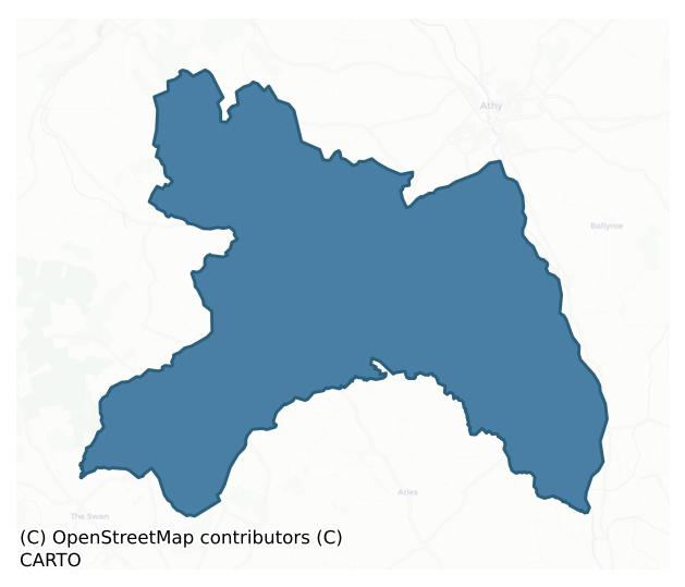
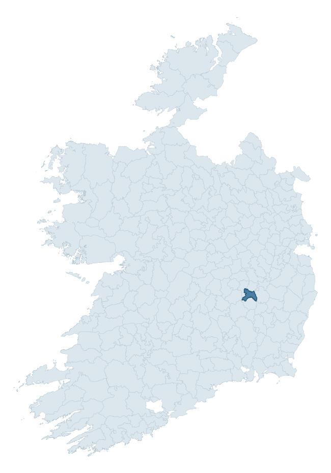
Where this barony sits in the Republic of Ireland
Geology and preservation
Bedrock geology shapes the landscape long before any settlement begins — controlling soil drainage, agricultural potential, the survival of upstanding monuments, and the preservation of buried archaeology. The figures below come from the Geological Survey Ireland 1:100,000 bedrock map.
The bedrock underlying Ballyadams is predominantly limestone (76% of the barony by area), laid down during the Carboniferous period (100% by area, around 359 to 299 million years ago). Limestone is the most heritage-rich bedrock in Ireland. It supports fertile, well-drained soils that favoured dense Early Medieval settlement and Norman manorial agriculture, and it weathers into karst features — sinkholes, caves, swallow holes, and souterrains — that frequently carry archaeology. Where peat overlies limestone, organic preservation can be exceptional. The single largest mapped unit is the Ballyadams Formation (57% of the barony's bedrock).
Rock type composition
Largest mapped unit: Ballyadams Formation (57% of the barony)
Placename evidence
Logainm records 14 heritage-diagnostic placenames for Ballyadams, a modest sample drawn predominantly from the townland record. The dominant stratum is pre-christian defensive. The most frequent diagnostic roots are cill- (6) and ráth- (5). With a sample of this size the count should be treated as indicative rather than definitive.
Pre-Christian / Early Medieval Defensive
| Root | Count | Meaning |
|---|---|---|
| ráth- | 5 | earthen ringfort |
| dún- | 2 | hilltop or promontory fort |
Early Christian Ecclesiastical
| Root | Count | Meaning |
|---|---|---|
| cill- | 6 | church (early) |
| cillín- | 1 | unconsecrated burial ground |
Other baronies in Laois
About this profile
Click any section below to expand.
What is a barony?
A barony is a historic administrative unit in Ireland, broadly equivalent to an English hundred. The 280 baronies used here are from the OSi 2019 National Statutory Boundaries (generalised 20m), covering the 26 counties of the Republic of Ireland. Baronies derive from the Norman period, were formalised in the 17th century, and have not been redrawn for statistical purposes. They vary enormously in area, from compact urban baronies in Dublin to vast upland baronies in Connacht, and should not be compared by raw site count without accounting for area differences.
What counts as a site?
This profile combines three distinct heritage registers, each with its own definition of what constitutes a recordable site:
- Archaeological sites (NMS). The National Monuments Service Sites and Monuments Record (SMR) catalogues every known archaeological monument or site of archaeological interest in the Republic, from prehistoric burial mounds and ringforts to medieval churches and post-medieval defensive works. Inclusion does not require legal protection — only that the site has been identified, surveyed, and assessed as having archaeological value. A separate subset of these sites lies within a recorded protection zone, which gives them statutory protection under the National Monuments Acts.
- Listed buildings (NIAH). The National Inventory of Architectural Heritage records buildings of architectural, historical, archaeological, artistic, cultural, scientific, social, or technical interest. Each surveyed structure is appraised on a five-tier scale: International, National, Regional, Local, and Record-Only. The NIAH appraisal is informational rather than strictly statutory, but it underpins local-authority Record of Protected Structures (RPS) listings.
- Heritage placenames (Logainm). Logainm is the authoritative database of Irish placenames maintained by the Placenames Branch. This profile applies a heritage-diagnostic classifier to the Irish-language form of each townland name, flagging roots that signal defensive sites (ráth-, lios-, dún-, caiseal-, cathair-), ecclesiastical foundations (cill-, teampall-, domhnach-, mainistir-), prehistoric burial-ritual features (tuaim-, carn-, leaba-), or Norse-contact settlement (gall-). Townlands without one of these diagnostic roots are not flagged here — they may still carry historical significance, but that significance is not encoded in the name itself.
Editorial principles
The narrative sections of this profile follow several explicit principles:
- Evidential. Every claim about this barony’s heritage character is anchored in the underlying register data. Where a site count, a placename count, or a percentile rank is cited, it is computed from the source datasets at export time, not estimated.
- Comparative. Counts and metrics are reported alongside their percentile rank against the other 279 ROI baronies. A barony with 50 ringforts in absolute terms could be unusually high or unusually low depending on its size and regional context; percentile ranking removes that ambiguity.
- Transparent on limits. Where a register has known coverage gaps, survey biases, or data-quality issues that affect this barony’s figures, the profile flags them rather than presenting the numbers as definitive.
- No interpretation beyond what the data supports. The narrative does not speculate about historical events, social dynamics, or cultural meaning beyond what the recorded heritage and placename evidence directly attests.
Data caveats and limits
- NMS Sites and Monuments Record is the product of survey campaigns conducted at different intensities across different counties and decades. Some baronies have been surveyed more thoroughly than others, and absolute counts should be read in that light. Sites destroyed by development before survey are typically not represented; sites in heavily forested or upland terrain are sometimes under-recorded.
- NIAH coverage is broadly complete for the Republic of Ireland but the survey was conducted on a rolling county-by-county basis, and the most recent appraisal date varies. Buildings demolished or substantially altered after their original survey may still appear in the register; conversely, recent buildings of merit may not yet have been appraised.
- Logainm classification applies a deliberately conservative pattern-matching approach to the Irish-language townland forms. The classifier prioritises true positives over recall: a townland may carry a heritage signal that the classifier doesn’t recognise, particularly where the diagnostic root has been heavily anglicised or where the townland name draws on a less common term. The 60,000+ townland records and ~9,800 classified placenames give a substantial signal at barony scale, but individual townland names should be checked against Logainm directly for definitive interpretation.
- Period attribution. The chronological distribution reflects only those NMS sites that carry a recognised period attribution in the source data. Sites listed as “Unknown” period are excluded from the dated subset.
- Boundary changes. Some baronies have undergone minor boundary adjustments since their 19th-century definition; the OSi 2019 generalised boundaries used here are the current statutory definition and may differ slightly from historical maps in border areas.
- Bedrock geology is mapped at 1:100,000 scale, which means local variation within a barony — small pockets of different rock type, mineral veins, alluvium overlying bedrock — is generalised. The dominant-system and rocktype figures are area-weighted, so a barony reading “70% Carboniferous limestone” may still contain small but archaeologically important pockets of older or younger rock. Around 3% of GSI polygons do not match the lexicon and contribute no rocktype or system attribution.
Data sources
- National Monuments Service — Sites and Monuments Record (SMR) https://data.gov.ie/dataset/national-monuments-service-archaeological-survey-of-ireland
- National Inventory of Architectural Heritage (NIAH) https://data.gov.ie/dataset/national-inventory-of-architectural-heritage-niah-national-dataset
- Logainm — Placenames Database of Ireland https://www.logainm.ie/
- Ordnance Survey Ireland — National Statutory Barony Boundaries 2019 https://data-osi.opendata.arcgis.com/
- EURODEM — European Digital Elevation Model https://www.mapsforeurope.org/datasets/euro-dem
- ESA WorldCover https://esa-worldcover.org/en
- Geological Survey Ireland — 1:100,000 Bedrock Geology https://www.gsi.ie/en-ie/data-and-maps/Pages/Bedrock.aspx
Explore more: Search any of the 280 ROI baronies, browse by historical province, or read the methodology and data sources for the full Republic of Ireland Heritage Tool.