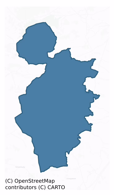
Clandonagh is a barony of County Laois, in the historical province of Leinster (Irish: Tigh na hInse), covering 177 km² of land. The barony records 242 NMS archaeological sites and 39 NIAH listed buildings, placing it at around the 26th percentile among 280 ROI baronies for sites per km². This means it is in the bottom third of all baronies for sites per km². Dated archaeological evidence runs from the Neolithic through to the Modern, spanning 8 of 9 archaeological periods, placing the barony in the 78th percentile among 280 ROI baronies for chronological depth. This means it is in the top third of all baronies for chronological depth. The largest dated subset of recorded sites dates to the Early Medieval. Logainm flags 28 placenames in the barony as carrying a recognised heritage root; the largest share — around 54% — are names associated with early Christian church and monastic foundations.

Heritage at a glance
Percentile rankings throughout this profile compare each barony only against the other 279 Republic of Ireland baronies.
The recorded heritage of Clandonagh
The National Monuments Service Sites and Monuments Record (SMR) is the statutory inventory of archaeological sites for the Republic of Ireland, maintained by the Department of Tourism, Culture, Arts, Gaeltacht, Sport and Media. Sites recorded here include earthworks, ringforts, megalithic tombs, ecclesiastical remains, and post-medieval features; not every record is legally protected, but each is registered as a monument of archaeological interest.
The National Monuments Service records 242 archaeological sites in Clandonagh, putting it at the 26th percentile among 280 ROI baronies for sites per km². This means it is in the bottom third of all baronies for sites per km². Protection coverage is near-universal — 231 sites (96%) fall within a recorded monument protection zone, indicating an extensively surveyed landscape. The record is dominated by defensive sites — ringforts, enclosures, hillforts, and stone forts (120 sites, 50% of the total), with ecclesiastical sites forming a substantial secondary presence (53 sites, 22%). The most diagnostically specific type is Ringfort – rath (40 records, 17% of the barony's NMS total) — compared to an ROI average of 20% across all baronies where this type occurs. Ringfort – rath is an earthen ringfort enclosed by a bank and external ditch — the most common Early Medieval farmstead, broadly dated 500–1000 AD. The broader 'Enclosure' classification — which catches unclassified ringforts and field enclosures — accounts for a further 46 records (19%) and reflects the difficulty of sub-classifying degraded earthworks from surface evidence alone. Across the barony's 177 km², this gives a recorded density of 1.37 sites per km².
Most common monument types
Hover or tap a monument type to see its definition.
| Type | Count |
|---|---|
| Enclosure a banked or ditched feature of uncertain type, used as a catch-all where the original function cannot be determined from surface evidence | 46 |
| Ringfort – rath an earthen ringfort enclosed by a bank and external ditch — the most common Early Medieval farmstead, broadly dated 500–1000 AD | 40 |
| Church a building used for public Christian worship, of any date from c. 500 AD onwards | 18 |
| Graveyard a burial area associated with a church, in use from the medieval period onwards | 17 |
| Castle – unclassified a castle whose form cannot be precisely classified, dating somewhere between the late 12th and 16th centuries | 8 |
| Moated site | 8 |
| Bawn the defended courtyard of a medieval house, tower house or fortified house | 7 |
| Castle – tower house a fortified residential tower of four or five storeys, mostly built by lords in the 15th and 16th centuries and often within a defended bawn | 5 |
Chronological distribution
The dated archaeological record for Clandonagh spans from the Neolithic through to the Modern, with activity attested across 8 of 9 archaeological periods. This is the 78th percentile across ROI baronies for chronological depth — an above-average span. Every period from earliest to latest is represented in the record — an unbroken sequence of dated activity across the full chronological span. Activity concentrates most heavily in the Early Medieval (73 sites, 39% of dated material), with the Iron Age forming a secondary peak (63 sites, 34%). A further 54 recorded sites (22% of the overall NMS register for the barony) carry no period attribution — appearing as 'Unknown' in the bar chart below. This typically reflects either records that pre-date the standardised period vocabulary or sites awaiting specialist dating review, rather than a genuine absence of chronological evidence.
Sample of recorded monuments
Show 25 sample monuments (of 242 total)
A representative sample of 25 recorded monuments drawn from the barony’s 242 total NMS entries. Sites within a recorded monument protection zone and rarer site types are prioritised so the list shows a meaningful cross-section rather than only the most common type. Each entry shows the official Sites and Monuments Record reference number and the description published by the National Monuments Service.
Sheela-na-gig
The sheela-na-gig is carved in relief on the SW external face of the W angle of the tower house (LA015-017001-) between the second and third floor. It is carved in relief on an L-shaped sandstone quoin stone approx. 10m…
The sheela-na-gig is carved in relief on the SW external face of the W angle of the tower house (LA015-017001-) between the second and third floor. It is carved in relief on an L-shaped sandstone quoin stone approx. 10m above ground level (Feehan and Cunningham 1978, 117). The figures feet are turned outward and pointed, the legs are short and stumpy, the knees are bent outwards. The right hand appears to rest on the hip while the left arm lies on the thigh, with bent elbows. The head is pear-shaped with pointed chin and the face bears a menacing expression with v-shaped mouth and slanted eyes. The ears are prominent while the vulva is represented by a deep depression (Feehan and Cunningham 1978, 117-18).
See attached screenshots of 3D model of Sheela-na-gig created by Digital Heritage Age. 3D model can be accessed on the Sketchfab website at: https://skfb.ly/6tCuV
The above description is derived from the published 'Archaeological Inventory of County Laois' (Dublin Stationery Office, 1995) compiled by P. David Sweetman, Olive Alcock and Bernie Moran. In certain instances the entries have been revised and updated in the light of recent research.
Date of upload: 17 December 2007
Bullaun stone (present location)
In gently undulating countryside. Near St. Molua's Church (LA023-015) is St. Molua's stone an ancient font (O'Hanlon and O'Leary 1907, vol. 1, 279). No visible surface remains of bullaun stone that was located in a…
In gently undulating countryside. Near St. Molua's Church (LA023-015) is St. Molua's stone an ancient font (O'Hanlon and O'Leary 1907, vol. 1, 279). No visible surface remains of bullaun stone that was located in a field to the SW of the church and graveyard (LA015-023001/002-).
Recorded by Elizabeth FitzPatrick in 1993 as St. Molua's Stone is a large weathered limestone boulder (L 1.6m x 1.1m Wth ; H 0.6m) which on its upper surface contains five depressions. The Bullaun stone was formerly situated at the NW end of the field across the road to the SW of the graveyard (LA015-022). During preparation of this field for tillage in more recent times, the stone was pushed right up against the N field boundary at its W end. According to T. L. Cooke the local people up to about 1810 held an annual meeting at this stone on the Festival of Lughnasa (1st August) for dancing, merriment and match-making. Recent site inspection recorded the presence of the bullaun stone located immediately inside the entrance gates to the graveyard on the S side.
The above description is derived from the published 'Archaeological Inventory of County Laois' (Dublin Stationery Office, 1995) compiled by P. David Sweetman, Olive Alcock and Bernie Moran. In certain instances the entries have been revised and updated in the light of recent research.
Date of upload: 17 December 2007
Sarcophagus (present location)
Originally located at E end of graveyard (LA015-023002-) under a hawthorn tree traditionally said to have been festooned with rags; it is now mounted in concrete in the yard of the modern Catholic church in Ballaghmore…
Originally located at E end of graveyard (LA015-023002-) under a hawthorn tree traditionally said to have been festooned with rags; it is now mounted in concrete in the yard of the modern Catholic church in Ballaghmore village. The rectangular sandstone trough (L 0.95m x 0.48m x 0.40m; T 0.13m) has a lip running around the inner edge of the top of the trough maybe to accommodate a lid for the sarcophagus or what may have been a saints reliquary.
The above description is derived from the published 'Archaeological Inventory of County Laois' (Dublin Stationery Office, 1995) compiled by P. David Sweetman, Olive Alcock and Bernie Moran. In certain instances the entries have been revised and updated in the light of recent research.
Date of upload: 17 December 2007
Graveslab
In gently undulating countryside. A cut stone slab with chamfered edges, originally from Skirke castle chimney. Reused as a grave slab and with the following inscription dated 1612.
IESVS. MARIA
IOHN. DVIGIN. I.…
In gently undulating countryside. A cut stone slab with chamfered edges, originally from Skirke castle chimney. Reused as a grave slab and with the following inscription dated 1612.
IESVS. MARIA
IOHN. DVIGIN. I. 1VL1112
ELLEN. PVRCELL.
(Carrigan 1905, vol. 2, 135). No visible surface remains of grave slab in graveyard (LA021-01002-).
The above description is derived from the published 'Archaeological Inventory of County Laois' (Dublin Stationery Office, 1995) compiled by P. David Sweetman, Olive Alcock and Bernie Moran. In certain instances the entries have been revised and updated in the light of recent research.
Date of upload: 17 December 2007
Field boundary
Not marked on the 1841 or 1909 editions of the OS 6-inch maps. A field bank, extending to the E and NW of ringfort (LA021-015001-) is visible on aerial photographs (GSI, S 79-80). No visible surface remains.
The…
Not marked on the 1841 or 1909 editions of the OS 6-inch maps. A field bank, extending to the E and NW of ringfort (LA021-015001-) is visible on aerial photographs (GSI, S 79-80). No visible surface remains.
The above description is derived from the published 'Archaeological Inventory of County Laois' (Dublin Stationery Office, 1995) compiled by P. David Sweetman, Olive Alcock and Bernie Moran. In certain instances the entries have been revised and updated in the light of recent research.
Date of upload: 17 December 2007
Henge
An almost circular enclosure (dims. c. 96m E-W, c. 90m N-S,) defined by bank (Wth 8-9m, int. H c. 1m, ext. H 2.5m-3m) and external fosse (Wth c. 7m) except at N. This site appears to have been a henge-type monument…
An almost circular enclosure (dims. c. 96m E-W, c. 90m N-S,) defined by bank (Wth 8-9m, int. H c. 1m, ext. H 2.5m-3m) and external fosse (Wth c. 7m) except at N. This site appears to have been a henge-type monument before it was adapted as a motte and bailey (LA021-021002-). The banks were originally formed by scooping out the clay from inside the line of the bank leaving the central area, higher than the extremities of the enclosure. This is a typical feature of the henge-type sites in Ireland (Cunningham 1987, 163-4). Standing Stone (LA021-021004-) in centre of henge monument.
The above description is derived from the published 'Archaeological Inventory of County Laois' (Dublin Stationery Office, 1995) compiled by P. David Sweetman, Olive Alcock and Bernie Moran. In certain instances the entries have been revised and updated in the light of recent research.
Date of upload: 17 December 2007
Castle – motte and bailey
Atop high ground with good views of undulating countryside, church (LA021- 010001-) and graveyard (LA021-010002-) immediately to the N. A flat-topped mound (diam. c. 13m, H 3m-3.5m) surrounded by a wide shallow fosse…
Atop high ground with good views of undulating countryside, church (LA021- 010001-) and graveyard (LA021-010002-) immediately to the N. A flat-topped mound (diam. c. 13m, H 3m-3.5m) surrounded by a wide shallow fosse with a substantial bailey (int. dims. c. 50m N-S, c. 75m E-W) which is defined by a bank (Wth 8-9m, int. H c. 1m, ext. H 2.5m-3m) and external fosse (Wth c. 7m) except at N. Entrance at E. The site appears to have been a henge monument that was converted into a motte and bailey. Standing stone (LA021-021004-) within centre of henge (LA021-021001-) that was reused as a bailey for the adjoining motte. Reference to a mound here (O'Hanlon and O'Leary 1907, vol. 1, 316). This is a reference to the motte at Skirke.
The above description is derived from the published 'Archaeological Inventory of County Laois' (Dublin Stationery Office, 1995) compiled by P. David Sweetman, Olive Alcock and Bernie Moran. In certain instances the entries have been revised and updated in the light of recent research.
Date of upload: 17 December 2007
Souterrain
Reference to a possible souterrain here (Helen Roe, A History of Co. Laois, Unpublished). No visible surface remains.
The above description is derived from the published 'Archaeological Inventory of County Laois'…
Reference to a possible souterrain here (Helen Roe, A History of Co. Laois, Unpublished). No visible surface remains.
The above description is derived from the published 'Archaeological Inventory of County Laois' (Dublin Stationery Office, 1995) compiled by P. David Sweetman, Olive Alcock and Bernie Moran. In certain instances the entries have been revised and updated in the light of recent research.
Date of upload: 17 December 2007
Urn burial
Urns and traces of burials and urns were found beside Skirk standing stone (LA021-021004-) (Feehan 1983, 236).
Traces of burials and urns were found beside the standing stone (LA021-021004-) in the bailey or…
Urns and traces of burials and urns were found beside Skirk standing stone (LA021-021004-) (Feehan 1983, 236).
Traces of burials and urns were found beside the standing stone (LA021-021004-) in the bailey or henge (LA021-021001-) interior (JRSAI, Vol 34, 321). Immediately to the NW of the standing stone is a small artificial mound or motte (LA021-021002-) (D. c. 5m, H. c. 0.5m). Nearby standing stone (LA021-023) in field to SE.
The above description is derived from the published 'Archaeological Inventory of County Laois' (Dublin Stationery Office, 1995) compiled by P. David Sweetman, Olive Alcock and Bernie Moran. In certain instances the entries have been revised and updated in the light of recent research.
Date of upload: 17 December 2007
Barrow – unclassified
Described in report (OPW file) as a low oval platform (dims c. 22.5m N-S, 18m E-W) with an external fosse (Wth c. 2.1m; D c. 0.15m) visible at NW and faint traces elsewhere. Now appears as a low flat-topped mound (diam.…
Described in report (OPW file) as a low oval platform (dims c. 22.5m N-S, 18m E-W) with an external fosse (Wth c. 2.1m; D c. 0.15m) visible at NW and faint traces elsewhere. Now appears as a low flat-topped mound (diam. 21m, H c. 1m). No visible surface remains of fosse.
The above description is derived from the published 'Archaeological Inventory of County Laois' (Dublin Stationery Office, 1995) compiled by P. David Sweetman, Olive Alcock and Bernie Moran. In certain instances the entries have been revised and updated in the light of recent research.
Date of upload: 17 December 2007
Cross – Wayside cross
National Monument No. 113. On roadside in undulating countryside, 100m SW of Errill church (LA027-024—) and graveyard (LA027-024001-). Only the lower half of a cross shaft (H c. 0.85m, Wth c. 0.38m, T c. 0.21m)…
National Monument No. 113. On roadside in undulating countryside, 100m SW of Errill church (LA027-024—) and graveyard (LA027-024001-). Only the lower half of a cross shaft (H c. 0.85m, Wth c. 0.38m, T c. 0.21m) survives rising out of a cut-stone chamfered base which stands on a stepped stone pedestal consisting of four steps. In 1860 the cross and pedestal (H 2.45m) was repaired by the first Lord Castletown, these repairs consisting of the insertion of a pair of iron clamps resulted in the destruction of the inscription and the coat of arms contained on the cross (Carrigan 1924, 147). The cross was described by Carrigan(1924,147) as following; 'On the upper part of front, or the eastern face, of the shaft there is a shield sculptured in relief with the arms of the Lords of Upper Ossory. There is a raised letter inscription on the lower part of the front, and another on the back stretching from the top to the bottom' (ibid., 147). The coat of arms consisted of the following; 'Sable, a saltire argent; on a chief azure, three fleur-de-lis or. Supporters, two lions sable, armed and langued gules. As there was no room for the supporters at the sides, the sculptor has placed them on the shield. The crest – a dragon vert, surmounted by a lion passant sable-was no doubt carved above the shield but that portion of the stone is now missing. On the lower part are inscriptions, dated 1613 and 1622, to the Baron of Upper Ossory, his wife Kathrin More and their son and daug…
Linear earthwork
Situated in a low lying marshy area 11m SSW of nearby ringfort (LA027-028001-) and stream to the S. Linear feature visible on aerial photograph (GSI, S 40-1). A flat-topped bank (Wth c. 5m) curving gently from SSW-NNE…
Situated in a low lying marshy area 11m SSW of nearby ringfort (LA027-028001-) and stream to the S. Linear feature visible on aerial photograph (GSI, S 40-1). A flat-topped bank (Wth c. 5m) curving gently from SSW-NNE (C c. 52.3m) is visible on the ground.
The above description is derived from the published 'Archaeological Inventory of County Laois' (Dublin Stationery Office, 1995) compiled by P. David Sweetman, Olive Alcock and Bernie Moran. In certain instances the entries have been revised and updated in the light of recent research.
Date of upload: 17 December 2007
Hut site
Within moated site (LA028-012001-) is a low irregular enclosure. (Carrigan 1905, vol. 2, 354). No visible surface remains.
Described by Carrigan as a 'Large square rath (LA028-012001-) in Beckfield 20 or 30 perches…
Within moated site (LA028-012001-) is a low irregular enclosure. (Carrigan 1905, vol. 2, 354). No visible surface remains.
Described by Carrigan as a 'Large square rath (LA028-012001-) in Beckfield 20 or 30 perches west of this bridge. It is partly square, and has a double rampart on the north and west sides, the outer one being high and very wide and massive. A low irregular enclosure within the rath marks the site of some ancient building. Outside is 'the Old Street', where there are extensive foundations of buildings beneath the surface of the field (LA028-074002-). A castle (LA028-074001-) or large residence is entered here on the Down Survey Map of 1657.' (Carrigan 1905, vol. 2, 354) Townland originally called Ballyawley and was changed to Beckfield after a spinster lady named Beck or Rebeccca Flood who built Beckfield House more than a century ago. In 1665 John Fitzpatrick paid hearth-money for two hearths in Ballyawly.
The above description is derived from the published 'Archaeological Inventory of County Laois' (Dublin Stationery Office, 1995) compiled by P. David Sweetman, Olive Alcock and Bernie Moran. In certain instances the entries have been revised and updated in the light of recent research.
Date of upload: 17 December 2007
Designed landscape feature
Marked on the 1908 edition of the OS 6-inch map only; an irregular line of hachures indicates part of a possible earthwork ( C c. 85m SSE-SW) located in front of Farranville House. Situated in slightly undulating…
Marked on the 1908 edition of the OS 6-inch map only; an irregular line of hachures indicates part of a possible earthwork ( C c. 85m SSE-SW) located in front of Farranville House. Situated in slightly undulating countryside. A slightly raised area in front of Farranville House and appears to be a landscape feature possibly a ha-ha associated with Farranville House.
The above description is derived from the published 'Archaeological Inventory of County Laois' (Dublin Stationery Office, 1995) compiled by P. David Sweetman, Olive Alcock and Bernie Moran. In certain instances the entries have been revised and updated in the light of recent research.
Compiled by Caimin O'Brien
Date of upload/revision: 09 December 2011
Castle – motte
Situated at the N end of a N-S ridge with stream to the NW. A flat-topped steep sided earthen mound (summit diam. c. 8m; H c. 7.5m). Slight remains of fosse visible (Wth c. 5.5m, D c. 0.97m) visible from SE through S to…
Situated at the N end of a N-S ridge with stream to the NW. A flat-topped steep sided earthen mound (summit diam. c. 8m; H c. 7.5m). Slight remains of fosse visible (Wth c. 5.5m, D c. 0.97m) visible from SE through S to SW only. No evidence of a bailey. Slight quarrying on the summit of the motte on the NW face has created a small hollow depression on this side. Impressive views of surrounding countryside in all directions. Remains of a possible mill race of unknown date in field immediately to the N of the motte. This linear earthwork appears to be earlier than the mill race in the field to the W of the motte which is associated with the eighteenth century maltings in the village of Donaghmore. Motte was built at N end of esker ridge and is steepest in its N face, likely bailey area if there ever was one to be in the flat elevated fields to the E and SE of the motte.
Described by Carrigan as 'St. Patrick's holy well (LA028-023—-) is a little to the north-west of the graveyard (LA028-025001-), but it is now closed, a great rock having been rolled into it about 1845. Beside the well is Donnaghmore "Moat" (LA028-024001-) a truncated cone, 11 yds. in diameter at the top and about 22 ft. high. There is neither trace nor tidings of Donnaghmore Castle (LA028-024002-), though it is mentioned in documents of 1571 and 1621 (Carrigan 1905, vol. 2, 352). Donaghmore medieval church and graveyard (LA028-025001-/002-) are located 240m SSE of the motte. St Patricks Well (LA028-023-…
Historic town
Described by Carrigan as 'a town, Rathdowney cannot boast of any great antiquity. It must have been a very small village in 1665, as only about a dozen persons paid hearth money in the whole townland of Rathdowney in…
Described by Carrigan as 'a town, Rathdowney cannot boast of any great antiquity. It must have been a very small village in 1665, as only about a dozen persons paid hearth money in the whole townland of Rathdowney in this year' (Carrigan 1905, vol. 2, 340). Described by Feehan as 'Rathdowney takes its name from a 'rath' (LA028-055003-) which stood until 1840 at the north end of the town square, close to the site of the medieval parish church (LA028-055001-) of Rathdowney, which was where the Protestant church stands. The ringfort may have been the seat of the Gaelic civil power in the local lordship in early medieval times, and together with the church made the place a natural focus for settlement which attracted the Normans in the late twelfth century' (Feehan 1983, 397-8).
In the thirteenth century the manor of Rathdowney figures prominently in the Ormond Deeds (Cunningham 1987, 166). Between 1207 and 1213 Adam de Hereford was granted the 'tuath of Mamocle in which his castle (LA028-055003-) of Radouney[Rathdowney] stands' (Cunningham 1987, 166). The historical references to the manor of Rathdowney along with the presence of a medieval church and thirteenth century castle all suggest that the present village of Rathdowney is built on the site of a thirteenth century settlement. This settlement is lkely to have been located on either side of the main street from the Church (LA028-055001-) and ringwork (LA028-055003-) at the Northern end of the town stretching southwards…
Sundial
There was a sundial on ten steps of the stairs in Ballagh Castle (LA033-002001-), descreasing in size as one descended the stairs. They were semi circles (JRSAI 1867, 4-5). There are no visible surface remains.
The…
There was a sundial on ten steps of the stairs in Ballagh Castle (LA033-002001-), descreasing in size as one descended the stairs. They were semi circles (JRSAI 1867, 4-5). There are no visible surface remains.
The above description is derived from the published 'Archaeological Inventory of County Laois' (Dublin Stationery Office, 1995) compiled by P. David Sweetman, Olive Alcock and Bernie Moran. In certain instances the entries have been revised and updated in the light of recent research.
Date of upload: 17 December 2007
Well
Reference to a well in the west of the enclosure (Feehan 1983, 260). No visible surface remains.
The above description is derived from the published 'Archaeological Inventory of County Laois' (Dublin Stationery…
Reference to a well in the west of the enclosure (Feehan 1983, 260). No visible surface remains.
The above description is derived from the published 'Archaeological Inventory of County Laois' (Dublin Stationery Office, 1995) compiled by P. David Sweetman, Olive Alcock and Bernie Moran. In certain instances the entries have been revised and updated in the light of recent research.
Date of upload: 17 December 2007
House – early medieval
Situated on a ridge within ringfort (LA033-021001-). Indicated on the 1908 ed OS 6-inch map only. A rectangular shaped area (L. c. 16.2m, W. c. 5m) defined by a low earthen bank.
The above description is derived from…
Situated on a ridge within ringfort (LA033-021001-). Indicated on the 1908 ed OS 6-inch map only. A rectangular shaped area (L. c. 16.2m, W. c. 5m) defined by a low earthen bank.
The above description is derived from the published 'Archaeological Inventory of County Laois' (Dublin Stationery Office, 1995) compiled by P. David Sweetman, Olive Alcock and Bernie Moran. In certain instances the entries have been revised and updated in the light of recent research.
Date of upload: 17 December 2007
Inscribed stone
Cloncourse castle (LA015-021) was built by the O'Duigin's in 1636 according to its datestone now at Mondrehid House which was built near the site of Mondrehid Castle (LA016-019). This slab was taken from Cloncourse…
Cloncourse castle (LA015-021) was built by the O'Duigin's in 1636 according to its datestone now at Mondrehid House which was built near the site of Mondrehid Castle (LA016-019). This slab was taken from Cloncourse Castle (LA015-021) and taken to the garden of Mondrehid House, the datestone has the inscription which reads 'I.H.S. 1636 I.N.R.I. JOHN." (Carrigan 1905, vol. 2, 134)
Ceremonial enclosure
Situated in grassland with stream 90m to W marking county boundary with Tipperary, poorly drained land to W with two fulacht fia (LA021-009—-/LA021-008—-) 95m and 85m to N and NW respectively. Henge monument…
Situated in grassland with stream 90m to W marking county boundary with Tipperary, poorly drained land to W with two fulacht fia (LA021-009—-/LA021-008—-) 95m and 85m to N and NW respectively. Henge monument (LA021-021001-) located c. 800m to SE. A large circular shaped enclosure (approx. diam. 96m N-S) defined by a slight bank with faintest suggestion of an external ditch with possible annexe of uncertain antiquity at NE. The cropmark of the possible annexe is depicted as a curving field boundary on the OS 25-inch map but is not depicted on the 1838 ed. OS 6-inch map which suggests that this feature may date from the 19th century. To S are faint linear cropmarks which may suggest the site of a possible field system of uncertain antiquity. Some of these field boundaries are depicted on the 1838 ed. OS 6-inch map. It is possible that the linear cropmarks identified may be a combination of the remains of old water courses associated with the stream which forms the W boundary of the field and post-1700 field boundaries depicted on various editions of the OS 6-inch maps. The straight linear cropmark running NE-SW which is 23m S of the enclosure is depicted on the 25-inch OS map as a stream or watercourse flowing from SE to NW.
Compiled by: Caimin O'Brien with details kindly provided by Stephen Kehoe of the Discovery Programme – see attached labelled aerial photograph showing identification of features by Stephen Kehoe
Date of upload: 24 April 2018
Enclosure – large enclosure
Situated in pasture, with ringfort (LA021-024—-) 70m to N. Partial outline of circular shaped area (approx. diam. 90m) defined by a fosse with traces of an outer enclosing element to NW visible on Google Earth…
Situated in pasture, with ringfort (LA021-024—-) 70m to N. Partial outline of circular shaped area (approx. diam. 90m) defined by a fosse with traces of an outer enclosing element to NW visible on Google Earth orthoimage and on Digital Globe orthophoto taken 2011-13.
See attached Google Earth orthoimage taken 30/11/2009
Compiled by: Caimin O'Brien based on details provided by Jean-Charles Caillère
Date of upload: 12 November 2020
Sarcophagus
St. Molua's Grave located in SW end of graveyard (LA015-023002-) described in the 19th century by T. L. Cooke as 'it is most remarkable, being 12 feet in length by three feet in breadth. A large, rude, and uninscribed…
St. Molua's Grave located in SW end of graveyard (LA015-023002-) described in the 19th century by T. L. Cooke as 'it is most remarkable, being 12 feet in length by three feet in breadth. A large, rude, and uninscribed stone marks one end; and a nearly similar stone points out the other end. The limits of the sides are defined by rough limestone flags standing on an end. The upper edges of these flags are barely visible above the surface of the ground'. Today, two of these sandstone erect slabs are still visible one placed at a right angle to the other, but the clearly defined elements of the plot observed by the Celtic Cross were one suspects altered by the erection of the commemorative Cross and replaced by modern kerbing in 1920 (Fitzpatrick 1993). This cross was erected by Mrs M. Delaney 1920 to commemorate the burial place of St. Molua.
Shrine of St. Molua now in British Museum. (Crawford J.R.S.A.I. Vol 53, 1923, 76, 80, 87, 161, 162).
The above description is derived from the published 'Archaeological Inventory of County Laois' (Dublin Stationery Office, 1995) compiled by P. David Sweetman, Olive Alcock and Bernie Moran. In certain instances the entries have been revised and updated in the light of recent research.
Date of upload: 17 December 2007
Megalithic structure
Within the large henge (LA021-021001-) there is a standing stone (LA021-021004-) and a motte (LA021-021002-). In addition, according to Ledwich (1803, 73) and following him O Byrne (1856, 19) and O'Hanlon and O'Leary…
Within the large henge (LA021-021001-) there is a standing stone (LA021-021004-) and a motte (LA021-021002-). In addition, according to Ledwich (1803, 73) and following him O Byrne (1856, 19) and O'Hanlon and O'Leary (1907, vol. 1, 316), the remains of a 'cromleach' were to be seen towards the eastern side of the enclosure. It is not clear to what feature Ledwich applied this term unless it was to a block of stone which, along with the standing stone and motte already mentioned, are shown within the enclosure on a sketch of the site reproduced by him (ibid. Plate III). There is no trace of this stone now. (Ledwich 1803, 73; O Byrne 1856, 19; O Hanlon and O Leary 1907, 316).
The above description is derived from the published 'Archaeological Inventory of County Laois' (Dublin Stationery Office, 1995) compiled by P. David Sweetman, Olive Alcock and Bernie Moran. In certain instances the entries have been revised and updated in the light of recent research.
Date of upload: 17 December 2007
Enclosure
Marked on the 1841 and 1909 editions of the OS 6-inch maps; a circular enclosure (max. diam. c. 20m). Situated in an upland area. No visible surface remains.
The above description is derived from the published…
Marked on the 1841 and 1909 editions of the OS 6-inch maps; a circular enclosure (max. diam. c. 20m). Situated in an upland area. No visible surface remains.
The above description is derived from the published 'Archaeological Inventory of County Laois' (Dublin Stationery Office, 1995) compiled by P. David Sweetman, Olive Alcock and Bernie Moran. In certain instances the entries have been revised and updated in the light of recent research.
Date of upload: 17 December 2007
Listed buildings
The National Inventory of Architectural Heritage (NIAH) is a state survey appraising buildings of architectural, historical, archaeological, artistic, cultural, scientific, social, or technical interest. Each surveyed structure receives a rating from International (the highest, for buildings of European importance) through National, Regional, Local, and Record-Only.
The NIAH records only 39 listed buildings in Clandonagh, the 18th percentile across ROI baronies — a relatively thin architectural record. The highest-graded structure include 1 of National significance. The Republic holds 937 National-graded buildings in total, so this barony accounts for around 0% of the national total. Construction dates concentrate most heavily in the Victorian (1830-1900) period. The most-recorded building type is church/chapel (9 examples, 23% of the listed stock).
Terrain and environment
Mean elevation across the barony is 125m — the 76th percentile among 280 ROI baronies for elevation. This means it is in the top third of all baronies for elevation. This is a relatively elevated landscape by ROI standards. Elevation matters for heritage because higher-altitude baronies typically favour defensive monuments — ringforts and hilltop forts placed on prominent ground — while lowland baronies are more likely to carry the dense settlement and church networks of intensive agricultural landscapes. A maximum elevation of 310m gives the barony meaningful vertical relief. Mean slope is 2.3° — the 19th percentile among 280 ROI baronies for slope. This means it is in the bottom fifth of all baronies for slope. This is broadly flat terrain, the kind of landscape best suited to intensive agriculture. Slope is a key control on both land use and archaeological preservation: steep ground resists ploughing and tends to preserve earthworks intact, while gentle slopes favour intensive cultivation that damages or destroys surface archaeology over time. The Topographic Wetness Index averages 11.6, the 77th percentile among 280 ROI baronies for wetness. This means it is in the top third of all baronies for wetness. This is wet, slow-draining ground by ROI standards — the kind of landscape that may carry waterlogged archaeological sites of unusual preservation value. Drainage matters for heritage because poorly-drained ground preserves organic archaeology (wooden trackways, leather, textiles, and on rare occasions human remains) far better than free-draining soil; well-drained ground favours arable use but destroys organic material rapidly. The land cover is dominated by improved grassland (81%) and woodland (13%). In overall character, this is elevated but relatively gentle terrain — typical of plateau country, with land use dominated by improved grassland.
Terrain measurements
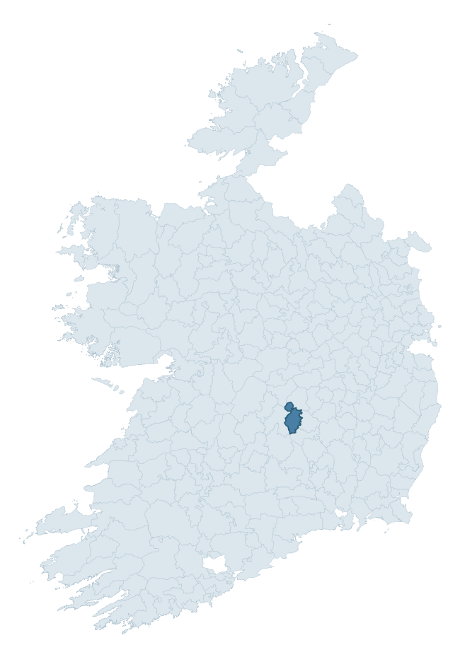
Where this barony sits in the Republic of Ireland
Geology and preservation
Bedrock geology shapes the landscape long before any settlement begins — controlling soil drainage, agricultural potential, the survival of upstanding monuments, and the preservation of buried archaeology. The figures below come from the Geological Survey Ireland 1:100,000 bedrock map.
The bedrock underlying Clandonagh is predominantly limestone (67% of the barony by area), laid down during the Carboniferous period (94% by area, around 359 to 299 million years ago). Limestone is the most heritage-rich bedrock in Ireland. It supports fertile, well-drained soils that favoured dense Early Medieval settlement and Norman manorial agriculture, and it weathers into karst features — sinkholes, caves, swallow holes, and souterrains — that frequently carry archaeology. Where peat overlies limestone, organic preservation can be exceptional. A substantial secondary geology of oolitic limestone (22%) adds further variety to the underlying landscape. The single largest mapped unit is the Ballysteen Formation (47% of the barony's bedrock).
Rock type composition
Largest mapped unit: Ballysteen Formation (47% of the barony)
Placename evidence
Logainm records 28 heritage-diagnostic placenames for Clandonagh, drawn from townland and civil-parish names across the barony. The dominant stratum is Early Christian ecclesiastical — cill-, teampall-, and domhnach-prefixed names that record the dense network of early church foundations established between the fifth and tenth centuries. The leading diagnostic roots are cill- (10 — church), ráth- (7 — earthen ringfort), and lios- (3 — ringfort or enclosure). This is broadly in line with the ROI average of 30.7 heritage placenames per barony. The presence of multiple heritage strata side by side indicates layered occupation of the landscape across successive prehistoric and historic periods. Logainm records 151 placenames for Clandonagh (predominantly townland names). Of these, 28 (19%) carry one of the diagnostic Gaelic roots tracked above; the remainder draw on more generic landscape vocabulary that does not encode a heritage period.
Pre-Christian / Early Medieval Defensive
| Root | Count | Meaning |
|---|---|---|
| ráth- | 7 | earthen ringfort |
| lios- | 3 | ringfort or enclosure |
| dún- | 2 | hilltop or promontory fort |
Early Christian Ecclesiastical
| Root | Count | Meaning |
|---|---|---|
| cill- | 10 | church (early) |
| domhnach- | 2 | pre-Patrician or earliest Patrician church |
| gráinseach- | 2 | monastic farm / grange |
| teampall- | 1 | church (later medieval) |
Burial, Ritual, and Norse-Contact
| Root | Count | Meaning |
|---|---|---|
| uaimh- | 1 | cave / souterrain |
Other baronies in Laois
About this profile
Click any section below to expand.
What is a barony?
A barony is a historic administrative unit in Ireland, broadly equivalent to an English hundred. The 280 baronies used here are from the OSi 2019 National Statutory Boundaries (generalised 20m), covering the 26 counties of the Republic of Ireland. Baronies derive from the Norman period, were formalised in the 17th century, and have not been redrawn for statistical purposes. They vary enormously in area, from compact urban baronies in Dublin to vast upland baronies in Connacht, and should not be compared by raw site count without accounting for area differences.
What counts as a site?
This profile combines three distinct heritage registers, each with its own definition of what constitutes a recordable site:
- Archaeological sites (NMS). The National Monuments Service Sites and Monuments Record (SMR) catalogues every known archaeological monument or site of archaeological interest in the Republic, from prehistoric burial mounds and ringforts to medieval churches and post-medieval defensive works. Inclusion does not require legal protection — only that the site has been identified, surveyed, and assessed as having archaeological value. A separate subset of these sites lies within a recorded protection zone, which gives them statutory protection under the National Monuments Acts.
- Listed buildings (NIAH). The National Inventory of Architectural Heritage records buildings of architectural, historical, archaeological, artistic, cultural, scientific, social, or technical interest. Each surveyed structure is appraised on a five-tier scale: International, National, Regional, Local, and Record-Only. The NIAH appraisal is informational rather than strictly statutory, but it underpins local-authority Record of Protected Structures (RPS) listings.
- Heritage placenames (Logainm). Logainm is the authoritative database of Irish placenames maintained by the Placenames Branch. This profile applies a heritage-diagnostic classifier to the Irish-language form of each townland name, flagging roots that signal defensive sites (ráth-, lios-, dún-, caiseal-, cathair-), ecclesiastical foundations (cill-, teampall-, domhnach-, mainistir-), prehistoric burial-ritual features (tuaim-, carn-, leaba-), or Norse-contact settlement (gall-). Townlands without one of these diagnostic roots are not flagged here — they may still carry historical significance, but that significance is not encoded in the name itself.
Editorial principles
The narrative sections of this profile follow several explicit principles:
- Evidential. Every claim about this barony’s heritage character is anchored in the underlying register data. Where a site count, a placename count, or a percentile rank is cited, it is computed from the source datasets at export time, not estimated.
- Comparative. Counts and metrics are reported alongside their percentile rank against the other 279 ROI baronies. A barony with 50 ringforts in absolute terms could be unusually high or unusually low depending on its size and regional context; percentile ranking removes that ambiguity.
- Transparent on limits. Where a register has known coverage gaps, survey biases, or data-quality issues that affect this barony’s figures, the profile flags them rather than presenting the numbers as definitive.
- No interpretation beyond what the data supports. The narrative does not speculate about historical events, social dynamics, or cultural meaning beyond what the recorded heritage and placename evidence directly attests.
Data caveats and limits
- NMS Sites and Monuments Record is the product of survey campaigns conducted at different intensities across different counties and decades. Some baronies have been surveyed more thoroughly than others, and absolute counts should be read in that light. Sites destroyed by development before survey are typically not represented; sites in heavily forested or upland terrain are sometimes under-recorded.
- NIAH coverage is broadly complete for the Republic of Ireland but the survey was conducted on a rolling county-by-county basis, and the most recent appraisal date varies. Buildings demolished or substantially altered after their original survey may still appear in the register; conversely, recent buildings of merit may not yet have been appraised.
- Logainm classification applies a deliberately conservative pattern-matching approach to the Irish-language townland forms. The classifier prioritises true positives over recall: a townland may carry a heritage signal that the classifier doesn’t recognise, particularly where the diagnostic root has been heavily anglicised or where the townland name draws on a less common term. The 60,000+ townland records and ~9,800 classified placenames give a substantial signal at barony scale, but individual townland names should be checked against Logainm directly for definitive interpretation.
- Period attribution. The chronological distribution reflects only those NMS sites that carry a recognised period attribution in the source data. Sites listed as “Unknown” period are excluded from the dated subset.
- Boundary changes. Some baronies have undergone minor boundary adjustments since their 19th-century definition; the OSi 2019 generalised boundaries used here are the current statutory definition and may differ slightly from historical maps in border areas.
- Bedrock geology is mapped at 1:100,000 scale, which means local variation within a barony — small pockets of different rock type, mineral veins, alluvium overlying bedrock — is generalised. The dominant-system and rocktype figures are area-weighted, so a barony reading “70% Carboniferous limestone” may still contain small but archaeologically important pockets of older or younger rock. Around 3% of GSI polygons do not match the lexicon and contribute no rocktype or system attribution.
Data sources
- National Monuments Service — Sites and Monuments Record (SMR) https://data.gov.ie/dataset/national-monuments-service-archaeological-survey-of-ireland
- National Inventory of Architectural Heritage (NIAH) https://data.gov.ie/dataset/national-inventory-of-architectural-heritage-niah-national-dataset
- Logainm — Placenames Database of Ireland https://www.logainm.ie/
- Ordnance Survey Ireland — National Statutory Barony Boundaries 2019 https://data-osi.opendata.arcgis.com/
- EURODEM — European Digital Elevation Model https://www.mapsforeurope.org/datasets/euro-dem
- ESA WorldCover https://esa-worldcover.org/en
- Geological Survey Ireland — 1:100,000 Bedrock Geology https://www.gsi.ie/en-ie/data-and-maps/Pages/Bedrock.aspx
Explore more: Search any of the 280 ROI baronies, browse by historical province, or read the methodology and data sources for the full Republic of Ireland Heritage Tool.