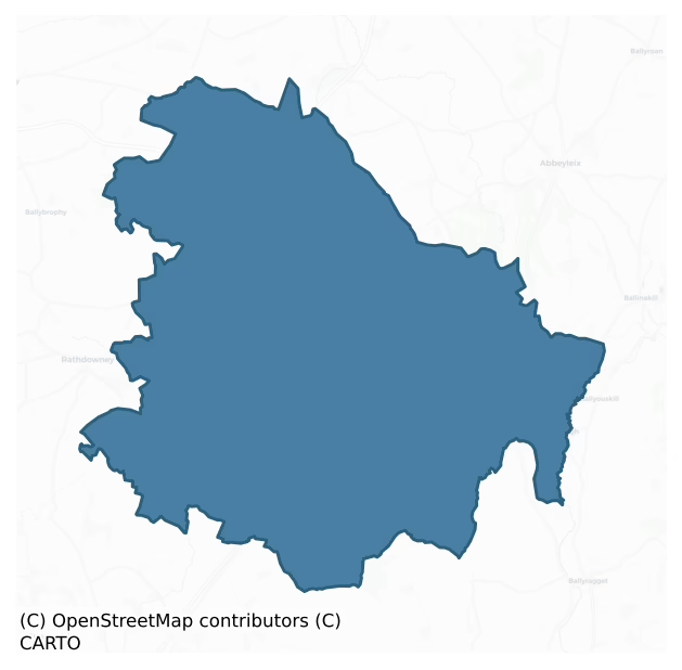
Clarmallagh is a barony of County Laois, in the historical province of Leinster (Irish: An Choill Uachtarach), covering 176 km² of land. The barony records 281 NMS archaeological sites and 49 NIAH listed buildings, placing it at around the 39th percentile among 280 ROI baronies for sites per km². This means it is in the lower half of all baronies for sites per km². Dated archaeological evidence runs from the Early Bronze Age through to the Modern, spanning 7 of 9 archaeological periods, placing the barony in the 23rd percentile among 280 ROI baronies for chronological depth. This means it is in the bottom third of all baronies for chronological depth. The largest dated subset of recorded sites dates to the Iron Age. Logainm flags 18 placenames in the barony as carrying a recognised heritage root; the largest share — around 56% — are names associated with early Christian church and monastic foundations.
Heritage at a glance
Percentile rankings throughout this profile compare each barony only against the other 279 Republic of Ireland baronies.
The recorded heritage of Clarmallagh
The National Monuments Service Sites and Monuments Record (SMR) is the statutory inventory of archaeological sites for the Republic of Ireland, maintained by the Department of Tourism, Culture, Arts, Gaeltacht, Sport and Media. Sites recorded here include earthworks, ringforts, megalithic tombs, ecclesiastical remains, and post-medieval features; not every record is legally protected, but each is registered as a monument of archaeological interest.
The National Monuments Service records 281 archaeological sites in Clarmallagh, putting it at the 39th percentile among 280 ROI baronies for sites per km². This means it is in the lower half of all baronies for sites per km². Protection coverage is near-universal — 263 sites (94%) fall within a recorded monument protection zone, indicating an extensively surveyed landscape. The dominant category is defensive sites — ringforts, enclosures, hillforts, and stone forts (162 sites, 58% of the record). The most diagnostically specific type is Ringfort – rath (36 records, 13% of the barony's NMS total) — compared to an ROI average of 20% across all baronies where this type occurs. Ringfort – rath is an earthen ringfort enclosed by a bank and external ditch — the most common Early Medieval farmstead, broadly dated 500–1000 AD. The broader 'Enclosure' classification — which catches unclassified ringforts and field enclosures — accounts for a further 85 records (30%) and reflects the difficulty of sub-classifying degraded earthworks from surface evidence alone. Across the barony's 176 km², this gives a recorded density of 1.60 sites per km².
Most common monument types
Hover or tap a monument type to see its definition.
| Type | Count |
|---|---|
| Enclosure a banked or ditched feature of uncertain type, used as a catch-all where the original function cannot be determined from surface evidence | 85 |
| Ringfort – rath an earthen ringfort enclosed by a bank and external ditch — the most common Early Medieval farmstead, broadly dated 500–1000 AD | 36 |
| Church a building used for public Christian worship, of any date from c. 500 AD onwards | 21 |
| Graveyard a burial area associated with a church, in use from the medieval period onwards | 19 |
| Moated site | 12 |
| Ring-ditch a circular ditch under 20m across, often the ploughed-out remains of a barrow, ring-barrow or roundhouse | 9 |
| Castle – tower house a fortified residential tower of four or five storeys, mostly built by lords in the 15th and 16th centuries and often within a defended bawn | 8 |
| Ecclesiastical enclosure a large enclosure surrounding an Early Medieval church or monastery and its associated activity areas | 7 |
Chronological distribution
The dated archaeological record for Clarmallagh spans from the Early Bronze Age through to the Modern, with activity attested across 7 of 9 archaeological periods. This is the 23rd percentile across ROI baronies — a relatively narrow chronological band, with much of Irish prehistory not represented in the dated record. Every period from earliest to latest is represented in the record — an unbroken sequence of dated activity across the full chronological span. Activity concentrates most heavily in the Iron Age (102 sites, 45% of dated material), with the Early Medieval forming a secondary peak (70 sites, 31%). A further 54 recorded sites (19% of the overall NMS register for the barony) carry no period attribution — appearing as 'Unknown' in the bar chart below. This typically reflects either records that pre-date the standardised period vocabulary or sites awaiting specialist dating review, rather than a genuine absence of chronological evidence.
Sample of recorded monuments
Show 25 sample monuments (of 281 total)
A representative sample of 25 recorded monuments drawn from the barony’s 281 total NMS entries. Sites within a recorded monument protection zone and rarer site types are prioritised so the list shows a meaningful cross-section rather than only the most common type. Each entry shows the official Sites and Monuments Record reference number and the description published by the National Monuments Service.
Religious house – Dominican friars
An Early Christian monastery was founded here in the sixth century by st Cainnech (Canice). It was plundered and burnt a number of times, and in 1234 was rebuilt as an Augustinian priory (Harbison 1970, 139). A…
An Early Christian monastery was founded here in the sixth century by st Cainnech (Canice). It was plundered and burnt a number of times, and in 1234 was rebuilt as an Augustinian priory (Harbison 1970, 139). A Dominican friary, founded by Florence MacGillapatrick, Lord of Ossory, was built close by in 1382. It was suppressed in 1540 (Gwynn and Hadcock 1970, 221).
The present Protestant church stands on the site of the Augustinian church (LA022-019002-). Some of its windows are from the nearby Dominican church (Harbison ibid.). The belfry tower, with its original plinth, dates to the thirteenth century, and has been refaced and added to in modern times. Its two-centred arched sandstone doorway probably dates to the fifteenth century. There is a medieval head on E side of doorway; two other similar heads are on the adjoining façade of the church. Medieval stonework is visible inside doorway to W. A horizontal grave slab (LA022-019005-), dated 1675, lies at E end of church and an octagonal font (LA022-019004-) lies outside entrance.
The Dominican church, to W, consists of a nave and chancel (L c. 32m, Wth c. 21m, Wall T c. 1.1m) with a transept at W end of S wall. Constructed mainly of rubble and limestone, its main features include a three-light window in E gable, a blocked-up doorway in W end of S wall, a similar doorway in N wall, which accessed the cloister, and a late medieval doorway in W wall. Within the church, set in e end of S wall, is an ogee-headed piscina with…
Graveslab
A horizontal grave slab of Dorothy Hedges who lived in Derrin Castle with a date of 1675 lay at the east end of church (LA022-019002-). (Carrigan 1905, vol. 2, 46). No visible surface remains.
The above description…
A horizontal grave slab of Dorothy Hedges who lived in Derrin Castle with a date of 1675 lay at the east end of church (LA022-019002-). (Carrigan 1905, vol. 2, 46). No visible surface remains.
The above description is derived from the published 'Archaeological Inventory of County Laois' (Dublin Stationery Office, 1995) compiled by P. David Sweetman, Olive Alcock and Bernie Moran. In certain instances the entries have been revised and updated in the light of recent research.
Date of upload: 17 December 2007
Habitation site
Described in the History of the Queen's County as 'In some cases, the inhabitants have found traces of ancient stone foundations, disposed in groups. These are supposed to indicate sites for houses, belonging to the…
Described in the History of the Queen's County as 'In some cases, the inhabitants have found traces of ancient stone foundations, disposed in groups. These are supposed to indicate sites for houses, belonging to the effaced City of Aghaboe' (O'Hanlon and O'Leary 1907, vol. 1, 159).
The above description is derived from the published 'Archaeological Inventory of County Laois' (Dublin Stationery Office, 1995) compiled by P. David Sweetman, Olive Alcock and Bernie Moran. In certain instances the entries have been revised and updated in the light of recent research.
Date of upload: 17 December 2007
Penal Mass station
Not marked on the 1839 or 1908 eds OS 6-inch maps. Within Tinnaragh Ringfort (LA028-017001-). Known as 'the Monument' or 'the Priest's Bush', it is a whitethorn (O'Hanlon and O'Leary 1907, vol. 1, 372-3). Numerous…
Not marked on the 1839 or 1908 eds OS 6-inch maps. Within Tinnaragh Ringfort (LA028-017001-). Known as 'the Monument' or 'the Priest's Bush', it is a whitethorn (O'Hanlon and O'Leary 1907, vol. 1, 372-3). Numerous bushes in this area.
The above description is derived from the published 'Archaeological Inventory of County Laois' (Dublin Stationery Office, 1995) compiled by P. David Sweetman, Olive Alcock and Bernie Moran. In certain instances the entries have been revised and updated in the light of recent research.
Date of upload: 17 December 2007
Crannog
Not marked on the 1841 or 1908 editions of the OS 6-inch maps. Revealed in 1860 when lowering the water-level of Grantstown Lough. It is defined by pointed stakes. Further stakes, grooved and nailed together, were laid…
Not marked on the 1841 or 1908 editions of the OS 6-inch maps. Revealed in 1860 when lowering the water-level of Grantstown Lough. It is defined by pointed stakes. Further stakes, grooved and nailed together, were laid horizontally across the center. Finds included an iron clasp, two nails with large heads, an arrow or spear of charred wood, a polished piece of bone, a large amount of animal bones and charred timer, a lump of gypsum and a rude box containing two small bones (Wood-Martin 1886, 208). The remains of this crannog (approx. dims. 13m N-S ; 12m E-W) can be seen clearly on aerial photographs which show this island located on Granstown Lake, 44m northeast of the shoreline (OSI aerial photos 2005-). A small notch on the west side of the island may be a small jetty or place to land a boat.
The above description is derived from the published 'Archaeological Inventory of County Laois' (Dublin Stationery Office, 1995) compiled by P. David Sweetman, Olive Alcock and Bernie Moran. In certain instances the entries have been revised and updated in the light of recent research.
Date of upload: 17 December 2007
Souterrain
Situated in gently undulating countryside. Not marked on the 8141 or 1909 editions of the OS 6-inch maps. A slight depression, in SE quadrant of ringfort (LA029-0180010, may indicate the line of a souterrain.
The…
Situated in gently undulating countryside. Not marked on the 8141 or 1909 editions of the OS 6-inch maps. A slight depression, in SE quadrant of ringfort (LA029-0180010, may indicate the line of a souterrain.
The above description is derived from the published 'Archaeological Inventory of County Laois' (Dublin Stationery Office, 1995) compiled by P. David Sweetman, Olive Alcock and Bernie Moran. In certain instances the entries have been revised and updated in the light of recent research.
Date of upload: 17 December 2007
Urn burial
A quantity of human bones including fragments of a skull, parts of ribs and long bones, and sherds of an encrusted urn were discovered in 1952 in the grounds of Moyne House (PRIA 1973, 551).
The above description is…
A quantity of human bones including fragments of a skull, parts of ribs and long bones, and sherds of an encrusted urn were discovered in 1952 in the grounds of Moyne House (PRIA 1973, 551).
The above description is derived from the published 'Archaeological Inventory of County Laois' (Dublin Stationery Office, 1995) compiled by P. David Sweetman, Olive Alcock and Bernie Moran. In certain instances the entries have been revised and updated in the light of recent research.
Date of upload: 17 December 2007
Cross
Reference to the rough limestone pedestal of a small cross at the head of St. Fintan's well (LA029-043001-) (Carrigan 1905, vol. 2, 212). Situated in a marshy area with river to the SW. No visible surface…
Reference to the rough limestone pedestal of a small cross at the head of St. Fintan's well (LA029-043001-) (Carrigan 1905, vol. 2, 212). Situated in a marshy area with river to the SW. No visible surface remains.
Described by Carrigan as 'His holy well (LA029-043001-), called 'Fintan's Well' or rather 'Fantan's Well', is within Lord Ashbrook's demesne, at the distance of about 100 yards from Durrow bridge. At its head, firmly embedded in the earth, is the rough limestone pedestal of a small cross; the socket is 5 in. long, and about the same in width and depth. The cross itself has been long missing. The small inch lying between the holy well and the river Erkina is called St. 'Fantan's Island' (Carrigan 1905, vol. 2, 212).
The above description is derived from the published 'Archaeological Inventory of County Laois' (Dublin Stationery Office, 1995) compiled by P. David Sweetman, Olive Alcock and Bernie Moran. In certain instances the entries have been revised and updated in the light of recent research.
Date of upload: 17 December 2007
Bullaun stone
To SE of Moyne House in large flat pasture field. A roughly oval-shaped earthfast limestone outcrop (dims. 2.1m E-W; 1.15m N-S; H 0.3m) containing two large basins and a third rudimentary one on N perimeter. The E basin…
To SE of Moyne House in large flat pasture field. A roughly oval-shaped earthfast limestone outcrop (dims. 2.1m E-W; 1.15m N-S; H 0.3m) containing two large basins and a third rudimentary one on N perimeter. The E basin (dims. 0.41m E-W; 0.34m N-S; D 0.23m) is oval-shaped, while the W basin (diam. 0.4m; D 0.21m) is almost perfectly circular.
Compiled by: Caimin O'Brien
Date of upload: 17 December 2007
Religious house – Augustinian canons
A monastery is said to have been foudned here in 550 (Carrigan 1905, vol. 2, 235). Records indicate that it was burnt in 1156 and that an Augustinian priory was established before 1168 by MacGillapatrick, Lord of Ossory…
A monastery is said to have been foudned here in 550 (Carrigan 1905, vol. 2, 235). Records indicate that it was burnt in 1156 and that an Augustinian priory was established before 1168 by MacGillapatrick, Lord of Ossory (Gwynn and Hadcock 1970, 156). Only the NE angle opf a medieval building (dims. 10.4m E-W, 7.2m N-S, wall T 1m) with a base-batter and built of limestone blocks survives. Pieces of masonry and architectural fragments are visible just N of the Protestant church which lies to SSW. A burial vault to SE is possibly of seventeenth-century origin (Carrigan 1905, vol. 2, 239) but has been modernised. Originally a gateway to the priory was situated to NW and a well to SW (ibid.) The church tower depicted by Grose (ibid., 236) appears to have been misconstrued as a castle, and was thus recorded on the OS 6-inch maps.
In 550 AD an abbey was founded here (O'Hanlon and O'Leary 1907, vol. 1, 177). Aghmacart was burned in 1156. (Carrigan 1905, vol. 1, 56). A priory was founded here by the Augustinians in 1170. Unlimited protection was granted to the Prior by Henry III in 1251. There is reference to it in the C15th and C16th (Carrigan 1905, vol 2, 235-7). Remains only of the NE angle of medieval building built of limestone blocks (dims. 10.4m E-W, 7.2m N-S, 1m T.) and with base batter. Modern building attached to it. Pieces of masonry are visible North of the priory and some architectural fragments.
Described by Carrigan as 'In 1156, or 1157, Aghmacart was burned…
Mausoleum
Marked on the 1840 ed OS 6-inch map only. Reference to C17th vault here. (Carrigan 1905, vol. 2, 237). Vault is now modernised. Situated NE of the modern church, the vault has been modernised. Four pieces of cut…
Marked on the 1840 ed OS 6-inch map only. Reference to C17th vault here. (Carrigan 1905, vol. 2, 237). Vault is now modernised. Situated NE of the modern church, the vault has been modernised. Four pieces of cut limestone lie at the E side of the vault, one stone from a cloister arcade and two window jambs.
Described by Carrigan as 'The burial vaults at Aghmacart are said to have been extensive and to have probably penetrated far under the building to the north of the Protestant church. Only one vault is now to be seen here; it belongs to the Fitzpatricks of Coolcashin, and has, over the doorway, the following inscription, of about 1770 'Pray for the souls of thye Fitzpatrick family interred in this Vault'
The vault itself, however, appears to be much older than the inscription, and may have been built early in the 17th century to receive the remains of Florence, Lord Baron of Upper Ossory, or Geoffrey Fitzpatrick, Esq. of Tintore, both of whom were buried at Aghmacart' (Carrigan 1905, vol. 2, 239).
This barrel vaulted building is orienated on a N-S axis and is located to the S of the priory of which it was once part of. Probably served as a domestic residence of a monk which was accessed of the cloister that was located to the S of the Augustinian priory (LA034-019003-). In the late medieval period this vaulted structured was re-used as a burial place for the Fitzpatrick family. There is a single light window in the centre of the N wall of the tomb and in the centr…
Round tower
Situated in a low lying area. Reference to a possible round tower or bell tower here (Roe, Helen M. 75). No visible surface remains.
In 1151 AD according to the Annals of the Four Masters at Achadh Meic Airt…
Situated in a low lying area. Reference to a possible round tower or bell tower here (Roe, Helen M. 75). No visible surface remains.
In 1151 AD according to the Annals of the Four Masters at Achadh Meic Airt (Aghmacart) where 'in the cloightheach of this church, Eochaid Ui Chuinn, the Fear Leighinn (lector) were burnt to death' (H. Roe, A History of County Laoighis (Unpublished), p. 75)
The above description is derived from the published 'Archaeological Inventory of County Laois' (Dublin Stationery Office, 1995) compiled by P. David Sweetman, Olive Alcock and Bernie Moran. In certain instances the entries have been revised and updated in the light of recent research.
Date of upload: 17 December 2007
School
Described by Carrigan as 'About 100 yards north-east of the graveyard (LA034-019005-), at the opposite side of the road to Cullahill, there is a small fertile field called the "Infirmary Field"; this is said to have…
Described by Carrigan as 'About 100 yards north-east of the graveyard (LA034-019005-), at the opposite side of the road to Cullahill, there is a small fertile field called the "Infirmary Field"; this is said to have been the site of the Priory Infirmary. In very dry summers, the foundations of houses may be distinctly traced here, beneath the surface. Tradition states that here, too, were a church-perhaps the first church ever built in Aghmacart-and a churchyard' (Carrigan 1905, vol. 2, 239).
This field is currently owned by a Mr Joe White and is the site of the medieval medical school of Aghmacart which was run by the O'Connors until the early 1600's when it was abandoned. The O'Connor's were hereditary physicians to the Fitzpatrick family who were Lords of Upper Ossory. An early sixteenth century medical manuscript from this school is in the possession of the Royal Irish Academy, Dublin. At this medical college students from Ireland and Europe were educated, the National Library of Scotland has in its ownership a manuscript from one of the scottish students who attended the medical college at Aghmacart. The medical school would have been associated with the nearby Augustinian Priory of Aghmacart (LA034-019003-).
Recent site inspection carried out by Dr Elizabeth Fitzpatrick of NUIG in 2010 identified the presence of a 'low relief bank/wall footing' in the field in the field known locally as the 'Infirmary Field' (LA034-019012) (Fenwick 2010, 1). In December 2010 Joe Fe…
Sheela-na-gig
A rude carving in relief of a female figure was visible, at a height of 13m, on S end of E wall of Cullahill castle (LA035-022001-) (Carrigan 1905, vol. 2, 232). Not visible due to ivy growth. Located approx. 14 m…
A rude carving in relief of a female figure was visible, at a height of 13m, on S end of E wall of Cullahill castle (LA035-022001-) (Carrigan 1905, vol. 2, 232). Not visible due to ivy growth. Located approx. 14 m above ground incorporated into the masonry of E wall close to SE angle of Cullahill castle (LA035-022001-) Described by Freitag as a ‘powerfully built limestone figure carved in relief. Stern, manly looking face with big ears; broad shoulders; big, limp breasts; strong, billowy lines indicating ribs across upper torso; arms in front of body, hands joined with fingers either covering or entering vulva; no legs’ (Freitag 2004, 131)
The above description is derived from the published 'Archaeological Inventory of County Laois' (Dublin Stationery Office, 1995) compiled by P. David Sweetman, Olive Alcock and Bernie Moran. In certain instances the entries have been revised and updated in the light of recent research.
Compiled by: Caimin O'Brien
Date of upload: 06 June 2012
Stone head
Stone head carved in relief on quoin stone of E gable of 19th century outhouse in the the town of Durrow. Stone head may be post-1700 in date and contemporaneous with the outbuilding on which it is located. …
Stone head carved in relief on quoin stone of E gable of 19th century outhouse in the the town of Durrow. Stone head may be post-1700 in date and contemporaneous with the outbuilding on which it is located. Alternatively the carved head may have come from the nearby church (LA029-045—-) located 175m to the SW.
Date of upload : 04 May 2012
Font
In low lying area in front of C of I parish church and thirteenth century abbey (LA022-019002-). An octagonal limestone font (D. c. 0.66m, Int. Dept. c. 0.2m) with central draining hole.
The above description is…
In low lying area in front of C of I parish church and thirteenth century abbey (LA022-019002-). An octagonal limestone font (D. c. 0.66m, Int. Dept. c. 0.2m) with central draining hole.
The above description is derived from the published 'Archaeological Inventory of County Laois' (Dublin Stationery Office, 1995) compiled by P. David Sweetman, Olive Alcock and Bernie Moran. In certain instances the entries have been revised and updated in the light of recent research.
Date of upload: 17 December 2007
Castle – motte and bailey
In 1172 Strongbow granted to Adam de Hereford the vill of Aghaboe and the entire half of the cantred of land in which it was situated. In a low lying area, N of Aghaboe Abbey (LA022-019001/002-). A slightly squared-off…
In 1172 Strongbow granted to Adam de Hereford the vill of Aghaboe and the entire half of the cantred of land in which it was situated. In a low lying area, N of Aghaboe Abbey (LA022-019001/002-). A slightly squared-off motte (summit diam. c. 35m; base diam. c. 42m), with a grass-covered stone wall around the edge of the summit, surrounded by a shallow fosse (Wth c. 8.6m, D c. 1m). Remains of a bailey (dims. c. 23.5m N-S), defind by a scarp, to N. (O'Hanlon and O'Leary 1907, vol. 1, 54-5; Orpen 1909, 333-5; Cunningham 1987, 159-61)
The above description is derived from the published 'Archaeological Inventory of County Laois' (Dublin Stationery Office, 1995) compiled by P. David Sweetman, Olive Alcock and Bernie Moran. In certain instances the entries have been revised and updated in the light of recent research.
Date of upload: 17 December 2007
Castle – motte
In undulating countryside. A square motte (summit dims c. 9m sq., H c. 4m) with slight evidence of a fosse at S and W.
The above description is derived from the published 'Archaeological Inventory of County Laois'…
In undulating countryside. A square motte (summit dims c. 9m sq., H c. 4m) with slight evidence of a fosse at S and W.
The above description is derived from the published 'Archaeological Inventory of County Laois' (Dublin Stationery Office, 1995) compiled by P. David Sweetman, Olive Alcock and Bernie Moran. In certain instances the entries have been revised and updated in the light of recent research.
Date of upload: 17 December 2007
Castle – motte and bailey
Known as the Mote of Monacoghlan or The Rath of Laragh, this Anglo-Norman earth and timber castle may have been built by Adam de Hereford(Cunningham 1987, 161-2). Situated on a natural hill in otherwise flat land, with…
Known as the Mote of Monacoghlan or The Rath of Laragh, this Anglo-Norman earth and timber castle may have been built by Adam de Hereford(Cunningham 1987, 161-2). Situated on a natural hill in otherwise flat land, with excellent views of the surrounding countryside. Kilbreedy Castle (LA028-046—) visible to the NW. A flat-topped motte (summit diam. c. 11.5m; H c. 8-9m) encircled by a berm with the remains of a wide stone wall on its outer edge, except at SE. Slight evidence of a fosse around base of the berm. Ridge to the E may have been utilised as a bailey and possible remains of an outer bailey. (Orpen 1909, 335-7). Described by Carrigan as, 'the 'Moat of Middlemount', properly called the 'Moat of Laragh', a truncated cone 16 yards (16m) in diameter at the top, 25 to 30 ft. (8.7m-9.1m) high, and seated on an elevated ridge; around the base are remains of a fosse and rampart, while the ridge to the west is intersected by several artificial trenches (LA028-05002-)' (Carrigan 1905, vol. 2, 61). An 18th century illustration of the motte and bailey depicts a very different monument to the one that survives today (Cunningham 1987, 162). Edward Ledwich in his 'Antiquities of Ireland', depicts the monument as consisting of a flat-topped mound or motte located at the N end of a ridge with an upper bailey the base of which is enclosed by a fosse except at SE where there is a lower second bailey the interior of which contains a well. This second outer bailey was entered via…
House – fortified house
Situated in slightly undulating countryside attached to W end of Tintore House. A Fitzpatrick castle (Wall T 1.3m) (Carrigan 1905, vol. 2, 66-67), three storeys high with base-batter and attached to W end of Tintore…
Situated in slightly undulating countryside attached to W end of Tintore House. A Fitzpatrick castle (Wall T 1.3m) (Carrigan 1905, vol. 2, 66-67), three storeys high with base-batter and attached to W end of Tintore House. Inward projecting NW angle contains fireplaces. Described by Carrigan as 'Tintore in Irish, signifies the House of the Togher or Causeway. The castle of Tintore is part unroofed, and in part modernized and incorporated with Tintore Ho. One of the narrow cut-stone loops of the under storey is still preserved. Within the castle lies a large fragment of a cut stone, chamfered slab, on it is inscribed in relief, the date "14 May, 1635'. This must be the date of some improvements in the castle, and not the date of the castle itself, as the 'Castrum de Tentowre' is mentioned, as already existing, in 1621 (Carrigan 1905, vol. 2, 66-7).
The above description is derived from the published 'Archaeological Inventory of County Laois' (Dublin Stationery Office, 1995) compiled by P. David Sweetman, Olive Alcock and Bernie Moran. In certain instances the entries have been revised and updated in the light of recent research.
Date of upload: 17 December 2007
Font
Recovered from the Gowl River some years ago and replaced in the church. (Carrigan 1905, 229). A large granite stone (W. c. 0.3m, dept. c. 0.18m) with a perforation in the centre.
This is the church of St. Aedhog,…
Recovered from the Gowl River some years ago and replaced in the church. (Carrigan 1905, 229). A large granite stone (W. c. 0.3m, dept. c. 0.18m) with a perforation in the centre.
This is the church of St. Aedhog, Maedhog or Mogue. (Carrigan 1905, vol. 2, 229-30). Rectangular area (dims. c. 9.2m N-S, c. 6.2m E-W) constructed of rough limestone boulders. The South wall is best preserved (W. c. 0.6m) only the foundations of the other walls are visible. No architectural features visible.
Described by Carrigan as 'The churchyard (LA029-041002-) of 'Kyleogue' or 'Killogue' is situated in the townland of Ballybooden. The church (LA029-041001-) has disappeared, not even a trace of its foundations being left. But few interments take place here now. There is but one inscribed tomb; it dates about 1850. Some years ago the holy water font, recovered from the Gowl River, to which, perhaps, pious hands had committed it, to save it from desecration, was again brought back to the churchyard; it is of freestone, very rough, with bowl 12 in. in diameter and 7 in. deep.' (Carrigan 1905, vol. 2, 229).
The above description is derived from the published 'Archaeological Inventory of County Laois' (Dublin Stationery Office, 1995) compiled by P. David Sweetman, Olive Alcock and Bernie Moran. In certain instances the entries have been revised and updated in the light of recent research.
Date of upload: 17 December 2007
House – fortified house
Marked on the Down Survey and as 'Castle (in Ruins)' on the 1841 edition of the OS 6-inch map. Situated at the bottom of a valley. A three-storey house built of roughly cut limestone. Remains include the E gable (L 7m…
Marked on the Down Survey and as 'Castle (in Ruins)' on the 1841 edition of the OS 6-inch map. Situated at the bottom of a valley. A three-storey house built of roughly cut limestone. Remains include the E gable (L 7m N-S; wall T 0.6m) with a central fireplace and part of the S wall (L 4.9m) with simple slit opes and remains of a bawn wall (LA029-048001-) projecting southwards from the SW angle. No other visible surface remains.
The above description is derived from the published 'Archaeological Inventory of County Laois' (Dublin Stationery Office, 1995) compiled by P. David Sweetman, Olive Alcock and Bernie Moran. In certain instances the entries have been revised and updated in the light of recent research.
Date of upload: 17 December 2007
Gateway
Not marked on the 1840 or 1906 eds OS 6-inch maps. Reference to a gateway site at entrance to priory, (Carrigan 1905, vol. 2, 237-239). No visible surface remains.
Described in the History of the Queens County as 'A…
Not marked on the 1840 or 1906 eds OS 6-inch maps. Reference to a gateway site at entrance to priory, (Carrigan 1905, vol. 2, 237-239). No visible surface remains.
Described in the History of the Queens County as 'A gate at the entrance, with a well turned arch of good workmanship, is a remarkable feature, with stone sockets for the gate to move in. Through the attention and care of the Right Rev. Dr. Pococke, whilst he resided as Protestant Bishop in the see of Ossory, a part of these ruins were repaired, and were used as a parish church' (O'Hanlon and O'Leary 1907, vol. 1, 178). According to Monasticon Hibernicum this gate stood at the NW side of the graveyard but had been taken down by the eighteenth century (Carrigan 1905, vol. 2, 239).
The slightest remains of this gateway survive in the fragmentary wall return of the graveyard wall to the W of the church of Ireland church where the pathway leads into the graveyard, in this wall return there is the remains of a bar-slot that was probably associated with the medieval gateway of the Augustinian priory. From this gateway the enclosing wall ran Eastwards onto the current Church of Ireland church fragmentary remains of this enclosing wall can been seen in the E and W walls of the Protestant church.
The above description is derived from the published 'Archaeological Inventory of County Laois' (Dublin Stationery Office, 1995) compiled by P. David Sweetman, Olive Alcock and Bernie Moran. In certain instances the entr…
Gateway
Not marked on the 1839 or 1908 eds OS 6-inch maps. In undulating countryside SW of church site (LA035-031001-). Reference to gateway here (O'Hanlon and O'Leary 1907, vol. 1, 227-228). Constructed with limestone boulders…
Not marked on the 1839 or 1908 eds OS 6-inch maps. In undulating countryside SW of church site (LA035-031001-). Reference to gateway here (O'Hanlon and O'Leary 1907, vol. 1, 227-228). Constructed with limestone boulders (Wth c. 5.1m, L c. 3.3m, T. c. 1m). Rebated entrance at E.
According to Carrigan 'The graveyard (LA035-031002-) has been walled in by the Board of Guardians, and is still used for interments by some old Catholic families in the neighbourhood. A few perches to the south are the remains of an ancient gateway which, perhaps, led to the presbytery attached to the church (LA035-031001-)' (Carrigan 1905, vol. 2, 228).
Monument consists of a rectangular gateway located 11m to the SW of the 19th century graveyard wall. This gateway (Wall T 1m; H 3m) was entered through an passage (Wth 3m; L 2.5m) from its W side. At the E end of this passage there are the lowermost chamfered and rebated jambstone surviving on either side of the entrance passage. Running off the external face of the N and S wall was the enclosing wall of the medieval church and graveyard. The circuit of this wall can now be seen only as a low rise of ground which is best visible to the S of the gateway and shows up on aerial photographs as a sub-circular enclosure (LA035-013004-).
The above description is derived from the published 'Archaeological Inventory of County Laois' (Dublin Stationery Office, 1995) compiled by P. David Sweetman, Olive Alcock and Bernie Moran. In certain instances th…
Enclosure
Situated on a ridge. Cropmark of subcircular enclosure visible on aerial photograph (CUCAP, AJQ 53). No visible surface remains.
The above description is derived from the published 'Archaeological Inventory of County…
Situated on a ridge. Cropmark of subcircular enclosure visible on aerial photograph (CUCAP, AJQ 53). No visible surface remains.
The above description is derived from the published 'Archaeological Inventory of County Laois' (Dublin Stationery Office, 1995) compiled by P. David Sweetman, Olive Alcock and Bernie Moran. In certain instances the entries have been revised and updated in the light of recent research.
Date of upload: 17 December 2007
Listed buildings
The National Inventory of Architectural Heritage (NIAH) is a state survey appraising buildings of architectural, historical, archaeological, artistic, cultural, scientific, social, or technical interest. Each surveyed structure receives a rating from International (the highest, for buildings of European importance) through National, Regional, Local, and Record-Only.
The NIAH records 49 listed buildings in Clarmallagh (23rd percentile across ROI baronies). The highest-graded structures include 2 of National significance. The Republic holds 937 National-graded buildings in total, so this barony accounts for around 0% of the national total. Construction dates concentrate most heavily in the Victorian (1830-1900) period. The most-recorded building type is house (12 examples, 24% of the listed stock).
Terrain and environment
Mean elevation across the barony is 108m — the 66th percentile among 280 ROI baronies for elevation. This means it is in the upper half of all baronies for elevation. Elevation matters for heritage because higher-altitude baronies typically favour defensive monuments — ringforts and hilltop forts placed on prominent ground — while lowland baronies are more likely to carry the dense settlement and church networks of intensive agricultural landscapes. A maximum elevation of 273m gives the barony meaningful vertical relief. Mean slope is 2.8° — the 33rd percentile among 280 ROI baronies for slope. This means it is in the lower half of all baronies for slope. Slope is a key control on both land use and archaeological preservation: steep ground resists ploughing and tends to preserve earthworks intact, while gentle slopes favour intensive cultivation that damages or destroys surface archaeology over time. The Topographic Wetness Index averages 11.3, the 68th percentile among 280 ROI baronies for wetness. This means it is in the top third of all baronies for wetness. Drainage matters for heritage because poorly-drained ground preserves organic archaeology (wooden trackways, leather, textiles, and on rare occasions human remains) far better than free-draining soil; well-drained ground favours arable use but destroys organic material rapidly. The land-cover mosaic combines improved grassland (80%), arable farmland (10%), and woodland (9%), giving a mixed agricultural and semi-natural landscape.
Terrain measurements
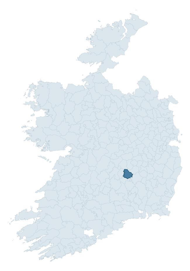
Where this barony sits in the Republic of Ireland
Geology and preservation
Bedrock geology shapes the landscape long before any settlement begins — controlling soil drainage, agricultural potential, the survival of upstanding monuments, and the preservation of buried archaeology. The figures below come from the Geological Survey Ireland 1:100,000 bedrock map.
The bedrock underlying Clarmallagh is predominantly limestone (63% of the barony by area), laid down during the Carboniferous period (100% by area, around 359 to 299 million years ago). Limestone is the most heritage-rich bedrock in Ireland. It supports fertile, well-drained soils that favoured dense Early Medieval settlement and Norman manorial agriculture, and it weathers into karst features — sinkholes, caves, swallow holes, and souterrains — that frequently carry archaeology. Where peat overlies limestone, organic preservation can be exceptional. A substantial secondary geology of dark shaly micrite, peloidal limestone (16%) and dolomitisd limestones (11%) adds further variety to the underlying landscape.
Rock type composition
Largest mapped unit: Ballysteen Formation (18% of the barony)
Placename evidence
Logainm records 18 heritage-diagnostic placenames for Clarmallagh, drawn from townland and civil-parish names across the barony. The dominant stratum is Early Christian ecclesiastical — cill-, teampall-, and domhnach-prefixed names that record the dense network of early church foundations established between the fifth and tenth centuries. The leading diagnostic roots are cill- (9 — church), ráth- (7 — earthen ringfort), and dún- (1 — hilltop fort or promontory fort). This is below the ROI average of 30.7 heritage placenames per barony, suggesting either lighter survey coverage or a townland-naming tradition that draws more on generic landscape vocabulary. Logainm records 151 placenames for Clarmallagh (predominantly townland names). Of these, 18 (12%) carry one of the diagnostic Gaelic roots tracked above; the remainder draw on more generic landscape vocabulary that does not encode a heritage period.
Pre-Christian / Early Medieval Defensive
| Root | Count | Meaning |
|---|---|---|
| ráth- | 7 | earthen ringfort |
| dún- | 1 | hilltop or promontory fort |
Early Christian Ecclesiastical
| Root | Count | Meaning |
|---|---|---|
| cill- | 9 | church (early) |
| tobar- | 1 | holy well |
Other baronies in Laois
About this profile
Click any section below to expand.
What is a barony?
A barony is a historic administrative unit in Ireland, broadly equivalent to an English hundred. The 280 baronies used here are from the OSi 2019 National Statutory Boundaries (generalised 20m), covering the 26 counties of the Republic of Ireland. Baronies derive from the Norman period, were formalised in the 17th century, and have not been redrawn for statistical purposes. They vary enormously in area, from compact urban baronies in Dublin to vast upland baronies in Connacht, and should not be compared by raw site count without accounting for area differences.
What counts as a site?
This profile combines three distinct heritage registers, each with its own definition of what constitutes a recordable site:
- Archaeological sites (NMS). The National Monuments Service Sites and Monuments Record (SMR) catalogues every known archaeological monument or site of archaeological interest in the Republic, from prehistoric burial mounds and ringforts to medieval churches and post-medieval defensive works. Inclusion does not require legal protection — only that the site has been identified, surveyed, and assessed as having archaeological value. A separate subset of these sites lies within a recorded protection zone, which gives them statutory protection under the National Monuments Acts.
- Listed buildings (NIAH). The National Inventory of Architectural Heritage records buildings of architectural, historical, archaeological, artistic, cultural, scientific, social, or technical interest. Each surveyed structure is appraised on a five-tier scale: International, National, Regional, Local, and Record-Only. The NIAH appraisal is informational rather than strictly statutory, but it underpins local-authority Record of Protected Structures (RPS) listings.
- Heritage placenames (Logainm). Logainm is the authoritative database of Irish placenames maintained by the Placenames Branch. This profile applies a heritage-diagnostic classifier to the Irish-language form of each townland name, flagging roots that signal defensive sites (ráth-, lios-, dún-, caiseal-, cathair-), ecclesiastical foundations (cill-, teampall-, domhnach-, mainistir-), prehistoric burial-ritual features (tuaim-, carn-, leaba-), or Norse-contact settlement (gall-). Townlands without one of these diagnostic roots are not flagged here — they may still carry historical significance, but that significance is not encoded in the name itself.
Editorial principles
The narrative sections of this profile follow several explicit principles:
- Evidential. Every claim about this barony’s heritage character is anchored in the underlying register data. Where a site count, a placename count, or a percentile rank is cited, it is computed from the source datasets at export time, not estimated.
- Comparative. Counts and metrics are reported alongside their percentile rank against the other 279 ROI baronies. A barony with 50 ringforts in absolute terms could be unusually high or unusually low depending on its size and regional context; percentile ranking removes that ambiguity.
- Transparent on limits. Where a register has known coverage gaps, survey biases, or data-quality issues that affect this barony’s figures, the profile flags them rather than presenting the numbers as definitive.
- No interpretation beyond what the data supports. The narrative does not speculate about historical events, social dynamics, or cultural meaning beyond what the recorded heritage and placename evidence directly attests.
Data caveats and limits
- NMS Sites and Monuments Record is the product of survey campaigns conducted at different intensities across different counties and decades. Some baronies have been surveyed more thoroughly than others, and absolute counts should be read in that light. Sites destroyed by development before survey are typically not represented; sites in heavily forested or upland terrain are sometimes under-recorded.
- NIAH coverage is broadly complete for the Republic of Ireland but the survey was conducted on a rolling county-by-county basis, and the most recent appraisal date varies. Buildings demolished or substantially altered after their original survey may still appear in the register; conversely, recent buildings of merit may not yet have been appraised.
- Logainm classification applies a deliberately conservative pattern-matching approach to the Irish-language townland forms. The classifier prioritises true positives over recall: a townland may carry a heritage signal that the classifier doesn’t recognise, particularly where the diagnostic root has been heavily anglicised or where the townland name draws on a less common term. The 60,000+ townland records and ~9,800 classified placenames give a substantial signal at barony scale, but individual townland names should be checked against Logainm directly for definitive interpretation.
- Period attribution. The chronological distribution reflects only those NMS sites that carry a recognised period attribution in the source data. Sites listed as “Unknown” period are excluded from the dated subset.
- Boundary changes. Some baronies have undergone minor boundary adjustments since their 19th-century definition; the OSi 2019 generalised boundaries used here are the current statutory definition and may differ slightly from historical maps in border areas.
- Bedrock geology is mapped at 1:100,000 scale, which means local variation within a barony — small pockets of different rock type, mineral veins, alluvium overlying bedrock — is generalised. The dominant-system and rocktype figures are area-weighted, so a barony reading “70% Carboniferous limestone” may still contain small but archaeologically important pockets of older or younger rock. Around 3% of GSI polygons do not match the lexicon and contribute no rocktype or system attribution.
Data sources
- National Monuments Service — Sites and Monuments Record (SMR) https://data.gov.ie/dataset/national-monuments-service-archaeological-survey-of-ireland
- National Inventory of Architectural Heritage (NIAH) https://data.gov.ie/dataset/national-inventory-of-architectural-heritage-niah-national-dataset
- Logainm — Placenames Database of Ireland https://www.logainm.ie/
- Ordnance Survey Ireland — National Statutory Barony Boundaries 2019 https://data-osi.opendata.arcgis.com/
- EURODEM — European Digital Elevation Model https://www.mapsforeurope.org/datasets/euro-dem
- ESA WorldCover https://esa-worldcover.org/en
- Geological Survey Ireland — 1:100,000 Bedrock Geology https://www.gsi.ie/en-ie/data-and-maps/Pages/Bedrock.aspx
Explore more: Search any of the 280 ROI baronies, browse by historical province, or read the methodology and data sources for the full Republic of Ireland Heritage Tool.